“Peak baggers”, i.e., people who set out to climb a lot of mountains, frequently group mountains into lists so that they can track their progress. Some lists group peaks by mountain range (e.g., the Sierra Peaks Section list) and others collect them by prominence, isolation, or altitude. This weekend I joined Craig, Andrew, and Dagmar as Craig ticked off the final summits (Twin Peaks and Eagle Peak) on a list of mountains in California with more than 2000 feet of prominence, also known as P2ks. We climbed a few other mountains as well, because… why not?
Trip Planning
Specs: 32.6 mi | +/- 11,500 ft | 2 days, 1 nights
Difficulty: Class 3 – 4 for Twin Peaks, Class 2 for Virginia and Camiaca Peaks, and Class 1 for Eagle Peak [learn more]
Location: Humboldt-Toiyabe National Forest and Yosemite National Park, California | Home of Washoe, Northern Paiute, Western Mono/Monache, and Me-Wuk peoples | View on Map
Route
- Approach for Twin, Virginia, and Camiaca Peaks: Begin at the Green Creek Trailhead and follow the trail to the junction just east of the lake. Follow the branch toward West Lake for a short distance and then transfer to the well-traveled use trail that continues along the north and west banks of Green Lake. Follow this trail all the way to Virginia Pass.
- Twin Peaks: Walk cross-country across grassy hills to the foot of Twin Peaks, just below a waterfall flowing down from Virginia Peak. Scramble up a grassy gully on the right side of a prominent ridge and between the two creeks marked on the map. At the ridgeline, turn right to continue up class 3 – 4 terrain to a flat summit ridge; continue north to the summit.
- Virginia Peak: From Twin Peaks, return to the top of the gully and then contour across the ridge, remaining on or very near the crest. The terrain is class 3 – 4 with a few exposed spots but is generally very solid and a lot of fun! Once on the flatter saddle between Twin and Virginia, pick a line up the northwest face of Virginia Peak to the summit. To descend, return to the saddle between Twin and Virginia and then descend through sand and gravel to the north bank of the lake below and north of Virginia Peak. Cross the outlet creek and scramble down the series of ramps and benches to reach the grassy hills below. Return to Virginia Pass via the same route taken on the approach.
- Camiaca Peak: From Virginia Pass, hike up to the obvious summit to the southeast. Beware of loose talus, and try to stay on the northern side of the slope where the terrain is slightly more solid.
- Eagle Peak: Begin at the Eagle Creek Trailhead and follow the cattle path up to the open meadows below Eagle Peak at about 10,000 feet. To reach the summit, walk up the shallow south ridge, trending westward to avoid the false summit. Return via the same route.


Permits & Regulations: No permits are required for day-hiking the Green Creek or Eagle Creek trails. There also appear to be no fees or restrictions on parking at the trailheads. Note that the roads to both trailheads are unpaved, so check conditions before you go. The road to Creek Creek is a little rougher than the road to Eagle Creek (at the time of writing), but neither require high clearance or four-wheel drive.
Resources: The pages for the Green Creek and Eagle Creek Trailheads offer scant information at the time of writing, but may be updated in the future. The National Geographic Yosemite Park Map includes both peaks, but not the entire approach to Eagle Peak, so I suggest printing your own maps from CalTopo or a similar service.
Virginia Pass Peaks
24 Sep 2022 | 17.6 mi | +/- 6900 ft | View on Map
Craig and I set off from the Green Lakes Trailhead at 6:00 AM. The sun hasn’t risen yet, so we stroll down the trail with headlamps glowing. Andrew and Dagmar were supposed to meet us at the trailhead, but they haven’t arrived yet. Luckily, we bump into them just a few minutes later; their headlamps give them away as they pack their bags. All together now, we continue walking down the road, which continues for a mile or two. It’s chilly this morning (the forecast predicted low 30’s), so I keep my hands buried in my pockets as I chat with everyone. I last saw Andrew and Dagmar when we climbed Mount Jefferson in July, so we have some catching up to do!


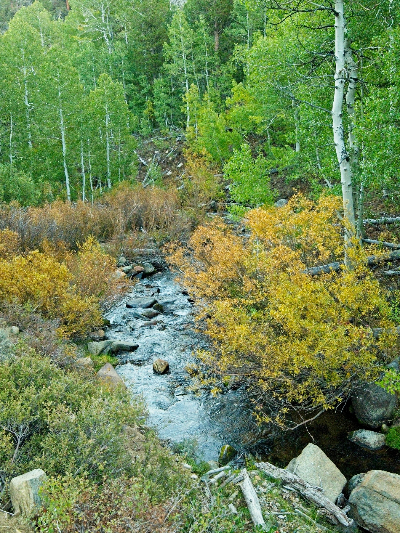
Soon, the sun has risen high enough to begin lighting the peaks. I can’t help but smile – what a beautiful day! The crisp air carries smells of aspens and willows, both of which are beginning to turn gold. To further remind us that fall is here, a dusting of snow lingers on the peaks.
We reach a trail junction at 7:00 AM and follow the path toward West Lake. We miss the side trail that leads toward Virginia Pass at first, but backtrack to find it and are soon strolling along the banks of Green Lake through dense foliage. After winding around to the west side of the lake, the well-traveled use trail begins climbing uphill beside the inlet to Green Lake. A little ways up the hill we pass a collection of old mining machines, including an 8-stamp mill, patented in 1899 by Alexander Prat and Charles La Grave (US634417A). Every part appears to be solid iron and we wonder at the time and effort it must have taken to get it all up here. A little research post-hike reveals that the Glines Canyon Ideal Stamp Mill (a.k.a. Rattler Mine) processed gold (and maybe also silver?); a mineral map (Tooker et al., 1983) includes tons of detail about the geology and mining potential of the area.


Past the stamp mill, we hike past an old cabin and a few other metal mining implements before continuing uphill. I’m happy to struggle up the steep path to maintain body heat; it’s still chilly and the sun isn’t high enough yet to warm us up. The trees soon give way to open alpine meadows (still no sunshine) and we reach the foot of Virginia Pass. The use trail winds up the rocky slope for a few hundred feet to reach the saddle. A classic “scalloped” Yosemite National Park sign marks the pass and we finally reach the sunshine (8:30 AM)! We pause for a few minutes to apply sunscreen and soak in the warmth.


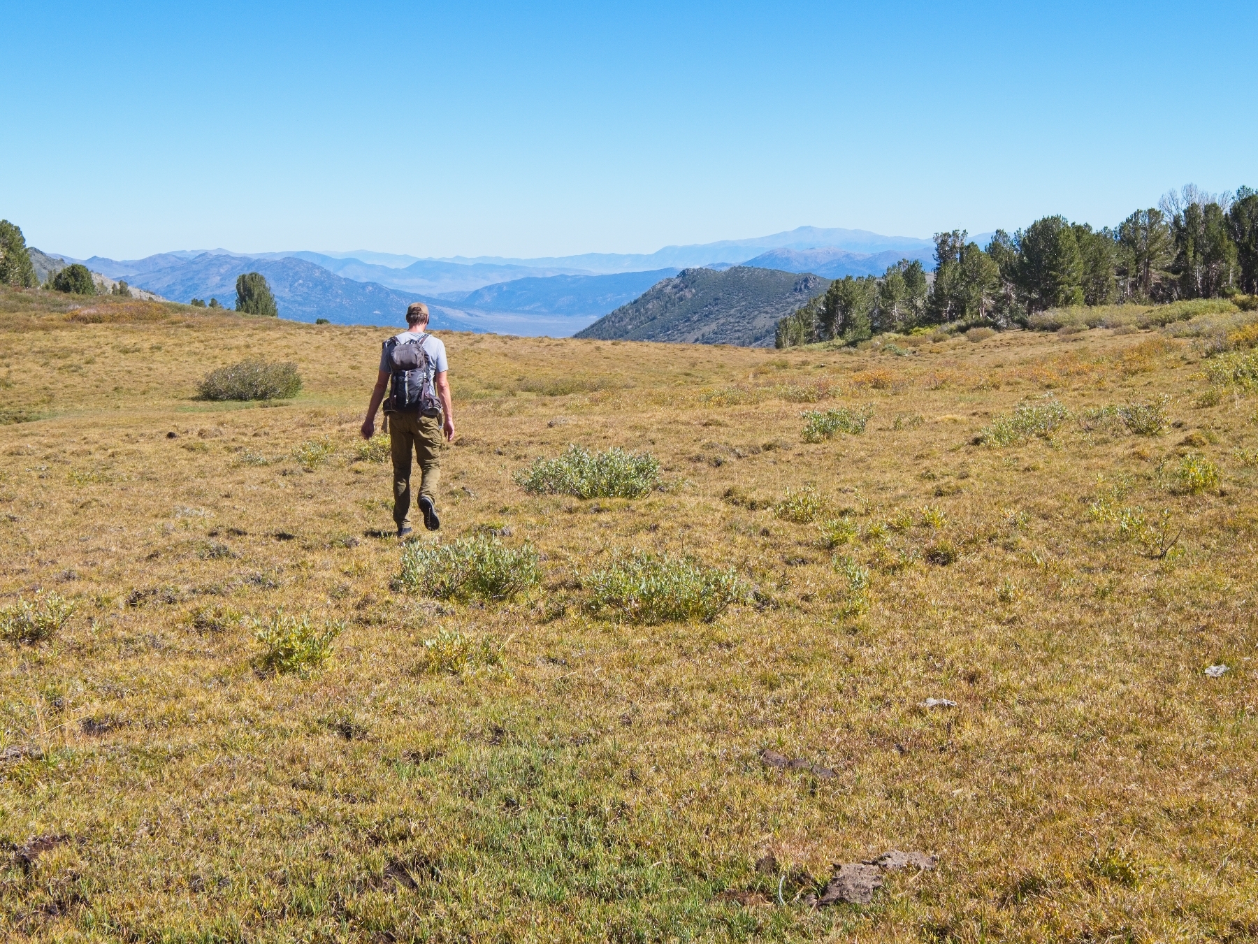
From Virginia Pass we walk north for a short distance over talus and small pockets of grass. Several hundred feet below, vast meadows stretch out to the northwest. Rather than try to contour across steep rocks, we scramble down to the grass and enjoy a mellow stroll. Craig spots Samantha and Louie, friends of his that camped up here overnight, far below us and hollers over to them to get their attention. They’re planning to climb Twin Peaks with us and are headed in the same general direction.


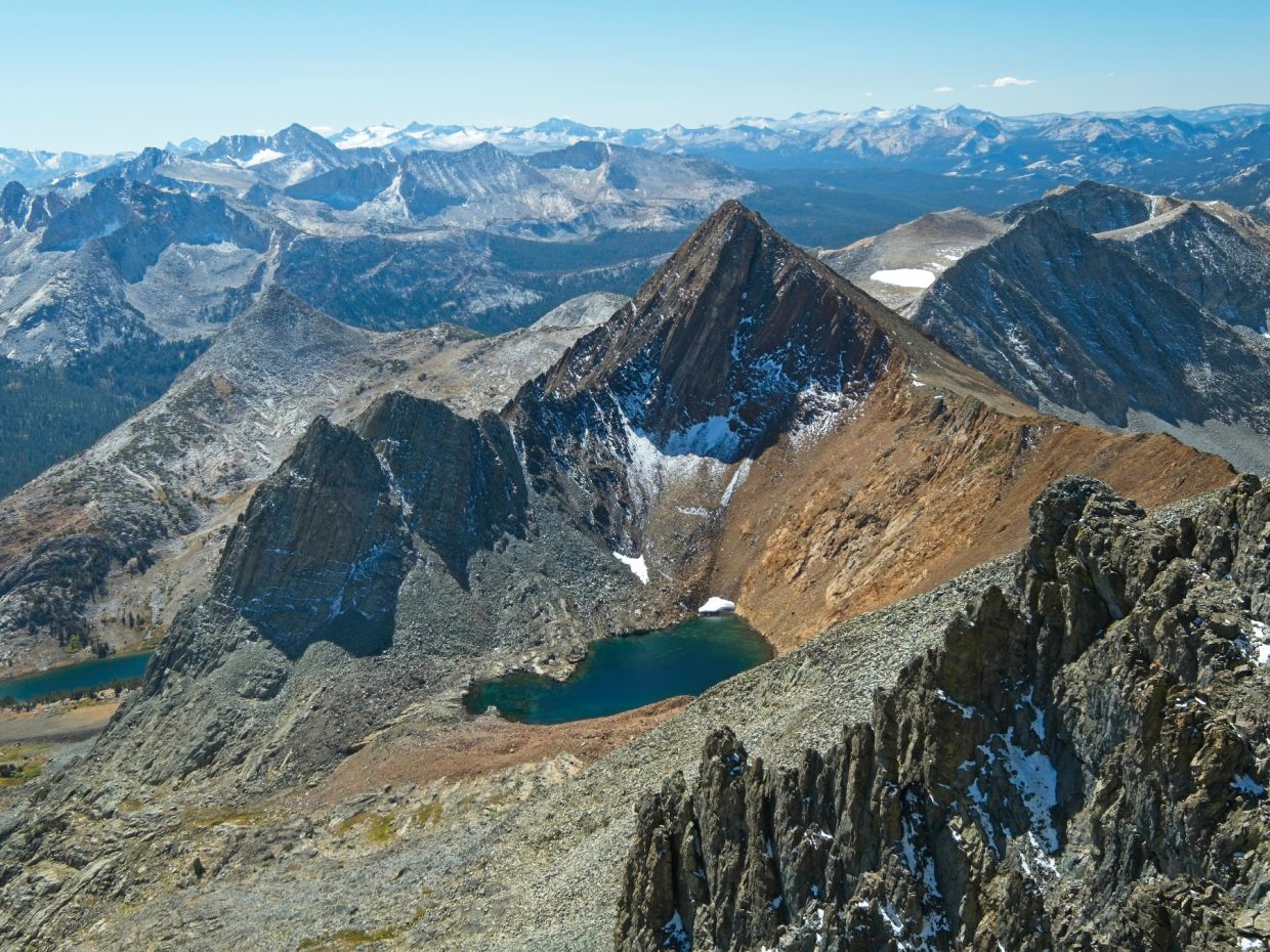
Craig, Dagmar, Andrew and I soon reach the foot of Twin Peaks. A small waterfall cascades down the rocks on the left and a second, smaller creek dribbles down a gully on the right. Our selected route follows a dry gully between the two creeks up to the ridge. After a short water break, we begin up the gully. It’s full of loose rocks, so the scrambling is quite tedious; we don’t want to send any of them hurtling down the chute. I stick to a dry wash on the left side of the gully since the rocks seem to be slightly more stable, cemented into the ground by sediment.
Further up the mountain the slope increases a bit and we transition from easy class 2 scrambling to some class 3 and class 4 climbing. Samantha and Louie have fallen far behind; we spot them in the lower chute from high up on the mountainside. Once we reach the ridge we turn right and climb up about 50 more feet of rock, emerging onto a relatively flat plateau. Of course, the summit is on the furthest point from us, but at least the walking is easy! We stroll north along this easy terrain, stepping over the occasional snow drift, to the summit of Twin Peaks, Craig’s second-to-last California P2k!


It’s only 11:00 AM and a bit early for lunch, but reaching a summit deserves some celebration, so we munch on snacks while admiring the view. Yosemite National Park stretches out to the south of us; we pick out the Cathedral Range, the Clark Range, and a bunch of other features. I particularly enjoy staring out at the gold-colored grass contrasting with the green trees and silver rocks; autumn is such a beautiful season!
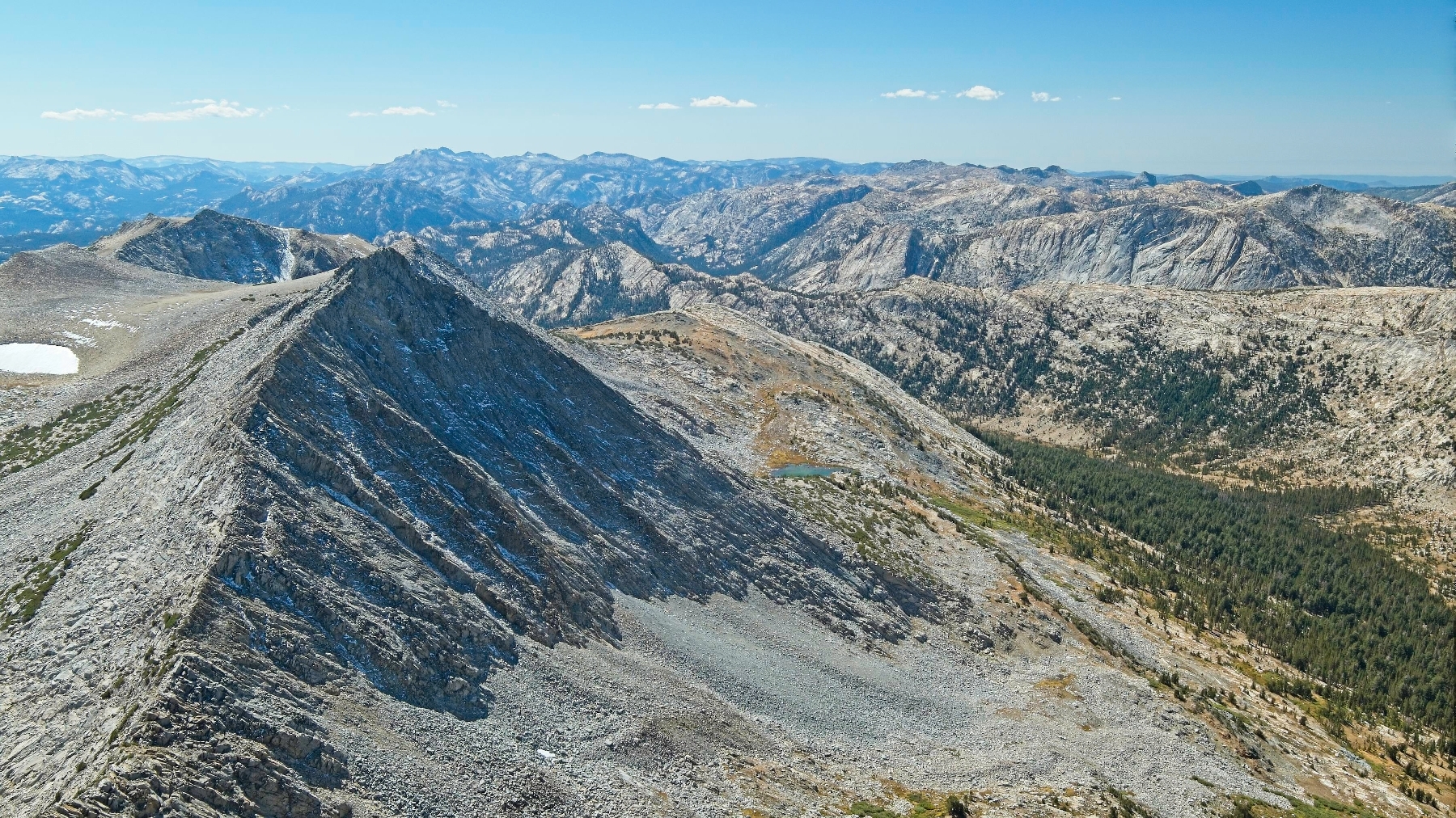
After a relaxing break atop Twin Peaks, we backtrack across the plateau and scramble down to the notch that marks the top of the gully. Rather than descend all the way to the waterfall then climb all the way back up to the ridge near Virginia Peak, we scramble along the top of the ridge. The route finding is surprisingly simple; obvious ledges wind across several steep faces, and the ridge crest itself is very passable most of the time. There are a few airy spots that require extra caution, but we all agree the climbing is a lot of fun.


The technical climbing eventually ends and we stroll across grass and slate toward Virginia Peak. The north face of the mountain stands dark and foreboding with drifts of snow scattered throughout the cliffs. Luckily, our route to the summit is on the much shallower west slope. We follow a faint path through the loose slate, the rocks clinking as we trudge through. Despite the relatively low angle, the looseness of the rock makes the climb very tedious.
By 13:00, we’re standing on top of Virginia Peak! We don’t stay for very long, however, and are soon trudging back through the slate. Dagmar and Andrew lead the way down a sandy slope above the unnamed lake, contouring around its north side to the outlet creek. We all stop here to refill water bottles, the first opportunity we’ve had to gather water since leaving the waterfall this morning.
Reaching the grassy meadows where we began the climb requires some tricky routefinding. Ramps and ledges lead in every direction and we make a few wrong turns on the way down, but between the four of us we’re able to string together a passable route. Once back on easy terrain, we stroll past a few beautiful ponds that I can’t resist photographing. The rest of the group presses on and I hurry to catch up as we retrace our steps back to Virginia Pass, arriving at 14:45.


Andrew and Dagmar are headed back to the trailhead, but Craig wants to climb Camiaca Peak, a nearby mountain that’s on yet another list of peaks (Vagmarken Sierra Crest List). I don’t have a particular interest in Camiaca, but Craig is my ride out of here and I figure the views might be nice so I join him for the ascent.
The climb up to Camiaca Peak begins nicely enough, with some fun rock hopping and grassy ramps. But the terrain soon transitions to endless talus, much of which is horribly loose. I’m somewhat used to loose rocks – they tilt one way or the other, causing you to jump to a more stable spot in a hurry. But some of these boulders spin! Like tops, or those circular balance boards. I grumble about the loose rocks as I climb, trying (and failing) to keep up with Craig. When I do reach the summit, exhausted, I’m pleased to learn that I completed the 1300-foot ascent in only 45 minutes.
After a much-needed rest (for me, anyway), we take a slightly more direct route back to Virginia Pass, staying on stable ground when at all possible (I still find a few more spinners). We’re back at the pass by 16:20 and waste no time heading down the use trail. The late afternoon sun casts warm light across the landscape, and I use photo ops as frequent excuses for breaks. Craig is on a mission to get back to the car and quickly disappears down the trail in front of me. I settle into my own “gotta walk for several more hours” pace and try to enjoy the late afternoon sights and sounds.


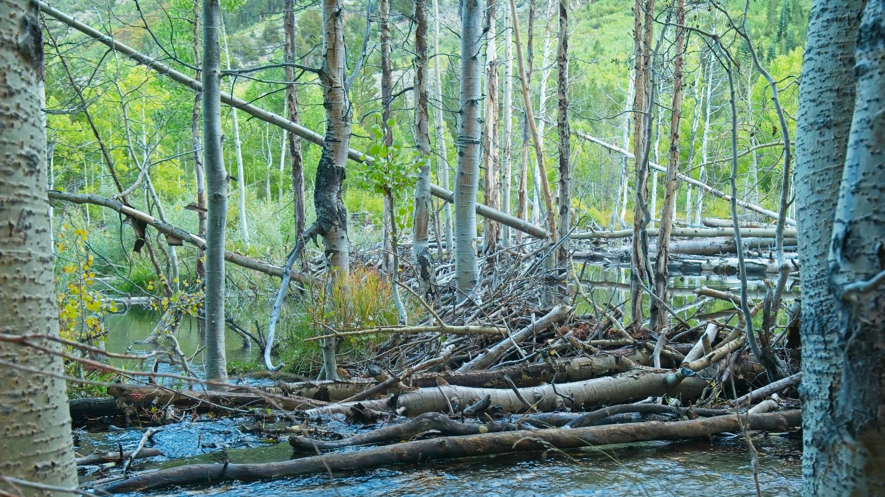
The highlight of the hike out for me is a massive beaver dam near the end of the road that we missed this morning in the dark. The wide, curving dam stretches a huge distance through a grove of aspens, creating a large pond on the upstream side. A few other people are gathered there with cameras and binoculars, perhaps looking for beavers or aquatic birds. I don’t stop to ask – my feet ache and I’m anxious to finish the hike out. I arrive at the trailhead at 18:30 and find Craig waiting, already changed into shorts and flip-flops. After a few stretches, I hop into the car and we drive off in search of hot food.
Eagle Peak
24 Sep 2022 | 15 mi | +/- 4600 ft | View on Map
Craig, Dagmar, Andrew, and I begin our hike at 6 AM again this morning, this time from the Eagle Creek Trailhead. A very steep shortcut leads us from the parking area to a cattle road that will be our path for the next several hours. Much like yesterday, it’s chilly (37 according to the car thermometer) and I keep my jacket on and my hands stuffed into my pockets. By 6:30 it’s light enough to turn off our headlamps as we trek up the wide, tree-lined road.
Although the road is sprinkled with cow-pies (piles of poop), we don’t spot any cows along the way. I wonder how often they graze up here? We do have an exciting wildlife encounter, though! A black bear in a pine tree comes crashing down through the branches when it notices us, creating quite the racket and stopping us in our tracks. It runs off in the opposite direction, of course, so we continue walking moments later.
The hike seems to drag on for hours, even after we leave the road and begin up a more pleasant single-track trail. The aspens and pines are beautiful, but perhaps a little monotonous after four or five miles. The trail also climbs continuously, rarely leveling out, and the soft, cow-pummeled soil steals my energy as I trudge along. We keep walking, half to keep warm and half to make good time; like yesterday, we’re still in the shade and want to reach a sunlit spot before stopping for a break.
When we finally reach the sunshine, we stop for a while to filter water, eat snacks, and apply sunscreen. The rest and fresh calories help bolster my mood and the improving scenery certainly helps too. At about 10,000 feet we reach a wide, grassy meadow and are treated to our first good view of Eagle Peak. It’s not particularly impressive from this angle, but at least the goal is in sight!


Rather than scrambling up one of the steep, loose scree slopes directly across the meadow, we continue southwest to the foot of a ridge that slopes gently up to the summit. On the way I spot a massive rabbit (I think it’s a white-tailed jackrabbit) that scampers off as soon as I get close. The climb is pleasant enough, but it becomes the highlight of the trip for me when I turn around and see the Sawtooth Ridge across the canyon. The snow-dusted, rugged peaks look spectacular!


We all settle into a comfortable pace and walk up to the summit together. It’s a bit windy up top, so we all pull on an extra layer or two and then sit down to celebrate Craig’s list finish! Andrew and Dagmar procure champagne and cups from their backpack, and Craig pulls out a flask of Fireball whiskey and a bar of white chocolate. A little alcohol goes a long way at 11,800 feet, and we finish of both bottles so… we’re all tipsy in short order.


After a fun celebration at the summit, we head down the mountain, laughing as we try to foot-ski through the semi-loose gravel. Everyone settles into their own pace and we spread out a bit during the hike out. Although it’s a nice downhill grade all the way back, it’s 7.5 miles and takes several hours to complete. Craig leaves me in the dust (literally, the dirt is very dry) and I’m a few minutes ahead of Andrew and Dagmar, so I cruise on down the trail lost in my own thoughts. I keep my eyes peeled for more wildlife, but the most exciting thing I spot is a red tailed hawk floating on the breeze overhead.
We all reunite at the trailhead a couple hours later. I change into cleaner, more comfortable clothes and then say goodbye to Andrew and Dagmar for now; I’m sure we’ll all hike together again soon!