I’ve been working on climbing all of California’s 14,000+ foot peaks (14ers) for a few years. Depending on whether you define a “peak” as having a certain amount of prominence, I either have one left (North Palisade) or four left (Thunderbolt, Starlight, North Palisade, Polemonium). Luckily all four are next to one another and there’s a popular traverse linking them together. It’s a technical endeavor with lots of 4th and 5th class climbing, so I wasn’t about to do it solo. I invited some friends from Texas to join me and one of them, Josh, was able to make it out.
Trip Planning
Specs: 17.2 mi | +/- 6200 ft | 3 days, 2 nights
Difficulty: Class 5.9 [learn more]. The majority of the traverse is 2nd – 4th class, but there are several fifth class sections. A couple can be skipped (Thunderbolt Peak summit block at 5.9; Starlight Peak summit block at 5.4) but others cannot.
Location: Inyo National Forest and Sequoia-Kings Canyon National Park, California | Home of Eastern Mono and Northern Paiute peoples | View on Map
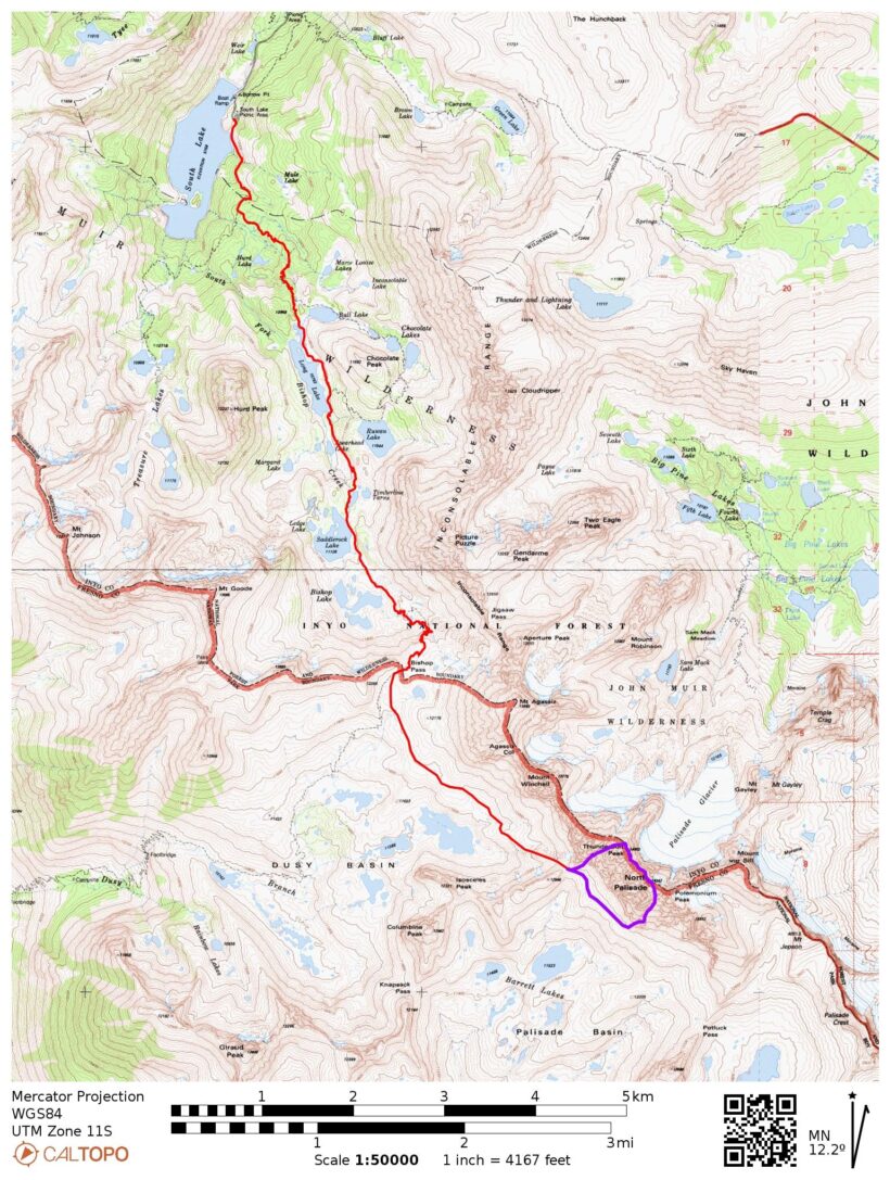
Route: This well-known traverse (Thunderbolt to Mount Sill) has been thoroughly described and documented by others. I suggest Steph Abegg’s trip report; they have a gold mine of labeled photos and useful descriptions. Summit Post and Mountain Project also have (less thorough) route descriptions.
We approached the traverse via Bishop Pass and Thunderbolt Col to avoid the late-summer bergschrund on the east side. Since Josh and I have already climbed Mount Sill, our goal was to follow the traverse to Polemonium Peak and then descend via the U-notch chute back to Palisade Basin.
Permits & Regulations: Permits are required for overnight trips; Inyo National Forest controls the permits for the Bishop Pass Trail. Campfires are prohibited along most of this route, and food must be stored appropriately to keep the bears out. As always, make sure you leave no trace out there!
Resources: The Bishop Pass Trail page is a convenient resource for information about the trail and current conditions.
Hike to the Palisade Basin
07 Oct 2023 | 7.6 mi | + 3100 / -600 ft | View on Map
Josh and I cowboy camped at the Four Jeffrey campground last night. There were plenty of open spots (even on a Friday night) and we were treated to clear skies and lots of stars. The higher campgrounds are all closed for the season, but Four Jeffrey is still at 8,000 feet, plenty high enough to begin acclimating us sea-level dwellers to the thinner air.
Since we’re in absolutely no hurry today (only 7 – 8 miles to hike), I stay cocooned in my sleeping bag until the sun has risen. Josh and I eat some breakfast and spend some time packing up our gear. There’s a lot of it for this trip: all the usual backpacking supplies plus a rope, cams, rock shoes, helmets, microspikes, crampons, and ice axes.
The big question in our minds is the snow and ice. The Sierra got several inches of snow last weekend and we’re not entirely sure if it’s powder or ice at this point. Blair from Big Willi Mountaineering Co. in Lone Pine told us to expect 6 – 8 inches of sugary powder at altitude, which we can probably handle in trail runners, but we decide to bring shoe-compatible crampons plus ice axes just in case. It would really suck to be forced to turn around by 10 – 20 feet of ice.
By the time we get to the South Lake / Bishop Pass trailhead, the sun has made it over the ridge. It’s a beautiful morning! The aspens are all turning bright gold and South Lake’s blue water sparkles in the sunlight (it’s also full to the brim, unlike last year). We leap frog with a few hikers for a couple hours as we wind up the switchbacks that lead to the gorgeous lake basin below Bishop Pass.


From the shores of Long Lake we get our first good look at the Sierra crest. There’s a lot of snow up there, but most of it is remnants from the record-breaking winter we had. A light dusting from last weekend is still hanging around too, particularly on the north and east aspects of the ridge. But it’s dry down here in the valley, so we just keep on hiking. We walk across a lingering snowfield and then cross a few icy patches on the switchbacks below Bishop Pass, but none of it is exposed or steep enough to make traction (microspikes, crampons) necessary.


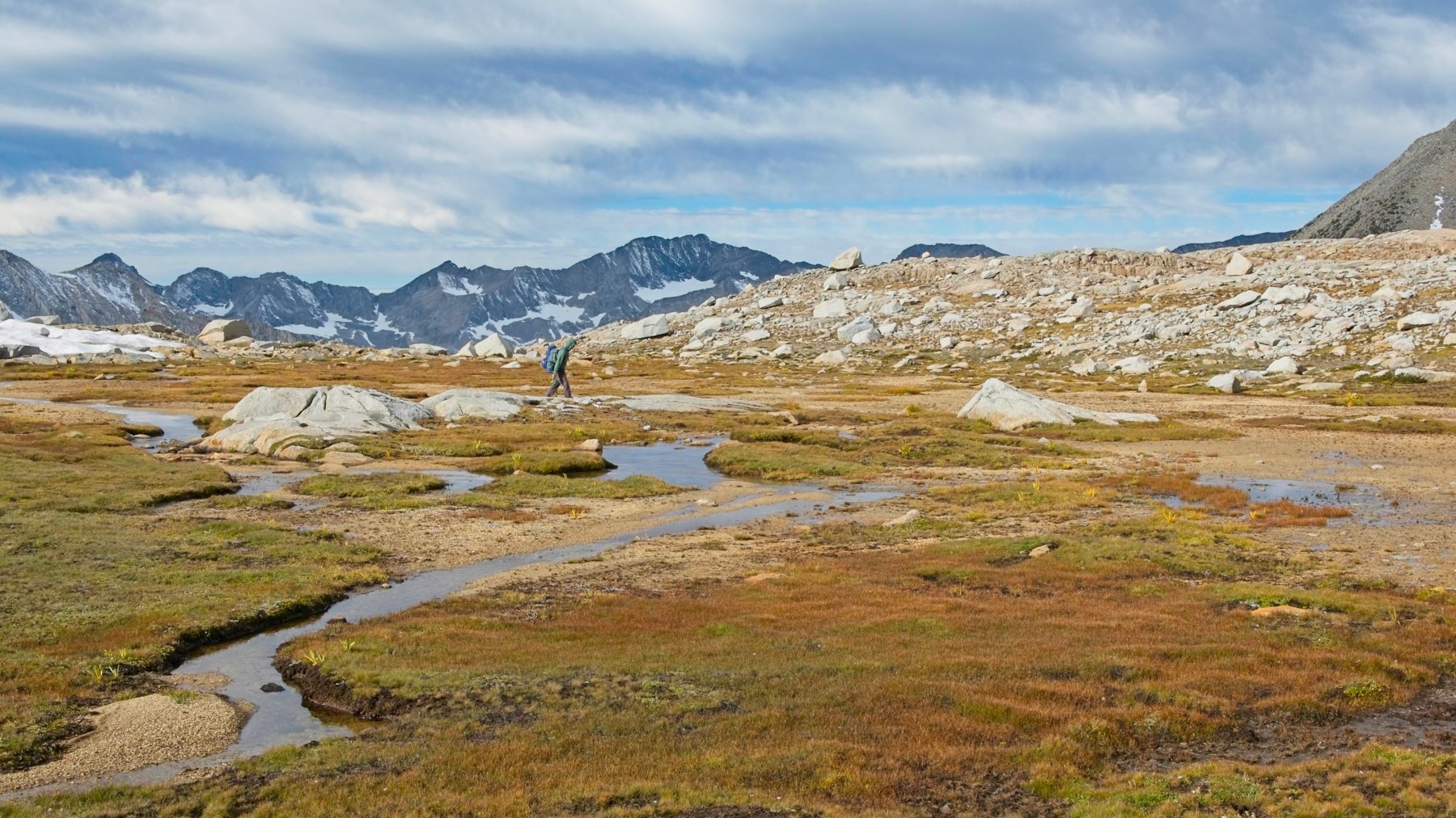
Josh and I pause for lunch at the little lake just above Bishop Pass. Across the lake we can see at least one person and a bunch of gear. Minutes later we spot one or two people descending the slopes of Mount Agassiz (13,893 ft), so we assume that they dumped their heavy gear by the lake while summiting the peak. The lone backpacker, wearing a brightly colored jacket, hikes away from the lake toward Thunderbolt Col, the direction we’ll be heading too.
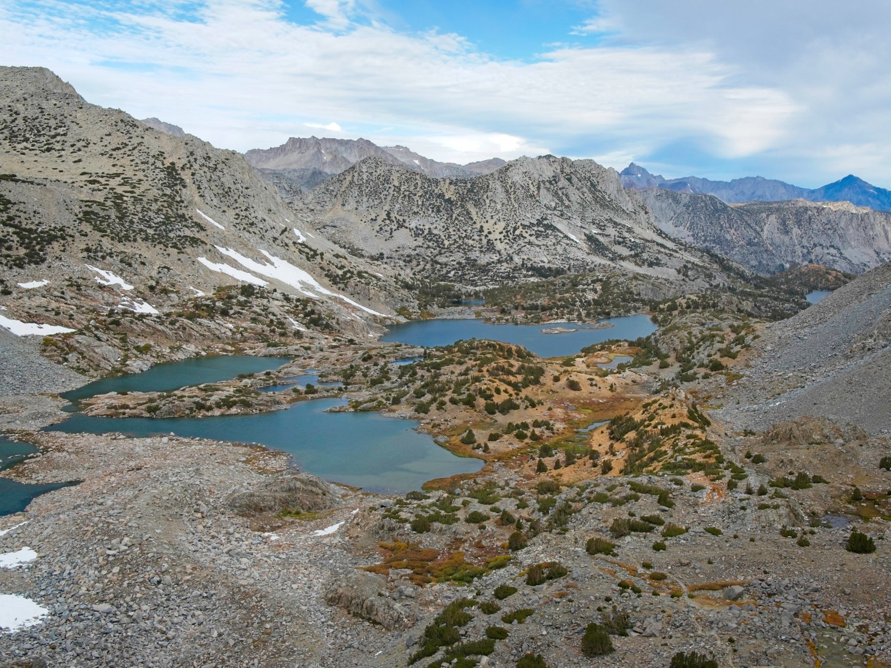
After lunch, we make our way across upper Dusy Basin. I really love this area, particularly in the fall when the grass and small plants turn shades of gold and red. We periodically see the backpacker in the bright jacket but they’re pretty far ahead of us. Josh and I toss around the idea of camping on this side of the pass since it will save us some time on the way out and the terrain is nicer: it’s grassier and less desolate than in the Palisade Basin. After some deliberation we decide to go all the way to the Palisade Basin to make tomorrow (traverse day!) as short as possible. But not before taking a mid-afternoon nap on a grassy bench! Despite the low mileage today, we’re both pretty tired and a little sleep is helpful before we tackle the talus slog up to Thunderbolt Col.
")


Once we’ve slept a little, we continue across the basin and then up the slope toward Thunderbolt Col. The convenient use trail that Josh, Alex, Kim, and I found last year on this pass is completely buried beneath a snowfield today, so Josh and I make our way up the large blocks of talus instead. It’s not particularly difficult, just a bit tedious and maze-like. The altitude is also taking its toll; my heart rate and breathing are much faster than they should be for this level of effort.
We relax once we reach the top of Thunderbolt Col and admire the spectacular views on both sides. The lone hiker we’ve been following all afternoon somehow ended up behind us. She (judging by the pitch of her voice) yells up to us once or twice but we have trouble making out what she’s saying. When we yell over to ask if she’s ok, she seems to say she’s “very tired.” Join the club.


The hiker reaches the pass while Josh and I are lounging about and I realize I know her: it’s Liz! I met her a few years ago up the North Fork of Lone Pine Creek when I was climbing Mount Russell. We chat for a few minutes and learn that she’s with a group of four or five other people. They’re meeting up just at Barrett Lakes in the valley below and are planning to climb Mount Sill tomorrow. We reassure her that we’ll direct her friends that way when they make it up here and she sets off to find a campsite.
In the meantime, Josh and I set up camp on a sandy little bench about 20 feet below the pass. There’s no water here – we’ll have to hike down a few hundred feet to fetch some – but we’re very close to the start of the traverse route which will be nice tomorrow morning. Liz’s companions appear atop the pass while we’re setting up camp. I’ve actually met one more of them – John – from the Williamson and Tyndall trip! We tell them Liz has already headed down to the lakes and they go off after her, disappearing down the valley.
We eat dinner on our little ledge and then wander down the hill to fetch a bunch of water. The hike back up to camp leaves me winded but hopefully we’ll only have to make this trek once. I expect we’ll be able to fill up on water again tomorrow afternoon when we return from the traverse.
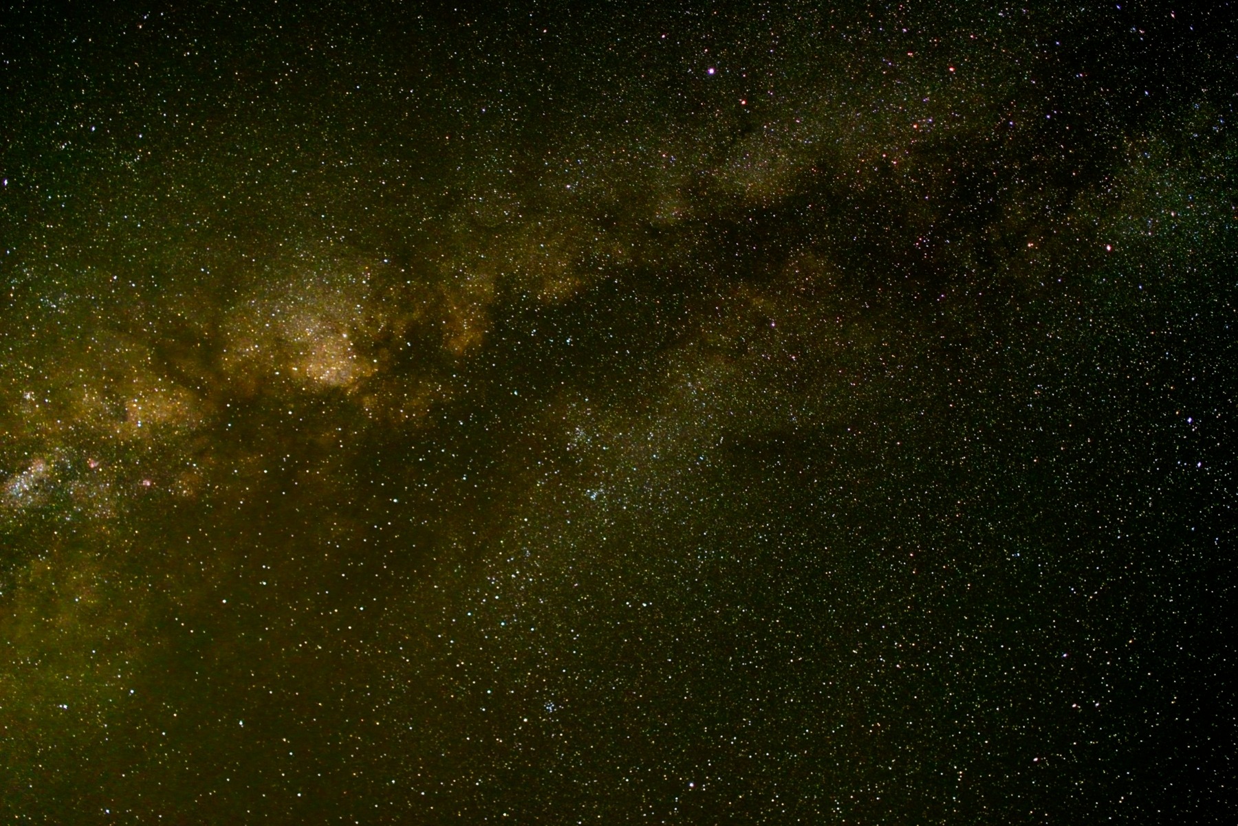
The sun sets early this time of year and it’s dark by 7 PM. A persistent breeze makes sitting around outside too chilly, so we hang out in the tent and chat for an hour or two. I lean out the door and try out some astrophotography by propping my camera up against one of my shoes. The results are surprisingly good! The night sky view is truly one of the most amazing parts of being out here, and it’s nice to enjoy it from the warmth of my sleeping bag.
Thunderbolt, Starlight, and North Palisade
08 Oct 2023 | 2.0 mi | +/- 2500 ft | View on Map
Josh and I are up an hour before sunrise this morning to maximize the amount of daylight we’ll have for the traverse. We’re on our way by 6:30 with pink cotton ball clouds stretched across the sky. There are several routes up to Thunderbolt Peak. Secor describes a route up a chute on the north side of Thunderbolt Col, but we’ve opted for the creatively named “southwest chute #1,” the first chute south of the col.


Even though I slept at altitude (12,000 feet last night!) and have a much lighter pack than yesterday, I’m quickly out of breath. Josh and I slowly scramble up the talus into the chute, pausing many times to breath. A few hundred feet up we reach a bit of a headwall with a deep snow drift below it. The wall might be climbable, but we don’t push through the snow to find out. We instead scramble up a few short 4th-5th class ledges on climbers’ right and pop out above the headwall.
For the next little while (maybe an hour), we struggle up through the thin air on easy 2nd class terrain. It’s loose and sandy, but not technically difficult. Following route beta we gathered before the trip, we stay right when the chute splits in two and continue up the slope. After what feels like a lot of time, we reach what looks like the top of the chute. The floor of the chute is covered in snow, so we step carefully to avoid slipping on icy slabs. After some tricky stemming on rock, snow, and ice, we reach a small saddle below a seriously imposing rock face. There are a few cracks up to the top, so it’s climbable, but looks really difficult. The rappel station next to us clearly indicates that climbers come this way, but we can’t see an “easy” way to the top. The ascent to Thunderbolt Peak is supposed to be fourth class; crack climbing on an otherwise blank face is definitely not fourth class.
Josh consults his phone GPS (mine has absolutely no idea where we are) and figures out that we’re still a few hundred feet away from Thunderbolt Peak. After some discussion, we decide that we probably didn’t stay far enough right and have ended up in the wrong branch of the chute. We could downclimb the way we came up, but neither of us are eager to stem back down the snow and ice. So we pull out the rope and rappel down into the other side of the chute.
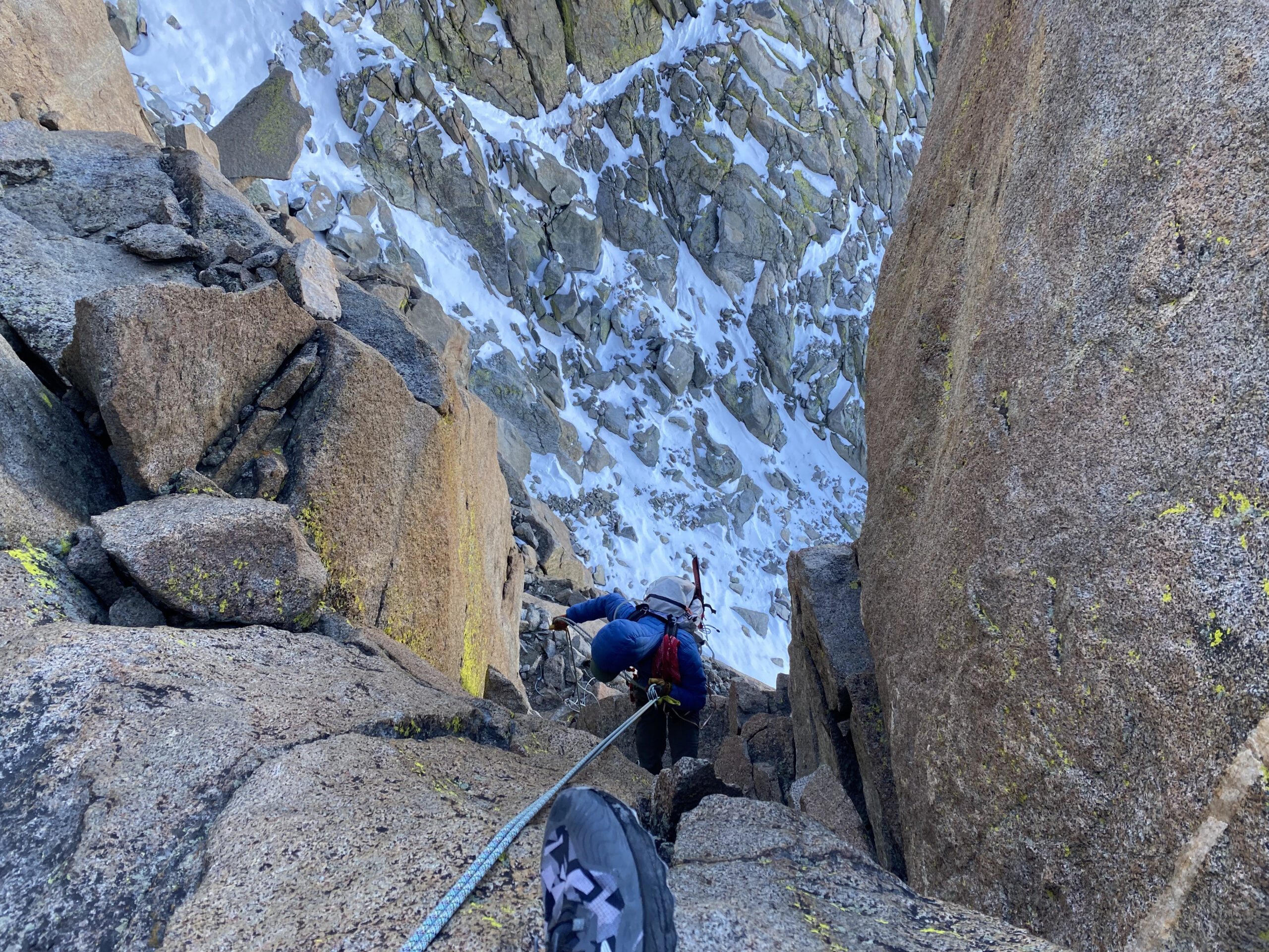
This chute is just as snowy as the first, but is at least slightly lower angle. I resort to some more stemming to avoid slippery rocks and end up kicking steps into a deep snow drift to reach the very top of the chute. It’s cold and a bit wet, but not too difficult. A cliff face on the right looks like it could be fourth class, and a rappel station above gives us confidence that we’re on the right track, so we scramble on up. It’s relatively straightforward climbing, but the powdery snow makes every move a little more tenuous… as beautiful as it is, I’m not a fan.
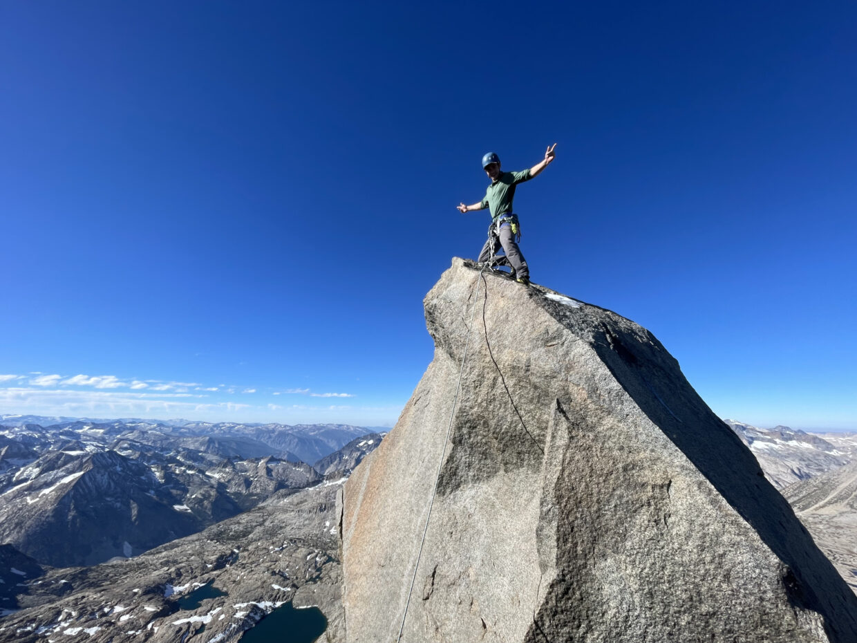
By 9:30 AM, we reach the top of the fourth class climbing and see the Thunderbolt Peak summit block just ahead. A large, flat, sun-bathed slab just below it provides the perfect place for us to take a short break, eat some snacks, and apply sunscreen. Josh and I both put on rock shoes and collect the rope and a few pieces of gear, leaving our damp shoes and socks to dry in the sun. An easy scramble across a very exposed, crack-covered slab leads us to the base of the summit block. Josh builds an anchor to belay from (so that the belayer doesn’t go sliding down the mountain) while I lasso the summit with the rope to set up an ad hoc top-rope system.
After double and triple checking our gear, we’re ready for the climb. I take the first crack at it and, after a brief struggle with the slippery lower half, make it to the top! I’m happy to find two shiny new bolts up there (“Euro-style” with a chain connecting them and one rap ring) and cheerfully thread the rope through before posing for a picture. Josh lowers me down and then climbs the summit block himself. We both agree that the 5.9 rating listed online feels appropriate.


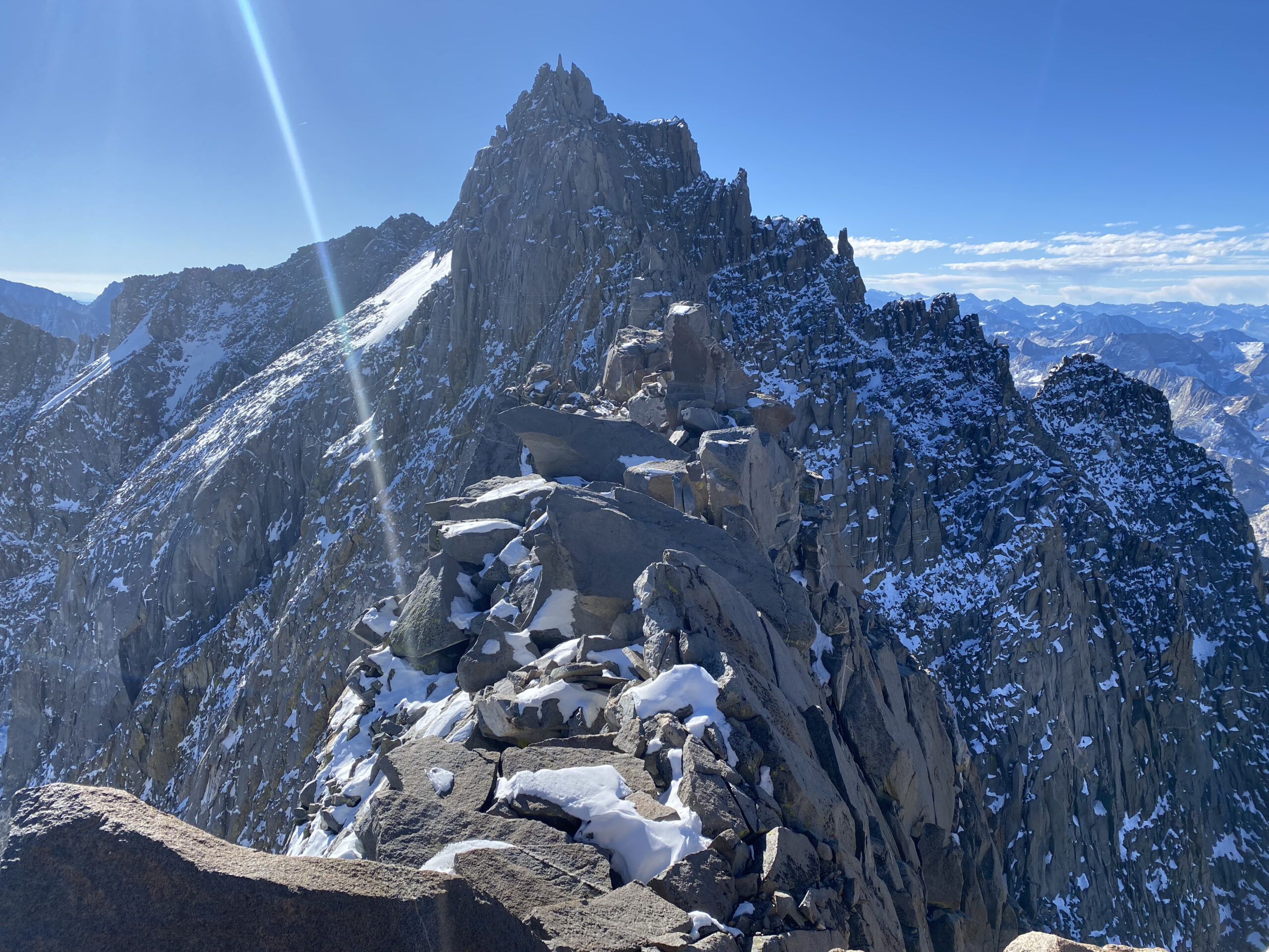
Back on the sunny rock, we eat a few more snacks and revel in the excitement of having climbed a fun technical peak at 14,000 feet. The iconic “milk bottle” summit of Starlight Peak is clearly visible from here a few hundred yards across the ridge and we study the route information and pictures while we have a high vantage point. It doesn’t sound too bad, but there’s a lot of snow and some of the alleged fourth class climbing so far has been pretty demanding.
After changing back into our hiking shoes, we scramble down the ridge and then carefully navigate a long fourth-class downclimb. Some of the cracks and chimneys we descend feel more like fifth class to me, but we manage without a rope and reach the next landmark, an exposed third class slab. Reaching the slab requires a few very airy moves that make Josh incredibly nervous, so we rope up and Josh leads the way over, placing a few cams and slings to protect against a fall. The slab itself isn’t so scary and we stow the rope and just downclimb the plentiful cracks until we reach mellower terrain below.
We’re done descending for now and begin working our way up toward Starlight Peak. We make quick progress for a little while, scrambling up small ledges on the west side of the ridge to a large, striped rock. We edge around the base of this formation on slippery, snow-covered rock, emerging into the sun atop a narrow ridge leading back up to the main Sierra crest. Josh makes quick work of some burly moves (just a couple of pull-ups on good hand holds with no foot holds…) that leave me grumbling. After a try or two I make it up and we continue toward Starlight Peak.
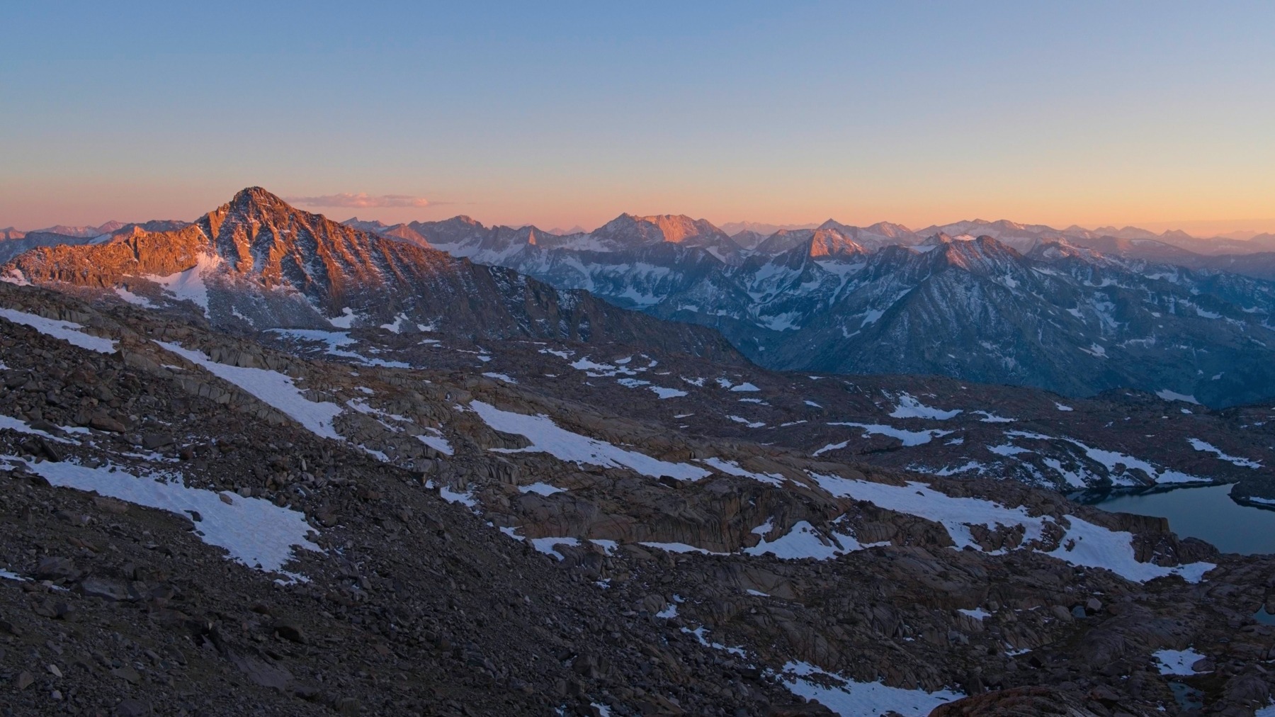
The rest of our ascent stays very close to the ridgetop with some stomach-turning drops down toward the Palisade Glacier. We rope up again, this time at my request, to protect an exposed section of climbing. In retrospect, it wasn’t so bad and I could have soloed it, but I certainly felt much safer with the rope out. As we wind our way up the ridge, clouds obscure the sun and we’re plunged into uncomfortable chilliness. Looking north we can see a bank of low-hanging clouds that look like they’re dropping precipitation.
My morale drops to a low point when snow flakes start drifting down. Gone is the excitement I felt after summiting Thunderbolt Peak. I’m tired, nervous, and cold, the climbing is hard, there’s snow all over the rocks and now also falling from the sky, and we’re not covering ground nearly as quickly as I expected us to. But there’s not really an easy way out. We could take our chances descending an unknown chute back to Palisade Basin, but we don’t know if there’s a route down; there could be large cliff bands or icy, permanent snowfields to contend with. The only sure way out is through, apparently.


By the time we reach the “milk bottle” at 14:15, snow is beginning to fall more quickly, the wind has picked up a little, and most of the surrounding peaks are shrouded in flurries. Like Thunderbolt Peak, the summit of Starlight Peak requires some technical rock climbing. However, unlike Thunderbolt Peak, it’s too tall to lasso, so we don’t have an easy top-rope. We hide out on the leeward side of the rock and Josh bravely leads the 5.4 climb, clipping the rope to a rappel ring that’s been slung a few feet below the top. I climb up after him, we sign the summit register, and then plan out the next leg of the traverse.


We backtrack a little and then wind around the base of the Starlight Peak summit to reach the first of two rappel stations that should take us down to easier terrain. I’m a little nervous about the rappels because our rope is 50m long and one of the route descriptions I found lists each rappel as 30m long (so you’d need a 60m rope to reach the next station). We find several intermediate rappel stations, however, and easily make it to the foot of the cliffs.
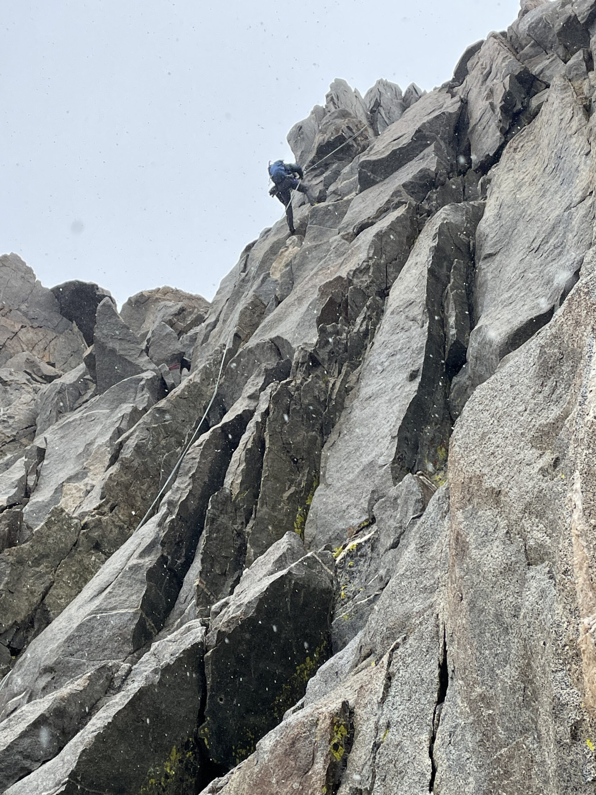
With snow now falling quickly and heavily, Josh and I scramble across a series of easy third class ledges that are increasingly wet and slippery as the falling snow melts. I get myself stuck on a 4th-5th class climbing problem some 5 feet up a wall and it takes me a few minutes to figure out a way out of the pickle. My nerves are again a little frayed and I ask Josh if we can rope up for the climb up and over the ridge. He agrees and I tie into the rope.
I lead the pitch up wet snowy rock, but the rope and protection is mostly pointless since it’s very straightforward climbing. I’m heading for a notch in the ridge where we’re supposed to cross over to the east side and then rappel into and across a deep notch. Just below the ridgetop I hear a faint humming. At first I think it’s the rocks humming but then I realize it’s the handle of my ice axe – there’s static electricity in the air. We’ve heard no thunder and seen no lightning, but… there’s always a first strike. I radio down to Josh to tell him what’s going on and then squat down, trying to make myself a shorter target. I can’t feel any static on my skin or in my hair, but I’m pretty well covered up. Does static electricity make your hair stand up inside a jacket?
As luck would have it, the storm begins to clear out just minutes later. A few patches of blue sky appear to the north, the wind calms down, the snow lessens, and my ice axe stops humming. So I scramble up the last 20 feet to the gap in the ridge. When I see the other side I’m immediately grateful for the rope. I need to descend a few very narrow, very snowy ledges to reach the rappel station above the notch, and the exposure is extreme. I somehow avoid slipping on the snow, tie myself in to the anchor, and then radio down to Josh that he can begin the climb up. There’s a tremendous amount of rope drag, but the extra workout is kind of nice since it keeps me warm while I sit on my snowy little ledge.
Our next challenge has earned itself the name of “the creative rappel” in others’ trip reports. We have to rappel down 20 or 30 feet while also moving horizontally 5 or 6 feet to avoid a very deep gap. People describe this as a “pendulum rappel.” I head down first but hesitate at the pendulum move. I end up clearing the gap statically by reaching one toe over to the ledge and pushing against the cliff face with my other toe. Then, with a bit of a wind-up, I rock myself over to the ledge where a thin strip of sunshine is streaming down.
Josh rappels down to join me and we make our way up another series of snowy ledges, now with a little sunshine to warm and cheer us up! We begin a running belay at an exposed step-across between two benches and just continue it up an easy slab, across some snowy, exposed ledges, all the way to the foot of the 5.5 chimney that leads to the summit of North Palisade. We swap leads here and Josh heads up the chimney. We’re both getting really tired so it’s a bit more work than it should be, but we make it to the summit right as the sun is setting. It’s 18:15, we’ve been at this for nearly twelve hours.
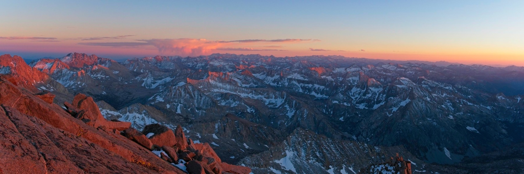
We desperately need a bit of rest and some calories, and the sunset summit view is breathtaking, so we spend a few minutes atop North Palisade. Two rappels deliver us to the foot of a cliff band just below the summit where we pack away our climbing gear and begin descending a chute toward the Palisade Basin. In our tiredness (and the darkness), we assume we’re in the “U-notch chute” but we’ve actually dropped into the chute just north of the U-notch. (To reach the U-notch chute, I think we probably should have stayed on the ridge for another hundred yards and then rappelled to the distinct notch.)
We descend easy terrain via headlamp for what feels like an hour before we discover our error when we reach a cliff band. Josh and I search around for alternate routes but it’s difficult to tell what will work in the dark. I discover a mysterious cairn on skier’s left, near a ledge that wraps around the corner, but can’t see a way beyond it. (In retrospect, I think this was probably the Clyde Variation route which would have gotten us back to the correct chute.)
So we decide to rappel down the cliff band. It’s not clear if we can reach the bottom with a single rappel, or if there are more cliffs below it. We can’t see that far in the dark. Josh finds a good rock and we sling it and add a rappel ring. After double-checking that we’ve tied knots in the ends of the rope, I rappel down and reach easier terrain with a few feet of rope to spare! I radio up to Josh that it’ll work and he drops down as well.
We descend 3rd and 4th class ledges for a while longer and then reach another cliff band. Thankfully, this one is very short (30 feet?) and we can clearly see that the bottom is easy scree. It takes us a bit longer to find an anchor (and it’s only barely workable) but soon we’re down the cliff and trudging through annoyingly loose rock. The rest of the descent goes more smoothly. It’s not without route-finding struggles, but thankfully Josh notices a landmark on the map that we’ve been to before and we’re able to make it there pretty easily.
By the time we reach the bottom of the chute it’s 10:30 or 11:00 PM. Josh is feeling crappy and has no interest in taking the “easy” route that descends all the way to Barrett Lake and then climbs 800 feet back up to the pass where we camped. I’m tired myself and it doesn’t take any effort from him to convince me to just traverse across the upper reaches of the Palisade Basin. It actually ends up being a pretty easy walk! About half of the terrain between us and camp is low-angle snow. It’s just soft enough that we don’t need traction devices while also hard enough to avoid punching through. The other half of the terrain is easy talus.
I reach camp right at midnight; Josh isn’t far behind. I scarf down some dinner and Josh sips on some soup, mostly in silence. We head to bed as soon as we can.
I didn’t imagine it would take us 17.5 hours to do the traverse, and we didn’t even make it all the way over to Polemonium Peak! People do this climb, extending it to Mount Sill, in a day, starting and ending at their car. The recent snow certainly slowed us down, particularly on the exposed sections of the route. And we pulled the rope out a few times where others would likely quickly solo the climbing. We also got a bit of a false start at the beginning of the day when we didn’t stay far enough right in SW Chute #1. But I think the bulk of our time was just spent route-finding. It’s really tough to find your way up there!
Easy Walking
09 Oct 2023 | 7.6 mi | +600 / -3100 ft | View on Map
Despite our extremely long day and late arrival at camp, Josh and I are both awake by 6:30 this morning. I know I’m not going to be able to sleep any more so I roll over and ask Josh if he’s ready to get the hell out of here. He is.
We pack up our gear and begin down from Thunderbolt Col into Dusy Basin. Josh speeds ahead, navigating the jumble of talus much faster than I can. I find him at a creek and we refill our water supplies from the ice-cold snowmelt.


I mostly enjoy the next couple of ours as we stroll across upper Dusy Basin. The sun’s out, the colorful plants are beautiful, and the walking is so easy. Note to future self (and others): the easiest line across this basin is around 11,800 ft where wide sand- and grass-covered benches are the norm. Higher up you’re forced to navigate rolling granite slabs and talus; it’s worth it to drop a little lower.
By the time Josh and I reach Bishop Pass, the sun has once again disappeared behind clouds. There’s no sign of precipitation today, but the wind is stiff enough that I’m more comfortable hiking with my fleece on than without it. We hurry down the switchbacks, past the upper lakes, and stop for a rest near one of the lower lakes. We see a few day hikers and a young family with overnight gear, but not nearly as many people as on Saturday. I’m not sure what’s keeping them away, the weather or the fact that it’s a Monday.
The sun peeks back out as we near South Lake and I’m able to take my fleece off. The sunlight also brightens up the aspen trees, so I stop several times during the last mile to snap photos of the colorful trees. And then we’re back at the car! I change into more comfortable clothes and then we head into town in search of a very large lunch.


")
Craig Barlow 30 October 2023
Great job! I don’t think the routefinding on the traverse can be overstated. We had the same issue where it took us way longer than expected. Unless you’re a total stud that can just solo whatever shows up in front of you, this is a very long day.
Andrew 4 November 2023 — Post Author
Thanks! I’m glad I’m not the only one to underestimate the difficulty 😀
Liz Romeu 2 January 2024
Wow! You had a really busy day, great report! We were back at camp before using our head lamp. The lone backpacker was so happy to see you and Josh, you and Joshua passed me, when I was having my lunch, I thought, you were part of my group. It was a big surprise, but really nice seeing you!
John Kang 2 January 2024
Very nice trip report, Andrew.
It’s nice bumping in you and Josh at Thunderbolt Pass.
Peter Carey 27 August 2024
Palisades in October! My first Sierra peak was Mount Sill via Swiss Arete (5.7) in early October – also after fresh snowfall – and it was a very big epic! The next year we did the Thunderbolt-Sill Traverse from Gayley High Camp in the much more enjoyable month of August and it was still a 16.5 hr day camp to camp; much of that due to route-finding! Good job on the traverse!
Andrew 7 September 2024 — Post Author
Thanks! It was gorgeous up there with the snow, I wouldn’t trade it, but it definitely made the climbing a bit more intense. 😀
Craig Jagow 24 March 2025
Great read Andrew! I have heard that traverse route finding is intense and based on your report, I can see why! Congratulations and great job!
Andrew 31 March 2025 — Post Author
Thanks Craig!