Last year I managed to climb 8 of the 11 mountains in California that are taller than 14,000 feet. Naturally, I’m eager to climb the last three and on this trip I planned to climb two of them: Mount Sill (Nee-na-mee-shee, “guardian of the valley,” sacred to the Paiutes) and North Palisade. Both are semi-technical with class 3 – 4 terrain on the easiest routes, so I invited some of my mountaineering buddies — Josh, Kim, and Alex — to come along.
Originally I planned to make this a four-day trip with one day for each peak and one day each for the approach and retreat from the Palisade Basin. Due to conflicting work schedules, we shortened the itinerary to three days. With little time to evaluate the new plan and everyone’s comfort and capability on complex terrain, I just compressed the schedule, removing nothing… This didn’t quite work out and I regret not adjusting (e.g., removing one of the peaks from the to-do list) so that we could relax a bit more. But I still had a fantastic time; I hope everyone else did too. We enjoyed gorgeous autumn weather and some quality rock climbing in about the most remote place you can find.
Trip Planning
Specs: 24.8 mi | +/- 8200 ft | 3 days, 2 nights
Difficulty: Class 4 [learn more]
Location: Inyo National Forest and Sequoia-Kings Canyon National Park, California | Home of Eastern Mono and Northern Paiute peoples | View on Map
Route: Follow the Bishop Pass Trail to the pass and then trek cross country to Thunderbolt Pass, staying well above the lakes in upper Dusy Basin. The pass is most easily approached on climbers’ right via a gully and a sporadic use trail.
To reach Mount Sill, drop down from Thunderbolt Pass to the large lake in the basin below and then hike back up grass and granite ramps to Potluck Pass. Descend from the pass and then hike northeast up the canyon, turning left to scramble up an apron of loose scree. Continue up the higher cirque/canyon, staying off the talus slopes on climbers’ right, until you reach the chutes that lead up to Mount Sill. Scramble up whichever you choose. Route finding near the top can be a little tricky, but if you’re ok with class 4 climbing you’ll find many options to reach the summit. Return via the same route.
To reach North Palisade, drop down from Thunderbolt Pass a few hundred feet and then traverse across talus to the foot of the “southwest chute.” I haven’t personally made it much further than this, so I’ll refer you to the SummitPost page; there are several variations and the route finding is supposed to be tricky, so do your homework!
 and our route to Mount Sill (purple)")

Permits & Regulations: Permits are required for overnight trips; Inyo National Forest controls the permits for the Bishop Pass Trail. Campfires are prohibited along most of this route, and food must be stored appropriately to keep the bears out. As always, make sure you leave no trace out there!
Resources: The Bishop Pass Trail page is a convenient resource for information about the trail and current conditions.
Trail Walking and Talus Hopping
07 Oct, 2022 | 7.9 mi | +3200 / -1000 ft | View on Map
After a chilly night cowboy camping near the South Lake Trailhead, Josh, Kim, Alex and I wake up to a stunning display of golden aspen trees. I’ve been trying to visit the Sierra during peak color for several years so I’m thrilled to catch it this year! We cook and eat breakfast at the picnic area just above the parking lot and then pack up our things. By 7:00, we’re strolling up the trail beside South Lake. The water level is incredibly low — maybe twenty or thirty feet below the line of trees that mark the usual water line.


As we continue up the gradually ascending trail we reach Long Lake, aptly named since it extends nearly a mile into the distance. The willows that line the shore are all glowing gold in the morning light, and the glassy water reflects the scenery perfectly. It’s a beautiful sight and I can’t help but snap pictures every couple of minutes.


About four miles up the trail, just above Saddlerock Lake, we reach a series of alpine meadows and scattered lakes. I’m still in awe of the spectacular colors; even the grass is a pleasant shade of gold! We pass a few 20-foot tall signs marking the California Cooperative Snow Surveys Snow Course. At first glance, we assume they’re some sort of marker for a recreational backcountry ski route but later research reveals they mark the location for snow depth measurements – this is the “Bishop Lake” location.


The trail soon begins zig-zagging up rugged, rocky slopes toward Bishop Pass, ending our leisurely stroll through the meadows. I’m impressed by the engineering that has gone into the trail; mortarless walls hold back heaps of talus from overflowing onto the path. The masonry reminds me of Forester Pass down near Mount Whitney. Many thanks to the people that developed and maintain this route!
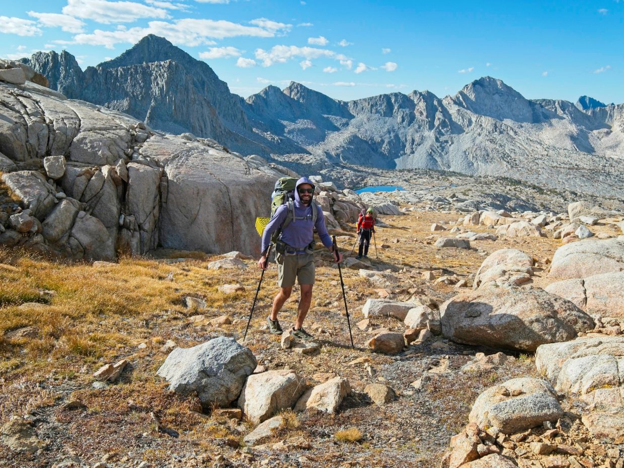
Bishop Pass turns out to be a very shallow saddle and it’s difficult to tell where the top is. Several false summits give me hope that we’ve reached “the pass,” only to revise my estimate when I round a corner and see the trail continuing uphill. In any case, we soon abandon the trail and strike out cross-country toward an unnamed lake marked on the topographic map. We won’t see another trail until we return to Bishop pass in a few days; it’s all cross country from here!
When we reach the lake, we stop for a sit-down break to refill water bottles and munch on snacks. This late in the season I’m not sure that any of the tiny ponds or creeks between here and our campsite in the Palisade Basin will have water, so it’s safest to gather all the water we need now.
After the break, we continue southeast across grassy ramps and granite slabs toward Thunderbolt Pass. We stay fairly high, well above the large lakes, but low enough to stick to the easy grass and low-angle rocks. Route finding across the upper basin isn’t entirely straightforward and we’re forced to backtrack a few times to avoid short cliffs, but the terrain is pretty gentle as far as cross-country travel in the High Sierra goes.


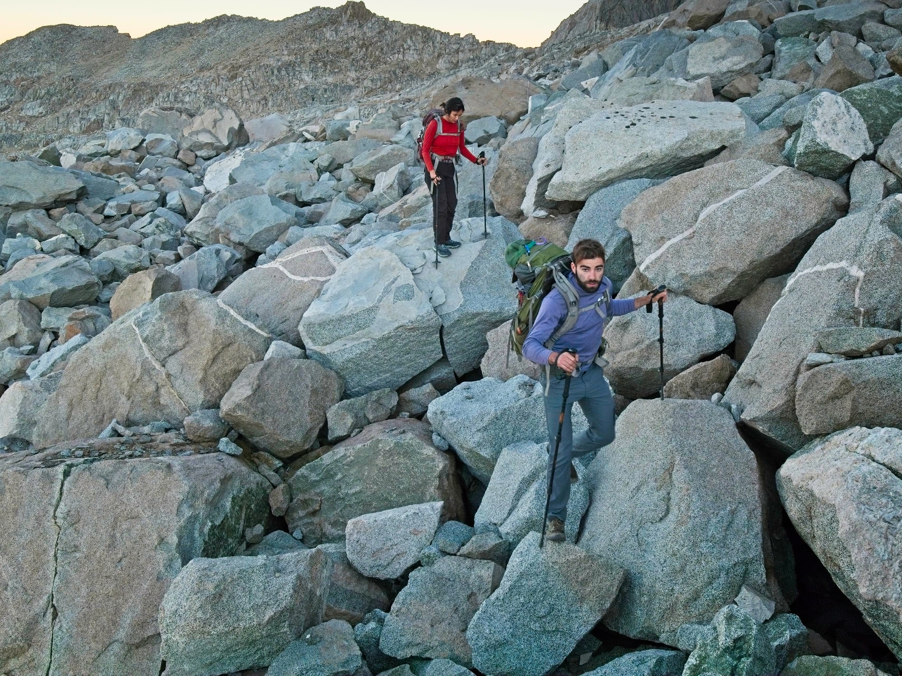
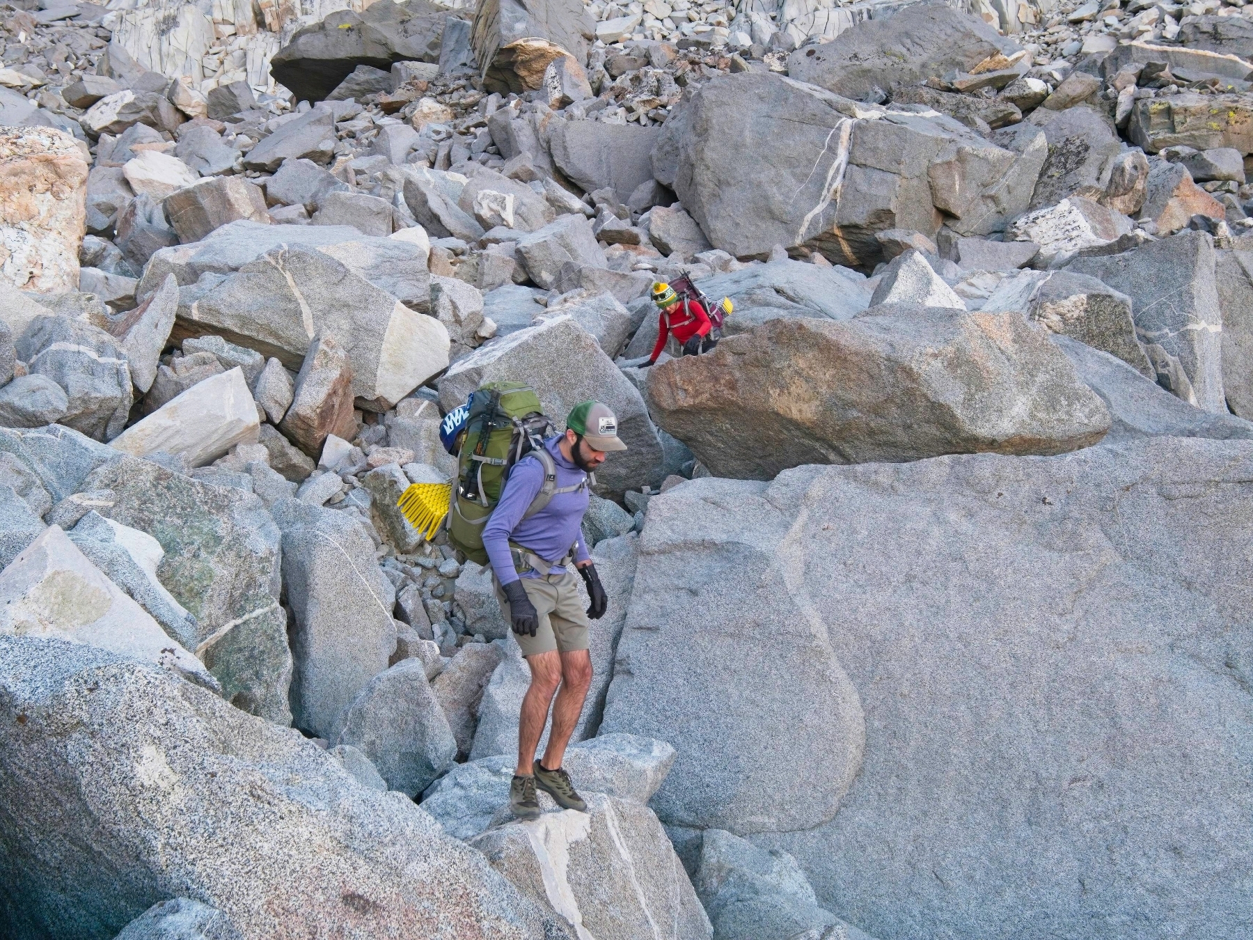
The pleasant stroll because less pleasant when we reach the talus field below Thunderbolt Pass. We choose a line that ascends on climbers’ left and then traverses right to reach the pass. The route is full of tedious rock hopping, sometimes between very large boulders that offer few hand or footholds. In retrospect (after having hiked back over this pass) the easier and more direct route stays further right and ascends to the pass via a gully.
Josh reaches the pass first and relaxes on the sunny granite slabs. I arrive soon after him and look behind me for Alex and Kim only to spot them far below. I thought they were a little closer! Kim, it turns out, is not as comfortable on the talus (and this is pretty difficult talus) as I assumed and takes a bit more time to navigate the complex terrain.


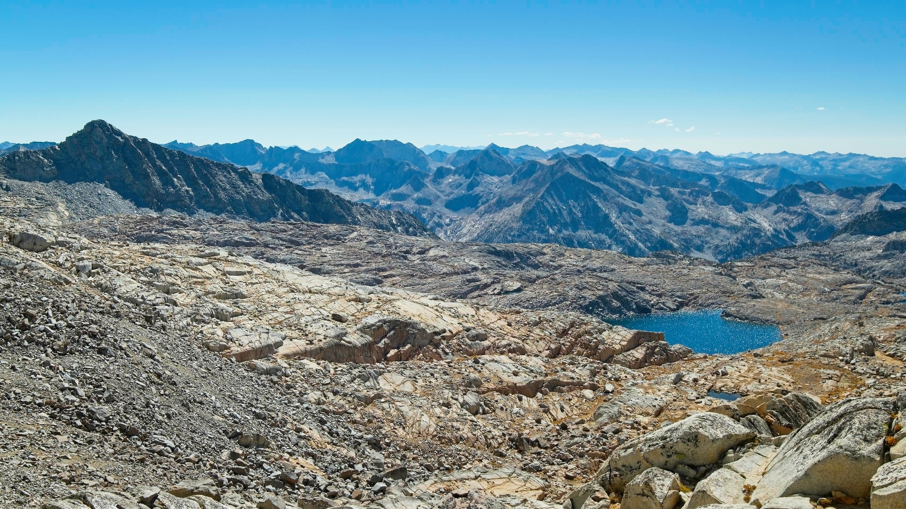
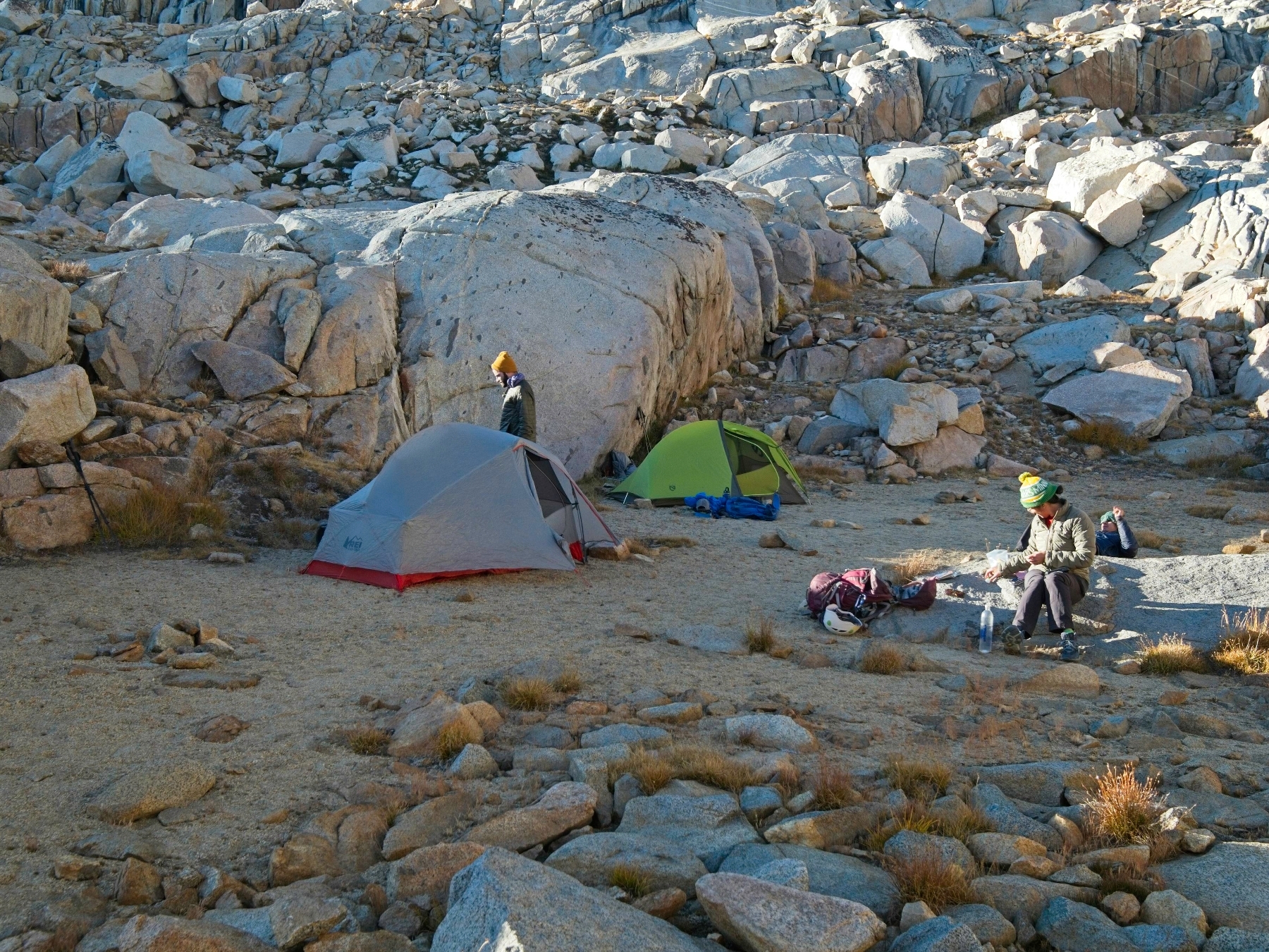
When Kim and Alex reach the pass we take some time to sit and scan over the rugged Palisade Basin on the east side of Thunderbolt Pass. Several large members of the Barrett Lakes stretch out nearly a thousand feet below us but otherwise it’s mostly a barren, rocky landscape. Our most pressing concern is deciding on a campsite location. There may be spots near the large lakes, but all I can see from here is solid rock. There are some sandy flat areas closer to us, however, and they’re within easy walking distance of a small tarn. One particular spot next to a small cliff band appeals to us; it looks large enough for several tents and the cliffs may provide some shelter from the wind.
Scrambling down to the basin proves to be a little less straightforward than I anticipated. Josh and I begin down a pile of talus with some class 3 sections, so I shout up to Alex and Kim that they should try another route. They find a much more straightforward series of ramps and slabs and meet Josh and me below the pass. From there we wander through a dry creek bed to the sandy spot we identified from above. It’s a great looking campsite, so we set up our tents and discuss plans for the rest of the day. It’s about 14:30, so there’s certainly not enough time to go climb North Palisade or Mount Sill but we do have several hours of daylight left.
After staring at the cliffs beside our campsite for a few minutes, Alex, Josh, and I decide to do some climbing. Alex picks out a traversing bouldering route a few feet off the ground – it’s tough but a lot of fun! We also set up a top-rope so we can climb a few short crack systems up the face of the rock. Alex shares two pairs of rock shoes he brought along and all four of us take turns climbing the granite wall! I have a blast climbing and particularly enjoy playing ‘action photographer,’ capturing shots of people climbing with the Palisades towering in the background.


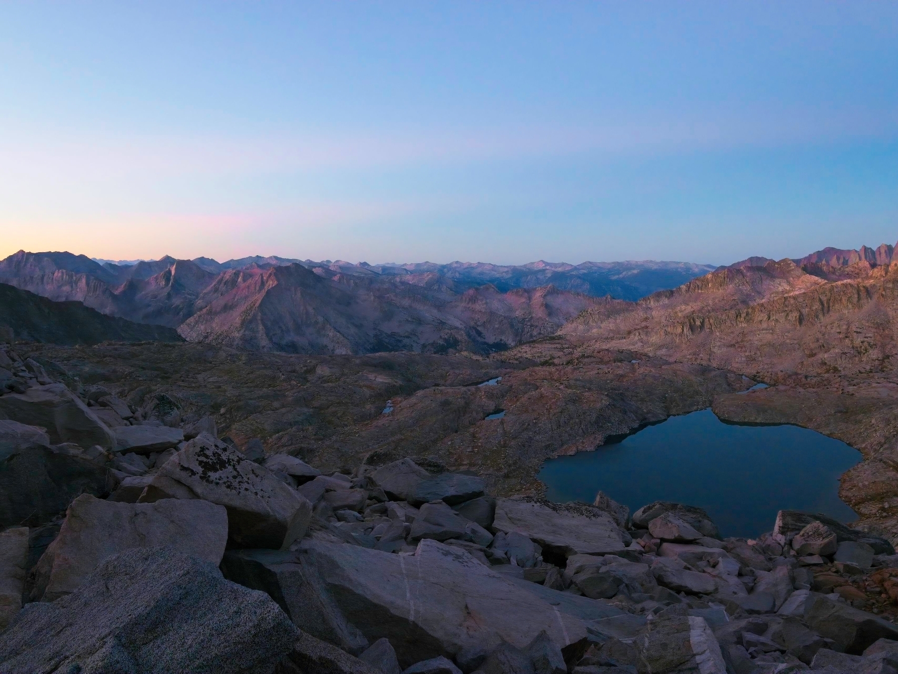
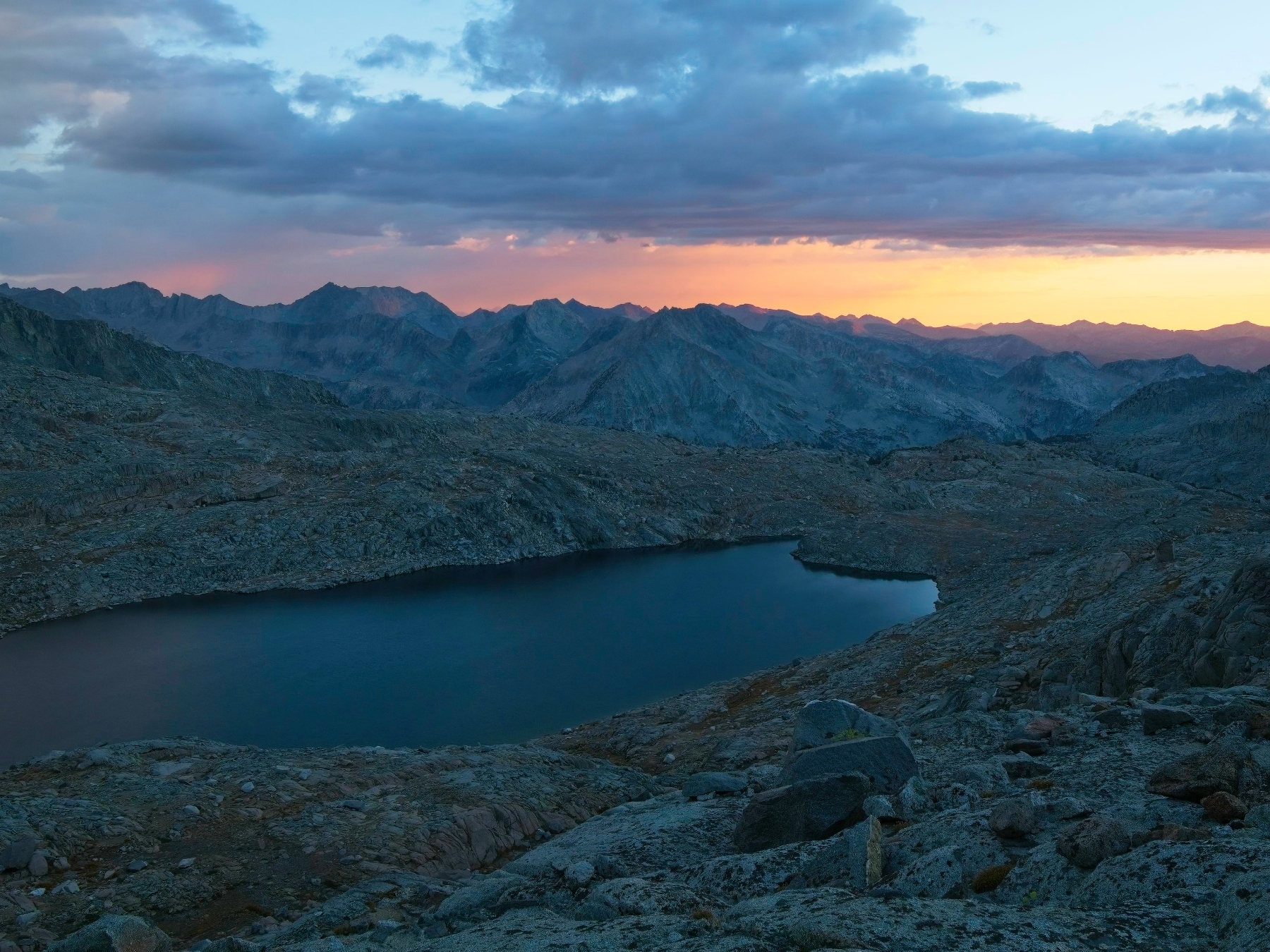
We climb for a few hours and then settle into camp chores: gathering water, inflating sleeping pads, etc. The temperature drops quickly once the sun sinks below the western peaks and we all pull on extra layers as we cook dinner. The light soon disappears from the Palisades, only to come back, bright orange, ten minutes later. Further from camp, the sky and a few clouds turn pastel colors just before the sun sets for good.


We stay up talking for a little while after the sun sets to decide on a plan for tomorrow. We’ll start as soon as it’s light out (6 AM) and hike to Mount Sill, hitting North Palisade on the way back, time permitting. As soon as we”re done chatting, we escape from the cold breeze into our tents and warm sleeping bags. I’m sharing a tent with Josh and chat with him for a little while. Even after talking for a while, it’s only 7 PM so I read a book until 8 PM, a “reasonable” time to go to sleep.
Split Mountain and a North Palisade Attempt
08 Oct, 2022 | 9.0 mi | +/- 4000 ft | View on Map
My alarm rings at 5:00 but I’m already awake. It’s been one of those tossing and turning kind of nights. I crawl out of my sleeping bag, pull on a few warm layers, and stumble out of the tent. Kim, Josh, and Alex are all stirring as well and soon we’re all huddled over stoves, heating water for breakfast. By 6:00 we’re on the move, heading southeast toward Potluck Pass.
We decide to traverse high across the top of Palisade Basin to avoid dropping five hundred feet to the lakes below. At first, we make great time walking across a series of granite slabs, avoiding cliff bands here and there. But we’re soon scrambling through talus and our progress slows. Some of the blocks are small and easy to hop across while others are enormous — the size of cars — and require more climbing than walking.
The talus traverse to Potluck Pass, a two mile walk with a mere 200 feet of elevation gain, takes us two and a half hours to complete. Looking back at the lakes from Potluck Pass, I think it’s probably easier and much more enjoyable to drop those five hundred feet to the lake and then walk up grassy ramps and granite slabs to the pass. Twenty-twenty hindsight, I suppose!
We rest for a few minutes on the pass, snacking, applying sunscreen, and enjoying the warm sunlight. A large, unnamed lake fills the basin on the other side of the pass. Memories of the Sierra High Route come flooding back as I look across the rugged landscape; I stashed gear down by the lake and hiked up the canyon toward Mount Sill but turned back when I realized how far away the peak was. Today we’re going all the way up though!
After resting, we work our way down the slabs and ramps to grass and talus below Potluck Pass. I lead the way up a sandy ridge, remembering bits of the route from four years ago. There’s plenty more talus to traverse, but these rocks are a little smaller and we discover that the wash in the center of the canyon is particularly easy to walk through.


Even with the easier talus, we’re still traveling much more slowly than I was hoping. It’s now 10:00 and we’re at the foot of an apron of loose scree that leads up to the cirque between Mount Sill and Polemonium Peak. Two thousand vertical feet of loose rock stand between us and the summit. At our current pace, I’m worried we won’t make it up and down the mountain with enough time left for North Palisade. So I suggest that we split up: Josh and I can speed ahead, tag Mount Sill, and then go tackle North Palisade while Alex and Kim climb Mount Sill at a slower pace. After a short discussion we do just that.
Josh and I hurry up the scree slope, slipping and sliding on loose rock. It’s not particularly fun climbing, but I do enjoy the rush of moving quickly. We stick to climbers’ right on the scree and are soon back on stable talus, traversing horizontally across the slope toward chutes that lead to Mount Sill’s summit. A hundred feet below, the floor of the cirque offers much easier walking, but we’re already up here and I don’t want to give up the altitude. Josh is even higher up the slope than I am, so we continue on the talus. Kim and Alex are soon out of sight.
Several chutes full of loose rock lead up to the summit ridge. The GPS tracks I downloaded while preparing for the trip aren’t consistent in their chute choice, so Josh and I scramble up the first one we come to. I don’t particularly enjoy the first thousand feet of climbing; it’s incredibly loose and we have to be careful to avoid knocking rocks down onto each other. Higher up the rock quality improves and I have fun climbing a bunch of third and fourth class slabs.
Our chosen chute tops out east of Mount Sill, so we walk west along the ridge. Just before the summit, a 10-foot deep notch blocks our path. Scrambling down into the notch proves straightforward, but climbing up the other side is not so easy. There’s nothing like a bouldering problem at 14,000 feet to get your heart pumping! Josh climbs up first; I hand him his backpack and then mine before climbing up myself. From here, we cross a little more class 3 talus and then we’re at the summit!
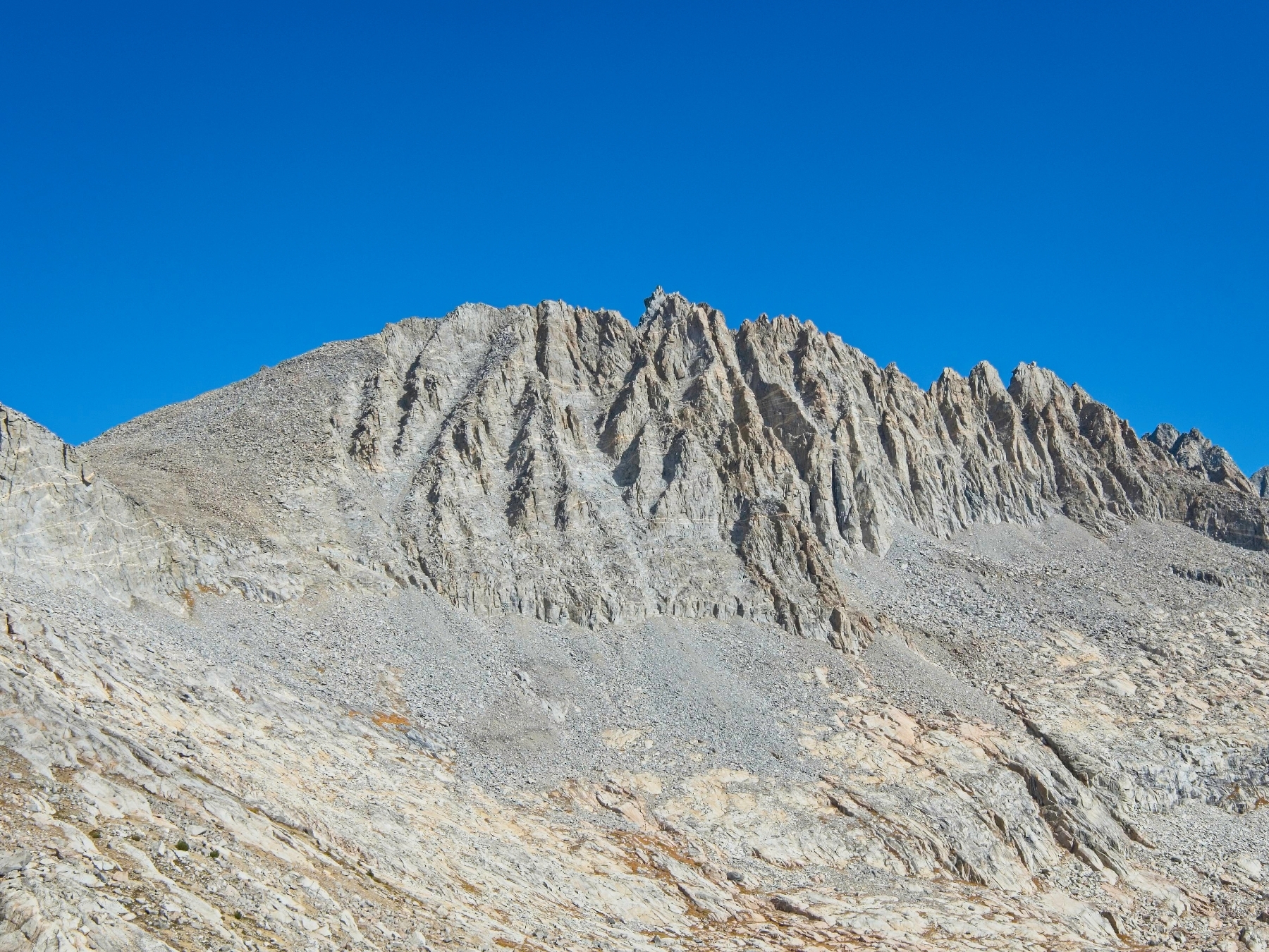
Moments after we arrive, two other climbers reach the summit. They’ve climbed up from the other side of the ridge, beginning on one of the Big Pine Creek trails early this morning. We chat for a little while and admire the panorama from the top. Secor says Mount Sill “has the best summit view in the Sierra,” though I disagree. It’s certainly a nice view, but I don’t think I’d call it “the best.” Maybe it was more spectacular a few decades ago… the glaciers have receded an awful lot in the past 50 years.


After resting and munching on snacks, Josh and I begin down the mountain at about 12:00. I suggest following the other chute since I don’t want to downclimb into that notch. My descent route ends up being even more technical than the notch, however. A hundred feet of sketchy fourth class climbing later, Josh and I reach the chute proper and carefully make our way through the loose rocks. I keep looking around for Alex and Kim but can’t find them, which has me worried. Did they scramble up a different chute? What if one of them got hurt? Maybe they turned around?
We continue all the way down to the cirque floor and refill our water bottles from glacial melt there. Hiking through the canyon down here is much easier than the talus above and we’re back at the top of the loose scree by 13:00. On the way down the scree I admire the facade of Palisade Crest. It’s rugged from most angles, but this side looks spectacular!
As Josh and I make our way back through the wash below Mount Jepson, I finally spot Alex and Kim in the distance perched atop Potluck Pass. I can relax, they’re ok! When Josh and I reach the foot of the pass, we scramble up fourth and fifth class slabs and chimneys to reach the top. It’s a ton of fun! We sit with Kim and Alex for a few minutes and compare notes. They did indeed turn around after discovering how loose the scree was.
I’m eager to attempt North Palisade, so after agreeing to meet Kim and Alex back at camp Josh and I head off. It’s 14:00 and the sun sets around 18:30, so we have four or five hours of usable light left. Thankfully, most of the terrain between Potluck Pass and the “southwest chute” is pretty straightforward and Josh and I reach a slope that leads up into the chute by 14:30. Our luck runs out here, however. As we begin scrambling up the mountain we discover the ground is a mix of crusty dirt and rocks that is ready to disintegrate at the slightest touch. It’s by far the loosest crap I’ve ever had the displeasure of climbing on!
After thirty minutes of torturous “climbing,” Josh and I reach solid ground beneath a pinnacle and take a break. A tiny pika peeks out of some nearby rocks, scurrying back and forth as it tries to decide if it wants to risk approaching us. It’s now 15:00 and both Josh and I are feeling a lot less enthusiastic about climbing North Palisade. Josh’s stomach is also causing him some distress, and gathering clouds over the valley threaten rain.


We quickly agree that we’d rather bail than climb (though Josh valiantly offers to push through his GI distress) and begin the descent. Although it’s not as terrible as the dirt-conglomerate we ascended to reach the chute, the chute is still full of incredibly loose rock. It takes us a full hour to descend 1200 feet to the grassy slopes down by the lakes and it’s a huge relief to reach the lush meadows. Josh is feeling even worse now so I think we made the right decision to turn back. I snap a bunch of photos of the colorful plants, creeks, and cliffs as we make our way back to camp.


Climbing five hundred feet from the lake up to our campsite isn’t the easiest end to the day, but at least it isn’t talus. We reach the tents at 17:20 and reunite with Kim and Alex, who are happy they don’t have to wait up for us. Much like last night, the breeze has picked up again and it’s getting cold out! We cook dinner together and then spend the rest of the evening relaxing.
Return to Bishop Pass Trail
09 Oct, 2022 | 7.9 mi | +1000 / -3200 ft | View on Map
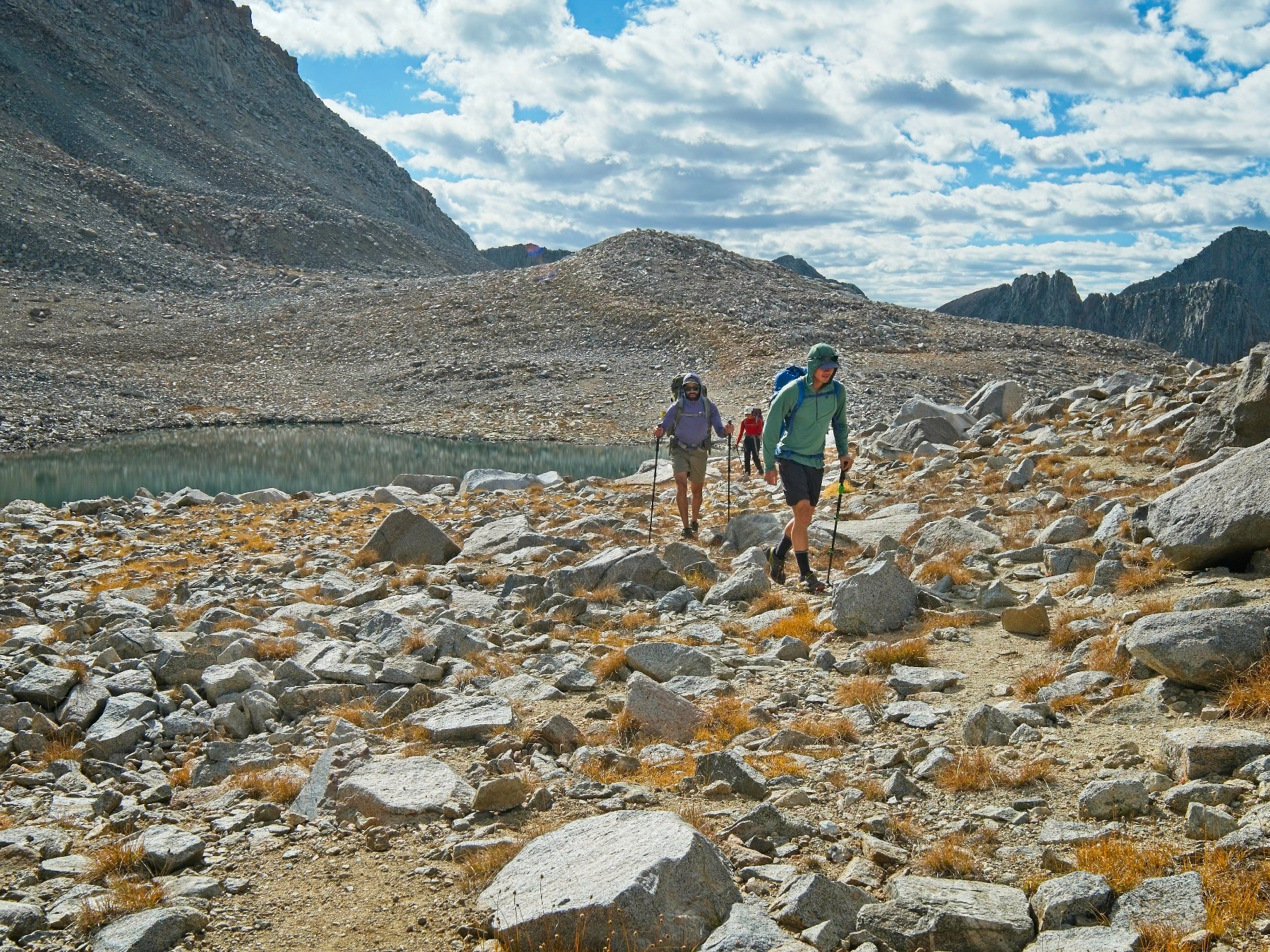
When I wake up in the morning at 5:45 I reach out to open the tent door and discover it’s covered in frost! Ah, fall weather… Today our only task is to hike back to the trailhead and drive home. It’s a long drive though, so we get an early start. After packing up camp we trudge up to Thunderbolt Pass. I’m surprised at how difficult the moderate climb feels since I should be pretty well acclimated by this point. I wonder if my body is just worn out after yesterday’s hiking? At the top of the pass we enjoy a Nalgene bottle full of raspberry jello, courtesy of Alex and Kim. They’ve also brought along pop rocks, which are a great pairing for the jiggly jello!


We make wiser route decisions on the descent from Thunderbolt Pass than we made a few days ago when we scrambled up. Sticking to skier’s left, we follow a use trail down a gully and then hop over mostly manageable talus. There are still a few spots with enormous boulders to scramble over, under, and around, but not nearly as many as on the other side of the talus field.
Once we reach the grass, we enjoy a long, leisurely stroll across upper Dusy Basin. I, for one, am glad to be back on easy terrain. Cotton ball clouds drift across the sky and bright sunshine highlights the autumn colors in the meadows; what a gorgeous morning!


We again stop for a snack and water refill break at the large lake just below Bishop Pass. Josh walked ahead of the rest of us and is on the other side of the lake, but easily within shouting distance. The water is smooth as glass this morning and the reflection of the clouds and sky is incredible! I’m comfortably warm sitting in the sun, but when clouds drift by it’s decidedly chilly.


Once everyone has refilled their bottles and rested, we finish the cross country hiking and return to the Bishop Pass Trail. Almost immediately we meet several groups of hikers, backpackers, and trail runners. The last time I checked, today’s forecast calls for rain in the afternoon, so I’m surprised to meet backpackers. One group is heading up to where we camped and will attempt the traverse from Mount Sill to Thunderbolt Peak tomorrow. I hope the weather holds out for them!
The gorgeous fall colors are a bit subdued on the hike down as the cumulus clouds begin to coalesce into a solid overcast layer. The sun peeks out occasionally, highlighting the reds, yellows, and oranges, and I make sure to snap photos. The aspen trees by South Lake really capture my imagination. Filaments of yellow foliage snake across the granite slopes on the opposite side of the lake, like a fire burning through the pines. The final quarter mile of the trail is lined by the colorful trees so I stop repeatedly to try to capture their intensity.


Back at the trailhead we all change into more comfortable clothes and stretch a bit in preparation for the long drive home. In contrast to Thursday evening and Friday morning, the trailhead parking lot is packed. Cars line the road for miles and dozens of photographers are taking pictures of the aspens. They’ve come to the right place! Although we didn’t spent a lot of time in the trees this trip, I’m glad we were able to catch some glimpses on the tail ends of our hike. One of these years I’ll have to plan a trip entirely dedicated to fall foliage… But right now all I want is a fresh sandwich, some ice cream, and a shower, so we’re off to Bishop.