Mount Hood, located just an hours’ drive from Portland, is Oregon’s tallest mountain and a popular mountaineering objective. It’s a challenging climb, with over 5000 feet of elevation gain and some very steep snow and ice to ascend. Hazards range from falling rock and ice to avalanches, exposure, and too-icy-to-self-arrest conditions. I was happy to join Jack and Josh on this climb, our first trip together since Mount Shasta in 2023.
Trip Planning
Specs: 7.7 mi | +/- 5300 ft
Difficulty: Class 2 [ratings] / AI1 (See Ascentionism for ice-climbing grades)
Location: Mount Hood National Forest, Oregon | Home of Cayuse, Umatilla, Walla Walla, Grand Ronde, Siletz, and Warm Springs peoples | View on Map
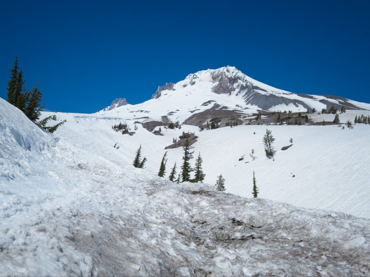
Route: We started at the parking lot near Timberline Lodge and followed the “climber’s trail,” a cat track that goes all the way up to the top of the Palmer Chair Lift. From there we followed the path of least resistance up to Devil’s Kitchen, the conspicuous, steaming valley on the right side of Crater Rock. From there, we followed the well-established boot track along Hogsback Ridge, trending left to reach the Old Chute area, which has 3 – 4 distinct chutes. We ascended the left-most chute (“Old Chute”) and descended via the second-from-the-left (“Mazama Chute”) since it was a little less steep.
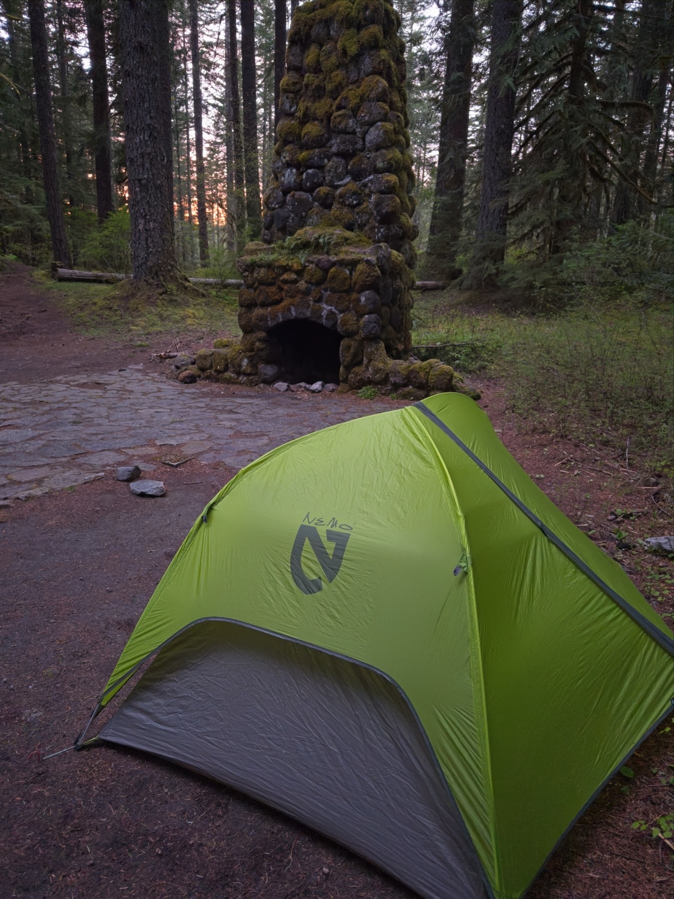
As far as camping the night before our climb, we had a difficult time finding a good spot. The parking area near the Timberline Lodge is not a great camping spot (though you could camp in your car), and the nearby Alpine and Still Creek Campgrounds were both closed. We ended up a few miles down the road at the very pleasant Camp Creek Campground

Permits & Regulations: A non-quota climbing permit is required to climb Mount Hood; you can get one online at Recreation.gov or at the Timberline Lodge. This counts as your wilderness permit as well. While on the mountain, solid waste must be carried out, so bring wag bags.
Resources: See the Climbing Mt. Hood USFS page for lots of details about the climb, and Mt. Hood Wilderness USFS page for additional info about the area.
A Peach Ring-Fueled Climb
4 May 2025 | 7.7 mi | +/- 5300 ft | View on Map
The weather forecast for the climb is concerning. Winds gusting up to 35 mph and temperatures well below freezing will keep the snow ice-hard well into the day, and it might not soften up at all on the upper mountain. That can be helpful since the ice provides good grip for crampons, but on the steeper sections it can also make it very difficult to self-arrest if you fall. Plus the cold and wind will just make the climb uncomfortable!
Given the cold conditions, we’re not worried about ice and rock fall (commonly a significant hazard when the sun hits the ice-covered cliffs near the summit) so we’ve decided on a relatively late start time of 4 AM. Josh and I are on skis and skins, Jack is booting up. The climber’s trail, a groomed cat track that heads up the slope from the parking lot (5880′) to the top of the Palmer Chair Lift (8430′) is icy from the start. The parallel grooves left by the snow cat reduce the amount of grip the skins have on the icy snow and I soon put ski crampons on to avoid sliding around. Josh, who doesn’t have ski crampons, just straps his skis to his pack and hikes onward in ski boots and crampons.
As we trudge up the icy slope, dozens of people pass us on their way down. We might be starting late, but not late enough for them to have summited already. We ask a few people why they’ve turned around and they cite icy conditions and strong winds at the top of the ski lift. Neither Josh, Jack, or I have climbed Mount Hood before, so the mass exodus down the mountain is concerning. Do they know something we don’t about how those conditions will affect the upper mountain? For the moment, the cold and the wind aren’t that big of a deal. It’s uncomfortable, but not a safety issue.
As we continue up the mountain, the sky lightens and we’re treated to a lovely sunrise. Mount Jefferson pokes up through a layer of fluffy clouds, all pastel colors in the morning light. I snap a few photos but can’t bear to expose my fingers to the icy air for very long, so the camera goes back in my bag very quickly. I follow Josh and Jack up the icy snow, not feeling very well. I’m tired, simultaneously warm and frozen, and my excitement level is low. But Josh and Jack are optimistic and press on, so I follow them as fast as I can; they’re kind enough to periodically wait for me to catch up.


When we reach the top of the Palmer Chair Lift at 6:30, we take a short break and hide from the wind in a deep, groomed cat track that cuts horizontally across the slope. Josh and I are both carrying our skis at this point, and they’ve become a real annoyance in the wind. Every gust buffets them around, threatening to knock us off balance. We decide to leave them here, at 8400 feet, since the forecast predicts consistent cold temps and winds all day; we figure the upper mountain will remain icy and no fun to ski, so why bother carrying the skis up further?
Once we leave the cat track we’re exposed to the wind again and I struggle my way upward. Ski boots are not as flexible as mountaineering boots, so walking with my feet pointed uphill feels very uncomfortable. Instead, I zig-zag across the mountain, side-stepping uphill in the French “pied à plat” style. Periodic fierce gusts of wind almost to knock me off my feet and burn the exposed skin on my face. I pull out ski goggles, which significantly decrease the wind burn, and continue struggling upward.

Besides the strong winds and the cold, the upper mountain stinks of sulfur. Mount Hood is an active volcano, and the wind is blowing the sulfuric gas from the crater downhill to us. That smell, combined with all the effort required for climbing, banishes my appetite. I try to eat a bar when we arrive at the fumarole dome called “Devil’s Kitchen” at 8:00, but I can’t stomach it. Luckily, I have a bag of gummy peach rings, and those taste great, so I stuff a few into my mouth. Almost immediately, I feel my body waking up from the sugar and my mood improves considerably. Peach rings to the rescue! I’m still not completely sold on continuing up to the summit ridge, but Josh points out that we have lots of time and are well ahead of our noon turn around time. We also now have a view of the chutes that lead to the summit ridge, and they don’t look as steep as I imagined.


After resting for a few minutes in the bitter, sulfuric cold, we begin the climb up to the Old Chute area. A well-worn boot track leads up a snowy, wind-sculpted ridge called the “Hogsback,” which is now in the sun! And, as an added bonus, the wind completely disappears as we move into the crater. I’m finally feeling excited to summit this mountain.
The trek up to the Old Chute area is relatively easy on firm snow with no wind,and plenty of sun to keep us warm. We chat with a few climbers that are on their way down and get some useful information about the quality of the various chutes. There are at least four; “Old Chute” is on the far left, and the one we’re aiming to ascend. To its right is “Mazama Chute,” which is currently full of descending climbers. There are also several groups of climbers in the chutes on the right, several of which are building anchors and belaying people up on ropes.
As we climb higher, the slope steepens and we all pull out extra ice axes and begin climbing with both hands and feet: our crampons are front-pointed into the slope and both ice axes are buried in the ice. I don’t have an inclinometer, but I’d guess the slope is around 45 degrees; I’ve seen ranges from 40 – 50 quoted on other descriptions of the route. I’m soon sweating; it’s difficult work, and also scary! Thankfully, the firm conditions and general cold mean that it’s a very secure climb and the only ice coming down the chute is the ice we kick down ourselves.


We top out onto the “catwalk”, a narrow ridge of snow and ice that connects the tops of the chutes to the much broader summit a few hundred feet to the east. Of course, the instant we poke our heads above the ridge we feel the gusty wind again, so it’s a nerve-wracking walk, particularly on the narrowest sections. A fall here would be very difficult to arrest… After down-climbing a 6-foot step and carefully winding our way along the catwalk we reach the summit at 10:00. By some miracle, the wind is nonexistent and we enjoy a long break in the warm sun, chatting with a few other people that are there.


After a leisurely break at the top, we head back over to the chutes and try to decide which we want to descend. Traversing all the way back to Old Chute seems unnecessary; Jack and I like the looks of the Mazama Chute because it seems less steep, but Josh is concerned that we can’t see the full runout and there might be a hidden steep section. A guide that is belaying his clients down a different chute reassures us that the Mazama Chute is perfectly doable, so we head over there and start downclimbing the ice. Josh, an experienced mountain guide, makes quick work of it, but Jack and I are slower. Even though the slope can’t be more than 45 degrees, it feels almost vertical and I’m not at all comfortable with my body weight held entirely on an inch of steel on my toes and hands. There’s no easier way down the mountain though, so I do my best to find good purchase with the ice axes and crampons.


By the time I reach the shallower slopes below the chute, I’m thoroughly sweaty but happy to be back on easier terrain. I follow Josh and Jack down the mountain, now side-stepping and moving much more quickly. We follow the same route down to Devil’s Kitchen as we took on the way up, arriving at 12:20, and then begin a long, knee-destroying descent to the Palmer Chair Lift. I wish I had carried my skis up further so that I could make quick work of the 2000-foot descent to the lift, but most of the snow is still very icy from the wind and it wouldn’t be good skiing anyway.
We take another long break when we reach our skis at 1:00. I spread out my hard shell on the snow and lounge in the sun, which feels amazing. We eventually regroup and start the final leg of the descent. Jack heads off down the climber’s trail, and Josh and I pop into our skis. We make a beeline for the groomed run that parallels the lift and I enjoy fast, easy turns through the sun-softened snow. We cut back over to the parking lot at the bottom of the run, beating Jack to the car by only about 15 minutes. We all do some re-packing in the parking lot, changing clothes, shuffling gear around, etc., and then drive off in search of a big meal.


Diane 11 July 2025
It looks cold and scary to me – I admire you guys and all the other climbers who are willing to tackle such a challenge. Your photos are amazing as always – I miss the flower pictures, though !
Diane