I had the pleasure of joining some of my peak-bagging friends on a trip to the Cascades this summer. The first peak on the docket was Glacier Peak. This late in the season – August – there’s not much snow left, but we brought glacier gear anyway. You have to do some glacier travel when climbing Glacier Peak, right?
Trip Planning
Specs: 35.1 mi | +/- 11,100 ft | 2.5 days, 2 nights
Difficulty: Class 2 [learn more]
Location: Baker-Snoqualmie National Forest, Washington | Home of Suak-Suiattle, Cayuse, Umatilla, and Walla-Walla peoples | View on Map
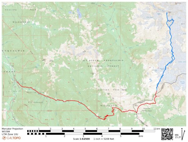
Route: There are many routes to the summit of Glacier Peak. The route we followed begins at the North Fork of the Sauk River trailhead and climbs up to White Pass. From there, we hiked the established use trail to the south ridge of Glacier Peak. Many hikers continued directly up the class 2 ridge to Disappointment Peak before summiting Glacier Peak, but we wanted to take the glacier route. So we traversed across the Suiattle Glacier on the southeast slope of Disappointment Peak and then up the Cool Glacier on the northeast slopes. From the top of the Cool Glacier, we walked up the sandy south ridge to the summit of Glacier Peak. On the way back we skipped the glacier travel and descended the class 2 south face of Disappointment Peak.
Permits & Regulations: Permits are not required for this hike, but the usual wilderness regulations apply. A recreation pass is needed to park at the trailhead.
Resources: The USFS page for the trailhead has lots of useful information about the area, including closure information and links to trip reports!
Temperate Rainforest to Alpine Cirque
25 Aug 2023 | 11.4 mi | +5200 / -900 ft | View on Map
I met Andrew R., Dagmar, Craig B., and Craig J. in Seattle last night. We drove to the North Fork of the Sauk River trailhead, arriving pretty late, and camped for the night. We don’t have too many miles to cover today (though there is a lot of elevation gain), so we sleep in until 7:00 and then spend a leisurely hour eating breakfast and packing our things for the trip.
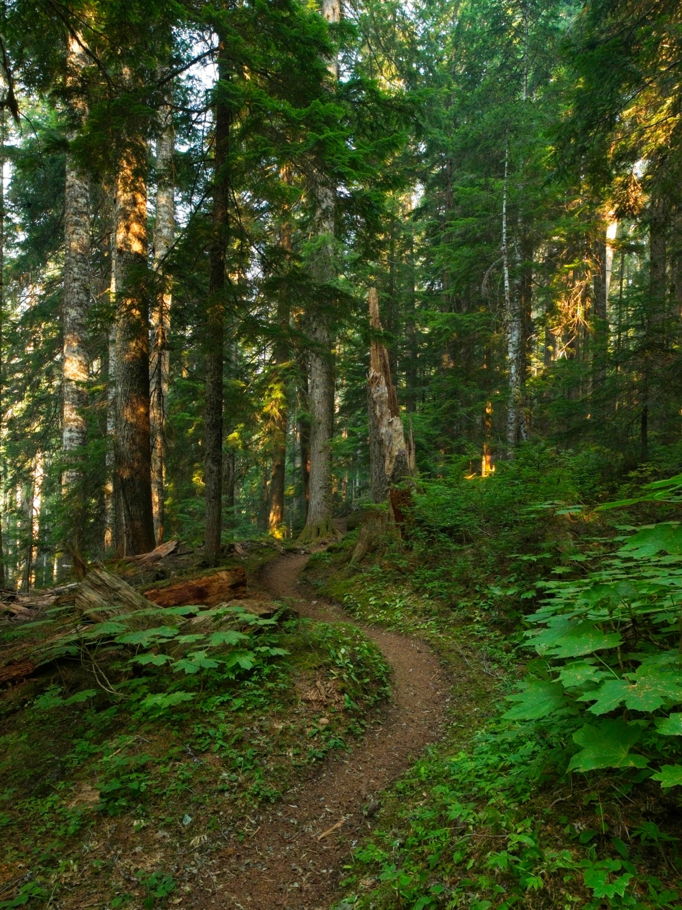
The trail starts in typical Pacific Northwest fashion, in a dense, dark, mossy temperate rainforest. The ground underfoot is soft, almost spongy with the compressed pine needles – a pleasure to walk on. The trail undulates up and down a bit for the first few miles but we don’t gain much altitude. The only thing marring an otherwise perfectly pleasant hike is the smoke in the air. It seems to come in patches; barely noticeable and then strong enough to taste.


I bought a new pack recently – a Hyperlite Prism – and am trying it out for the first time on this trip. It’s a very light bag with great features for technical climbing and good storage for the sharp, pointy bits (crampons, ice axes/tools) but I’m unsure about its comfort when carrying a lot of gear. The hip belt and shoulder straps dig in and I keep adjusting the weight distribution. But I’m not sure if it’s the bag that’s uncomfortable or just the weight; it’s been a while since I’ve carried this much stuff up a mountain.
After several miles of flat hiking, we reach a series of switchbacks and really start gaining altitude quickly. It reminds me a lot of the approach to Mount Jefferson – a flat forest walk and then steep uphill slog. The smoke feels thicker now; I can feel it in my throat and I’m beginning to get a headache. A light drizzle begins as we trudge up the hill, which is rather nice! It keeps things cool and maybe even takes some of the smoke out of the air. The steep uphill really pays off once we emerge above the forest! We enjoy sweeping views of the (smoky) mountains and lots of colorful plants.


For a brief quarter mile just before White Pass our path coincides with the Pacific Crest Trail. We don’t see any thru hikers, but we’re on and off their route in a matter of minutes. After a chilly lunch at Windy Pass, we leave the officially maintained trail and set out on a very well-traveled climbers trail. As we hike away from the valley we’ve been hiking up, the smoke grows thinner, which is a welcome relief. The open, grassy landscape up here is also gorgeous and we finally get our first Glacier Peak sighting! It looks really far even though it’s no more than 7 miles away.


We set up our camp of all Nemo tents at the first spot we find, a rocky cirque below a steep pass. There’s a small creek gurgling down from a snow field toward larger lakes lower in the valley. It’s only 2:30 PM but we’re all pretty tired from hauling our gear some 5000+ feet up the mountain, so we rest for several hours. The sun has come out and it’s a bit warm, but I’m comfortable reading a book in the shade of the tent with the breeze blowing through. Over the course of the afternoon, several groups of backpackers pass through on their way to higher campsites. We saw a few of them on the trail this morning, and I’m sure we’ll see them again tomorrow.


Later in the evening we emerge from our respective Nemo tents and eat dinner together. I really enjoy catching up with everyone and just chatting about whatever topics come up. It’s a very pleasant end to the day. By the time the sun sinks below the ridge, we’re all ready for sleep and go to bed.
Glaciers and Till Plains
26 Aug 2023 | 12.3 mi | +/- 5000 ft | View on Map
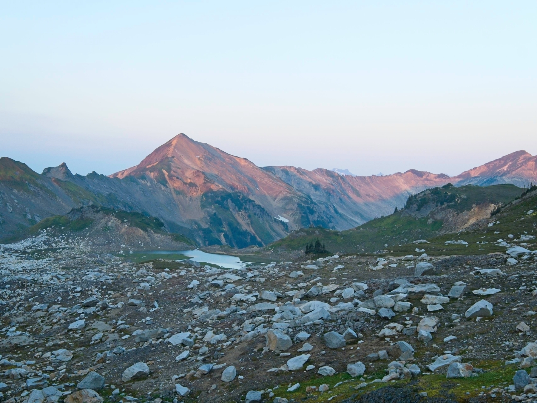
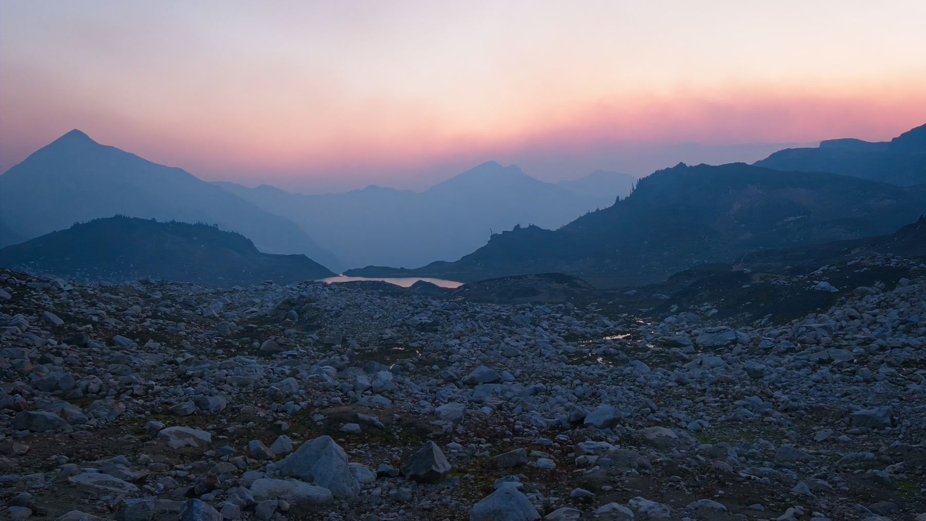
We’re on the trail this morning at 6:30. The smoky haze that lingered over camp last night is gone and we’re treated to beautiful alpenglow on the nearby peaks. We hike past several campsites, all potentially more scenic than the one we chose… oh well! The terrain we’re hiking through is otherworldly – desolate and rocky with hundreds of tiny creeks flowing down from glaciers. I think this is what’s called a “till plain,” the land underneath a glacier (in this case, the White Chuck Glacier) that’s melted away. We follow others’ footprints and numerous cairns across the plains toward Glacier Peak.


We stop for a sit-down break at a pass overlooking the scattered remnants of the Suiattle Glacier. Like the White Chuck Glacier, there’s much less ice in front of us than the topographic maps depict. Our path to Glacier Peak is pretty clear. We’ll wind up the ridge for several miles, cut across the Suiattle Glacier just south of the Disappointment Peak, and then hike up the Cool Glacier to reach the foot of Glacier Peak.
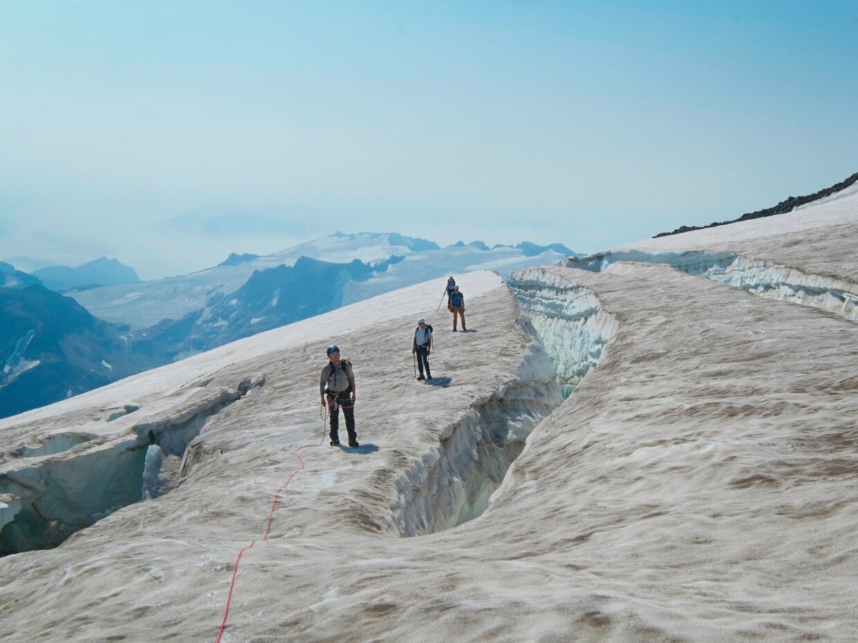
After resting, we do just that. Several descending parties pass us and we leap frog with others that are ascending. Everyone else is hiking up and down the class 2 south ridge of Disappointment Peak, which looks unpleasant but doable. We’re the only group braving the glacier. We leave the ridge trail when it begins to get tediously rocky and drop down onto the glacier. For a little while the slope is gentle and we make do with our hiking shoes but soon transition to stiffer boots and crampons.


We begin traversing east across the glacier a little higher than I would like. The upper glacier is covered in dirt and rocks that have tumbled down from the mountain above and more are falling every minute – the air is full of the sounds of falling rock. On the other hand, the lower glacier is criss-crossed with large crevasses and this upper section is mostly crevasse-free. And we’re already up here; Andrew R. and Dagmar charge ahead, so we follow them through the maze of ice and rocks.


After an uncomfortable scramble through the on-glacier talus field, we rope up and begin more traditional glacier travel. There are a few tenuous moments! Andrew R. post-holes through a snow bridge while crossing a crevasse. We leap across a few gaps wide enough to see the depths of the glacier. I am firmly out of my comfort zone, but that’s what makes this kind of trip so fun! I’m out here to push my limits with capable and supportive climbing partners.
Some zigging, zagging, and jumping later we reach the other side of the Suiattle Glacier and are faced with the rugged, crevasse-laced edge of the Cool Glacier. I’m not sure how we’re going to get up there… The least technical terrain over on the east slope of Disappointment Peak is firmly out of the question since very large rocks keep tumbling down there every few minutes.
Dagmar leads the way out onto the glacier but reaches a dead end of impassable crevasses. So we reverse direction and I lead the way up a different spot. I’m nervous walking on the narrow ridges of ice between crevasses but my boots and crampons are secure it’s not technically difficult – just heady.
The route I pick soon reaches the wider, flatter expanse of the glacier. I trek out toward the center on what appears to be a path between crevasses, but then I reach a dead end. There’s a 5 – 10-foot wide crevasse that’s at least 30 or 40 feet deep. Jumping across is not an option. So we turn around and Dagmar leads us up an alternate route. Thankfully, it’s the last about-face we have to do and she finds us a way to the top of the glacier!


We leave all the glacier gear – rope, harnesses, boots, crampons, ice axes – on the edge of the glacier. We won’t need it for the rest of the hike to the summit, it’s all dry ground. We do keep our helmets though; there’s plenty of loose rock. I don’t mind the sandy, especially with a light pack. It’s easy on the feet and not loose enough to be truly terrible. We see several groups of hikers, some on their way up, others coming down, all of whom have come up via Disappointment Peak and skipped the glaciers altogether. It’s certainly a straightforward route but I prefer the glacier travel! It’s much more exciting and interesting and is already the highlight of the trip for me.


We all gather on the summit for a snack break and a rest. Since we didn’t start particularly early and we’re worried about rockfall and deteriorating conditions on the glacier, we decide to descend via the Disappointment Peak route. Not only will it be safer, but it’s shorter and will save us some time.
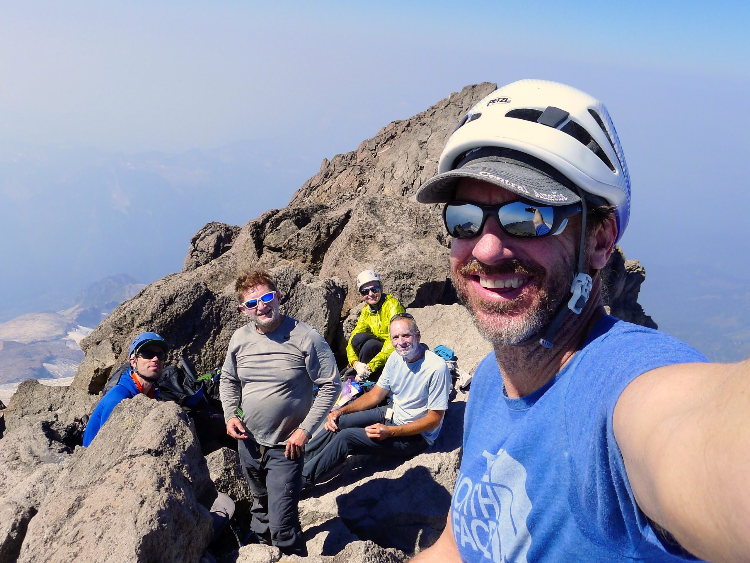
After enjoying the summit, we plunge back down the sandy slopes to where we left our glacier gear. We pack up and then head out across the rocks, following a faint use trail and the occasional cairn. Once we reach the south face of Disappointment Peak the route-finding becomes straightforward: descend the loose rocks. We have to be careful to avoid sending rocks hurtling down at those in front and are not entirely successful. Our helmets remain on and we listen carefully for cries of “rock!”


The slope lessens after dropping a thousand feet and we make our way back over to the Suiattle Glacier. It’s wet and slippery but still easier than rock-hopping on the ridge. From there we retrace our steps and spread out a little. Dagmar and Andrew R. speed ahead, and Craig J. and I fall behind. Distances are deceptive out here though. What looks like a huge amount of space can be a mere 5 minutes’ walk. I’m in no hurry to sit in my tent so I stop to admire the scenery whenever it catches my eye.
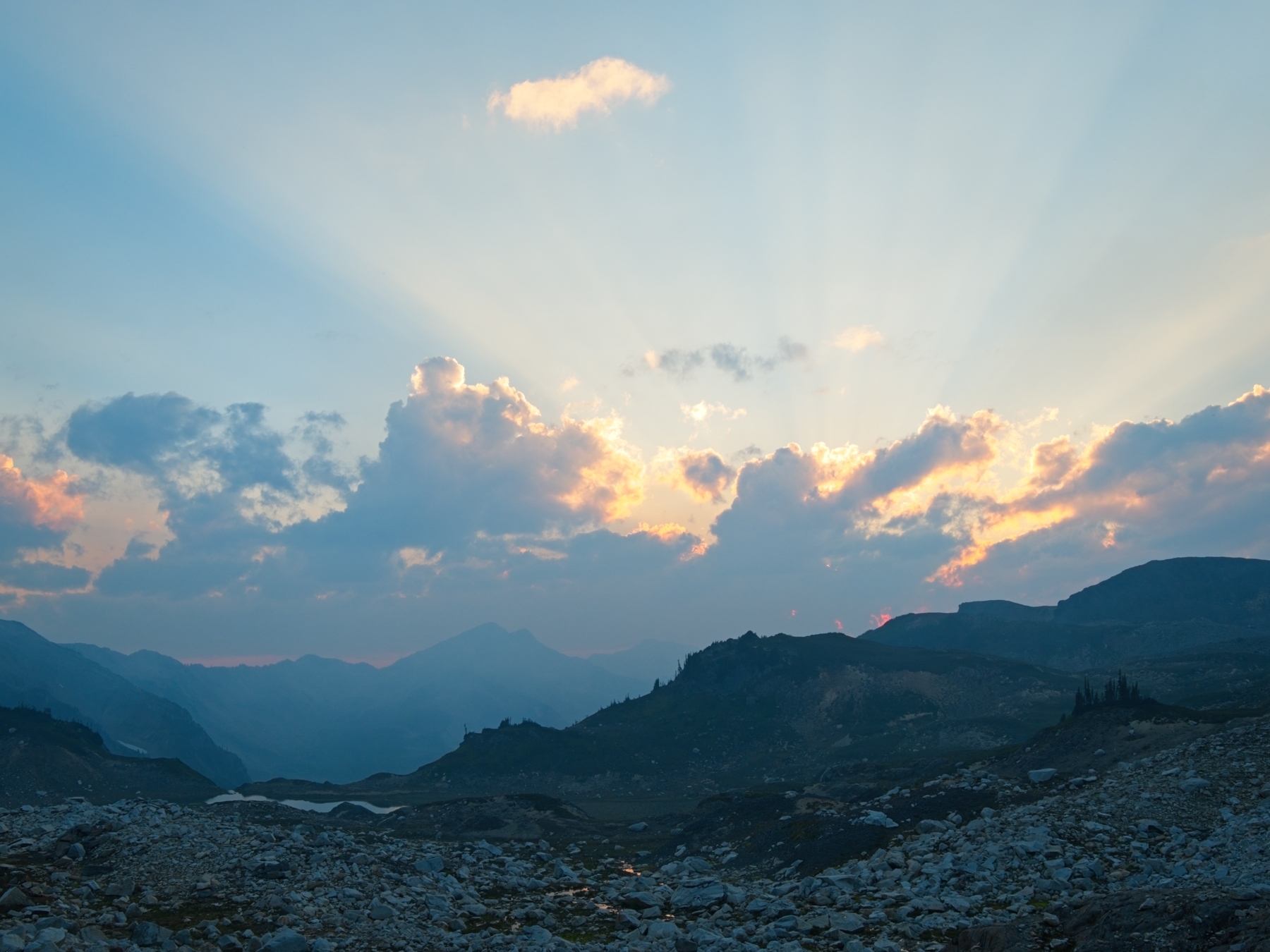
By the time I reach camp I’m very ready for a long rest. Like last night, we all retreat to our own tents for a while and then gather for dinner. I feel a lot better after eating and enjoy chatting for the rest of the night. We’re treated to a colorful, smoky sunset.
Return to the Trees
27 Aug 2023 | 11.4 mi | +900 / -5200 ft | View on Map
We leave camp this morning at 7:00. We endure a few brief, steep uphill climbs but are otherwise descending. I appreciate the warm light, which lasts much longer than the usual “golden hour” due to a plume of smoke that stretches across the sky. The winds seem to have shifted since our first day and the smell/taste of smoke in the air isn’t so bad, even as we descend into the North Fork of the Sauk River drainage. We pass a large guided group on the way down and tell one of the guides about our experience on the glacier. She seems excited to learn that it’s still possible to path-find across the glaciers.


I don’t enjoy the switchbacks down into the valley. My feet, knees, hips, and shoulders all hurt from the constant downhill. But I do enjoy the flatter forest hike, especially the soft ground. We’ve spread out to the point where I don’t see anyone in front of me or behind me, though I know we’re only minutes apart.
We regroup at the trailhead at noon. I’m happy to wash off in the river and change into cooler, cleaner clothes. Once everyone has freshened up a little, we pile into the rental car and head into town for a hot meal.
David Haynes 16 July 2025
I hiked up there to Glacier Peak in 1975 right out of high school. I hiked around out there for over 3 weeks learning mountaineering and rock climbing skills, no crampons though. I want to go back and re-experience some of that area.