My goal for this trip was to climb as many peaks as I could manage on the west side of Kearsarge Pass while also enjoying myself (not trying to suffer too much here). Mount Rixford (class 2) is an obvious candidate, standing about 1500 feet above and 1 mile from the trail. Mount Bago (class 1) is another easy one, located right next to Charlotte Lake. I also had my eye on East and West Vidette. The easiest climbs are class 3 with supposedly decent rock, and they’re not far from the other peaks. I envisioned a route to hit both in one day with significant uncertainties about the snow cover and creek crossing hazards. In the end I only managed West Vidette, but I’ll be back for its eastern sibling!
Trip Planning
Specs: 33.4 mi | +/- 12,200 ft | 3 days, 2 nights
Difficulty: Class 3 – 4 at the hardest, mostly class 1 [learn more]
Location: Sequoia-Kings Canyon National Park, California | Home of Western Mono/Monache, Eastern Mono/Monache and Western Shoshone peoples | View on Map
Route: As most of the route is on very well-established trails (Kearsarge Pass, Pacific Crest), I’ll focus on the off-trail routes.
- Mount Rixford [class 2] – I left the trail at the creek coming down from the basin southeast of the summit. I followed the water uphill, angling west toward the rocky ribs that provide more solid footing than the very loose scree. Once atop the ridge, hike north to the summit. I took advantage of the snow to glissade back down into the SE basin and did some “foot-skiing” through the loose scree.
- Mount Bago [class 1] – From the head of Charlotte Lake, hike cross-country up the hillside through the forest until you reach flatter ground. Follow the ridge up to the red, rocky peak northeast of Mount Bago and then cross the flat plateau to reach Mount Bago.
- West Vidette [class 3 – 4] – Cross Bubbs Creek at Vidette Meadow and follow the use trail into the canyon, staying on the north side of Vidette Creek. Cairns mark the way but the topography is gentle enough that you can go just about any way you like. I followed a series of ledges and ramps up to the east ridge of West Vidette. There are numerous chutes providing access to the ridge; I chose one on the south side and scrambled up class 3 – 4 rock and plenty of loose scree to the summit ridge. Route finding was a bit tricky; there are probably lines that keep the difficulty at or below class 3. I reversed the route to get back.


Permits & Regulations: Permits are required for overnight trips and bear canisters are strongly recommended (though you can find campsites with bear boxes in this area). Wilderness regulations do apply and, as always, make sure you leave no trace!
Resources: The Kearsarge Pass Trail page is a great resource for trip planning.
Rixford and Bago
28 July 2023 | 13.2 mi | +6000 / -4800 ft | View on Map
I wake up bright and early with the sun, ready for some peak bagging and backcountry camping. After tearing down my campsite at the Onion Valley Campground and moving my car to the “hikers lot” I hit the trail. It’s 06:40 AM. There are a few other people stirring, even a couple on the trail already, but it’s fairly quiet. I pass some brightly colored wildflowers on the way up the trail and notice that the air is already warm… I have a feeling it’ll be a hot day.
The Sierra received record-breaking snowfall this winter and spring – last month I was skiing up here – but the Kearsarge Pass Trail is mostly clear of it now. A few large snowfields linger on the east side of the cliffs below Big Pothole Lake, but otherwise I enjoy an easy, dry hike up to the pass. I’m in no hurry and this trail is one of the most gentle paths over the Sierra Crest, so it makes for a nice start to the day.


I reach Kearsarge Pass itself and the border of Sequoia-Kings Canyon National Park just before 09:00. I pause for a snack break and admire the Kearsarge Lake basin on the west side of the pass. The lakes are bright blue, reflecting the sky. It looks like the snow is mostly gone over here too, so the microspikes in my bag will likely go unused.
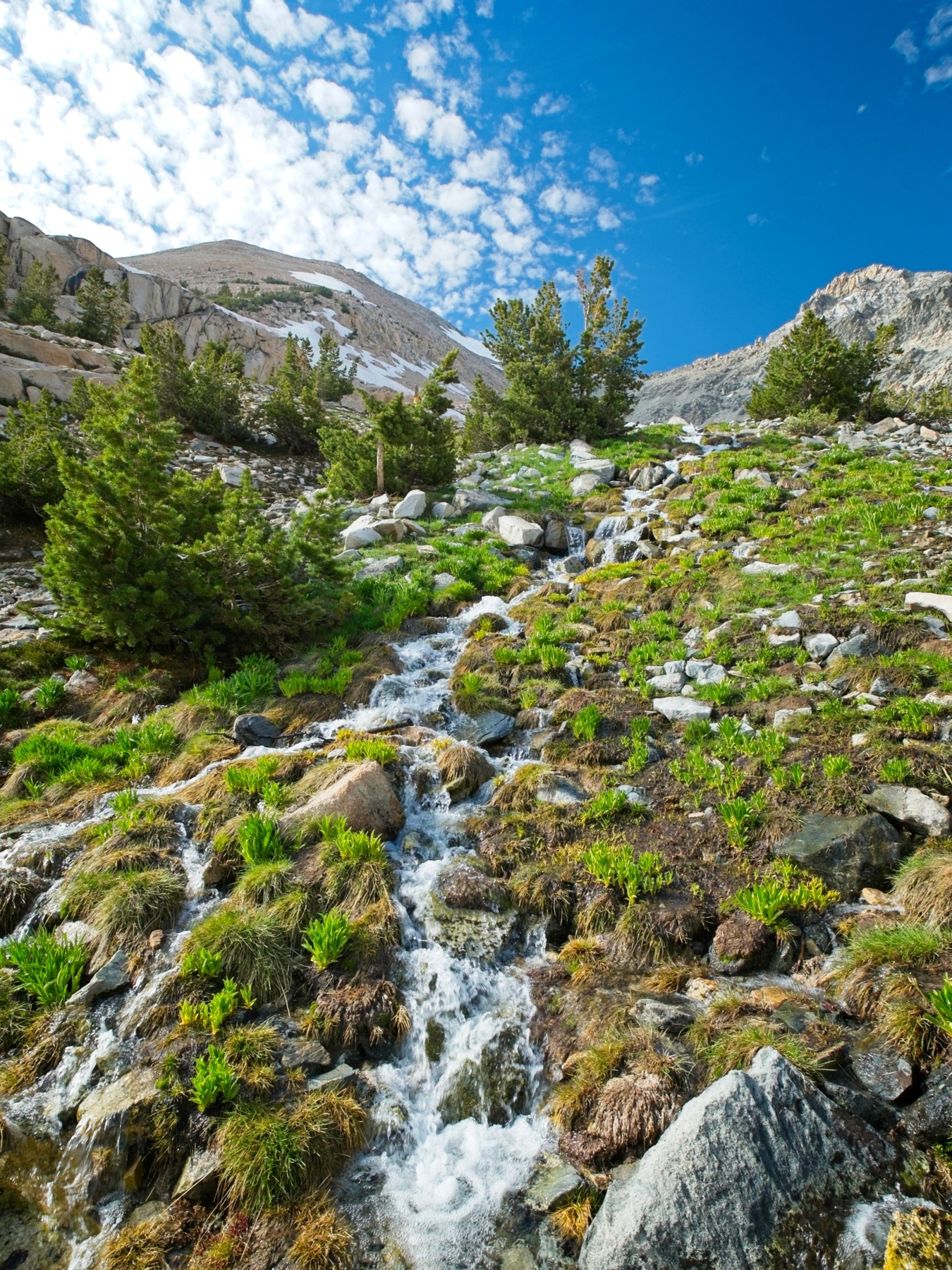
After a short rest, I continue down the trail, navigating one or two very small snow patches, and take the high trail when it splits. A note left by the wilderness ranger warns of recent bear activity in the area, which I take note of; I don’t want a bear to steal my food. A few more snow patches cover the trail as I walk on, but they’re all very low angle and already soft. When I reach the creek flowing down from the basin southeast of Mount Rixford I stop and rearrange my gear for a summit hike. I stuff a layer or two and plenty of snacks and water into my day pack, place all the remaining scented items into the bear canister, and then stash my overnight bag and the bear canister in the shade.
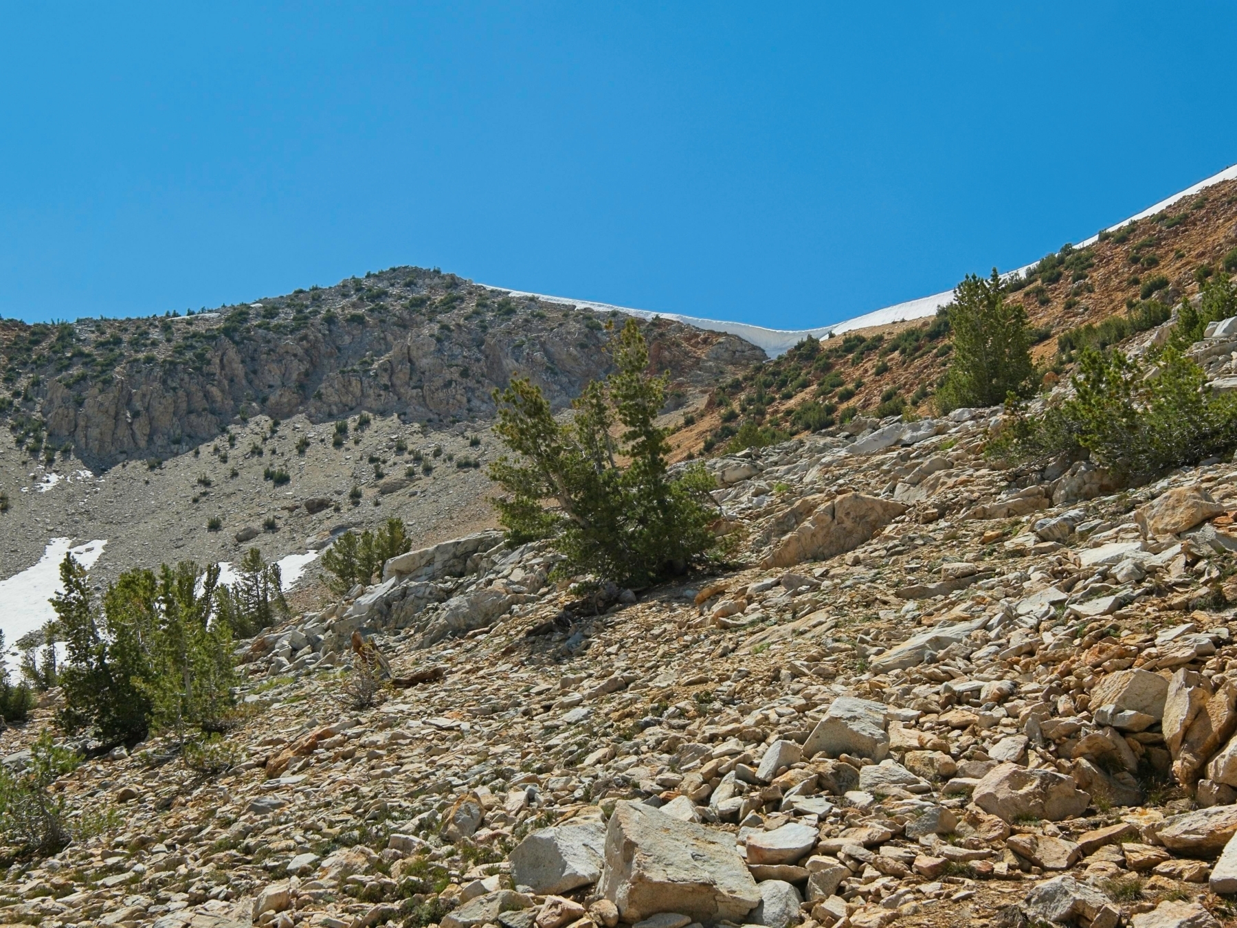
The trip reports I studied while planning this trip seem to mostly follow the prominent south ridge of Mount Rixford to the summit. I’m a little to the east of the ridge and it looks like a loose pile of scree, so I decide to follow the southeast basin instead. It’s plenty loose, but low-angle and easy to walk up. I aim for a rocky rib that extends up to the south ridge in the hopes that it will be solid and easily climbable. It turns out to be semi-solid; there’s plenty of loose stuff in the mix, but the larger rocks provide enough stable hand- and foot-holds.


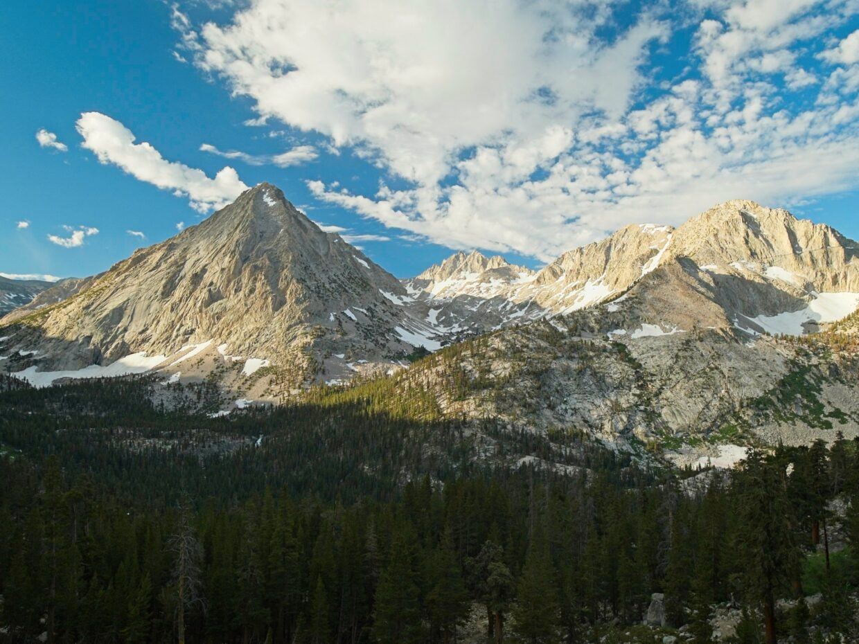
Once on the south ridge, I turn north and wander up the gentle slope to the summit. A narrow chute of dark, metamorphic rock with stair-like stones leads me up to the summit ridge. I’m impressed by the views! The famous Rae Lakes and 60 lakes basins lie below to the north. With most of the roads into Sequoia-Kings Canyon National Park closed this year, I’m guessing there aren’t a ton of campers down there; normally people flock to the “Rae Lakes Loop” that begins at Roads End.
I turn to look south and study Vidette Canyon, bounded by East and West Vidette peaks. I’m happy to see that the canyon floor seems to be mostly snow-free. On the other hand, I can see a prominent stream of white water flowing down from the lakes so… creek crossings may be an issue. I’ll have to hike over there to find out!


Rather than try to descend via my ascent route, I take a chance and glissade down a steep snowfield just below the summit. It’s in perfect condition: soft enough to provide plenty of friction so I don’t hurtle out of control but still firm enough to be an exhilarating slide. The sun cups make for a bumpy ride, but it’s still more enjoyable than tip-toeing down the loose rocks. At the bottom of the snowfield I traipse through some low-angle loose scree, then glissade down another snowfield to reach the bottom of the southeast basin. From there it’s an easy stroll back to my stashed gear.
Back on the trail, I stroll along the ridge with fantastic views of the Kearsarge Lakes. I spot at least three people fly fishing in the inlet to Bullfrog Lake far below. A few miles later I reach a junction with the Pacific Crest Trail; the trail intersection and sign are out in the middle of a lake several feet deep. I stroll around the shore and find the trail that leads down to Charlotte Lake, passing a few other backpackers along the way. I don’t hike all the way to the ranger station where there are (reportedly) bear boxes and lots of established campsites. Instead, I follow a faint use trail paralleling the head of the lake until I find a nice (also established) tent site in a stand of pine trees. I’ve got a fantastic view of the lake, no noisy neighbors, and hopefully less bear risk since I’m away from the popular sites.


Once I’ve setup camp I lie down for a little while. It’s hot out, my body is tired, and I need to talk myself into climbing another peak. Also, it’s only 13:00 so I have all the time in the world. About an hour later, I drag myself out of the tent, grab my gear, and begin a slow and steady trudge up the steep hill that leads to Mount Bago. Thankfully, there are lots of trees and shade, so it isn’t as hot as it could be. And, once again, I’m in absolutely no hurry so I take my time with plenty of breaks. I find a hot pink heart-shaped party balloon midway up the slope, probably dozens of miles from where it escaped. I seem to find at least one of these every trip.
When I reach the ridge above Charlotte Lake I have a decision to make. I can continue up the ridge, aiming for a reddish peak north of Mount Bago and then traverse across the snow-covered ridge to Bago. Alternately, I could take my chances with an approach through the basin and hope to skirt below an enormous cornice. I decide on the ridge route, and it turns out to be a good choice. The ridge between the red peak and Mount Bago is wide and mostly snow free, so it’s an easy walk over once I make it up there.
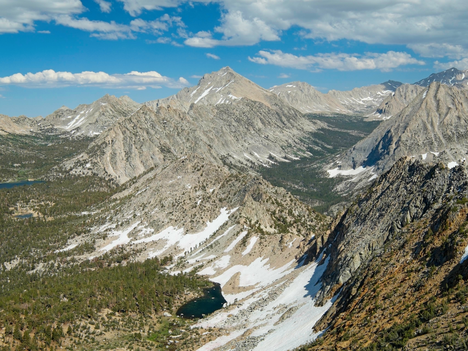
The view from Mount Bago is perhaps one of the best I’ve found so far in the Sierra, and that’s saying a lot! I’m particularly excited about the rugged landscape to the south. There are dozens of peaks and several huge canyons and I’ve explored none of them! So much to see. Bubbs Creek Canyon and Charlotte Dome make for a spectacular view to the west, and a sinuous ridge of pinnacles leading to University Peak makes for an even better view to the east! I sit for at least half an hour, admiring the view and enjoying the accomplishment of the summit. There’s nothing more interesting for me to see down at camp and it’s a beautiful day, so why not hang out here?


I retrace my steps to descend the mountain. It’s not the most enjoyable hike down since the ground is hard and covered with slippery gravel, but it’s honestly not that bad, I’m just tired. Back at camp I sit out on a big rock with a view of the lake and stretch for a while. After stretching, I retrieve my bear canister and stove and cook dinner out on the rock. Across the lake I can see the green roof of the ranger station and a few people walking around. It’s quiet on this side of the lake though. I retreat to the tent after eating to escape the mosquitoes and spend the rest of the evening relaxing horizontally.
West Vidette
29 July 2023 | 14.7 mi | +5700 / -4800 ft | View on Map
My ambitious goal for today is to climb West Vidette via its east ridge, then hike around to the east ridge of East Vidette and climb it too. I’ve decided to tackle West Vidette first because there’s more snow on that route and I’d rather hit it in the morning when it’s at least a little firm. I’m still not sure if I can event make it across Bubbs Creek, not to mention the cross-country route from West Vidette to East Vidette. So it’s an exploration day. If Bubbs Creek turns out to be uncrossable, I’ll hurry over to Center Peak instead.
I’m on the trail by 7:00 and am immediately walking uphill which warms me up in a hurry. I reach the PCT in short order (it’s only 0.6 miles or so) and then speed downhill to Vidette Meadow, very aware that I have to hike back up all 1200 feet I’m losing. I get a nice view of Vidette Canyon from the switchbacks and also spot some serious whitewater in Bubbs Creek, which worries me. Down at the bottom of the hill, mosquitoes follow me around as I navigate across half a dozen forks of the Bullfrog Lake outlet creek. It’s a tricky crossing but I eventually string together enough rocks, logs, and grassy islands to make it across without getting my feet wet.
My next challenge is crossing Bubbs Creek and I won’t be staying dry for this one. The creekbed is 10 to 15 feet wide and the water looks to be at least 2 – 3 feet deep and moving quickly. I wander upstream, looking for the widest, shallowest bit of water I can find. After exploring a little I settle on a spot where the creek splits in two, take off my shoes and socks, and wade into the icy water. The first fork of the creek comes up to my knees but the second fork nearly reaches my waist. I move slowly, careful to stay upright, and am across in no time.
After drying my feet and putting my shoes and socks back on I continue hiking upstream. I’m surprised to find a well-preserved cabin just a few feet from the creek! It looks almost livable; the roof has some holes and the cot frame inside is probably not weight-bearing, but the floor is tidy and the walls are upright. Post-hike research reveals that this is “Shorty’s Cabin,” built by fur trapper Shorty Lovelace in the early 20th century as part of a network of up to 36 cabins. The nomination form to create the “Shorty Lovelace Historic District” is a fascinating read with maps of the cabin locations and pictures of several; see the National Archives, NAID 123858697, document reference number 78000293.


From the cabin, I begin trekking up into Vidette Canyon. Almost immediately I stumble upon a use trail and follow it uphill, keeping Vidette Creek nearby on my left. I can hear it roaring, so I wander over for a view and am amazed to see a huge cascade! My plan to reach East Vidette later today involves crossing the creek… that seems problematic now. But one thing at a time.
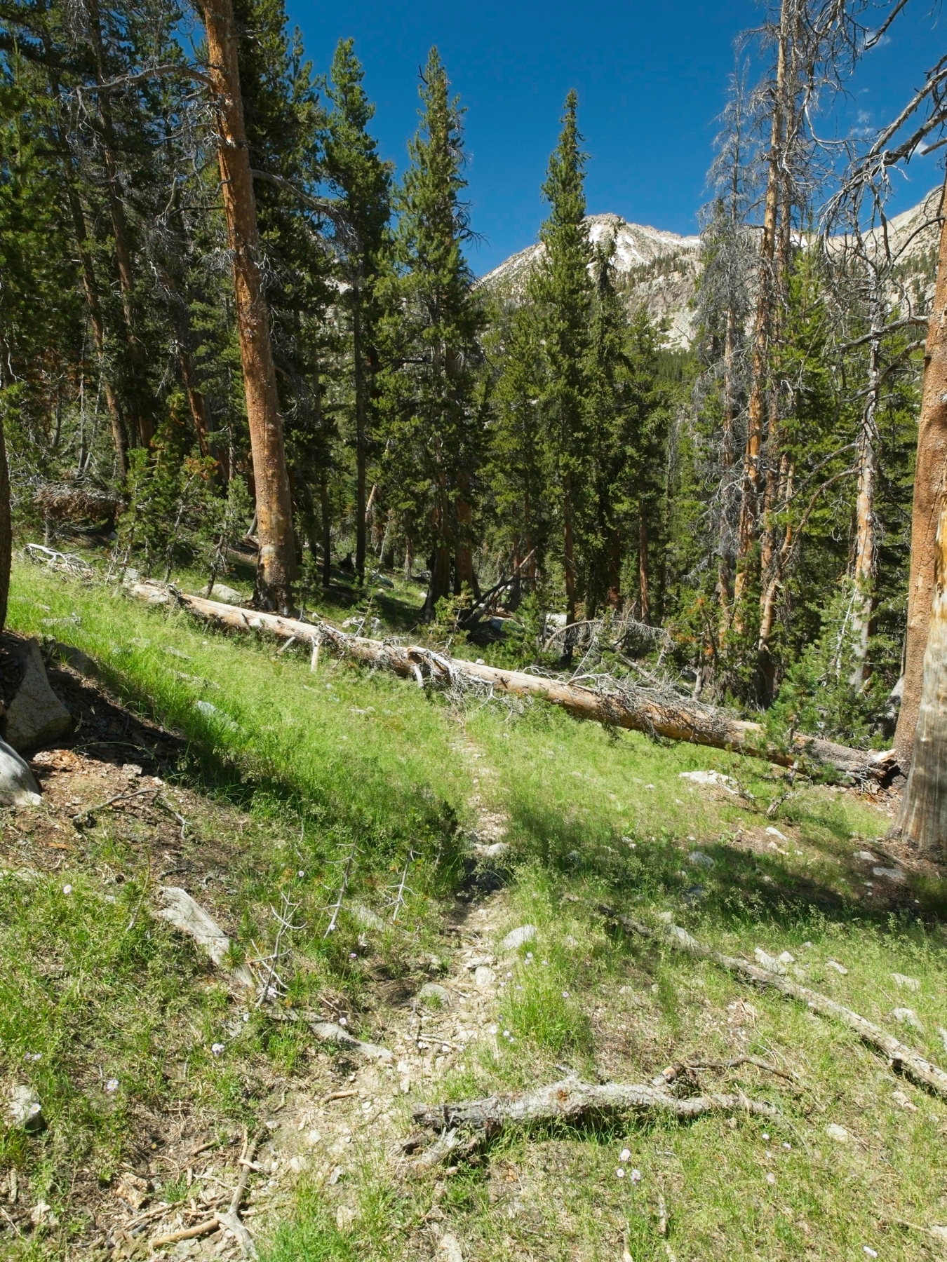
I lose the use trail a few times as I wind through the forest and bushwhack up a marshy hillside. But I keep finding the path again; for an unmarked trail, it certainly seems well-traveled. I feel happier and happier as I gain altitude, particularly once the trees begin to thin out and I’m strolling through classic Sierra high country. Granite slabs, shallow pools, snow fields, wildflowers, and stunted pines. I peer up at West Vidette as I walk. It’s not a particularly prominent peak and I’m not sure I’d know which route is the “east ridge” without the GPX track I have downloaded on my phone.
Once I’ve hiked past the lowest three or four lakes in the canyon, I begin angling uphill. I cross a few snow fields (getting soft now) and walk up large granite slabs to reach a lovely series of ramps and grassy ledges that make the ascent a breeze. The easy terrain eventually gives way to talus, much of which is fairly loose. I send a few boulders tumbling down the slope behind me as I scramble up to the foot of the east ridge. It looks like there’s a chute or two that cut through the steep cliff faces and provide access to the ridge itself; I’m heading for one of those.


At the foot of the chute I pause for a few minutes to eat a snack and reapply sunscreen. Then it’s onward and upward. I squeeze past a deep snow drift hiding in the shady chute and then begin scrambling in earnest. The “east ridge” isn’t so much a defined ridge as a series of loose scree chutes with ribs of exposed class 3 – 4 rock between them. I try to stick to the chutes, scrambling up granite steps and zig-zagging across sandy ledges. It’s tricky route-finding through and I find myself on fourth class terrain more than once. My route tops out a little south of the true summit, forcing me to step ever-so-carefully across the exposed ridge to the high point.


I relax for a little while up top but am not nearly as impressed with the views as I was yesterday. So I sign the register (first entry of 2023!) and leave soon after arriving. I find a slightly more direct and less technical route down the mountain but I’m careful to return to the snow-filled chute where I began. The other chutes could very well end in abrupt cliffs and I don’t want to have to back-track.
It’s not until I’m off of the loose talus and back on solid granite that I relax. It’s about noon and starting to get very warm, so I make a beeline for some trees down by a lake and stop there in the shade for lunch. After a little deliberation I decide I’m not going to attempt East Vidette today. The route I envisioned would cross Vidette Creek here, contour around the north side of East Vidette, and then ascend the east ridge. But the creek is wide and lined with likely unstable snow bridges and East Vidette is flanked by steep snow fields and talus that I have no desire to struggle through. The only other option is to retrace my steps, cross Bubbs Creek, follow the PCT south, and then cross Bubbs Creek again to reach the ridge. But that also sounds like a lot of extra work and I’ve had enough adventure for one day. I’m here to have a good time, after all; the peak bagging is just an excuse to come out.
So I continue down the canyon after I finish lunch. The use trail is easier to follow this time and I manage to avoid bushwhacking through the marsh on the way down (the trail skirts it on the west). I cross Bubbs Creek at a slightly shallower spot than before and then begin the long uphill trudge to Charlotte Lake. I pass a few backpackers who look at my tiny day pack with disgruntled expressions. But even with a light bag, I’m pretty worn out by the time I reach my campsite. A deer grazing in the grass beside the lake gives me an excuse to sit on a rock and graze on my own snacks for a while.
Seeing as it’s only 4:00 in the afternoon, I decide to begin hiking toward Kearsarge Pass. Every mile I do today is a mile I don’t have to walk tomorrow and it would be nice to have some time to do chores at home before work on Monday. So I pack up camp, shoulder the much-heavier overnight bag, and start walking. I really struggle with the hike. It’s hot out, the air is still, and I’m very tired. But I take plenty of breaks and try to notice the amazing views instead of my own discomfort.
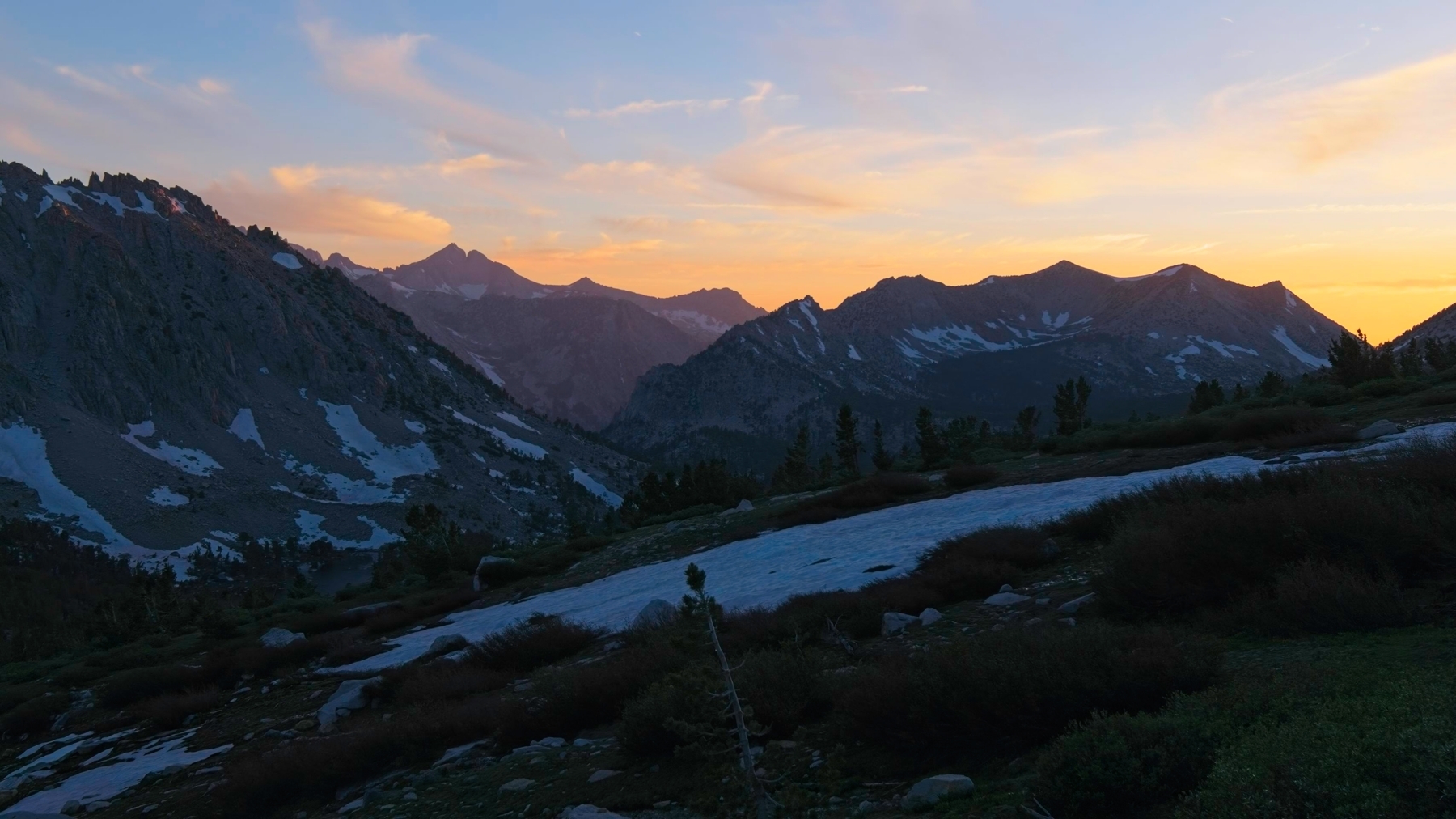
A half-mile shy of Kearsarge Pass I find a fantastic little campsite nestled into a grove of trees near the trail with a sweeping view of the Kearsarge Lakes. I know if I keep going over the pass I’ll have at least a few more miles to walk before I find a campsite, so I happily call it a day and set up the tent. After dinner I lie down, too tired to do much else. I do get up to watch the sun set, but then head straight to bed once the light fades.
Hike Out
30 July 2023 | 5.5 mi | +500 / -2600 ft | View on Map
I’m up early this morning – 5:00 – and walking by 6:00. As beautiful as the mountains have been this weekend, I’m very ready to ditch these sticky, sweaty clothes. And a delicious that isn’t re-hydrated sounds really nice too. I make quick work of the hike out. It’s an easy trail, sometimes too easy with long, gradual switchbacks where I’d prefer to take a more direct line downhill. But it only takes me 2.5 hours to reach the car, and then I’m off to find a hot breakfast in Lone Pine.
Laurie Schwaller 28 August 2023
082823
Dear Andrew — Great photos and a fine report. You might enjoy learning a little more about Shorty and seeing some more historic photos on our website, https://www.tularecountytreasures.org/shorty-lovelace-historic-district.html
Happy Trails to You.
— Laurie S./for TCT Project Team
Andrew 15 September 2023 — Post Author
Thanks Laurie, that’s a really interesting article!