There are five mountains on the Sierra Peaks Section (SPS) list easily accessible from and very close to Onion Valley. I had some free time this weekend so I drove up, slept at the trailhead for acclimation, and spent a day climbing up the tallest of the bunch, University Peak (13,595 ft). Besides the thin air up there making breathing a tad difficult, it was very straightforward and I had a great time!
Trip Planning
Specs: 9 mi | +/- 4500 ft
Difficulty: Class 3 [learn more]
Location: Inyo National Forest, California | Home of Eastern Mono/Monache and Western Shoshone peoples | View on Map
Route (North Rib / North Face): Follow the Kearsarge Pass Trail to the foot of Flower Lake. Cross the outlet creek and travel uphill toward Bench Lake. The Matlock Lake trail doesn’t quite go the right way, so don’t follow it. Skirt Bench Lake on its eastern shore, aiming for the slabs at the southeast end. Scramble up the ramps, sticking to the center of the ridge until you reach the talus fields below University Peak. Continue straight up the ridge, staying above the loose chutes on either side. Follow this rib of class 3 rock to the summit ridge. Traverse across the north side, scrambling up a small chute and then a few low-angle slabs to the summit; this area is marked with plentiful cairns.
For the descent, I recommend following the rib back down. Although the chutes look like the sandy floor may provide an easy descent, the terrain is incredibly tedious and there are numerous class 3 – 4 slabs to downclimb.
Permits & Regulations: No permits are required for day hikes in this area, and parking is free. Wilderness regulations do apply and, as always, make sure you leave no trace!
Resources: The Kearsarge Pass Trail page is a great resource for trip planning. I referenced Secor’s The High Sierra: Peaks, Passes, and Trails for route guidance.
University Peak
27 Aug 2022 | 9 mi | +/- 4500 ft | View on Map
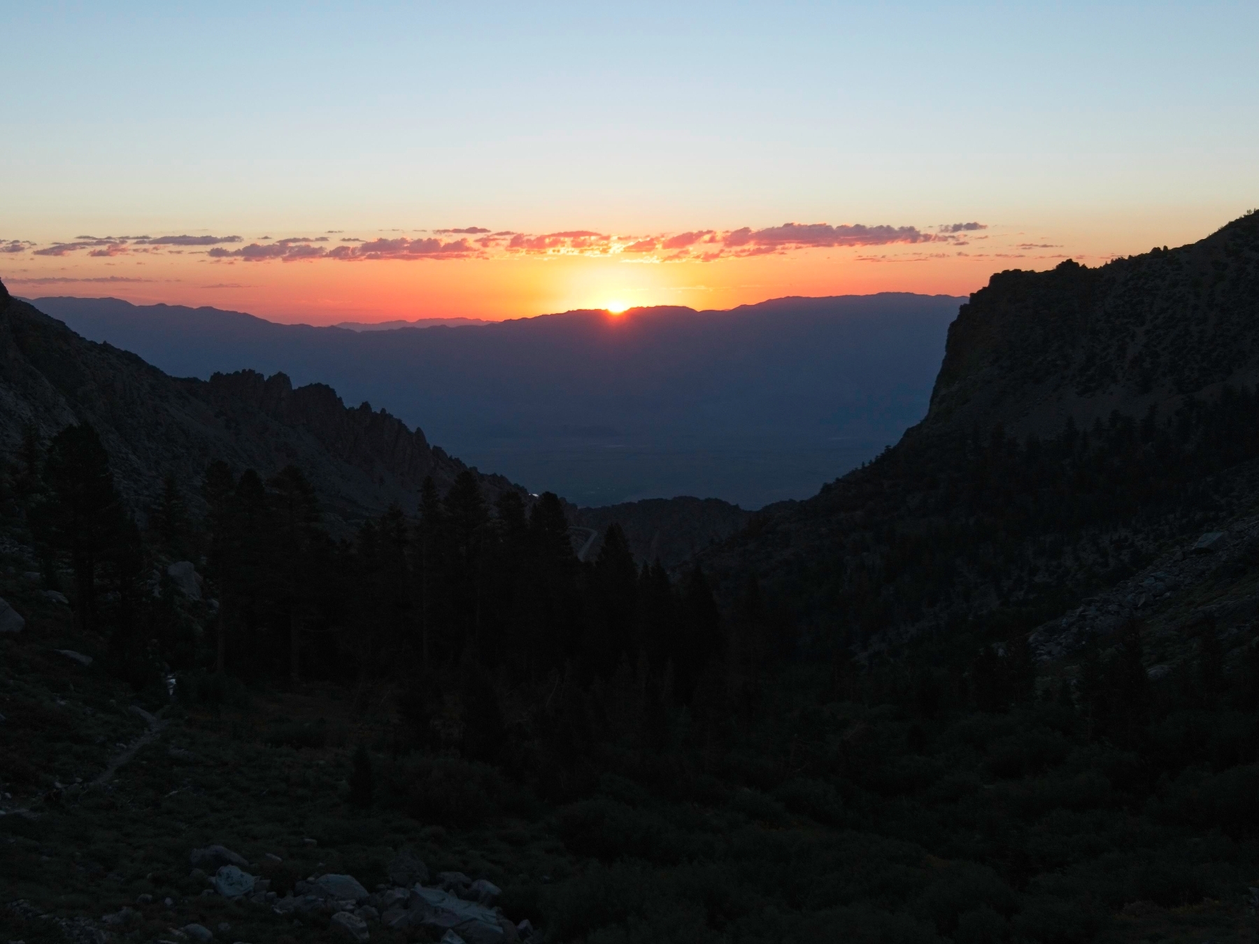
As is often the case when sleeping in a tent for the first time in a while, I did not sleep well last night. The 9,000-foot altitude didn’t help either; my heartbeat was much faster than usual. But I did get some rest and I woke up at 5 AM ready for some mountain climbing! I did most of my packing last night so all that’s left is to eat breakfast and toss my tent and sleeping gear into the trunk of the car.
I hit the trail at 5:40. There are already other hikers and trail runners up and about in the parking lot, but I don’t see anyone else on the trail. Sunrise is in about 40 minutes and there’s enough pre-dawn light to see without a headlamp. The Kearsarge Pass Trail is an easy hike even without much light; the grade is very shallow and there aren’t many rocks or roots to trip over.
The sun peeks over the White Mountains about 45 minutes into the hike, bathing the entire landscape in soft, red light. I spot signs of the torrential rainfall that pummeled the area in early August everywhere I look. Clear washes streak down from the mountaintops, and several sections of trail pass over freshly disturbed rocks and gravel. As I hike further into the wilderness, I walk past five or six grouse. Their best efforts to evade me involve them running down the trail at a full sprint, never turning off to the side. I’m eventually able to get around them and leave the birds behind to continue their grazing.


About an hour into the hike I reach Gilbert Lake. I pass a few quiet tents but don’t see any people up yet. A short stroll up the trail leads me to Flower Lake where I depart the main trail and turn south toward University Peak. I follow the maintained path toward Matlock Lake for a few minutes but soon abandon it since it’s trending too far to the east.
Cross-country hiking through the woods is pretty enjoyable! The terrain isn’t too steep and it’s nice and cool up here at almost 11,000 feet, a very welcome change from the daily summer heat down in LA. I make a beeline for the outlet of Bench Lake, arriving at the small creek right where it begins to flow downhill.
After filling both of my water bottles to the brim, I stroll across the small cliffs that line the eastern shore of Bench Lake. Secor’s instructions say to climb up the slabs at the southeast end of the lake, so I make a beeline for them. At first, I keep to the left (E) side but soon reach cliff bands that are difficult to navigate, so I backtrack a tiny bit and find much easier terrain on the right (W).
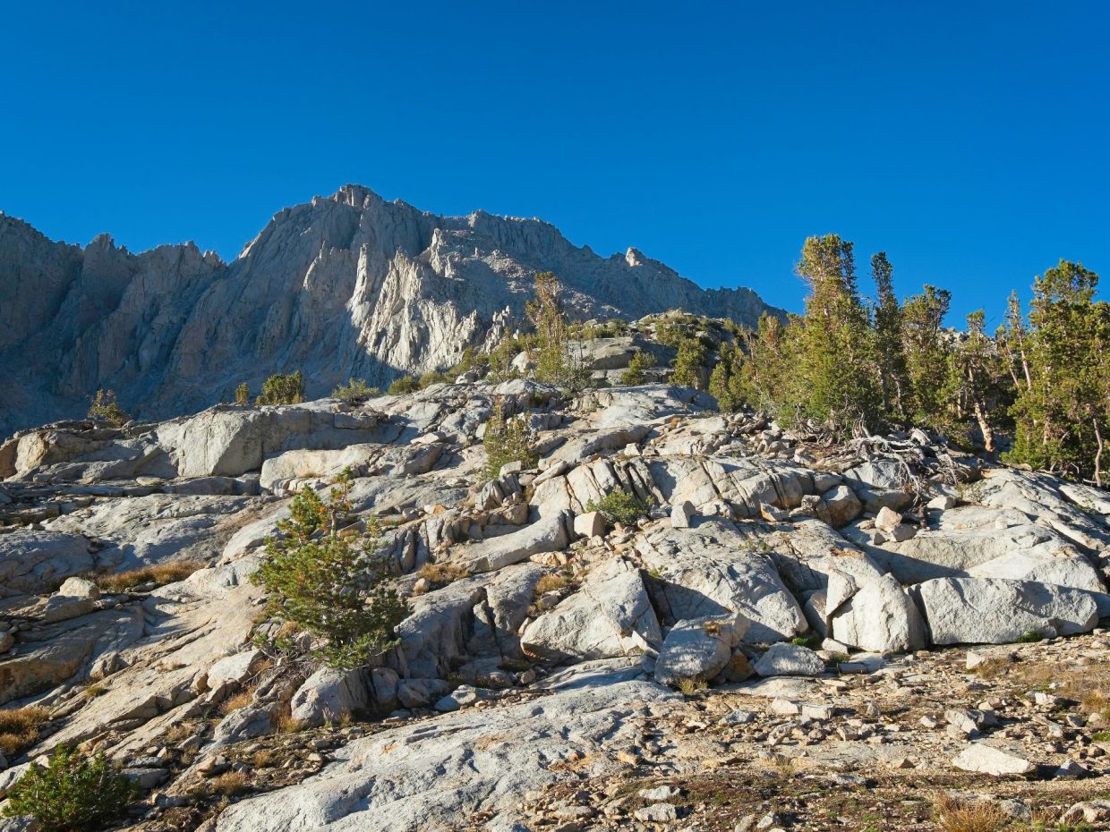
From the top of the slabs there are several possible routes to University Peak. To climbers’ right, scree-filled chutes lead upward to the summit. Alternatively, directly in front of me is a “rib” of talus bordered on the left by numerous spires. Fellow climber Rafee reports that this rib is “enjoyable class 3,” so I decide to give it a try, especially since the chutes look miserably loose.
Scrambling up the rib does prove to be quite enjoyable! The difficulty ranges from class 2 to 3 with a few class 4 problems sprinkled in if you wander off to one side or the other of the rib. I also encounter a few short (10 – 20 ft) sections of horribly loose scree, but it’s certainly a more solid route than the chutes. The rib leads all the way to the summit ridge, so there’s not much route finding to do until near the top where I pass a small gendarme via easy terrain on climbers’ right.
Although the climbing is incredibly straightforward, the altitude is really kicking my butt. I haven’t climbed this high since early in the summer on Mount Newcomb and my body is not used to the thin air. There’s not much to do about it except take frequent pauses to catch my breath.


The final fifty feet of climbing to reach the summit ridge is my favorite part of the whole ascent. A series of steep (40 – 50 deg) slabs run up the left side of the slope with talus to the right. Although the talus is certainly an easier climb, the slabs look really fun and I decide to give them a try. There are plenty of bumps and small weaknesses in the slabs, making the climb a class 4 affair (as opposed to class 5). The most exciting section follows a ground-level undercling with a combination of lie-back and slab climbing moves. Above this 20-foot face the cracks spread out horizontally and make for pretty easy scrambling.
Once I reach the summit ridge, I follow a series of cairns along the right (N) side of the ridge. There are a few spots with some exposure, but the climbing is no harder than class 3. I take them slowly, wary of the altitude-induced light-headedness I’m feeling. A shallow chute followed by a few low-angle slabs leads me the rest of the way to the summit (9:20 AM).
I’m really feeling the 13,600-foot altitude, so I sit down for a few minutes. When I pull the summit register out from its ammunition box I discover that the notebook is wet all the way through! I set it out in the sun to dry a bit while I lie down and enjoy the stillness. It’s pretty chilly up here with the breeze, so I pull on a few layers and try to soak up the sun. The rocks are still cold, however, so lying down isn’t a great solution to staying warm.
Giving up on a summit nap, I dig through my pack, pull out a protein bar, and look around. The views today are pretty phenomenal! I particularly enjoy looking south into Center Basin, a horseshoe-shaped valley with Center Peak rising in the center. Somewhere down there, the Pacific Crest Trail (a.k.a. John Muir Trail here) climbs toward Forester Pass.


On the way down I try to scout out a path into the Robinson Lake drainage on the east side of the ridge. It’s still early in the day, and I can easily tag another peak! However, all of the obvious routes are at least class 4, and there are large cliff bands further down, so I eventually give up the hunt. I’m not particularly excited about down-climbing difficult rock into unknown terrain that may or may not involve cliffs.
To descend from the summit ridge, I decide to try one of the chutes. After all, loose rock can be much nicer when descending than ascending. Unfortunately, this maxim is not true here. I struggle to stay upright on the loose rock and do not enjoy scrambling down steep slabs every 50 – 100 feet. On the way down I pass a climber who has ascended the chute all the way from the tarn down at 11,400 feet, perhaps unaware that the rib offers a much more pleasant climb. I’m forced to descend down the chute a little further (access to the rib I climbed up is blocked by a series of cliffs) and meet four more climbers on their way up. I guess the rib isn’t popular after all!
As soon as I can, I traverse right across the chute and back onto the rib. I much prefer hopping down the talus – at least it’s (mostly) solid! For anyone else attempting this climb, I recommend staying on the rib for the entire descent.
It’s noon by the time I reach Bench Lake and I’m ready for lunch. I find a shady spot beneath a couple of pine trees and enjoy a peanut butter sandwich and a fresh apple. It’s probably just the hiking, but it’s one of the tastiest apples I’ve ever eaten! Just below Bench Lake I can see Matlock Lake, Slim Lake, and a smattering of unnamed lakes. There are two distinct colors: Slim Lake and a few others directly below the mountain are light teal, like the lakes you see full of glacial till; Matlock Lake and the others near the center of the valley are a more usual dark blue color. There aren’t any glaciers left here, so I’m guessing the heavy rains earlier in the month washed enough of the rock dust into the lower lakes to change their color.

The remainder of the hike flies by. I take a more direct cross-country route down to Flower Lake, rejoining the Kearsarge Pass Trail at the foot of the lake. It’s getting a bit warm, but a light breeze keeps me feeling pretty comfortable on the way down. I’m a little surprised at how good my body still feels, but perhaps that’s just because most of my recent hikes in Oregon left me feeling half asleep on the walk out to the trailhead. I briefly contemplate an afternoon jaunt up one more mountain – I certainly have time for another peak – but the increasing heat and prospect of being exhausted for the four-hour drive home convince me to quit while I’m ahead. I reach the trailhead a little before 13:30 for a round-trip time of just under eight hours. After a change of clothes, a (still cold!) peach lemonade, and a bunch of stretches, I head home.
Colin 26 November 2024
Fantastic pictures!! I’d say that the view is better than that from Whitney because it doesn’t have a flat top!