Spring time is the best time to visit the southern Sierra Nevada. The remaining snow patches provide plenty of water where there would otherwise be none, the meadows are lush and green, and it’s not so hot just yet. This year, “spring” in the mountains is a little late due to the record-breaking snowpack we received and, thus, a bit on the warm side. But it’s still pretty nice and, since the rest of the range remains mostly covered in snow, a great option for an “early” backpacking trip.
My goal for this trip was to check off two peaks: Muah Mountain and Cartago Peak. Muah is very close to the PCT and only a few miles from the trailhead. Cartago Peak, on the other hand, is roughly 15 miles from the trailhead or a much shorter but horrendous 7000-foot climb directly up from the town of Cartago. I opted for the 15-mile walk.
Trip Planning
Specs: 35.4 mi | +/- 7200 ft | 3 days, 2 nights
Difficulty: Class 1 – 4 [learn more]
Location: Inyo National Forest, California | Home of the Tubatulabal, Northern Paiute, Eastern Mono, and Western Shoshone peoples | View on Map
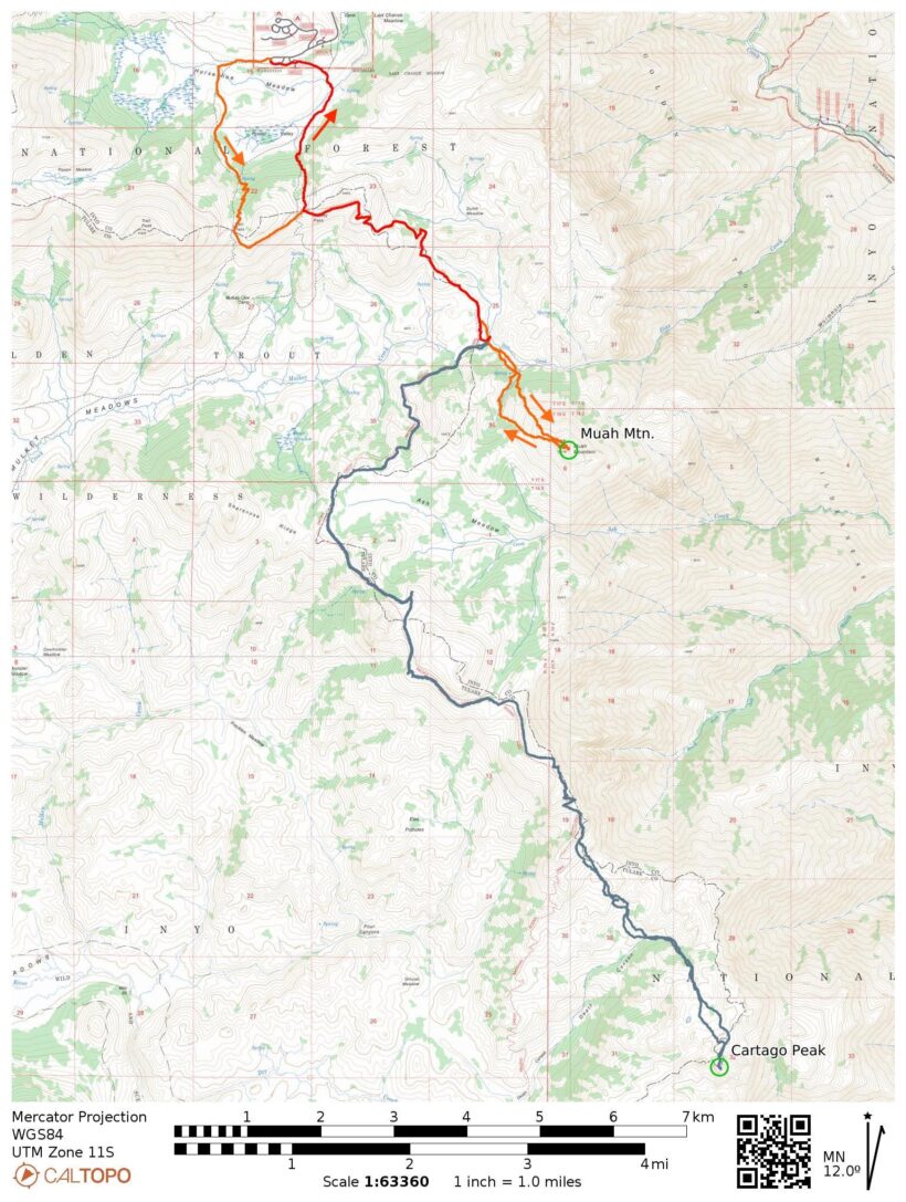
Route: Begin at the Cottonwood Pass Trailhead and hike up to Trail Pass, continuing southbound on the PCT to Diaz Creek. Leave the trail here and climb cross-country (class 2 at the highest) up the sandy northwest slope of Muah Mountain. There are several false summits; the true summit is the furthest across the ridge (as usual!).
Backtrack to the PCT and continue southbound to the ridge overlooking Death Canyon. Contour southeast across the canyon, staying below the rock pinnacles and aiming roughly for the top of the creek as marked on the USGS and USFS topo maps; you’ll drop about 800 feet. Follow the creek uphill (class 2) to the Cartago Peak summit plateau and stroll across the easy terrain to the highest pinnacle on the south end of the plateau. Scramble up the pinnacle (class 4) to the summit register and spectacular views! Reverse the route on the way back.
Permits & Regulations: Wilderness permits are required for overnight trips, but this route does not (at the time of writing) include a quota! Food, trash, and scented items must be stored in a bear canister or counter balanced. Otherwise, the usual wilderness regulations apply; make sure you leave no trace!
Resources: The USFS page for Trail Pass has useful information and links. For navigation, I recommend the Tom Harrison map for the Golden Trout Wilderness.
Muah Mountain
02 July 2023 | 9.5 mi | +2200 / -2500 ft | View on Map
I roll into Lone Pine at noon and stop to buy a sandwich and a few snacks from the market. It’s a balmy 95 degrees out and only getting warmer, so I hurry up to Horseshoe Meadow where it’s a more comfortable 70 deg F. By 13:00 I’m strolling down the sandy trail, wondering if leaving my microspikes at home was a happy accident or an unfortunate mistake. Snow still blankets every peak I can see!
Just a few minutes down the trail I turn left onto the path to Trail Pass and wade through the creek. Currently swollen with snowmelt, the water comes up to my knees when I stand on the rocks that normally provide dry passage. I pass a few hikers and backpackers on the way up to Trail Pass and hop across half a dozen smaller snowmelt streams that are gushing down the hillsides. There are plenty of snowbanks to cross too, but they’re soft and easy to step through without traction devices.
Once I reach the pass, I head south on the Pacific Crest Trail. It’s a nice easy walk, perfect for a warm afternoon. The trail slopes gently downhill and a light breeze keeps me comfortably cool. I spot Muah Mountain through a gap in the trees – it looks much farther away than I anticipated, but distances are often deceiving out here.


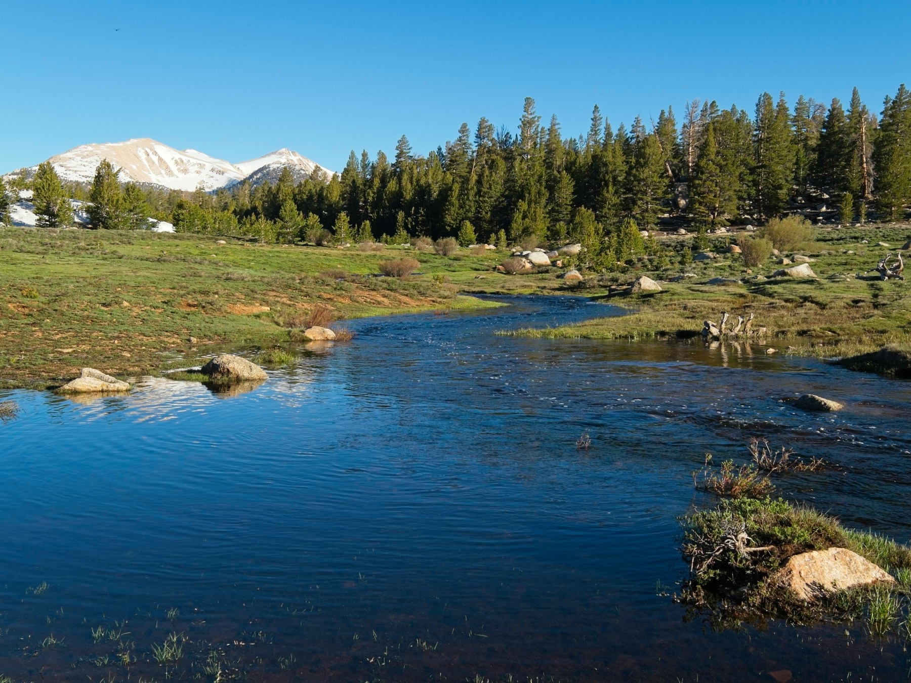
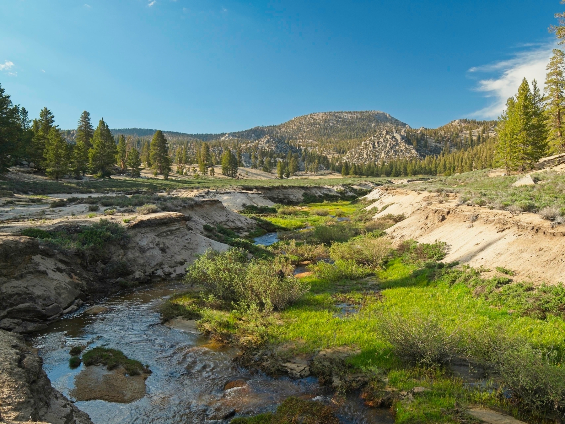
I arrive at Diaz Creek around 15:40 and set up my tent in a shaded spot where others have clearly camped before. I find cow pies throughout the area but don’t see any cows. Do people still graze cattle up here? I hope not.
With camp established, I walk down the meadow a little ways and then begin trudging up the steep northwest slope of Muah Mountain. It’s difficult work and I stop often to catch my breath and mop sweat from my forehead. Once I reach the shallower, more open upper slopes, the breeze returns and cools me off. I skip an obviously false summit but am fooled by a second, scrambling up only to discover a higher point a few hundred feet further down the ridge.
I reach the true summit just before 17:00 and spend at least half an hour munching on snacks and admiring the views. Looking north I can see the snow-covered Cirque Peak and Mount Langley. To the south, Olancha Peak dominates the view. I eventually sign the summit register and scramble down.


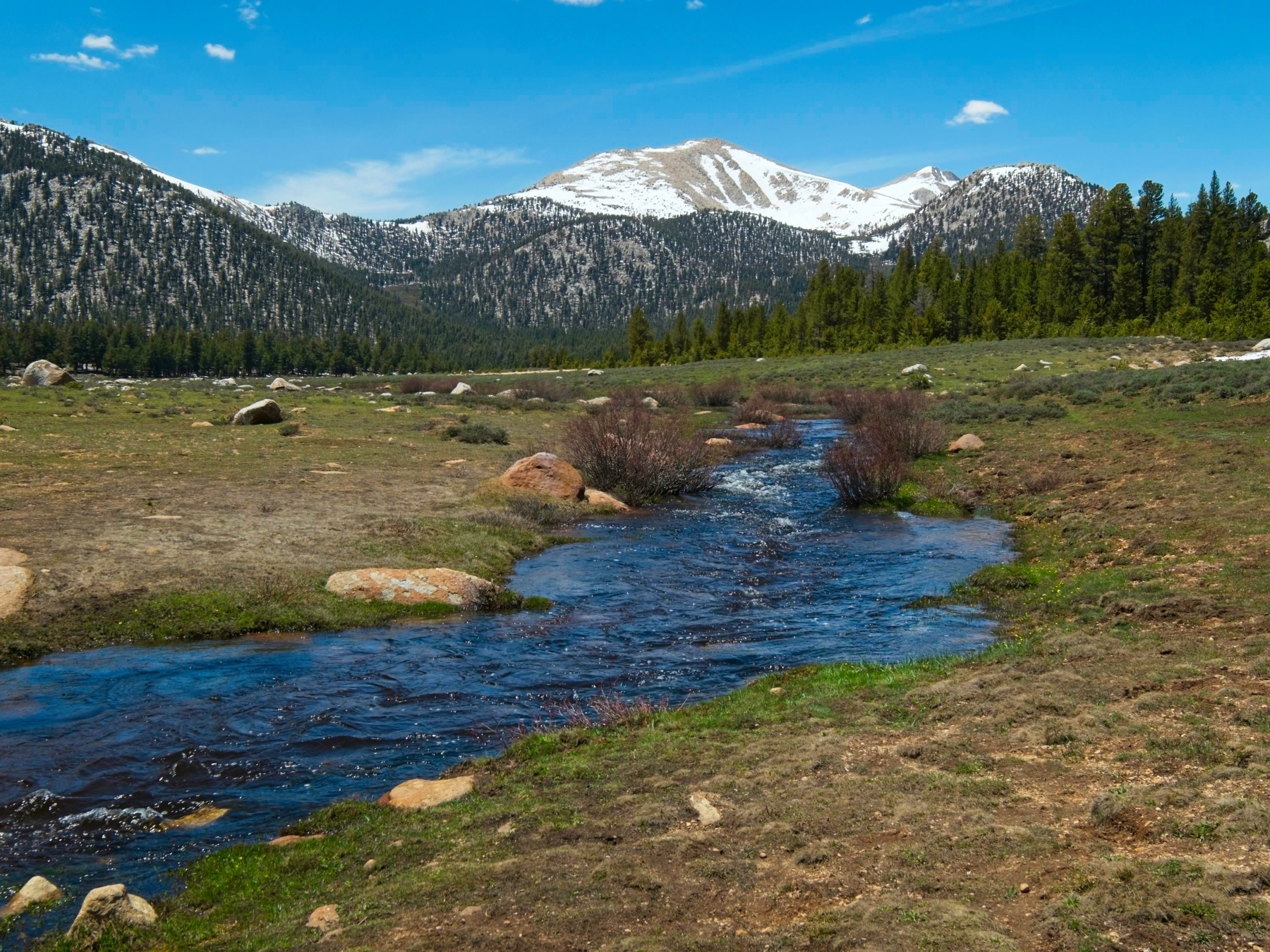
I follow a slightly different route back to camp. Rather than retracing my steps down the slope, I make a beeline for a creek and refill my water bottles directly from the snowmelt. Why not avoid the cow poop if I can? I find a clear use trail beside the creek as well, so that makes for an easy descent.
When I reach camp, I find four PCT thru-hikers have arrived! We talk while cooking and eating dinner. They’re from all over the world, including Italy and New Zealand. After dinner, I wander around a little and watch the light change over the meadow and Diaz Creek. It’s a beautiful spot!
Cartago Peak
03 July 2023 | 21.1 mi | +/- 4000 ft | View on Map
I wake up at 5:30 after a fitful nights’ sleep. I’ve got a lot of miles to cover today, so I eat a quick breakfast, pack my day bag, and hit the trail. For several hours I enjoy easy walking on the shaded west side of the mountains. The PCT eventually finds its way to the Sierra Crest with views clear down into the Owens Valley and plentiful sunshine. Still, the day is young and the air is still cool.


At about 9:00 I reach the high point for the day, 10,700 feet on the PCT. The trail begins a series of switchbacks and quickly drops toward Big Dry Meadow. After losing about 400 feet, I abandon the trail and descend cross-country into upper Death Canyon. The 800-foot descent is quite easy thanks to plentiful soft sand and open terrain, though I do have to backtrack a few times when I reach the edge of a cliff. I see a few animal prints in the sand – mountain lions, I think, and also deer – but don’t see any critters larger than a butterfly.
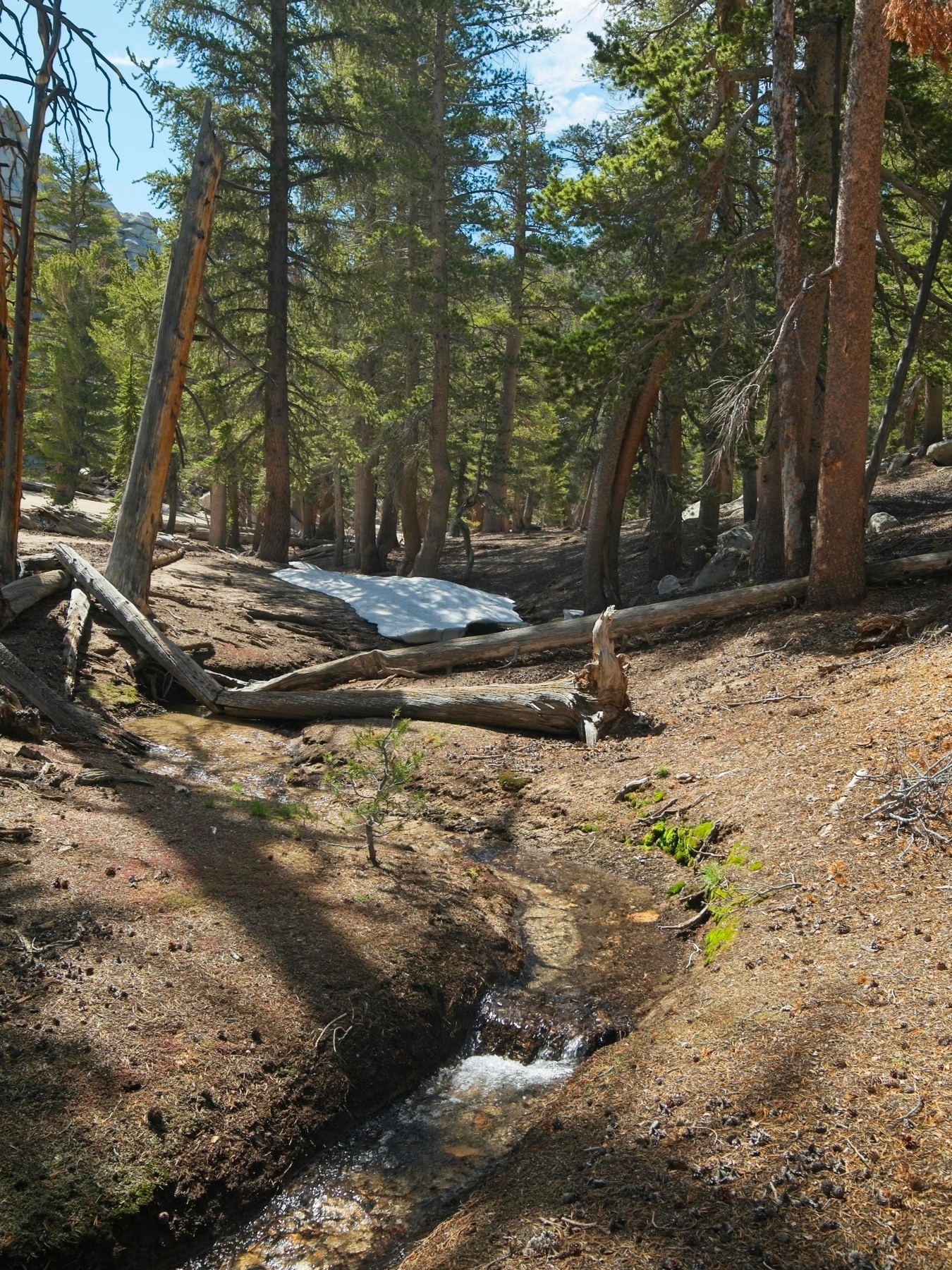
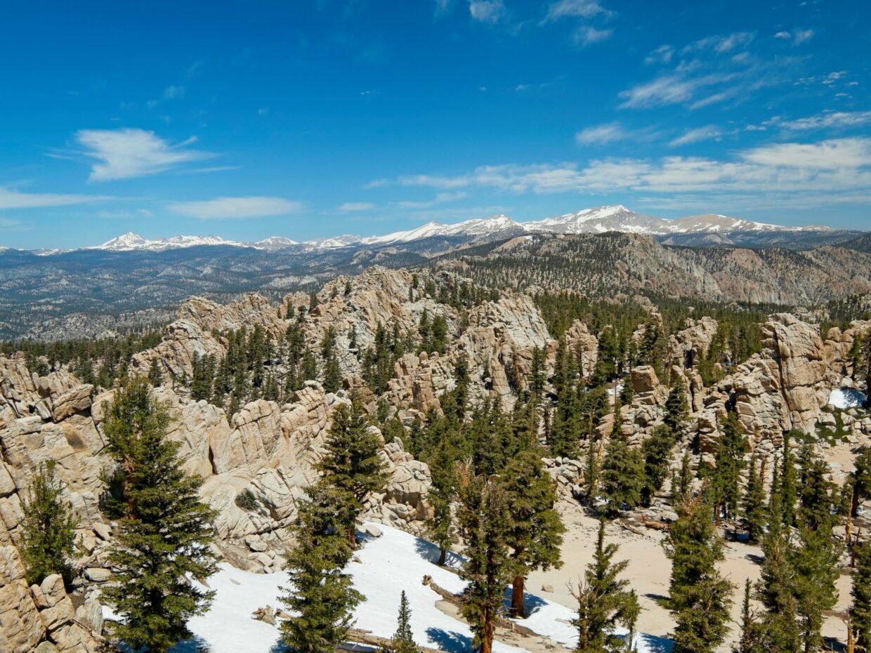
When I reach Death Canyon Creek, I begin walking uphill. Despite its foreboding name, the creek is very peaceful and pleasant, winding quietly through the trees. I follow it through sandy flats for a few minutes and then up a few hundred feet of talus to an enormous sandy plateau dotted with snow banks and towering pines. There are dozens – maybe even hundreds – of granite pinnacles up here. If it were more accessible, I imagine this plateau would be a rock climbers’ paradise!
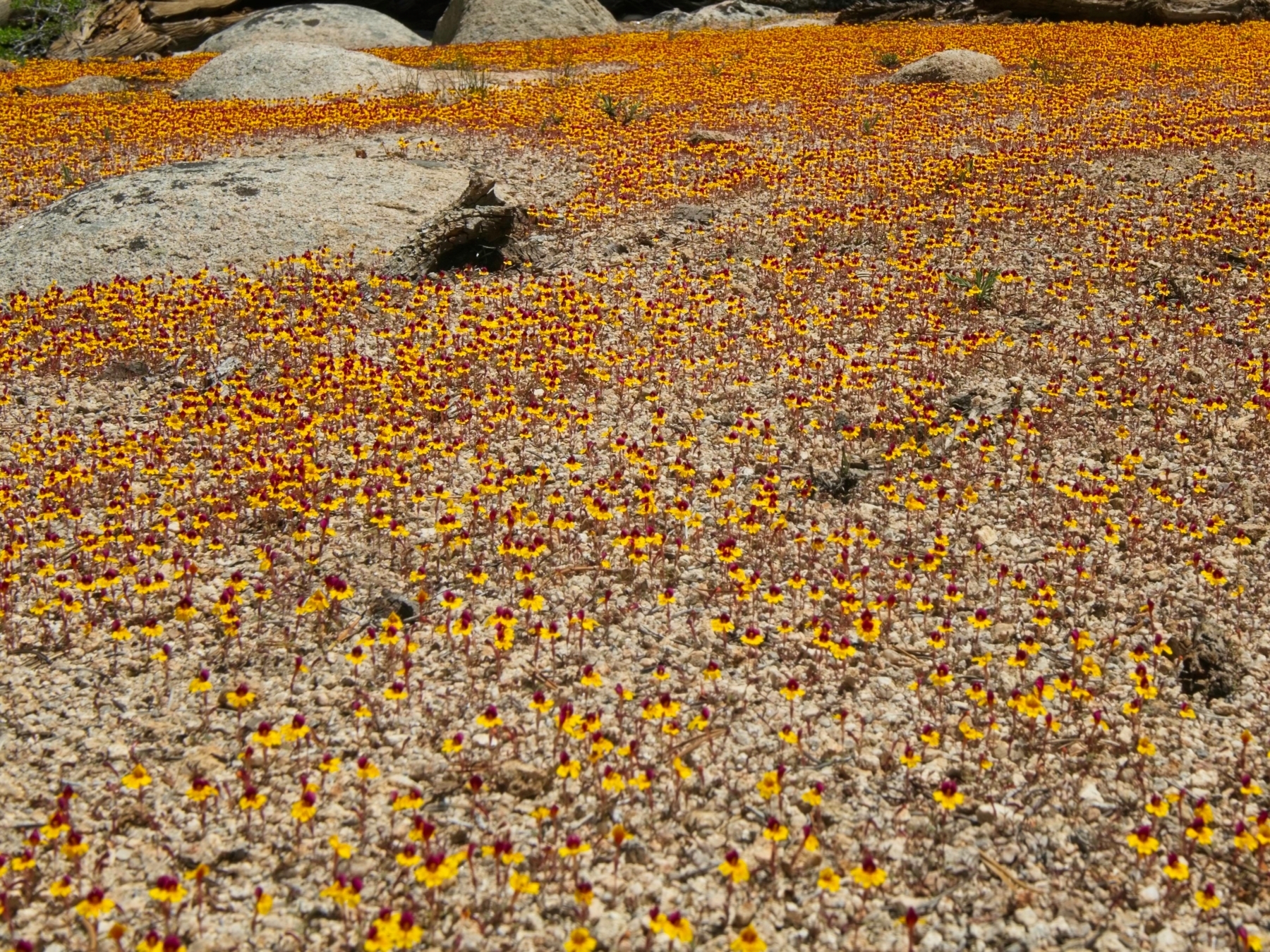
I stroll through the trees and pinnacles for a mile, checking the GPS as I near the southern end of the plateau to make sure I find the correct pinnacle. The scramble up is relatively straightforward, but decidedly class 4 (others have said class 3). Once up top (10:50 AM), I sit for a long while and admire the spectacular views. For such an unimpressive looking peak, the panorama is amazing! Olancha Peak towers directly to the south, and the snowy high peaks (Cirque, Langley) spread across the northern horizon. I’ve got a great view of Owens Lake too, which has a ton of water this season. Even the foreground view – pines and granite pinnacles – is great!


After a long rest, I scramble back down to the sandy plateau and return to Death Canyon. It’s getting hot and I’m grateful for my sunshirt as I trudge through the sunny wilderness. The climb back up to the PCT through soft sand wears me out, so I take another break in some shade on the Sierra Crest to eat lunch.
The rest of the afternoon I do my best to keep walking and not think about my aching feet. The sooner I get back to camp, the sooner the suffering will be over. Hypothetically, I could hike out tonight but I doubt very much that I’ll have any desire to put my body through another 5 miles with a fully-loaded backpack. At least the hiking is easy; it’s mostly downhill and the PCT is clear of obstacles.
I reach camp at about 15:45 and spend a few hours relaxing. I take a nap and then listen to a podcast before getting up to make dinner. No PCT hikers stop at the campsite tonight, so I have the place all to myself. I sit out on a rock for a little while and scan the meadow for wildlife, hoping to see some deer or maybe even a mountain sheep, but I don’t spot anything. I crawl into my tent and go to bed as soon as the light begins to fade.
Early Morning Escape
04 July 2023 | 4.8 mi | +1000 / -700 ft | View on Map
To my chagrin, I toss and turn all night again. By the time 4:30 rolls around, I’m sick of lying around so I get up, pack up camp, and am on the trail within an hour. I’m not in a good mood, so I just put my head down and trudge up the trail.
Two nights ago the PCT hikers told me they were exiting over Mulkey Pass, which is a mile or two closer than Trail Pass, so I decide to give it a try. The trail is definitely less well-traveled, but it’s good enough and I soon find myself standing on the edge of Horseshoe Meadow. It’s freezing down here; there’s even frost on the grass! I crunch through frozen sand for 3/4 of a mile to the Cottonwood Creek crossing. It’s wide but still shin-deep here and any dry summertime crossing is underwater. With the car less than a mile away, I don’t bother to take my shoes off as I wade through the ice-cold water. I leave the trail just past the creek crossing and trek through the sandy forest, heading directly for the parking lot. I’m back at the car shortly after 7:00 and waste no time changing into clean clothes. It’s time for a hot breakfast in town and a much-needed coffee.