I’ve been ticking off California’s 14,000-foot peaks this year and with winter approaching, I wanted to summit one more: Mount Langley. Thankfully, the wildfires that closed many of the national forests and national parks this fall have died down a bit and the air in the Eastern Sierra has been clean for several weeks! Being the enthusiastic hiker that I am, I decided to follow Bob Burd’s trip report and climb Cirque Peak in the same day – you’ve got to have a bonus peak. To give myself enough time for this adventure, I drove up to Horseshoe Meadows after work on Friday and camped at the trailhead so that I could get an early start on Saturday.
Trip Planning
Specs: 21.6 mi | +/- 5200 ft
Difficulty: Class 1 with a tiny bit of class 2 [learn more]
Location: Inyo National Forest and Sequoia National Park, California | Home of the Tubatulabal and Western Shoshone peoples | View on Map
Route: Follow the Cottonwood Lakes trail to either New Army or Army Pass (New Army Pass is better-maintained, but Army Pass is more direct). From the Sierra Crest, follow the well-trod path and a series of enormous cairns to the summit of Mount Langley. Reverse the route to return to the pass but instead of descending back to the Cottonwood Lakes area, continue south and west along the Sierra Crest (class 1) to Cirque Peak. From the summit, descend south about 50 – 100 feet and then turn due east and descend class 1 – 2 rock to the sandy wash below the peak. From the looks of things, you might also descend by first scrambling down to the saddle south of the peak on the Sierra Crest and then into the sandy wash. To return to the trailhead, hike cross-country down the drainage until you pick up the trail that runs between the South Fork Lakes and the main path.


Permits & Regulations: Wilderness permits are required for overnight trips, but day-hiking is red-tape-free! Bears frequent this area, so don’t leave your snacks (or other scented items) unattended. As always, follow the leave-no-trace principles to maintain this pristine wilderness!
Resources: I recommend the National Geographic Mount Whitney map for hikes in this area – it has a good scale! For up-to-date information about the trail, road, and area in general, visit the Forest Service page for Cottonwood Lakes.
A Perfect Autumn Hike
16 Oct., 2021 | 21.6 mi | +/- 5200 ft | View on Map
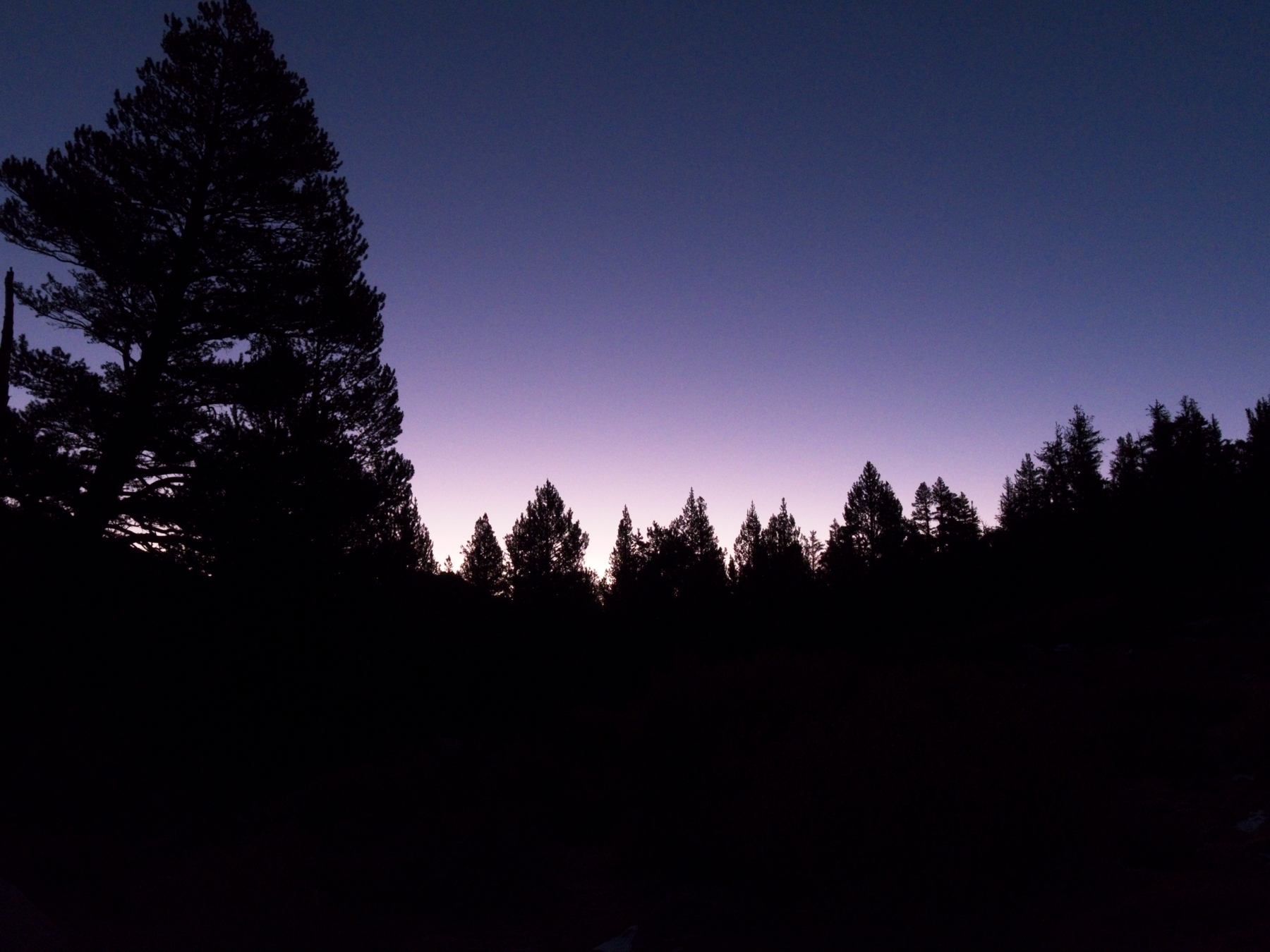
The temperature dipped down to about 29 F (-2 C) last night, making this the chilliest camping trip I’ve been on in a while. Although I was perfectly warm in my sleeping bag, I barely slept… I could feel my heart racing, trying to pull enough oxygen from the thin air, and cars kept rolling into the nearby parking lot until 2 AM. I think I managed a little bit of very light sleep between 3 and 4:30, but that’s about it.
My plan for the day was to begin hiking at 5:30, but I begin early at 5:15 because I’m wide awake and cold. I’m not usually one for long day hikes and my little day pack feels unusually light, but that just means I can move quickly. The sun won’t rise until nearly 7 AM, so I’m destined to walk in the dark for a few hours. I actually enjoy it, wrapped up in my warm layers, marching through the darkness. Thoughts of hungry mountain lions and curious bears cross my mind every now and then, but I push them away and keep trekking, stopping only to replace the batteries in my headlamp.
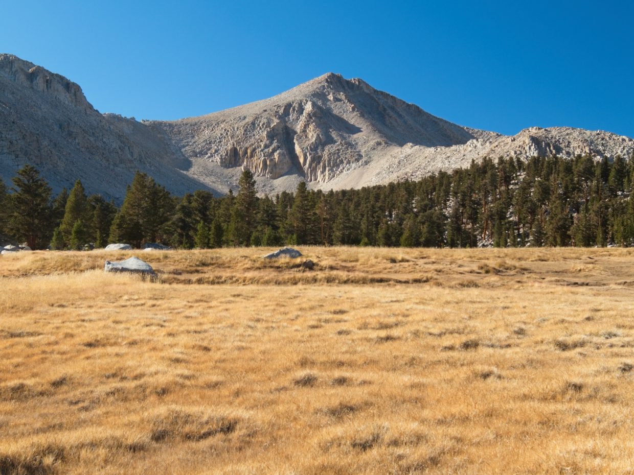
By the time I reach Cottonwood Lake Number One, the sun is just beginning to peak over the horizon. At first it bathes the Sierra Crest and Mount Langley in red alpenglow, then slowly casts is warm rays over the trees and the grassy meadows. I’m beyond excited to be witnessing this light show so far into the wilderness; it makes starting at 5:15 entirely worthwhile!


For the next glorious, golden hour I hike in spurts, stopping every few minutes to stare at (and sometimes photograph) the scenery. With the exception of a solo camper at Long Lake, I don’t see a single person on the trail. It’s just me and the mountains. The trail winds through some airy groves of trees, gradually gaining altitude. Thankfully, my body seems to have acclimated a little bit during the night and I’m feeling great as I climb above 11,000 feet. The weather is absolutely perfect too: chilly, a very light breeze, and not a cloud in the sky!


Just past High Lake I begin up a series of switchbacks that lead to New Army Pass. The steeper grade forces me to slow down a little bit and I also shed a layer or two to keep cool. As I climb higher, I’m treated to some excellent views of the lakes and forests as well as the silhouetted White Mountains in the distance. Thanks to the well maintained and gently graded trail, I’m soon up on the Sierra Crest looking north toward Mount Langley. It’s only 8:30 AM, and I’m already up at 12,200 feet and 8.5 miles into the hike! I know that the next three miles will be much harder, however; the high elevation makes a big difference.


From New Army Pass, I descend about 200 feet due north to “Old” Army Pass and then begin up a sandy trail that leads to Mount Langley. Across the barren landscape I spot several other hikers ahead of me: a couple in bright red jackets, and a trail runner slowly jogging up the mountain. My walking speed proves faster than the runner’s pace (but who runs at 13,000 feet?) and I catch up with him where the slope steepens. The final 1500 feet of vertical ascent are a bit of a slog since the sandy soil makes it difficult to climb, but that’s just business as usual. A few steps forward, a break to catch my breath, a few more steps forward, etc.


After what feels like a very long time, I reach the summit of Mount Langley. A quick glance at my watch reveals that it’s 10:30 AM, so my pace slowed down considerably but I’m not worried; I’m an hour ahead of schedule. The two gentlemen I spotted lower on the mountain are also here, snapping photos and admiring the views. Mount Langley is a pretty spectacular vantage point, particularly if you’re interested in seeing peaks. Nearly half of California’s 14,000-foot peaks are visible to the north (Whitney, Russell, Tyndall, and Williamson), and the Great Western Divide and Kaweah Peaks dominate the western horizon. The Tuttle Creek canyon just below Mount Langley draws my attention, however. A light dusting of snow lingers on the northern aspects, and the brush near the foot of the canyon blazes red, orange, and gold. I’m also intrigued by Miter Basin, a barren valley just above the Tuttle Creek canyon. Add them to the never-ending list of places to explore!
")


After signing the summit register and thoroughly enjoying the vista, I head back down the mountain. It only takes me an hour to return to New Army Pass; the sand that made the ascent so tedious also makes it easy to glissade downward in leaps and bounds. I greet several groups on their way up the mountain, but return to solitude as soon as I’m off the slopes of Mount Langley.
The route to Cirque Peak is very straightforward: just follow the ridge line in a big bend around the valley. Unfortunately, Cirque Peak is 700 feet higher than New Army Pass, so I have some more huffing and puffing to do.


Before tackling Cirque Peak, I find a spot with a good view and plop down to eat lunch and rest. Those 1.5 hours of sleep are starting to affect my energy and mood, so I definitely need to refuel. The high altitude isn’t helping either. I’m grateful for the beautiful weather, though. It’s pretty rare to have practically no wind up here!
After a bit of a break, I begrudgingly continue around the ridge. It’s an easy walk — mostly flat on solid rocks — but the two-mile trek drags on. I distract myself from the tiredness and a headache by trying to name all of the peaks I can see and by examining some curiously weathered rocks I pass along the way.


Although the ridge walk feels like it takes forever, in reality it only takes me a little over an hour to reach Cirque Peak (13:20, still one hour ahead of schedule!). I peruse the summit register while reclining against a slab. There aren’t nearly as many signatures in this book as in the Mount Langley register, but Cirque Peak, at 12,900 feet, is not nearly as desirable a summit as Mount Langley. On the other hand, it’s so close and so straightforward to get to once you’re up on the Sierra Crest! The views are nice as well; I particularly enjoy looking back at Mount Langley with Mount Whitney and Mount Russell in the background. I’m also happy to locate Triple Divide Peak and Lion Rock off to the west.


The descent from Cirque Peak proves to be the most difficult part of the entire day. I have a GPS track loaded on my phone, but I try to avoid referencing it too often. I’d rather spend my time inspecting the landscape and picking a good line than staring at the GPS. That strategy ends up leading me astray, however, and I find myself on horribly loose rock with what appear to be very steep drops a few hundred feet down the slope. Returning to the GPS track (the red path in the route photos in the trip planning section) requires a bit of exhilarating class 4 climbing across a short series of exposed ledges, but from there it’s easy sailing. I even get to do some more sand-glissading!


I thoroughly enjoy the rest of the day’s hike. From the foot of Cirque Peak, I trek cross-country through airy forests and across golden meadows. The brilliant autumn colors and crisp air are second only to the glorious sunrise I experienced this morning. Despite being completely off trail, I spot signs of other people: shoe prints, broken stems and twigs, even the odd hoof mark.


A few miles below the peak, I find the unmaintained trail that parallels the South Fork of Cottonwood Creek. I follow it through increasingly dense trees and the occasional meadow, passing a ramshackle cabin and plenty of snow and ice lingering in the shade. The final few miles blur by; I’m tired but the trail is wide, flat, and free of obstacles. I arrive back at the trailhead at 4:30, happy to have spent the entire day hiking through the mountains in these beautiful fall conditions.
Craig Barlow 2 November 2021
That’s cool that you could pick out Lion Rock and Triple Divide from Cirque!
Andrew 2 November 2021 — Post Author
Spending the afternoon with a view of the entire Great Western Divide really motivated me to try to remember as many of them as I could! The big notch in Lion Rock gave it away, and then finding Triple Divide was pretty easy.
Milissa 7 May 2022
Thanks for the great write up and beautiful photos! Its a big help in my trip planning, was looking into a Langley summit and now am totally motivated to add Cirque Peak onto the itinerary! Would you recommend descending Cirque on the orange line to avoid that class 4 section? Thanks!
Andrew 8 May 2022 — Post Author
Milissa, the red line is a good option, you just have to keep that rib on skier’s right. My mistake was to follow the orange line for a short distance and then cut left with that steep cliff face on my right and the rib on my left.