Every year, Diane, Daniel, Josh, and I meet up for a backpacking trip. Diane and Daniel took the lead on planning this year and put together an awesome weekend loop in the eastern Sierra Nevada Mountains that includes the Cottonwood Lakes area and some gorgeous cross-country hiking through Miter Basin. Unfortunately, Josh wasn’t able to make it this time, but the rest of us enjoyed the early-season weekend in the eastern Sierra.
Trip Planning
Specs: 42.9 mi | +/- 8500 ft | 3 days, 2 nights
Difficulty: Class 2 at Crabtree Pass, but otherwise class 1 [learn more]
Location: Inyo National Forest and Sequioa-Kings Canyon National Park, California | Home of Northern Paiute, Tubatulabal, and Western Shoshone peoples | View on Map
Route: Begin at the Cottonwood Pass trailhead and hike up and over Cottonwood Pass to the PCT. Take the PCT northbound to Lower Crabtree Meadow and continue up Whitney Creek a short distance further to a faint use trail that climbs up to the Crabtree Lakes. Follow the use trail to its terminus at Middle Crabtree Lake and then continue cross country up the canyon, passing the highest lake on the north side. Many class 2 routes lead to the top of Crabtree Pass, the obvious saddle east of the lake; choose one and scramble up! From Crabtree Pass, descend SSE into Miter Basin, staying above lake 12129 and making for the small lake basin between Mt. Newcomb and Sky Blue Lake. Follow the outlet creek of these lakes to Sky Blue Lake, passing it on the east side. Contour around Sky Blue Lake to its outlet creek and then descend into the beautiful meadows below. Pick up the faint use trail here and follow it down the canyon until you pick up the trail near Rock Creek or at Soldier Lake. From here, make your way up one trail or another to either Army or New Army Pass and then back to the trailhead.

Permits & Regulations: Permits are required for overnight stays and bear canisters are required for food storage (there is a bear box at the Rock Creek campsite, but no similar amenities in Miter Basin). See the USFS website for details.
Resources: The USFS website has most of the information you need. The National Geographic Mt. Whitney map provides a great overview of the area, and Secor’s The High Sierra book details the cross-country routes, including Crabtree Pass.
Cottonwood Pass to Rock Creek
3 June 2022 | 14 mi | +2000 / -2400 ft | View on Map
Waking up in the mountains is always a treat, particularly when you’re still fresh and clean. Diane, Daniel, and I drove up from LA last night to the walk-in campground at Horseshoe Flats and slept up here at 10,000 feet above sea level. The extra acclimation before we hike up the trail with heavy backpacks is nice but it also allowed us to get lots more sleep than driving up this morning would have.
It’s a cool morning, but not terribly cold. We take our time making breakfast and packing our bags, so it’s 7:30 by the time we begin walking down the trail. I feel right at home, particularly since I was last on this trail just three days ago! The first few miles on the Cottonwood Pass Trail are a gentle walk through the woods, slowly gaining altitude as we hike toward the pass.
We stop at Chicken Spring Lake at 10:30, about half a mile past Cottonwood Pass, and take a break for a little while. Like last weekend, there are plenty of PCT thru hikers here filling their water containers and/or packing up camp. Thankfully, this weekend is considerably warmer than last weekend and the wind is nice and calm.


After relaxing at Chicken Spring Lake for a little while, we continue north on the PCT. I don’t take a ton of photos this morning, having walked this path (twice) last weekend, but Diane and Daniel’s enthusiasm for the spectacular views brings a smile to my face. We chat as we trudge down the sandy trail at a relaxed pace, catching each other up on what we’ve been up to over the past year. It’s a gorgeous spring day – warm in the sunshine but chilly in the shade – and we take plenty of breaks to enjoy the hike.
")

We stroll into the campsite beside Rock Creek at about 4:45 and find only a few other tents there. We choose a spot away from the creek crossing and the bear box and set up our tents. Once we’ve established camp, we eat dinner and discuss our plans for tomorrow. I’m hoping to make a short detour from the planned route to climb Mount McAdie, but that will depend on our pace and how much energy I have left when we get to Crabtree Pass. The pass is at 12,600 ft and we have lots of cross-country travel to do, so it’s not exactly an easy stroll!
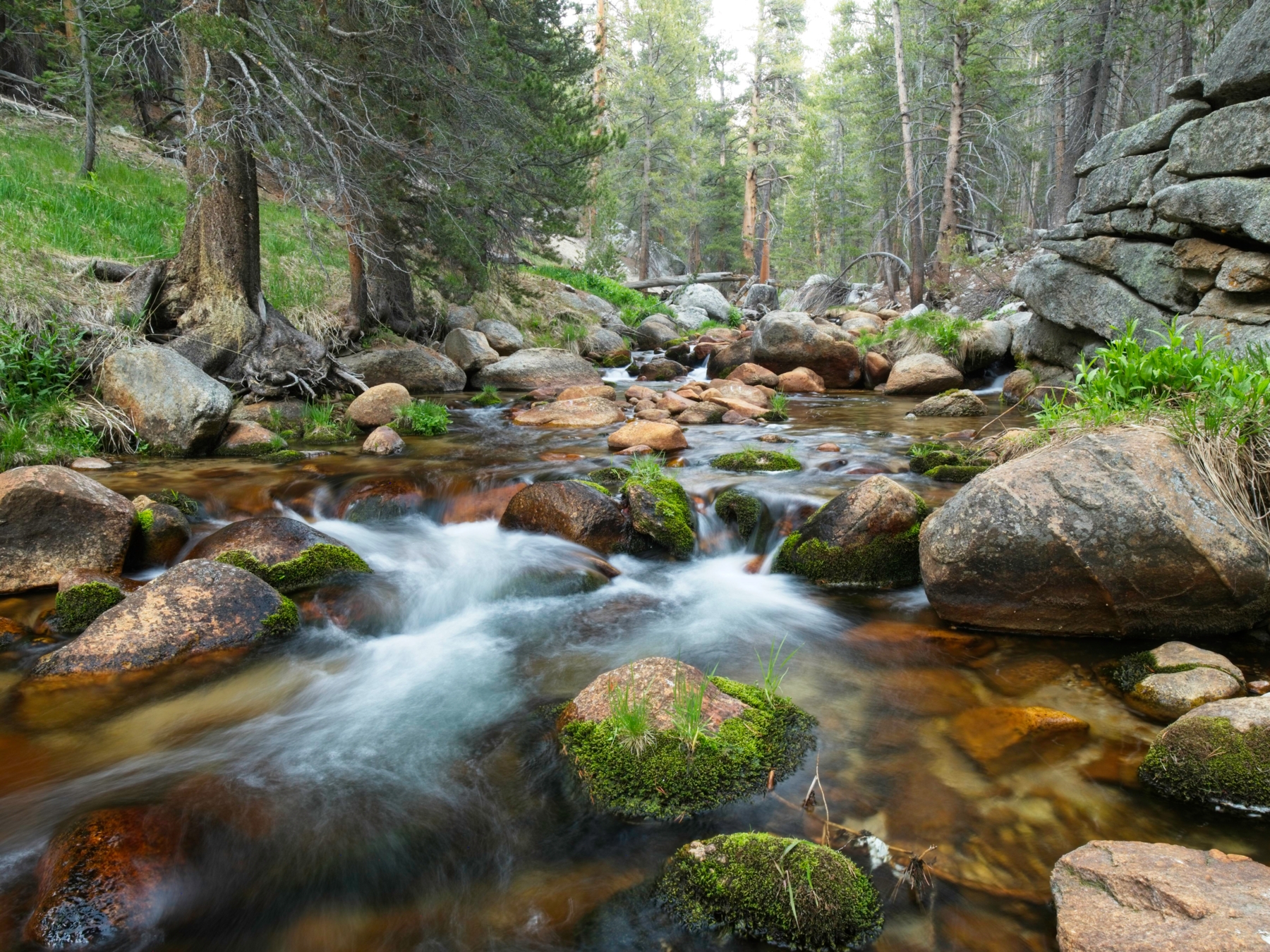
There’s still plenty of daylight left after dinner, so I play around with some long exposures of Rock Creek and then read Ursula Le Guin’s The Lathe of Heaven until bed time.
Crabtree Lakes and Miter Basin
4 June 2022 | 13.8 mi | +4400 / -2400 ft | View on Map
Much like yesterday, we start hiking this morning at about 7:30 AM. Quite a few PCT hikers rolled in last night and seem to still be asleep so we try our best to be quiet as we cross the creek and begin climbing the switchbacks up and out of Rock Creek Canyon. Although Guyot Pass is about 1300 feet higher than our camp, the hike up doesn’t feel too difficult and we’re standing on the ridge in what feels like a very short amount of time. It’s a great spot with nice views of Mount Anna Mills, so we find a sunny clearing with granite boulders to recline against and relax for a little while.
The next several miles pass by quickly on a mostly flat stretch of trail. We pass a few hikers heading south, but I’m a little surprised at how vacant the trail is. The flat hiking comes to an end just before we reach Crabtree Meadow. A few switchbacks up a hill lead us to the top of a ridge; even more switchbacks lead down into the meadow. We cross Whitney Creek on a precarious stone walkway and then leave the PCT, instead following a trail that parallels Whitney Creek and eventually joins the JMT en route to Mount Whitney. Several dozen tents sit scattered throughout the woods here, but there’s not a person to be seen. They’re probably all up climbing Mt. Whitney.


We’re not going as far as Whitney today. Instead, we soon leave the established trail and follow a faint use trail into a vast meadow. Our goal for the afternoon is to hike all the way to the head of the canyon and cross Crabtree Pass to reach the Miter Basin. The use trail wastes no time gaining altitude so we take lots of breaks to breathe. A little further up the canyon we find a nice, sunny slab for lunch and enjoy views of the distant Great Western Divide.
Shortly after lunch we finally reach “the good part,” i.e., the first of the Crabtree Lakes. Dozens of fish swim through the water near the outlet creek, though they scatter if we get too close. It’s a beautiful spot, particularly with the towering cliffs on the south side of the lake. Unfortunately, clouds have gathered throughout the morning and it’s now pretty overcast. The wind has picked up too – it’s starting to feel a lot more like last weekend!


The use trail grows fainter and fainter as we continue up the canyon but the navigation is pretty straightforward. We just keep walking uphill, following the canyon as it bends toward the Sierra Crest. I love this kind of hiking: not much of a trail, ruggedly beautiful scenery, and the promise of even more epic hiking to come.


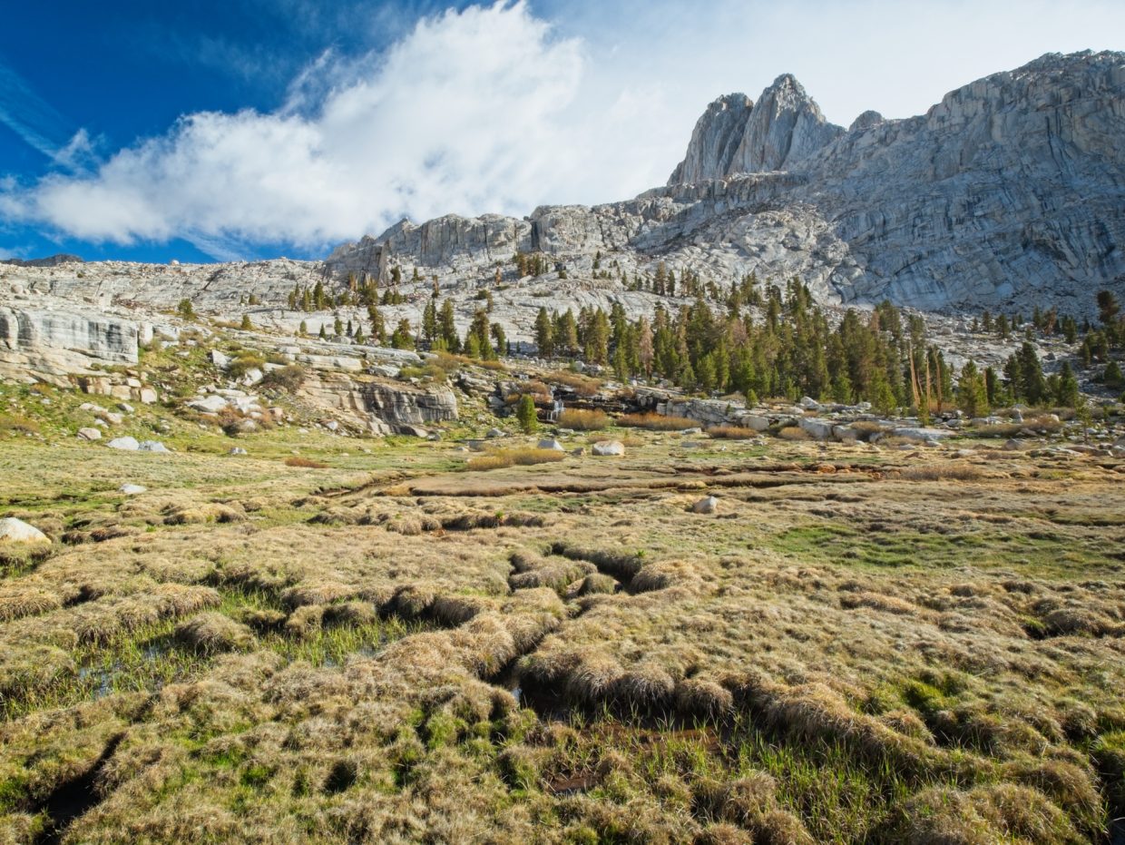
Middle Crabtree Lake turns out to be my favorite of the bunch, mostly because of its wide, sandy beach. I’m guessing the lack of snow this winter has something to do with the amount of exposed sand, especially since past years’ watermarks are clearly visible on the rocks surrounding the lake. But it’s a beautiful sight and lots of fun to walk around!


The trail completely disappears above Middle Crabtree Lake, but the way forward could not be more clear. It’s remarkably fast cross-country travel with plenty of grass and slabs for easy walking. Every once in a while the sun peeks through the clouds and casts interesting shadows on the mountains, prompting a flurry of photos from the lot of us, but the overcast skies generally persist. The lack of sun does keep things cool, which is nice while we’re hiking uphill, but it’s awfully chilly when we stop!


Before tackling Crabtree Pass, we take shelter from the cold wind behind a large boulder and eat some snacks. From across the uppermost Crabtree Lake, the namesake pass looks pretty steep and it has Daniel and Diane worried. I’ve never been up this particular canyon, but I know that slopes almost always appear steeper from a distance than they actually are. My main concern is the snow cover, both surrounding the lake and at the foot of the pass. We’ve all got microspikes but those are only marginally helpful if the snow is steep and icy. None of us are anxious to slide into the ice-covered lake.
The north side of the lake looks a little easier to hike around (there’s also a pretty obvious trail), so we head that way, crossing some small, low-angle snowfields on the way. Thankfully, it’s warm enough out that the snow is soft and easy to walk across and we’re soon back on dry, sandy ground, contouring around the lake. We cross a few more patches of snow, but they’re all equally soft and low-angle.


Climbing the first fifty feet of Crabtree Pass proves to be the must difficult for us, at least from a technical perspective. The snow-free rock that is exposed is mostly friction slab, i.e., slabs of rock without many features that force you to rely on friction to climb up. Daniel and Diane are pretty uneasy about the climbing, but I’m able to coach them through the most difficult spots. Above the slabs is a few hundred feet of loose, crappy rock. It’s much less technically challenging but also much less enjoyable. A little bouquet of sky pilots (polemonium eximium) cheer me up during the tedious climb.
 display on the pass")


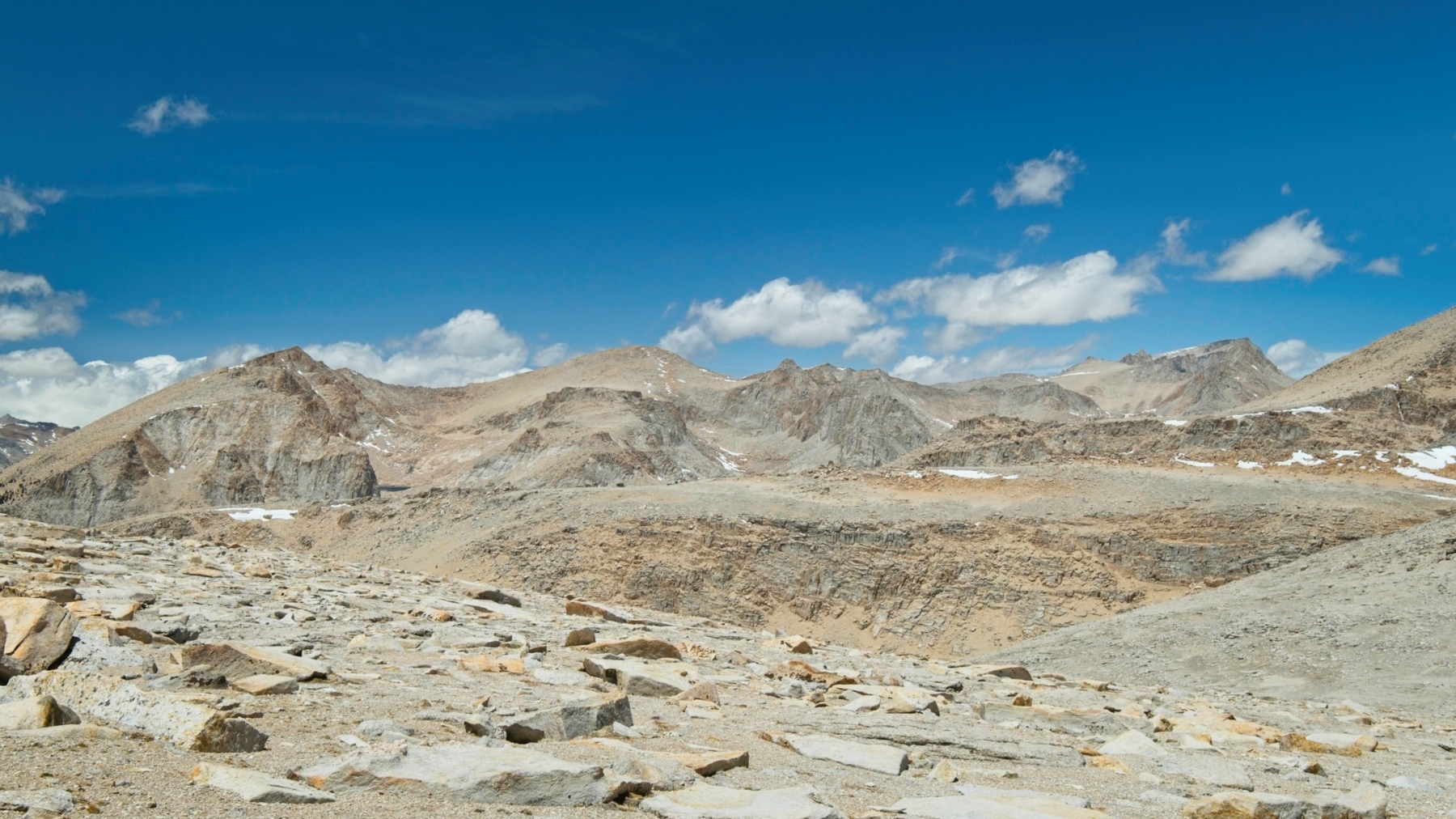
From the top of the pass we get our first look at Miter Basin. I wasn’t expecting such complex terrain! The entire landscape is a mess of boulders, benches, and snowfields; it’s going to take some time to get across all of this! I check my watch and quickly conclude that there isn’t nearly enough time to scramble up to Mount McAddie. I’m also out of snacks for the day and I’m not about to start a 1000+ ft climb without some snacks.
So we set off across the valley, staying north of a few tarns and making for the high ridge to the west of the ice-covered, nearly circular lake below. In contrast to the hike up Crabtree Canyon, the route finding here is anything but straightforward. We meet a solo hiker heading up toward Crabtree Pass and wish him good luck; he’s got a long way to go to find a good campsite.


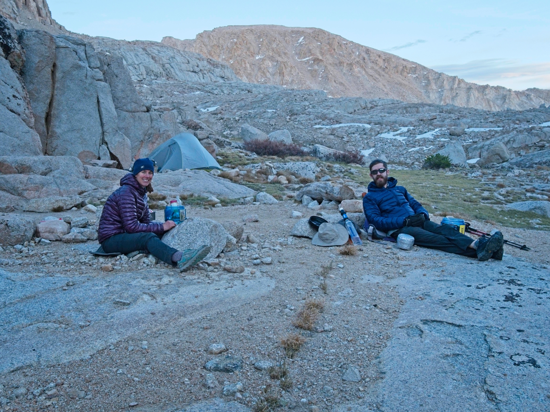
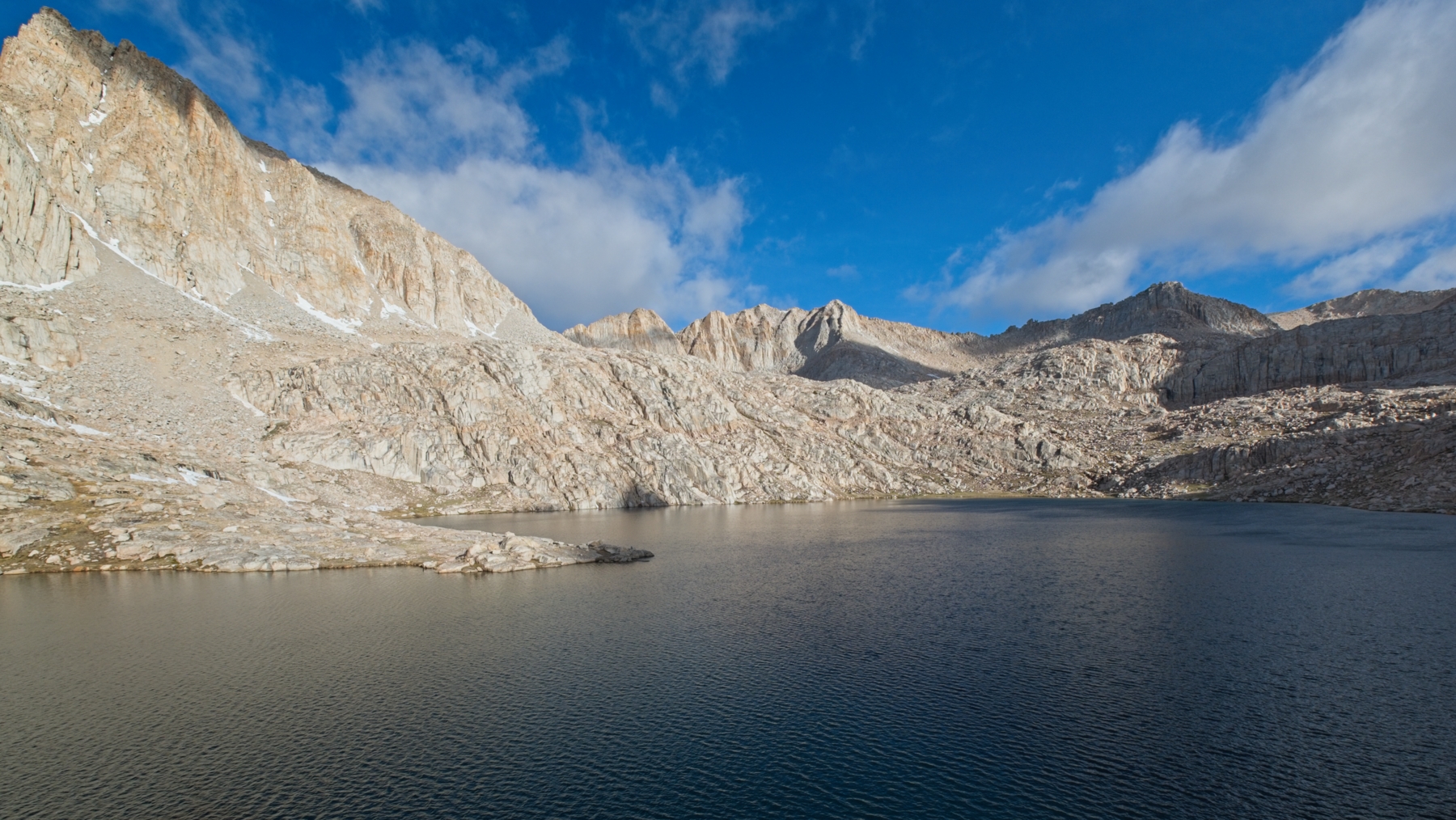
After several hours of route finding across benches and between lakes, we finally reach a slope that leads directly to Sky Blue Lake, our destination for the day. The sun has already sunk below the mountains and I’m getting pretty cold and very hungry. We pass a solitary camper in a bivvy beside the lake but there aren’t any larger tent sites nearby so we continue around the lake until we find a spot with more space. Thankfully, nearby boulders shelter us from the worst of the cold wind and we’re able to set up camp without being blown around. Then it’s dinner time – finally! We get to watch the sun set as we cook and eat, a lovely conclusion to a fun and challenging day.
Miter Basin and New Army Pass
5 June 2022 | 15.1 mi | +2100 / -3700 ft | View on Map
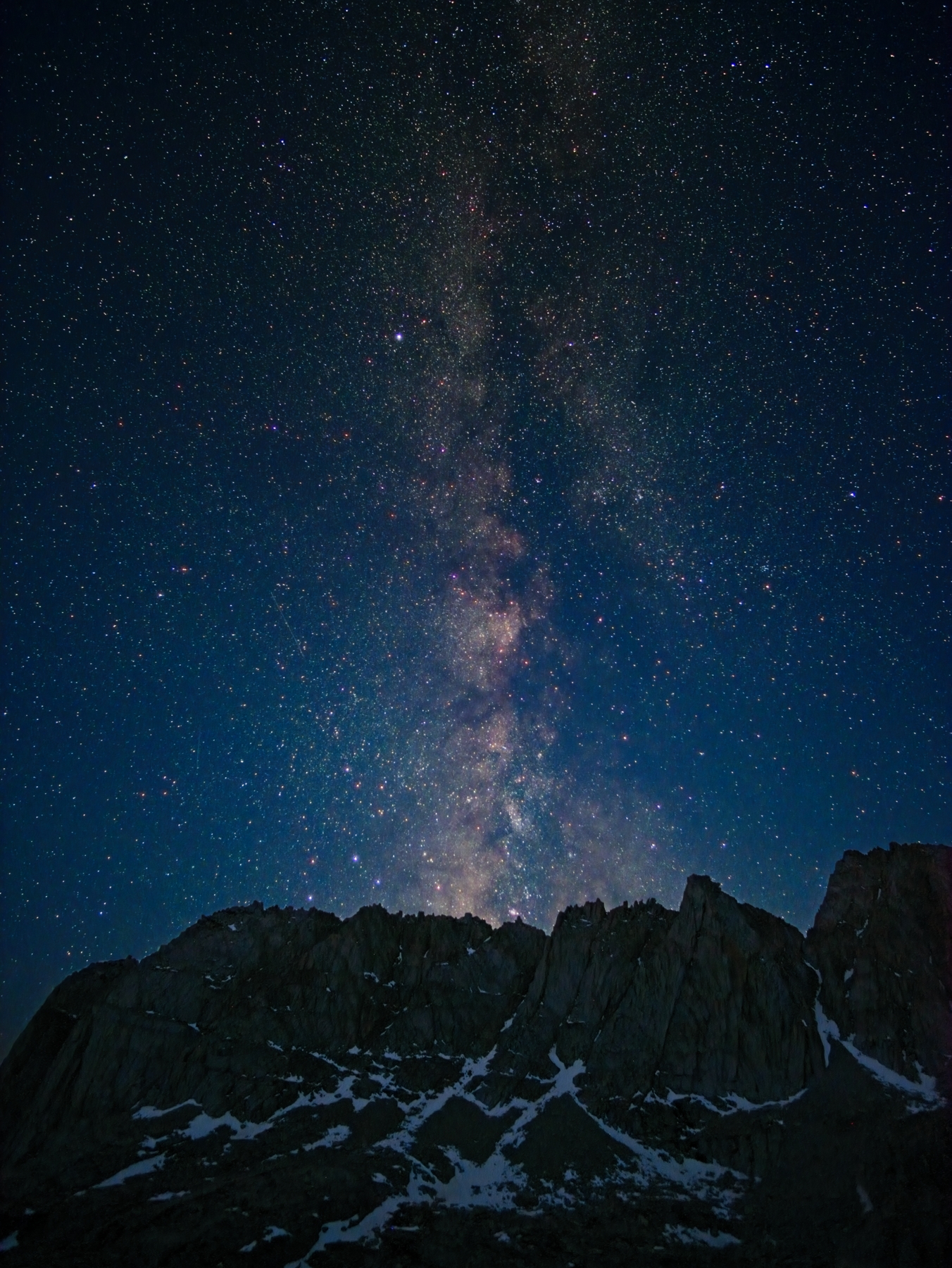
I woke up last night at about 3:30 and spent a few minutes with the tripod photographing the milky way over our campsite. I expected frigid temperatures but was pleasantly surprised by the mild conditions. After capturing some pictures I liked, I went back to sleep for about an hour until sky began to brighten.
The wind has picked up a little this morning and a bank of clouds keeps the sun at bay while we cook breakfast and pack up. By the time we begin hiking, however, the sun makes it over the peaks and through the clouds. On our way to the outlet creek, we scramble up to a sunny outcropping overlooking Sky Blue Lake. After snapping a few photos, fierce gusts of wind convince us to continue down the canyon.
Thankfully, the wind dies down to a gentle breeze as we descend and I’m able to pack away all of my warm layers and enjoy the morning stroll. We scramble down some rocks beside a picturesque cascade just below Sky Blue Lake and then wander down slabs, heading for the grass-filled canyon below. It’s incredibly beautiful and we’re all snapping photos left and right.


For the next hour, we walk through lush green meadows and over small, boulder-strewn knolls on a gradual descent through Miter Basin. There’s really not much to say besides emphasize how beautiful the entire area is! Easy walking, lots of grass, meandering creeks, towering granite buttresses; it’s an alpine paradise.


We eventually begin a more rapid descent through a narrow chute, leaving Miter Basin behind. Cairns and a use trail lead us down to a small meadow where we stop for a break in the sun. The serrated ridge of peaks on the Sierra Crest still draw my eye, even after hiking below them all morning.
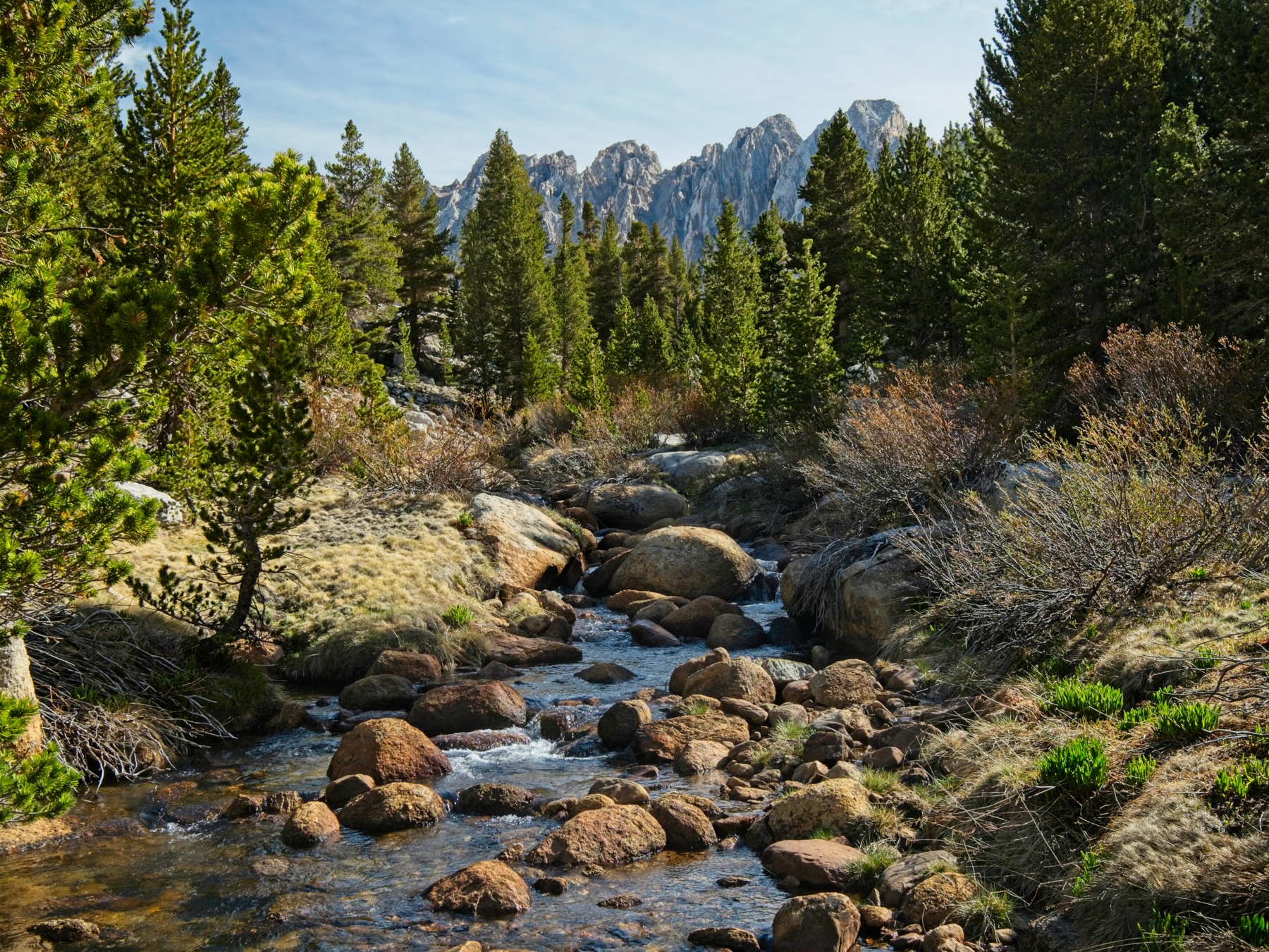
The trail continues downhill, passing through several more meadows and small canyons to reach the maintained trail in Rock Creek Canyon. We’ve descended a little over a thousand feet this morning and now have to gain it all back, which I’m not too thrilled about. The ascent begins on a steep but shaded trail that leads to Soldier Lake. I work up a good sweat by the time I reach the next junction!


At the meadow below Soldier Lake we turn onto the trail toward Army Pass. As the trail climbs we transition from forest to dry meadows to a sandy wasteland. It’s a gradual ascent until the final few tenths of a mile where the trail climbs steeply through the loose sand. Reaching the plateau takes a lot of effort so we take our time, slowly trudging up the trail into an increasingly fierce wind.


On the flatter terrain of the Sierra Crest I take off my hat and secure it to my pack; I don’t want it to blow away! Diane, Daniel, and I walk over to Army Pass to see how it looks. We’d like to descend to Cottonwood Lake #5 but there’s a bunch of steep snow covering the upper portions of the trail. None of us are particularly keen on traversing the steep snow so we pause to eat lunch and then continue climbing a few hundred more feet to New Army Pass. On the way up we get a spectacular view of many of the nearby peaks, including Joe Devel, Pickering, Newcomb, and Mount Whitney.


Although there’s a little snow blocking the trail down New Army Pass, we’re able to scramble around it to reach the path. The switchbacks drive me nuts on the way down – they loose altitude so slowly, sometimes just traversing the face of the slope for hundreds of feet without descending an inch! Down below the switchbacks we stop for a break beside a massive boulder; I’m getting really tired, probably thanks to the early morning astrophotography session, so I lie down and close my eyes for a bit.

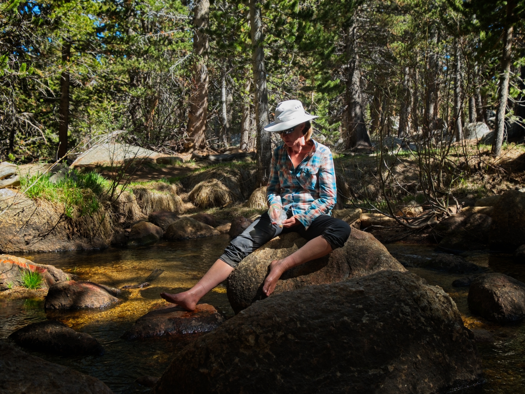
We eventually continue down the trail, passing several groups on their way up to the pass. I don’t envy them; it’s warm out now and they have a lot of ascending to do! Despite my short nap, I’m still feeling pretty tired so I just settle into an easy pace, put my head down, and walk, pausing every once in a while to stay with Diane and Daniel. A few miles down the trail we stop for another snack break beside the North Fork of Cottonwood Creek and soak our feet in the cold water for a while.
The last couple of miles feel like they take forever to walk and I get annoyed at several tedious uphill stretches. Reaching the parking lot and backpacker’s campground brightens my mood somewhat – the walking is over! We set up camp and then change into cleaner clothes before dinner. Diane saved some hot chocolate packets for the last night; I mix mine with some leftover oatmeal to create a chocolate-strawberry gourmet dessert. We’re all pretty tired and we’ve got to hit the road early tomorrow to get Daniel and Diane to the airport in time for their flights, so we head to bed once the sun goes down. As tired as I am, I had a blast exploring Miter Basin with these two this weekend!
George Lynn Paul 30 July 2023
Wonderful account. I’m planning a trip in this area for early September and this really is helping me plan.
Andrew 11 August 2023 — Post Author
Thanks! I’m glad it’s helpful for you.
Jerad 31 August 2023
Just stumbled accross your site looking for writeups on the Miter Basin. I had a funny fealing when I read about the “solitary camper in a Bivvy beside the lake” at Sky Blue Lake. I checked the date posted for your trip along with one I did a while back in 2022. Turns out I was the solitary camper! I do rememeber a group of three passing through that evening when I was camped there. What a coincidence! Happy Trails!
Andrew 15 September 2023 — Post Author
Oh hi, Jerad! What a fun coincidence 😀 Maybe I’ll see you out there again… happy trails!
Chris 6 October 2023
Thank you for these photos and reflections- they are inspiring and exciting as we head to this area next week!
Looking for suggestions as we finalize our one-way route toward Whitney. Coming from Cottonwood Lakes, would you recommend heading through Miter Pass on the way to Mt Whitney (your “out” route), or trekking around it, near Mt. Guyot (the reverse of your “back” route)?
Andrew 11 October 2023 — Post Author
Hey Chris, the “better” route depends on your comfort with cross-country travel and snow.
Last weekend (1 Oct), the Sierra got fresh snow. I saw up to 8 inches of powder this weekend (8 Oct) in shaded spots. Also, the lingering snowfields are *much* larger this year due to the record snowpack we received, so the photos above are not representative of what you’ll find out there right now.
Miter Pass is shorter and I think it’s way more fun, but it also involves plenty of class 2 hiking, and some of that may be snowy or icy. The PCT route (by Guyot) is longer but is also a maintained trail.
Justin Nikodemski 14 November 2023
Hi Guys, Great write-up. What permits did you need to acquire for this hike? Thanks!
Andrew 1 December 2023 — Post Author
Thanks Justin! You’ll need an overnight permit for Inyo National Forest; see https://www.recreation.gov/permits/233262.
Michael Schafer 23 January 2024
The Miter Basin is so beautiful. i was up there in 2022 and enjoyed wondering around. I approached from Horseshoe Meadow. I look forward to this counter clockwise trip this year. In a normal year is early June reasonable?
Andrew 12 February 2024 — Post Author
A “normal year” is a bit difficult to define… 2022 was an exceptionally dry winter, though not very far out-of-family for the past 20 years. In general, I wouldn’t count on easy access above 10k feet until July. See also https://www.postholer.com/articles/PCT-Auto-Updating-Snow-Conditions for historical data.
Steve Orr 11 February 2024
Thanks so much for sharing your amazing trip!
Roger 29 August 2024
Curious what camera lens/es and tripod you took on this amazing trip..
Andrew 7 September 2024 — Post Author
Hi Roger, a short of my usual camera gear is here: https://backcountrysights.com/photography-gear/
I definitely brought the 10-24 mm lens, and maybe also a Rokinon 12mm f/2 for the astro stuff.
Steve Thaw 23 October 2024
Enjoyed your great trip report! No need to add “mountains” to the Sierra Nevada which is Spanish for “Snowy Range”! Cheers, Steve Thaw, Moraga, California
Gary Reichert 25 April 2026
Interesting reading and pics. I was a back country ranger in sequoia\kings for 5 years. Had the Crabtree area for 2 of those which included the mitre basin. Climbed the Mitre twice, MT Leconte, Corcoran, Pickering and one other. 1970 thru 1974. Great experiences. My book about it. High Sierra Ranger on Amazon.