I had an abundance of free time this holiday weekend and decided to spend a day hiking up to Fox Mountain and Condor Peak. They’re both named after local fauna, although no California Condors have been spotted here in many, many years [HPS 1, HPS 2]. The hike itself is very straightforward and pretty well graded besides a few steep social trails that lead to the summits. However, there isn’t much shade, so I recommend this one for the fall, winter, or early spring.
Trip Planning
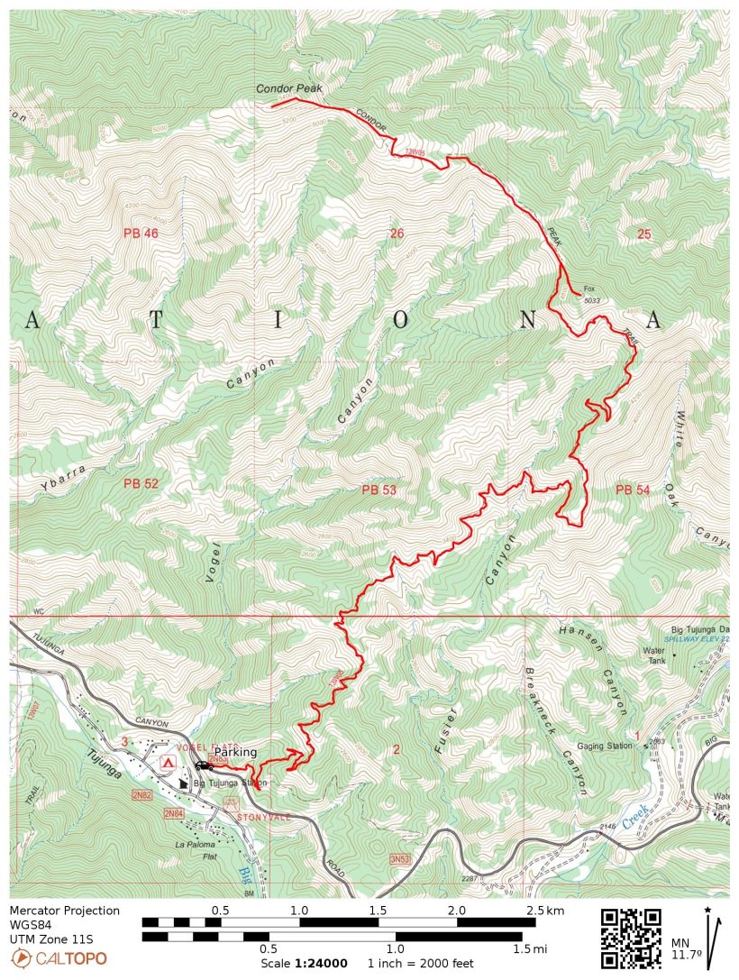
Specs: 14.75 mi | +/- 3800 ft
Difficulty: Class 1 [learn more]
Location: Angeles National Forest | Home of the Kizh, Tongva, and Fernandeño Tataviam peoples | View on Map
Route: Park at the second pullout south of Vogel Flat Road (mile marker 4.50); the trail begins across the road. Only a short distance later, this spur trail intersects with the well-traveled Condor Peak Trail. Follow the Condor Peak Trail to the ridge between Fox Mountain and Condor Peak. A use trail provides access to Fox Mountain from the ridge, and a similar use trail further down the Condor Peak Trail leads up to Condor Peak itself.
Permits & Regulations: The only restriction on this hike is that an Adventure Pass or Interagency Pass is required to park on Forest Service land. Otherwise, just follow leave no trace ethics and enjoy the hike!
Resources: The Angeles NF National Geographic map depicts the Condor Peak Trail (13W05) but not the path from Vogel Flat to the trail nor the use trails to the two summits. Also check the Angeles National Forest website for current alerts, warnings, and restrictions.
Condor Peak Trail
2 Jan, 2022 | 14.75 mi | +/- 3800 ft | View on Map
It’s chilly this morning (39 F, 7:45 AM), but that’s perfect for a hike! Eager to get moving, I grab my trekking poles and backpack from the car and start up the trail. A few tenths of a mile later I reach the well-traveled Condor Peak Trail and take a good look at the trail junction; there isn’t a sign marking the path back to the car and I want to make sure I recognize the spot on the way down. The Condor Peak trail meanders across the shaded western face of the ridge for several miles, gaining altitude at a very gentle rate. I enjoy the walk and wonder if I’ll see any other people out today. There were several other cars at the trailhead and I see fresh foot- and bike-prints on the trail in front of me, but I have yet to see or hear people.

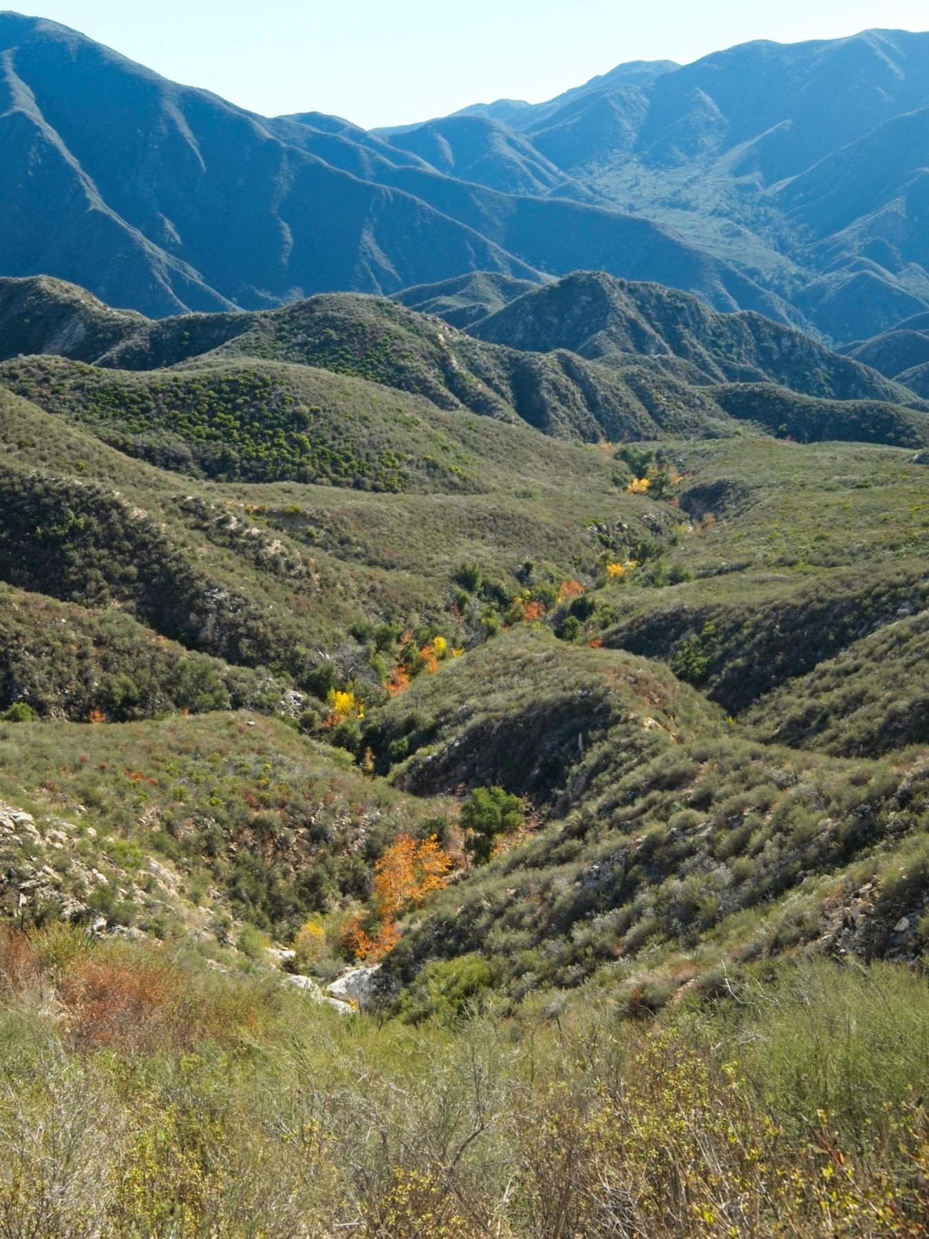
A little over two miles up the trail I finally leave the chilly shade behind and step out into the sunshine. I pause for a few minutes to eat a snack, put on some sunscreen, and take off my jacket. The trail now contours across the east-facing ridge below peak 3961, still gaining elevation very gradually. We’ve had a very wet December in Los Angeles, and it shows. Creeks gurgle through many of the canyons, and the mountainsides are green rather than brown. I particularly enjoy the orange and yellow sycamore trees dotted through the canyons.


The trail eventually steepens a bit, but it still feels pretty gentle to me. Perhaps I’ve spent too much time on highly inclined terrain lately… both Iron Mountain and the Cactus to Clouds hike involved a lot of steep climbs. Still, my legs are burning by the time I reach the foot of the Fox Mountain summit block. There’s a woman resting here; she’s waiting for her sister-in-law to return from Condor Peak. After chatting with her for a minute, I head up to Fox Mountain. The social trail that leads up to the summit is far steeper than the maintained Condor Peak Trail, but scrambling up it proves fairly straightforward. The ground is completely frozen, so the sandy soil is uncharacteristically solid.
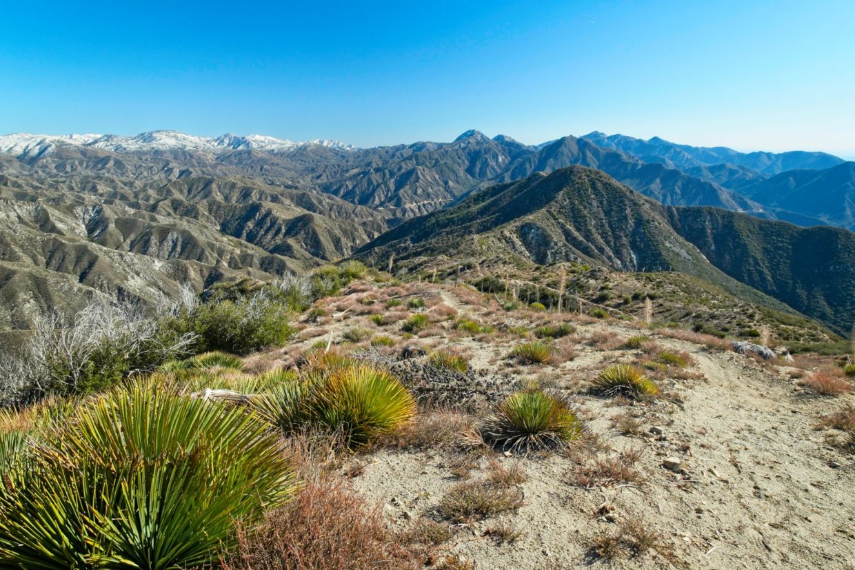
Fox Mountain offers some nice views of the San Gabriel Mountains; there are so many peaks to see! Snow-covered Mount Baldy stands out in the distance as do Strawberry Peak, Josephine Peak, Mount Wilson, and Mount Lukens. After looking around for a few minutes and snapping a few photos, I head out – it’s only 10:30, much too early for a summit lunch break.


Descending on the frozen sand is a little treacherous and I’m glad to make it back to the Condor Peak Trail without impaling myself on a yucca. I continue along the ridge-top trail for about 1.3 miles and really enjoy the stroll. The air is really clear today and I can see all the way out to the ocean! Little container ships sit scattered along the coast with Santa Catalina Island clearly defined against the horizon. I try to capture a photo a few times but the wide-angle lens doesn’t really capture the scene very well.


Like the final ascent to Fox Mountain, Condor Peak is reached via a steep social trail (more of a network of social trails, really). This one is a little less treacherous since it’s sun-lit and thawed out. The sister-in-law passes me on her way down the from the summit and we chat for a minute before going our separate ways. I crunch through a few lingering patches of snow and ice and then plop myself down on a sunny rock for a nice, long rest. After pulling my lunch out, I peruse the summit register. It’s a bit of a mess; three separate notebooks hold scattered signatures from the past few years with dozens of blank pages between entries and no apparent chronology to the books. I sign one of them and then stuff the bunch back into the tube and secure it under a rock.
Looking down from the peak, I spy the road far, far below. Part of me wishes for a zip line or a wing suit or some way of getting back to the car that doesn’t require walking another seven and a half miles. So I sit for a while longer and enjoy the windy silence.
Some time later – around 11:50 – I begin the return journey. There’s not much to say about it besides that the ground is noticeably damp in some places, an interesting feature only because these mountains are so incredibly dry most of the year. I zone out for the next several hours, enjoying the mellow terrain and the freedom to let my mind wander wherever it pleases. The time flies by and I reach the car at about 14:40; a nice long stretching routine completes the day’s adventure for me.
Roger 16 January 2023
Thank you so much for this post! It looks great and the pictures are gorgeous. We’re planning on doing it soon 🙂