With an elevation gain of 10,400 feet in 15 miles (only 800 feet shorter than the climb from Everest Base Camp to the summit), the “Cactus to Clouds” route is rated as one of the hardest hikes in the United States. You begin your day at 470 feet above sea level and ascend a grueling 8000 feet in 9 miles through the arid desert above Palm Springs. There are no reliable water sources during this stretch and temperatures quickly rise above 100 F in the summertime, so an early start time, plenty of training, and several liters of water are all requirements for this hike. Once you’ve reached Long Valley (8500 ft), there’s still a 10-mile round-trip hike to the summit with additional challenges including thin, high-altitude air and cool, cold, or even frigid weather. With all those warnings in mind, this is a very rewarding hike with beautiful scenery. Prepare for the challenges and enjoy this monster of a walk!
Trip Planning
Specs: 19.2 mi | +10,400 / -2,400 ft (this is what my GPS track measured; other sources claim the route is 21.2 mi with 10,800 feet of gain; let’s just agree that it’s a lot and not worry too much about the specifics)
Difficulty: Class 1 [learn more]
Location: Agua Caliente Indian Reservation and San Jacinto State Park | Home of the Cahuilla peoples | View on Map
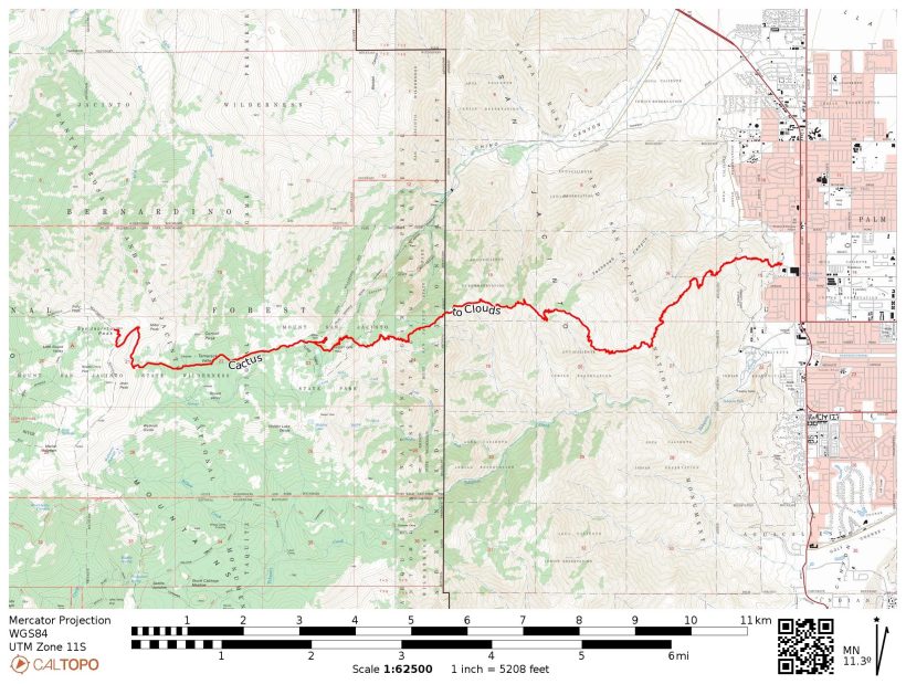
Route: Begin at the Skyline Trail trailhead on the northwest side of the Palm Springs Art Museum parking lot (101 N Museum Dr, Palm Springs, CA 92262); park on the street, not in the museum lot or the adjacent parking garage. Follow the white-blazed trail up into the mountains; we lost the route once or twice, so keep your eyes peeled for the white paint and occasional reflective tape markers. The Skyline Trail ends at the lip of Long Valley; follow the Desert View Trail over to the ranger station, where you can pick up a day-hiking permit. Next, hike the Round Valley Trail to Wellman Divide and then turn north on the “Peak Trail,” following signs for the summit. Some maps show a trail through Tamarack Valley, following the creek up to the Peak Trail in a fairly straight line, but this route is not maintained or marked. From the summit, reverse your route back the ranger station and then make your way to the tram station for an easy ($14) descent back to the desert.
Permits & Regulations: A permit is required to hike in the San Jacinto Wilderness, but it’s an easy self-issue process at the ranger station; I suggest the ranger station in Long Valley since it’s on the way to the summit. Otherwise, this hike is pretty red-tape-free! Take care to leave no trace on this rugged hike to preserve it for future adventurers.
Resources: For up-to-date trail conditions, check out SanJacJon.com. Make sure to check the tram schedule as well – you don’t want to be forced into a Cactus to Clouds to Cactus hike! I haven’t found a print map that covers this entire route, so I suggest downloading a GPS track onto your phone and carrying a back-up paper map if you feel so inclined.
Two Vertical Miles
12 Dec, 2021 | 19.2 mi | +10,400 / -2,400 ft | View on Map
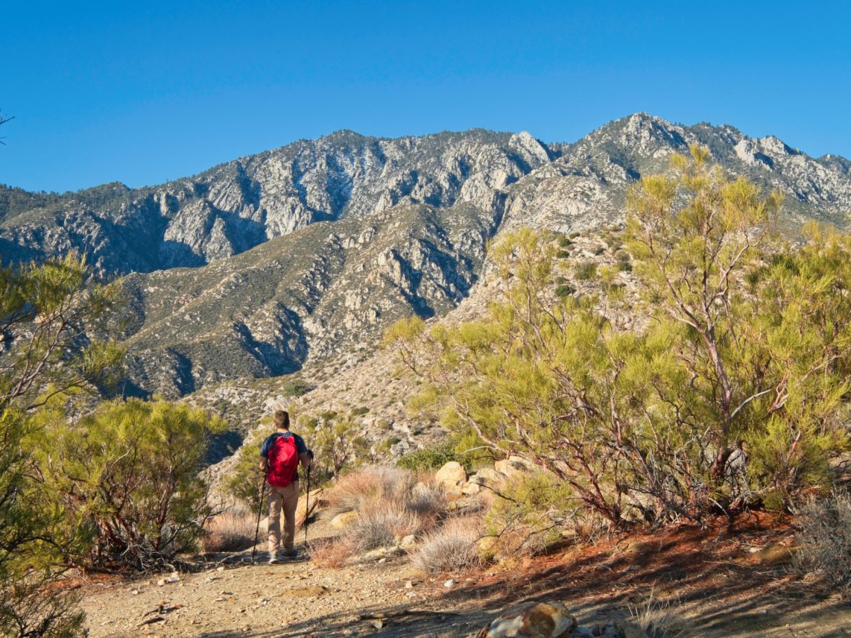
Kim, Alex, and I pull up at the Palm Springs Art Museum at 4:45 AM. It’s dark, of course, but also much chillier than I expected; the car thermometer reads 35 degrees! We’re already packed and ready to go, so we hit the trail right away. White paint splotches mark the way up a steep, rocky slope between social trails. It’s an aggressive start, but we do have over ten thousand of feet to climb… might as well get started at a good rate.
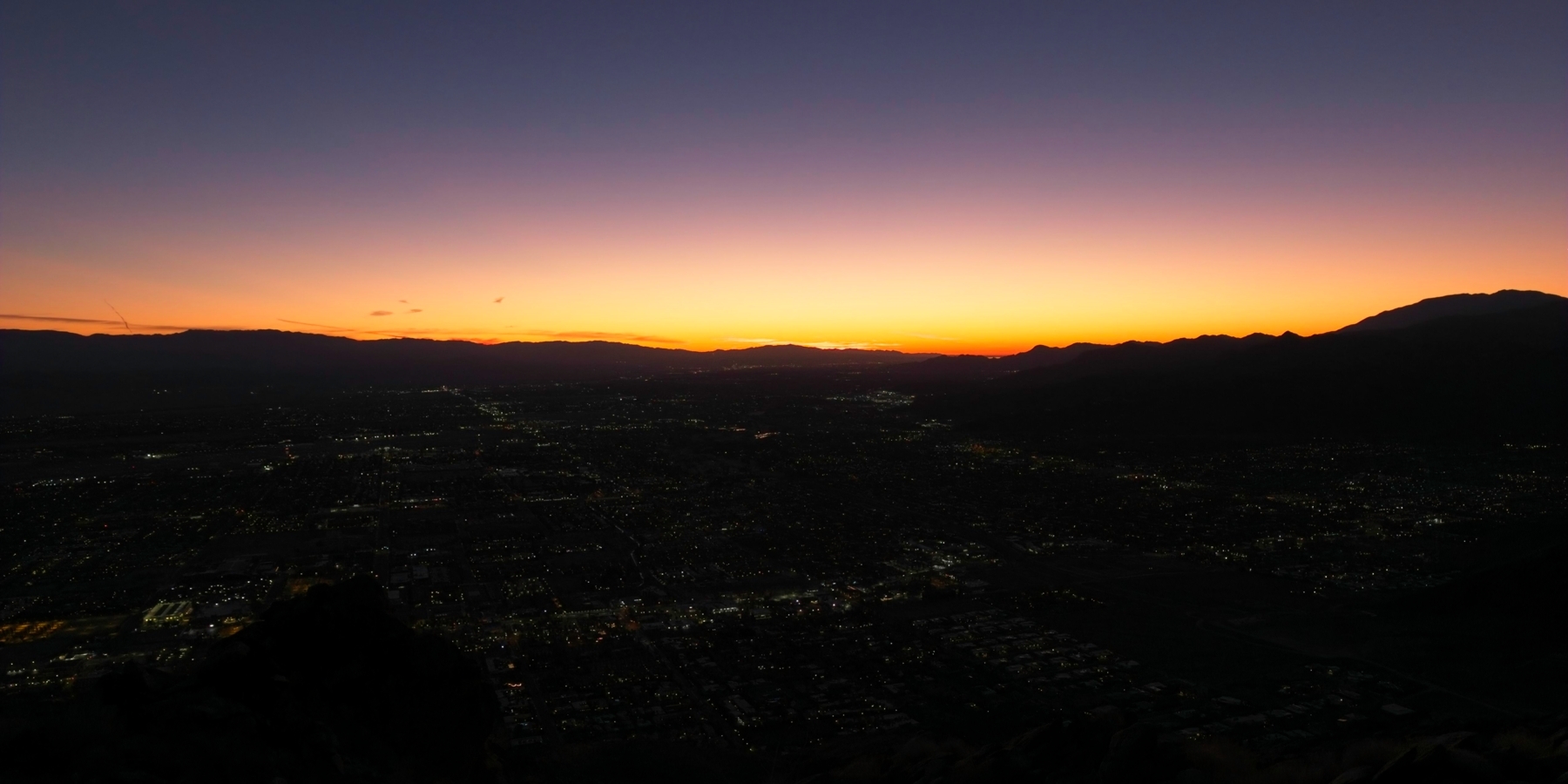
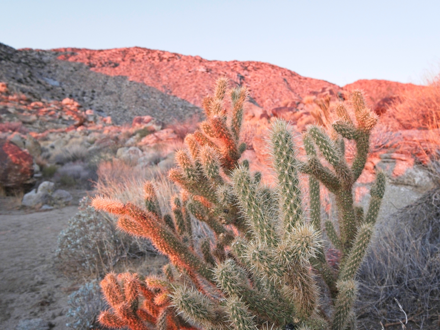
Palm Springs twinkles below as we climb higher and higher at a pace that we can maintain for a long time. An hour or two into the hike the sky begins to lighten and we’re treated to a spectacular sunrise full of blues, oranges, and purples. Once the sun has risen above the eastern mountains I take the opportunity to snap a photo of a cactus: one half of “Cactus to Clouds.”
Although the sun is up, the temperature doesn’t increase a whole lot; I’m still chilly in the shade, but it’s very comfortable in the sun. We continue upward – up, and up, and up – chatting and generally having a good time. Every hour or so we stop to rest, eat some snacks, and admire the improving view of the eastern San Jacinto ridge.


Further up the mountain (about 7000 feet above sea level) we cross a ridge onto a shaded, northern aspect and begin crunching through snow. Microspikes prove useful here, and I pull on some gloves when my hands become uncomfortably cold. The slope steepens enough that I stop every switchback or two to catch my breath. It’s a pretty section though, with the snow, ice, and slivers of light streaking through the trees.

 stone buttress beside the trail")
After a difficult, steep climb we reach Long Valley and find a sunny spot to rest and eat lunch. We’ve been hiking for about seven and a half hours and I think it shows because hikers from the nearby tram station just stare at us as they wander by. Once we’ve rested and eaten we head over toward the tram station ourselves and pick up a day-use permit from the ranger station. The ranger issuing the permit offers plenty of cautionary advice: Do we have at least 3 liters of water? What about microspikes? Headlamps? It’s a long, rugged hike! In reality, it’s only five miles with 2500 feet of gain (one way), a much easier walk than what we’ve accomplished already today, so I reassure him that we’re well-prepared.
We’re soon on our way again, now striding along the Round Valley Trail through the snow covered forest, following numerous signs toward the summit. We pass lots of hikers on their way back to the tram (including one woman in sandals! In the snow!), but see fewer and fewer of them as we put distance between ourselves and station. I love walking through the snowy scenery and the quiet that accompanies it. The path continues uphill, but at a much shallower grade than the climb this morning, thankfully. We’re all slowing down a bit at this point but we press on; this was never going to be an easy hike.


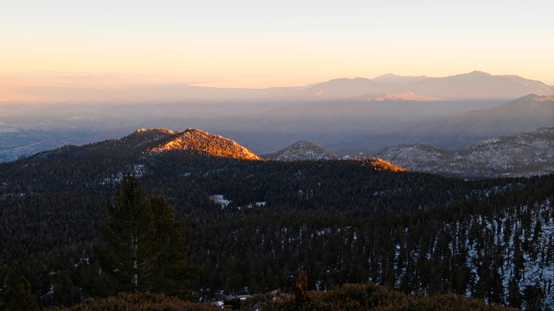
The wind picks up as we near the summit and the snow transitions to ice. I’m very happy to have microspikes now! The Salton Sea glimmers in the evening light far to the east while the forested slopes of San Jacinto lie in shadow. Palm Springs looks so far away now; it’s strange to see how far we’ve walked today.
Alex, Kim, and I reach the summit at 16:30, just as the sun is reaching the horizon. Long shafts of warm light stream between the trees, and the summit itself is bathed in red, pink, and orange hues. We stay for several minutes, snapping pictures and celebrating our 10,800-foot ascent. Besides the spectacular view of the San Bernardino Valley, I love seeing the shadow of the mountain – it stretches all the way to the horizon!


We can’t find a summit register and I can’t remember if there has ever been one, so we descend after a few minutes of admiring the view to the nearby cabin for a break out of the icy wind. Inside, I wolf down some salted nuts and peanut butter M&M’s and prepare for the descent back to the tram station. I’ve been pretty warm during the ascent, but the temperature is dropping quickly now and I know from experience that I’ll want more layers on the way down. I also pull out my headlamp since the light is fading.

Once everyone is ready for the final leg of the hike, we leave the sheltered cabin and begin descending. I’m once again thankful for the extra traction the microspikes provide. I’m sure we could do without them, but the confidence to put my feet down wherever I please makes things much easier. By the time we reach the Wellman Divide, the moon and stars have risen to light our way. Time blurs by as we crunch through the snow. I occupy myself looking at the various animal tracks in the powder beside the trail – mostly rabbit prints, but we pass a mountain lion track too!
My leg and knees ache by the time we reach the tram station at 19:20. I hadn’t realized how much pressure and torque the microspikes put on my feet until I take them off and walk around without them. Kim, Alex, and I buy one-way tram tickets and spend a few minutes stretching while we wait for the next gondola to arrive. It only takes ten minutes for the tram to lower us all the way back down to 2600 feet, saving us another eight hours of hiking, and a short Lyft ride completes the journey back to the car parked at the trailhead. Before leaving town, we stop at a pizza place. I don’t know how many calories we burned today, but I’m sure that it’s a very large number so I don’t feel even remotely guilty for finishing my entire pizza. The delicious, hot food is a wonderful way to celebrate completing this difficult hike; I’m certainly proud to have completed it!