I’ve been feeling cooped up: working at home all day, eating at home, entertaining myself… at home. So I decided to pick a trail, any trail, and go for a hike this weekend. I settled on the Stone Canyon Trail, which leads to the summit of Mount Lukens. While there are several fire roads that provide easy access to Mount Lukens, the Stone Canyon Trail offers solitude and a sense of remoteness that fire roads definitely lack. This approach from the north also provides shade (particularly in the winter) and a calf-burning workout.
Trip Planning
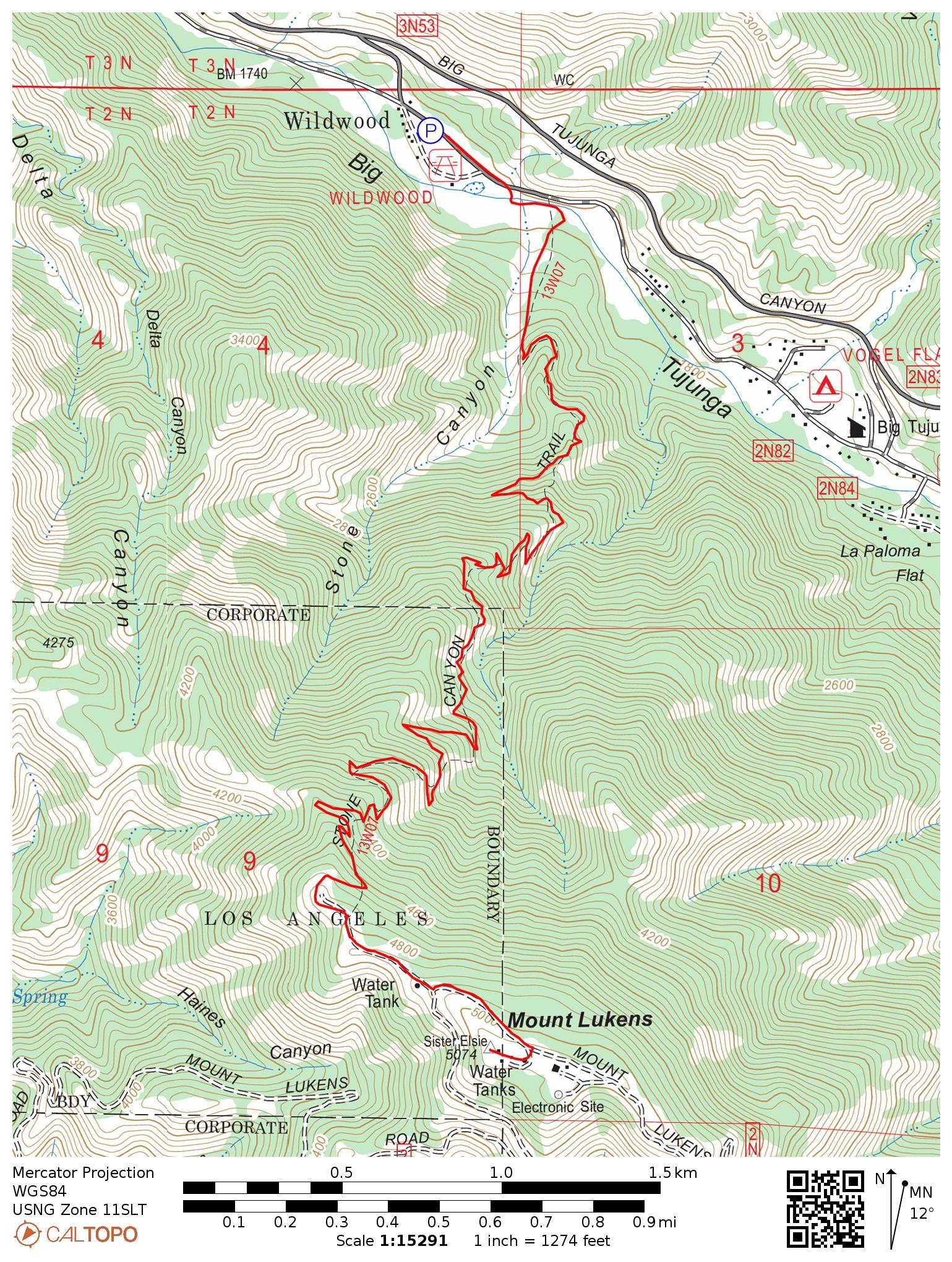
Specs: 8.5 mi | +/- 3300 ft
Difficulty: Class 1
Location: Angeles National Forest | Home of the Kizh, Tongva, and Fernandeño Tataviam peoples | View on Map
Route: Park at the Wildwood Picnic Site (or just off the main road if the gate to the picnic area is closed) and walk to the eastern end of the parking log. Follow the trail, keeping south (left) and cross the Big Tujunga Creek. The trail soon begins ascending directly toward the mountains to the south. Follow it to the summit.
Permits & Regulations: Parking at the Wildwood Picnic Site requires an adventure pass or interagency pass. No permit is required for hiking.
Resources: This is a short day hike with almost continuous views of roads, so just get out there! Bring plenty of water, snacks, and sunscreen if you do this hike in the summer. Check the Angeles National Forest website for up-to-date news and alerts, particularly during fire season.
A Never-Ending Climb
13 December 2020
I arrive at the road to the Wildwood Picnic Site only to find the way barred by a large metal gate. I’m not sure why the road is closed. The weather is fine, there are no nearby fires, and trails remain open despite other pandemic-related closures. Thankfully, there is plenty of room to park on the side of the road near the gate, so I pull over, grab my backpack, and stroll past the gate.
I reach the trailhead a few minutes later and spend a moment or two admiring the beautiful trees. I’m relatively new to the LA area, and I’ve been surprised to learn that “peak color” here is apparently in December.
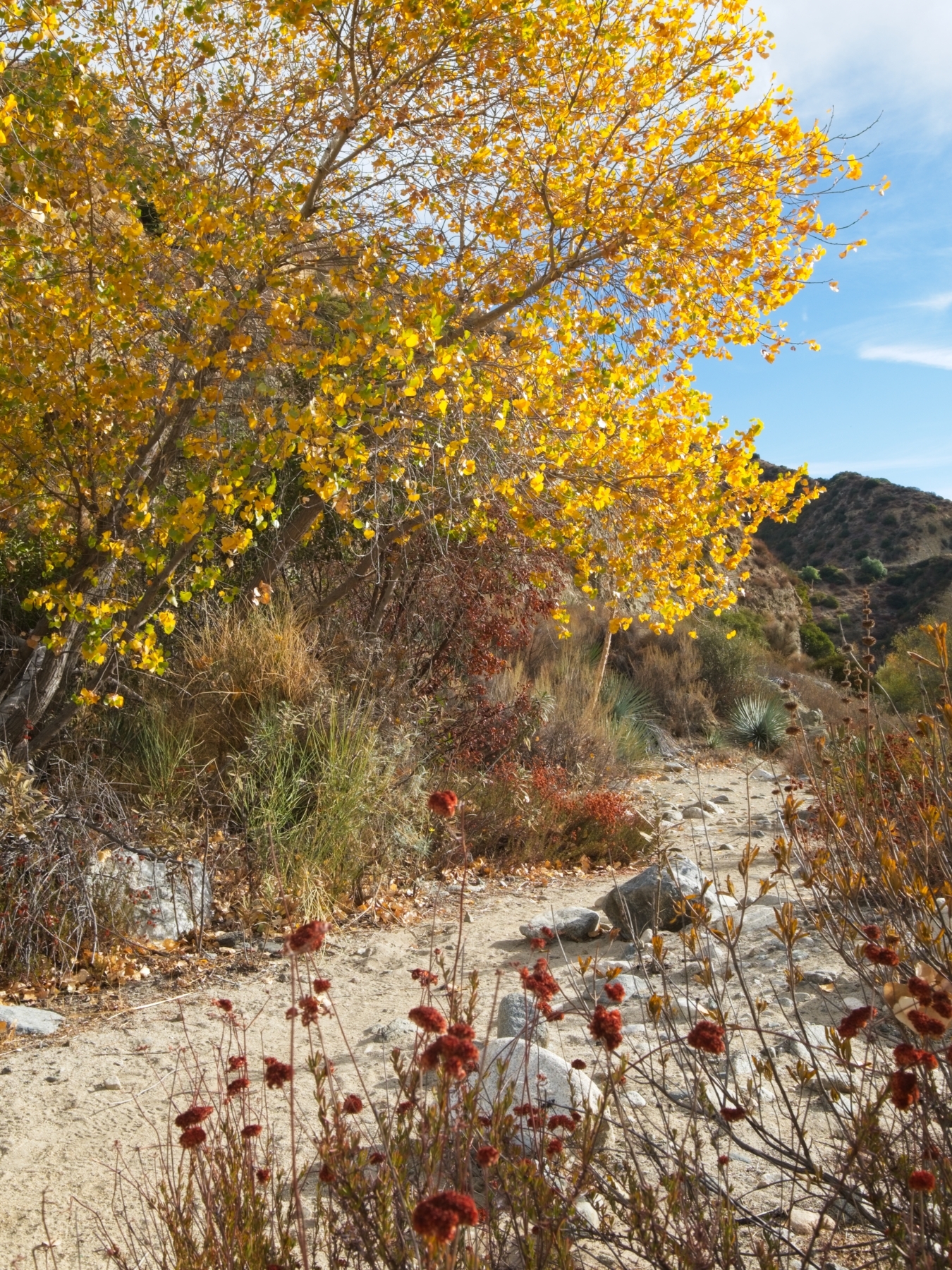
The trail winds through the sand, between smooth river rocks, to the banks of the Big Tujunga Creek. Trip reports from the spring report this creek as a raging torrent, but crossing it is as quick as a single hop today. I follow the sandy path for a few minutes, paralleling the creek, until the trail turns south and begins ascending toward the mountains. The steep grade proves to be quite the workout!

To say that this hike is entirely uphill is nearly 100% accurate. Thankfully, the sun stays low in the southern skies this time of year, so this path is shaded all day long. I settle into a steady rhythm and enjoy the peace and quiet. Well, relative quiet – I can’t escape the loud car noises from the highway below. I pass three or four hikers on the way to the summit, quite a low number for the mountains surrounding Los Angeles. This trail is probably remote enough (and steep enough) to dissuade most casual hikers from visiting.
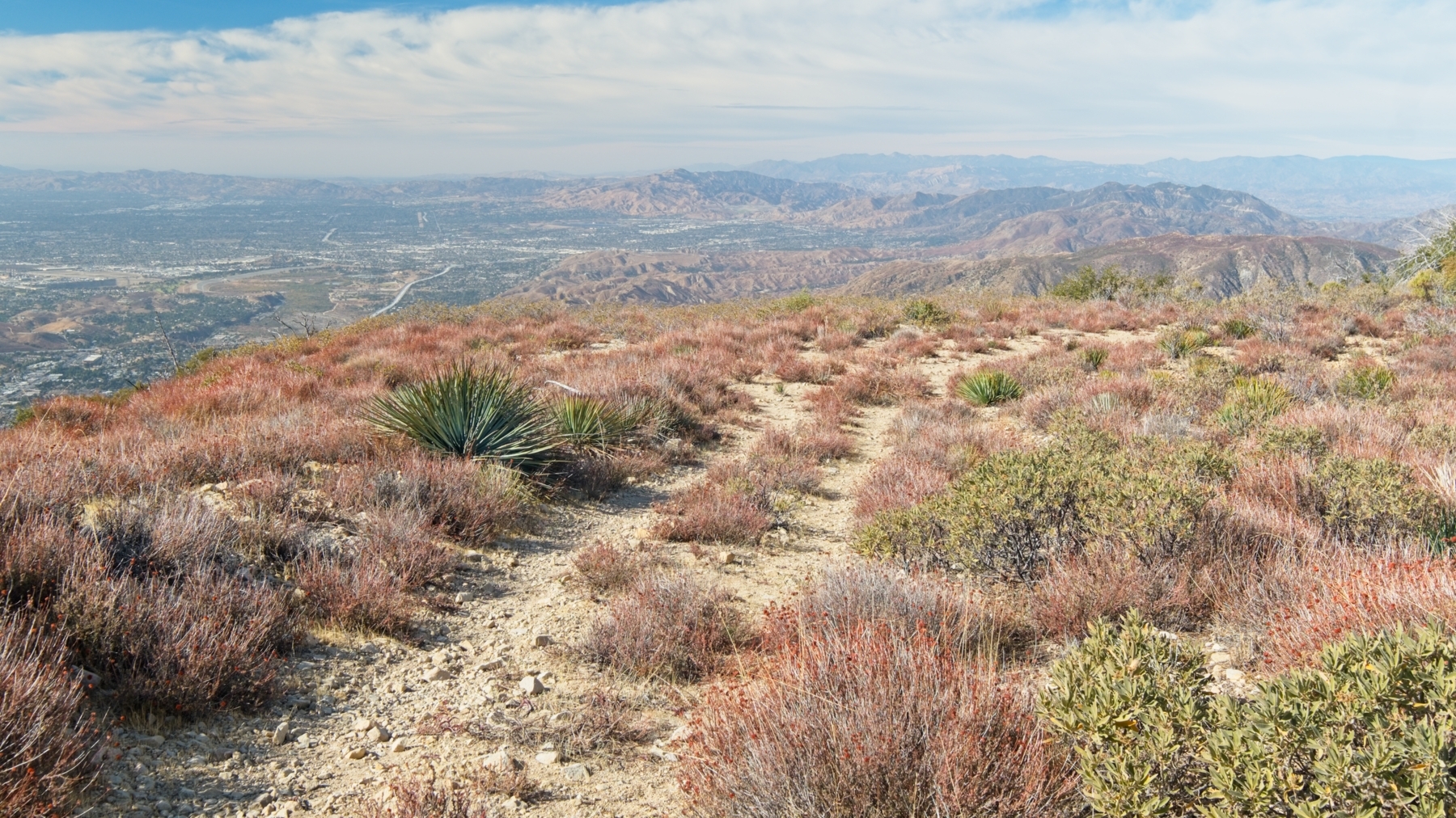
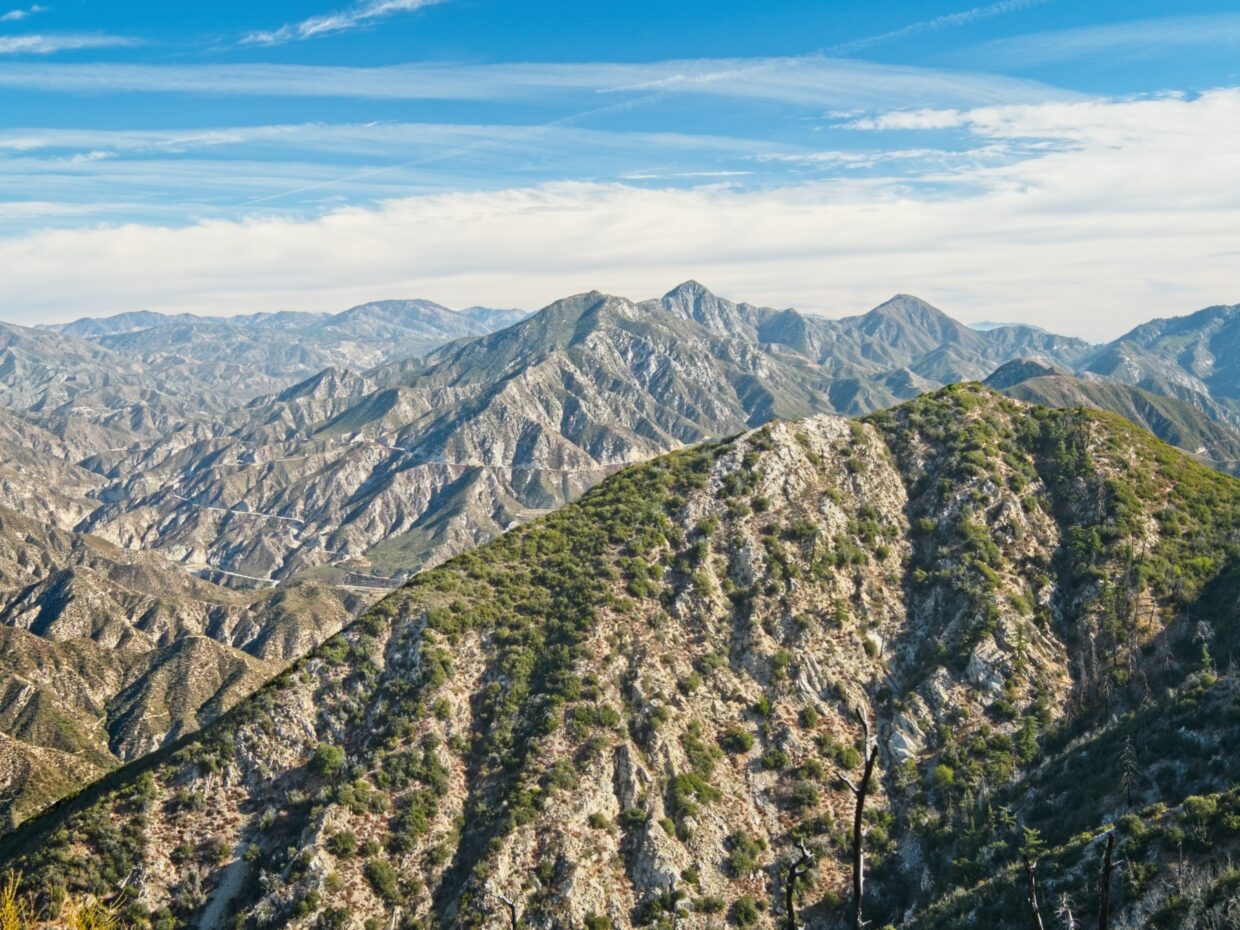
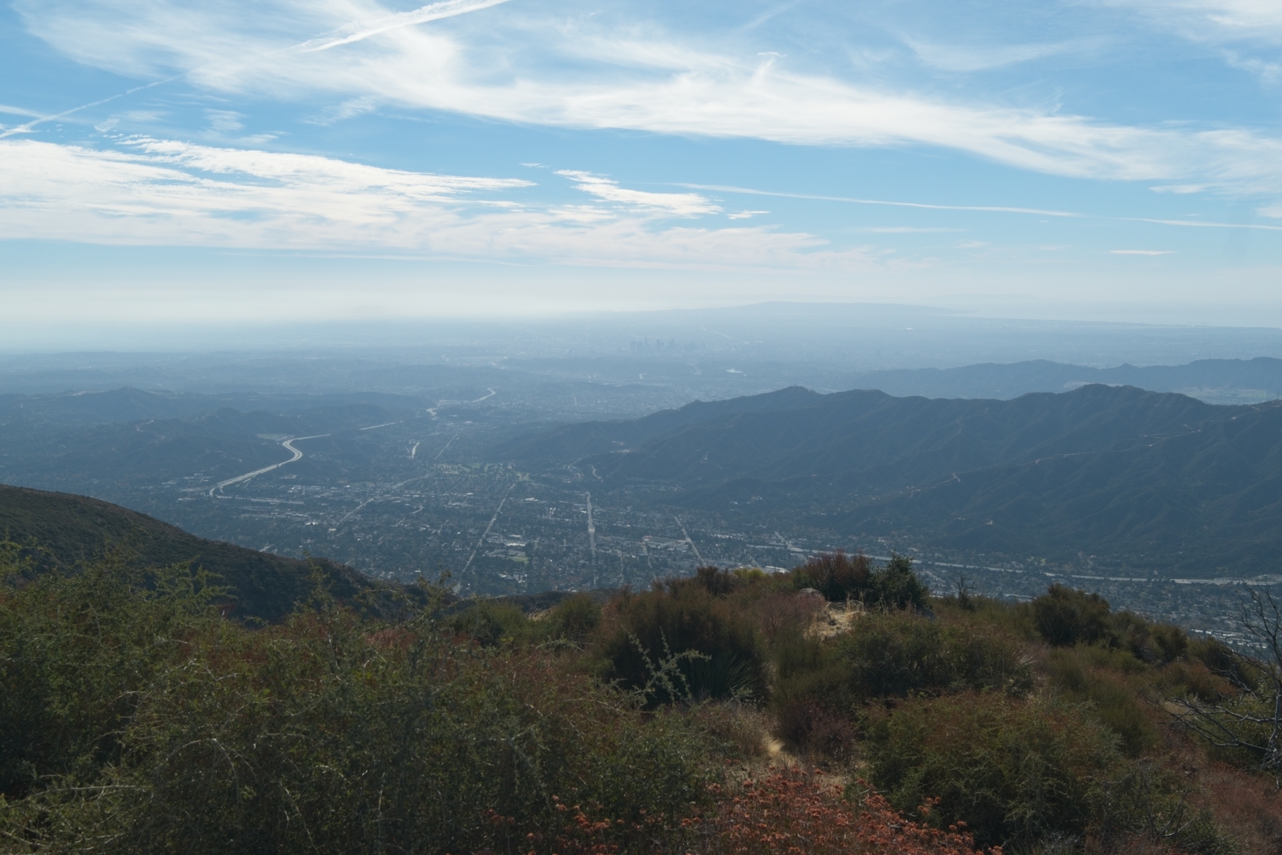
I struggle up a steep, loose section of the trail just below the Mount Lukens ridge. The USGS map shows the trail following an alternate route here, but I can’t locate that old path. The new trail appears to have circumvented a few of the old switchbacks and makes a beeline for the ridge above. Upon gaining the ridge, the path flattens out and I’m treated to sweeping views of the San Fernando Valley.
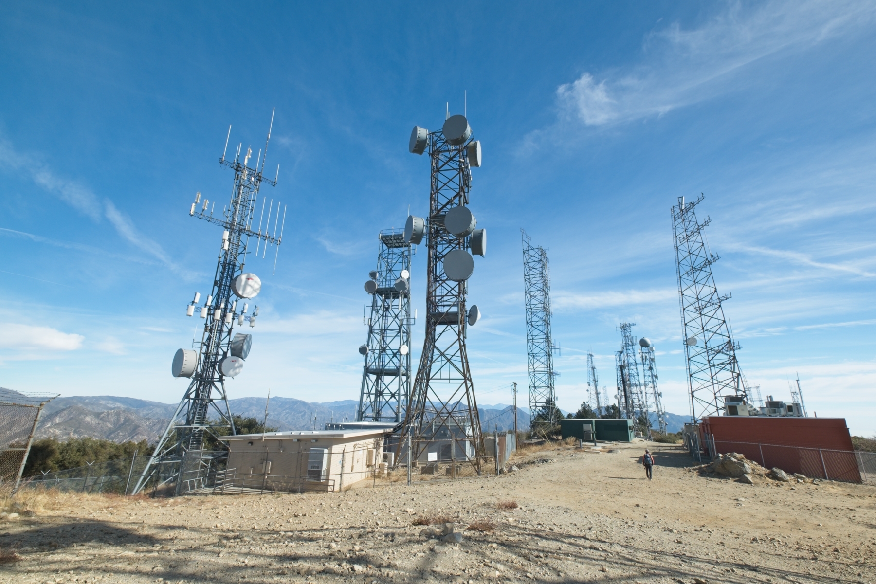
It’s only a short walk up to the summit, which is crowned in an assortment of radio towers. Signs posted on fences warn of harmful levels of radio radiation if you venture within their confines, so I don’t stay too long – just long enough to eat some lunch and admire the views. Haze obscures most of the Los Angeles skyline, but Santa Monica Bay is hard to miss; I often forget that the ocean is so close by!
The descent takes far less time than the ascent, and I pass a few more hikers on their way up the mountain. By the time I reach the locked gate and my dusty car I’m tired but content, ready to relax and pleased to have spent the day outside.
Carlos M. Bowman 31 January 2021
Thank you for sharing. I am glad that you can do all these things.