This holiday season has been incredibly dull – I didn’t travel this year, and after a few days’ holiday from work I felt restless. Luckily, despite the many, many COVID-related closures, the trails remain open! So I hopped in the car this morning and popped over to the Colby Canyon Trailhead for a quick stroll up to Josephine Peak. Despite the moderate length and elevation gain, you’ll have no trouble with this hike. You gain most of the elevation in the first few miles and then enjoy a lovely ridge walk and a gradual, spiraling ascent to Josephine Peak.
Trip Planning
Specs: 8.2 mi | +/- 2300 ft
Difficulty: Class 1
Location: Angeles National Forest | Home of the Kizh, Tongva, and Fernandeño Tataviam peoples | View on Map
Route: Begin at the Colby Canyon Trailhead just off of highway 2. There is parking for about 5-10 cars at the trailhead and it often fills up, so arrive early! Follow the Colby Canyon Trail to Josephine Saddle and then head west on the single track connector trail that contours across the north side of the ridge. You’ll soon reach a fire road; follow this wide, dirt path along the ridge and up to Josephine Peak.

Permits & Regulations: There are no permit requirements for parking or hiking here!
Resources: This is a short day hike with almost continuous views of roads, so just get out there! Bring plenty of water if you’re out during the summer. Check the Angeles National Forest website for up-to-date news and alerts, particularly during fire season.
A Holiday Stroll
27 Dec. 2020
I snag one of the last parking spaces at the trailhead, squeezing my little sedan between a truck and a rock wall. After grabbing my backpack and camera, I follow the trail into Colby Canyon, winding through deciduous trees. A small stream gurgles through the rocks and my feet crunch on fallen leaves; their autumn scent fills the air. It’s a decidedly beautiful walk!
I emerge from the shaded canyon after a little less than a mile and begin a steady, sunny climb to Josephine Saddle. This portion of the hike is by far the most difficult, but even so, it’s pretty manageable. Along the way I enjoy views of Strawberry Peak and try to avoid bumping into any of the needle-sharp yucca plants. By the time I reach the Josephine Saddle, I’ve already completed three quarters of the elevation gain.
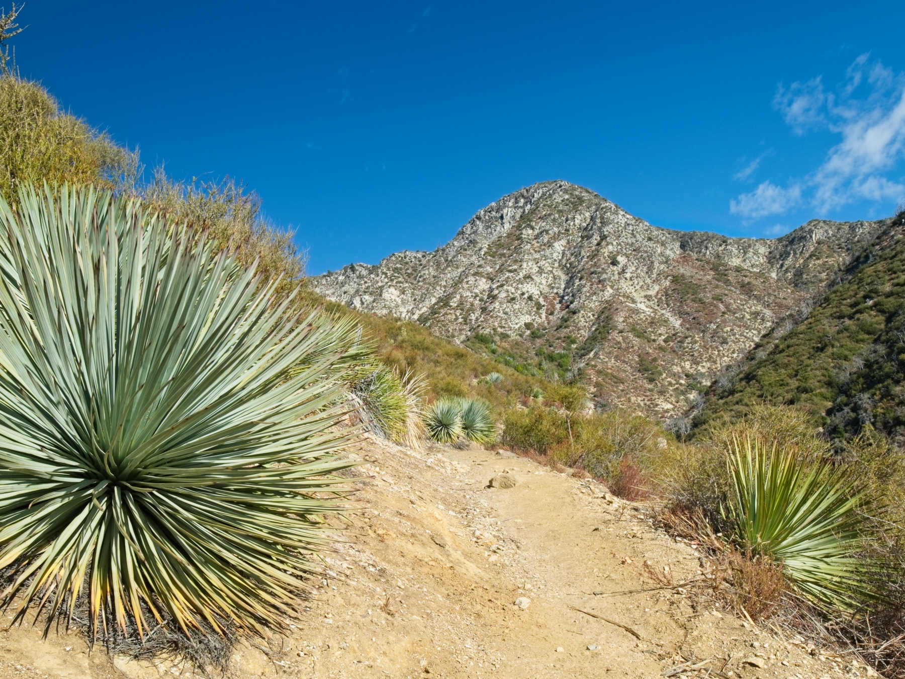
At the saddle, the trail forks: the western route leads to Josephine Peak and the northeastern route winds around Strawberry Peak. The “mountaineer’s route” to the Strawberry Peak summit also begins here, following a steep, loose gully. I take the western path and follow the meandering, single-track trail through a cool pine forest. The trail hugs the north-facing slope of the ridge and is in perpetual shade this time of year. The narrow path soon merges with a wide, dusty fire road that leads to the summit of Josephine Peak. Judging by the number of people I pass on the road (which descends all the way to Highway 2 at the Switzer Visitor Center), this seems like a popular route.
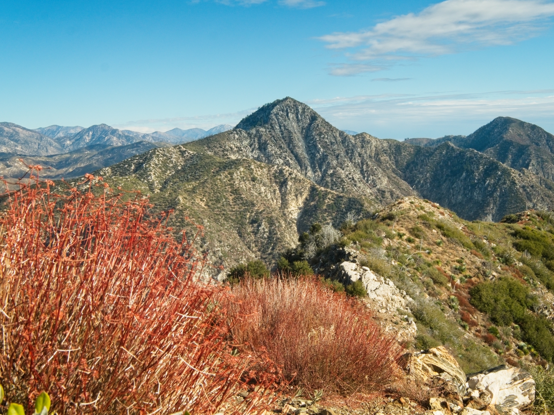
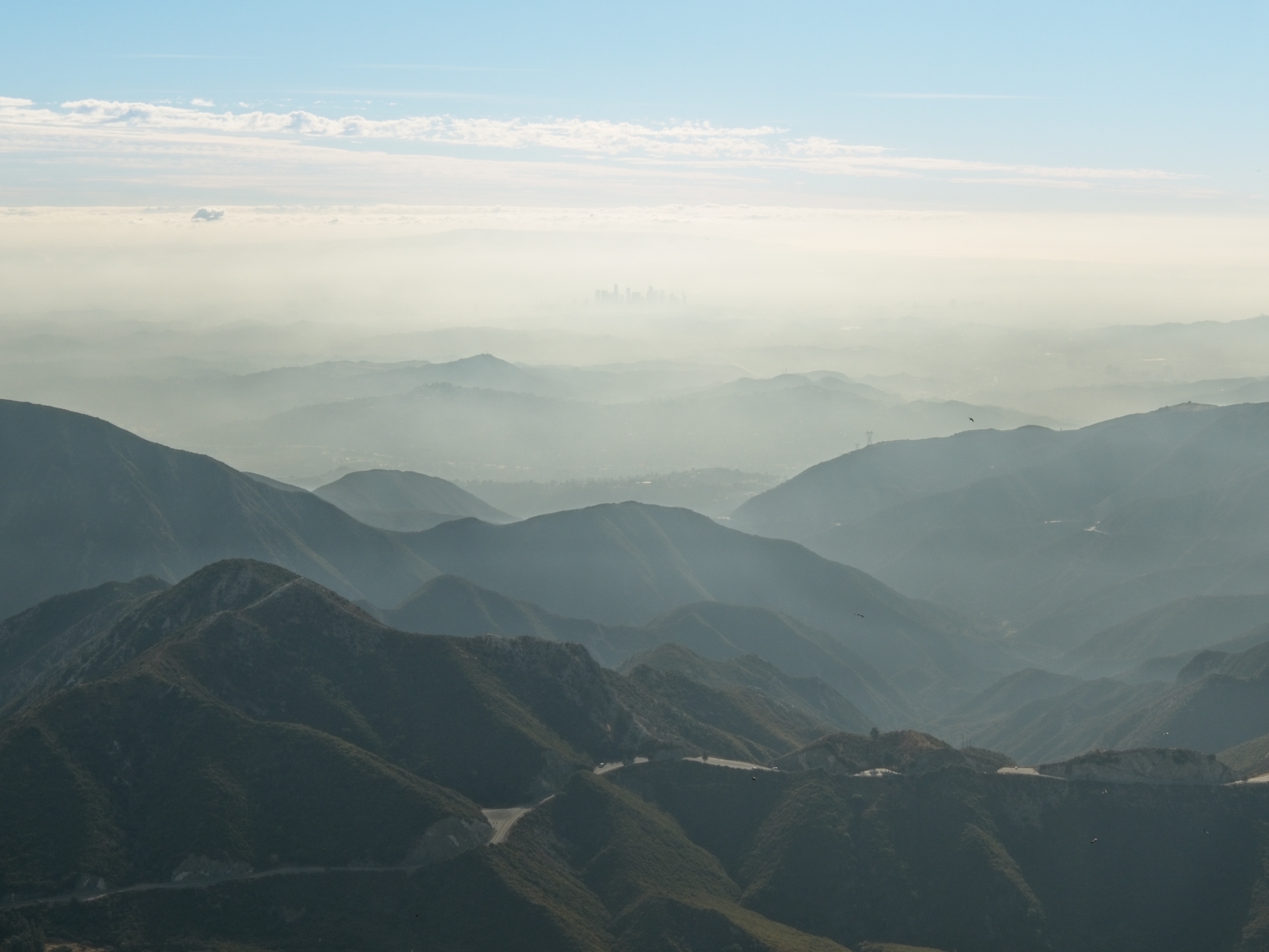
The fire road switches back a few times and then spirals up to the summit of Josephine Peak. I enjoy the views, particularly looking east toward Strawberry Peak; its western face is magnificent! The scene to the south is a typical LA sight: haze for miles with the city skyline barely visible in the distance. I relax for a while, munching on snacks, and then follow my footsteps back to the trailhead.