With summer quickly approaching, my friends and I planned a final ski tour in the eastern Sierra to follow a few days of rock climbing in Bishop. There were originally four of us, but Maddie and Collin decided not to ski in the end. Ironically, Maddie chose the tour – a short jaunt up the Robinson Lake drainage to the east face of University Peak. Andrew and I slept a few hours at the Onion Valley campground and got an early start.
Trip Planning
Specs: 6.0 mi | +/- 3800 ft
Difficulty: Class 2 [ratings]
Location: Inyo National Forest, California | Home of Eastern Mono/Monache and Western Shoshone peoples | View on Map
Route: Begin at the Robinson Lake Trail on the southeast side of the Onion Valley Campground and follow the trail up to Robinson Lake. From there, continue up the canyon to the large bowl south and east of University Peak. There are several large couloirs and faces that hold snow late into the season; we chose one that tops out northeast of University Peak. Descend via a similar line.

 and descent (green)")
Permits & Regulations: No permits are required for day hikes in this area, and parking is free. Wilderness regulations do apply and, as always, make sure you leave no trace!
Resources: The Kearsarge Pass Trail page is a great resource for trip planning; see also the Robinson Lake Trail page. We referenced Greenberg and Mingori’s Backcountry Skiing California’s Eastern Sierra for route guidance.
University Peak East Face
27 May 2024 | 6.0 mi | +/- 3800 ft | View on Map
My alarm jolts me awake at 3:15 AM. I groggily change into ski pants, pull on a few warm layers, and take down my tent. Andrew and I toss our gear into the back of the car and move it a few hundred feet down the hill from the campsite to the hiker parking lot. After a quick pit stop at the toilet, we trudge down the road to the Robinson Lake Trailhead (9,200 ft), starting our hike at 4:00.
The trail crosses Robinson Creek almost immediately; thankfully, a sturdy log bridge spans the noisy creek and we don’t have to get our feet wet. The trail then climbs steeply up the hill and we’re soon navigating between crunchy snow patches and spongy pine needles. We quickly lose the trail completely, but it’s not much of a hindrance in the open woods. Route finding does become a little more tedious further up the canyon when we reach a flatter area choked with willows. Andrew and I occasionally find traces of the summer trail, and there are some ski tracks in the snow, but we’re mostly just following the path of least resistance up the canyon.
We reach Robinson Lake (10,500 ft) at about 5:20. It’s half frozen, an island of ice surrounded by a thin band of open water. We don’t stop, instead continuing up the slope on rolling drifts of snow. After a little more walking we reach an area where the snow looks continuous – no more dry ground! We’re both tired of navigating the snow in hiking shoes with skis (and boots) on our backs, so we take the first opportunity to stop and transition to skis and skins.


The snow is still nice and crunchy, great conditions for skinning. Andrew and I have different approaches to the ascent; he makes a beeline for the top while I zigzag across the face. I struggle to edge across some of the steeper slopes (I think I need to trim my skins some more…) and pause to put crampons on my skis. After that only the altitude slows me down.
We reach the top of the steep slope (11,500 ft) at 6:30 AM, finally emerging into full sunlight. The Moon is close to the horizon and looks much larger than normal, which makes for some fun pictures. We discuss route options for a few minutes. The couloir we’re heading for is directly up the canyon with lots of talus and sandy soil between us. There’s also a thin ribbon of snow spanning the upper slopes of the canyon. It looks a bit steep, but hoofing it through the talus and sand in ski boots sounds less fun than a long snow traverse, so we make up our minds to continue skinning.


Skinning up the snow to the traverse is a steep and little tedious. I get some good kick-turn practice in though! Then comes the long traverse, which starts out relatively easily but becomes more difficult through a section of sun cups and small penitentes. Also, side bar: I don’t think I’ve seen penitentes before. What a cool snow feature!
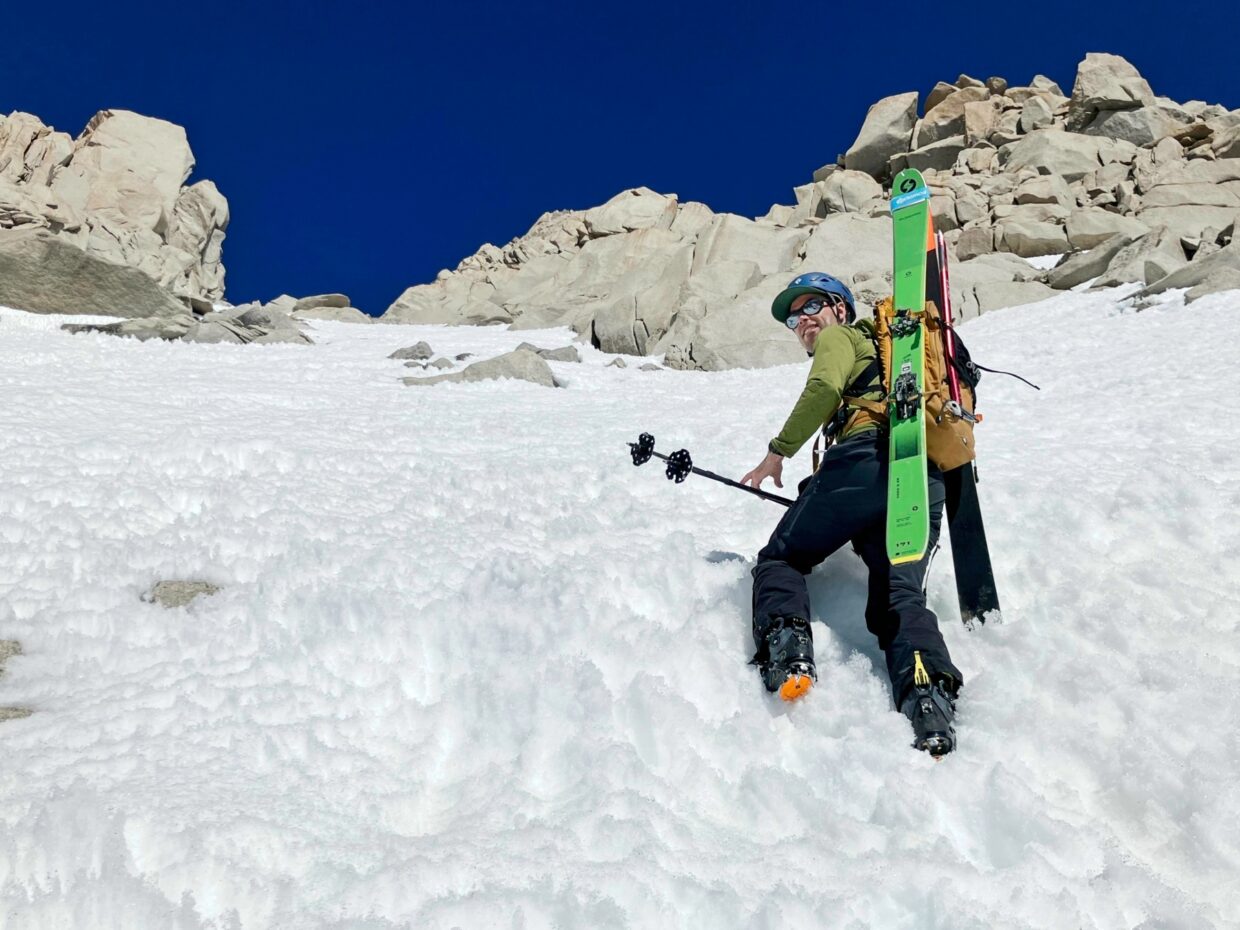
At about 8:20, Andrew and I reach the edge of our chosen couloir. We strap our skis back on our bags and begin booting up the slope, leaving some unneeded gear at the edge of the snow. It’s not too steep at first, but the angle increases to 35 – 40 degrees as we near the top. The snow is also softening up and I’m sinking in more and more, which only exacerbates the high altitude struggle.


By 9:30, we decide we’re high enough at 13,100 feet. The snow is a nice consistency for skiing and we won’t gain any particularly interesting skiing by continuing to struggle upwards. Also, I’ve already visited the University Peak summit and Andrew doesn’t care about summiting, so we might as well ski while the conditions are nice. We take a break for a few minutes, reapplying sunscreen, munching on snacks, and admiring the views. Mount Williamson stands out just to the south of us, and the Owens Valley looks awfully far away.
Once we’ve rested a bit, we ski down the couloir! Andrew leads the first pitch, cruising through the soft penitentes; they collapse instantly underfoot. I follow, much less graceful on the fast, slippery snow. I make it through the rocky top of the couloir and then enjoy more relaxed turns lower down. Avalanche debris makes things a bit bumpy in spots, but it’s still a lot of fun!


")

We pause on the way down to pick up our stashed gear and then ski to the very bottom of the snow field. There’s not a continuous line, so we pop out of the skis and hike to the next snowfield, skiing as much as we can. One final teetering scramble through talus brings us to a snowfield that descends all the way to Robinson Lake where ski within inches of the water.


Andrew is determined to ski as far as we possible can, so we continue on skis from the lake. At first, we follow the outlet creek, sliding over half-buried logs and weaving through the willows. We soon find less crowded terrain though and end up skiing all the way down to about 10,000 feet.
We take a long break at the edge of the snow. I’m tired, Andrew is tired… and hiking out is work. We eventually pack up and start hiking. It’s easier to find the trail in the light and we manage to follow it all the way back to the trailhead. We pass a few hikers along the way; they all look a bit surprised to see skis. In the parking lot we meet two climbers that have just returned from Charlotte Dome. They report very little snow on the trail – sounds like it’s almost backpacking season!