On days four and five of the Oregon peaks trip, Linda, Craig, and I climbed North Sister and Middle Sister. We all expected North Sister to be a fairly difficult peak, but it turned out to be surprisingly straightforward (although horribly loose). Middle Sister was even easier, a nice bonus peak for the trip.
Trip Planning
Specs: 17.6 mi | +/- 6600 ft | 2 days, 1 nights
Difficulty: Class 4 [learn more]
Location: Deschutes National Forest, Oregon | Home of the Molalla, Grand Ronde, and Siletz peoples | View on Map
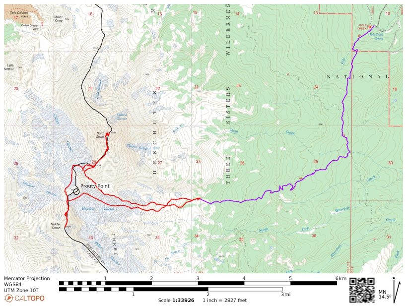
Route: Begin at the Pole Creek trailhead and follow signs for Chambers Lakes. Cross Soap Creek, but not the next major creek (not marked on the map). Instead, follow a well-traveled use trail up the slope beside this unmarked creek, aiming for Prouty Point. The climbers’ trail follows the top of a lateral moraine on the north side of the Hayden Glacier, eventually fading away. Continue uphill to the obvious saddle, then scramble northeast up the (horribly loose) slope to point 9185. Follow the ridge northeast and then north, following the use trail. Route finding is more difficult to describe than perform, so choose your favorite path. Traverse across the permanent snowfield and then scramble up a short ramp, making a sharp (nearly 180-dgree) right turn into the “bowling alley.” The headwall at the top of the ‘alley’ is easy class 4 – climb up and to the right until you reach easy class 2 terrain, then walk over to the summit block. The final bit of scrambling is easy class 3.
To reach Middle Sister, reverse the route back to the saddle between Prouty Point and North Sister. Walk along the top edge of the Collier Glacier, passing Prouty Point on the west, until you reach the north ridge of Middle Sister. Follow the climbers’ trail to the summit.
An alternate ascent/descent path follows the prominent ridge (a.k.a., hog’s back) on the Hayden Glacier. According to local climbers, this ridge is crevasse-free; we didn’t see any signs of crevasses on this part of the glacier.
Permits & Regulations: Permits are required for overnight trips between June 15 and October 15; day-use permits are free and self-issued at the trailhead. Parking at the trailhead also requires a day-use fee or a valid recreation pass. Wilderness regulations apply, and make sure to leave no trace!
Resources: Visit the Pole Creek Trailhead page for a full list of useful information.
A Scorching Approach
26 July 2022 | 4.8 mi | +1700 / -200 ft | View on Map
Today is another short day in terms of hiking distance, so I sleep in until 6:30 and then read in my tent for a while. After a delicious oatmeal breakfast, I drive into the town of Sisters to use the public showers. Although I know it won’t last, it feels wonderful to be clean. Craig, Linda, and I meet up at the Polecreek Trailhead at about 9:00 and spend an hour repacking our backpacks for the overnight trip. By the time we begin hiking it’s downright hot out! Much like the approach to Mount Washington, we’re walking through a burn scar (2012 Pole Creek fire) with practically no shade. Thankfully, a light breeze provides just enough cooling to make the hike bearable.


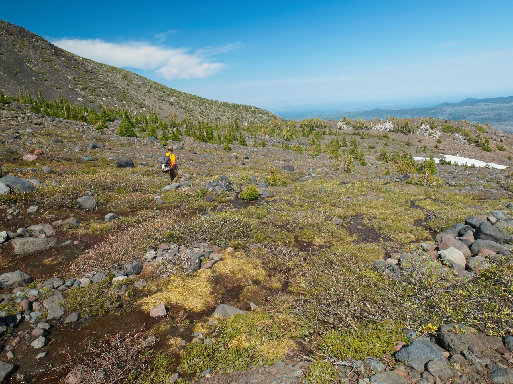
We take a long lunch break when we reach the shade of live trees and discuss our campsite plans. It would be nice to get as close to the mountains as possible so that our summit day shorter. But we also want to camp near a water source and find some shade so that we can relax this afternoon. A short distance down the trail from our lunch spot we find a very well-traveled trail that parallels a creek and climbs toward the mountains. Curiously, neither the trail nor the creek are marked on the USFS, USGS, or any other map we can find. Craig convinces Linda and I to give the path a shot, so we leave the main trail and begin heading uphill. There are a few steep sections, but it’s not too bad of a climb, even with our very heavy backpacks.
About two thirds of a mile up the climbers’ trail, near 7000 ft, the trees begin to thin out and the ground becomes increasingly rocky. At least a dozen small creeks (none of which are marked on the maps) run downhill from the glaciers, so there’s no shortage of water but shade is becoming rare. After some reconnaissance sans packs we locate a campsite with at least a little shade where we can relax during the hot afternoon hours.
We all spend the rest of the afternoon relaxing. Judging by the snoring coming from his tent, Craig falls asleep almost immediately. I listen to a few podcasts, do some reading, and also fall asleep for a little while. I wake up when the sun begins shining into the tent. Even with a mostly mesh exterior, it turns into a sauna under direct sun so I get up and move to a shadier spot.
In the evening, Linda, Craig, and I gather for dinner and a route-planning session. There are three main options for our ascent to North Sister’s south ridge tomorrow. We could follow Bob Burd’s route up the southeast ridge, we could climb up the Hayden Glacier and traverse behind Prouty Point, or we could split the difference and follow the north edge of the Hayden Glacier to the top of the Collier Glacier. Judging from the GPX tracks on PeakBagger, the third option seems to be the most popular so we decide to give it a shot. There’s safety in numbers, right?
As the sun sets behind the ridge, we all get ready for bed. We’ll be starting our hike before dawn so that we have plenty of time to climb North Sister. The route descriptions I’ve read make it sound difficult, complete with a snow/ice traverse and some loose rock climbing. If we have time, we’ll climb Middle Sister as well before hiking out.
One Day, Two Sisters
27 July, 2022 | 12.8 mi | +4900 / -6400 ft | View on Map
My alarm wakes me up at 4 AM, a time that is starting to feel normal. I enjoy a bowl of granola while I pack up all my mountaineering gear, including mountaineering boots, snow pickets, ice tools, and assorted rock climbing gear. Despite the early hour and relatively high elevation, it’s already comfortably warm so I leave most of my insulating layers in the tent.
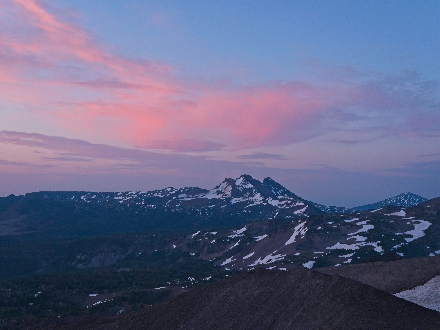
When we begin hiking at 5:00, the sky has lightened just enough to make headlamps unnecessary. We soon find the climbers’ trail and follow it up onto the top of a long, winding lateral moraine below the Hayden Glacier. Unlike the ridge walk up to Mount Jefferson, this hike is quite easy and very scenic! Sunrise fills the sky with color and I enjoy staring at the crevasses on the glacier.


Eventually the climbers’ trail fades away and we begin hiking across snow fields. They’re solid enough to avoid post-holing but soft and low-angle enough to walk across with trail runners. Much of the snow is also covered in a layer of colorful volcanic pebbles (which I decide to call “fruity pebbles”) that provide plenty of traction. Many of the rocks are pumice, porous stones that are much lighter than their size warrants.


Thanks to the gentle slopes and easy terrain, we reach the saddle between North Sister and Prouty Point at 6:30, just 90 minutes from camp. We take a short break to eat snacks and stare up at the next section of climbing. The slope up to the south ridge of North Sister looks like a very loose pile of volcanic rock, so we put on helmets before beginning up. “Loose” doesn’t even begin to do this slope justice. It’s horrible! Not only do the volcanic pebbles shift and slide beneath our feet, but the large rocks are also prone to sliding.


We put our heads down and focus on climbing, pointing out loose boulders to each other along the way. About 400 feet up the ridge (at point 9185) the slope eases up a little. It’s still horribly loose, but less tenuous. We hike around a few gendarmes and downclimb a short 5th class step and then follow a climbers’ trail upward through a pile of fruity pebbles.
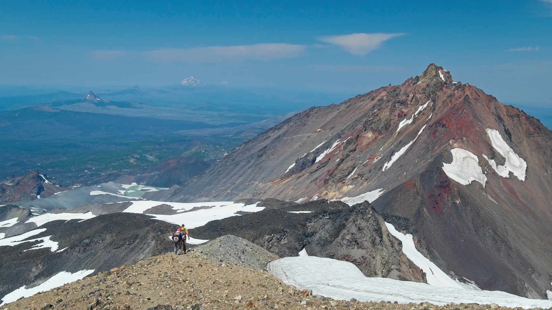
An hour and 1000-feet of gain after leaving the saddle, we reach the south ridge of North Sister. We’re mostly done with the uphill portion of the climb, but the routefinding gets a bit trickier here. We stay mostly on the west side of the ridge, crossing over to the east side only briefly. There are plenty of footprints to follow, so we just stick to the established paths.
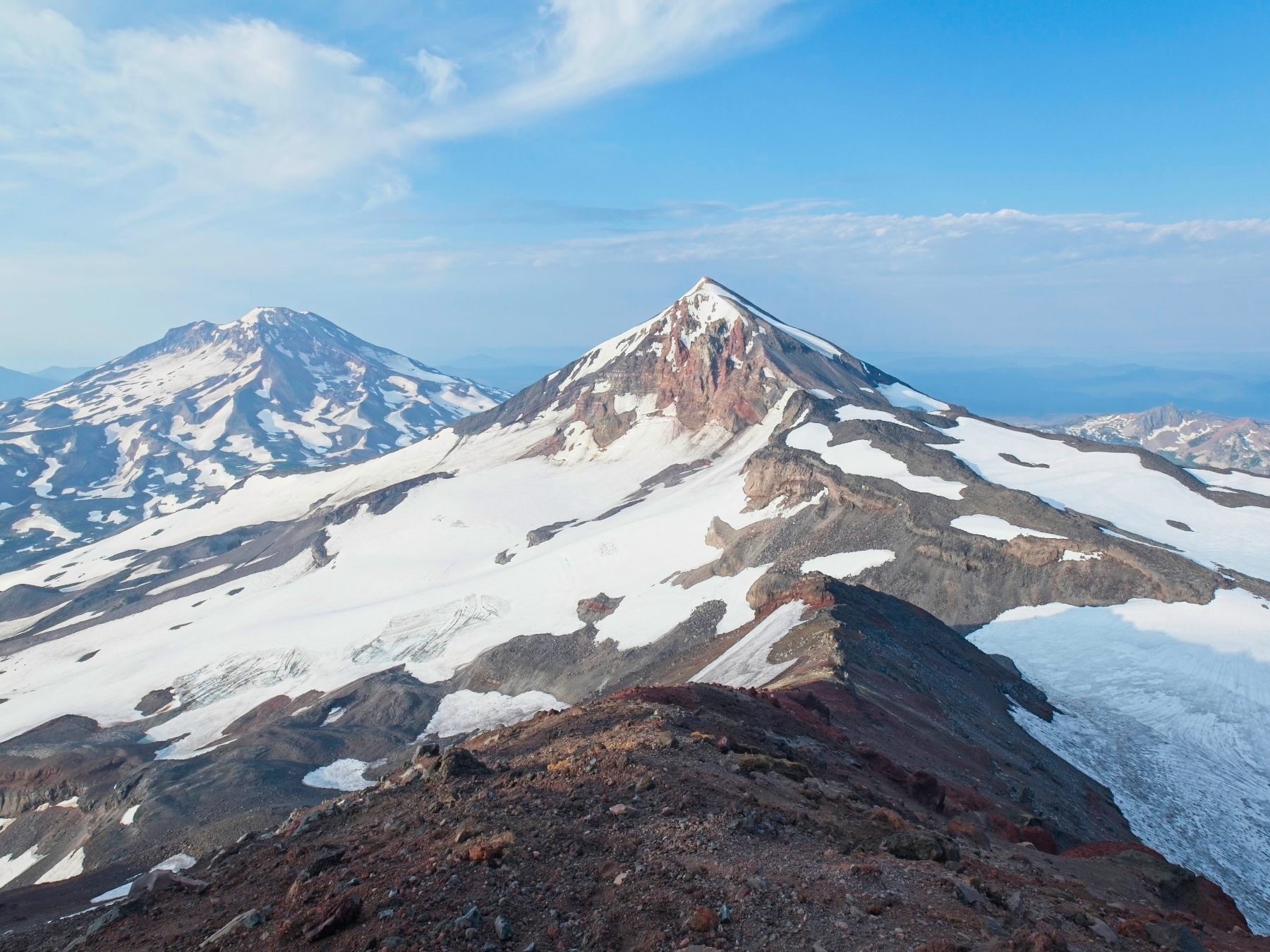
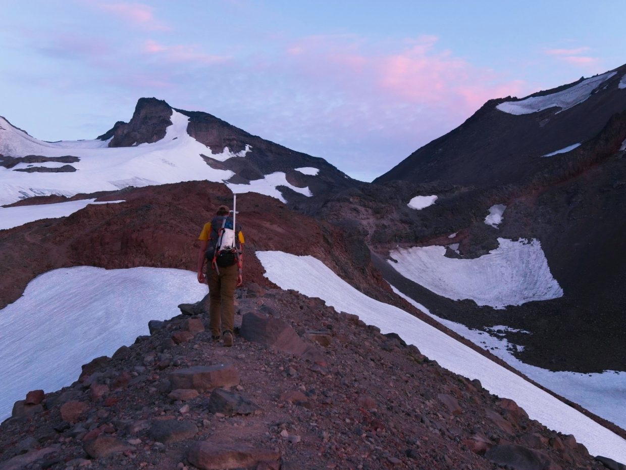
At about 8:30 we turn a corner around a gendarme and arrive at what others have named “the terrible traverse,” a moderate-angle snowfield. We all change into our mountaineering boots and rope-up for the traverse but leave our crampons stowed since the snow is soft enough to kick steps into. Linda builds an anchor in the rocks and then belays Craig as he heads out across the snow. The snow pickets clipped to his harness clang loudly, inspiring several cow-related jokes. I clip into the middle of the rope once Craig is far enough out and follow on a running belay, just like we did on Mount Jefferson two days ago. Craig soon reaches the end of the snow and continues across steep, loose scree to a cliff band where he can build a make-shift anchor.


Linda and I join Craig on the rocks (Linda pulls out the pickets and clangs along behind me) and we all change back into our hiking shoes. Compared to the ice climbing on Jefferson, we all agree that this was a piece of cake – certainly not “terrible!” Leaving the snow gear behind, we scramble up a short ramp and then turn right into the “bowling alley,” a chute full of loose rock. Once again, the reality of the terrain proves to be much milder than the name implies. Sure, there’s plenty of loose rock, but that’s par for the course in practically any chute. We stick to the uphill side, careful to avoid dislodging the rocks, and make it to a section of steeper climbing without any trouble whatsoever.


It’s not immediately clear which direction we should climb up the headwall. I begin the scramble from the left side of the chute and find that trending right provides the best holds and easiest climbing (no harder than class 4). Once I’m a little higher up I find a sling and rappel anchors, confirming that we’re at least following the same line as previous climbers. Linda and Craig scramble up behind me to a flat ridge and we walk together over to the summit block. From a distance, it looks steep and difficult but closer inspection reveals a series of class 3 ledges that make scrambling up a very straightforward affair.


We reach the summit at 9:40, a gloriously early summit time! A few hundred giant, flying ants have already claimed the summit as their own so we don’t stay for very long, just long enough to snap some pictures and scarf down a snack. We downclimb the class 3 rock to the short ridge and then carefully scramble down to the rappel station. Linda goes first, followed by Craig and then me. We coil up the rope, make our way back down the bowling alley, and return to our stashed gear. Reversing the traverse is easy enough – thankfully, the snow is still in the shade and hasn’t softened up yet.


Safely on the other side of the snow traverse, we all change out of our climbing gear and backtrack down the south ridge. When we reach the steep, loose slope that was so horrible to climb up this morning I suggest an alternate route that drops to the Collier Glacier. It’s an easy descent until we near the edge of the glacier and discover a precarious mix of ice and gravel. With a little help from our ice tools, we all make it down to shallower snow and then stroll over to a small pool where we eat lunch, refill water bottles, and relax for a few minutes. It’s about 12:30, so we have lots of time to climb up to Middle Sister!
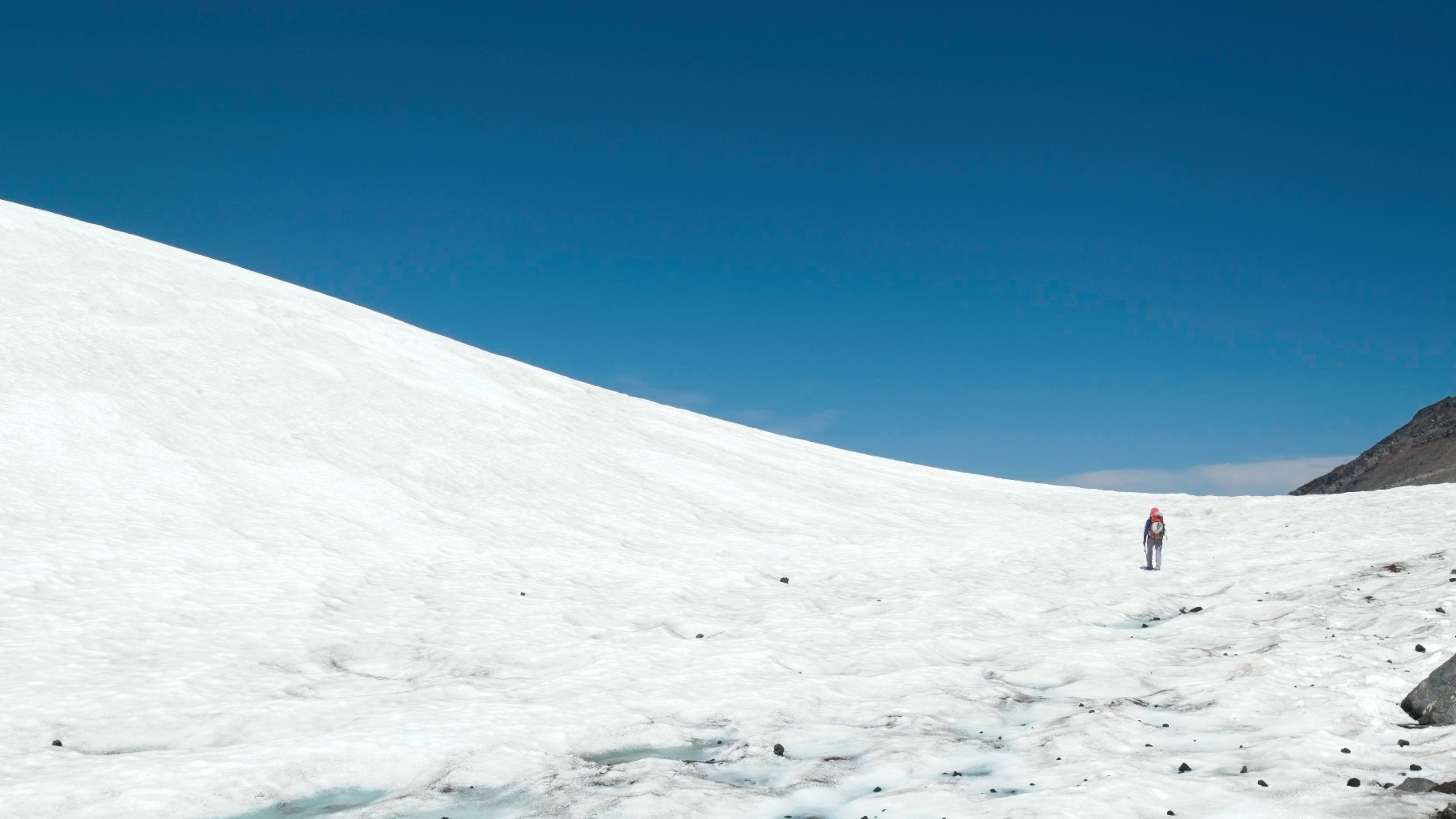
Once we’ve rested a bit, we strike out across the Collier Glacier. Mountaineering boots would be helpful but are hardly necessary; we do just fine in the soft snow with our hiking shoes. I’m soon sweating despite the easy walking as the midday sun reflects off the expansive glacier. Thankfully, we reach the far side of the glacier quickly enough and transition onto a moraine of sorts at the top of the Hayden Glacier.
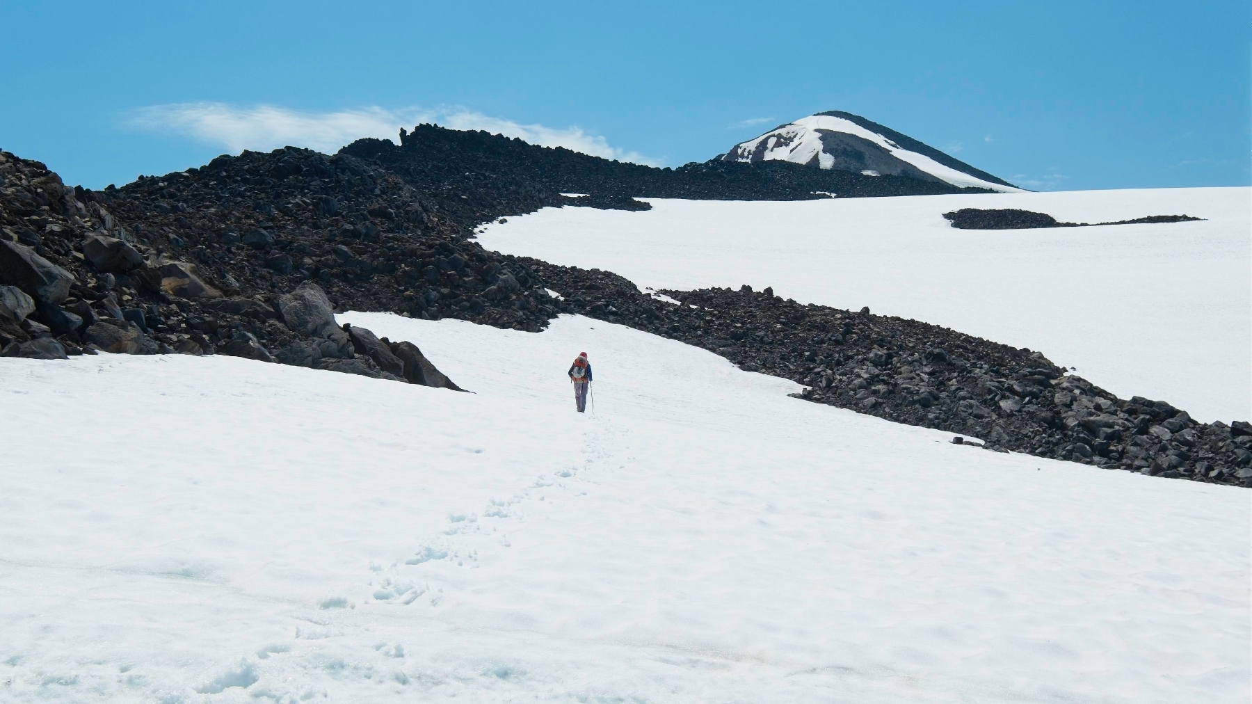
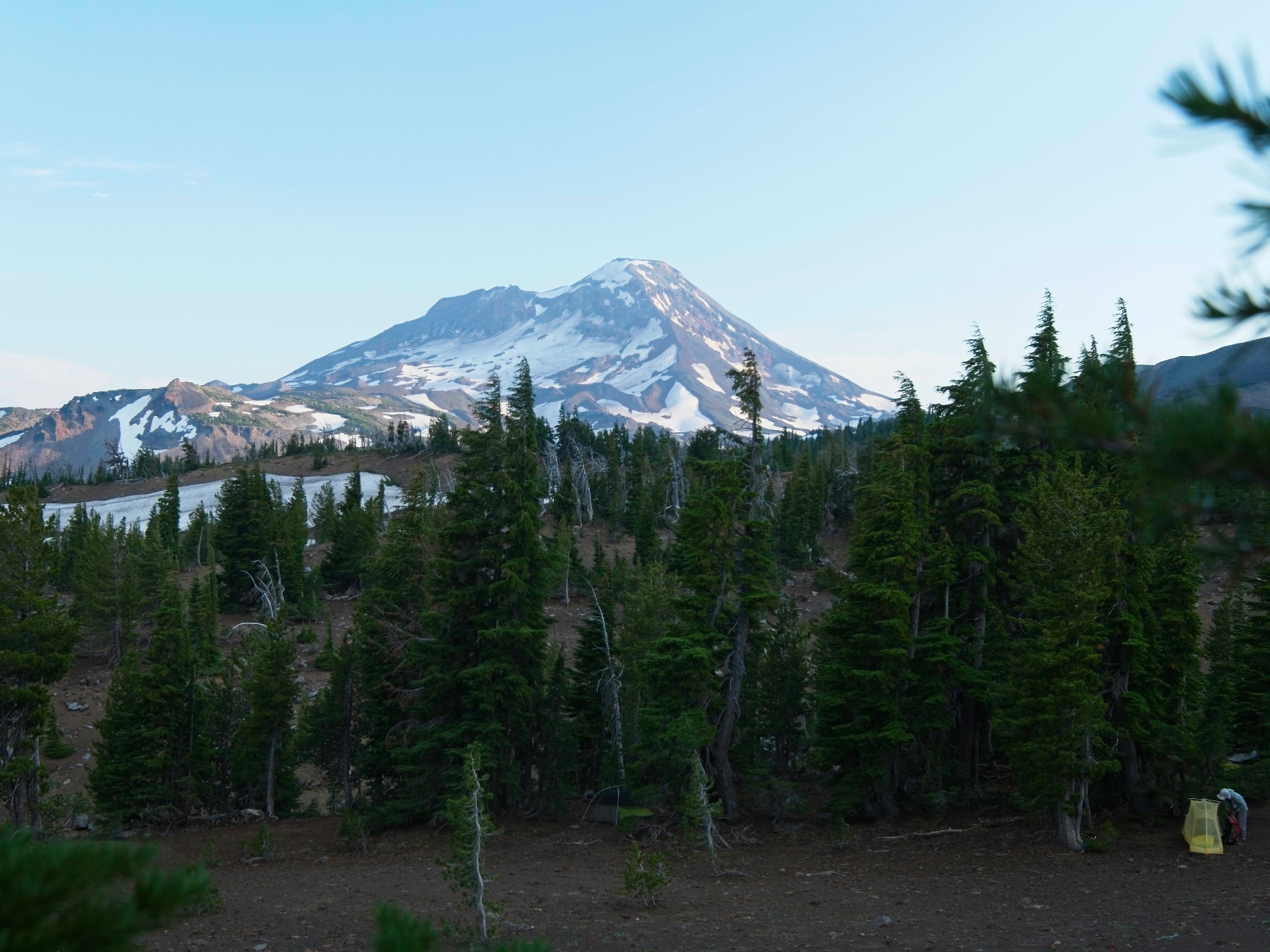
A climbers’ trail ascends the north ridge of Middle Sister, beginning at the saddle between Middle Sister and Prouty Point. Much like the south ridge of North Sister, the trail is loose and tedious but easy to follow. Several sections are just as horribly slippery as the worst sections of North Sister. Just below the summit we climb up a snowfield, following the boot tracks of previous climbers. We arrive at 13:40 and enjoy a long break on the spacious (and ant-free) summit. A massive thunderhead towers over Broken Top and Mount Bachelor to the south, but there aren’t any clouds threatening our position.


After a nice, long break, we head down the mountain. It’s an easy descent except for one section where a large ice patch blocks the climbers’ trail. On the way up we scrambled up and around, but we decide to traverse below it this time. It’s an incredibly unpleasant scramble; the ground is so unstable that I’m afraid I’ll slip and slide halfway down the mountain in a waterfall of dirt and gravel. But we make it across the traverse without any long slides and return to the established trail.
Rather than hike back down the Collier Glacier to the saddle between Prouty Point and North Sister, we hike directly down the Hayden Glacier. I did some research before the trip and this glacier is reported to be mostly crevasse-free, at least on the “hogs back” ridge that descends from Prouty Point. So we don’t bother to rope up and just walk down the shallow slope with ice axes in hand. Along the way we pass a bunch of large insects sitting out on the snow. I wonder what they eat out here?


We follow the snow as far as is practical and then scramble over to a use trail on a nearby lateral moraine. Craig leads the way through the maze of creeks, gullies, and trees to our campsite (which we’ve all marked on our GPS applications), arriving at 15:45. We quickly pack up and then follow the climbers’ trail back down to the main trail. We’re soon out of the shaded woods and back into the sun-soaked burn scar; it’s hot, but at least we’re walking downhill! Like many of our hikes out this trip, we each settle into our own pace and churn out the miles, arriving at the trailhead at about 18:00. I happily drink an entire liter of Gatorade and change into cleaner clothes before driving off to our campsite for the night.