Several months ago Craig invited me to join him and several others to climb a bunch of the volcanoes in the Oregon Cascades. As soon as I was confident I could take off from work, I excitedly accepted his invitation. Most of the peaks involve some technical travel, either class 5 rock climbing or steep snow/ice travel that requires crampons, snow pickets, and/or ice screws. To be honest, I was pretty nervous about a few of the peaks but I trust Craig and his choice in climbing partners. Besides, I’m not about to miss a week of epic, technical peaks in the Cascades!
I flew into Portland and drove down to join Craig and Linda last night (Fri, 22 July). It’s a gorgeous drive, particularly the section on highway 22 through the mountains, and only took me about 2.5 hours. The first two peaks of the week for me are Mount Washington (class 5) and Black Butte (class 1).
Mount Washington
Saturday, 23 July 2022 | 10.2 mi | +/- 3000 ft
Difficulty: Class 5 [learn more]
Location: Willamette National Forest, Oregon | Home of the Molalla, Tenino, and Siletz peoples | View on Map
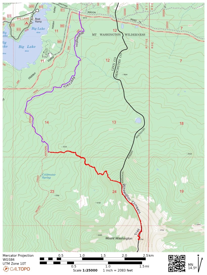
Route: Begin at the PCT junction with the Santiam Wagon Road near Big Lake. Follow the PCT south about 2.7 miles to the climbers’ trail. This well-worn path climbs up to the north ridge of Mount Washington. Pass the gendarmes just below the summit block on the west side and scramble up a loose gully to a notch. Two ramps lead up and to the left on climbers’ right; scramble up the second, higher ramp (class 3) and climb a 10 – 15 foot wall to a set of slings. From here, choose your own class 3 – 4 adventure to the summit, taking note of the many rappel stations you can use on the way down.
Permits & Regulations: Permits are self-issued at the trailhead. Wilderness regulations apply, and make sure to leave no trace!
I wake up to my alarm at 4:30 and groggily sit up in the tent. Since I got in last night around 10, I haven’t slept nearly enough. Dawn is still an hour away and the sky is full of stars. We’ve agreed to a 5:30 start time, so I start packing up my camping gear, tossing most of it unceremoniously into the back of the rental car. I boil some water and then munch on oatmeal with strawberries while I pack for the day. Craig and Linda are both up as well, eating breakfast and packing their own gear.
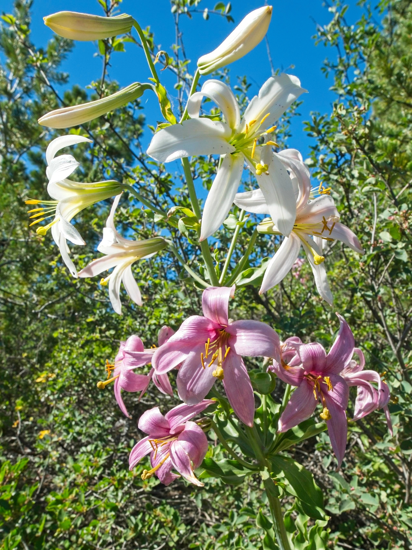
At about 5:40 we drive over to the Pacific Crest Trail (PCT) junction with the Santiam Wagon Road just east of Big Lake. Craig leads the way southbound on the PCT through 2011 Shadow Lake fire scar. This is my first time meeting Linda, so we chat and get to know each other a little bit on the approach hike. It’s a beautiful walk too, with young pine trees flourishing everywhere and sprigs of lupine and bear grass around every bend in the trail.


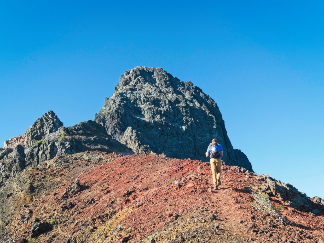
About 2.7 miles down the PCT we reach the climbers’ trail, a well-marked path that leads east toward the North Ridge of Mount Washington. It’s a pretty typical climbers’ trail, winding steeply and unpredictably through the woods toward higher ground. We’re able to follow the track pretty easily, although we do miss a few turns. Once we reach the ridge the trail becomes less important – all we have to do is hike uphill. I enjoy the views, particularly to the north where Hayrick Butte, Three Fingered Jack, and Mount Jefferson tower above the landscape. We pass two young climbers on the way up but don’t see any other parties on the mountain ahead, which is good news for us. The rock on these peaks is infamously loose and we’d all prefer to not be below other climbers.


Craig, Linda, and I reach the end of the easy walking just before 9 AM at the top of a loose, gravel-filled gully. Figuring out where to go next proves a little difficult; the route instructions from SummitPost describes a “fractured ramp” that leads to a “rotten chimney.” We explore a ramp that leads up and to the left, but doesn’t seem to connect to a chimney and has quite a bit of exposure. Slightly higher up the ridge, another left-trending ramp appears to provide an easier route. Anticipating class 5 climbing, we pull on climbing harnesses, put on rock shoes, and flake out the rope.
As the most experienced rock climber in the group, Linda takes the lead with a rack of nuts and cams while I belay from a makeshift anchor at the bottom of the ramp. The ramp itself is easy class 3 terrain, albeit a bit loose, and Linda is at the “chimney” in no time. She places a few pieces of gear on her climb up the vertical rock and ties into some slings that previous climbers have left behind. Craig ties into the middle of the rope and climbs up to join Linda while she belays him from above. Finally, I clean the anchor, tie into the end of the rope, and scramble up the ramp. The crux of this pitch of climbing is a 10-foot, slightly over-hung headwall composed of crumbly volcanic rock. I certainly wouldn’t call the feature a chimney, although I do rely on stemming moves to climb it as I would for a chimney. The climbing itself isn’t too difficult but I barely trust the rock… it feels like it will break away at any moment.
Once I reach Linda and Craig, we pack up the rope and continue scrambling up toward the peak. We largely ignore the route beta from SummitPost and scout out our own way. A 20-30 foot pitch of exposed class 4 is the most difficult section, but with rock shoes and relatively light climbing packs, we make quick work of it.


By 10:30, we’re standing atop Mount Washington! There’s plenty of room to lounge, so we take a long break and admire the panoramic views of the many snow-covered volcanoes. Two of the Three Sisters (North and Middle) dominate the southern skyline with Broken Top on their left. An enormous lava field spans most of the space between us and the Three Sisters.


After eating some snacks and relaxing, we scramble down the mountain about a hundred feet to some slings and rappel down the exposed class 4 rock to easier terrain. We rappel two more times to reach the top of the gravel-filled gully where we began the climb this morning. Then we follow the climbers trail back down the north ridge, through the forest to the PCT. With the sun high in the sky, it’s a much hotter walk than it was earlier. Craig and Linda settle into faster paces than I’m willing to maintain, but we’re never more than a few minutes apart. The hike seems to drag on forever to me, but I reach the cars by 14:10, just one hour after departing the climbers’ trail.


 poses on the climbers' trail")

Black Butte
23 July 2022 | 4.1 mi | +/- 1500 ft
Difficulty: Class 1 [learn more]
Location: Deschutes National Forest, Oregon | Home of the Grand Ronde, Tenino, Warm Springs, and Siletz peoples | View on Map
Route: This is a simple walk up from the trailhead to the summit.
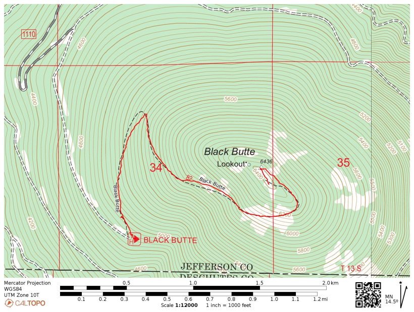
Permits & Regulations: No permits are required at this trailhead, but you do need a recreation pass to park! As always, make sure to leave no trace.
Linda heads into town for a shower and relaxation while Craig and I drive over to Black Butte, a prominent peak near Sisters, Oregon with a trail all the way to the top. We arrive at the upper trailhead a little after 15:00 and Craig introduces me to Andrew R. and Dagmar. They’re ready to hike, so they head up the trail while Craig and I shuffle some gear around. Dagmar assures us we’ll catch up soon because they’ll be walking slowly, but we don’t catch up with them until we reach the summit at 16:10. The hike is gorgeous, although I’m too hot and tired to appreciate it fully. I do enjoy sitting on a bench at the top and admiring the phenomenal outlook.
After a rest and drinking a full liter of water, I head back down the mountain with Craig. He, Andrew, and Dagmar head into town for dinner. In the meantime, I stop at the grocery store to pick up a few things including a half dozen bottles of Gatorade; there’s nothing better than guzzling down a liter of the stuff after sweating all day! We all meet up at Santiam Pass in the evening to go over our plans to climb Mount Jefferson tomorrow and Monday. My lack of sleep last night is catching up with me, so I head to bed as soon as darkness falls.
Craig Barlow 12 August 2022
This was a fun peak. Looking forward to reading your trip reports for the rest too!
Andrew 12 August 2022 — Post Author
It was! Jefferson is up now… working on the rest 🙂