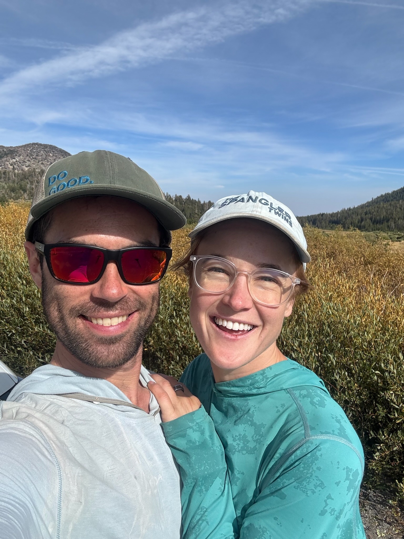
The Tahoe Rim Trail, or “TRT” for short, has been on Shannon’s to-do list for a few years. I’d never heard of it until she invited me to hike it with her this summer. Shannon did practically all of the planning, which I’m very grateful for! Her original plan had us completing the trail in fewer days, but I hike slightly slower than she does so we extended it a little. However, I wanted to hike up a few of the peaks along the way so then the route got longer again… In the end, it was a really nice hike albeit very tiring.
Trip Planning
Specs: 195.3 miles | +/- 33,400 ft | 10 days, 9 nights
Note: These specs include several spurs to summit peaks near the trail.
| Day | Miles | Gain (ft) | Loss (ft) |
|---|---|---|---|
| 1: Tahoe Meadows & Marlette Lake | 19.4 | 2600 | 2800 |
| 2: Spooner Lake & Kingsbury | 22.3 | 3000 | 4200 |
| 3: Heavenly & Freel Peak | 20.9 | 5200 | 3000 |
| 4: The Southern Loop | 24.5 | 3300 | 5300 |
| 5: Desolation Thunder Storms | 7.4 | 1300 | 600 |
| 6: Dicks Peak & Mount Tallac | 18.3 | 4300 | 4500 |
| 7: The Harvest Section | 23.4 | 3200 | 3700 |
| 8: To Tahoe City & Watson Creek | 23.4 | 3300 | 3100 |
| 9: Watson Creek to Gray Lake | 17.6 | 3500 | 2000 |
| 10: Mount Rose | 18.1 | 3600 | 4200 |
Difficulty: Almost entirely class 1 [ratings]; the scramble up to Dicks Peak includes some class 2/3 terrain
Location: Lake Tahoe, Nevada & California | Home of Washoe, Cayuse, Umatilla, and Walla Walla peoples | View on Map
Route: We began and ended our trip at Tahoe Meadows, an area just off highway 431 north of Incline Village. Following the Tahoe Rim Trail is not hard, it is incredibly well-marked!
Permits and Regulations: Permits for the TRT are non-quota and issued via the forest supervisor’s office. Part of this permitting process includes a TRT thru-hiking permit for Desolation Wilderness. You’ll also need a California Campfire Permit if you plan to use a stove during your hike. Visit the Tahoe Rim Trail Association’s page on permits and regulations for the details.
Resources: The Tahoe Rim Trail Association is the primary source for all information about the trail. We also used the Far Out guide to find and evaluate water sources; it was very accurate in predicting which sources were flowing and which were dry. Many sections of the trail have little to no water available for many miles, particularly on the east side of the lake (16 miles was our longest dry stretch). Do your research, and plan accordingly!
Tahoe Meadows & Marlette Lake
Day 1: Friday, 29 Aug, 2025 | 19.4 mi | +2600 / -2800 ft | View on Map
Shannon and I arrived in Incline Village last night a little after midnight, so we’re not up very early this morning. After some breakfast and coffee, we drive up highway 431 to Tahoe Meadows and begin walking down the Tahoe Rim Trail at about 9:15. Tahoe Meadows is, as the name suggests, a very large meadow. We stride down a boardwalk from the road under bright morning sun, feet echoing against the wood. We soon reach the end of the boards and walk into the forest on a wide, dirt road, just ahead of another group of backpackers. They tell us they’re also hiking the TRT and have only got a day left! We ask about their experiences so far, particularly with the dry areas, and they confirm that they hiked some long, waterless sections between Tahoe City and Mount Rose. Something to look forward to.


We pass a small, gurgling creek about 2.5 miles down the trail, but we have plenty of water and don’t need to refill. The trail climbs up to a ridge top, providing alternating views of Washoe Lake to the east, and Lake Tahoe to the west. The sparse pines, plentiful manzanita, and granite boulders remind me of Mount San Jacinto in southern California. There are also stretches of berries along the trail. An app on Shannon’s phone informs us they are bitter cherries and, while edible, are not very good. Shannon and I both try one and can confirm that they are incredibly bitter, not at all worth eating.


After about 6 miles of gentle descent, we reach Twin Lakes, two dry meadows this late in the season. The trail begins to climb just past the “lakes,” and I’m suddenly keenly aware that I didn’t get much sleep last night. As if to match my energy, dark clouds are gathering overhead. There isn’t any rain in the forecast for the day, but forecasts are notoriously wrong in the mountains… We just keep walking. If it rains, it rains.


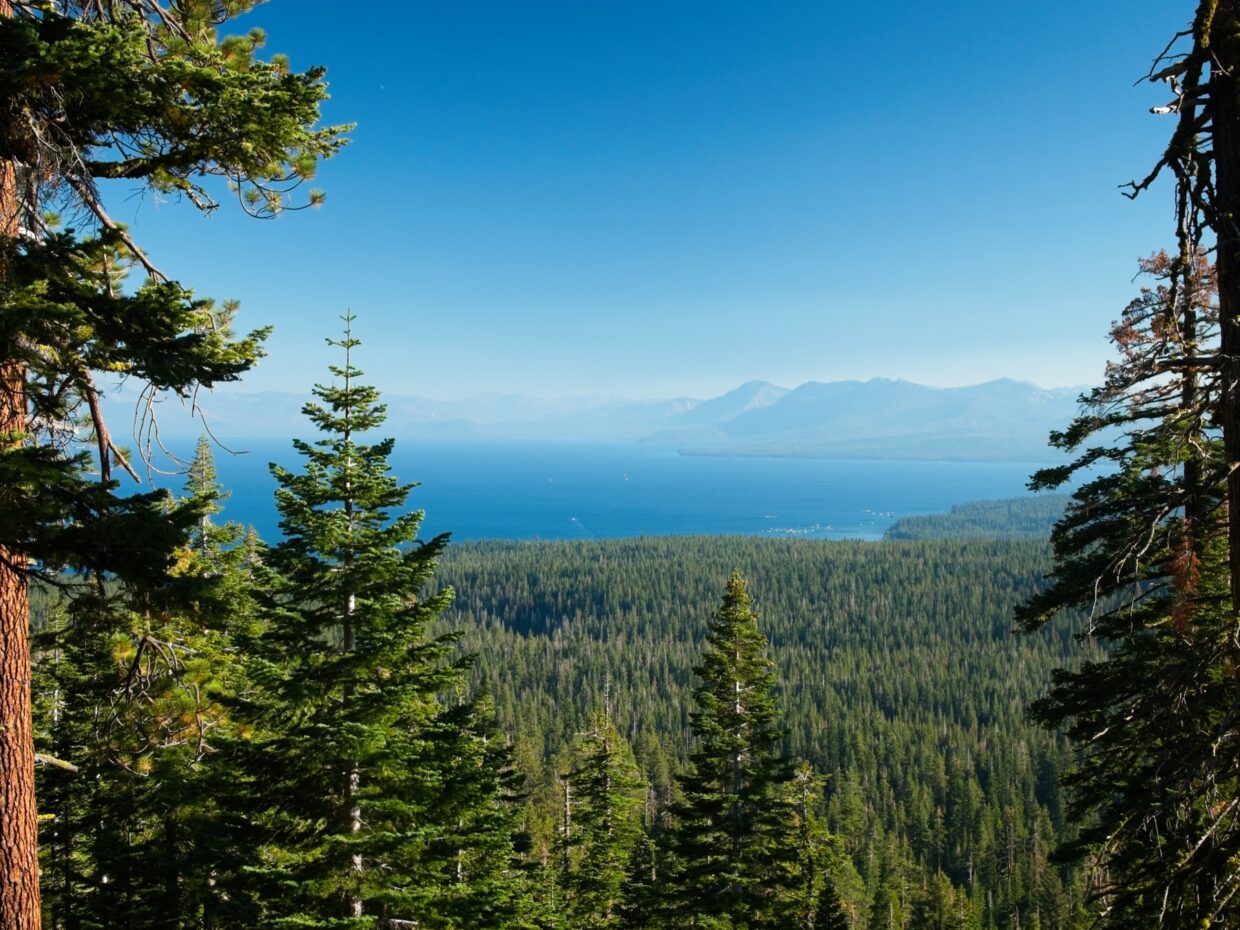
At around 2:45 we emerge from the forest onto a wide-open hill covered in sagebrush and other desert brush. The dark clouds have scattered into happier-looking cotton balls, and we have a nice view of Marlette Lake and Lake Tahoe. We pause at a little overlook for a few minutes to admire the view. It’s a little hazy, either from water in the air, or more probably smoke from the Garnet Fire in Sequoia-Kings Canyon National Park. Out on Lake Tahoe we spot a spiral-shaped swirl in the water; it must be hundreds of feet wide! How does that form? Wind? Currents? I have no idea.


We soon continue down the trail, winding around the north side of Marlette Peak to the established Marlette Peak Campground. We refill our bottles from a hand-pumped spigot, collecting several liters each; we won’t pass any more water sources until we reach Spooner Lake tomorrow. The water is potable but tastes very metallic… it’s what we have. I’m really tired, so we rest for a while at the campground, falling asleep on a picnic table for a spell. I feel much more energetic after the short nap.


We leave the campground at 4 PM and hike through the forest for another hour or so. After trudging up several hundred feet of switchbacks we reach wide-open hills once more, but this time they’re wall-to-wall lupine! I’ve never seen so much lupine in my life! Imagine these hills earlier in the year when every plant is covered in purple blossoms… I bet it’s incredible.
The trail reaches a high point near Snow Valley Peak and then traverses across the east side of the mountain and ski resort. We’re treated to continuous, sweeping views of Lake Tahoe, and a very pleasant breeze. It’s now 6 PM and we’ve covered a little less than 18 miles. My second wind has worn off, but we’re at least on a downhill march. By 6:30 we’ve made it to a nicely forested ridge and find a campsite a little off the trail. It’s a dry camp, but we have plenty of water thanks to the generous amount we collected from the spigot.


In what will become our nightly routine, Shannon sets up the tent while I make dinner. Once the water has boiled, I add it to our food (cheesy rice and broccoli) and we hobble down the ridge a short distance to sit on some rocks and watch the sun set over Lake Tahoe. The food is delicious and the sunset beautiful — a lovely evening. We go to bed as soon as we’re done packing away the trash into the bear cans.
Spooner Lake & Kingsbury
Day 2: Saturday, 30 Aug, 2025 | 22.3 mi | +3000 / -4200 ft | View on Map
Shannon and I wake up around sunrise. We’re not particularly sprightly this morning and don’t start hiking until 8 AM. Thankfully, we’re starting out today with a 5-mile downhill walk to Spooner Lake. It’s Saturday morning on Memorial Day weekend, so we see lots of day-trippers: several trail runners (with dogs!) and many hikers (more dogs!). We reach Spooner Lake at about 10 AM and filter water from the lake. It’s murky and buggy, but the inlet isn’t flowing and waking around to the outlet is too far since we have 22+ miles to cover today. The next water source is 16 miles away, so we camel up (drink all we can) at the lake and then fill several liters each to get us through the dry section.


Just past Spooner Lake we reach Highway 50, an extremely busy, 4-lane road. There’s no crosswalk, stoplight, or otherwise protected way to cross the road, so we wait for a break in the cars and make a run for it. It’s certainly not comfortable, and the drivers don’t seem amused, but it’s the only way across.
Beyond the highway we begin a long, uphill climb, gaining about 1800 feet over 6.7 miles. It’s not a particularly scenic section — many of the areas have been thinned and there are logs and branches everywhere — but we distract ourselves with conversation and push through the slog.
We emerge from the forest onto a grassy ridge top at 1 PM and take a break for lunch on a pile of basalt. The view of Lake Tahoe is superb! The panoramic vista continues for about a mile down the ridge, and then we’re back in the forest again.


The rest of the day is a long, downhill walk to Kingsbury. We’re mostly confined to the forest, most of which is pleasant though unmemorable. Lots of the larger trees are covered in lime-green wolf lichen, which almost glows in the filtered light. As we near town, we walk past what sounds like a shooting range. We never do see the shooter… hopefully they’re firing away from us.


We reach Kingsbury at about 6 PM and step off of the official Tahoe Rim Trail for a little while to visit the Fox & Hound, a small grill next to the Heavenly Ski resort. In true Nevada fashion, the bar area is full of video poker machines; we plop ourselves down at a table outside and order beers, a burger, and pizza. While we wait for the food, I try to stretch out my calves and Achilles, both of which are aching tonight.
After we’ve eaten and washed up we walk three quarters of a mile down the hill to a quiet campsite near Edgewood Creek. I set up camp while Shannon refills our water bottles from the creek and then we head to bed, thoroughly worn out from the long day.
Heavenly & Freel Peak
Day 3: Sunday, 31 Aug, 2025 | 20.9 mi | +5200 / -3000 ft | View on Map
We’re up relatively late again this morning, choosing to sleep in to recuperate from the miles. We hit the trail at 8 and begin walking uphill immediately. It’s a gradual slope and the trail is smooth and easy, but it still feels hard. I’m happy to discover that my Achilles feel better than yesterday and (hopefully) won’t be a chronic issue for the whole hike.


We hike through the Heavenly Ski Resort for most of the morning, passing under four different ski lifts as we wind around the mountain. We’re treated to many sweeping views of the Nevada countryside and feel the desert heat on the sparsely-treed slopes. Just before noon, we cross the Nevada-California state line and then hike over Monument Pass at 8800 feet.


From the pass we get our first look at Freel Peak, a sandy mountain in the distance and today’s high point. Between us and Freel is a massive basin full of trees, meadows, and several winding creeks. I enjoy the relatively flat hiking for the next few miles as we wind along the upper valley. We reach Star Lake at about 1:30 and take a long break to swim and then eat lunch while drying off in the sun. The cold water feels amazing!


We’re on our way again by 2:15, gradually ascending a sandy trail full of mountain bike tracks. At Freel Pass (10,100 ft) we stash our backpacks in a copse of trees and pack a few snacks and layers into smaller backpacks we’ve brought along for summit excursions. We follow a well-trodden trail up the side of Freel Peak and across its north face to the summit (10,883 ft), arriving just before 4 PM. We stay for a few minutes, admiring the views and shooing away an aggressively curious chipmunk. But with only a few hours of daylight left, we soon retrace our steps back to our bags.


From Freel Pass, we hike down long, frustratingly gradual switchbacks and then across a long, pleasant traverse to Armstrong Pass. We’re treated to some beautiful wildflowers and one of the most interesting, pocketed granite faces I’ve every seen. The trail climbs uphill from Armstrong Pass and then flattens out a bit on a sandy plateau sprinkled with whitebark pines. The sun is fully setting and we’re eager to find a place to camp for the night, but every nice-looking spot we pass already has a tent on it!


We find a spot of our own just after 7 PM and happily dump our packs onto the ground. Shannon sets up the tent while I get dinner ready – tonight we’re feasting on mashed potatoes and gravy, stuffing, and chicken packets (I couldn’t find turkey). For dessert, we brought one of those tiny pumpkins pies from the grocery store. It’s a fantastic meal, particularly after hiking 21 miles! The sun sets and we finish eating via head lamp and then go straight to bed.
The Southern Loop
Day 4: Monday, 1 Sep, 2025 | 24.5 mi | +3300 / -5300 ft | View on Map
We’re up extra early this morning – we have over 24 miles to cover today, ending at highway 50 near Echo Lake. We have a hotel reservation tonight in South Lake Tahoe, and we’d love to be there in time to have a nice dinner and soak in the hot tub! So no time to lose.


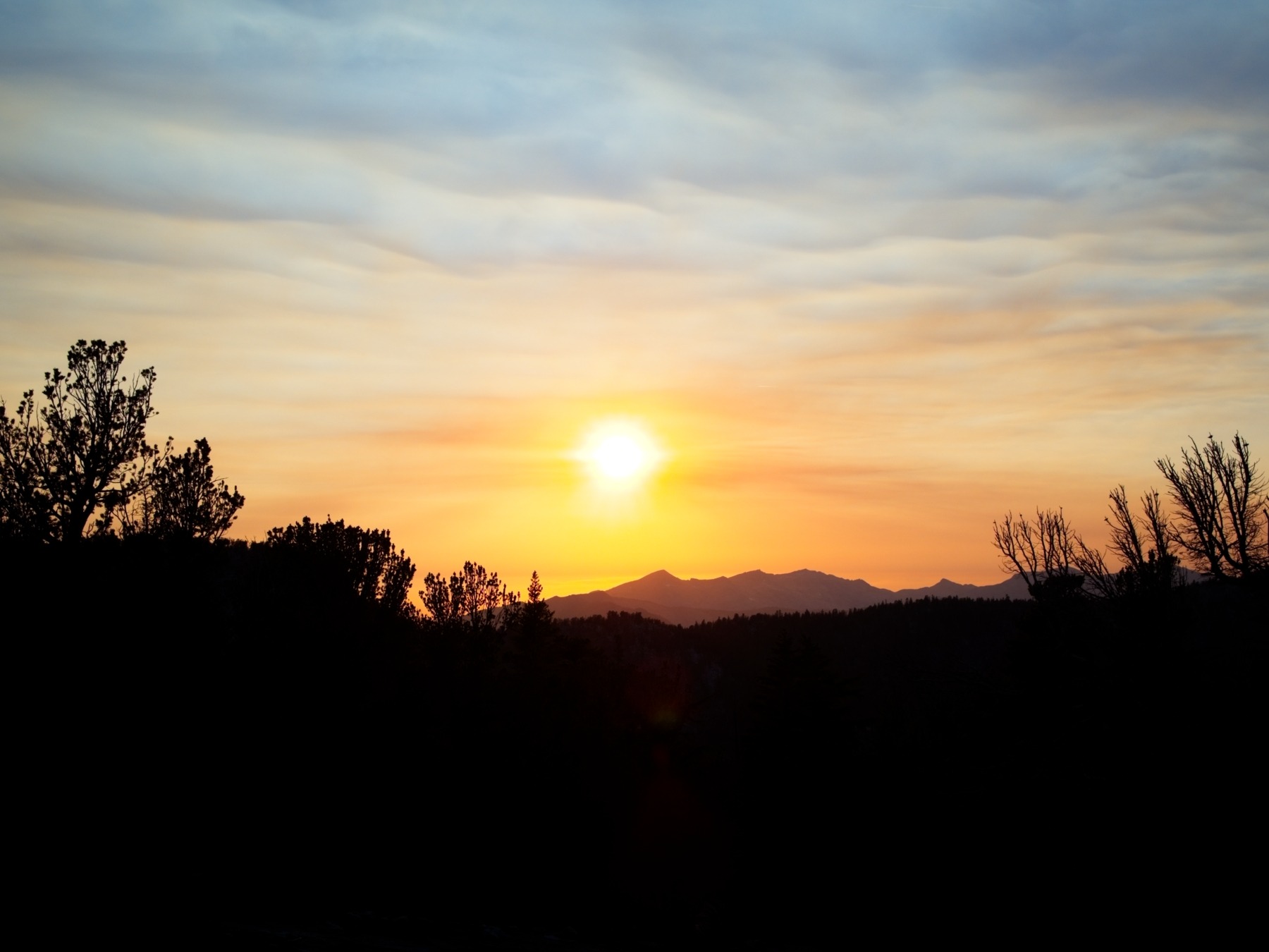
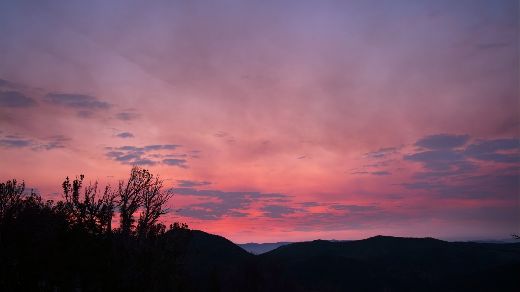
We’re on the trail by 6:00 and move quickly across the plateau under wavy pink and purple clouds. The trail then descends gradually for 7 miles, winding through lots of beautiful forests and a few lush meadows. We keep our eyes peeled but — to Shannon’s chagrin — see no bears or large game of any kind. At the bottom of the hill we reach civilization again: highway 89, pit latrines, and plenty of day hikers.


After a short break beside Grass Lake Creek, we continue down the trail, cross highway 89, and begin a short uphill walk to Big Meadow. When we arrive we find that it’s aptly named – it’s big. We cross Big Meadow Creek via a quaint footbridge and then stroll through the grass to the forested hills on the other side. The trail climbs again for a few miles and I’m soon sweating from the heat and humidity. Luckily, there’s plenty of shade, so it’s not as warm as it could be.


We reach Round Lake at about 11:00, having covered 11.3 miles. We’re cruising so far! We refill our water bottles at the lake and then hike along the eastern shore. The forest is littered with enormous conglomerate boulders, which fill my head with questions about how, when, and why they formed. I’m used to the granite we’ve seen along the trail, but conglomerate is not something I’m used to finding in the Sierra.


As we reach the southern end of the lake the ecology changes quickly: the pine forest gives way to aspens and then to dusty meadows. It’s very warm, but we’re mostly hiking on flat ground or slightly downhill slopes, so the heat remains bearable.


Roughly 3.3 miles from Round Lake we reach the Pacific Crest Trail (PCT)! The Tahoe Rim Trail coincides with the PCT for the next several days of our trip. After seeing hardly any people for the past hour, we’re suddenly overwhelmed by a dozen people on the PCT. Rather than stay with the throng at the junction, we hike down the trail for a few minutes to find a less crowded, shady spot for lunch. After a short rest, we continue hiking and cross the Truckee River, just a small creek here. It’s headwaters are only a few miles south of us! Beyond the river, we hike uphill again, passing Showers Lake on the way to the top of the ridge. We get some nice views of Freel Peak, which looks awfully far away now.


The next few hours are hard for me. By 2:30 we’ve covered about 18 miles and my feet ache. We’re mostly hiking downhill, which is helpful for tired muscles, but not so helpful for painful feet. Shannon distracts me for a while with conversation and we gradually close the gap between ourselves and the highway. The final couple miles are steep, rocky, and complex, which isn’t particularly welcome at mile 22, but we make it through and reach the highway at 5:30 PM. We try to flag down a car to hitchhike into town, but nobody even slows down, so I call a rideshare. It takes the driver a while to arrive — today is Labor Day and the road is clogged with people heading home — but he eventually arrives and we glide off to a hotel, hot showers, and fresh food.
Desolation Thunder Storms
Day 5: Tuesday, 2 Sep, 2025 | 7.4 mi | +1300 / -600 ft | View on Map
We sleep in this morning (relative to yesterday, anyway), getting out of bed at 7 after a very comfortable night on a real mattress. I walk down the street to get some breakfast while Shannon meets with the director of a short film she’s auditioning for. Once her meeting is over, we eat breakfast, pack up our things, and call a rideshare to take us up to Echo Lake; it’s not far from where we left the trail last night.
We start hiking from the dam on Lower Echo Lake at 10:20, a late start compared to past days, but our plan is to take things a little easier today. We’re entering Desolation Wilderness, which is renowned for being a particularly scenic section of the Tahoe Rim Trail, so we want to enjoy it! Our plan for the day is to hike about 12 miles to Gilmore Lake, set up camp, and then summit nearby Mount Tallac.
I enjoy the hike around Echo Lake, though it’s very humid today and I feel sticky even though we’ve barely done any uphill hiking at all. We hike over plenty of granite slabs, which has me feeling right at home. Soon we reach the sign marking the boundary of Desolation Wilderness. The trail begins climbing up a loose, rocky slope that has us pining for the smooth dirt sections of the TRT we covered on days past.
")


After a couple miles of uphill effort, we reach the top of the ridge and get our first view of Lake Aloha through the trees. The water level is fairly low and the lake is a maze of exposed granite and narrow waterways, a really cool sight! Shannon is instantly excited and we hurry down to the waters’ edge to have lunch. We find a nice bench in the granite right next to the lake where we can dangle our legs over the water and munch on our food.


By the time we’ve finished eating, the sky is looking significantly darker than when we first sat down. Looking east, we can see even darker clouds and potentially the haze of falling rain. It’s not too dark here yet, and we’re not sure what direction those clouds are moving, so we continue hiking. Less than a mile later, we look back and see rain beginning to hit the hills on the far side of Lake Aloha, so we hurry to find a campsite. We don’t quite have the tent up before the rain arrives, but we manage to stay mostly dry and are into the tent when the heavy rain arrives.
After sitting on the increasingly wet ground for for half an hour, we wise up and inflate our sleeping pads. I’m used to afternoon thunderstorms in the Sierra that blow through in an hour or two, so we’re hopeful that we’ll be able to hike several mores miles this afternoon.
The rain continues for hours, however, fading and swelling in waves. Every time the patter on the rain fly stops, we get hopeful that it’s over for the day. But then another wave begins, sometimes bringing lightning strikes scarily close to our tent. We escape the tent every once in a while during a break in the rain to stretch our legs, pee, and look out at the mountains. The cliffs opposite our campsite have a new set of waterfalls flowing down them! And a small low spot near our tent is now an 18-inch deep pond. I dig some “irrigation ditches” around the tent to route the water flowing off of the rain fly away from the tent – it seems to reduce the puddle under our sleeping pads a little.


We entertain ourselves throughout the afternoon and evening with books and looking through old photos on our phones. When dinnertime arrives, we cook under the rain fly and enjoy some cheesy broccoli and rice from the comfort of the tent. The rain eventually stops completely at about 8 PM, much too late to do any more hiking. It’s decidedly chilly now, and getting dark, so we pop outside for a few minutes to stretch and then head to bed around 9:00.
Dicks Peak & Mount Tallac
Day 6: Wednesday, 3 Sep, 2025 | 18.3 mi | +4300 / -4500 ft | View on Map
Shannon and I are up early today — 5:30 AM — but are delayed a bit when I realize that I left a bag of food at our lunch spot yesterday. I run (literally) back to get it and find it right where I left it, though now with a few holes chewed into the plastic bag. The rain has ruined the tortillas, but at least the cheese, peanut butter, and fruit are untouched! I get back to camp and we’re on our way by 7:30.


It’s a beautiful morning! Lake Aloha is smooth as glass, and the sky is bright and full of small, puffy clouds. We wander up the trail on the east side of the lake and then descend to Heather Lake, which is also mirror-like. We snap dozens of photos, stopping every few minutes as we get new vantage points. We soon walk past yet another glassy lake, Susie Lake. It’s like the weather is making up for yesterday.


Past Susie Lake we ascend a few hundred feet to Gilmore Lake and leave our backpacks there, draping the wet tent over nearby trees. With our summit bags, we follow a well-traveled trail that departs the lake and heads northeast up the side of Mount Tallac. It’s a pretty trail, passing through lots of long grass and some wildflowers! We can see the summit block, a conspicuous collection of jagged rocks at the top of the slope, from far below. It looks far away at first, but we make quick progress with our light backpacks.


On top of Mount Tallac we find several other groups of people, and even a dog! Lake Tahoe looks amazing from here, and we sit and enjoy the view with snacks for a few minutes. After a short break, we head back down the mountain, speeding along the trail. A whole flock of Clark’s nutcrackers serenade us with their squawks for a while but go silent as soon as I take my phone out to record them… they know, somehow.


Back at Gilmore Lake, we eat lunch and then repack our backpacks. They feel really heavy as we continue up the Tahoe Rim Trail, slowly ascending the side of a ridge. We’re treated to some amazing views of the lake basin below us, including Half Moon Lake and Susie Lake.


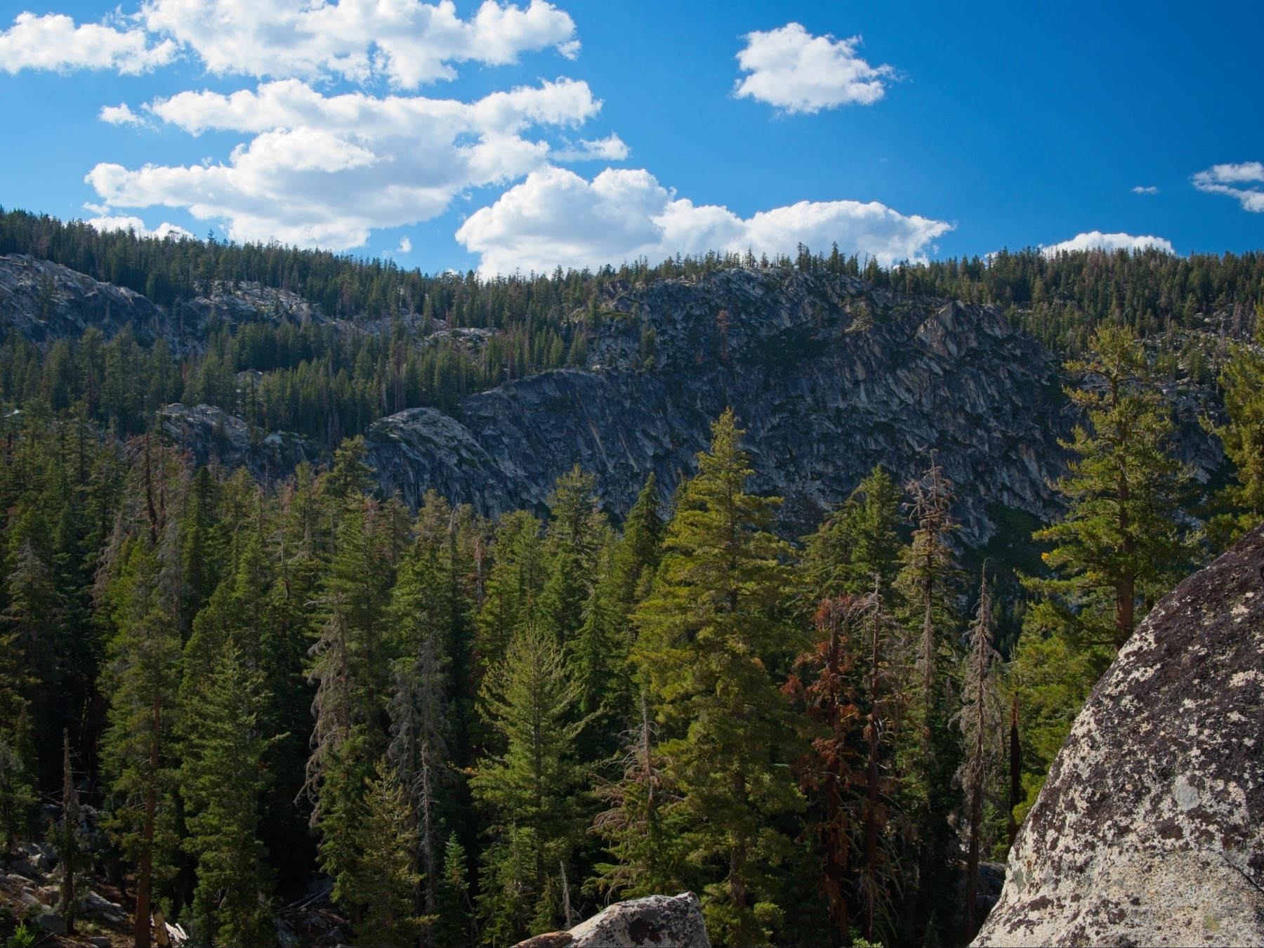
By the time we reach the saddle between Dicks Pass and Dicks Peak at 2:00, dark clouds are starting to gather overhead. I’m optimistic that they’re not storm clouds, just big clouds, but we hurry regardless. The path to Dick’s Peak is not nearly as well-traveled as the trail up Mount Tallac, or at least it seems that way. The ground is made entirely of small and medium-sized rocks, so a trail wouldn’t be that visible in the first place. We contour around the south side of a small crest in the ridge and then begin a steeper climb up to the summit itself.
Although SummitPost lists this climb as class 2, I’d give it a class 3 rating; there aren’t many class 3 moves, but there are a few and they’re not avoidable as far as I can tell. There’s also plenty of loose rock and scree, which adds a little spice to the climb. Shannon is nervous about the climbing and the weather, we make it to the to top unscathed and enjoy some spectacular views of the lake basin to the north. Some of the clouds have broken up a bit, particularly to the north, and the lighting on the lakes and the granite is really beautiful!


After a short break on the summit of Dick’s Peak, we retrace our steps down the northeast ridge. A few raindrops fall as we scramble down, but they don’t develop into a drizzle. We pause at a snowfield on the way down to touch some frozen water – it’s the only snow we’ve been close to so far! Then we finish the hike back to the trail, grab our backpacks and hike uphill to Dick’s Pass, which is confusingly not actually at the low point of the ridge.


From Dick’s Pass, our route for the rest of the day is all downhill. We navigate a long set of switchbacks and then walk past Dick’s Lake and Fontanillis Lake. As the trail continues to descend, we pass by Middle Velma Lake. Our last water for the day comes from a stagnant marsh along the outlet from Middle Velma; we use Shannon’s Sawyer filter on the murky water to remove as much debris as we can. It tastes great, even if it is a little brown.


Shannon and I are both quite tired, so we don’t walk very far beyond Middle Velma Lake. We find a quiet spot a few tenths of a mile up the trail and call it a day at 6:40. We fall into our usual routine of camp chores and enjoy whats left of the day with hot Indian curry and much-needed back massages.
The Harvest Section
Day 7: Thursday, 4 Sep, 2025 | 23.4 mi | +3200 / -3700 ft | View on Map


We’re up and on the trail by 8:00; we enjoy the cool air and a relatively flat trail for many miles. For much of the morning we’re on a ridge overlooking the Rubicon River and the Crystal Range, though we can’t see very far through a smoky haze that’s settled here today. Being on a ridge, we also don’t encounter water for quite a while. We have plenty from last night, but our next water is at Richardson Lake, some 8.5 miles from camp.
Despite the lack of water sources, the forest we’re walking through is very damp. The trail is lined with ferns, mushrooms, and all sorts of berries, including raspberries, little white berries, more bitter cherries, and thousands of california gooseberries, or “spike berries” as we start calling them since they have massive thorns. We much on the raspberries but avoid the others since we’re not sure how edible they are. With all the on-trail food, we decide that this is the “harvest section” of the Tahoe Rim Trail.
We arrive at Richardson Lake at about 11:00. The smoke is particularly obvious here; even the opposite shore of the small lake is noticeably hazy! We take a long break in a shaded grassy spot beneath some massive trees. We wash a few clothes in the lake and watch a school of minnows flit about. There are also several crayfish patrolling the shallows; every once in a while they bump into each other and have a little standoff. A large dragonfly stops by and stares at us for a few minutes before flying off after a potential mate.


After a lovely break, we continue down the trail, crossing Miller Creek and then stopping at Bear Lake Creek for some lunch. The water is icy cold and distinctly free of mud, so we’re happy to refill here. I’m a little nervous about the amount of lunch supplies I have for the rest of the hike since I had to toss my tortillas yesterday, but we do a quick inventory and decide we have plenty of extra snacks, so my lunches will just be more diverse than I had planned them.
The next several miles take us through more forest, several meadows, and lead up to Barker Pass. I take advantage of the pre-dug toilet there (a pit latrine) and then we continue up the trail. We pass a whole crew of trail maintenance volunteers and thank them for the work they’ve done – the Tahoe Rim Trail is really well-maintained and well-marked.


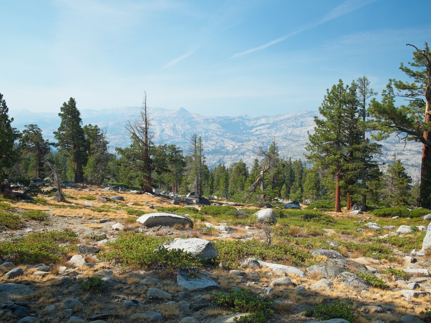
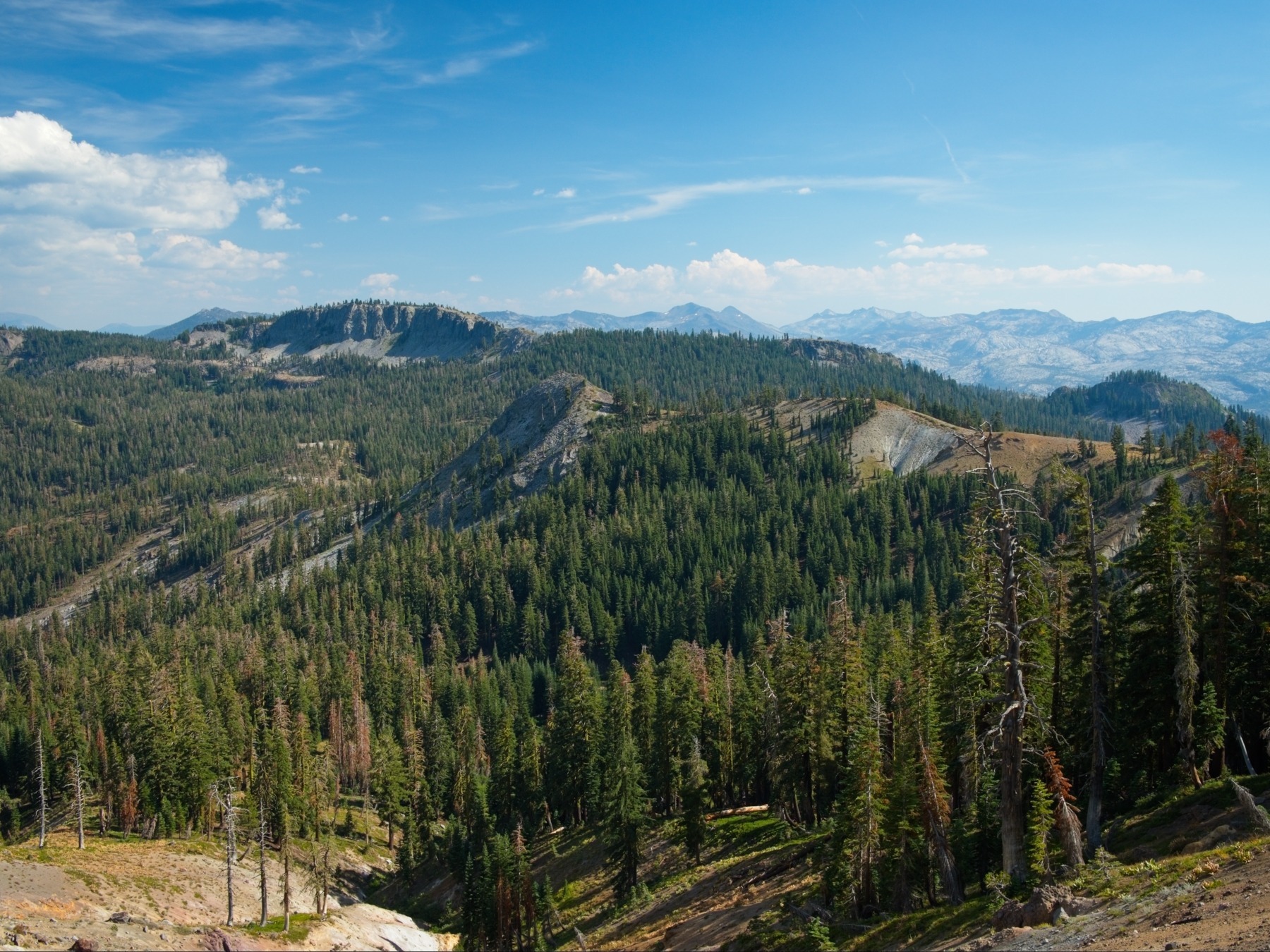
After climbing about 1300 feet over 5 miles from our lunch spot, we reach the top of a ridge with an interesting outcropping of volcanic rock. We wander over to take a look and then sit for a few minutes to eat a snack. We’re covered 17 miles so far and are both tired, which we’ve come to realize is pretty consistently how we feel at mile 17. Luckily, we’ve got some nice views to distract us! The smoke has cleared up a little (I think the winds changed direction?) and we can see the Crystal Range spanning the south-eastern horizon. There are also several features that look like cinder cones, or some sort of volcanic rock; it’s an interesting view!
We descend for a few miles into a shady east-facing canyon riddled with little creeks and plentiful raspberries. We refill our water bottles from the North Fork of Blackwood Creek and then traverse below a band of cliffs. The trail then climbs upward again, not too aggressively but it’s certainly more effort than I want to put in. Several groups of south-bound PCT hikers pass us as we trudge up the switchbacks to the top of the next ridge.
We emerge from the shade into evening light and a stiff breeze atop the ridge at about 5:45. A wooden sign marks the boundary of the Granite Chief Wilderness. Just a short distance further and we reach a junction where the Tahoe Rim Trail splits from the Pacific Crest Trail. Our original plan for this trip was to continue along the PCT and summit Granite Chief near the Squaw Valley Ski Area. But with the rain a few days ago, we haven’t able to cover enough miles to make that feasible. Luckily, we can still take the Tahoe Rim Trail all the way back to our car – it saves us several miles and will allow us to finish on time without pulling any ridiculously long days (at least, not any more ridiculous than the days we’ve already been pulling).


After a short snack break at the trail junction, we depart the PCT and follow the TRT along the south face of Twin Peaks and then down some nicely graded switchbacks. There’s a creek in the valley below where we can camp for the night and we should have just enough time to reach it before dark. As we descend, the lighting through the trees and wolf lichen is excellent – I stop several times to take photos. We hurry down the trail as quickly as we can and reach a perfect little campsite by a gurgling tributary of Ward Creek right at 7:30. We set up camp and cook dinner via headlamp and then crash for the night.


To Tahoe City and Watson Creek
Day 8: Friday, 5 Sep, 2025 | 23.4 mi | +3300 / -3100 ft | View on Map
We’re up and on the trail this morning at 7:45. We begin with some easy downhill walking to Ward Creek and then follow the creek on an increasingly wide path through forest that looks like it’s been logged. A few miles in, the trail transitions to a dirt road and Shannon and I walk side by side, admiring the morning light and enjoying the cool temps. A hiker we pass tells us he was visited by bears last night, but we see no sign of them, unfortunately.
We cross a paved road at mile 3.7 and then hike up a short, steep incline to a plateau covered in meadows. They’re very pretty, but it’s smoky again this morning and the haze is obvious when looking across the open grass. The highlight of the morning is a red-breasted nuthatch chirping its little heart out on a tree right next to the trail. Not only is he a cute, colorful guy, but his cries are so nuanced that he sounds like a baby trying to talk. Shannon and I just stand and watch him for a few minutes, trying not to laugh and scare him away. Eventually he flits off to another tree, so we continue through the meadow.


The descent from the meadows begins on unpleasant, loose, rocky trails. It eventually smooths out a bit, though, and we stroll through hundreds of cedars. The trail takes us all the way down to the Truckee River, now flowing out of Lake Tahoe and much bigger than when we stepped across it a few days ago. We cross on a pedestrian bridge on the outskirts of Tahoe City and then walk a little ways into town to get some supplies: packaged snacks from a gas station, and then sandwiches and smoothies from The Dam Cafe. The smoothies really hit the spot, and the sandwiches look amazing! We’ll save them for later, though; it’s only 11:00 right now.


After a nice rest in town, we return to the Tahoe Rim Trail and begin a long, uphill march. It’s steep at first, but then eases up considerably. We’re mostly walking along the ridge above the Truckee River and highway 89, but thankfully we’re far enough from the road that we can’t hear the constant hum of traffic. Several day hikers pass us in the early afternoon, but we don’t see nearly as many people as last Friday.
We reach a high point named “Painted Rock” at about 4 PM, some 8.5 miles from Tahoe City. We look around the area for colorful rocks, but don’t see anything that deserves a name on the map. As we continue down the trail and spot other rocks with colorful lichen, it becomes a joke: “Oh! So this is painted rock!”
Over the next couple of hours we follow the trail over undulating hills and are passed by several groups of mountain bikers – they must be out for their post-work ride. They soon disappear, though, and we’re left to walk in peace along a lovely ridge traverse with beautiful views of Lake Tahoe. Much like yesterday, the smoke seems to have mostly cleared out this afternoon, and the remaining haze makes for a cool scene.

The easy traverse soon ends, however, and the trail climbs sharply up the ridge for about 500 feet. It then drops down the opposite side, leaving the views of Lake Tahoe behind. We walk past Watson Lake at 6:45 and continue just a little further down the trail to a water source the Far Out app says is flowing well. Sure enough, we find a tiny creek full of cold, fresh water about 0.6 miles past Watson Lake and happily set up camp in a nearby clearing.
Watson Creek to Gray Lake
Day 9: Saturday, 6 Sep, 2025 | 17.6 mi | +3500 / -2000 ft | View on Map
After hiking two 23+ mile days in a row, Shannon and I are finding it increasingly difficult to get out of bed. My alarm wakes us up at 5:45, but we don’t muster the energy to get up until nearly 7. We don’t have nearly as many miles to cover today, fortunately, so we’re not in a huge rush.
Like yesterday, we begin the days’ hike with some gentle downhill walking. We meet a mountain biker who enthusiastically tells us about a cistern big enough to swim in near the trail. However, when I check its location on the map, I see that it’s several hundred feet below the ridge that the trail traverses so we probably won’t make the detour. A few miles down the trail we reach a strange sight: a massive tree has splintered into a 20-foot doorway arching over the trail. And, just beyond the doorway is an old-fashioned fire extinguisher perched atop a log. It feels like Wacky Wednesday out here.
As we near highway 267 and Brockway Summit we begin to run into lots of people: bikers, hikers, and runners. The trail from Brockway Summit up toward Picnic Rock is crowded with hikers that reek of laundry detergent, fabric softener, and deodorant. Isn’t it funny how those scents become overwhelming when you’ve spent days outside?


Thankfully, we leave the crowd and their smells behind when the trail branches off to Picnic Rock and we’re left with the mountain bikers and trail runners who buzz by far too quickly to get a whiff of. The trail climbs gradually but continuously past Martis Peak and then up to Mount Baldy (9300 ft). The combination of the altitude, a persistent breeze, and cooler weather overall makes the summit a very pleasant spot to take a break, so we sit down and enjoy some snacks while looking out on an expansive view of the northern end of Lake Tahoe.

From Mount Baldy we follow a meandering, mostly-flat trail across the ridge. Along the way, we cross from California back into Nevada and then enter the Mount Rose Wilderness. A hiker we met at Echo Lake a few days ago told us this wilderness was really beautiful but I’m not sure I see it. The ridgeline walk is very nice, particularly because of the amazing views of Lake Tahoe, but it’s dusty and dry. It’s beautiful in a rustic, subdued way.


We pass a few other hikers and backpackers on the ridge. One couple tells us they completely missed a spring that is supposed to be on the side of the trail, a spot we were hoping to camp tonight. They mention that Gray Lake is really nice, however, so we decide to head down there. Besides the more plentiful water, it’s down below the ridge and will hopefully offer some shelter from the increasingly chilly wind.
From the ridgetop, we descend 300 feet to Gray Lake. The wind is more subdued, and the evening light is really beautiful as it plays across the grassy meadows beside the lake. We find a campsite and are unpacked by 5 PM, which feels so early compared to all of our nights arriving at camp at 7:30 PM. We chat with some other people who are also hiking the Tahoe Rim Trail and then wander around the lake to take photos and refill our water bottles. Then it’s back to camp for a leisurely dinner and a relaxing evening.


Mount Rose
Day 10: Sunday, 7 Sep, 2025 | 18.1 mi | +3600 / -4200 ft | View on Map
When we wake up in the morning, the lake basin is full of the smell of smoke. However, once we’ve hiked up to the ridge (where the breeze is still blowing strong!) the scent fades away. It’s a chilly day, an odd but welcome feeling after days of being overly warm. From the ridge above Gray Lake we can see Tahoe Meadows and highway 431 below us – the car is parked down there somewhere! It’s only a 2-mile walk, but we’re taking the long way around: 18 miles with a spur trip to summit Mount Rose.


We’re mostly walking uphill this morning, topping out at 10,330 feet on Relay Peak. It’s cold enough that I pull out my puffy and wind breaker while we sit and eat a snack. Several groups of trail runners pass us on their morning outings, but we don’t see any other backpackers. The Tahoe Rim Trail contours around the northwest side of Relay Peak, giving us some views of distant lakes that have mostly been hidden by trees so far. That aspect doesn’t last long, however, and we’re soon descending back down the southeast side of the mountain, loosing all of the elevation we’ve gained.
The trail bottoms out at a pretty waterfall on a rocky step between two bands of meadows. We refill our bottles from the top of the falls, above the crowd of people we can hear mingling below, and then descend to the foot of the falls. After stashing our backpacks behind some trees, we join a small throng of day hikers on the trail up to Mount Rose. I expect to be slower than many of them since we’re worn out from days of hiking, but we pass practically everyone on the trail, completing the 1700-foot climb in an hour and 20 minutes.
The wind is howling over Mount Rose, so much so that I almost lose my hat a few times. Shannon and I find a spot on the leeward side of a rocky outcropping to eat lunch. We don’t have to save any food for tomorrow, so we eat as much as we want, finishing off bags of tortillas, crackers, cheese, and other goodies. Three dogs visit us periodically, hoping for some handouts, but we’re too hungry to share. After eating and admiring the views for a few minutes, we charge back down the trail to finish the hike out.


From the base of the waterfall, we endure a tiny bit more uphill hiking and then enjoy a long, gradual descent to “Mount Rose Summit,” a high point on highway 431, and then down into the lush meadows on the south side of the road. We’re both quite ready to be done hiking, so we speed along toward Tahoe Meadows and the car, only stopping once or twice to remark on how beautiful the meadows are.


When we reach the boardwalk where we began the hike, we’re concerned to find caution tape and “trail closed” signs blocking our way. From the meadow, my car is nowhere to be seen and a backhoe sits where I had parked. We duck under the caution tape, cross the boardwalk, and look around. Apparently the highway department has begun construction here since we left! And there’s the car, towed a few hundred feet up the road, but without a ticket, boot, or other notice that we owe someone money. How considerate of them, they could have towed it away completely.
We happily dump our backpacks into the trunk and then drive into town for showers, as much pizza as we can eat, and a very long sleep in a proper bed.