Shannon and I planned this January hike as both a fun weekend trip and a scouting mission for a trail run along the Gabrielino Trail. I was particularly excited because, despite living a few miles from Angeles National Forest, I’ve never actually backpacked there! We enjoyed mild weather and encountered tons of water thanks to some recent rains. (As such, don’t assume water availability will match this trip report.)
Trip Planning
Specs: 30.8 mi | +5100 / -6000 ft | 2 days, 1 night
Difficulty: Class 1 [ratings]
Location: Angeles National Forest, California | Home of the Gabrielino / Tongva peoples | View on Map
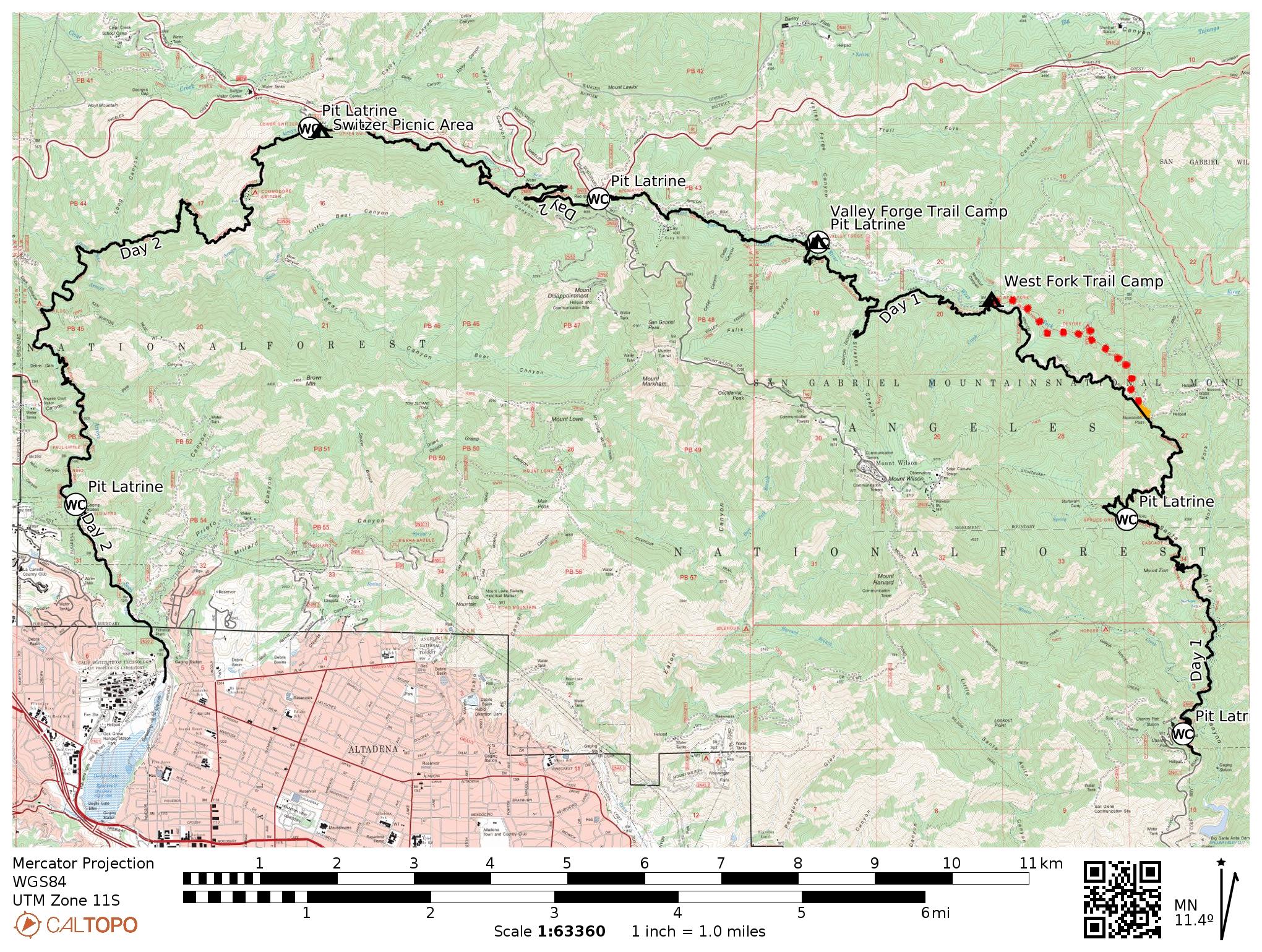
Route: Begin at the Chantry Flat Trailhead, hiking along the trail toward Sturtevant Falls. At the trail junction, follow either the lower or upper branch of the Gabrielino Trail (not toward the falls, but above them) and hike to Newcomb Pass. The Gabrielino Trail more or less disappears at Newcomb Pass; do your best to follow the map, or just bushwhack downhill to the Rincon-Redbox Truck Trail (a fire road). Follow the road to West Fork Campground, where you can rejoin the Gabrielino Trail.
From the West Fork Campground, follow the trail to Red Box and then down to the Switzer Picnic Area. About 1.3 miles farther downstream, diverge from the crowds heading to the waterfall and continue along the Gabrielino Trail across the ridge and then down into a deep canyon. Follow the trail all the way down the canyon to the trailhead near the many spreading ponds and the Jet Propulsion Laboratory.
Permits & Regulations: As far as I can tell, permits are not required for overnight camping in Angeles National Forest. Campsites seem to be first-come, first-served, and are often visited by black bears, so make sure you store your food and scented items in a bear box or use a bear hang. Also check fire restrictions before you go — campfires or even portable stoves may be prohibited if the fire risk is extreme or critical. Parking at trailheads generally requires an Adventure Pass or equivalent interagency pass (such as the America the Beautiful pass). As always, make sure you leave no trace!
Resources: The Forest Service maintains a Gabrielino NRT page with some general information.
Chantry Flat to Valley Forge
17 Jan, 2026 | 13.4 mi | +3400 / -2000 ft | View on Map
Shannon and I arrive at the Chantry Flat trailhead at about 9:00 AM. As is usually the case on a weekend morning, the parking lot is completely full and we have to park a quarter of a mile down the road in one of the many pullouts. We’ve already staged our other car in the Arroyo Seco, at the other end of the hike; we’ll be back there in two days.
After applying sunscreen and double-checking that we have the keys for both cars, we start down the trail. The “trail” begins as a road that descends steeply into Santa Anita Canyon. We soon reach the creek level and stroll past a series of waterfalls tumbling over the flood-control dams. The weather is just about perfect — warm in the sun but cool in the shade — and we enjoy an easy walk along the canyon floor for a little while, passing dozens of hikers on their way to or from Sturtevant Falls.
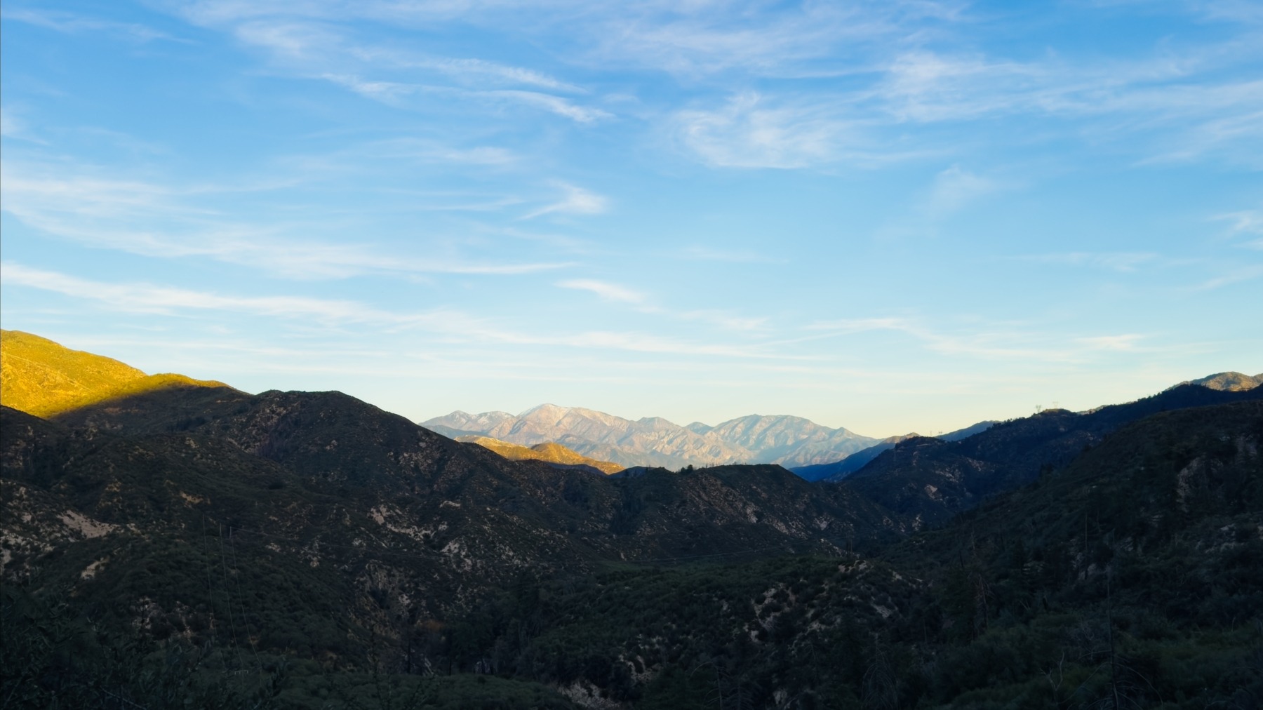
Once we pass the turnoff to the waterfall, the crowd thins out considerably. The trail also begins gaining elevation. We walk past the top of the waterfall, following the creek up the canyon. About four miles into the hike, we reach the final creek crossing we’ll encounter for a few miles and pause to refill our water bottles. From here, the trail climbs above the trees, and we get some nice views of the valley far below. It’s now much warmer, particularly on the sunny, ridge-top trail, so I’m grateful when we reach more trees on the north side of the ridge.


Shannon and I pause for lunch at Newcomb Pass. We sit at an old picnic table and enjoy relatively luxurious backpacking food — bread, tuna, avocado, and hot sauce, plus fresh oranges and the always-delicious Nerd Clusters. After eating, we begin a downhill section of the Gabrielino Trail. It’s incredibly difficult to follow, however, and disappears after about 50 feet. We bushwhack and scramble our way down a steep, leafy slope, eventually reaching a more defined section that leads down to the Rincon-Red Box Truck Road. We try to pick up the trail across the road and down the slope below it, but when the trail dead-ends in a massive, multi-tree snag, we decide to take the truck road for a while.


Although the truck road is a less interesting walk than the trail, it’s mostly clear of fallen trees and much easier to follow than the apparently unmaintained Gabrielino Trail on this side of the ridge. Over the next 2.5 miles, we pass several gurgling creeks, giving the impression of lushness and greenery that is a bit out-of-character for the San Gabriel Mountains. This is a north-facing slope, so it’s more sheltered from the sun and retains more moisture. But I suspect the creeks are mostly a remnant of the recent rains and will dry up within a few weeks.


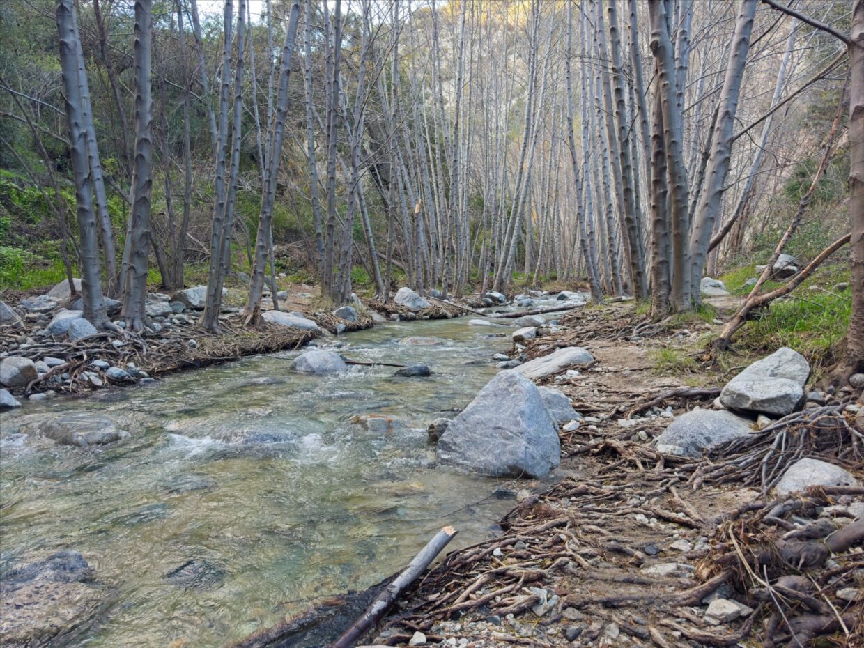
We reach the West Fork Trail Camp at about 3:00 PM and decide to leave the road and rejoin the Gabrielino Trail. Shannon and I are both happy to discover that this section of the trail is easy to follow and is clear of fallen trees and overgrown plants. We are on an uphill march again, but the winter sun has already dipped below the mountains and the air is lovely and cool. We pass a few waterfalls and some lingering autumn leaves along the way; what a nice walk up the West Fork of the San Gabriel River!


Shannon and I arrive at the turn-off for the Valley Forge Trail Camp at about 5 PM and, after a slightly involved rock hop across the West Fork, pick a nice campsite. There seems to be one other group of campers at the other end of the campground, but between the wind and the sound of the nearby rushing water, we barely notice they’re there.
Shannon sets up the tent while I prepare dinner: ramen noodles with some homemade jammy eggs. Darkness falls as we work and the temperature drops abruptly, so we’re both very happy to have the hot soup. After eating, we gather dead branches and make a small campfire; it may be fully nighttime, but it’s still only 6:30 PM — far too early to go to sleep yet. We chat and sit by the fire until 8:30 or 9 and then call it a night.
Down the Arroyo Seco
18 Jan, 2026 | 17.4 mi | +1700 / -4000 feet | View on Map
Shannon and I enjoy a leisurely morning at camp, returning to the trail at about 9 AM. It’s surprisingly cold, particularly as we walk next to the river. Several downed trees force us off trail in a few places, and we completely miss a non-obvious creek crossing, but we’re able to follow the trail relatively well. It’s a beautiful walk to Red Box with many creek crossings, autumn leaves, and lots of shade from the trees.


After a brief bathroom and snack break at Red Box, we follow the Gabrielino Trail downhill into the Arroyo Seco drainage, which we’ll follow for the rest of the day. We pass several trail maintenance crews clearing fallen trees – one crew with the Mount Wilson Bicycling Association and another from Lowelife’s Respectable Citizens Club. (You can volunteer with both groups do help maintain our trails!)


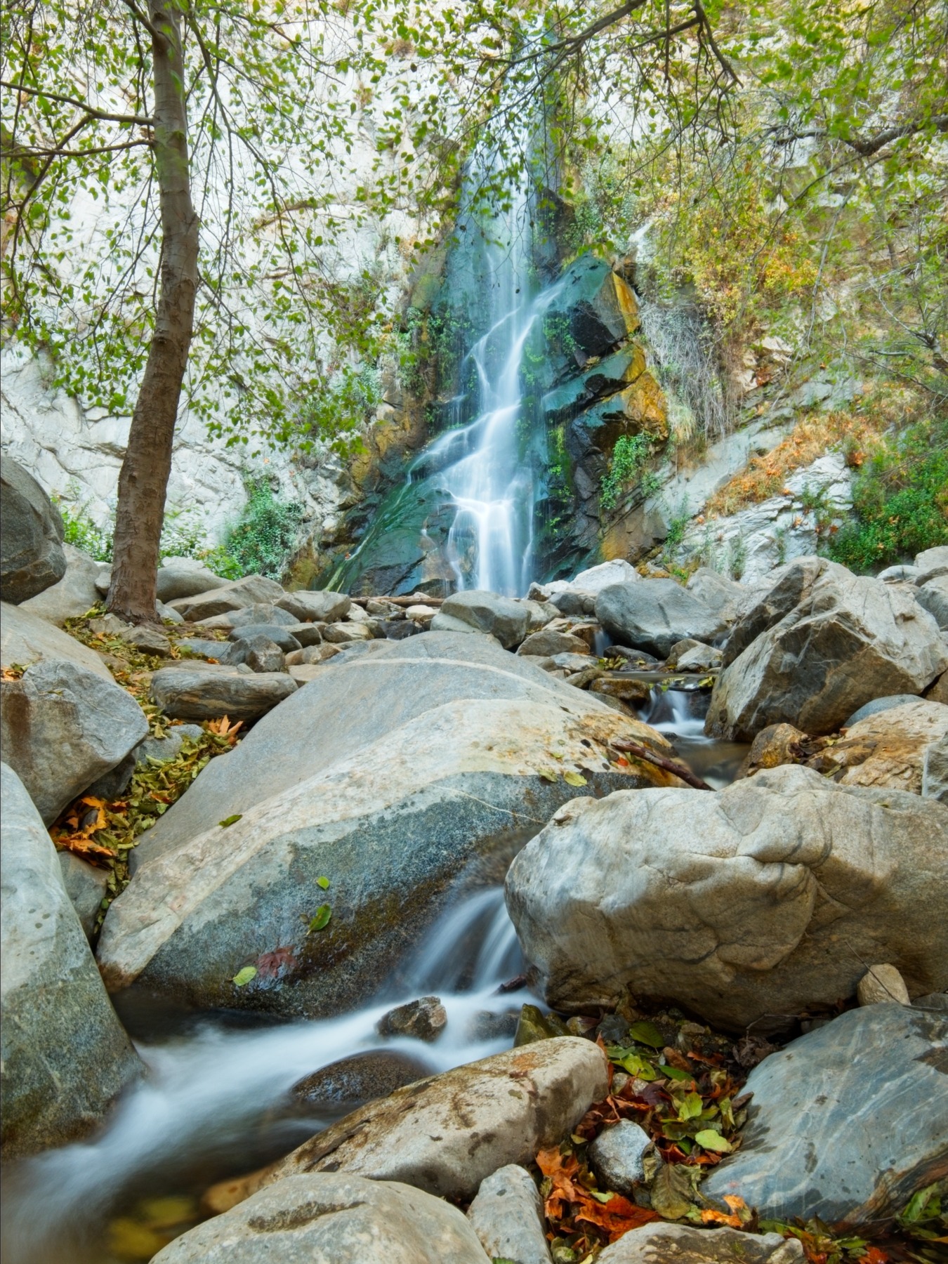
We reach the Switzer Falls picnic area a little before noon. Much like the Sturtevant Falls area near Chantry Flat, the trail is crowded with day hikers on their way to/from the falls. The waterfall is nice but — in my opinion — the canyon above it and the views from the trail above it are far better than the waterfall. In fact, the view of Bear Creek canyon is one of my favorites in the San Gabriel Mountains, and it’s just another quarter mile past the turn-off for the falls.


Below Switzer Falls, the Gabrielino Trail enters a deep, beautiful canyon. We trek down steep switchbacks, crossing many small creeks, walking through dense trees, piles of fallen leaves, and past moss- and lichen-covered rock faces. Near mile 11, we reach a wide and deep river crossing that cannot be avoided. We take off our shoes to wade through and continue walking for another 30 minutes through the beautiful canyon.


Soon we encounter another river crossing, and then another, and we stop taking our shoes off. I count eight crossings in the next three miles. As tedious as walking with wet feet is, the cold water feels really nice, and it’s less tedious than taking our shoes off every few minutes.


In the lower canyon, we pass the Brown Mountain Dam, which has its own impressive waterfall. It’s late enough in the day now that the crowds have gone and Shannon and I hike through the woods beside the Arroyo without having to pass many hikers.


We reach the Arroyo Seco trailhead of the Gabrielino Trail at around 5:00 and set off to reverse our car shuttle. It takes about 30 minutes to drive back to Shannon’s car (versus 16 hours on foot). We head home for a quick shower and then drive into the city for sushi with friends.