This weekend I planned an ambitious itinerary to climb five peaks in the Miter Basin area (just south of Mt. Whitney). Four of the five (Joe Devel, Pickering, Newcomb, and Chamberlin) are located on a U-shaped ridge overlooking the Perrin Creek drainage and are only about a mile from one another. The fifth peak, Mt. Guyot, is also nearby with an easy approach via the Pacific Crest Trail. This trip ended up being much more social than I anticipated since I met three climbers with the exact same itinerary! We ended up climbing together and had a great time exploring the area.
Trip Planning
Specs: 46.7 mi | +/- 13,000 ft | 2.5 days, 2 nights
Difficulty: The majority of this route is class 1 [learn more], but the off-trail peak bagging sections are more technically difficult. See the route descriptions below for details.
Location: Inyo National Forest and Sequioa-Kings Canyon National Park, California | Home of Northern Paiute, Tubatulabal, and Western Shoshone peoples | View on Map
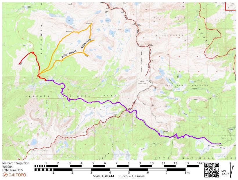
Route: To reach base camp, follow the Cottonwood Pass trail from Horseshoe Meadows to the PCT and then take the PCT north-bound to the Rock Creek crossing. Directions to each of the peaks are included below.
- Joe Devel Peak (class 2) – from the Rock Creek base camp, continue up the PCT to the sandy plateau, then head east toward the prominent west ridge of Joe Devel Peak. This ridge offers the most solid terrain; other slopes are mostly soft sand. Continue up the ridge to the summit.
- Mt. Pickering (class 2) – from Joe Devel Peak, backtrack down the west ridge and then follow the ridgeline north toward Mt. Pickering, staying on the east side.
- Mt. Newcomb (class 3) – from Mt. Pickering, backtrack to the “main” U-shaped ridge that connects the four peaks and then begin traversing north toward Mt. Newcomb, staying on the west side and gradually descending. Aim for some pinnacles just beyond the low point between Newcomb and Pickering where you’ll find a short class 3 climb between the pinnacles. Continue traversing the west side of the ridge to the summit.
- Mt. Chamberlin (class 3) – from Mt. Newcomb, descend to around 12,400 ft where a series of sandy benches traverse across the slope. Scramble up one of the chutes that leads to the summit. To descend, follow the easy sandy slopes down the SW ridge.
- Mt. Guyot (class 2) – from “Guyot Pass,” the saddle between Chamberlin and Guyot where the PCT passes through, scramble up the NE ridge to the summit.
Permits & Regulations: Permits are required for overnight stays and bear canisters are required for food storage (but there is a bear box at the Rock Creek campsite, so you can plan to use that instead). See the USFS website for details.
Resources: The USFS website has most of the information you need. The National Geographic Mt. Whitney map provides a great overview of the area, and Secor’s The High Sierra book details the routes between peaks.
Base Camp and Mt. Guyot
Saturday, 28 May 2022 | 20.5 mi | +4800 / -5200 ft | View on Map
I camped at the walk-in campground at Horseshoe Meadows last night, arriving late after driving up from LA. It was pretty warm and quiet, so I slept well enough and have woken up ready to hit the trail at about 5:15 AM. I pack up my campsite and enjoy a pot of hot oatmeal in the parking lot. Several PCT hikers are making the rounds, looking for rides into town. They’re worried about very cold temperatures in the next few days; according to the forecast they’ve seen, it’ll be down into the teens (F) on Sunday and Monday with high winds. I’m a little skeptical since the forecast I saw only predicted wind gusts up to 30 mph and temperatures in the 30’s… I suppose I’ll find out which forecast is more correct!
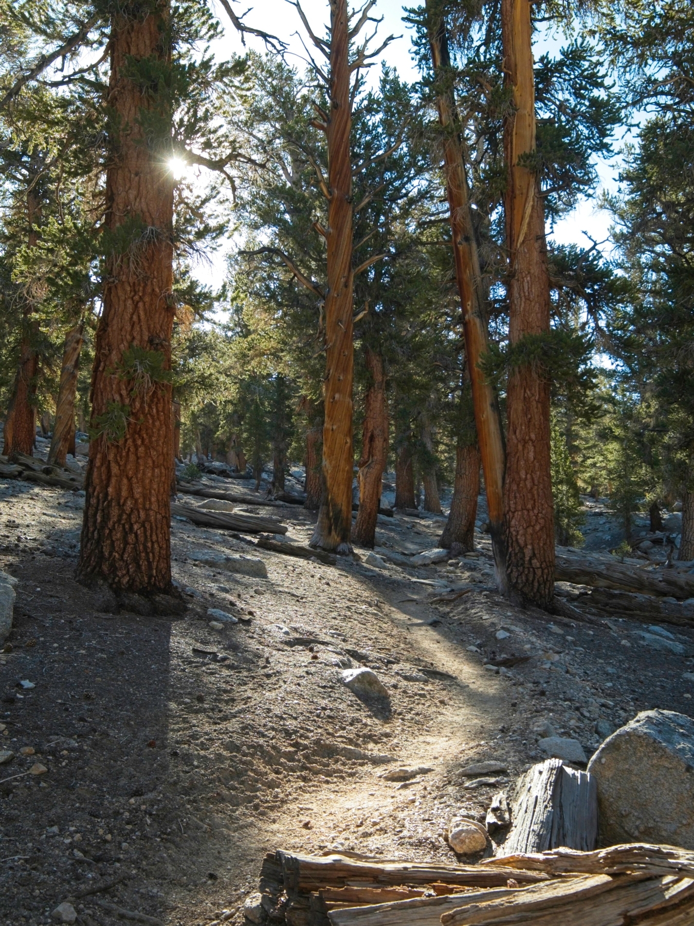
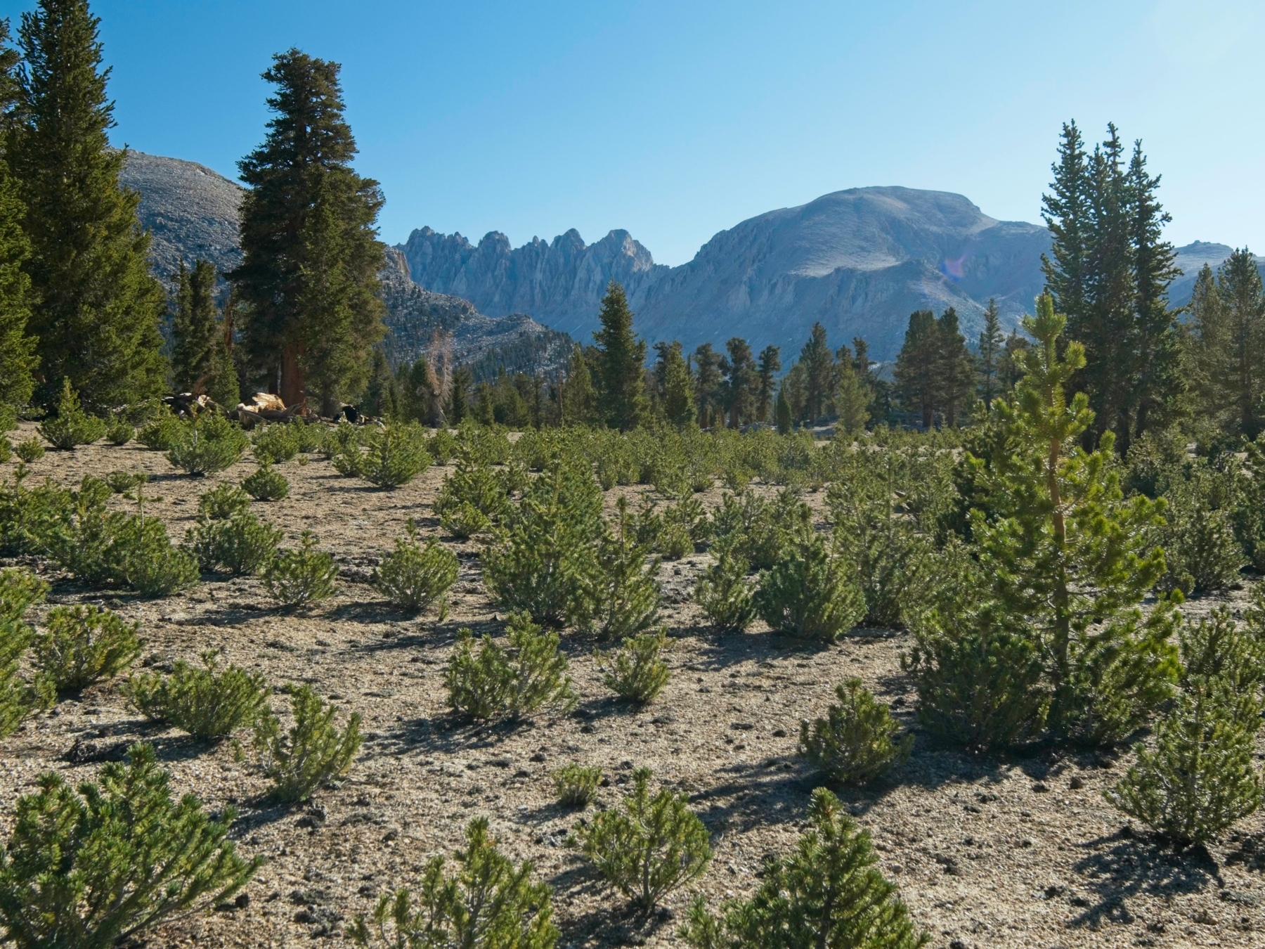
After eating, I finish packing, double check that I have the car keys, and head off down the Cottonwood Pass Trail. It’s a nice flat walk for several miles, passing through pine forests and lots of soft sand. There’s a bit of snow on the north-facing slopes of Trail Peak but it’s otherwise pretty dry; it already looks like mid-summer out here.


The trail eventually begins to climb more aggressively up to Cottonwood Pass, switching back through scattered boulders. It doesn’t take me long to reach the top of the pass at about 11,150 ft; I pause for a water and snack break and pull on a couple of layers to keep the cold wind from stealing all my hard-earned heat. Several PCT hikers hurry past me, coming from the north and heading out the way I just hiked up. The few that stop long enough to chat quote the same frigid forecast, but then they’re also wearing tiny running shorts and thin shirts… I’m guessing they conflated the lack of snow in the southern Sierra with warm temperatures.


From Cottonwood Pass, it’s a short walk to Chicken Spring Lake. I spend several minutes admiring the scenery, snapping photos, and chatting with even more PCT hikers. It’s a pretty spot, but still chilly with the breeze blowing through.


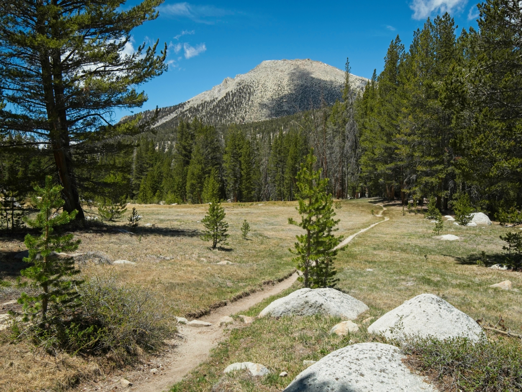
Continuing up the trail from the lake, I walk up a series of switchbacks, gaining a few hundred feet to a ridge that overlooks Whitney Meadow and offers sweeping views to the west. The cold wind motivates me to snap pictures quickly, and I soon continue along the trail on a long, sandy, downhill slope. Somewhere above me to the right is Cirque Peak, but from here I can’t really tell where the high point on the ridge is.


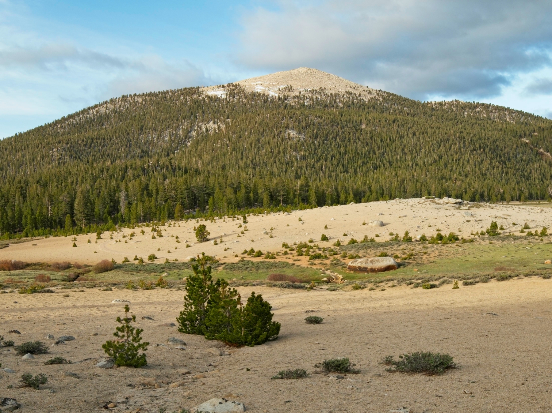
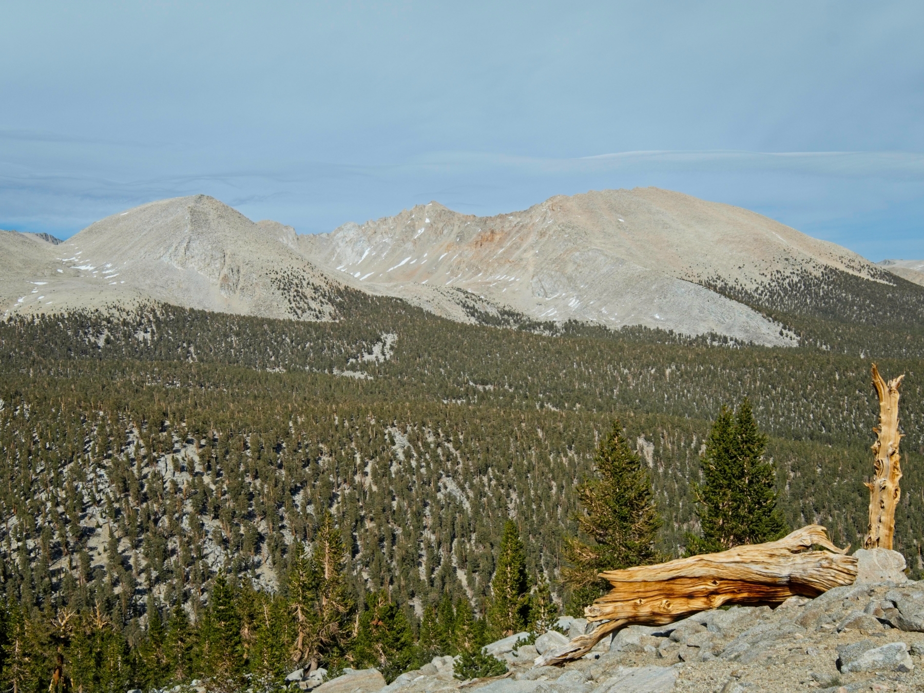
For the next hour or two, I stroll down the sandy PCT, mostly trending downhill but with a few short uphill sections. I leap-frog with PCT hikers as I stop to snap pictures, eat snacks, and adjust the layers I’m wearing. At one of these photo breaks I meet a hiker, “Northman,” carrying a large Sony camera. We get to chatting about photography and walk together for a while. The conversation helps the miles fly by and soon I’m descending switchbacks toward Rock Creek. Northman stops for lunch, but I press on since my campsite for the day is only a mile or two further. I get my first glimpse of Mt. Guyot from the trail in Rock Creek Canyon and am thrilled to find that it’s mostly snow-free! That’ll make for easier climbing.
I arrive at the Rock Creek campsite at about 12:30. After setting up the tent and tossing all my overnight gear inside, I sit down to eat lunch. With so much daylight left, I decide to go and climb Guyot today. I can take the PCT all the way to Guyot Pass and then scramble up the ridge to the summit; it should be pretty straightforward.
So, after finishing my lunch, I continue hiking. The PCT climbs some 750 feet from the campsite to a sandy plateau above the canyon, which wears me out a little. But the next mile or two are easier, gaining altitude gradually, albeit in the soft sand. One final set of switchbacks climb up to Guyot Pass (11,000 ft); by the time I reach the top I’m beginning to regret my decision to keep on hiking. I still have another 1300 feet to climb!
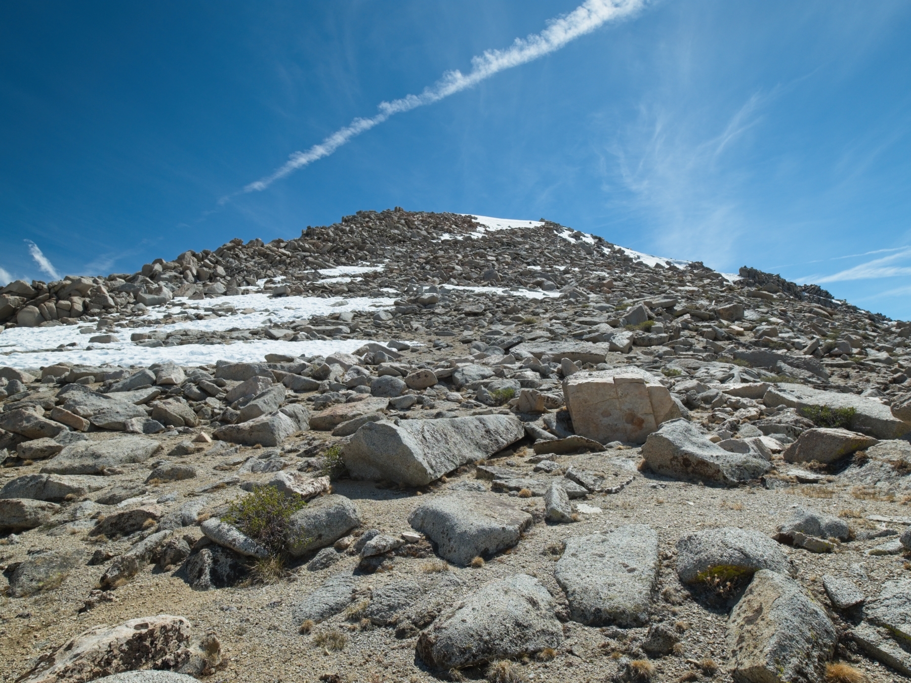
I continue onward despite the fatigue, slowly making my way up the class 2 northeast ridge. It’s not technically difficult, but it’s been a while since I’ve exerted myself at this altitude and I’m really struggling. Partway up the slope I spot a few hikers ahead of me. At first I think they’re descending but they don’t get closer as I continue to climb so they must also be on their way up.
At the top of the slope I skirt a small snowfield by scrambling through some rocks on the right side and then emerge onto the much flatter summit ridge. I head for the center of the ridge, the high point according to Secor but not the USFS topographical map. A short scramble delivers me to the top of the mountain where I find the summit register and log my visit. The views are pretty amazing! The Kern River cuts a deep gouge through the mountains directly west of Mount Guyot. The cliffs there below the “Red Spine” are so steep they overhang the river! Looking northeast I admire a long lenticular cloud hanging over Mount Whitney.


From the summit I spot the hikers I’ve been behind over on the southern end of the ridge (where the map says the top is). I’m feeling social, so I wander over to say hi. We get to talking and soon realize that we’ve planned the exact same itinerary for this weekend. Peter, Sarah, and Egor left the trailhead just before me this morning and I’ve probably been 20 minutes behind them all day. We’re even camping at the same spot! They inquire about the register, and I tell them where I found it. After a little more chatting, we say goodbye for the time being; I head down back toward camp and they scramble up to sign the register.
Back at camp I eat dinner in a spot of sunshine and chat with a couple of Swiss thru-hikers. Afterward, Peter, Sarah, Egor, and I discuss our plans to climb Joe Devel, Pickering, Newcomb, and Chamberlin tomorrow and decide to go together. Once we’ve settled on an itinerary, I head to bed. It’s been a long day (20+ miles!) and I’m ready for sleep.
Four-Peak Traverse
Sunday, 29 May 2022 | 12.5 mi | +/- 5800 ft | View on Map
I wake up the next morning at about 5:30. As I crawl out of the tent I’m happy to discover that it’s not that cold (yet, at least). I heat up some breakfast, pack my day bag, and meet my new friends near their tent. We’re on our way by 6:40, heading northbound on the PCT to get back up to that sandy plateau. Once we reach the plateau we abandon the trail, heading ENE up a gradual, sandy incline, aiming for the southwest ridge of Joe Devel Peak. It’s nice easy walking, so we chat and walk side by side through the open forest. Along the way we startle a large rabbit, which is the only non-squirrel wildlife I’ve seen this weekend besides a couple of deer in a meadow near camp.
The slopes leading up to Joe Devel Peak are comprised almost entirely of sand, which is really a pain to hike through. It’s a two steps forward, one step back kind of situation. The top of the southwest ridge looks like it’s got a few more rocks, so we head up to the more solid ground while staying just below the ridge crest to stay out of the cold wind. It’s definitely an improvement, but there’s still plenty of sand to slog through – 3000 vertical feet of the stuff, to be exact. At least the company is great!


By 10:30, we’re standing atop Joe Devel Peak. It’s quite chilly with the wind, so we huddle down behind some rocks while we peruse the summit register and sign our names. After a bit of a rest we backtrack down the summit ridge to where it meets the “main,” U-shaped ridge that connects the four mountains. We drop down a little bit onto the eastern (leeward!) side of the ridge that connects to Mt. Pickering and happily scramble through the class 2 talus out of the cold wind.


Like Joe Devel Peak, the summit of Mount Pickering is about as far from the traverse route as possible. We arrive at 12:30 to another chilly, windswept summit. I pull on all of my layers, which are just barely enough to keep warm. We take turns signing the register and take the opportunity to eat some lunch before continuing on.


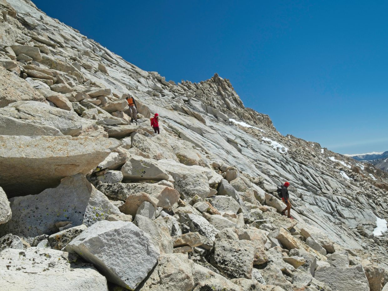
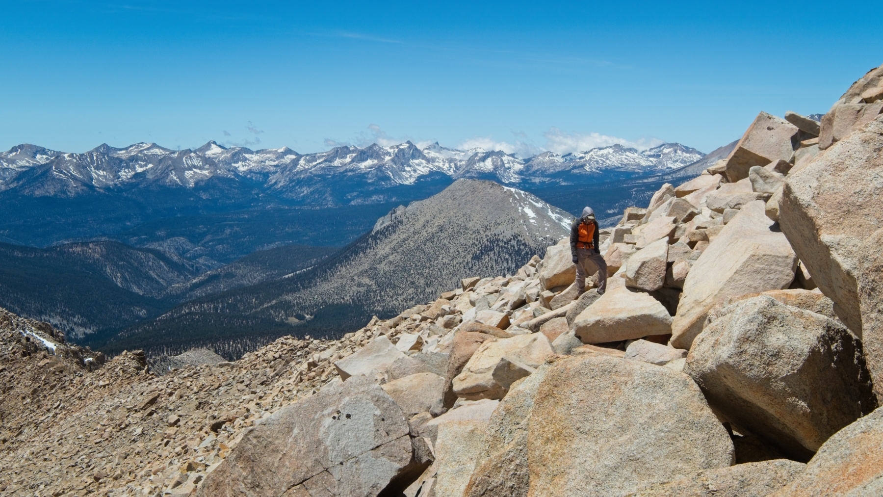
The traverse from Pickering to Newcomb proves to be the most technically challenging section of the day. From the western edge of the Pickering summit ridge, we drop down a bit on loose, crappy rocks and begin contouring along the ridgeline. The western side is just of sheer cliffs, so that’s out, and the eastern side, like many steep ridges, features a series of protruding ribs. The challenge with this kind of terrain is usually figuring out where on the next rib you should aim for. Pick the right spot and you easily scramble up and over; pick the wrong spot and you find yourself facing a sheer drop off. Sometimes the best crossing spot is obvious, or marked with a cairn, but sometimes you just have to try something and see. With four of us, we’re able to explore a few possibilities at once, which is a nice feature of traveling with a few other climbers! It’s difficult to describe our exact route, but we stay high crossing the first two ribs, and then have to drop down a few hundred feet to cross the third one. Between ribs three, four, and five we traverse across smooth granite slabs via small weaknesses, e.g., cracks and little sandy benches.


Near the low point between Pickering and Newcomb, at the fifth rib, we scramble over to a ledge that leads to a notch and a small pinnacle. On the other side of the notch is a pretty straightforward class 3 – 4 downclimb of about 10 feet. Peter scrambles down first, sans backpack, and Sarah and I hand our bags down to him and scramble down ourselves. Egor brings up the rear, joking as he climbs down that “at least we don’t have to worry about car insurance!” (Geico, we will accept any and all mountaineering-related advertising contracts.)


The remaining traverse up to Mt. Newcomb is much more straightforward and speeds by; we arrive at about 16:10. It’s potentially even colder up here than on any of the previous peaks, with the wind absolutely whipping through the summit boulders.


From the summit of Mount Newcomb, we descend about a thousand feet to a series of sandy ledges that traverse over to the foot of Mount Chamberlin. You can also stay high and scramble along the top of the ridge, but it looks incredibly exposed and difficult, so we accept the extra up and down and take the “easy route.”


Navigating through the sandy benches is a little tricky, but we just keep heading for where we know the base of a chute is located. A short class 3 scramble leads to the foot of the chute, which includes all kinds of interesting terrain. Loose talus fills the middle of the chute, as usual, but the left side is a series of slabs and ledges. I make may way over there and enjoy scrambling up the solid rock. Peter, Sarah, and Egor choose slightly different routes, but we’re all heading in the same general direction. The long day is beginning to take its toll; the banter and laughter from earlier in the day are replaced with silence now.
Just before reaching the summit I pause to pull on all my layers again. I’m glad I did too, because it’s incredibly windy atop the mountain, although it comes in bursts separated by long calm moments. My watch reads 18:10 as we settle in to sign the register and eat a few snacks. A bank of clouds is creeping over the Great Western Divide, which looks incredible from this high vantage point.

To begin the descent, we walk southwest across the summit plateau through the fierce wind. My jacket flaps violently around me and I stuff my hands into my pockets to keep them warm. A few particularly strong gusts redirect my momentum mid-leap between rocks, which is a strangely fun way to travel – really keeps you on your toes!
Once we descend a bit below the summit ridge, the wind dies down and we enjoy a few thousand feet of foot-skiing through the soft sand. It might be a pain while climbing, but it’s truly a joy to walk through sand on the way down.
Peter’s figured out the optimal path back to camp, so we all make for a forested plateau below. At the foot of Mount Chamberlin, we stop to empty sand from our shoes and pull out trekking poles, though they’re not really needed for the leisurely stroll ahead. I enjoy the walk in silence, too tired to chat with the rest of the group. As the sun sets, Mount Guyot catches some gorgeous alpenglow!
The sky remains light until we reach the PCT (and pass a couple more of those big rabbits we saw this morning). By the time we reach camp (at 20:40), however, the last light has faded from the sky. I’m pleasantly surprised to find that the temperature at our Rock Creek campsite still isn’t as frigid as predicted. I guess those PCT hikers’ forecast was wrong after all.
Return Journey
Monday, 30 May 2022 | 13.7 mi | +2400 / -2000 ft | View on Map
Despite yesterday’s 14-hour mountain climbing adventure, I wake up with the sun this morning at 5:15 AM. A barely-frozen puddle on the trail hints that the temperature has dipped below freezing, but it doesn’t feel too bad to me! I enjoy one last pot of hot oatmeal on the trail and then pack up my gear. On the way out of camp I say goodbye to Peter, Sarah, and Egor and get their contact information. I really enjoyed climbing with them, so hopefully we can do some more peaks together in the future!
The hike back to Horseshoe Meadows begins reasonably well. The switchbacks up and out of Rock Creek Canyon are tough, but I enjoy the flatter stroll along the edge of the Siberian Outpost. PCT hikers begin streaming by a few hours later, hiking north from wherever they camped last night.
I do not particularly enjoy the long, sandy climb back up to Chicken Spring Lake; it feels like it drags on for ages today, and my body is tired from Saturday’s and Sunday’s efforts. I don’t stop to photograph the lake this time since I know the pass is just around the corner. Instead, I plop down on a rock overlooking Horseshoe Meadow and rest for a while.
Descending the thousand feet from Cottonwood Pass wears me out almost as much as the ten-mile climb from Rock Creek to the pass. I meet a few day hikers on their way up and a few thru hikers returning to the PCT, but its otherwise a pretty quiet walk back to the trailhead. I reach the car at about 12:30, and change into some clean clothes: shorts, a t-shirt, and sandals. It’s nice and warm for a change!
Craig Barlow 6 July 2022
Cool, that you got to meet Peter and Sarah, I’ve seen their names on peakbagger, but haven’t run into them yet. Nice report!
Andrew 9 July 2022 — Post Author
Thanks!
Robert Luher 19 October 2023
Thanks for the pictures and words. They will help greatly when I hike those peaks next season.