This post roughly covers the third Sierra High Route section which Roper names “Lake Country”; additional posts detail my journey along the rest of the high route.
Trip Planning
This trip report details part of a longer hike along the Sierra High Route. See Cirque (2) for the beginning of the trip, complete with trip planning details.
Brown Bear Lake to Cotton Lake
5 August 2018 | 15.3 mi | +5100 / -5500 ft | View on Map
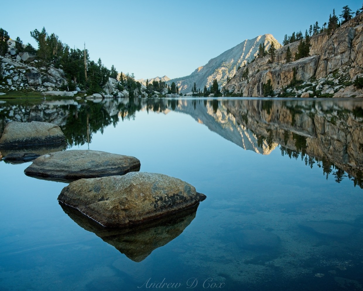
Today marks my sixth morning on this Sierra High Route adventure; I’ve settled into a groove and, other than yesterday’s smoky air, am enjoying exploring the trailless wilderness. Today is probably the coldest morning I’ve experienced so far, so I’m extra grateful for a hot pot of oatmeal. After eating and packing up, I set off down the valley below Teddy Bear Lake. A short while later, I reach the Lake Italy Trail and follow it northeast toward the lake for which it is named. Roper (the author of The Sierra High Route) describes Lake Italy with the phrases like “not particularly interesting,” “fundamentally ugly,” and “drab,” but, upon reaching the large body of water, I have to disagree. Soft green grass lines much of the shoreline, and numerous granite peaks surround the lake, many of them reflected in the smooth, glassy surface. Of course, I have the advantage of the lovely morning light to highlight every texture and color; perhaps Roper visited on a day like I experienced yesterday with smoke and less pleasant lighting. In any case, Lake Italy is certainly not ugly!
Despite his misjudgment of the lake’s beauty, Roper’s instructions to walk around the northern side of the lake is sound. I’m happy to stroll across meadows and avoid the steep talus slopes that drop precipitously into the lake on the opposite shore. Toward the eastern end of the lake, the grassy shores give way to tiny, sandy coves with a few footprints that look like they might belong to a mountain lion or a wolf!
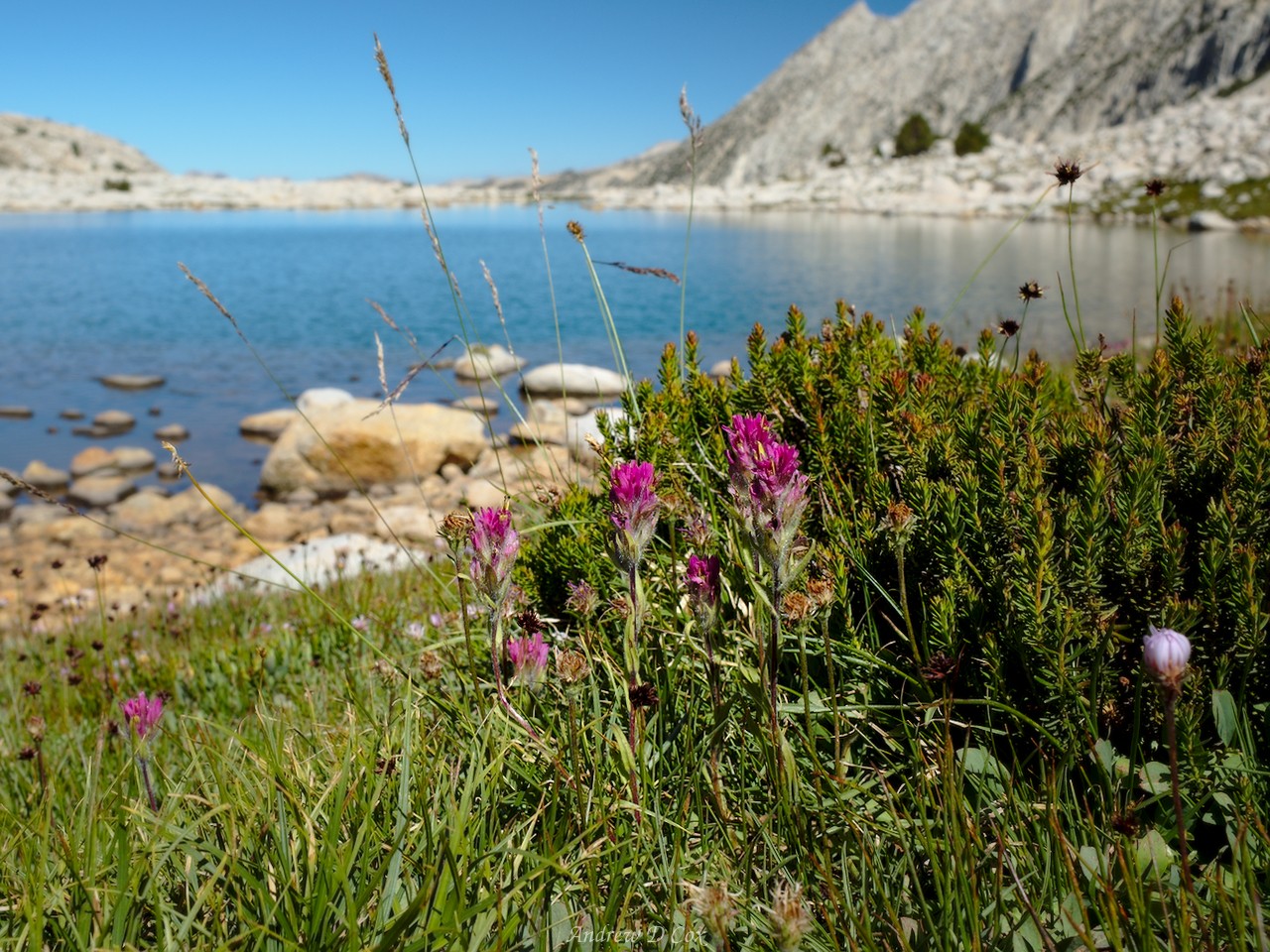
At the top of the lake I turn northward, hike past Toe Lake, and work up grassy slopes toward Gabbot Pass. Wildflowers poke up between the grass, adding bright splashes of violet, pink, blue, red, and yellow to the otherwise green surroundings. While the ascent to Gabbot Pass requires absolutely no technical skill, it’s certainly not easy; I huff and puff all the way to the top, pausing many times to catch my breath.
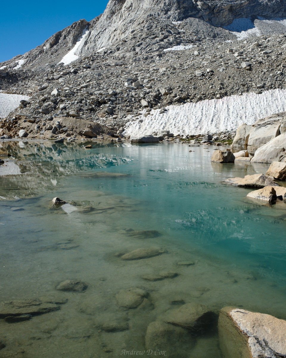
On the northern side of the pass, I find long snowfields leading down to several small ponds. The sun still hasn’t made it all the way over the Sierra crest, so parts of the valley remain shaded. Working my way down to the snow, I’m disappointed to discover that it is solid ice… this morning’s cold temperatures were not isolated to my campsite, it seems. Rather than risk slipping and falling down the icy slope, I begrudgingly clamber through the talus beside the snow, at least until the snowfield levels out a bit. I ditch the rock-hopping as soon as I feel safe navigating across the snow and then shuffle along the icy surface to the first rock-bound tarn. A thin layer of ice floats on the electric blue water, a further indication that it really was quite cold last night!
Beyond the tarn, I’m forced to continue hopping between boulders. Here’s the thing about rock-hopping: it’s really not that difficult and it can even be quite fun once you get into a grove. You just have to commit to focusing on your foot and body placement to avoid falling. It certainly requires much more focus than walking down a smooth, packed dirt trail. Navigating the talus can be difficult when the rocks are loose or the slope is steep, but much of the terrain here is stable and gently sloped.
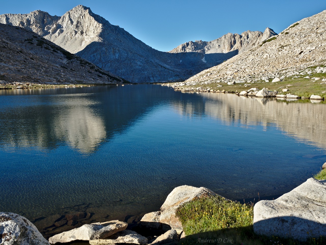
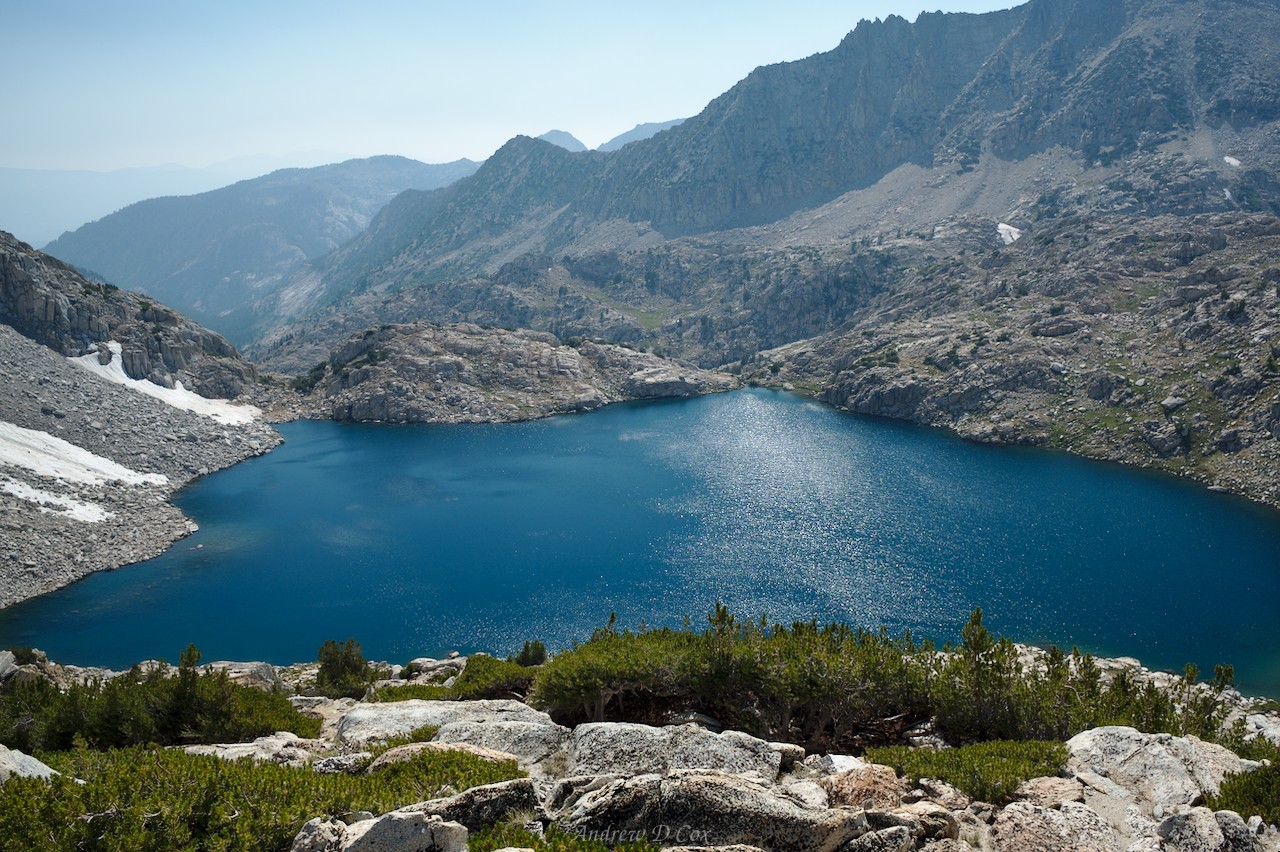
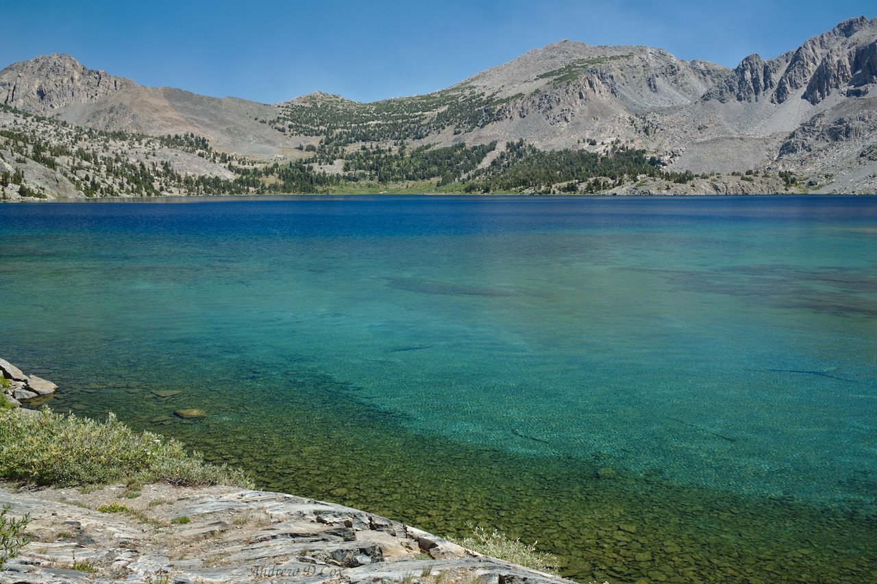
I soon find myself standing on a ridge looking down on the highest of the Mills Creek Lakes, one of several turquoise beauties encircled by grass and silver granite. Roper clearly indicates the easiest route forward in his guide, so I follow his advice and turn away from the enchanting waters for a few minutes to scramble down the opposite side of the ridge.
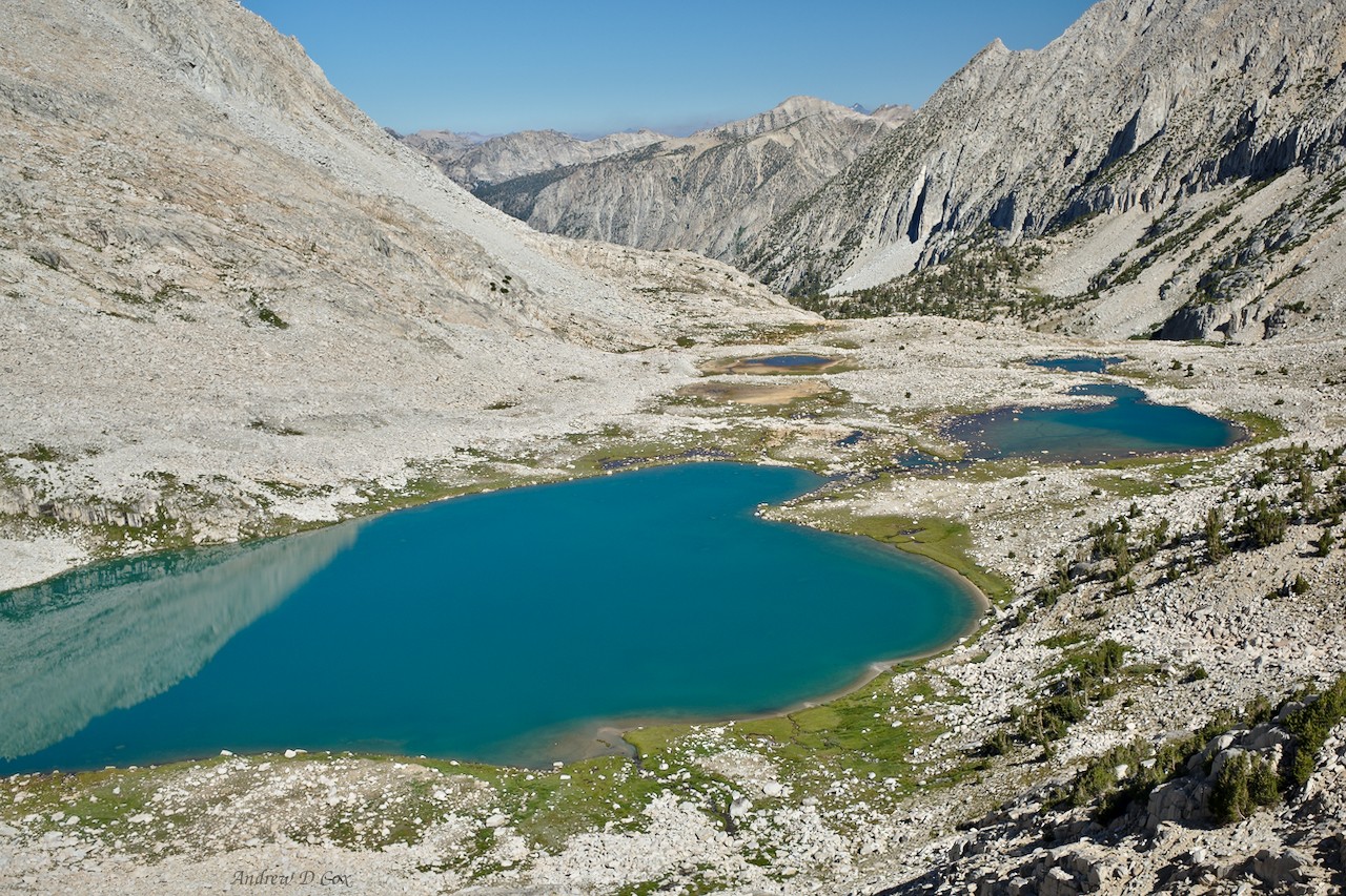
By the time I reach the shoreline, I’m ready for a break, so I kick off my shoes, find a nice boulder to sit against, and munch on a protein bar while admiring the scenery. It’s a fantastic spot to relax, what with the gorgeous lake, soft grass, and abundant wildflowers. Conspicuously missing are the blood-sucking demon mosquitoes that so frequently attack any visitors in areas like this. I’m sure grateful that they seem to have disappeared for the season; it’s so much easier to enjoy backpacking without them!
After resting, I continue down the canyon. A faint use trail winds along the shore of the lake and then disappears into a talus field before reappearing near the next lake. I follow the string of lakes to a short talus slope overlooking Lower Mills Creek Lake. After a short scramble down the rocks and a bit of bushwhacking through 6-foot-tall willows later, I reach the edge of a vast, spongy meadow surrounding Lower Mills Creek Lake. “Spongy” really is the best word for the meadow; the earth squishes and sinks beneath my feet as I follow another use trail toward the lake. Near the shore, the ground solidifies a bit.
Another use trail makes a beeline through the wet grass, so I follow it, skirting the idyllic alpine lake on the northern side.
Skirting the idyllic alpine lake, I reach the outlet creek and follow it downstream for a while. The landscape transitions from squishy grass to granite slabs and I soon lose the trail amongst the rock and an abundance of fallen pine trees. However, there’s only one direction to go from here: downhill. Path-finding proves slightly more difficult than I first expected as the slope grows increasingly steep, but I’m able to find enough ramps along the steep hillside to reach a small pond at the bottom.
Roper’s instructions from this point are terribly unhelpful and the path he references is very difficult to follow. As with most faint paths, I find that the easiest course of action is to ignore the path where it exists and follow the terrain. Even this task is difficult, however, due to the excessive number of fallen trees. Dense undergrowth and scattered boulders further obscure routes down the slope. I make poor route decisions multiple times and am forced to backtrack up the steep slope and try other paths; in short, this descent into the Second Recess is not enjoyable.
After what feels like hours of struggling through thick brush, loose rocks, and steep slopes, I reach the floor of the Second Recess, one of several hanging valleys above Mono Creek Canyon. It’s a relief to walk along level ground again and I’m a little surprised to find the cool, forested valley completely devoid of people. As I near the lip of the hanging valley, the number of fallen trees increases again; perhaps the struggle to reach this particular valley is just too great for the average hiker.
I descend a few hundred feet from the Second Recess to Mono Creek, push through some dense brush to a log that spans the wide creek, and cross to the other side. At first, I follow a track that seems far too faint for what ought to be a major thoroughfare; surely the dozens of alpine lakes up the valley attract hoards of hikers from the nearby trailheads at Lake Thomas Edison? It’s only later when I reach a truly well-trodden path that I realize I’ve been following an old use trail. A little further up the trail I reach the junction with the Laurel Lake trail and begin an uphill hike. The first few switchbacks maintain a pleasant grade, but the trail soon steepens and climbs aggressively, progressing more or less straight up the northern side of Mono Creek Canyon. Pausing back during the ascent to catch my breath, I admire views of the Second Recess across the canyon.
Although the climb from the valley floor is hot, difficult, and exposed, I’m soon rewarded with shaded forests and gorgeous meadows. The trail fades into the long grass and I revert back into cross-country hiking mode. The route before me is pretty much a straight shot up the long valley; Laurel Creek winds through the lush grasslands and is an easy guide to follow. For a while, my thoughts wander away from hiking to an incredibly intellectual pursuit: coming up with names for the friends and family of the Muffin Man, that famous character that lives on Drury Lane. Three syllables, alliteration, and a breakfast theme are the rules; I figure the whole gang is called the “Breakfast Bunch.” There’s the Pastry Pimp, the Danish Dame, the Bagel Boy, the Waffle Wench, the Donut Dude, the Grapefruit Gal, the Bacon Bro, the Strudel Siss, the Pancake Pal… and you thought backpacking was full of deep thoughts and introspection.
Eventually, I run out of characters for the Breakfast Bunch and am distracted by the breathtakingly beautiful scenery. Wildflowers line the creek where it tumbles down the slope below the unnamed peaks towering in the background. I continue along the creek for a while until reaching a steep, grassy slope that leads up toe Laurel Lake. It’s been a few hours since my last break, so I plop down beside the lake and relax for a few minutes. My feet ache and I’m hungry, so snacks and a foot soak in the cold lake are in order. I watch tiny fish dart through the water while I munch on trail mix.What do they do for food in the wintertime?

Unfortunately, my time strolling through lovely grassy meadows is over for the time being. Bighorn Pass, my next destination, looms hundreds of feet above Laurel Lake. To reach the top, I get to scramble up some of the steepest grass I’ve ever laid eyes on. At least it’s not talus! Curiously, the grass grows with a terrace-like pattern, so climbing up to the pass is almost like climbing a long flight of stairs – very, very steep stairs. I pause, panting, many times on the way up, but the ascent isn’t technically difficult, just steep. When I finally reach the top, I’m afforded a great view of the vibrantly blue Ross Finch Lake on the opposite side.
Rather than descending to the shoreline, Roper advises contouring (i.e., moving horizontally without gaining or losing much altitude) around the valley. Following his advice proves to be a fun puzzle; several outcroppings block my view of parts of the valley, so I have to choose a route and hope it continues to pan out on the other side of each outcropping. My choices turn out well, and I have a great time working between granite slabs, over small fields of talus, and even through the occasional grassy meadow high above the lake. After contouring to the opposite side of the valley from Bighorn Pass, I’m faced with a barrier of cliffs. Near the lake, they drop precipitously into the water, so there’s no working around them; I’ll have to climb over. Luckily, they’re not very tall cliffs – maybe 8-10 feet tall at most – so all I have to do is find a spot with sufficient handholds or a nice chute to scramble up. I locate just such a spot, toss my trekking poles onto the top, and then climb up.
For a little while, I make easy progress over flat, rocky terrain. However, to reach the next Sierra High Route landmark, Shout-of-Relief Pass, I have one more valley to navigate, this one with a tiny tarn nestled between the rocks at the bottom. What’s a little more route-finding at this point? I sip on electrolyte-infused water while working my way across the rocky slopes; I ran out of snacks for the day at Laurel Lake, so sugar water will have to do!
Shout-of-Relief Pass allegedly gets its name from the nice, easy terrain located on the northern side. I agree that the landscape is pleasant, but I’m not sure it warrants any shouting. Although that may just be my fatigue speaking. In contrast to the rocky terrain between Bighorn and Shout-of-Relief Passes, the landscape before me is a complex mix of endless grassy meadows, a few dozen lakes and ponds, and small rocky ridges. Large, flowing swaths of granite disrupt the green carpet in places. I decide to walk over to Cotton Lake because it should provide nice westerly views as the sun sets. I might as well choose the most beautiful spot I can to spend the rest of the evening!
The descent from Shout-of-Relief pass proves easy enough and I soon find myself amidst the lakes and ridges. I’m far too tired to dedicate much energy to exploring tonight, but I would love to come back to this spot in the future; there are so many hidden nooks and crannies! Roper notes that many different birds call this valley home, but, not being a bird enthusiast myself, I take his word for it. As I stride between the various lakes, I admire the warm evening light shining on Red and White Mountain, a distinctly striped peak comprised almost entirely of red and white slate.
After more walking than I anticipated, I reach the edge of Cotton Lake. Several other backpackers have set up their campsites nearby, so I find a spot nearby and drop my pack. I chat with two fellow Sierra High Route travelers, Terry and Stever while cooking and eating dinner. We compare notes and list our favorite (and least favorite) parts so far. It’s fun to hear their perspectives!
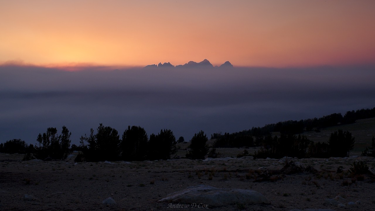
After dinner, I set up my tent, toss in my gear, and then go for a stroll around the lake to capture some photos. To the west, a thick blanket of smoke obscures the Ritter Range although the air here looks and smells pretty clean. As the sun dips lower toward the horizon, the light grows warmer and warmer. At peak color, the mountains glow red and pink, likely due to the smoke between the peaks and the sun.
Although it makes for a beautiful sight, I can’t help but worry about what the smoke means for the rest of my trip. I remember how disgusting hiking through the smoke was in Humphrey’s Basin and near the bear-named lakes yesterday; I’m not eager to spend any more time breathing smoke. From the looks of things, the valleys in and around the Ritter Range are full of smoke from the Lions fire, and that’s where I’m heading… I suppose I’ll just have to see what the conditions look like when I get closer.
Cotton Lake to the Mammoth Crest
6 August 2018 | 14.5 mi | +3600 / -3600 ft | View on Map
When I wake up in the morning, the first thing on my mind is the smoke near the Ritter Range. Has it cleared out? It’s difficult to say for sure, but the air looks much clearer than last night even if it is still definitively hazy. I quickly pack up camp, eat breakfast, and move out. It’s a beautiful morning in the Sierras – clear skies, a light breeze, and chilly air makes for perfect hiking conditions.
From Cotton Lake, I follow Roper’s instructions to descend a steep grassy slope to Izaak Walton Lake. The route instructions are oddly specific, but I understand why when I reach the lakeshore; most of the lake is surrounded by unassailable granite cliffs. Strolling around the southern shore, I can’t help but admire the glassy water reflecting the nearby cliffs and distant, sunlit peaks.

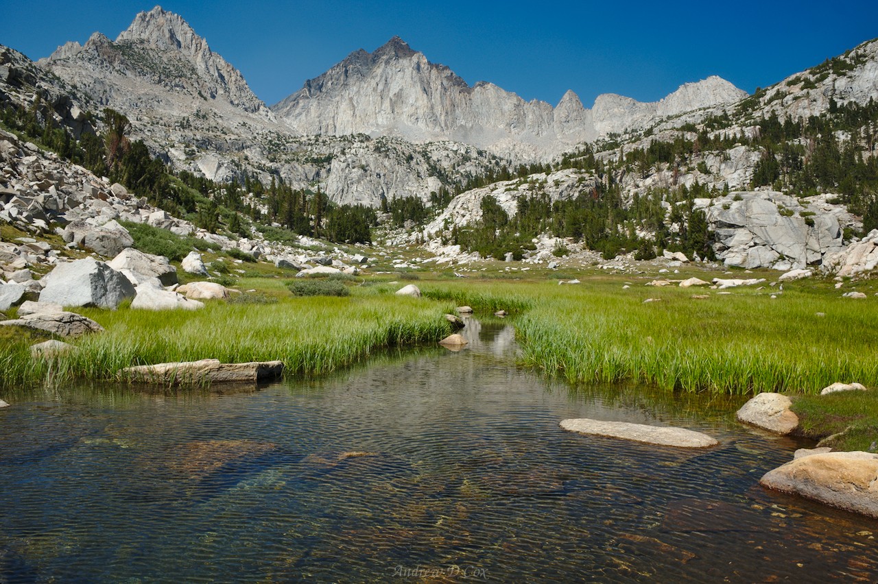
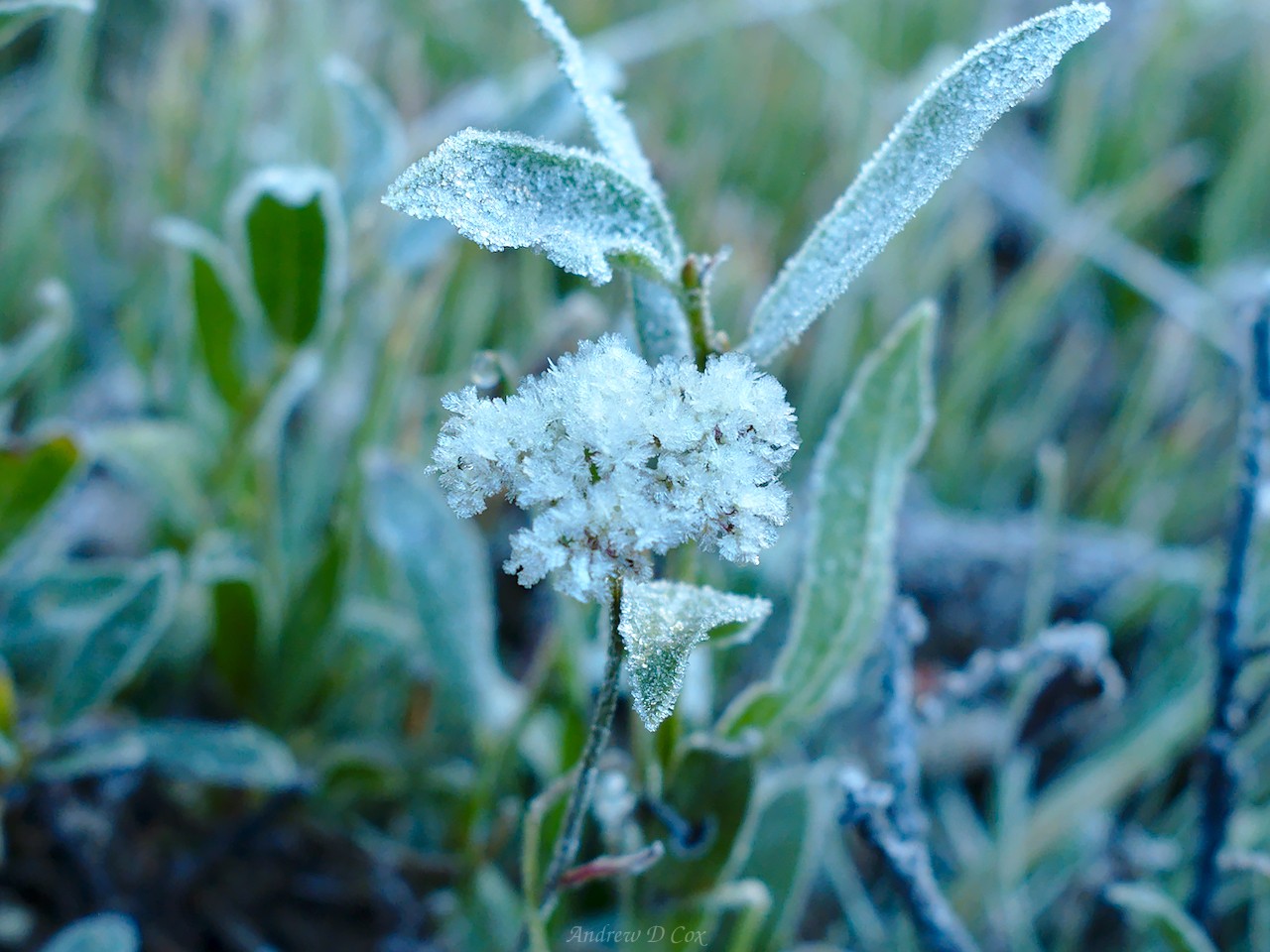
At the northern edge of Izaak Walton Lake, the terrain drops several hundred feet to Tully Hole. Finding a route to the bottom is a fun challenge; tall pines obscure my line of sight, so I get to experiment a bit, switching between various wooded ramps. Thankfully, the underbrush is light here and I tread easily between the trees on soft pine needles and granite slabs. Near the bottom of the slope, I have to fight through some 8-foot tall willows but soon reach Horse Heaven, a lush meadow nestled between tall valley walls. The sun hasn’t reached the valley floor yet, so a thick layer of frost coats the grass and wildflowers in the meadow. I crunch through the green-blue frozen foliage for a few minutes and then make my way over to the McGee Pass Trail.
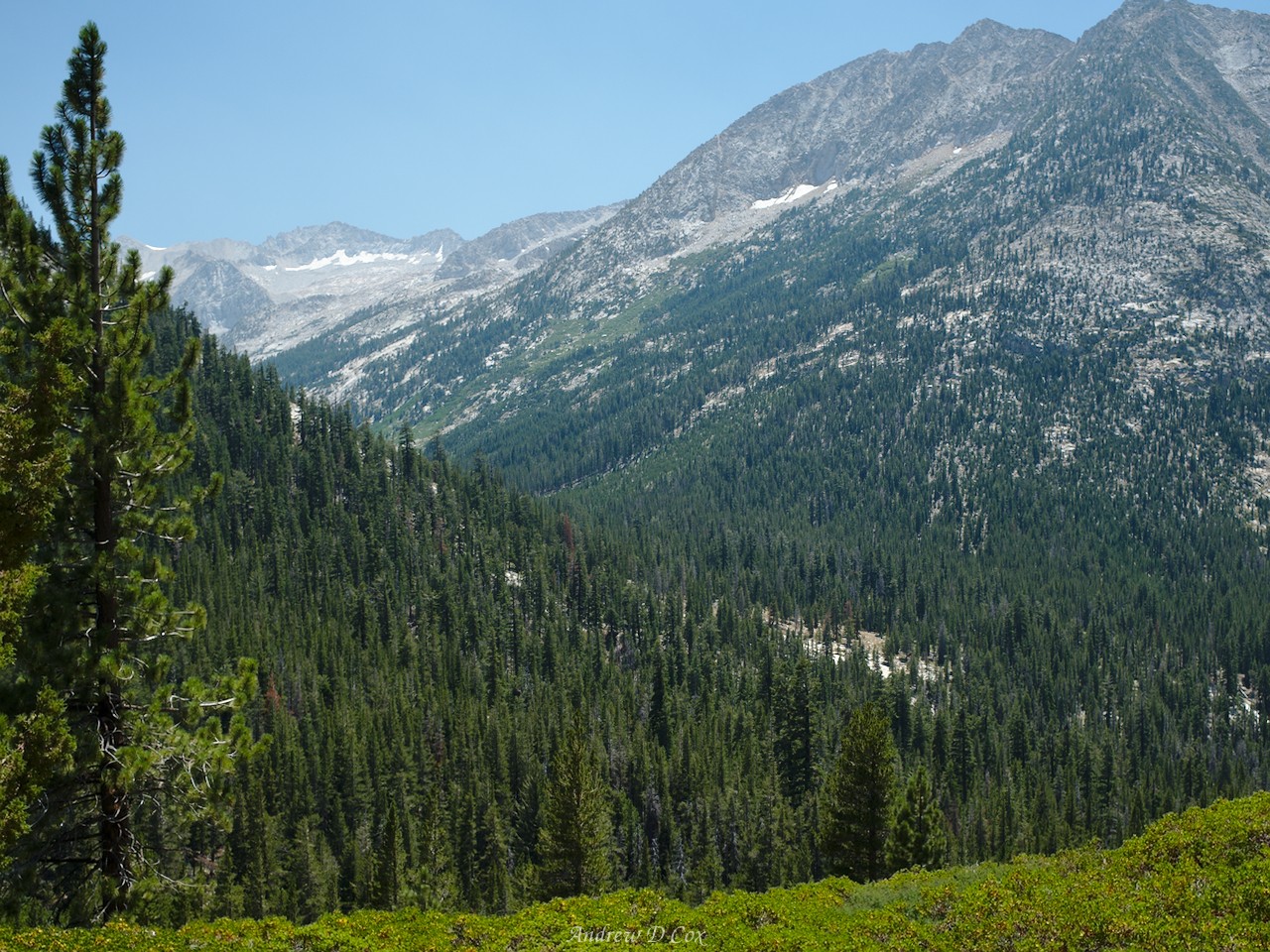
Once I reach the trail, I slip into a rhythm for a while. Compared to cross-country hiking, following a trail can be mind-numbingly simple. Crossing Fish Creek at Tuly Hole proves to be a bit of a challenge; the rocks and logs in the water are slippery and surrounded by deep water, so I opt to wade through. The wade isn’t difficult, but the water is absolutely freezing! On the opposite bank of Fish Creek, I rejoin the John Muir Trail (JMT) for the first time since Evolution Lake and begin the long climb out of Tully Hole. Some may curse the switchbacks, but I’m just glad others have done the hard work of grading and smoothing the trail; switchbacks are certainly easier than climbing straight up the slope.
As soon as I rejoin the JMT, I begin running into hikers every five or ten minutes; they’re everywhere! Since most of them are heading south and have likely hiked from Yosemite, I ask each group how the smoke has been for them. Many reply that the mornings have been clear but the afternoons have been smoky and terrible. Others claim they experienced multiple days of smoky hell; some say the smoke hasn’t been that bad. In short, there’s not much consensus. So I continue on, hiking monotonously down the JMT. This section wasn’t my favorite last year either; the mountains peaks, while impressive, lie far from the trail that winds through uniform forests of dense conifers. The large mountain lakes (Virginia and Duck Lakes) along the way do break the monotony though!
After what feels like an eternity, I reach a trail junction. Rather than descending with the JMT, I leave the famous route and climb to Duck Lake, another gorgeous alpine jewel. I pause here for lunch and a shade break after my long morning walk.
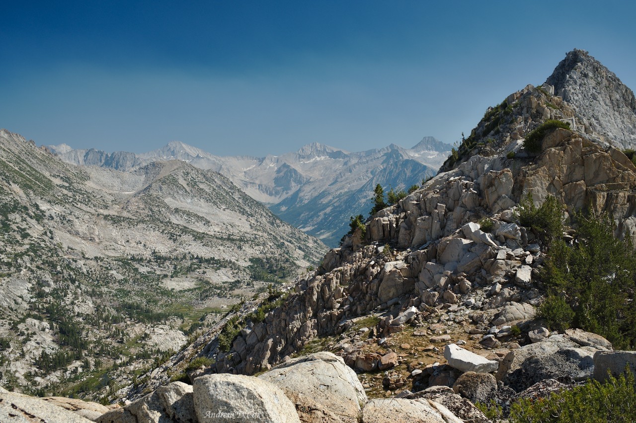
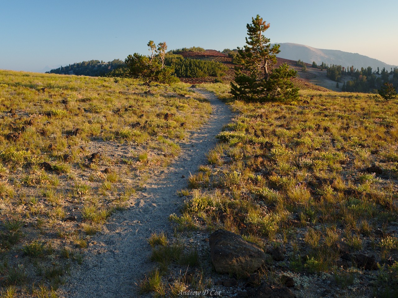
The trail climbs high above the lake to a pass on the Sierra crest suitably named Duck Pass. Here, the map depicts a trail junction at the pass with one branch leading west to Deer Lakes. However, when I reach the pass I find no such junction; not a sign, not another trail, nothing. I don’t waste too much time searching and instead just start walking in a general westerly direction. The terrain is fairly flat and is covered in small, flat rocks and thin grass. An occasional tree supplies some shade from the hot afternoon sun, but it’s generally very open. In contrast to the Sierra crest south of here, the “ridgeline” is quite wide – more of a plateau than anything else, really. I thoroughly enjoy wandering through the waving grass, free from the trail once more.
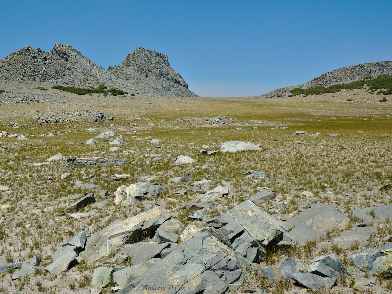
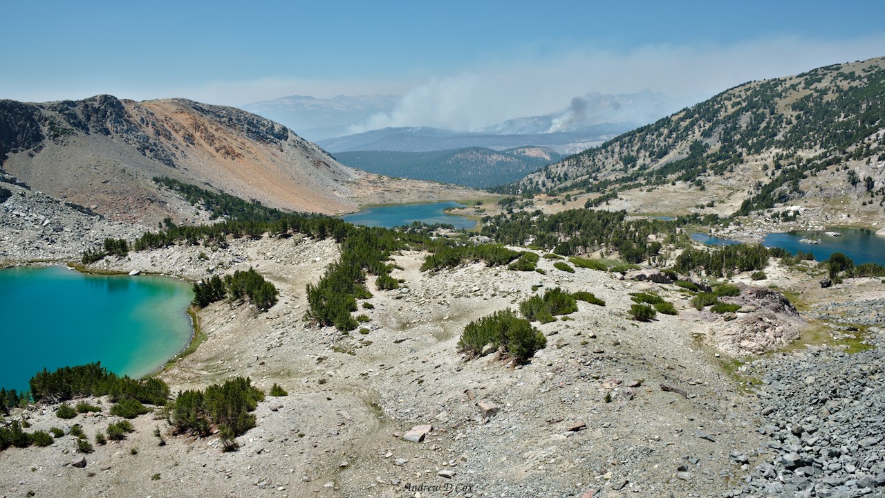
For a mile or two, I stroll across the wide-open plateau, reveling in the feeling of being on top of the world. None of the nearby peaks are tall enough to protrude above the edges of the plateau, so all I can see is sky beyond the flat expanse of grass and stone. After an hour, I reach a talus slope that drops into a basin with several gorgeous lakes. But beyond the basin, two plumes of smoke capture my attention. The smoke drifts northward, the direction I’m heading on the Sierra High Route. I’m grateful that the wind isn’t blowing the smoke toward me, but I’m very worried about what the rest of the hike will be like.
A short scramble delivers me to the base of the slope and I pick my way across the rocky landscape to the Deer Lakes. I find a stand of trees near one of the lakes and drop my pack. I’m not planning on camping here – it’s far too early to stop for the day – but a swim would be nice! Like most mountain lakes, the water is icy cold, but it feels good to dip in for a few minutes. After a very short swim, I return to the sunny shore, dry off, and spend an hour or two relaxing on the grass.
Since I still have plenty of food for today and all of tomorrow, I’m free to take my time. Rather than hike all the way to Red’s Meadow, which would be a tall order, I decide to continue to a plateau that Roper lauds for its excellent views. Along the way, I clamber up to an unnamed summit that overlooks Mammoth Lakes and provides pretty great views in every other direction as well.

In addition to views, my vantage point from the summit puts me in line-of-sight with the cell towers down in Mammoth Lakes. With the wildfires continually weighing on my mind, I do a little investigating to determine what the next few days might look like. The fires are nowhere near contained, so the smoke will continue. The winds are forecast to continue blowing in a generally northward direction, so the smoke will also continue to blow into the mountains that I’ll be hiking through. I call up the Tuolumne Meadows ranger station and learn that the air quality there is alternating between “unhealthy” and “hazardous.” (A “hazardous” air quality advisory means the air is unsafe to breathe even if you have a perfectly healthy respiratory system.) Even besides the obvious health concerns, I’m not stoked about the terrible visibility. The whole reason I’m out here is to admire the incredible views in the off-trail wilderness; there’s no point in continuing if my primary goal cannot be accomplished.

So, I make the tough decision to leave the trail at Red’s Meadow tomorrow. After calling up a few friends and family from the peak and snapping a few photos, I return to the Mammoth Crest Trail and hike northward to a gravel-covered plateau. Scattered stands of whitebark pines provide perfect windbreaks, so I find one with a good view of the Silver Divide to the south and the Ritter Range to the north and set up camp. Like yesterday evening, the Ritter Range is obscured by smoke, although a few peaks poke out above the haze.
After dinner, I spend some time wandering around the plateau. A small patch of lupine illuminated by the late evening light catches my eye. The smoke turns the light a darker shade of red than usual, and the effect on the lupine is beautiful; the violet and white blossoms are tinted rich purple and light pink. Naturally, I snap a few photos!

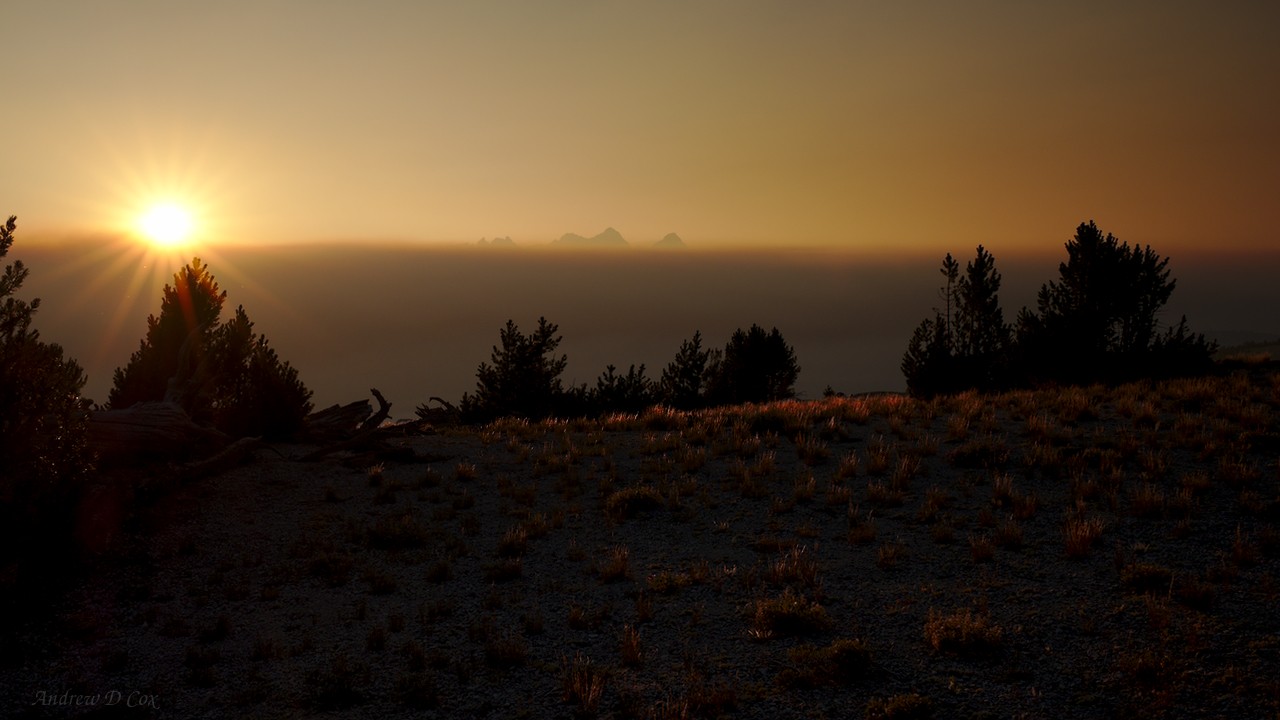
When the sun finally dips below the smoke, the Ritter Range stands out silhouetted against the colorful sky. It’s a beautiful sight, but the knowledge that the dense, fluffy clouds are comprised entirely of smoke is sobering. That’s a lot of smoke! For now, the wind continues to blow northward, for which I’m thankful; I’m enjoying the relatively clean air up here on the plateau. As dusk fades to night, I return to the tent and crawl into my warm sleeping bag. Before drifting off to sleep, I begin to smell the smoke more strongly; the winds must have shifted. To avoid breathing in the smoke, I burrow into the sleeping bag; I think I made the right choice to leave the trail tomorrow.
Mammoth Crest to Devil’s Postpile
7 August 2018 | 7 mi | +400 / -3500 ft | View on Map
When I wake in the morning, I discover that the smoke has cleared! I can see the Ritter Range and the valley below! Of course, the fires continue to burn, but it seems that the wind has shifted for the time being, blowing the smoke east rather than north. I remind myself that many JMT hikers noted this pattern of clear mornings and smoky afternoons; clear air right now is not an indication that conditions will remain so perfect. That being said, I might as well enjoy the beautiful morning while it lasts! I eat some breakfast, pack up my gear, and crunch across the gravel on the plateau to the trail.

In contrast to many of the previous mornings, I’m literally on top of the world today and the sunshine arrives quickly since there’s nothing to shadow the Sierra crest. Every blade of grass casts a shadow in the warm, shallow side light, and the colors are magnificent! The walking is easy too; I don’t have much elevation to gain or lose for now and stroll easily along the ridgeline.
After walking for a while, I reach a section of trail that winds through dark red pumice, a porous rock with such a low density that it floats in water. According to Roper, the pumice was blown here from a series of explosive volcanic eruptions in the region. The airy rock is certainly an interesting contrast to the usual granite!

Some time later, I reach the end of the lovely, flat trail. Several use trails lead downhill to another small plateau to the east. Below that plateau, the ridge drops sharply to the wide saddle known as Mammoth Pass, my next destination. To reach the saddle, I get to “surf” down a steep slope of loose gravel and dirt. Descending is fun and easy, but I would hate to try to climb uphill; I imagine progress would be slow and frustrating. Once at the bottom of the sandy slope, I continue along a winding trail into a dense pine forest that stretches across the saddle until reaching a trail that leads to Red’s Meadow.
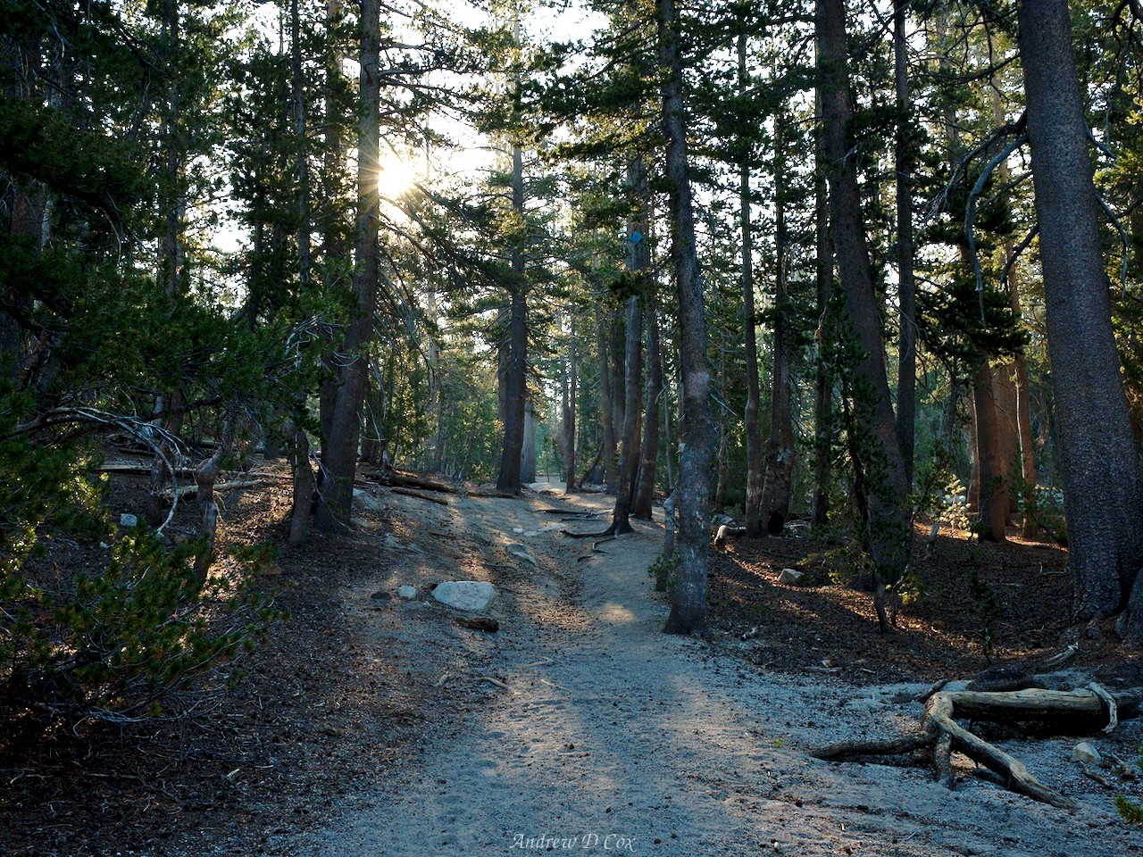
The next several hours of hiking pass slowly as I trudge through the forest and, later, endless switchbacks that descend all the way to Red’s Meadow. A good portion of the switchbacks wind through the remnants of the Rainbow Fire (1992). I’m amazed that, even 26 years later, the landscape is still pretty barren. It takes the environment a long time to bounce back from a forest fire.

By the time I reach Red’s Meadow, I’m tired and grumpy from the boring, downhill hiking. Reaching the valley also means that my hike is nearly over, which I’m not too pumped about. I stop at the restaurant and devour a plate of pancakes and eggs, and then shoulder my back one more time to finish out this section of the Sierra High Route. Another mile or two to Devil’s Postpile completes the hike!
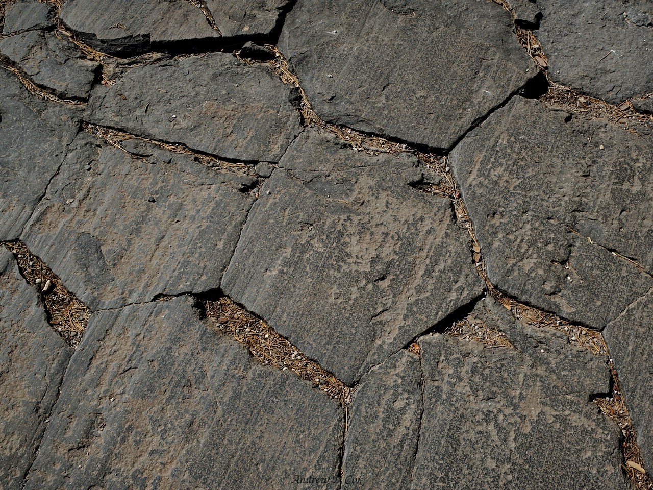
After spending a few minutes admiring the columnar basalt, I hike down to the Ranger’s station. I chat with the staff for a few minutes to get their opinion on the smoke. The air is so clean and the weather is so nice that I’m second guessing my choice to give up on finishing the route. I desperately want to keep hiking, but I’m not at all excited about hiking in the smoke for the last 75 miles. The words that finally convince me that continuing is a bad idea are, “this is the best day we’ve had in weeks!” The forecast calls for more dry weather, so it’s unlikely that the smoke will lighten. With much regret, I board the bus and say goodbye to the Sierra High Route for now.
The next day, I and at least a dozen other backpackers ride the ESTA bus north toward Reno. Many of them are hiking the John Muir Trail or the Pacific Crest Trail, but they’re all on the bus for the same reason as me: we’ve all decided to leave the trail due to the smoke. I think all of us feel a little guilty to be leaving; it feels like giving up. But we take comfort in the company and remind ourselves that we’re out in the wilderness to experience awe and beauty, not to cough and choke and stare at walls of haze. At some later time, we’ll return to the Sierras and finish what we’ve begun.
Until then, happy trails!
Use the links below to read about other sections of the Sierra High Route