This short hike to the summit of Mount Lawlor traverses some rugged terrain off the main, well-traveled path. It’s a great sunset workout, particularly in the cooler months!
Trip Planning
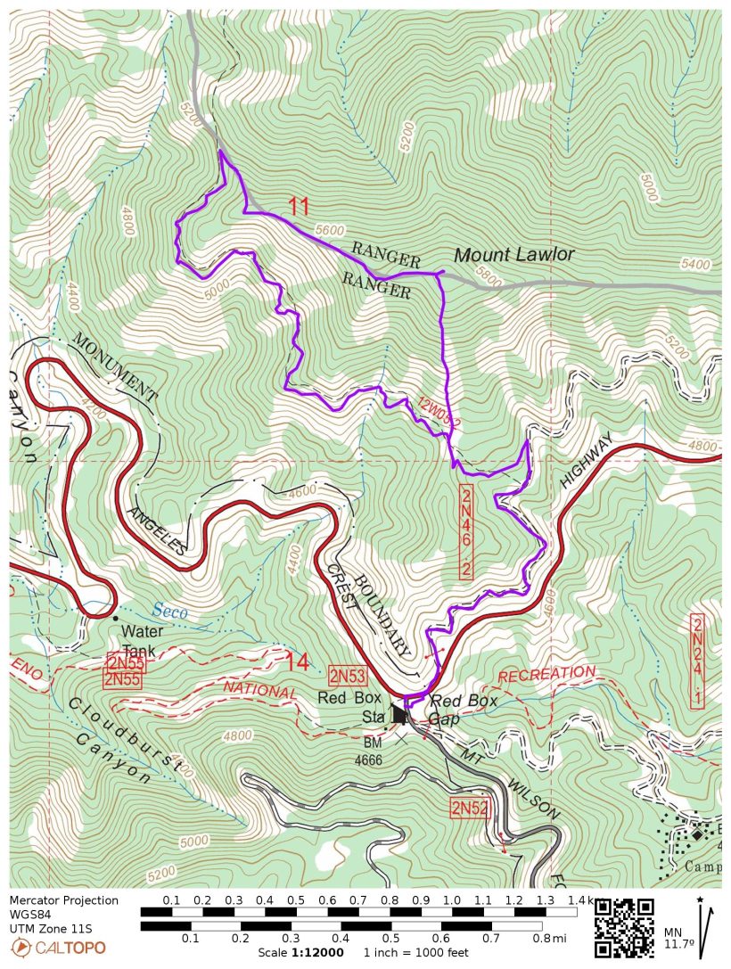
Specs: 4.6 mi | +/- 1300 ft
Difficulty: Class 1+ (a steep climb up the south face and a tiny bit of scrambling on the west ridge) [learn more]
Location: Angeles National Forest | Home of the Kizh, Tongva, and Fernandeño Tataviam peoples | View on Map
Route: Begin at the Red Box Picnic Area. Follow the wide path / fire road that begins across the street and winds up into the mountains. About 1.15 miles up the trail you reach a fire break that climbs steeply up to the summit; you can either follow this very direct route or continue on the trail. Whichever route you choose for the ascent, I suggest taking the trail down as the direct route is incredibly steep and fairly loose. I chose the direct ascent and then descended via the west ridge to the saddle between Mount Lawlor and Strawberry Peak. From there I followed the trail back to Red Box Gap.
Permits & Regulations: An adventure pass (or equivalent interagency pass) is required to park at the trailhead, but no other permits are needed. In the wintertime you may need chains to navigate the steep and winding mountain roads; check before you go!
An Impromptu Evening Hike
25 Feb, 2022 | 4.6 mi | +/- 1300 ft | View on Map
I was feeling bored and cooped up this afternoon so I decided to go for a hike. After grabbing a few snacks, some water, and several layers, I drove up to the Red Box Picnic Area. On the weekends, this spot can be really busy, but it’s almost entirely empty tonight. I grab my bag, pull on a light jacket (it’s in the low 40’s up here!) and begin a brisk walk up the trail. The path deviates a bit from the National Forest and USGS maps, which causes me a little confusion, but I eventually find my way to the south face of Mount Lawlor.
At a shallow saddle, the trail crosses a fire road of sorts. I say “of sorts” because it’s the steepest road I’ve ever seen and I’d be amazed to see a vehicle make it up. The “road” isn’t marked on the map, but it appears to lead directly up to the summit of Mount Lawlor some 900 feet above. My original plan was to follow the trail to the summit; it’s a much shallower grade but is also several miles longer. The steep road looks manageable to me, so I decide to give it a try.

The route proves pretty difficult and I would not suggest it to anyone that isn’t confident on steep and loose terrain. I rely on careful foot placement and route finding to avoid slipping and stop frequently to give my burning calves a break.
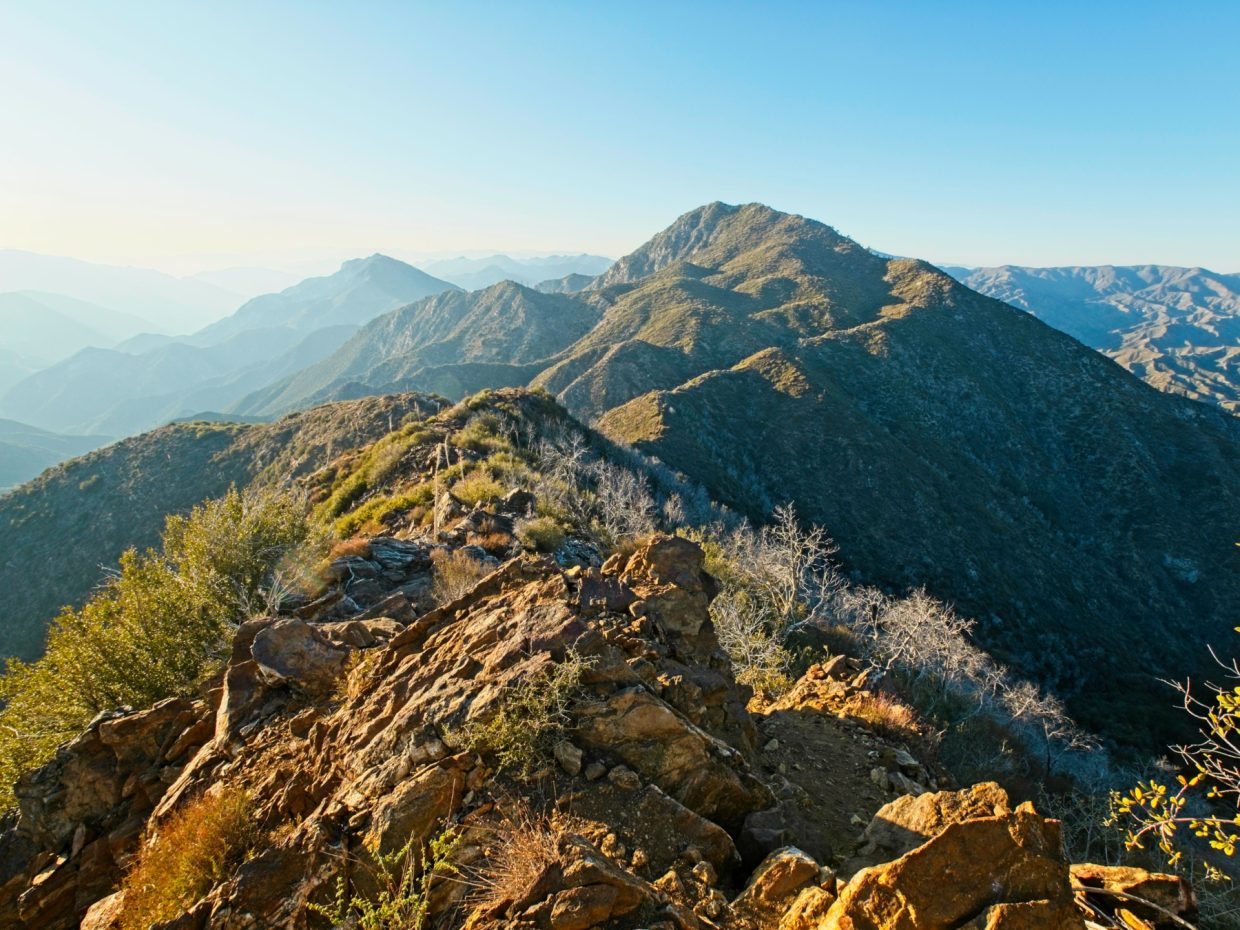
When I reach the summit a little while later, I am thoroughly underwhelmed. A wide fire break cuts across the ridge, exposing a jumble of rocks and mud. There’s not even a summit sign! So I don’t stay long. After a short break to catch my breath and drink some water I begin down the west ridge of Mount Lawlor. The path is faint and wonderfully rugged, winding between rocky outcroppings and through dense stands of chaparral. There’s even a tiny bit of talus, a rarity for the San Gabriel Mountains!

Although the west ridge path is steeper than most trails in these mountains, it’s much less steep than the route I took up and I’m grateful for the relatively secure footing. It doesn’t take very long to reach the saddle between Mount Lawlor and Strawberry Peak, and then I’m striding down the maintained trail back toward the car. The adventurous part of the hike might be over, but I thoroughly enjoy the warm evening light! By the time I reach the steep, south-face route again, the sun has sunk to just above the western ridges.
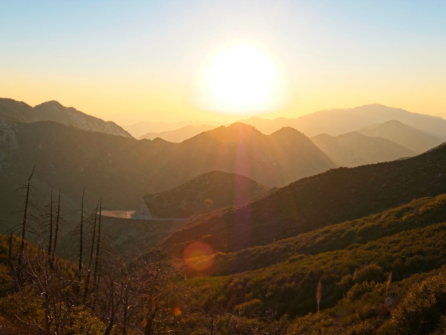
The rest of the hike descends on the east side of a ridge, now completely shaded. I pull on my puffy, stuff my hands in my pockets, and hurry back to the car. It’s been a short hike – just under two hours – but the perfect end to the afternoon.