This walk to Gobbler’s Knob is by no means a spectacular hike. There’s not even a trail, just a road meant for OHVs. On the other hand, if you visit in the “off season,” particularly if the weather is marginal and the Sheep Creek Truck Trail is impassible for the OHVs (deep snow, recent heavy rains), you can have it all to yourself. I enjoyed this hike with some snow, particularly when I got to the top and was treated to views of the snow-covered northeast aspects of the San Gabriel’s tallest peaks.
Trip Planning
Specs: 5.7 mi | +/- 1900 ft
Difficulty: Class 1 [learn more]
Location: San Bernardino National Forest, California | Home of Serrano and Gabrielino peoples | View on Map
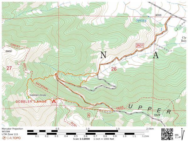
Route: If you have a high-clearance vehicle, you can drive almost all the way to the summit (conditions permitting). I parked near the paved road and hoofed it up to the summit, following the (dry) creek rather than the road switchbacks; see the map below.
Permits & Regulations: No permits are required to day hike in the national forest, though you should display a California Adventure Pass if you park here (to be safe).
Resources: There is no official trailhead here, so resources are scant. Try searches for “Sheep Creek Truck Trail” for related information about OHV travel on the road but don’t mind the comments about washouts if you’ll be traveling on foot.
Quiet Winter Stroll
24 Feb 2024 | 5.7 mi | +/- 1900 ft | View on Map
I pull up to the Sheep Creek Truck Trail mid-morning after struggling through a surprising amount of traffic on I-15. Thankfully, the lines of cars are a few ridges away and it’s blissfully quiet out here. I’m in the mood for a walk, so I don’t try driving down the truck trail even though it looks completely passable. There’s a pull-out just off the paved road, so I park the car and set off on foot.


I follow the Sheep Creek Truck Trail for about a mile to where it crosses the namesake creek (dry today). Rather than following the road up several long switchbacks, I step off into the brush and start following the dry creekbed up the canyon. For a few minutes I’m convinced I’m on a very faint use trail but then it disappears and I’m bushwhacking through the desert. Unsure of where to go, I scramble up the hill to the snow-covered road. It’s a steep climb and not at all enjoyable; in retrospect, following the creekbed all the way up the canyon is a far easier route.


I follow the road to the next hairpin turn and then set off cross-country again, this time with better route finding skills. Patches of wet snow cover the ground and I try my best to avoid them and stay on the relatively firm, dry ground. Partway up the hill I step across the Pacific Crest Trail, which is completely covered in snow here. There are no signs of traffic in the snow, but it’s still quite early for PCT hikers; they’ll be out in a few months.
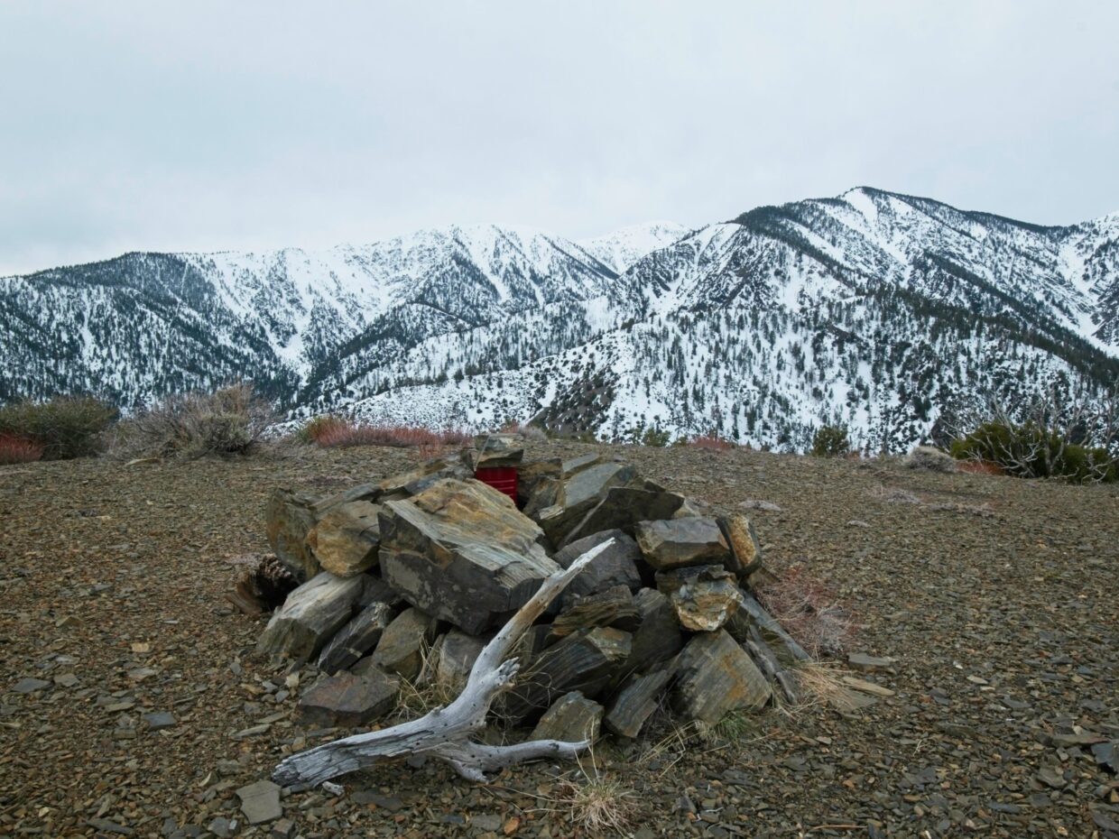
The final push to the summit of Gobbler’s Knob is almost entirely covered in snow, some of it firm but not quite icy, so I don’t have to break out the microspikes. Up on top I find a small cairn and a well-protected summit register. The views of snow-covered Mt San Antonio are very nice and I regret not bringing a telephoto lens to zoom in on the snowy ridges.


After a short break on the summit, I head over to the east ridge and descend back to the truck trail. The snow on the road is very wet by now and the water soaks through my shoes as I slip and slide down the road. Once I reach the hairpin turn, I give the Sheep Creek canyon another try, this time staying closer to the creekbed, and am able to find my way down the wash without any trouble.


And then I’m back on the truck trail, just a mile from my car! While I’m walking back, a few off-road vehicles zoom past me, blaring music and drifting around corners. I wonder if they’ll make it up the snow (there weren’t any tire tracks up there) and I think they must have because they don’t come roaring back down the road. I don’t see any other people on the walk back.