A little over a month ago, Maddie and I attempted a Birch Mountain summit. It wasn’t in the cards that day, unfortunately (though the skiing was wonderful!), and we vowed to come back and try again. We even put it on the calendar. This weekend we completed the climb! And, as if making it to the top wasn’t enough, the skiing was even better than last time.
Trip Planning
Specs: 10.3 mi | +/- 7200 ft
Difficulty: Class 1 [learn more]. Slope angles between 25 and 35 degrees, pretty wide-open terrain
Location: Inyo National Forest, California | Home of Western Shoshone, Eastern Mono/Monache and Northern Paiute peoples | View on Map
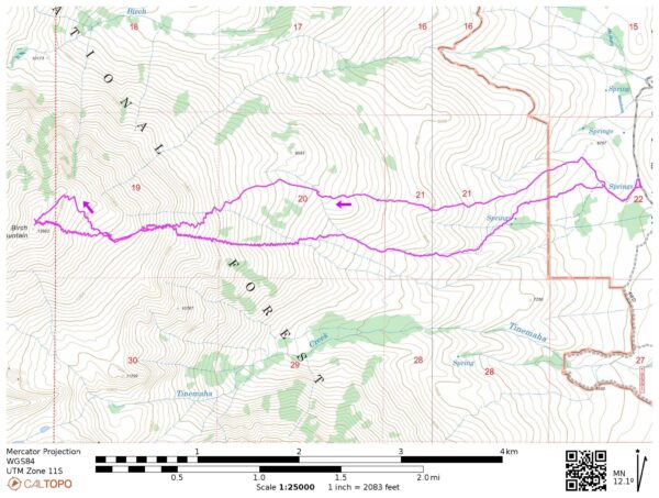
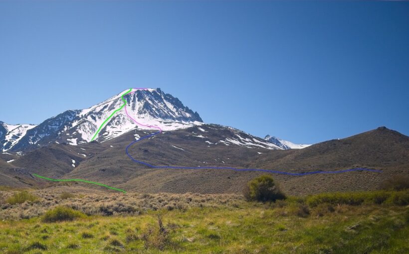
Route: We began near McMurry Meadows and followed the ridge north of Fuller Creek to the southeast face. We then hiked/skinned directly up the southeast face via a wide ridge to about 12,000 feet. From the top of the ridge we headed across the wide bowl to the summit! We followed roughly the same line on the descent but took advantage of a snow-filled creek rather than returning the the ridge north of Fuller Creek.
Permits & Regulations: No permits are required for day trips in this area, and there are no parking restrictions along the McMurry Meadows Road. Wilderness regulations do apply and, as always, make sure you leave no trace!
Resources: Greenberg and Mingori’s Backcountry Skiing California’s Eastern Sierra includes some information about this route, but there are not many other resources available. The Eastern Sierra Avalanche Center occasionally forecasts as far south as Big Pine but you’ll probably have to rely on your own assessment of the avalanche risk.
Back At Birch
Saturday, 27 Apr 2024 | 10.3 mi | +/- 7200 ft | View on Map
Maddie and I leave work early on Friday and drive up to the eastern Sierra. Much like our trip a month ago, we press through stormy weather during the drive. Winds are gusting up to 70 mph in the desert and the forecast warns of scattered snow showers and even thunder in the mountains. However, by the time we arrive at McMurry Meadows (the foot of Birch Mountain) the wind has calmed down and it’s downright peaceful outside. We park on a grassy pullout near a camper van just off the dirt road.
We sit in the car for a while, devouring a pizza and staring up at the mountain. There’s a lot less snow up there than last time, which surprises me a little. It has been warm and sunny this past week, but the mountains have had several sizeable storms during the past month; I guess it didn’t last. Maddie and I discuss route options and settle on a line that mirrors our ascent route from last month: hike up the sagebrush-covered ridge to the snow, then skin and boot up the ridge until we reach the shallower summit bowl where we can continue skinning. Mike, the resident of the van, ambles over while we’re planning to say hello and chat. We talk with him for a while, trade adventure stories, and marvel at the never-ending stream of cars on highway 395 in the valley below (trout season starts tomorrow!).
Once the sun sets, Maddie and I say goodnight to Mike and finish prepping our gear for the tour. We figure we can cover the five miles and 7200 feet of gain to the summit in about 9 hours. The forecast for tonight calls for more wind (up to 30 mph, decreasing through tomorrow) and summit temperatures of -4 F with wind chill, but it’s also supposed to be a sunny, cloudless day, so we’re gambling on soft snow by midday for our descent. Working backwards, we’ll need to start the hike at 3 AM to reach the summit at noon, so we set an alarm for 2:30 and try to sleep.
I wake up to the alarm at 2:30 and am instantly awake. Bright moonlight streams through the car windows and illuminates the mountains, which is a much more welcoming “good morning” than the pitch-black, overcast snow storms we woke up to the last time we were here. Maddie and I pack our bags and start walking at 3:15.
Just like last time, we follow the dirt road up the hill until it ends and then bushwhack our way through sagebrush, generally following the ridgeline. Frigid bursts of wind gust over the ridge, so we stay a bit below the top, hugging the leeward (south) side to avoid the cold. The bright moonlight and clear skies make for a relatively cheerful hike this morning, though the bushwhacking is long and tedious. We reach patchy snow at about 8300 feet and then, finally, reach consistent, ski-able snow at 9200 feet right as the sun is rising at 6 AM.
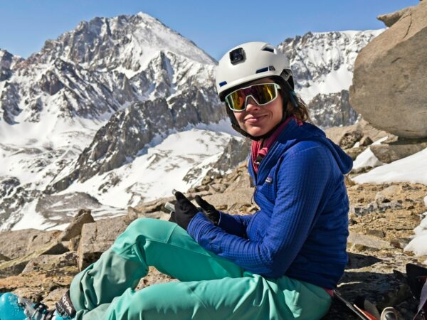
We take a break at the edge of the snow to eat some food, put on sunscreen, and transition from our hiking shoes to skis and skins. Mount Tinemaha and Split Mountain catch the morning alpenglow while we’re resting and I snap as many photos as I can before my fingers are too cold to use. Maddie begins skinning up the snow (and into the sunlight!) to stay warm while I finish fumbling around with my gear. I’m still relatively new to touring – this is only my fifth backcountry ski trip – and I don’t have my “workflow” committed to memory yet.
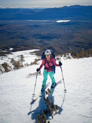
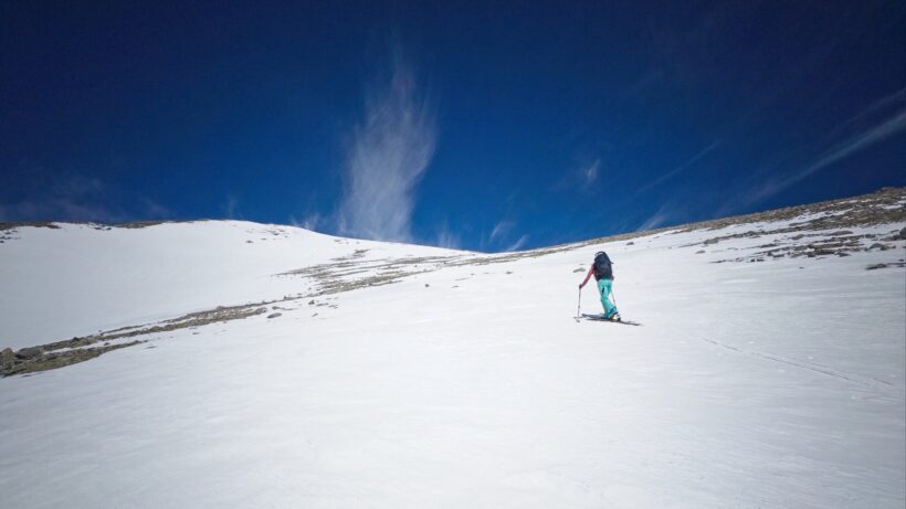
We skin up the low-angle snow, navigating between rocks and protruding bushes that were completely buried a month ago. The snow is firm and icy, the perfect conditions for ascending. With any luck it will soften up later in the day! The wind is practically calm up here, which is a welcome change from the forecast and the icy gusts we endured lower on the mountain. Of course, with little wind, consistent snow cover, and bright sun, I’m soon sweating and I shed most of my layers and open all of the vents on my pants and jacket. Spring skiing at its best!
As the slope steepens, our skins stop sticking to the icy snow and Maddie and I stop to put crampons on the skis. They work perfectly! We zig-zag up the slope, crossing below a large avalanche debris field (it slid sometime before Apr 20; I took a photo of this debris from the road last weekend) and then up onto the tree-dotted ridge. I feel fantastic, way better than last time when we were struggling through eight inches of powder up here. Maddie, on the other hand, is suffering through some ankle blisters.
Eventually the slope is too steep even for skis with crampons, so we transition to boots and crampons (9 AM, 11.5k feet). Maddie puts some moleskin on those blisters and then powers up the ridge. I struggle to keep up with her and pause every few feet to catch my breath. The snow is still firm, but it’s getting softer under the constant sun; I think we’ve timed this just right!
After 40 minutes of struggle, I’m relieved to reach the top of the ridge where Maddie is relaxing on a sandy, sunny ledge. It’s only 9:40 AM and we’re already at 12,000 feet, so we’ve gained roughly 5600 feet in 5.5 hours. We’re making great progress toward our goal to summit by noon! The steepest climbing is now behind us, but we still have another mile and 1600 feet of elevation gain, and the air is only getting thinner.
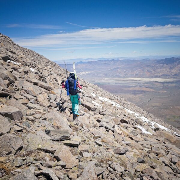
Once we’ve rested, reapplied sunscreen, and downed some more calories, we shoulder our bags and start across a few hundred feet of talus. If you’ve ever hiked across talus, you know how tedious it can be. It’s much worse in ski boots. At least we don’t have to gain any altitude here, we just hobble across the rocks to where the snow resumes and then transition back to skis, skins, and ski crampons.
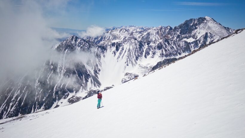
Thin, wispy clouds swirl around the distant-looking summit as we slowly work our way up the bowl. The angle isn’t particularly steep and the skins/crampons grip the snow without slipping. But the altitude makes even this moderate exertion very difficult. Maddie and I are both pausing every 30 seconds or so to breathe; sometimes it takes almost as long to catch my breath as it did to lose it in the first place. At least the views are spectacular. Mount Tinemaha and Split Mountain tower to the south (with some nice looking ski terrain, I might add!) and the snow-covered peaks stretch on as far as I can see.
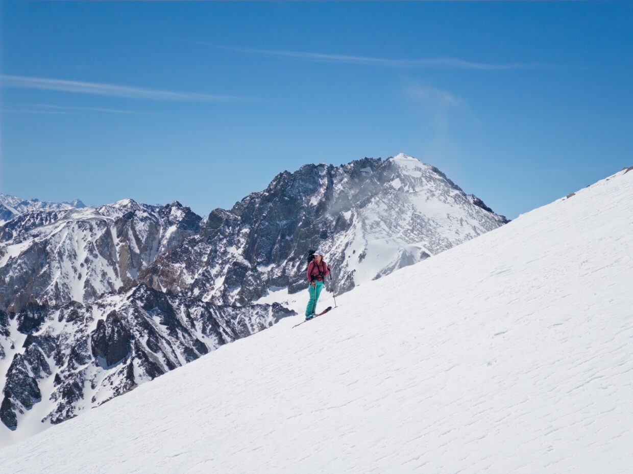
We make our way up climber’s right, sticking to the lowest angle slopes in an attempt to keep this as easy as we can. Lots of rock bands cross the snow, which makes for some interesting route finding, but we manage to find a mostly continuous line across snow. In the wide bowl to our left there is the faint outline of a ski descent; turns frozen into crusty snow. I can’t wait to join them and be done with the grueling uphill climb!
After a few hours and several sit-down breaks, Maddie and I reach the summit right at noon! We gratefully step out of our skis and plop down on the dry rocks. I retrieve the register and sign us in; it looks like we’re the second party up here this year, just a few days after the first (probably the ones that carved those turns into the snow in the bowl). We rest for a while and admire the spectacular views of snow-covered Sierra peaks.
Maddie feels really tired and is nervous about the descent, but I feel pretty ok, all things considered. We agree to ski slightly separate lines: Maddie will take the lower-angle slopes that we skinned up and I’m going to try the slightly steeper terrain in the middle of the bowl. The first couple hundred feet of the descent are uncomfortably icy and my skis are chattering around. But then I reach softer snow (low enough to be out of the “summit wind”?) and am carving turns with a massive grin on my face. Maddie wastes no time skiing over to join me and we thoroughly enjoy slicing through the corn snow.
After descending about a thousand feet, we reach the talus traverse and hurry to reach the steep ridge on the other side. We don’t want it to get too soft! The snow consistency on the ridge is patchy – icy, frozen crust in some places, and lovely, soft corn in others. Maddie leads the way and chooses a line through scattered rocks on the ridgetop. I follow her for a few turns and then decide to try my luck with the avalanche chute below. I don’t think the snow is soft enough yet for wet slides, and I don’t really want to navigate through the rocks.
Maddie and I reconverge a few hundred feet down the ridge and then enjoy several thousand feet of fantastic spring skiing! We drop into a wide, shallow gully and enjoy smooth, sweeping turns all the way down. By the time we reach the bottom (9000 ft), the snow is getting pretty sloppy, but the wet layer is thin enough that it doesn’t slow us down much. We pop out of our skis at the bottom of the snowfield and step a few feet over a berm to a snow-filled creek bed and then resume skiing. A few more short hikes and subsequent “creek runs” get us all the way down to 8000 feet – anything to avoid hiking through the sagebrush!
From here, the snow becomes too patchy to continue bothering with skiing, so we change back into hiking shoes and stuff our warm layers deep into our backpacks. It’s 14:45 – what took us 8-9 hours to ascend, we’ve descended in just over 2 hours. It takes us another 45 minutes (though it feels like a lot longer) to bushwhack our way back to the car, bringing our trip time to a little over 12 hours.
Back at the car, Maddie and I change into cleaner, more comfortable clothes and reflect on the amazing day. The weather was perfect, our time estimates were spot on, the snow was just the right firmness on the way up, and the ski down was… *chef’s kiss*. We even packed just the right amount of layers, food, and water! It’s so satisfying when things work out this well. As awesome as today was, I’m glad we made it to the summit and don’t have to come back for Birch Mountain, take 3. I might be convinced to do this again someday, but I want to ski from the car. 😛
A comparison of Birch Mountain from McMurry Meadows on Mar 16 and Apr 27 after each ski tour.
