After hiking to the northernmost pass on the Sierra High Route, I needed to get back to my car at Mammoth Pass. Under normal circumstances, I would hike a few miles to Mono Village and either take a bus or hitchhike back to Mammoth Lakes. However, this year I decided to hike back to avoid the COVID risks associated with a bus or hitchhiking ride. The long walk back has some perks: I’m excited to hike through the northern Yosemite wilderness, an area I haven’t visited before! I’m also pumped to hike the John Muir Trail (JMT) between Tuolumne Meadows and Devils Postpile because it’s the only bit I haven’t seen yet (my JMT thru hike had a bit of an alternate beginning)! This hike back traverses about 35 miles of Yosemite National Park (north to south) followed by 25 miles through Inyo National Forest, most of it on either the Pacific Crest Trail or John Muir Trail.
Trip Planning
Specs: 59.2 mi | +9600′ / -11400′ | 3.25 days, 3 nights
Difficulty: Class 1 [learn more]
Location: Yosemite National Park and Inyo National Forest | Home of the Me-Wuk, Western Mono/Monache, Eastern Mono/Monache, and Northern Paiute peoples | View on Map
Route: This is a continuation of the Sierra High Route Canyon Country and Headwaters Country routes to create a loop that begins and ends at Mammoth Pass. This final section begins at Horse Creek Pass on the northern border of Yosemite. Hike down Spiller canyon, following the creek until to you reach the Pacific Crest Trail (PCT). Follow this wilderness highway to Tuolumne Meadows, then on to Thousand Island Lake. Here, leave the PCT and follow the JMT to Devils Postpile. At Red’s Meadow, ascend the Mammoth Pass trail back to the Horseshoe Lake Trailhead.
Permits and Regulations: A wilderness permit is required for all overnight trips in Inyo National Forest and in Yosemite National Park. Because I began this hike at Mammoth Pass in Inyo N.F., I reserved a permit through their website on Recreation.gov. Note that bear canisters are required for all portions of this hike. Finally, remember to leave no trace; it is your responsibility to preserve the wilderness for others to enjoy!
Resources: A good topographic map is a must-have on these wilderness hikes, particularly when they include off-trail travel as this one does. I carried the Yosemite topographic map from National Geographic; it’s a good map, though it doesn’t show quite enough detail for my liking. I supplement the printed map with detailed USGS topos on the GaiGPS app. For information on current conditions visit the Yosemite N.P. and Inyo N.F. websites
Spiller Canyon to Glen Aulin
7 July, 2020 | 15.0 mi | +1000′ / -3800′ | View on Map
I just finished hiking the Sierra High Route! It’s been a journey several years in the making and I’m excited to finally check this goal off my list. While I may be done with the High Route, I’m not exactly done hiking… Standing here atop Horse Creek Pass, I’m about 60 miles from my car.
Steve Roper, the author of the Sierra High Route guidebook, suggests a loop route from Horse Creek Pass back to Tuolumne Meadows via a pass between Matterhorn Peak and Whorl Mountain. Originally, I was excited about this option: climb up to “Matterhorn Pass” (+800′), then descend through Matterhorn Canyon to the PCT (-2800′) before climbing up and out of Matterhorn Canyon (+1100′) and dropping back to Spiller Canyon (-1100′), a total distance of about 12.2 miles. However, after hiking rim to rim across Virginia Canyon, I’m not super stoked for the ups and downs the loop requires. I’m also running lower than I expected on sunscreen and stove fuel.
With gear limitations in mind, I decide to follow an alternate route. I’ll simply walk down Spiller Canyon, a much shorter (only 7.2 mi) and less strenuous (all downhill: -2200′) path toward Tuolumne Meadows. A brief inspection of the map verifies that there aren’t any obvious topological concerns (e.g., cliffs) so I pick up my pack and begin the long descent.
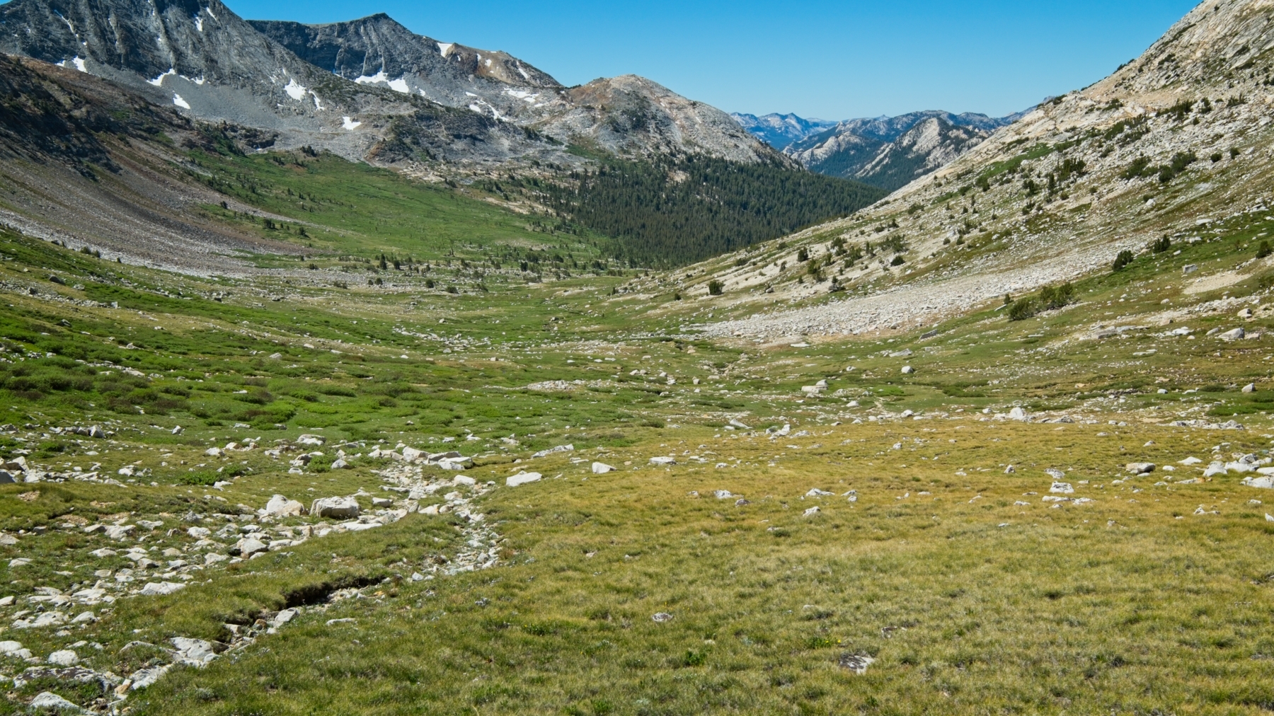
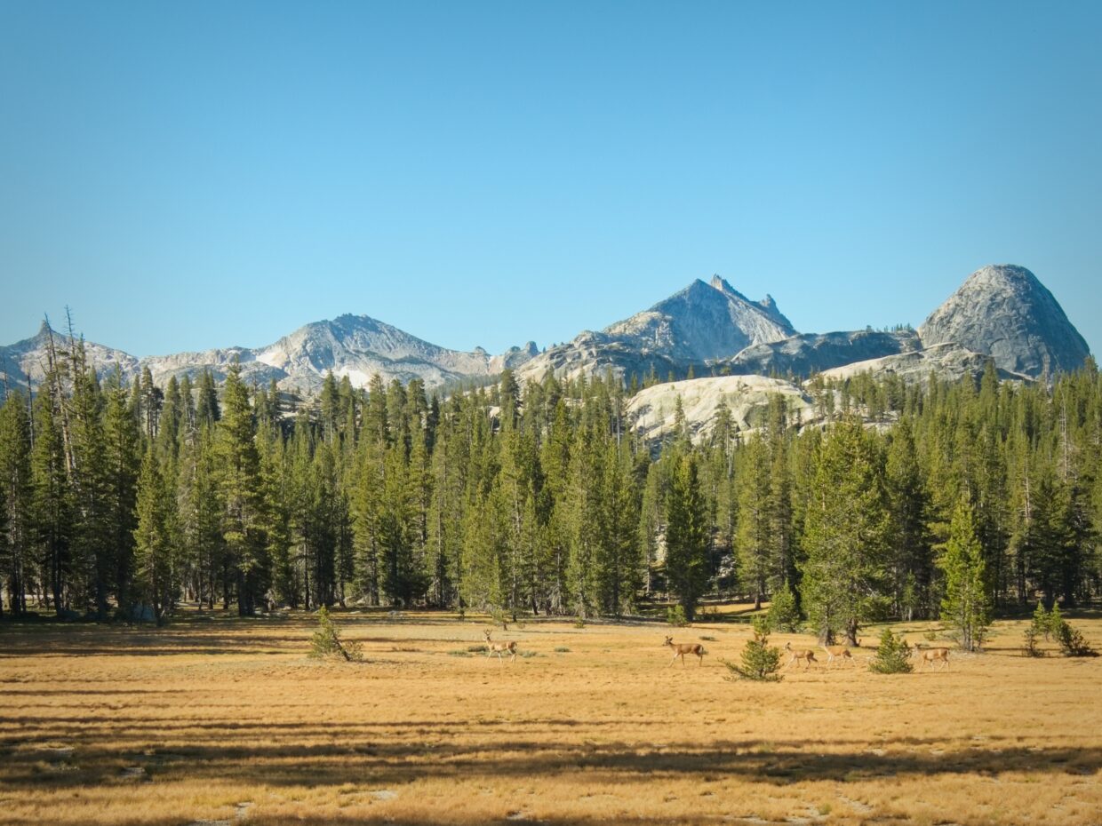
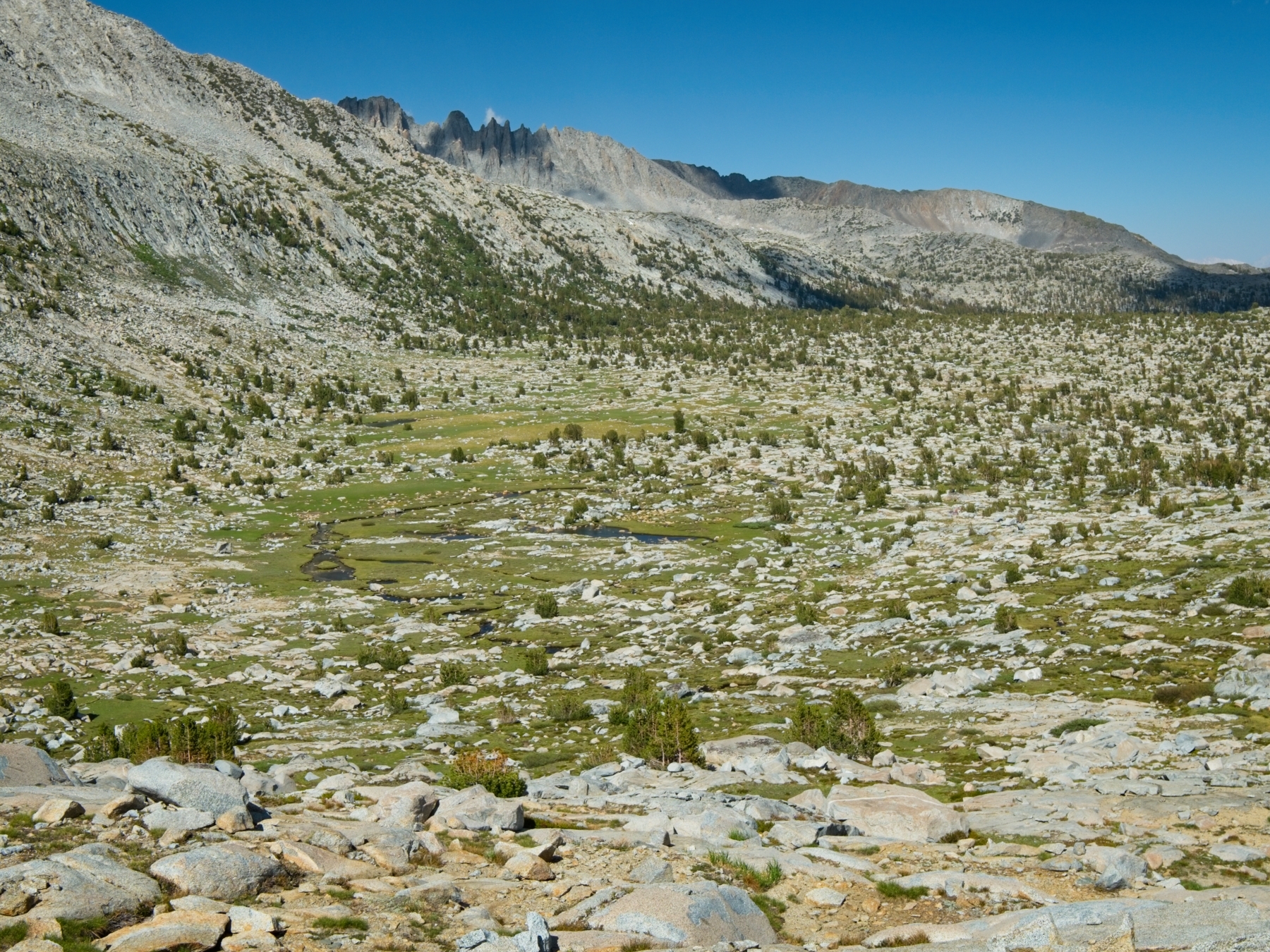
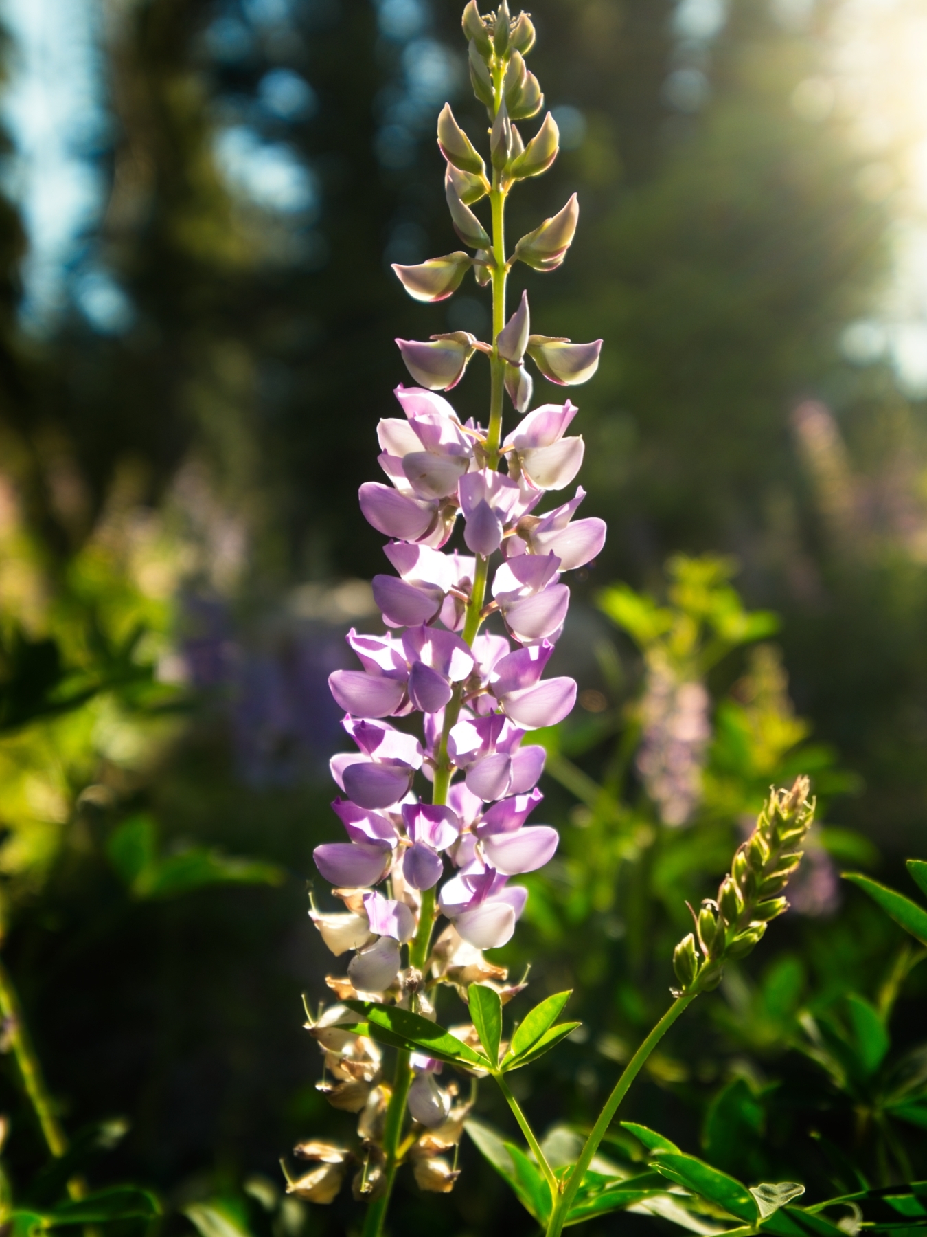
The hike down Spiller Canyon proves to be easy and very peaceful. I wander through open meadows beside the creek for miles, wondering when the grass is going to give way to brush-choked forest. The thick brush never appears, however; it’s a wonderful stroll all the way down the canyon! Along the way I spot a young buck and enjoy views of wildflowers and some interestingly shaped rocks.


Toward the very end of my final cross-country miles, the forest does thicken up a bit, but I soon encounter the Pacific Crest Trail. Although it’s only noon, I’m already ahead of my original itinerary by several miles thanks to this alternate route I’ve chosen. From here, I’ll be following either the Pacific Crest Trail (PCT) or the John Muir Trail (JMT) all the way back to Devils Postpile. Compared to cross-country hiking, walking on the PCT is a piece of cake. I no longer have to think about navigation or worry about my footing, I just walk.


In just the first mile or two on the PCT, I pass at least a dozen thru hikers. I’m surprised to see so many; I figured most would have called off their trips this year. Then again, I’m out here backpacking, so I suppose I shouldn’t be too astonished that others are as well. After completing a difficult 500′ climb in the hot afternoon sun, I enjoy another long, gentle hike through towering pines and then vast, open meadows. My goal for the evening is to reach Glen Aulin, a popular location and High Sierra Camp some 8 miles from the foot of Spiller Canyon.

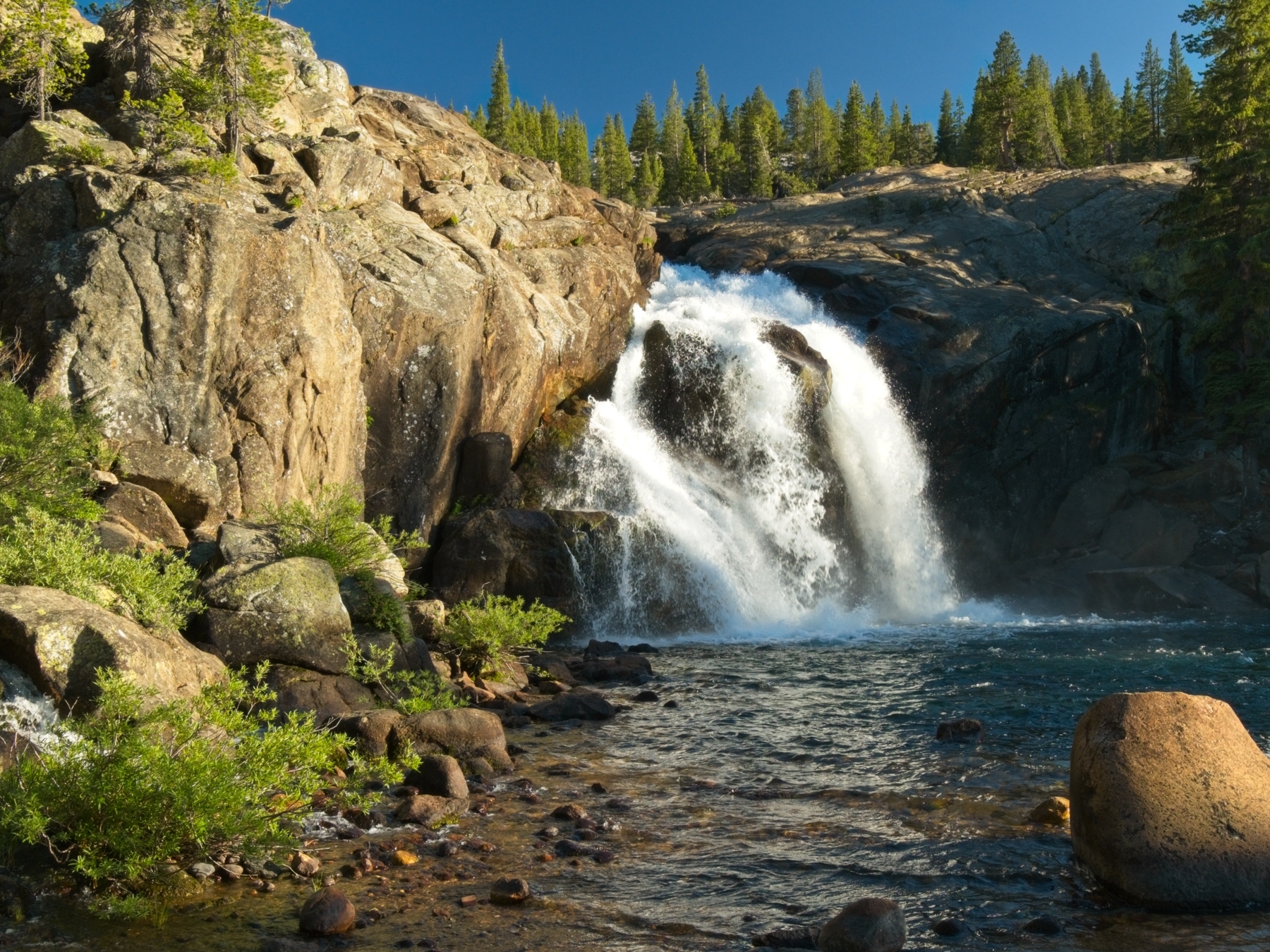
Although the hiking is about as easy as it gets, my feet and legs ache by the time I reach Glen Aulin. I spot lots of tents from the ridge-top trail as I approach but find plenty of open sites in the backcountry camping area. I choose a spot on a small, rocky peninsula, away from the mosquitoes that live near the creeks below. Once I’ve established my campsite, I enjoy a hot meal and then wander down to an incredible waterfall just below the campsites. A quick wash in the cool river water feels fantastic and I spend the rest of the evening relaxing at camp.
Glen Aulin to Donohue Pass
8 July, 2020 | 19.8 mi | +3900′ / -1300′ | View on Map
The first thing I notice in the morning is the temperature – it is cold! I heat some oatmeal for breakfast but the gas canister runs out of fuel before bringing the water to a boil, so I’m stuck with lukewarm oats… not the greatest start to the day. However, I’ll have the chance to resupply from my stash at Tuolumne Meadows later today, so I’m not too worried about running out of fuel.
As if to make up for the disappointing breakfast, the sunrise this morning is absolutely gorgeous! Warm sunlight streams through the trees as I ascend beside the tumultuous Tuolumne River; there are several waterfalls and cascades within just a few tenths of a mile of Glen Aulin! A little further up the trail I spot what appears to be a small outcropping of columnar basalt on the opposite bank of the river. I don’t venture over to check it out but make a mental note to look it up when I get home. (It is indeed basalt! The formation is known as “Little Devil’s Postpile.”)


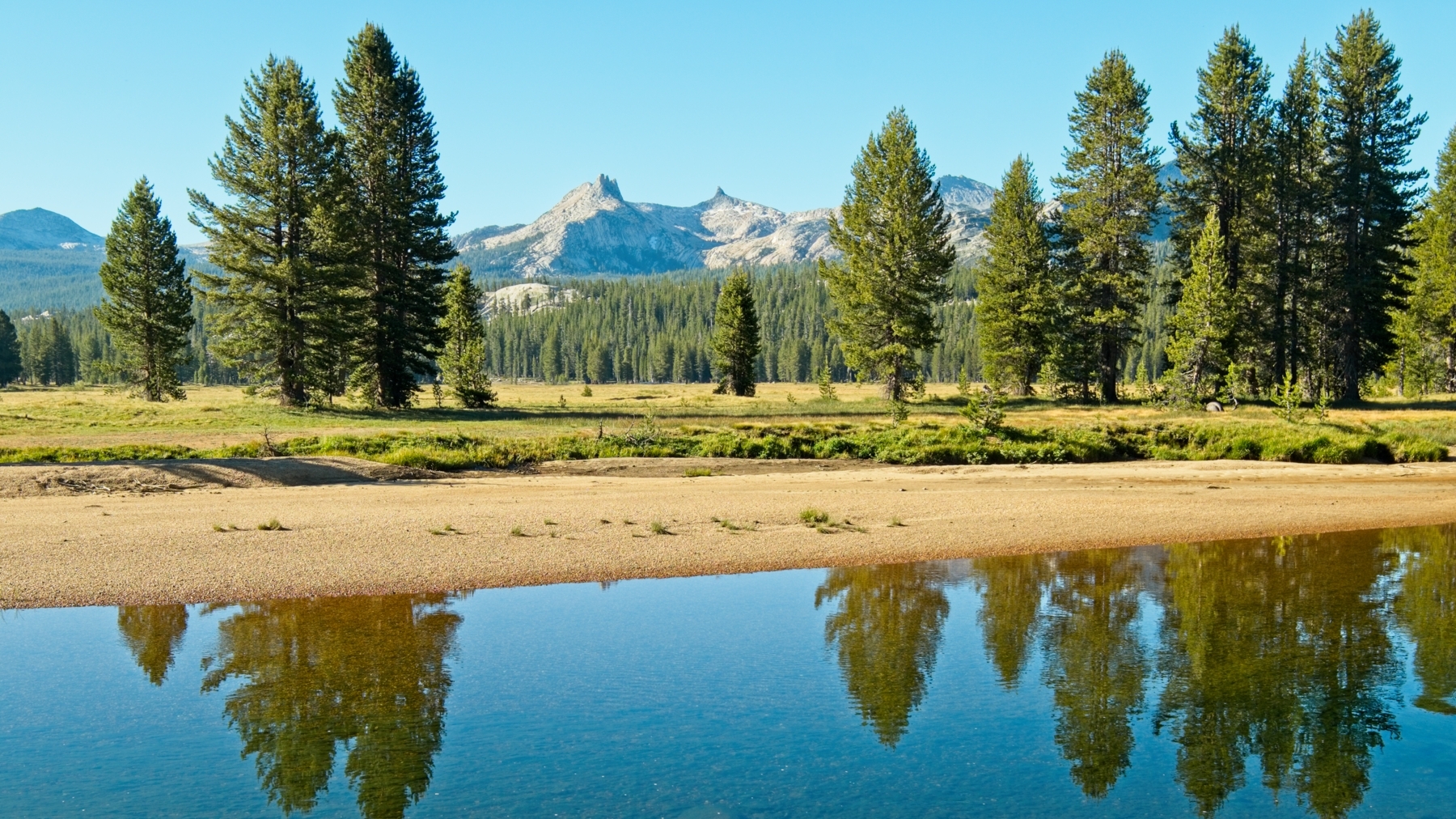
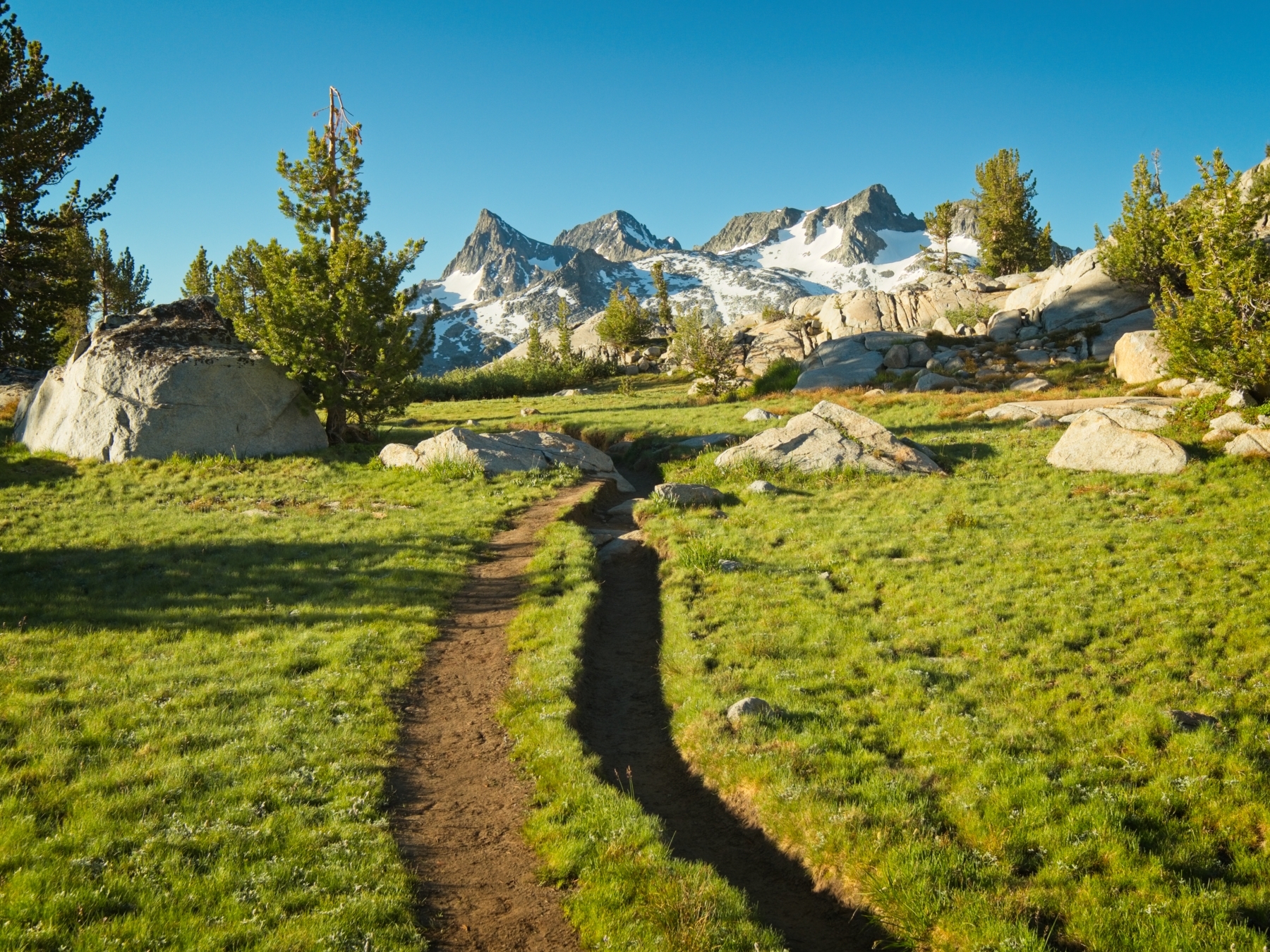
The PCT soon diverges from the river and meanders through quiet, peaceful woods for a mile before rejoining the Tuolumne River as it winds through enormous, golden meadows. It’s one of the most beautiful bits of hiking I’ve done in a while, completely tranquil and quiet.
A little further up the trail I spot some deer grazing in the meadow. As I draw closer, they notice me and begin walking away from me, but parallel to my path. I half chase, half follow them for the better part of a mile before they cross the PCT and trot off into the hills away from the trail.

When I arrive at the bear boxes outside the Tuolumne Meadows ranger station, I’m happy to meet two JMT thru hikers that are busy unpacking their own resupplies. We chat about the weather, bears, the pandemic, and the trail ahead (I’m also following the JMT from here to Devils Postpile) as we sort through gear. I finish my packing while they debate the pros and cons of packaged salmon; I’m eager to hit the trail so I wish them good luck and say goodbye.
My goal for the day is to reach the opposite side of Donohue Pass, a 12 mile hike from Tuolumne Meadows. It’s only 10 AM, so I have plenty of time, and most of those 12 miles are a flat walk through Lyell Canyon. As I walk away from Tuolumne Meadows (TM), I’m excited for these next few days. I’ve never walked the JMT between TM and Devils Postpile in its entirety!
Despite my excitement for new experiences, the long, flat walk up Lyell Canyon grows a tad boring after a few hours. My feet and legs ache, and my newly resupplied pack weighs heavily on my hips and shoulders. I try to focus on other things, like the beautiful scenery, but it’s difficult to avoid dwelling on the discomfort.


After what feels like an eternity (in reality, three hours of hiking), I glimpse snow-covered mountains ahead and know that I have a climb to do. The trail turns out to be fairly steep as it ascends toward Donohue Pass, but I welcome the change. About 1200′ of elevation gain later, the scenery really gets good! The forest gives way to alpine meadows, talus fields, and bright blue lakes. I pass several groups that are camping near the water and a large group of young PCT hikers. I’m a little surprised to find folks setting up their camps already — it’s only 3 PM — but this is just about as gorgeous a spot as you can find!


From this alpine heaven, the JMT/PCT winds through increasingly rocky terrain, gaining about 900′ to reach Donohue Pass at 11,000′. Yosemite wilderness permits carefully regulate the number of people that exit the park via this pass. I half expect to find a cabin and a ranger guarding the area, but there is not a single person up here. There is cell service, however, so I send a quick “I’m still alive” message to my family before descending the eastern side of the ridge. It’s been a long day and my legs are tired; I half trudge, half fall down the trail to the welcoming meadows below.
With Donohue Pass and nearly 20 miles behind me , I feel no need to continue past the meadows. It doesn’t take too long to find a campsite and set up my tent. I take some time to stretch as well; it’s bound to alleviate some soreness tomorrow! The fuel canister I picked up from my resupply (the same canister as I began this hike with) feels pretty light to me, so I cold soak my couscous dinner; I’d rather have a hot breakfast tomorrow than a hot meal tonight. I lie down on a sunny rock and soak up the warm evening light while I wait for the food to rehydrate. Mosquitoes buzz around me, but I’m prepared with a head net and bug spray. They’re really not too bad… I suppose once you’ve had a truly horrible mosquito experience, everything else feels manageable. Nevertheless, I don’t sit outside for long after dinner, opting instead to relax for the rest of the evening in the cozy confines of the tent.
Donohue Pass to Minaret Creek
9 July, 2020 | 17.7 mi | +2700′ / -5100′ | View on Map
I hit the trail bright and early to enjoy the beautiful light, but I seem to have gotten up on the wrong side of the sleeping bag. I’m grumpy this morning! My legs hurt, my hips and shoulders hurt, and I can’t seem to overcome feelings of tiredness, hunger, and thirst… I do my best to snack, drink, and rest, but don’t much enjoy the spectacular scenery as I walk through the alpine wilderness.

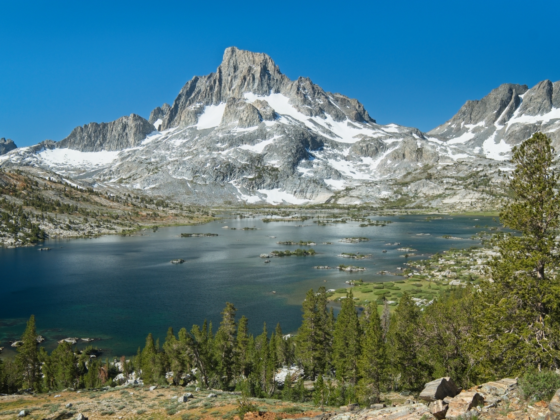
Thankfully, the epic views of Banner Peak from Island Pass are sufficient to distract me from the discomforts of backpacking and I enjoy a snack break on some rocks overlooking Thousand Island Lake. There are lots of other hikers out: I pass families, couples, even a group of frog researchers! Their enthusiasm for this beautiful place is infectious and I can’t help but smile as I continue down the JMT.
The hiking between Thousand Island Lake and Shadow Lake is familiar; I passed through here years ago on my first trip to this particular section of the Sierra Nevada Mountains. There are a lot of ups and downs… this section of the JMT is a roller coaster of a trail. On the third or fourth steep uphill climb, I begin to wonder whether I should have taken the path that follows the San Joaquin River downhill through the valley instead. It is almost certainly an easier path, but the thought of visiting new parts of the JMT keeps me going.
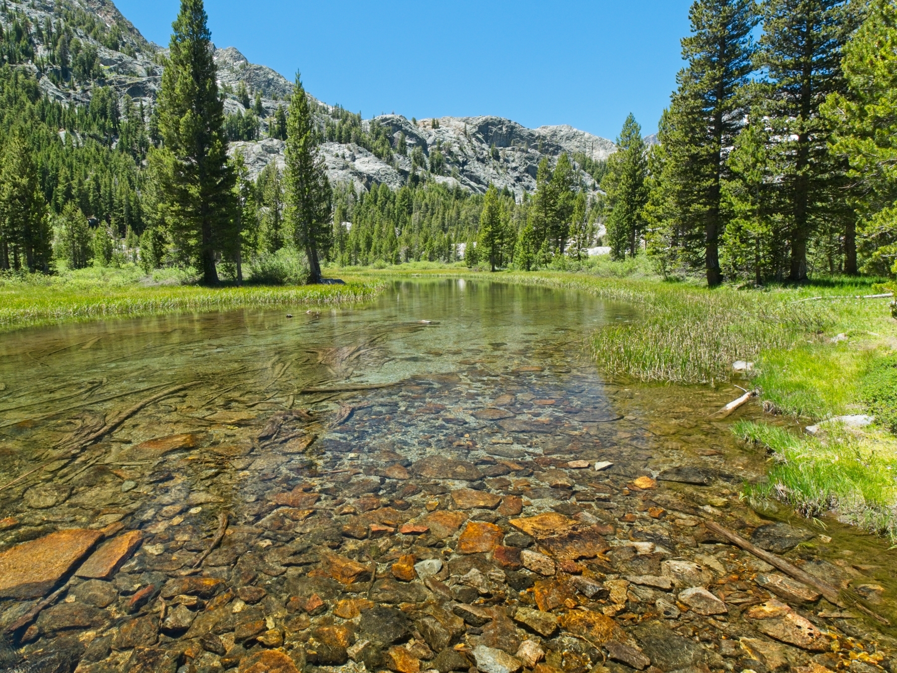
I pause for a long lunch at Shadow Creek and soak my sore feet in the icy water. Once I’ve eaten and rested, I hike down to Shadow Lake. Nestled deep in a valley, it’s an incredibly quiet and peaceful place. The tranquil walking doesn’t last very long however, as the JMT climbs out of this valley via a long set of switchbacks that leave me sweaty and out of breath. The next few miles are much gentler, thankfully. I enjoy trekking past Rosalie Lake, another quiet place, though there seem to be a fair number of (currently vacant) campsites nearby. Gladys Lake is less inviting due to the swarms of mosquitoes…
As I stroll through the quiet woods near the Trinity Lakes, I realize I’m finally comfortable! I’m not sure what changed; maybe my body just got tired of complaining. Either way, I enjoy the walk to Minaret Creek, the last campsite on the JMT before Devils Postpile. I find the final descent to the creek particularly awe-inspiring; the trees are enormous! I try to count the rings on one or two but give up after reaching 100.

The mosquitoes at the Minaret Creek campsite make it difficult to lounge around outside, so I spend most of the evening in my tent. I don’t bother putting the rain fly on. I figure it will be relatively warm because I’ve descended a few thousand feet. Plus, it’s nice to see the sky and the stars!
Minaret Creek to Mammoth Pass
10 July, 2020 | 6.7 mi | +2100′ / -1200′ | View on Map
I wake up the next morning to surprisingly cold air. After a hot oatmeal breakfast, I pack up camp and hike the final few miles to Devils Postpile. I stop at Reds Meadow for a bathroom break and am tempted to to buy a plate of pancakes and eggs but decide against it; I have several miles of hiking with about 2000′ of elevation gain to reach Mammoth Pass and I’d rather get that out of the way before the sun heats things up too much.
The hike to the trailhead takes more time than I expect; I don’t remember it being very long when I hiked in! The hot, exposed section of the climb goes relatively quickly, but I grow impatient as the trail continues to ascend for several more miles through the forest to the shallow Mammoth Pass saddle. The last half mile is steep and unpleasant, but over quickly enough.
I reach the parking lot a couple hours after departing Reds Meadow and happily deposit my backpack and trekking poles in the trunk of the car. I’d really like a shower right about now, especially since I have a long drive ahead of me, but I’m not really sure where to get one. Horseshoe Lake looks inviting enough, so I walk over and wade in. The water is absolutely frigid, but refreshing! I scrub my body and my clothes, probably annoying several families that are scattered around the lake on blankets and lawn chairs. Feeling much better, I change into clean, dry clothes on the shore and then amble back to the car. This has been a long trip (10 days / 9 nights; 134 mi; +/- 33,700′; but who’s counting?) since I began this trip, and I’m ready to go home. Until next time, Sierra Nevada!