White Mountain Peak is the third highest mountain in California and the fourth tallest in the contiguous United States. Despite it’s lofty elevation, the hike to the summit is incredibly simple. You drive to the trailhead at 12,000 feet, walk along a wide, open 4×4 road for about 7.5 miles, and you’re at the top! The entire walk is beautiful, though dry (there are no reliable water sources), with spectacular views of the entire eastern Sierra range along the way.
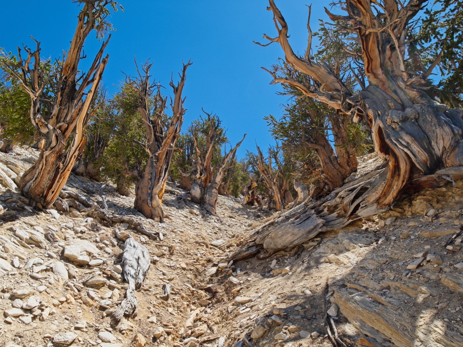
Kim and Alex joined me on this two-day excursion to the White Mountains. We drove up on a Saturday morning and spent several hours in the afternoon strolling through the nearby Ancient Bristlecone Pine Forest, home to the world’s oldest non-clonal (i.e., not part of a colony) trees. Several of the bristlecone pines in the Methuselah Grove are over 4000 years old, and the Methuselah Tree itself germinated about 4852 years ago, making it older than the Egyptian pyramids at Giza! The hikes through the trees were fun and doubled as acclimation for the hike to White Mountain Peak. We spent the night at the trailhead (12000 ft) for extra acclimation and bagged the peak in the morning. This itinerary also made for a much more relaxed schedule since the drive from LA is over 5 hours long.
Trip Planning
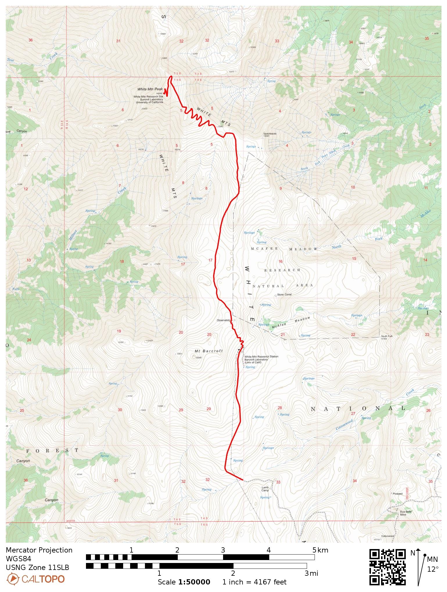
Specs: 15.2 mi | +/- 3600 ft
Difficulty: Class 1 [learn more]
Location: Inyo National Forest | Home of Western Shoshone and Paiute peoples | View on Map
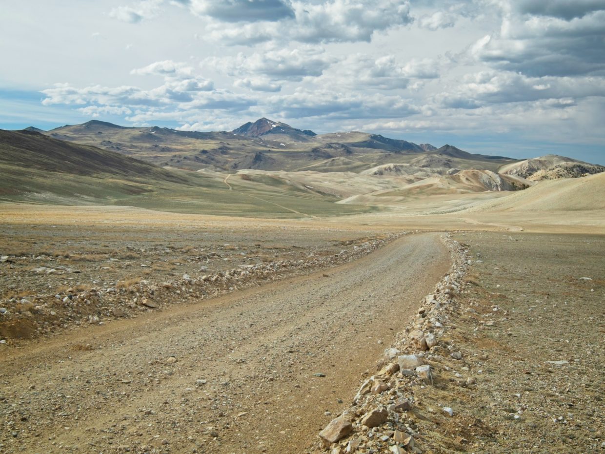
Route: Drive the long, dirt road to the trailhead. The road is a bit rocky but very well maintained; I would have no qualms driving it in my low-clearance sedan. From the trailhead (which has a pit latrine!), follow the 4×4 road to the summit. There is no water along this route, so bring all that you need!
Permits & Regulations: Regulations are light here; you don’t need a permit to hike or even to camp (as far as I can tell). A good portion of this hike falls within the White Mountain Wilderness, and the usual leave-no-trace rules apply.
Resources: Check out the SummitPost page or the Forest Service page for White Mountain Peak for more detailed route descriptions and information about the area. I printed a map from CalTopo, seen above, but there’s really not much need for it; the trail/road could not be any clearer.
A High Desert Stroll
6 June, 2021 | 15.2 mi | +/- 3600 ft | View on Map
I wake to bright sunshine filtering through the tent walls. It’s a brisk morning, but the cloudless sky promises warmer temperatures later in the day. Kim, Alex, and I eat some breakfast and then pack up camp, tossing our overnight gear into the back of Alex’s car. We fill up 3 – 4 liters of water each since we’ve got a 15-mile round trip hike ahead of us with absolutely no creeks or springs along the way. After a final gear check and a silent prayer that the marmots don’t chew on the underside of the car, we set off.


The trail, a 4×4 road, climbs uphill from the trailhead for a few hundred feet and then levels off as it approaches Barcroft Station, a high-altitude science lab. We don’t see any signs of current research as we walk through; it’s quiet as can be!


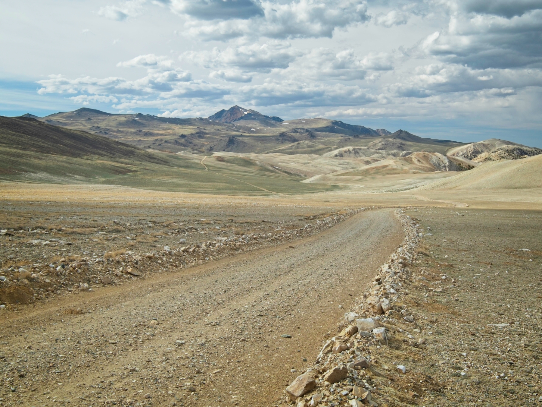
After another short climb up a hill just past the research station, we reach a huge plateau. The 4×4 road winds across the landscape, leading to the colorful summit in the distance. Alex, Kim, and I walk side by side across the beautiful plains, chatting and marveling at a few trail runners that breeze past us. We catch up to and pass a few other hikers who seem to be struggling with the altitude, making me grateful that we got some high-altitude hiking in yesterday and that we slept at the trailhead.


Our leisurely stroll across the plateau eventually brings us to the foot of the mountain and we begin up a series of switchbacks. With the exception of one or two steep spots, the grade is really quite low and we soon reach the summit. A fellow hiker kindly snaps a photo of us with one of the several summit signs and then we relax for a few minutes, eating snacks and gazing across the Owens Valley at the snow-capped Sierra Nevada. We spot Mount Ritter and Banner to the north, and, with the help of Kim’s binoculars, what we think is Mount Whitney to the south. In other words, the entire eastern Sierra range is visible from up here!


After a short rest, we begin the journey back. We’re only halfway done with the hike, after all, and we’ve got a long drive to get home. It’s a tad warmer but also windier during the descent and I wear light jacket for most of it. Time drags on a little, particularly during the end of the hike, but we reach the car eventually. Thankfully, the marmots didn’t chew on anything critical (as far as we can tell), and we drive home without incident.


Andrew 31 July 2024
Nice post. Just happened to find your page when googling White Mountains.
We just visited the Ancient Bristlecone Pine Forest this weekend but only managed to hike the Discovery Trail.
Cheers!