This is a hike for those who enjoy the process more than the end goal. The most direct route to Mount Baden-Powell (9399 ft), one of the tallest peaks in the San Gabriel Mountains, climbs about 2800 feet and clocks in at 7.8 miles round trip. This hike, on the other hand, is almost twice as long with almost twice as much elevation gain. But you do get to visit three other peaks (Hawkins, Throop, and Burnham) along the way!
Trip Planning
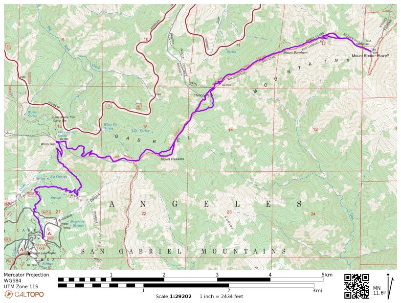
Specs: 15.3 mi | +/- 5200 ft
Difficulty: Class 1 [learn more]
Location: Angeles National Forest | Home of Kizh and Tongva peoples | View on Map
Route: Begin at the Windy Gap Trailhead in the Crystal Lake campground area – there’s a large parking lot and a few pit latrines there. Follow the trail up to the ridge and then hike east on the Pacific Crest Trail to Mount Baden-Powell. Note that there are no reliable water sources along this trail, so carry what you need.
Permits & Regulations: No permits are required to day-hike on the Windy Gap or Pacific Crest Trails. An adventure pass or an interagency pass (USFS website) is required to park at the trailhead. As always, follow the seven leave-no-trace principles to maintain the wilderness for everyone to enjoy.
Resources: Visit Angeles National Forest website for information about current closures, alerts, and notices.
Detailed Report
17 April 2022 | 15.3 mi | +/- 5200 ft | View on Map
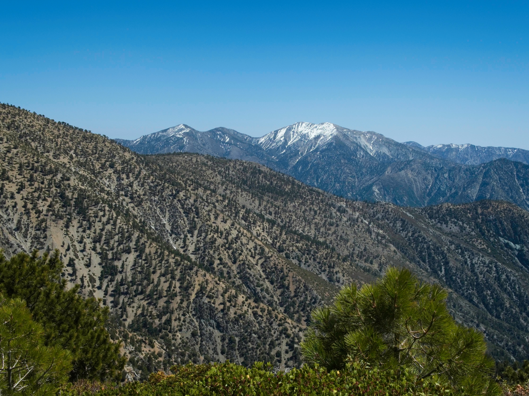
I got up as early as I could bear this morning and, after a mostly enjoyable drive through the mountains, hit the trail around 8 AM. It’s cool in the shade of the pine trees that surround the busy Crystal Lake campground, but the shade doesn’t last very long. Just a few minutes into the hike and I’m out in the sun. The forest burned here 20 years ago (2002 Curve Fire) and there are still obvious signs like charred trunks and conspicuous patches of land without any trees at all. To the south toward Los Angeles I see a blanket of clouds, a sight I always enjoy.


By the time I reach Windy Gap, I’m ready for a snack and a rest. I plop down on a hefty tree trunk that’s been carved into a bench and look out at the mountains while I munch on some food. My legs are already feeling a little tired, probably a consequence of doing a difficult workout yesterday, and I wonder if they’re going to hold out for the next 13 miles… Only one way to find out! Thankfully, it is a bit cooler up here on the ridge and I’m soon feeling refreshed and ready to go.
The trail (now the Pacific Crest Trail, or PCT) climbs about 600 more feet via a series of switchbacks before leveling out and contouring along the ridgeline. Patches of snow still cling to the north-facing slopes, which surprises me a little – it’s easy to forget that winter conditions persist up here when it’s warm and sunny down in the valley. A little less than a mile up the trail from Windy Gap I reach the foot of Mount Hawkins. The steep hike to the top leaves me panting even though it’s a straightforward little jaunt; I blame the 8850-foot altitude and my (apparent) complete lack of acclimation.


After catching my breath at the top, I follow a faint use trail down the opposite side and continue along the Pacific Crest Trail toward Mount Baden-Powell. The next mountain on the ridge is Throop Peak (9138 ft). A plaque at the summit informs me the mountain is named after Amos G. Throop, the man who founded Throop University (now CalTech) in 1891. I snap a few photos of the nice summit sign and then begin descending back to the PCT.
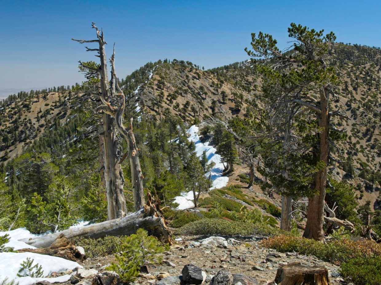
Between Throop Peak and Mount Burnham, I’m forced to navigate through and around a considerable amount of snow. For the most part I can follow use trails right on the ridge line, keeping the mounds of snow (some as high as seven or eight feet!) on my left. I occasionally leave the dusty ridge and step through deep boot trenches in the snow when the ridgeline is too inconvenient. As tedious as the varied terrain is, I enjoy messing around in the snow; it’ll be gone soon.
At the foot of Mount Burnham I again abandon the PCT to follow another use trail directly up to the summit. The route winds through stands of manzanita and through a few snow drifts before arriving at the summit where I find another nicely painted summit sign. The views are more or less the same as the previous couple summits, so I don’t stay long.


Like the hiking between Throop Peak and Mount Burnham, the final mile to Mount Baden-Powell is mostly snow-covered. I again follow the existing use trails and boot tracks and soon arrive, panting, on the summit of Mount Baden-Powell. A group of Pacific Crest Trail thru-hikers cheerfully greet me as I sit down beside them and dig into lunch. We chat for a little while, but I eventually say goodbye and start back down the mountain.


The hike back to Crystal Lake goes a little more quickly than the hike up (3.5 hrs vs 4 hrs), mostly because I’m able to skip a few of the steep summit trails along the way. The patchy snow makes the going a little tougher than it would otherwise be; the Pacific Crest Trail, a usually well-graded and well-packed path, is almost entirely buried between Baden-Powell and Throop Peak. I miss the cool morning temps as well; the afternoon sun has really warmed things up!
By the time I get back to the trailhead, the campsite is much emptier; weekend campers are either packing up or have already left. After some stretching, I join the max exodus back to the city.
Johnson Grey Cloud Meadows 7 June 2026
For accuracy, the Tongva stole the land from the Hokan speaking people who preceded them and colonized and pushed the Chumash out of their historical home lands. Accuracy matters.