After last weekend’s inspiring hike to a series of mountains near Goodykoontz Peak, I returned to the area for more peaks. Waterman Mountain and Twin Peaks are both on the Hundred Peaks Section list (which I’m working on!) and are right next to each other, so I planned a loop to hit both. As an added bonus, we got a little snow overnight, which only made the hike more scenic and beautiful!
Trip Planning
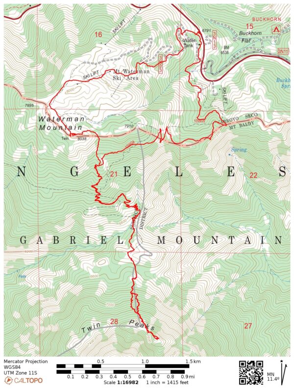
Specs: 10.6 mi | +/- 3800 ft
Difficulty: Class 1 [ratings]
Location: Angeles National Forest, California | Home of Gabrielino/Tongva, Tatavim, and San Manuel peoples | View on Map
Route: Begin at the Buckhorn Day Use Area and hike south on the trail that leads to the ridge. I followed the trail up the ridge onto the south face of Waterman Mountain and then down into the canyon between Waterman and Twin Peaks. The trail up to Twin Peaks is rough and unmaintained. I did a bit of bushwacking to reach Waterman and then followed the road down through the ski lifts back to the Buckhorn Day Use Area.
Permits & Regulations: An Adventure Pass or America The Beautiful Pass is required for parking at the trailhead, but no permit is required to day hike in the San Gabriel Mountains. All the usual wilderness etiquette and leave-no-trace ethics apply!
First Snowfall?
16 Nov 2024 | 10.6 mi | +/- 3800 ft | View on Map
I begin the hike at 9 AM from the Buckhorn Day Use area. It’s a bright, sunny day, but cold: a dusting of snow lingers in the shade. The blue-tinted snow presents quite the contrast to the golden, sun-bathed ferns on the other side of the hill. I’m not sure if this is the first snow that’s fallen this season, but it’s the first I’ve seen!


I follow the Waterman Mountain Trail as it winds its way up to the ridge and then out onto the south face of Waterman Mountain. It’s considerably warmer in the full sun and I enjoy a comfortable descent down a series of switchbacks to the saddle at the top of Devil’s Canyon. Along the way I cross several small, gurgling creeks, which surprise me a little. The landscape is overwhelmingly dry and I didn’t expect to find running water this high up in the mountains.

")
The “maintained” trail ends at the saddle and I begin a long uphill climb to Twin Peaks. There’s a pretty well-traveled use trail, but I lose it once or twice on the way up. No matter, there’s really only one way to go: up. Near the top of the ridge I reunite with the use trail and follow it to the summit, arriving at about 11:30. After signing the summit register, I find a sunny spot to sit and eat some lunch. Without the benefit of movement to keep me warm, I get cold quickly and pull on a few layers to stay warm.
Once I’ve finished lunch, I head back down the mountain to the saddle above Devil’s Canyon and then back up the many switchbacks on the south face of Waterman Mountain. Rather than returning the way I came, I cut up the ridge to the summit of Waterman Mountain and find the benchmark atop a jumbled pile of granite boulders. The air is incredibly clean today and I can see Catalina Island clearly – it’s over 70 miles away!


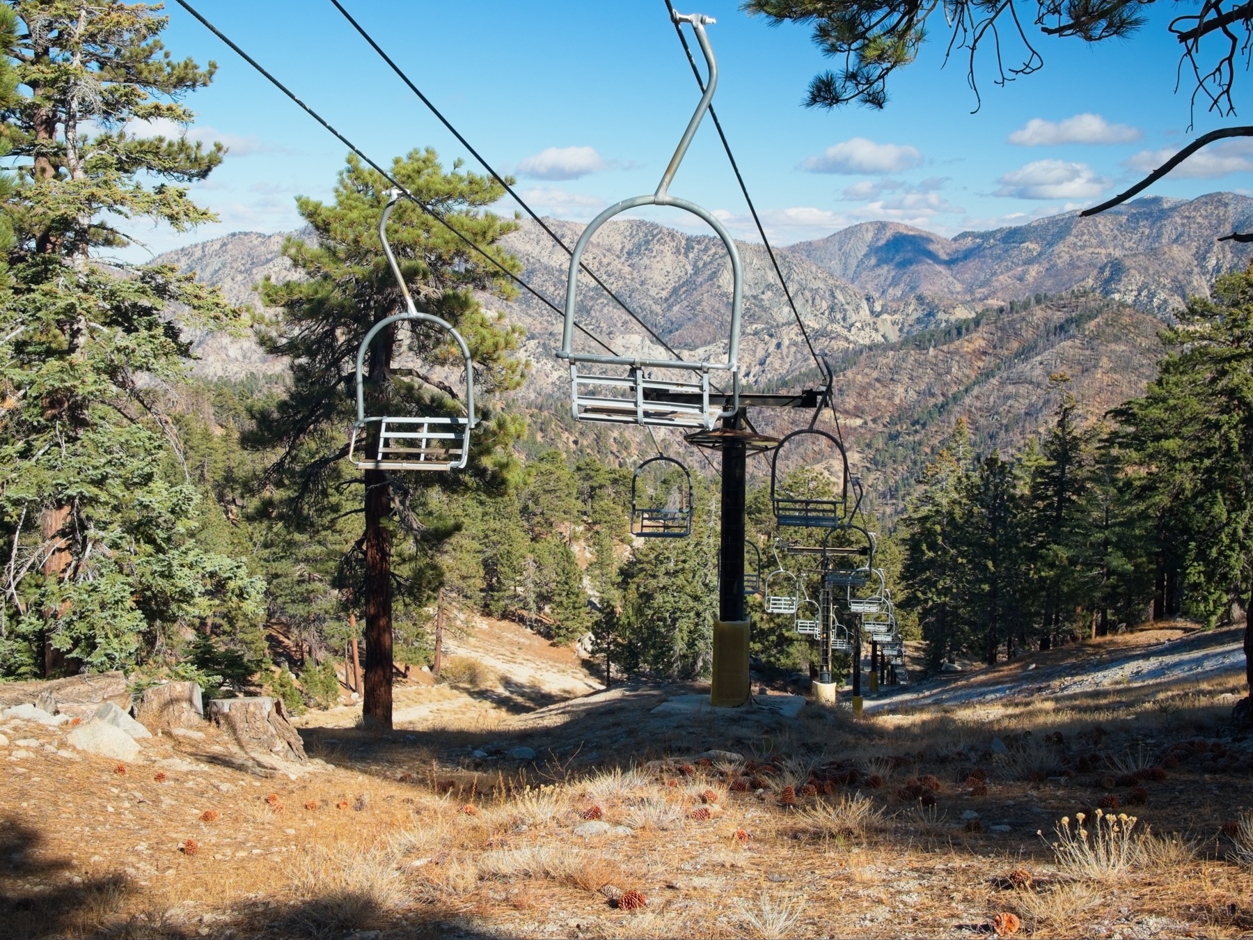
I leave the summit at about 1:15 and hike along the ridge-top trail over to the Waterman Mountain ski lifts. I walk down the chair 2 lift line, then cut down to the access road and follow it back to the highway. Although it’s only 2 PM when I reach the trailhead, the sun is low in the sky and it feels like late afternoon already. I happily hop into my warm car, turn up the music, and enjoy the mountain drive back to LA.