It’s been two years since I last stepped foot in the Sierra Nevada Mountains. I haven’t been avoiding them — I just didn’t get the opportunity to visit last year and hiked elsewhere — but my last experience wasn’t amazing, involving multiple forest fires and smoke-filled air. Thanks to those poor conditions, I wasn’t able to finish hiking the Sierra High Route (SHR) in 2018 so I’m back to finish it this year! I have two sections remaining: the “Headwaters Country” and “Canyon Country” segments. (See the links below for trip reports covering the other SHR segments.)
Trip Planning
Specs: 51.3 mi | +15,300′ / – 15,600′ | 4+ days, 4 nights
Difficulty: Mostly class 1 with some class 2/3 sections [learn more]
Location: Inyo National Forest and Yosemite National Park | Home of the Me-Wuk, Western Mono/Monache, Eastern Mono/Monache, and Northern Paiute peoples | View on Map
Route: This section of the Sierra High Route begins at Devils Postpile. There are a myriad of trailheads nearby; I chose to begin at the Horseshoe Lake Trailhead, following the Red Cones Trail over Mammoth Pass before descending to Devils Postpile. From the national monument, follow Steve Roper’s guidebook for the Sierra High Route to Tuolumne Meadows, the terminus of this section of the route.
Permits and Regulations: A wilderness permit is required for all overnight travel in the Sierra. Since the entry trailhead is located in Inyo National Forest, you’ll apply for a permit through the forest service at Recreation.gov. Note that bear canisters are required for most of this hike. Finally, remember to leave no trace; it is your responsibility to preserve the wilderness for others to enjoy!
Resources: Steve Roper’s book, The Sierra High Route, is a crucial resource to navigate the off-trail portions of this route. I augmented his instructions with the National Geographic topo map for the Yosemite area (it includes everything except the very beginning of this route, i.e., the Mammoth Pass trails). The scale on this map makes navigation difficult, however, so you might find my interactive map of the Sierra High Route more useful for your own purposes. Hosted on CalTopo, this map can be exported at any scale to a PDF and printed!
Preparations for the Sierra High Route
I almost didn’t plan this trip. With the COVID-19 pandemic sweeping the world, I was so uncertain about if and when various public lands and facilities would be open that I nearly gave up. I’m glad I didn’t! To mitigate uncertainty, many aspects of this hike were designed to be robust to closures. For example, I was unsure if the shuttle bus to Devils Postpile National Monument would be running, so I planned the hike to begin at Mammoth Pass, just a few miles from the monument with an easily accessible trailhead. Additionally, the status of the infrastructure at Tuolumne Meadows was uncertain for quite some time, so I planned to stash my own resupply there rather than count on the post office, store, or grill being open. An additional perk of stashing food is that I could avoid other people almost entirely to minimize my (and their) exposure to disease vectors.
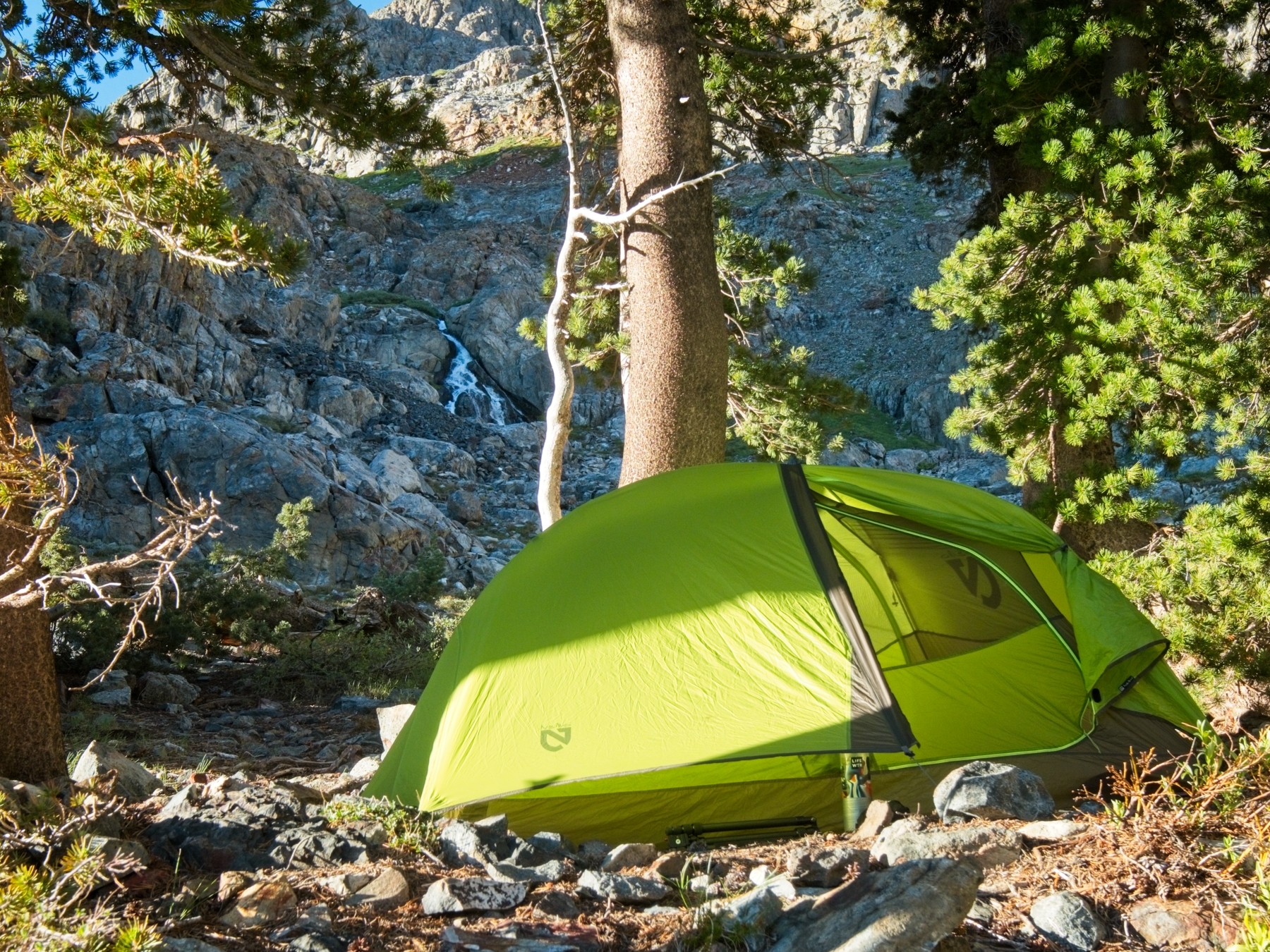
I need a full day to prep for the hike. I spend the first half of the day driving to Tuolumne Meadows. A cheerful ranger at Tioga Pass lets me enter the park for an hour (access this season is limited to those with a reservation or a wilderness permit) to set up my resupply; it’s a quick drive from the pass to Tuolumne Meadows, where I deposit a box full of food into a bear locker, and I’m soon driving out of the park again. Next, I head south to Mammoth Lakes and pick up a few remaining supplies from the grocery store. Finally, I head over to the Twin Lakes Campground and set up camp. I’m thankful that I reserved a campsite because the place is full! Almost immediately after establishing my camp, I stumble upon a baby black bear devouring the contents of some naive camper’s ice chest…
I spend the rest of the evening relaxing and wandering around the beautiful Twin Lakes, trying to calm my nerves about the upcoming hike! I haven’t done a solo backpacking trip since my last Sierra High Route trip in August of 2018. I’m also pretty uneasy about the prospect of leaving luxuries like showers, air conditioning, fresh food, and flushing toilets behind. Backpacking is hard! It’s a new psychological battle for me; I’m usually pretty pumped to be leaving civilization! The final and perhaps most daunting hurdle I worry about is a recent knee injury. I’ve been to a few physical therapy sessions (10/10, I would always recommend visiting a PT for your sports injuries!) and am hopeful that I’ll be OK, but I’m trying to manage my expectations… I may be hiking out very soon with crippling knee pain. Needless to say, I don’t sleep very well.
Devils Postpile to Minaret Lake
1 July, 2020 | 13.5 mi | +4400 / -3600 ft | View on Map
I wake up early — well, early compared to the rest of the people at the Twin Lakes Campground. It doesn’t take me long to eat breakfast and break down camp, and I’m at the Horseshoe Lake Trailhead at 7 AM. I spend a few minutes stretching while admiring the spectacular scenery from the parking lot. My campsite from last night is only a few miles away, but the views up here are much better. For all you campers out there: you should definitely go to the Lake Mary or Lake George campgrounds instead of Twin Lakes!
The first three-quarters of a mile gain a little altitude — maybe 500 feet — before leveling out in the wide saddle of Mammoth Pass. I enjoy strolling beneath the massive pine trees, content to listen to the crunch of gravel beneath my shoes and the occasional birdsong. I soon emerge from the cool forest into bright sunlight; a massive area here is still recovering from the 1992 Rainbow Fire. It’s warm, but I’m heading downhill to Devil’s Postpile so the extra sunshine isn’t really a nuisance.

I’m careful to shift as much weight as possible from my knees to my trekking poles during the descent. Thankfully, my injured knee is feeling just fine this morning! In no time at all I find myself strolling into Red’s Meadow. I stop at the store to buy a popsicle; it’s only 9 AM, but who cares? Plus, I’m supporting a local business by indulging my sweet tooth, right?


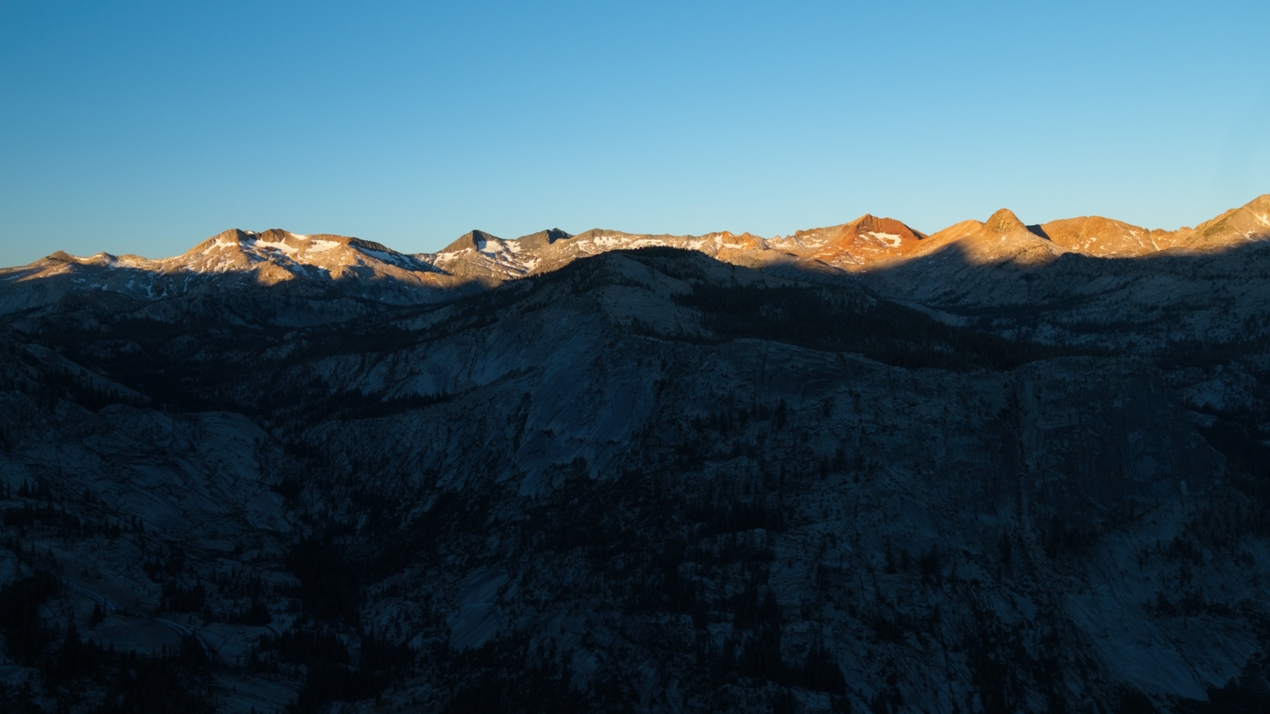
As I continue down the trail to Devils Postpile, I encounter a few other hikers, but not very many. I’m not sure if the early hour or the global pandemic is more responsible for the diminished turnout, but I enjoy the peacefulness of the empty trails. Before leaving the monument, I pause for a short moment to snap a photo of the basalt columns. It’s incredible how they form into towering hexagonal pillars… why hexagons? I’m sure there’s a reasonable explanation that involves the structure of the crystals or something, but I don’t know much about rocks… I need a geologist friend.
Just north of the basalt columns, I cross the Middle Fork of the San Joaquin River on a sturdy footbridge and soon meet the John Muir Trail. I actually haven’t hiked this famous route between here and Tuolumne Meadows; I’ve hiked every other bit of it, but not this 33-mile stretch. Unfortunately, today is not the day I get to hike the JMT (I’m hoping to hit it on my return trip from the northern terminus of the SHR, though!) and I soon depart the JMT on the Becks Lake Trail. The path climbs gradually up into the hills, switching back every few hundred feet. It’s not a particularly difficult trail, but I’m a little out of shape. I haven’t walked with a loaded pack since last October, and my sore muscles are clear evidence of that!
The trail eventually levels out as it contours around Red Top Mountain. An energetic dog wearing a green backpack follows me for a bit, but I haven’t seen another soul since I left Devils Postpile. I hope her people are around somewhere! I shout a few times but don’t hear anyone.
On the west side of Red Top Mountain I begin to glimpse snow-covered mountains, a promise of some respite from this hot summer air. A short while later, I reach Superior Lake and take a long lunch break. It’s only early afternoon, but I am tired! After eating, I lie down for 20 or 30 minutes and contemplate the rest of the day. My knee is feeling good and there are at least 7 more hours of daylight, so I’m not eager to just sit around here. Plus, if I’m serious about finishing the rest of the Sierra High Route (if not, there are many places I could bail) I really need to put in some more miles to avoid running out of food before Tuolumne Meadows.


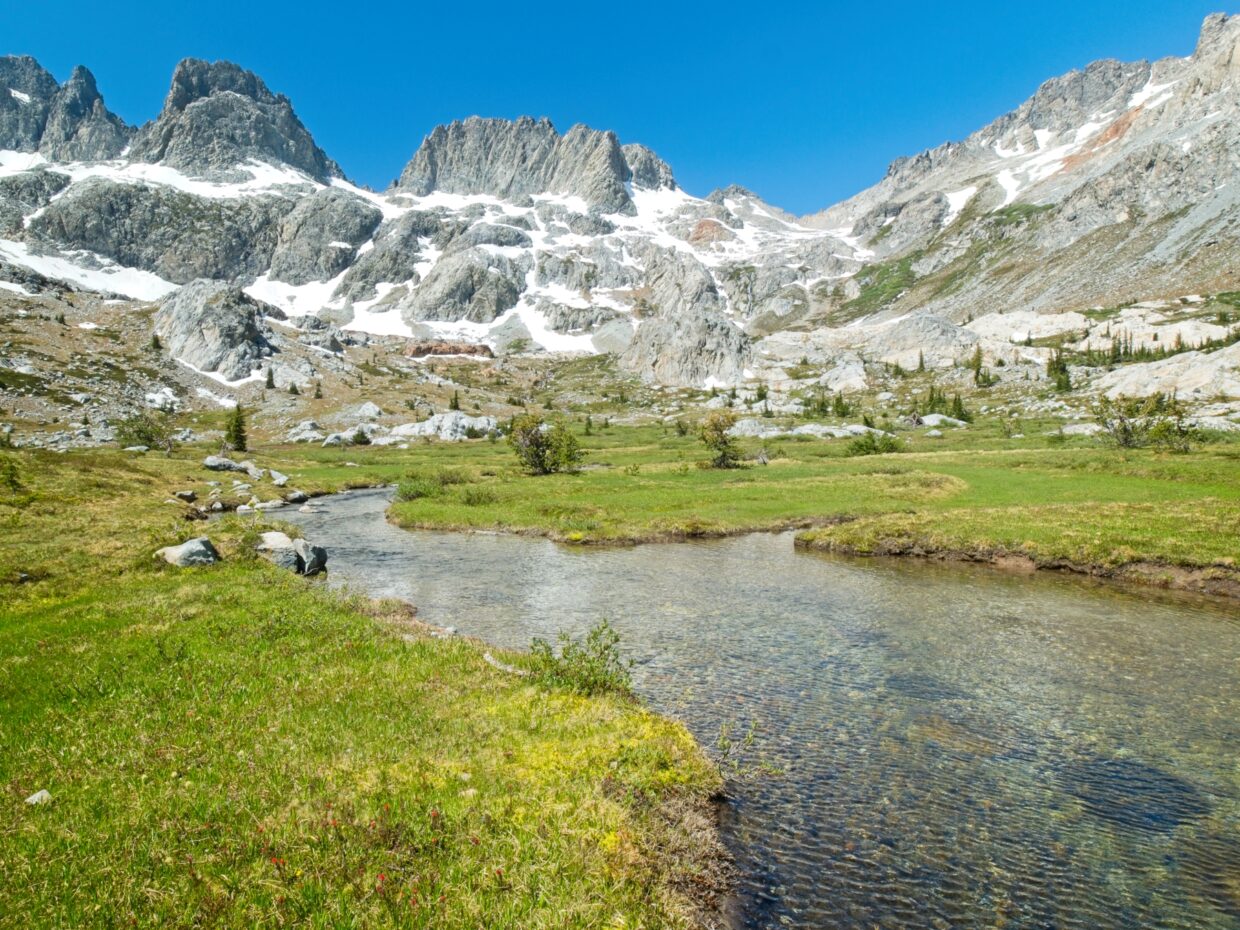
So I leave the shaded shore of Superior Lake and begin following Steve Roper’s instructions in the Sierra High Route guidebook. My next objective is Nancy Pass, which is pretty easy to find on the ridge above Superior Lake. Reaching the pass, on the other hand, is anything but easy. Some of the difficulty is the result of my poor route-finding — I end up surrounded by willows partway up the slope — but this is also just a steep climb! When I arrive at the pass (panting), I find a little plague identifying the spot and explaining the name. Rest in peace, Nancy.


As always, the best part of the struggle up to the pass is the view you earn at the top: sweeping views of where you’ve been and of where you’re going. The scenery behind me is lush and inviting; a beautiful lake, green meadows, and plentiful trees. The terrain to the north is quite the opposite: barren volcanic cliffs, steep granite slabs, and plentiful talus. Welcome to the Sierra High Route!
The next few hours are unpleasant. Descending the talus has irritated my injured knee and hiking is now painful. I struggle to find a route through the complex terrain; every feature invites me to descend, but Roper explicitly advises against losing too much elevation. So I do my best, backtracking every now and then when my chosen route ends at a cliff. The scenery is arguably beautiful, but I’m not in the mood to appreciate it. Between my aching knee, the afternoon sun, and the difficult route finding, I’m downright grumpy!


By the time I reach Minaret Lake, I’m discouraged and tired. Why am I doing this? The alpine meadows I hiked through during the past few hours did nothing to cheer me up; do I even enjoy backpacking? In an effort to take my mind off of my disgruntled feelings, I get busy setting up camp and cooking dinner. Food will help, right? I also take some vitamin-I (ibuprofen) and fashion a backcountry ice pack for my knee using an extra ziplock bag and some nearby snow.
With some hot food in my belly and anti-inflammatories in my blood, I’m thinking a bit more rationally. There’s no point in making a decision tonight; I’m tired and am certainly not going anywhere. If I feel good in the morning, I’ll continue hiking the Sierra High Route. If not, I can bail immediately or later in the day. Comforted by the postponed decision, I call it a night and spend the rest of the evening relaxing by the lake.

Crossing the Ritter Range
2 July, 2020 | 8.9 mi | +3600 / -3600 ft | View on Map
When I wake up in the morning, I’m pleasantly surprised to find that my knee feels fine! I cook some oatmeal and watch the sun rise over breakfast and then pack up my gear. A fellow backpacker wanders over while I’m packing and we chat for a few minutes; he’s out with his two young daughters, who love backpacking!


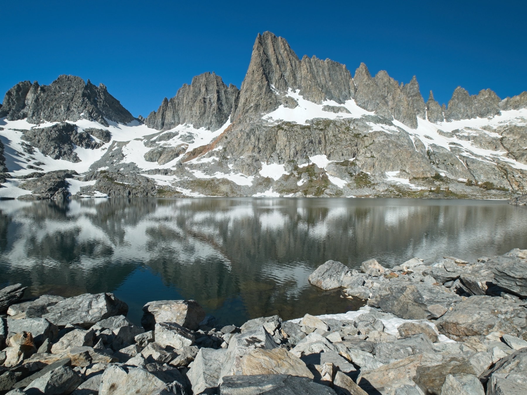
The walk around Minaret Lake is incredibly scenic. The air is still this morning, so the mountains reflect perfectly in the water. I follow a well-traveled trail to the northwest side of the lake and then begin climbing toward a rocky saddle. A look back at Minaret Lake provides a beautiful view of the lake with distant peaks in the background.


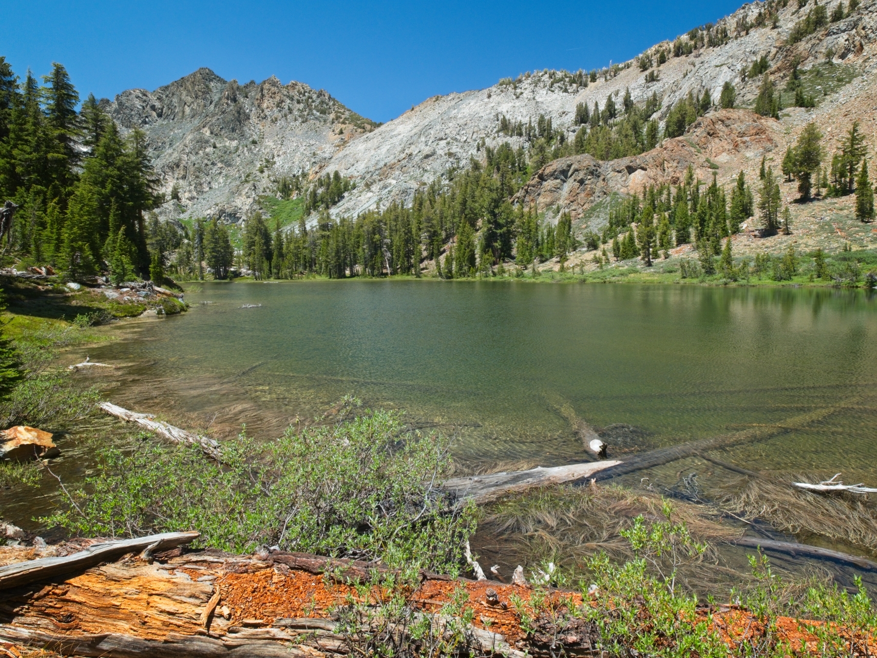
A bunch of use trails lead from the upper reaches of Minaret Lake to Cecile Lake. I follow one of them up some easy class 3 rock and am rewarded with sweeping views of Cecile Lake. The water is completely encircled by slabs and talus; what a barren landscape! Hiking around the lake proves to be fairly straightforward, though navigating through the big rocks begins to irritate my knee again. Partway around the lake I’m faced with a route finding decision: either traverse an icy snowfield that drops into the lake or clamber 20-30 feet higher through the talus to avoid the snow. Not wanting to irritate my knee further, I choose the former. With microspikes firmly attached to my trail runners, I proceed carefully across the snow. In retrospect, crossing the snow/ice was a stupid decision; one slip could have easily put me into the frigid lake, potentially beneath overhung snow and with a heavy backpack on my shoulders. Luckily I don’t slip and make it safely to the other side where I take off the microspikes and continue talus hopping to the foot of Cecile Lake.
At the outlet creek from Cecile Lake I struggle to locate the path that descends to Iceberg Lake. Part of it appears to be beneath a snowfield that bridges over the outlet creek; walking on that is a no-go since it could collapse. My other option is to cross some steep scree to a more defined trail I see lower on the slope. I’m not particularly stoked about this option either, but it ought to be relatively safe. I slide a few times — as one is wont to do on scree — but am soon on firmer, less stressful terrain.

The path soon reaches a steep, icy snowfield. The runout here is much longer than the snow around Cecile Lake and is just as icy. Luckily, two gentlemen that are ascending the trail come to the rescue. They’re both carrying ice tools and cut steps for themselves as they traverse the snow. Once they’ve passed, I don my microspikes (there’s no point in taking any extra chances) and follow their footsteps. I repeat the process a few more times as I cross the remaining snow fields and soon find myself strolling along a comfortable, muddy trail on the banks of Iceberg Lake. I sit down for a snack break on the grass, grateful to be back on more secure footing.
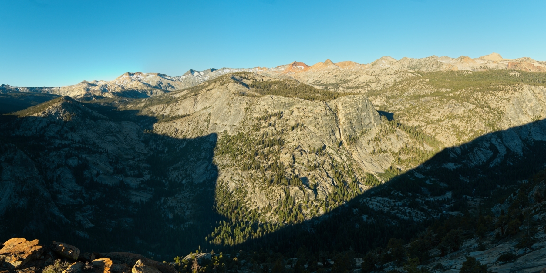
Luckily, the rest of the day proves to be much less nerve-racking. I review Roper’s instructions and then set off cross-country again just below the outlet of Iceberg Lake. Compared to the talus and ice, strolling across the grassy meadows is a piece of cake. Even better, the scenery is spectacular and, for the first time this trip, I’m really, truly happy to be out here!


Midway through a lush valley full of granite slabs and wandering creeks, I happen upon a trail that seems to be heading the same direction as me. I follow it for a while, climbing the slope beside a roaring creek, only leaving it when I reach a small tarn below the snow-bound Ritter and Banner peaks. The Sierra High Route lies to the east, so I make a 90-degree right turn and walk up pleasant slopes toward where Whitebark Pass should be. I’m not entirely certain if I’m following Roper’s route exactly, but that’s not really the point, is it? I eventually reach the pass, a saddle above the Nydiver Lakes.


The descent from Whitebark Pass isn’t too bad, just a bit of talus hopping, but nothing too steep. I thoroughly enjoy strolling through the meadows above Garnet Lake and make quick work of the small pass to Thousand Island Lake. As soon as I reach the shore of this popular destination, I’m swarmed by a few dozen mosquitoes… I was hoping they wouldn’t be too bad on this trip. I should have known better; it’s far too early in the season for the bugs to be gone.
After crossing to the northwest side of Thousand Island Lake, I pause to evaluate my knee and decide whether or not to proceed further into the wilderness. Bailing from here is easy; I can follow the PCT or JMT all the way back to Devils Postpile and be back at my car in a day’s time. If I head further into the wilderness, there are practically no options other than to proceed forward or backtrack to this spot. Although I suffered through a bit of knee pain while boulder hopping around Cecile Lake, I’ve felt much better this afternoon. The fact that my knee is feeling better now than it did at this time yesterday convinces me to continue!
From the shore of Thousand Island Lake, I begin the ascent that introduced me to the Sierra High Route in August of 2016. During that trip, I spotted the prominent pass north of Banner Peak from the shores of Thousand Island Lake and decided to hike up to it. The climb, then and now, is spectacular and not too strenuous. I follow a faint use trail through spongy alpine turf up into fields of talus and snow. I’m happy to see the snow now; the sun has had plenty of time to soften it up, and climbing through the snow is so much easier than climbing the refrigerator-sized talus that leads up to this pass!


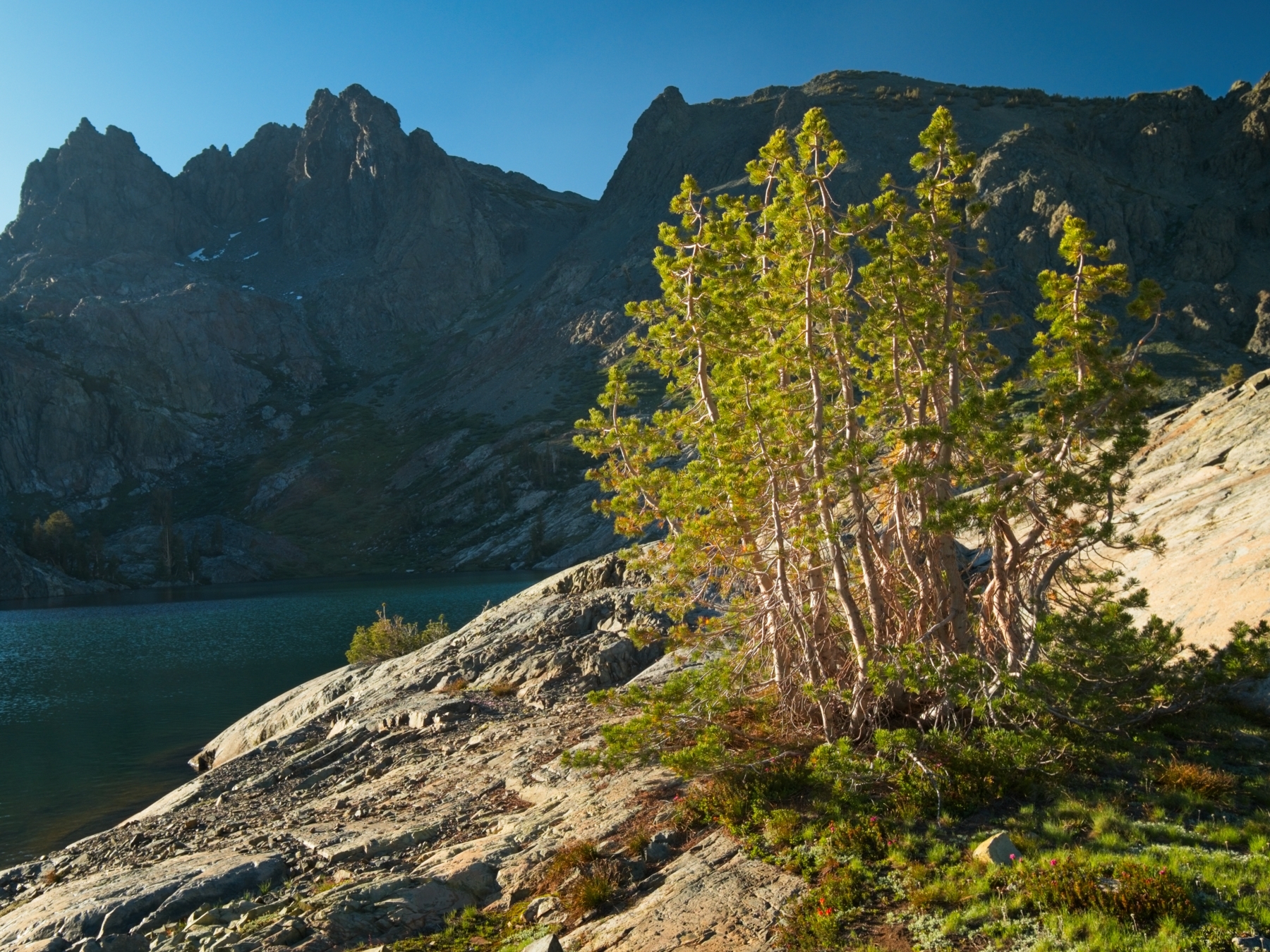
North Glacier Pass is just as I remember it: rocky and incredibly windy! Descending a few feet from the saddle helps with the wind and I take a moment to appreciate the view of Lake Catherine. There is so much more snow and ice than the last time I was here (photo from 2016)! As I gaze across the landscape I realize that I’ve been looking forward to this moment ever since I began hiking the Sierra High Route in 2018; I’ve been here, but never beyond. What will I find? There’s only one way to find out!

The first step is to navigate around Lake Catherine. This is mostly a boulder-hopping challenge, but I have to evaluate the stability of a few snow bridges and slopes along the way. Soon enough I reach a series of long, sloping granite slabs and get my first view of the wilderness I’ll be walking through for the next day or two. It’s a pretty rugged view and I’m nervous about finding my way through the complex terrain, so I refer to Roper’s route description frequently.
Thankfully the navigation below Lake Catherine proves to be straightforward. Even a section that Roper describes as “short, class 3 cliffs” is relatively easy. I pass an impressive waterfall along the way and thoroughly enjoy the meadows and the constant, expansive views of the San Joaquin River watershed. Perhaps my favorite part of the descent this evening is hiking along an unnamed creek that descends from an unnamed tarn located west of Lake Catherine. There is no established trail, so I make my way along the roaring water, even jumping over it at a particularly narrow spot. My path takes me within a few feet of another splendid waterfall before leveling out in a small meadow dotted with a few tall pines.


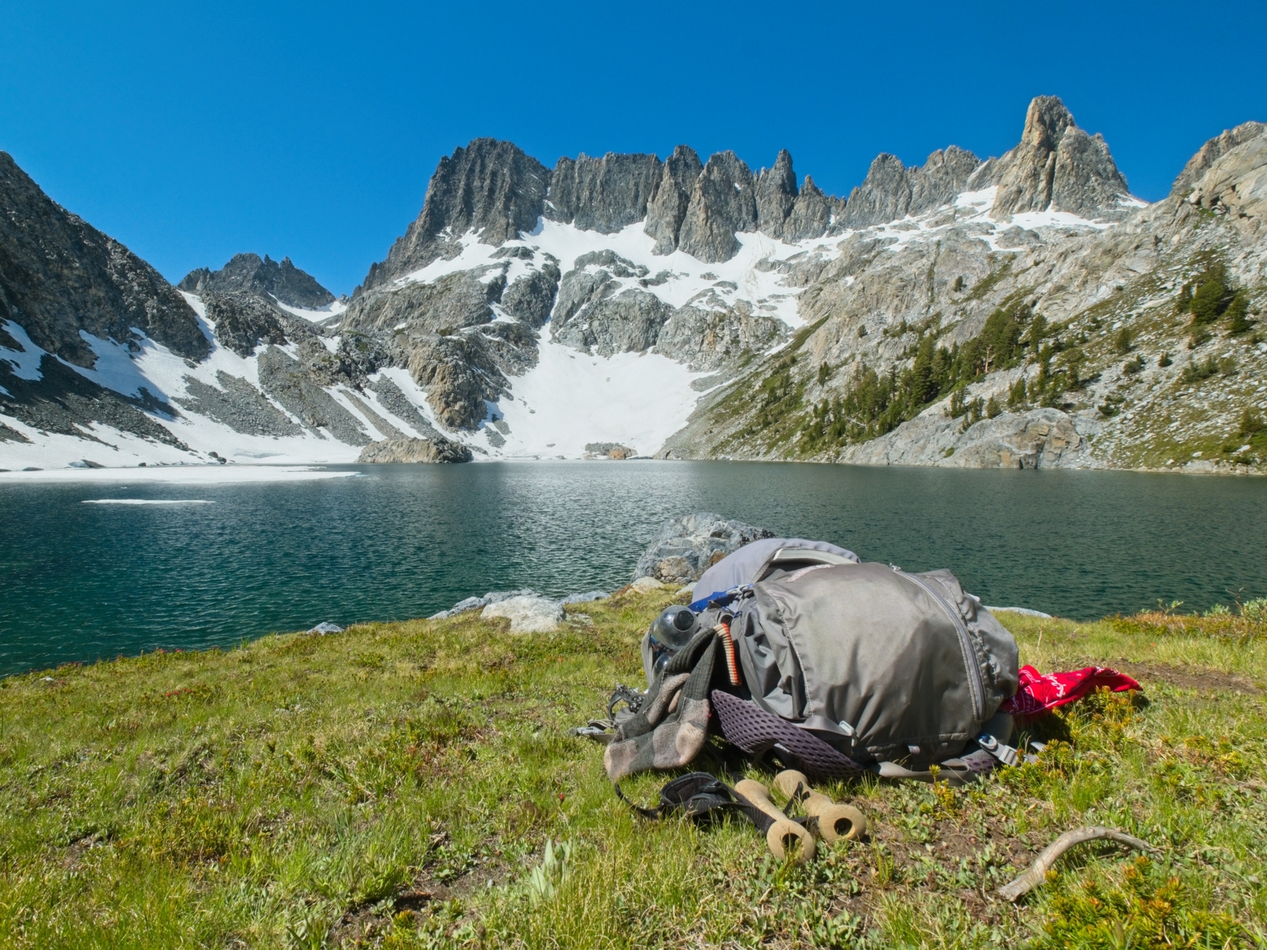
Beyond the meadow is another steep drop-off into an even more picturesque valley; the Sierra High Route, however, does not venture down into the valley and instead skirts the top of the valley to the Twin Island Lakes. Faced with several more hours of hiking to reach the next viable camp site, I decide to call it a day here. Several established campsites are nestled beneath the trees and I appear to be the only person here, so I choose the best one and set up my tent.
My original itinerary had me hiking from Superior Lake all the way to the Twin Island Lakes today. On the map, it’s only a 12-mile walk, a distance I would normally allocate 6-8 hours for. The off-trail travel takes quite a bit longer, even longer than I expected, given that it took me a full day (about 10 hours) to cover the nine miles between Minaret Lake and this spot.


I spend the rest of the evening relaxing. I enjoy a hot meal and chat with a few other hikers that pass through or camp nearby. By the time sunset arrives, there are at least three other groups of 1-2 people camping in the general area, a surprising number since we’re several miles from any trail!
Into Yosemite
3 July, 2020 | 10.9 mi | +4100 / -4500 ft | View on Map
I’m up early again today, excited to venture further into the wilderness west of the Ritter Range. After eating breakfast and packing up my things, I head off along a small bench. Following the guidebook’s suggestion, I take a good look at the complex terrain between myself and the Twin Island Lakes before dropping down into the valley. A small use trail guides me toward the picturesque canyon below. I eventually leave the path and contour across the top of the valley to reach a series of benches below Twin Island Lakes. I absolutely love hiking early in the morning! The cool temperatures are marvelous and the warm, soft light makes for some fine views.
I soon reach the lower Twin Lake but realize I need to backtrack a bit to reach its outlet creek. After scrambling up and over a large granite hill, I descend a short chute to a small grassy knoll beside the outlet. The creek is just as the Sierra High Route guidebook describes: a few feet deep, about 20 feet wide, and impossible to avoid fording. I take a few measures to avoid drenching all of my clothes. First, I remove my pants and socks and stuff them into the mesh pocket in my backpack. Next, I put my shoes back on (they’ll get wet, but better to have wet shoes than a cut or otherwise injured foot) and wade through the creek. The water is frigid! Safe on the other side, I squeeze as much water out of my shoes as possible before redressing and moving on.
A short, easy stroll leads me to the upper Twin Island Lake and I’m soon standing at the top of the lake, looking back. A swarm of mosquitoes rises from the marshy meadow to greet me, so I don’t stay long to admire the amazing view.


Over the next few hours, I continue to travel cross country, following Roper’s guidance as closely as possible. I realize that I’ve strayed off course when I find myself several hundred feet above a lake that I’m meant to stroll beside. It’s not a problem — I follow a series of grassy ramps and granite slabs back to the lake — but it is a tad annoying to have spent all that extra effort climbing when I could have remained lower. I think “contouring,” i.e., moving horizontally across a slope, is one of the most difficult things to do when traveling cross country. I inevitably end up off course.


Beyond the lake, I have an easier time following the guidebook, even while contouring across a talus slope to reach the “dark bluff” that overlooks Bench Canyon. At first glance, the descent into this pristine, sinuous canyon appears treacherous, but, as with most of the cross-country travel, turns out to be relatively straightforward.
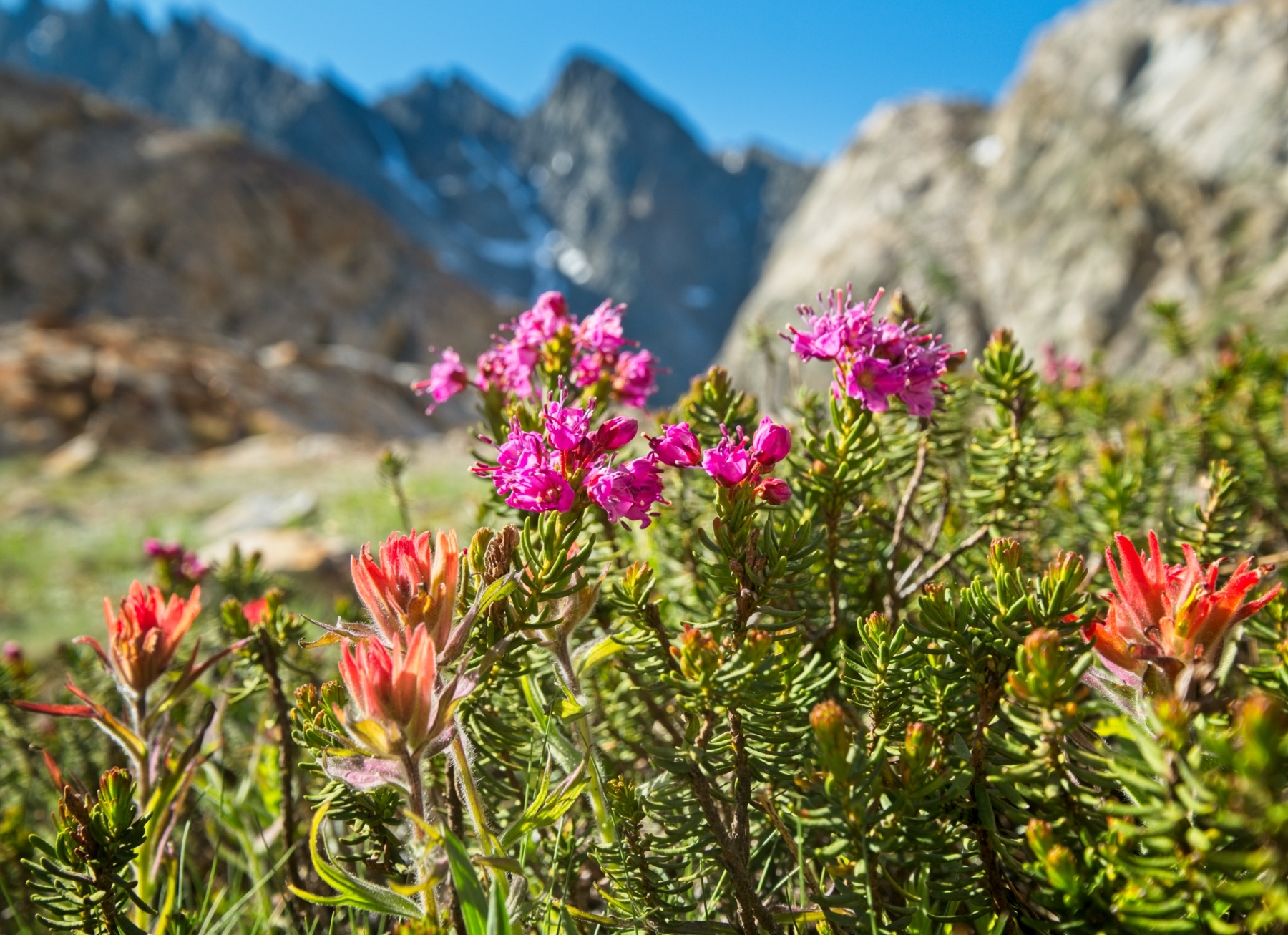
Steve Roper spares no superlatives when he describes Bench Canyon, and I can’t help but agree with him – this is an incredibly beautiful place! A wide creek winds across the canyon floor, through dense pine groves, open meadows, and over granite slabs. The wildflowers seem to have finished blooming already, which is a tad disappointing; I was looking forward to experiencing what Roper calls a “fairyland” of blossoms. Ah well – I suppose I’ll have to come back earlier in the season sometime!
The Sierra High Route follows the canyon to its terminus at Blue Lake, and I thoroughly enjoy the walk. It’s easy going, wandering through the meadows, and there isn’t another person around; it’s all mine to enjoy! By the time I reach Blue Lake, my stomach is rumbling so I stop for a lunch break and admire the scenery. My feet and legs are pretty tired too, so I rest for a while, soaking my feet in the icy water and napping on the soft turf.


My next obstacle for the day is Blue Lake Pass. Roper describes the ascent as a series of “easy” grass ramps… it’s certainly a straightforward climb, but hardly an easy one. I pant all the way up to the 11,250′ pass, taking plenty of breaks to catch my breath along the way. The views from the pass are well worth the effort! To the east, I can see the entire Ritter Range as well as several other ranges to the south. On the western side of the pass lies Yosemite National Park; the Clark Range stretches prominently across the horizon. I find a pass log stuffed into a glass jar between some rocks. These are always fun to read! I sign the log myself – gotta immortalize this moment!


The descent into Yosemite from Blue Lake Pass isn’t particularly enjoyable — it’s mostly just talus hopping — but I do have fun on a short glissade! Once I reach the rockbound lake below the pass, it’s easy going for several hours. I simply wander across meadows, rock slabs, and sandy plains toward the prominent, pyramidal Peak 11,210. While the walking is easy, it’s not particularly comfortable. I’m hot and annoyed by persistent mosquitoes; not my favorite way to travel.


Once I reach the slopes of Peak 12,100, I leave the open meadows and descend through a dense forest toward an unnamed lake. Just beyond the lake I find the Isberg Pass Trail — I’m done route-finding for a few days! Following the gently rolling trail, I hike around Peak 11,210 until I reach the edge of the Lyell Fork Canyon. A long ramp along the canyon wall makes for a relatively gentle descent, but my joints aren’t too happy about it regardless. I’m running a bit low on water and have been hoping to take a nice, shaded break on the banks of the Lyell Fork. However, when I arrive at the river I’m immediately swarmed by dozens of mosquitoes, so any plan of an extended break is immediately gone. I spend all of 30 seconds looking for a convenient log crossing but, frustrated by the flying vampires, I give up and just wade through the shallow water to the opposite bank. Wet feet? Oh well.


I do pause long enough to fill my bottle from the river, but leave immediately afterwards. A little further down the trail I sit down on a nice granite slab where I can squeeze out my socks and shoes and purify the water I’ve collected. After a short rest, I continue up the Isberg Pass Trail. In contrast to the dusty route I followed down to the river, the trail is quite nice north of the Lyell Fork! Several tall, majestic California junipers tower over the trail; I love these trees! My efforts to capture them on camera are thwarted by the position of the sun, unfortunately.
A little further down the trail I find a large open space between the trail and the canyon’s edge, giving me plenty of room to satisfy the leave-no-trace camping principles. I drop my backpack beneath some pine trees and wander around to explore. Under normal (non-pandemic) conditions, I would expect this gravely plateau to be a popular camping area: from a single rock outcropping I can see the Lyell Fork Canyon, the Triple Peak Fork Canyon, the Merced Peak Canyon, and the Merced River Canyon! It’s an incredible vista and I’m happy to have found such a picturesque campsite at the end of the day!
In an effort to dry out my socks from the Lyell Fork crossing earlier this afternoon, I hang them out in the evening sun while I cook and eat dinner. It’s not much use unfortunately, but I do have a spare pair that are dry. Once I’ve eaten and cleaned up after dinner, I enjoy the rest of the evening lounging on the rocks overlooking the canyon(s) and snapping photos.
Rest Day in the Yosemite Wilderness
4 July, 2020 | 10.6 mi | +2900 / -2500 ft | View on Map
The sunrise this morning is so magnificent that I disrupt my normal quick-to-leave-camp routine and sit on the canyon rim for a while to watch. I’ve probably written this before, but it surprises me that more people don’t venture into the Yosemite backcountry. The views out here are honestly just as good or better than the views from Yosemite Valley – you get the same awe-inspiring granite walls without the noise and crowds.
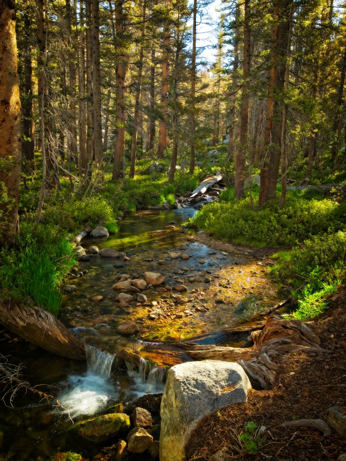
The hike along the Isberg Pass Trail is pleasant for the entire morning, not gaining or losing too much elevation. I cross a few small creeks and generally remain under the shade of the pines as the trail winds along the canyon rim.
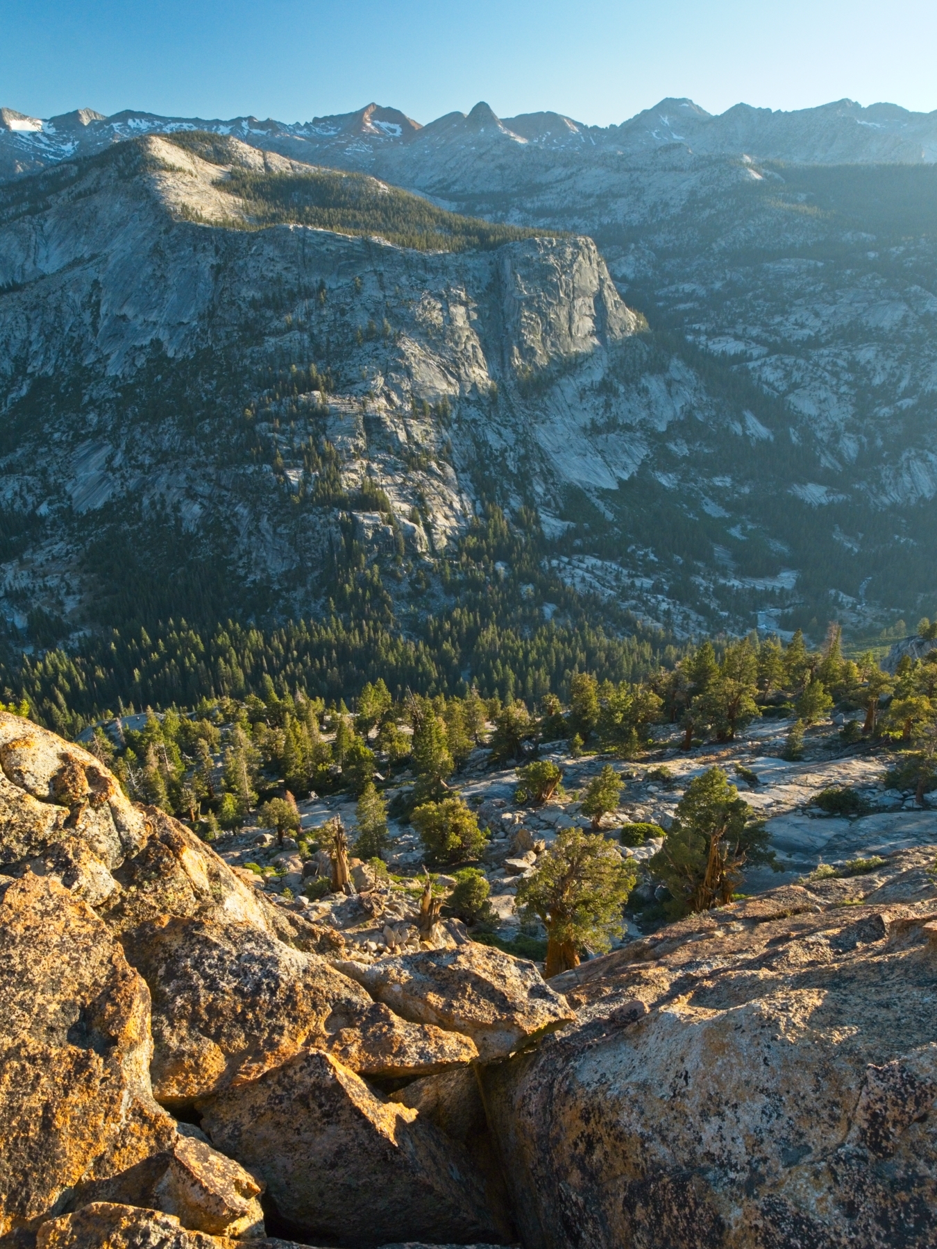
The pleasant, flat walking comes to an end several miles later. Just before the trail begins dropping down to Lewis Creek, I get a fantastic view of Half Dome! The steep descent isn’t too bad; come to think of it, my knee doesn’t hurt at all this morning! After a steep descent to Lewis Creek, I follow a new trail northeast and begin a long, gentle uphill climb toward Vogelsang Pass. Over the next hour or two, I get lost in my thoughts as I ascend the gentle grade, charmed by wildflowers, creeks, and waterfalls. Several groups of backpackers pass me going the opposite direction, which reminds me that haven’t seen any people at all since leaving camp above Twin Island Lake!


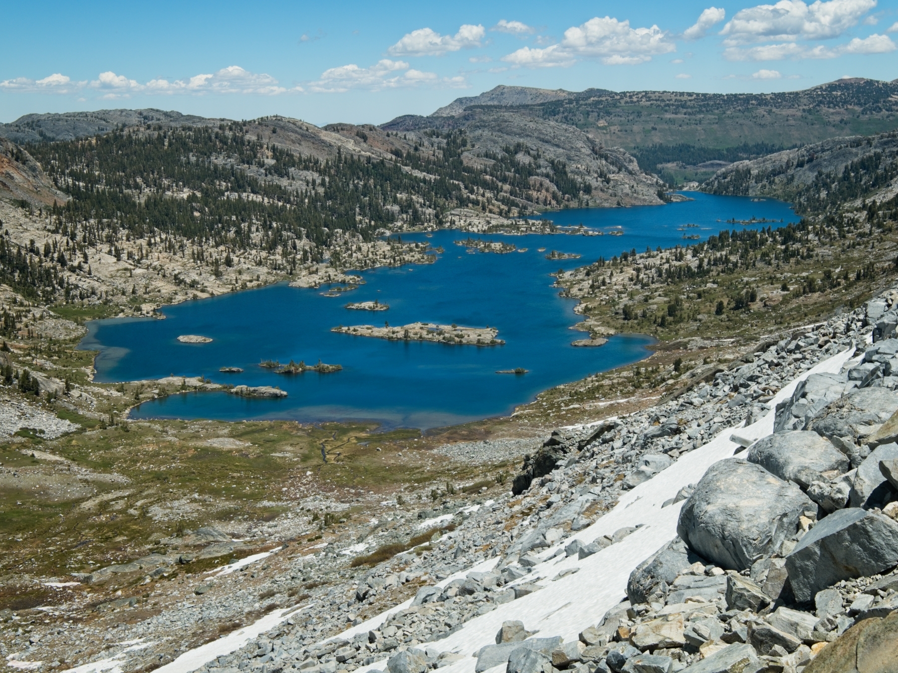
The Lewis Creek Trail eventually emerges from the shade of the forest into lovely alpine meadows just below Vogelsang Pass. Now out in the open sun, I sweat profusely during the steep climb to the pass. The views are nice though! I stop every switchback or two to gaze out at Gallison Lake and the wilderness beyond. After several days of cross-country travel, my brain is trained to evaluate the landscape for routes and I find myself planning a route over to the lake… a traverse from here over to the lake looks doable as long as you stay above the steeper bits and the willows, then it’s easy walking across the meadows to the rocky ridges. I wonder if any of those passes are traversable?
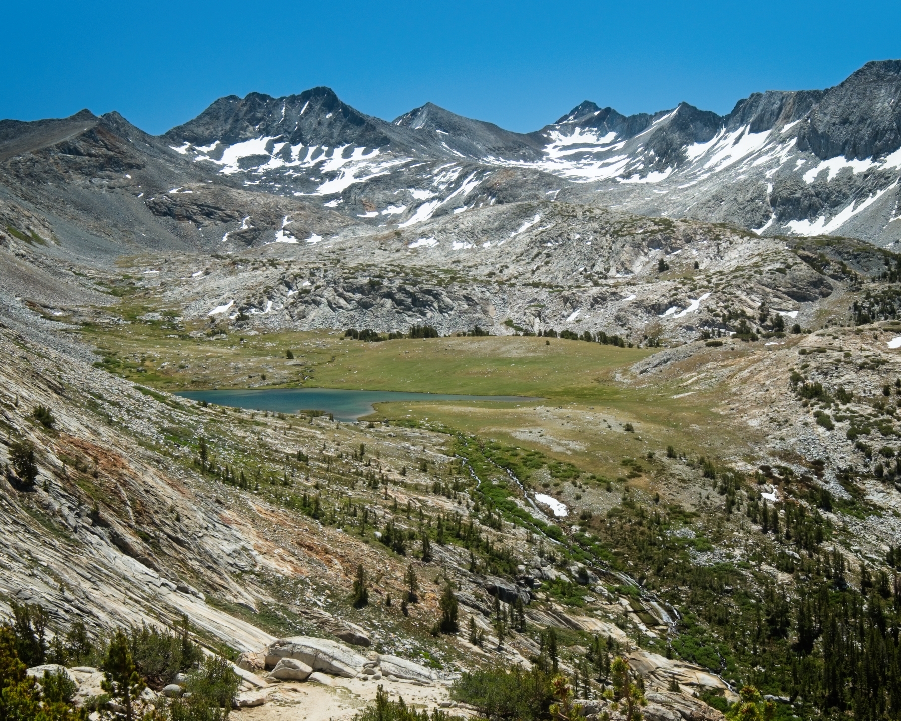
Entertained by the possibilities, I struggle up to Vogelsang Pass and then cross it, hiking down toward Vogelsang Lake. I’ve been noticing my body odor more than usual lately, so I ditch the trail and hike down to the shore and find a sheltered cove where I can go for a swim and eat lunch. Like most alpine lakes, the water is absolutely freezing, but I stay in long enough to scrub some of the sweat and dirt and then lounge in the sun for a while.

Once I’m fed and dry, I wander around the lake, rejoining the trail near the outlet creek. I spot Half Dome again; it’s only about 11 miles away, as the crow flies. A little further down the trail I trek past the Vogelsang High Sierra Camp, which, under normal operating conditions, has running water, a dining room, and tent pads for those lucky enough to buy permits. The national park cancelled all of those permits this year, however, so the camp is empty; metal tent frames lie scattered around the ground.
Continuing on, I soon reach Tuolumne Pass, a shallow saddle and junction between several trails. I have a decision to make: I could continue hiking to Tuolumne meadows or I can find a campsite up here in the backcountry somewhere. There are many hours of daylight left, so hiking to Tuolumne is well within the realm of possibility, but I’m not pumped about camping near RVs and the road. Dispersed camping is prohibited within several miles of Tuolumne, so my options are really just here or in the car-campground. I decide to remain in the backcountry; we’ll chalk today up to a “rest day.” I may have hiked 10 miles already, but they were easy and I’m essentially taking half of the day off!


I find a nice campsite near Boothe Lake, a lake I’ve actually visited before. To kill some time, I listen to a few pre-downloaded podcasts on my phone and then go for a wander around the lake. To be honest, I’m a bit bored; I’ve never really been good at sitting still… I somehow survive the boredom and appreciate the restful afternoon. My knee has felt good all day, which is really encouraging! Tuolumne Meadows is the next bailout point, but I won’t be utilizing it – I’m going to finish the Sierra High Route this week!
Speaking of the route ahead, I’m nervous about the terrain, snowline, and mileage that I’ll need to cover in the next few days. Roper’s descriptions of the route on the slopes of Mount Conness sound difficult and I’ve heard that Sky Pilot Col is tough to climb. I suppose I’ll find out soon enough.
Easy Walk to Tuolumne Meadows
5 July, 2020 | 7.4 mi | +300 / -1500 ft | View on Map
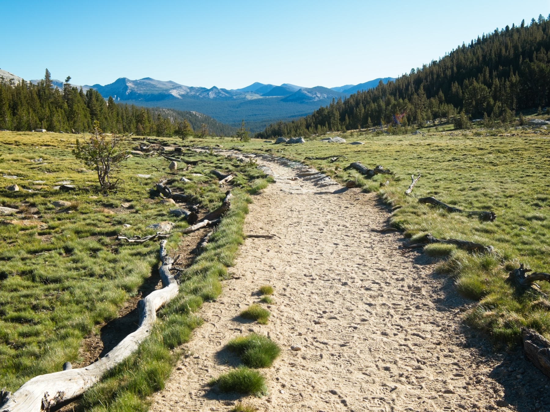
I hit the trail bright and early in the morning and make quick work of the long, easy to Tuolumne Meadows. It’s exactly as I remember it in 2015: an unending, slowly descending, wide, sandy path.
I reach the Tuolumne Meadows ranger station by 10 AM and locate my stashed food in one of the bear boxes. My plan for the next week is to hike north to Horse Creek Pass, the final pass on the Sierra High Route. Rather than hike the final few miles of the High Route to Twin Lakes (another set of lakes, not the ones I camped at before the trip), I’ll head south and hike back to my car. To accommodate these plans, I have two, four-day resupplies in my box. I leave one there — I’ll be back in a few days to pick it up — and stuff the remaining food into my backpack. After a quick bathroom break at the ranger station, I shoulder my pack and head back out into the wilderness to begin the final section of the Sierra High Route.
This concludes the Headwaters Country section of the Sierra High Route. Use the links below to read about other sections of the route, including the final leg immediately following this one!
Steve Cox 30 August 2020
Thanks for another great hiking log, Andrew! Sounds like this one was emotionally and physically tough – par for 2020, don’t you think 😉 ? Gorgeous pictures and great writing!
Andrew 5 September 2020 — Post Author
You’re very welcome!
Robert 3 September 2020
These photos are stunning! Glad some of the initial pain abated, it looks like it was worth forging on!
Andrew 5 September 2020 — Post Author
Thanks, Robert!
Mark Peters 23 May 2023
Very good. Thanks for sharing