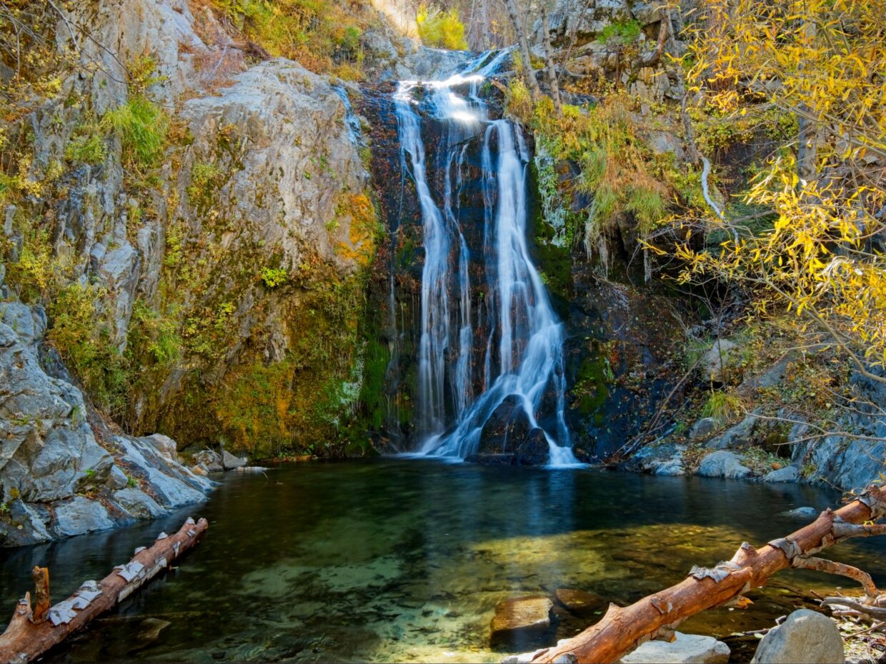
I was feeling like a long hike this weekend, so I invited Shannon, a fellow big-miles hiker, to join me on a loop that hits five peaks on the Hundred Peaks Section list: Mount Williamson, Goodykoontz Peak, Pallett Mountain, Will Thrall Peak, and Pleasant View Ridge. The loop also passes by the beautiful Cooper Falls.
Trip Planning
Specs: 18.7 mi | +/- 6100 ft
Difficulty: Class 1, some off trail but non-technical [ratings]
Location: Angeles National Forest, CA | Home of Gabrielino/Tongva, Tatavim, and San Manuel peoples | View on Map
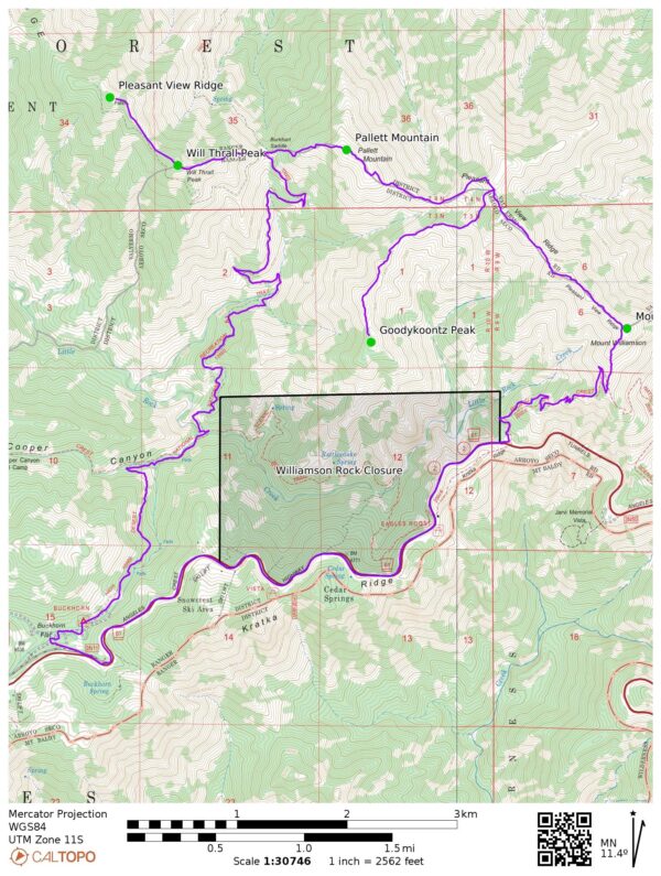
Route: Begin at the Eagles Roost Picnic Area and follow the PCT toward Mount Williamson. Leave the PCT at the top of the ridge and continue uphill to the Williamson summit. From here, follow use trails or your own best judgement along the Pleasant View Ridge. There’s no real trail out to Goodykoontz Peak, but it’s not difficult to find the ridge and walk along it. Backtrack to the Pleasant View Ridge and then hike up to Pallet Mountain via a use trail. This path continues down the steep west slope to Burkhart Saddle and then up the equally steep east ridge of Will Thrall Peak. Continue along the ridge to the final peak, named “Pallet” on the USFS and USGS maps or “Pleasant View Ridge” on the Map Builder or Open Street Maps maps.
To return to the trailhead, backtrack to Burkhart Saddle and follow the Burkhart Trail out to the highway (the east-bound PCT is closed as part of the Williamson Rock Closure through Dec 2026). Walk the road back to the start.
If you want to get a good look at Cooper Falls (and you should!), I’d recommend reversing this loop so that you can see the falls in the daylight. Also note that this entire area burned during the Bobcat Fire and there is very little shade outside of the canyons; plan accordingly.
Permits & Regulations: No permits are required to hike here, but signs indicate that you should have a forest adventure pass (or an equivalent interagency pass) to park at the trailheads. All the usual wilderness etiquette and leave-no-trace ethics apply!
Autumn Hiking
9 Nov 2024 | 18.7 mi | +/- 6100 ft | View on Map
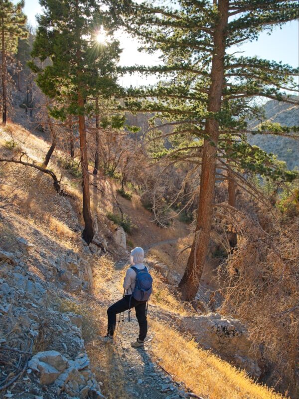
Shannon and I start out from the Eagles Roost picnic area just after 8:00. After a brief road walk we hike up the PCT on the southwest side of Mount Williamson. There’s not much shade on the trail, mostly thanks to the Bobcat Fire that burned through this area in 2020. But the lack of shade doesn’t matter much; it’s a cool, sunny day with a chilly breeze, the perfect hiking weather! We make pretty quick work of the climb up to Mount Williamson and sign the register before setting off along the western ridge.
There is no maintained connecting Mount Williamson, Goodykoontz Peak, and Pallett Mountain, but the route gets enough traffic that there’s a pretty clear use trail in most places. We hike along the ridge for about a mile and then traipse down a steep, loose slope to the ridge that connects over to Goodykoontz Peak. We find a crowd of about 20 Sierra Club members there, all out on a day hike to bag the peak. I chat with them for a minute or two and then Shannon and I sign the register and head back the way we came.
Regaining the ridge between Williamson and Pallett requires us to walk through several dense patches of Poodle-dog Bush. We’re very careful to avoid touching it (it can cause blisters for weeks!) and are thankful to reach the relative openness of the ridgetop. Our next peak is Pallett Mountain, which has a wide, flat summit. There’s not much to see besides the skeletal remains of burned trees.
After signing the register and eating lunch, we follow a use trail down the steep west ridge of Pallett Mountain to the Burkhart Saddle. Then it’s back up the equally steep east ridge of Will Thrall Peak, which has me pausing every few minutes to catch my breath. Despite the steep angle, it’s a relatively pleasant trail with plenty of live trees and even a few wildflowers. Will Thrall Peak is crowned with golden grass and a small plaque paraphrasing Will Thrall:
There is no exercise so beneficial, physically, mentally, or morally, nothing which gives so much of living for so little in cost, as hiking in our mountain and hill trails and sleeping under the stars. — Will Thrall
The final peak of the day is Pleasant View Ridge and is a relatively easy half-mile ridge walk from Will Thrall. The register is missing from this peak, though the canister is still here. Shannon and I take a short break before beginning the return journey. The low-hanging sun casts long shadows, which makes it feel late even though my watch says it’s only 2 PM. That being said, we’re only halfway done with the hike and the sun sets in three hours! At least it’s mostly downhill from here.
We make quick work of the hike back to Burkhart Saddle and then stroll down a moderately-maintained trail to the PCT. It’s a nice break from the steep, completely unmaintained ridge trails! The scenery is lovely too – autumn colors in the grass and shrubs with warm, late afternoon sun casting a gold glow on everything.
We reach the PCT at about 4 PM. The shortest way back to the trailhead is along the southbound PCT, but that trail has been closed since 2005 to protect the endangered Mountain Yellow-Legged Frog. There are no signs or other indications that the trail is closed besides it’s complete lack of maintenance. The PCT is usually a thoroughly trampled thoroughfare, but this section is barely visible.
Crossing the creek we head up the trail toward the Buckhorn Flat campground. It’s an incredibly beautiful canyon with an surprising diversity of trees including incense cedars, sugar pines, white pines, foothill pines, ponderosa pines, birch/aspens, and lots of canyon live oaks. The undergrowth is also in peak fall color with gold and red leaves. We walk past Cooper Falls and then up the trail in growing darkness.
Darkness falls well before we reach the road, so we finish the hike with headlamps on. Shannon spots a few deer and several raccoons in the forest just from the reflections of our lights in their eyes. By the time we get back to the car, I’m completely worn out. It’s been a long day, but a very pleasant hike.


