The Dolly Sods Wilderness, located in West Virginia, is an incredible area and is the best backpacking location I’ve encountered in the mid-Atlantic so far. Granted, my experience is limited but I enjoyed the weekend here much more than previous Appalachian Trail hikes in Maryland and Virginia. Dolly Sods offers sweeping vistas, meadows of tall grass, forests of both deciduous and evergreen trees, and most importantly, a sense of wilderness that is difficult to find on the AT.
Dolly Sods has been through some rough times in the last few centuries. Before early American settlers discovered the plethora of natural resources available, dense forests of ancient red spruce and eastern hemlock blanketed the Dolly Sods highlands. These trees were massive, towering 60-90 feet tall with some measuring as large as 12 feet in diameter. Elk, bison, and mountain lions all roamed those woods along with black bears, snowshoe hares, foxes, bobcats, and many other faunae.
Unfortunately, heavy logging activities destroyed much of the Dolly Sods ecosystem in the late 19th and early 20th centuries. Loggers clear-cut large swaths of land and the topsoil dried out. Sparks from trains and loggers’ fires ignited the dry ground and caused extensive fires that destroyed the remaining trees and brush deemed unfit for logging. Thankfully, nature conservancy groups and concerned citizens fought to protect the area and purchased the land and mining rights from private owners. The Dolly Sods Wilderness and greater Monongahela National Forest are now maintained for everyone’s enjoyment.
Dolly Sods Wilderness Trip Planning
Specs: 19.3 mi | +/- 2300 ft | 1.5 days / 2 nights
Difficulty: Class 1 [learn more]
Location: Monongahela National Forest | View on Map
Permits & Regulations: Because Dolly Sods is located within a National Forest and not a National Park, regulations are relatively lax. Of course, this does not mean we hikers and backpackers are off the hook when it comes to outdoor ethics. Always practice leave-no-trace and be considerate of others, both current and future; the Forest Service website lists some general rules and provides useful publications for trip planning, including a trail map. You do not need a permit to hike or backpack in the Dolly Sods Wilderness.
Most of the trailheads in the area are accessible from Forest Road 75, a wide, gravel lane that skirts the east and south sides of the wilderness area. Plenty of parking spots and gravel pullouts exist along the road, particularly near the trailheads. Dispersed camping is allowed in the wilderness (subject to some restrictions based on proximity to trails, water, and other campers), so enjoy the freedom! However, note that most of the area is very, very wet. Plan for campsites at high points in the topography.
A Night Hike
June 23, 2017 | 1.4 mi | +200 ft / -280 ft | View on Map
I meet Jen, a fellow DC ultralight (DCUL) backpacker, at a metro station and we carpool out to West Virginia. It’s a long drive, made even longer by evening rush hour traffic, but time flies by when you have someone new to get to know! I have yet to meet a backpacker that I haven’t gotten along with. After all, not everyone is willing to drive into the middle of nowhere, fend off mosquitos and bears, sleep on the ground, and carry all their necessities for miles.
The forecast calls for rain all night and into tomorrow morning, but we’re lucky and don’t encounter much en route to Dolly Sods. Jen and I are the last to arrive at 9:30 or so and meet a few group members that have kindly waited for us; others have already hiked into camp.
After double and triple checking that I have my keys, I lock the car, shoulder my pack, and we set off down the Bear Rocks Trail. This weekend marks a new moon and the skies are overcast, so we all rely on headlamps to illuminate the rocky path in front of us. We don’t have a long walk to camp – only a mile or two – and the miles slip away as I chat with some other group members.
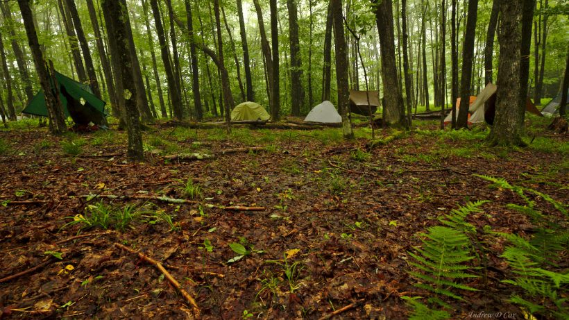
We soon reach our campsite, a flat area near the trail and above the soggy meadows surrounding a nearby stream. I struggle a bit to find a campsite in the dark but one of the other group members who arrived earlier points out a nice saddle where I can set up my tent. As I’ve only set up my tent a few times, I make several attempts before finally arranging all of the pieces in the proper orientation. And none too soon! The soft patter of raindrops in the trees above announces the arrival of forecast showers. The rain and late hour are enough to drive me inside for the night.
A Soggy Slog to Lions Head Rock
June 24, 2017 | 9.2 mi | +940 ft / -1115 ft | View on Map
After a somewhat restless night, I wake up and stretch my legs. Extracting myself from my tent proves to be a bit of a challenge. Although the ground beneath my sleeping bag is level, I have to scramble up a slope to get out the door on the other side (the other door is blocked by a tree). The lack of friction between my socks and the thin nylon floor only exacerbates the issue.
Once I make it into the greater outdoors, I retrieve my bear canister (I’m prepping to hike the John Muir Trail on which bear canisters are required) and add some water to a bag of oatmeal. I love hot oatmeal, but I don’t mind eating it cold especially on days as warm as today. I join a few other group members and chat about this and that – mostly questions about each others’ gear and general introductory topics like, “what do you do?” Water is still falling from the sky, though it’s difficult to tell whether it is raining or if the wind in the canopy above is knocking down droplets from earlier showers. Regardless, we keep our rain gear on for now.
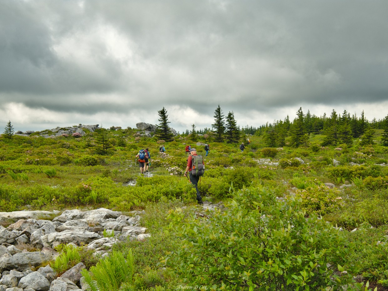
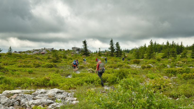
Since we arrived late last night, we break camp a little later than usual to give everyone a chance to catch enough z’s. The trail from camp winds up to the top of a grassy plateau. I get my first glimpse of Dolly Sods from this vantage point. Heath covers the surrounding hillsides and stands of trees dot the landscape. The entire area is wet from last night’s rainstorm, although others in the group that have visited before make it clear that Dolly Sods is always wet.
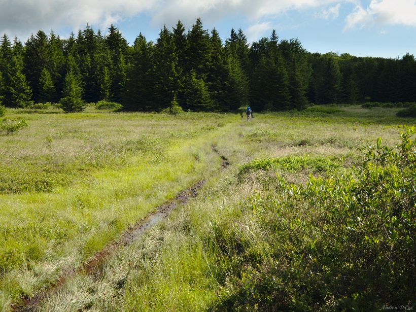
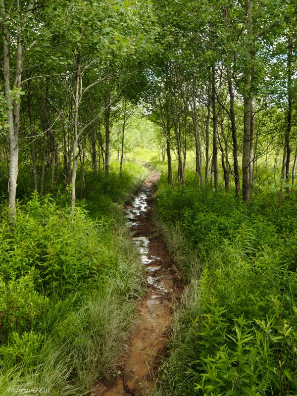
Low-hanging clouds fly over our heads as we cross the plateau and descend to a large meadow area. At first, puddles dot the trail and we side-step them to keep our shoes and feet dry. Soon, however, it becomes apparent that the trail is going to be muddy and wet for the foreseeable future. After accidentally stepping in a few ankle-deep puddles, I give up on keeping my feet dry and just walk through the water.
I fall behind the group as I stop to take pictures every few minutes. One of the joys of visiting a new place is all the new photo opportunities! Of course, not every new sight is photo-worthy; I have to remind myself of this mantra to avoid ending up with a memory card full of uninspiring snapshots.
Speaking of photography, I acquired another piece of gear for my John Muir Trail (JMT) hike since my last backpacking trip: the Fuji XF 10-24mm lens. The focal range of the lens is great for backpacking: it covers the ultra-wide end at 10mm and moderate zoom levels at the 24mm end. I prefer zoom lenses like this one for hiking because I don’t have to swap lenses to change the focal length. Exchanging lenses on the trail is not only time-consuming and a little tedious but it can also introduce dust and other contaminants onto the sensor.
During the next few miles, I stop a few times to photograph dense clumps of ferns, lovely pink mountain laurel, and a pair of mushrooms perched on a mossy stone. I’m impressed by the focus distance of the lens; I’m able to hold the lens inches from the mushrooms and zoom right in! I capture the shot and then hurry to catch up with the rest of the group.
After several miles of muddy trails through meadows and dense pine thickets, the trail emerges out onto a rocky plateau. Make no mistake, the ground is still sopping wet, but it’s easier to walk through puddles on stone and gravel than through mud. The skies are still filled with fast-moving, dramatic clouds left over from last night’s storm. Thankfully, the rain has stopped and doesn’t seem to be coming back any time soon.
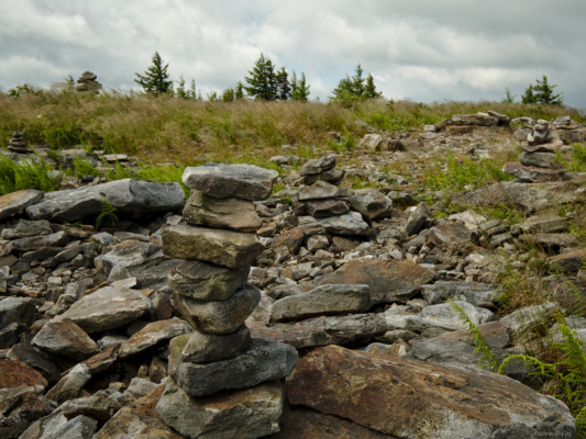
We stop for a break, and to wait for group members to catch up, at a rocky area just north of the Breathed Mountain Trailhead on the west edge of the park. It’s only 11, but someone suggests lunch and nobody argues, so the short break becomes our lunch break. It’s a great spot to relax for a while. Visitors to his area have piled rocks into dozens of cairns just off the trail, which is sort of interesting. Normally cairns are used to mark particularly tricky sections, but they’re wholly unnecessary here. I, along with several others, take off my shoes and socks and let my wet feet dry out. The swift breeze and the sunshine feel great! I brought sunscreen just in case the sun came out, and I’m glad I have it now.
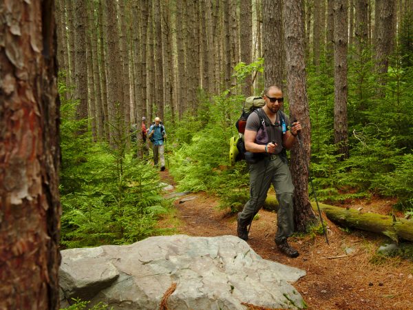
After enjoying lunch (I ate hummus, dried fruit, and a tortilla), we don our wet shoes and socks and continue up the trail. The next several miles bring more of the same familiar experiences: trails turned into creeks, mud, mud, and more mud. The group spreads out as people settle into hiking paces they are comfortable with. Soon, I find myself walking alone through a pine forest. The trail (well, stream bed) is particularly beautiful here: the water cascades over roots and rocks and flows down a carved-out canyon in the dirt. Pine needles and bright green moss line the sides of the brook. Naturally, I stop to take a few photos before continuing on.
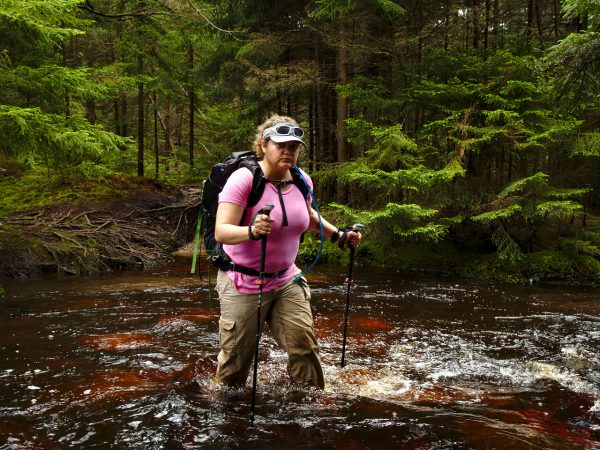
A little further down the trail, I round a bend and come face to face with a 10-foot wide section of Stonecoal Run. The trail has paralleled this creek for miles and, as tributaries join the main branch, the creek has transformed into a small river. On a drier trip, I would take the time to take off my shoes and socks before crossing. But my shoes and socks are already soaked and muddy, so why bother? If anything, walking through the water will only clean my shoes.
It’s been a long time since I’ve done a proper river crossing! There are almost always fallen logs or stepping stones across rivers and creeks in the backcountry. Most of the group has already crossed and are waiting on the other side, so I walk through the shin-deep water and wait on the opposite bank with the others for the rest of our group. We don’t have to wait long and are soon on our way again.
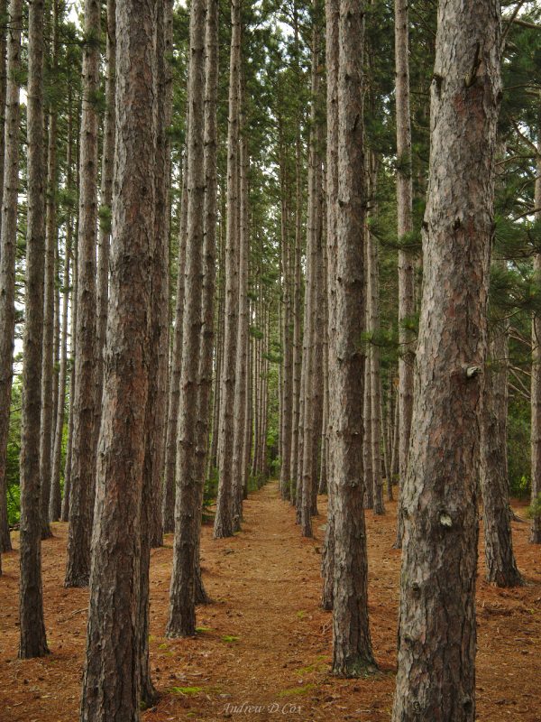
After the river crossing, the trail heads uphill a bit and we put a little distance between us and the soggy flatlands. The trail is – dare I say it – dry! Well, mostly dry. I particularly enjoy walking through several stands of tall pines. The biodiversity and number of different ecosystems here is incredible!
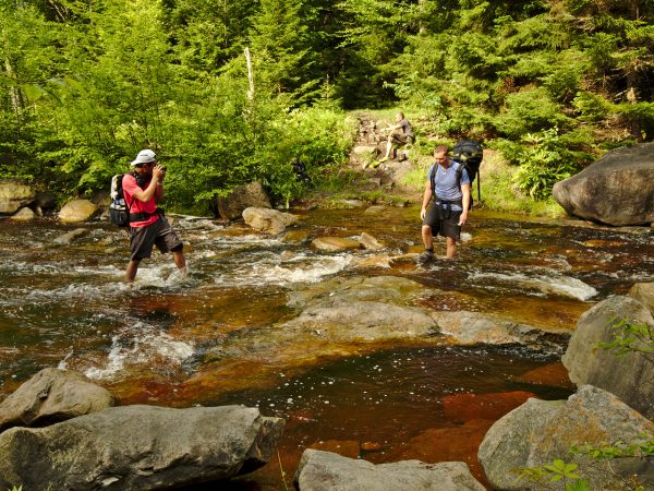
In the next mile or two, we cross Stonecoal Run two more times and each time the river grows larger. I’m not really sure why the trail crosses the waterway so many times. It would be much simpler to stay on the east side of the creek after the first crossing.
The final ford is particularly exciting with a fast current and knee deep water. I take a few minutes to package my camera in a gallon ziplock bag; I want my expensive toy protected if I slip and fall in. I’ve also been taught to undo the hip belt and chest strap for crossings like this. The idea is that in the event you fall in, you can quickly escape from your heavy, waterlogged pack and avoid becoming trapped under water. The risk here is low, but higher than I’m used to and I undo the extra straps anyway. Better safe than sorry!
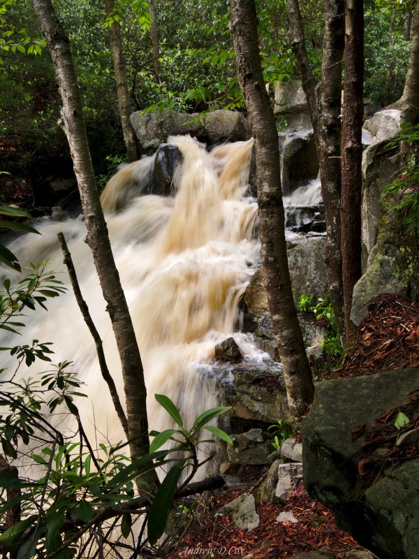
We discover an impressive waterfall only a few hundred feet downstream of our last river crossing. We’re very close to camp for the night, so a few of us photography enthusiasts pause for a few minutes to capture the rushing water.
Just past the waterfall is a spur trail that leads to Lions Head. We climb the steep path up Breathed Mountain and soon level off in a beautiful stand of tall pine trees. There are campsites everywhere, and all of them are fantastic! The ground is almost perfectly flat and covered with pine needles, there are several stone fire rings, and previous visitors have constructed benches from fallen logs and slabs of stone. The pine trees are perfect for those sleeping in hammocks too! I set up a rope between trees and dry out all my gear before putting it in my tent. I leave my shoes and socks swinging in the wind and don Xero trail sandals for campsite activities.
We spend the next hour setting up camp and relaxing. Everyone is hungry after a day of hiking, and all manner of pots and stoves appear as folks prepare dinner. After eating, I and several others go in search of Lion’s Head, a rock formation that is supposed to look like a lion’s head. The small trail that leads out to the rock is marked by a small cairn near our campsite. The route winds through thick trees and brush and is occasionally difficult to follow. Cairns mark the way through the trickiest sections and we soon emerge from the dense woods onto a rocky area. Crevasses criss-cross the surface, some of them 10 – 15 feet deep, so careful footwork is required. Most of the cracks are not terribly wide, but a broken leg or ankle is easily within the realm of possibility.
There are several other backpackers out soaking up the sun. A few of them direct us to the best place from which to view Lion’s Head. I can see the resemblance, but it’s no Mount Rushmore. In my opinion, the views of the surrounding countryside are much more impressive. Large, fluffy clouds punctuate the bright blue sky, and trees line the mountains as far as the eye can see. It’s a bit chilly with a stiff breeze, but the sun is shining! We all take a few minutes to admire the views. And I take pictures of people admiring the views, and of James taking pictures of people admiring the views – us photographers have to get some shots of each other!
I wander back up to camp after taking in the views for a while. The summit of Breathed Mountain should be nearby and I go looking for it, but I’m unable to locate any significant summit. Oh well! I settle down in my tent and read John Muir’s My First Summer in the Sierra for a while. That man sure can write eloquently! His constant, unshakable awe of nature is inspiring. I finish the book in a few minutes (I didn’t have much left) and then drift off to sleep.
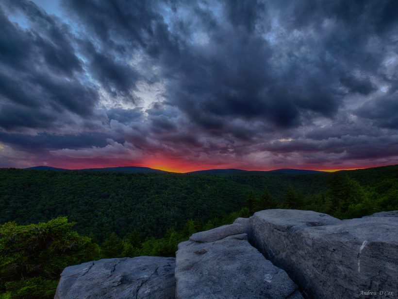
At 7:00, I wake up. The sun is beginning to creep down the horizon and I want to go take pictures so I put my shoes back on. They’re not quite dry, but are certainly not dripping anymore! It seems that just about everyone in the group fell asleep, so I wait for them to wake up and a bunch of us walk back down to the rocky ledge and settle down to watch the sunset. There are lots of clouds on the horizon, but I’m hopeful for a fiery display when the sun sinks just below the clouds. The sky does not disappoint and I snap a bunch of frames as the sun sets.
One of the lessons I’ve learned about sunsets is that the best light often occurs after the sun has sunk below the horizon. I can’t tell you how many times I’ve walked away after the sun sets and regretted it 10 minutes later when my gear is stowed and the sky is on fire. So I stay out with Jim until the skies are good and dark. We walk back to camp with headlamps on and join the rest of the group around a lively campfire.
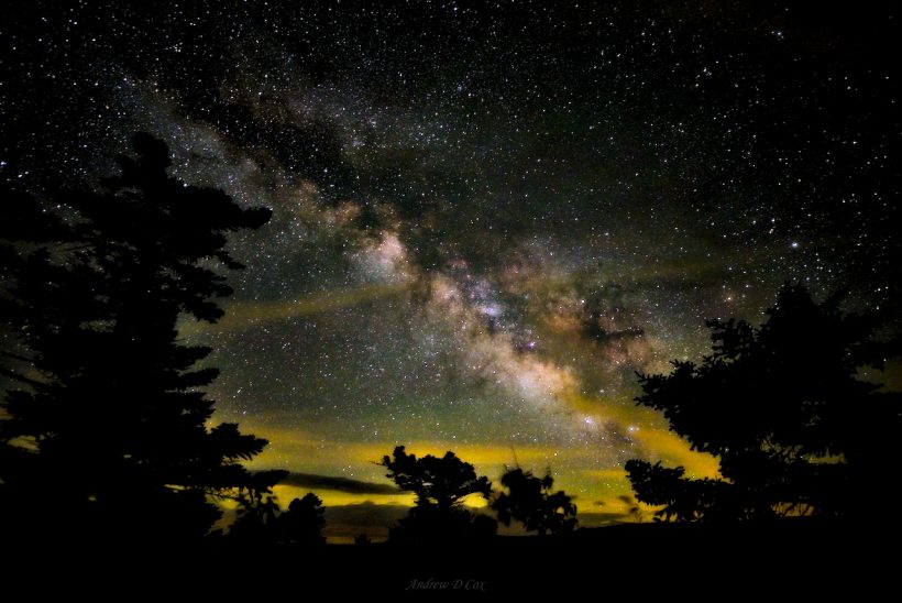
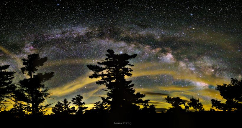
To our collective annoyance, it begins to rain while we enjoy the fire. Luckily, the showers are partially blocked by the pines above and are not long-lived. Soon, the clouds clear and stars peek through. James and I return to the rocks and spend an hour or two taking pictures of the night sky. We’re both shooting with the same camera and lens and I very much enjoy chatting with him about photography. We head back to camp at about midnight and head to bed – we’re leaving camp early tomorrow morning!
Bogs and Mountain Meadows
June 25, 2017 | 8.7 mi | +1150 ft / -890 ft | View on Map
We leave camp early this morning and hike back down the spur trail to Rocky Point Trail. The path here is mostly shoe-sized rocks, many of which are loose. I lead the pack for a little while and then fall behind to take a few pictures. Despite the tricky footwork, it’s refreshing to hike on dry ground. With fresh socks on, my feet are dry for the first time in 24 hours!
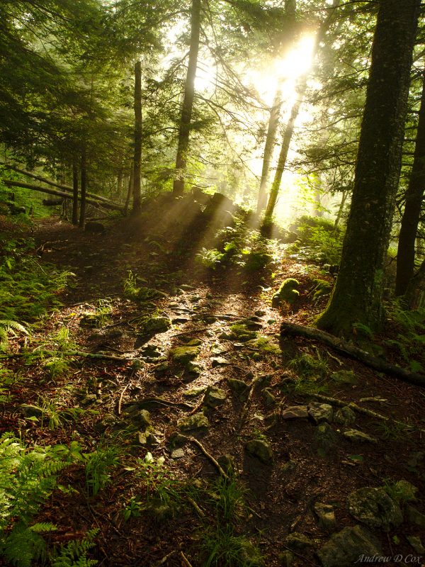
The Rocky Point Trail winds around Breathed Mountain and the boulders we watched the sunset from last night. Lion’s Head isn’t visible from the trail because of heavy tree cover, but it isn’t far past the tree tops. Patches of mist obscure distant trees along some sections of the trail and create spectacular sights where the early morning sun streams through the foliage. I really enjoy this stretch of trail – it’s both flat and dry!
Of course, the dryness is too good to last and I’m soon hopping from one rock to another in an attempt to avoid stepping in muddy puddles. I’m moderately successful until I reach Red Creek; crossing in shoes and socks means sopping wet feet once more. Peter has already warned us that the trail today leads through an infamous stretch of deep mud, so I knew that the dryness wouldn’t last. It was nice for a while, though!
After fording Red Creek, the path begins to climb toward Blackbird Knob. One might think that only trails in the flatlands would be soggy, but that is not the case here. I walk upstream (or ‘up trail’) through murky ankle deep pools. Maintaining stability in the slippery mud puts extra strain on my knees and hips so I’m grateful for trekking poles to help relieve the stress. The poles are particularly useful on the final hundred yards of Red Creek Trail: the grade is steep, muddy, and slippery, and being able to maintain four points of contact with the ground keeps me from landing face first in the mud.
Despite the less than ideal muddy conditions, I really enjoy the hike. After climbing a few hundred feet, this stretch of Red Creek Trail emerges from the woods into a beautiful (and soggy) meadow. Bright sunlight streams from the sky, birds are singing, and a morning breeze rustles through the long grass. I’m reminded of hiking out west, particularly of the meadow near William’s Creek Trail.
I also relish the chance to hike alone. I know there are several group members behind me and several more in front, but I can’t see or hear any of them. While I really love backpacking with groups like this, I appreciate the chance to walk on my own and dwell in my own head space for a while. I also don’t feel guilty for holding others up when I stop to take pictures if the group is fluid like this.
I expect to meet the group members that are hiking in front of me at the junction of Red Creek Trail and Blackbird Knob Trail, but when I arrive nobody is there. Those in back of me arrive soon, and then we all continue together.
After a brief walk down the Blackbird Knob Trail, we turn north on Upper Red Creek Trail. At first, the route is incredibly muddy. I pause to tighten my shoelaces to avoid losing a shoe in the deep silt. However, as the trail trends uphill the wetness subsides a bit and walking becomes easier. The forest gives way once more to meadows and the occasional stand of aspens shivering in the wind. I’ve never seen aspens in this part of the country; I wonder how they got here? Or, perhaps, if they’ve always been here, where did all the other aspens go?
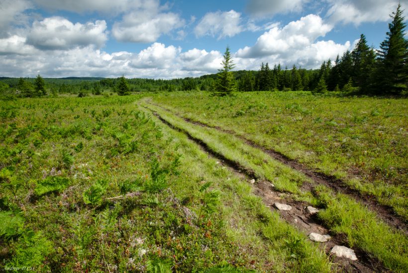
I pause to take a few pictures and my hiking companions continue on ahead. The next mile on Upper Red Creek Trail is my favorite of the entire trip. Cotton ball clouds drift lazily overhead and a breeze ripples through the tall grass in the meadows. The trail morphs from single-track into several tracks where hikers have chosen drier routes. The deep tracks through the soft ground remind me of alpine trails in the mountains; the surrounding pines and cool air only add to the illusion. I establish a rhythm on this dry stretch of trail and time slows down for a while.
I meet most of the rest of the group at the junction with Dobin Grade Trail. According to our resident Dolly Sods expert, the Dobin Grade Trail is built on the bed of an old railroad. So, while it is muddy and a “right of passage” for Dolly Sods hikers, if you remain on the trail you won’t sink in past your ankles! It’s the little things in life…
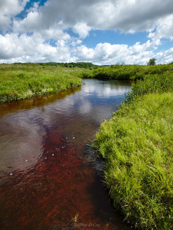
We cross Red Creek once more and then brave the bog. The first muddy section takes me by surprise when I step through what appears to be solid ground. Beneath the murky water, I can feel the gravel and rocks of what I imagine are the old railroad bed. I step off the trail once or twice and sink up to my knee! I use my trekking poles as feelers after that to make sure that suspicious puddles are not deeper than they appear.
The boggy section of trail is over much sooner than I expect and we make excellent time along dry, flat trail. The Dobbin Grade Trail eventually tees into Bear Rocks Trail and we make our way back toward the cars. I enjoy actually seeing the landscape this time; it was dark when we hiked through here on Friday. The heathland stretches for miles; pines and rock outcroppings punctuate the sea of green shrubs, and those cotton ball clouds are still hanging around.
Before I know it we’ve reached the trailhead; the cars are just a hop, skip, and a jump away. I and several others wash off our feet and legs, change into sandals, and then sit and talk for a few minutes. However, with a 3.5-hour drive still to go, we say our goodbyes and drive away.
If you’re a hiker or backpacker in the mid-Atlantic, you need to visit Dolly Sods. I was skeptical at first, especially after learning about the infamous bogs and muddy trails. However, I’ve now seen the light. Yes, it is terribly muddy, but does anyone really get into backpacking because it’s comfortable and easy? The amount of diversity is awe-inspiring and the sense of wilderness is much stronger than on other trails on the east coast. I had a great time, made even greater by the fantastic people I got to know over the weekend.
Until next time, happy trails!










Steve Cox 1 July 2017
Thanks for posting another fun report, Andrew! I especially loved the shots of the milky way on the horizon. Gorgeous!
Andrew Cox 1 July 2017
You’re welcome – I’m glad you like the photos!