Another weekend, another trip! My friend Michael planned this adventure several weeks ago; until he posted the trip plan on our Facebook hiking and backpacking group page, I hadn’t considered driving up to the Sierras. From where I live in LA, it takes between 3.5 and 5 hours to drive to the Eastern Sierra trailheads. That’s a fair amount of car time, and I’d discarded those trips as “too far,” in my mind. All it took was a tiny shove – a Facebook event indicating that others were willing to make the drive – and suddenly a drive up to the Sierra Nevada didn’t seem so tedious. This all occurred before my trip to Mt. Whitney, so I have to thank Michael for giving me the nudge I needed to plan trips to these distant, but totally worth it, mountain trails.
Trip Planning
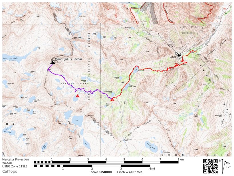
The Pine Creek trail is depicted on the south side of the Mammoth Lakes National Geographic Map, though not at a high level of detail. The Tom Harrison Mono Divide map has a finer scale or you can print your own from CalTopo.
Permits are required for all overnight trips in this area and, due to the popularity of the region, are difficult to come by. You can reserve one online months ahead of time or try your luck at the daily permit lotteries for a walk-up permit. The usual Sierra Nevada rules and regulations apply (bear canisters are required) and take care to leave no trace! For more information, visit the Inyo National Forest website.
Let the Weekend Begin!
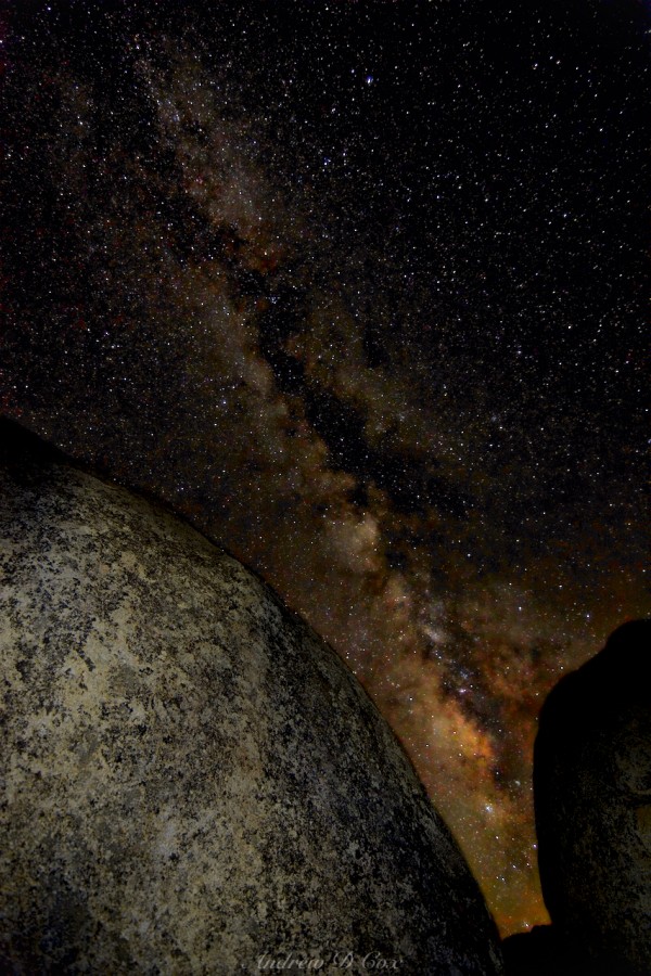
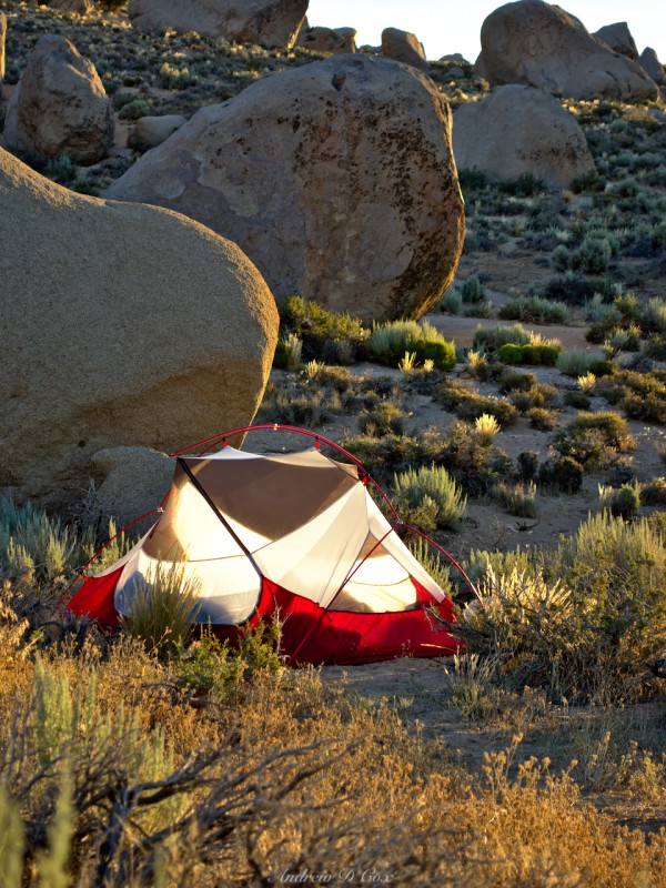
I meet Michael and Eddie at the parking garage after work, and we stop by CalTech to pick up John and Roya. Soon enough, we’re zooming down the highway toward Mojave, jamming to Michael’s playlist and excitedly anticipating a weekend in the Sierra Nevada. After a brief stop for dinner at a McDonalds (they’ve really classed up their restaurants!), we’re on the road again. Because we left LA at about 6 pm, the sun sets during the drive. The plan is to camp in the Buttermilks, a well-known bouldering area just outside of Bishop. We arrive at about 11:30 and drive down a terrible washboard dirt road between the fields of boulders. We find a spot to pull off the road and set up our tents in using the light from our headlamps. Michael and Eddie share a two-person tent, as do John and Roya. I’ve got my little one-person tent and set it up quickly. I wander off into the boulders with my camera and tripod to capture a few images of the night sky. Despite the fact that Bishop is only a few miles away, the skies are very dark and the Milky Way is clearly visible to the naked eye, which means it will be incredibly easy to photograph! I find two boulders with a gap between them and line up the camera and Milky Way, as in the image below. I light the boulders by very quick passes of my headlamp; this technique is called “light painting” because you are essentially painting the foreground with the light source. It takes a few tries to get the brightness right, but I eventually capture a shot I really like. Satisfied, I go to bed; I’ve left the rain fly off and fall asleep looking up at the stars.
Welcome Home
July 8, 2016 | 11.1 mi | +4,972′ / -1,971′ | View on Map
I regularly wake up at about 05:00 in order to get a workout in before work, and my internal clock remains on that schedule on the weekends. However, that works out well because the sun rises about then. The White Mountains to the east block the rising sun for a while and the sky grows bright while the sun tries to peer over the peaks and illuminate the landscape near our camp. I grab my tripod and camera and wander around to take pictures in the morning light.
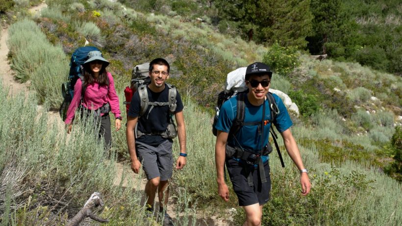
Once the sun crests the eastern mountains, the temperature quickly begins to rise. My companions wake as their tents glow like lanterns in the direct sunlight. It’s a beautiful morning! We all eat breakfast and prepare our packs for the weekend. Some of us ration out food from bulk containers and others change into hiking clothes and stash our street clothes in the car. We drive back down to Bishop to pick up our permits at the ranger station; I enjoy chatting with the rangers there. They know so much about the nearby wilderness and always have useful suggestions and tips about what sights to check out. After filling our water bottles, we pile back into the car and drive to the Pine Creek trailhead.
The Pine Creek trail begins near an old Tungsten mine that is thankfully no longer operational. Rumor has it that the mine will open again if and when the price of Tungsten rises. That possibility seems very likely from the look of the mine: it is clean and well maintained.
The first several miles of the trail climb gradually up the mountains in a series of long switchbacks. The slopes are covered in talus, sagebrush, and a healthy collection of wildflowers. As we climb higher, a tumultuous cascade, a Sierra Nevada trademark, comes into view. We don’t have these kinds of waterways out east; the ground is too erodible and quickly forms canyons and streambeds. The granite here, on the other hand, doesn’t seem to erode at all and the water simply flows over the surface, only inches deep.
Soon we reach trees and a gorgeous alpine lake, Lower Pine Lake. We eat lunch while admiring the view and then relax for a little while. In fact, several of us take a brief siesta. 🙂
After resting, we continue on. We accomplished most of our altitude gain on the switchbacks and the trail here is relatively flat. As a bonus, the path winds its way through pine forests and is very shaded and cool. The scent of pine needles is one of my favorite things in the world… that smell, combined with the clean mountain air, is incredibly soothing.
We soon reach Upper Pine Lake, and then Honeymoon Lake. It’s about 4:00 and we’ve covered a little over 5.5 miles with an ascent of about 3,100 feet. I feel great and am ready to keep hiking, but my companions want to stay at Honeymoon Lake. It’s a beautiful location and it is our planned stopping point for the day. I find a flat spot for my tent between some granite boulders and pine trees, and unpack my sleeping bag, sleeping pad, and bear can. I’m not really ready to spend the rest of the afternoon sitting around, so I bid adieu to my companions, promise to be back by 19:00 and head up higher into the hills with a lighter pack (water, snacks, first aid, photography gear, etc.).
Granite Park
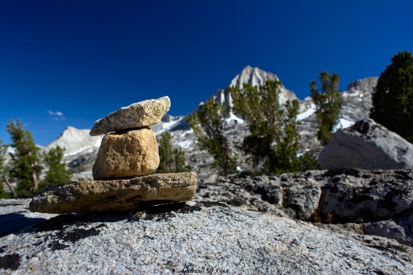
There are two trails that climb into the high country from Honeymoon Lake. One path heads east to Italy Pass, the other south to Pine Creek Pass. Rather arbitrarily, I choose the route toward Granite Park and Italy Pass. Almost immediately after leaving the popular camping area near Honeymoon Lake, the trail becomes difficult to follow. Instead of a well-worn dirt path through the trees, the trail climbs over slabs of granite where footfalls are much harder to see. Luckily, this is not an unfamiliar problem and wilderness wanderers (e.g., native Americans) found a solution long ago. Small piles of rocks called cairns (see below) guide me through the rocks until I reach a typical dirt route in a grassy field. Regardless of the ruggedness of the terrain, this section seems to be less well maintained (or perhaps just much less traveled) than the trail my friends and I followed this morning and afternoon. The footpath climbs up steep inclines, barely bothering to switch back, and crosses through lightly trodden meadows. Often my only hint of direction is a thin dirt track a hundred feet away. I don’t mind, though. The barely marked trail has a wild aura that lends itself to a fantastic sense of adventure.
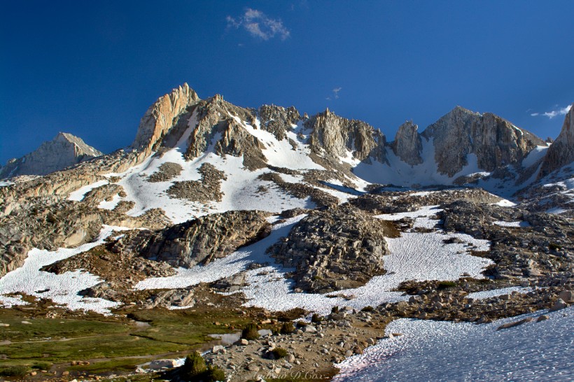
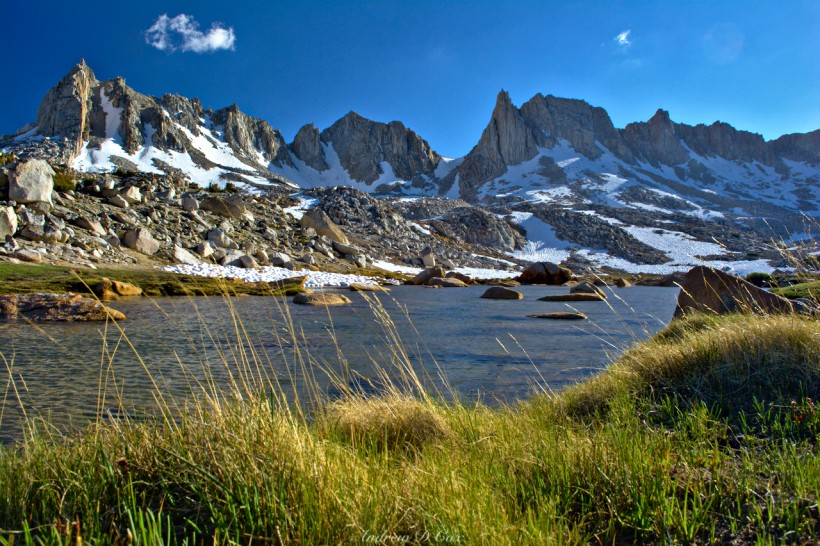
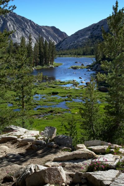
As I climb higher, the trees thin out and snow fields begin to dot the landscape. In several spots, snow banks completely cover the trail and I’m left to find my way around (or through). Soon I’m walking through large meadows dotted with boulders, snow, and crystal clear ponds and streams. I’m not sure why, but walking into this wilderness feels like coming home. Perhaps some deeply buried evolutionary instinct is at work, comforted to have access to so much water and shelter. A huge grin works its way onto my face as I traverse the meadows and hop from boulder to boulder over the snow-fed streams.
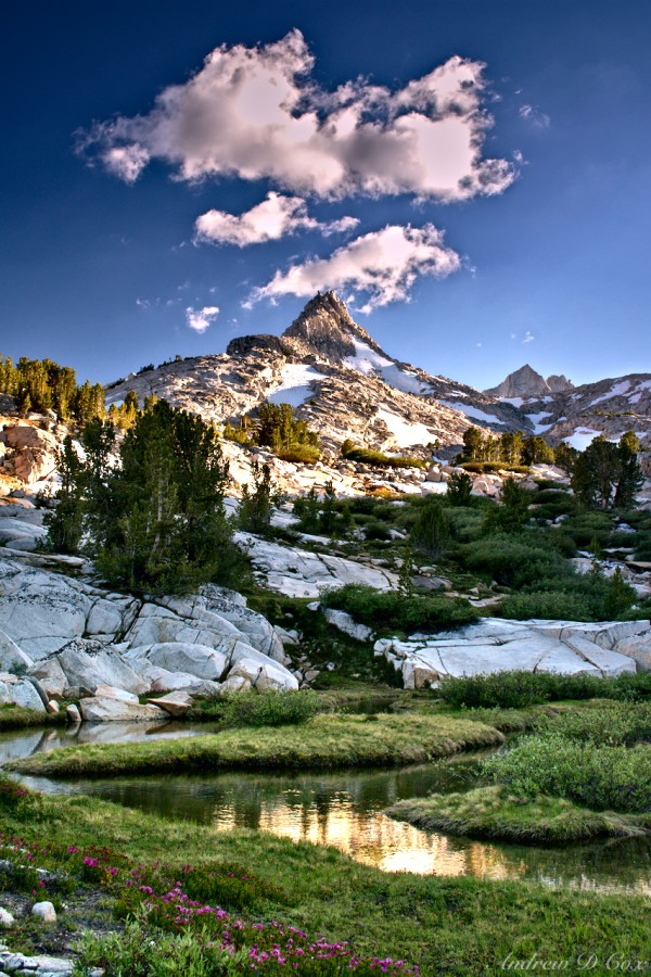
The landscape of the High Sierras is a strange juxtaposition of fragility and strength. The soil is made up of gravel-like chunks and is thin and dry; the plants that grow here are smaller and easily dislodged from the soil. Stepping off the trail leaves deep imprints in the foamy grass and “leave no trace” acquires new meaning. Even the air is thin and delicate. In contrast, massive granite peaks tower over the streams and meadows, and imposing snow fields bar access to the higher slopes. One is left feeling both powerful and tiny, capable of destroying the fragile environment, yet exposed and weak in the presence of the magnificent peaks.
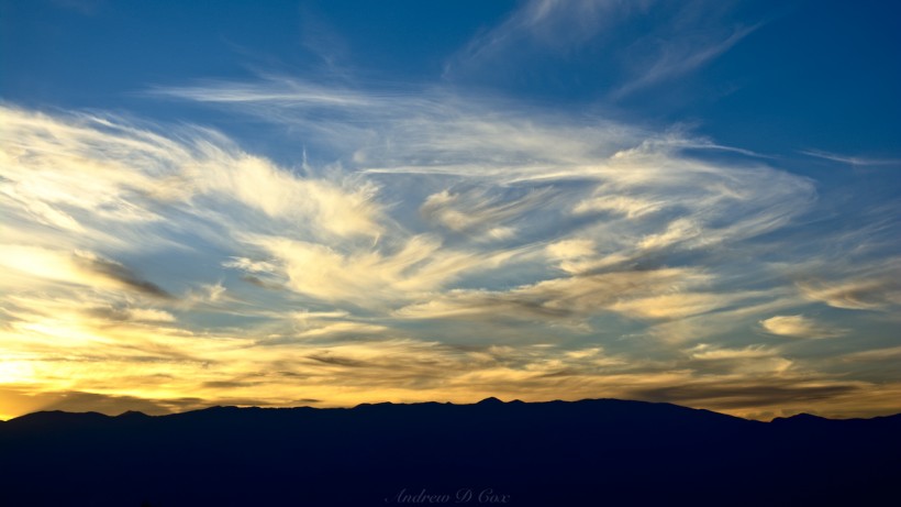
My goal is to hike through Granite Park to Italy Pass, but by the time 18:00 rolls around, I recognize that there are still several miles between myself and the pass and turn back toward camp. The sun is beginning to set and long shadows adorn the granite cliffs and snowfields. As it’s prime picture taking time, I stop many times to capture images of the breathtaking scenery along the way. I lose the trail many, many times – it’s tough to find the tiny cairns among the rocks – but eventually make my way back to Honeymoon Lake. I’m every so slightly late; I promised to be back by 19:00, but it’s 19:15. John and Roya have already finished mourning my supposed death and are hiding in their tent to escape the devilish mosquitos. I’d forgotten about the bugs… My trip last weekend to Mt. Whitney was more or less bug-free, likely because the Sierras are much drier in that area. Here, however, next to a lake and a plethora of other bodies of water, the mosquitos thrive. The only solution is to cover every inch of exposed skin with clothing or hide somewhere the bugs can’t reach you. I don a head net and jacket to shield my face and arms from the tiny flying vampires and then set about cooking dinner. A cup of boiling water added to a ziplock bag of couscous, dehydrated vegetables, tuna fish, and spices yields a tasty meal. I awkwardly spoon my dinner into my mouth under the head net and talk to my friends through the wall of their tent. They’re excited to see the area I just explored, and we agree to hike up there as a group tomorrow. After I finish eating, I stow all my scented gear and trash in the bear can and then hide out in my own tent for the rest of the evening.
Fun at High Altitude
July 9, 2016 |6.2 mi | +3,113′ / -2,121′ | View on Map
The next morning brings cooler temperatures which (sort of) banish the mosquitos. Somehow they still find me, so I bring the head net and jacket back out to avoid being bitten. I slept in a bit today, so I’ve missed the alpenglow on the mountains, but there are still photo ops to be had: the wind is calm and the lake is glassy. I remove my shoes and wade through the frigid water to reach a vantage point that positions the lake between me and several peaks. Protected by long sleeves and mosquito netting, I sit and admire the view between taking photos and wait for my friends to wake up.
Soon enough, everyone is up and we pack up camp. I lead the way (mostly… finding the trail is still difficult, even the second time ’round) up toward Italy pass. We make our way through the snow fields until we reach an unnamed lake that I glimpsed last night and thought would make a great campsite. There is lots of snow up here! We find a flat spot amidst a field of granite boulders and set up our tents. The tent that Roya and John are sharing is more difficult to set up than the others. It only has one pole and relies on a series of guylines to maintain a tent shape. Unfortunately, we’re unable to convince the stakes that come with the tent to stay in the ground and end up tying the lines off to rocks. Eddie shows off his NASA engineering ingenuity and finds a way to use the stake bag as an extra guyline, which puts the finishing touches on the whole shebang. It seems to hold up against the gusty winds, so we deem the enterprise a success and move on to planning the rest of our day. In the meantime, Michael makes a snowman (when at altitude…). 🙂 Eddie, Roya, John, and I decide to hike up to Italy Pass and see the sights I was unable to reach last night. Michael elects to explore the snowfields and peaks around the lake, which we’ve decided to call “Birthday Lake” since Michael and I both have birthdays this weekend.
The trail from Birthday Lake to Italy Pass traverses a landscape almost entirely made up of talus and solid granite. We make some progress following cairns for a while but eventually give up and just walk uphill, over whatever rocks suit our purpose, toward the pass. There is no plant life to trample at these high altitudes, and nobody feels guilty about walking over the granite outcroppings. A short while later, we arrive at the pass, which lies in a saddle between two peaks. It is incredibly windy atop the ridge, windy enough to feel like I’m being blown over. We take shelter behind a slab of granite and admire the clouds. The sky is dark blue, and clouds race overhead; they can’t be that far away, as we’re pretty high up at 12,408 feet! I’m glad I spent last weekend at altitude – I’m not feeling the effects of the thin air at all today.
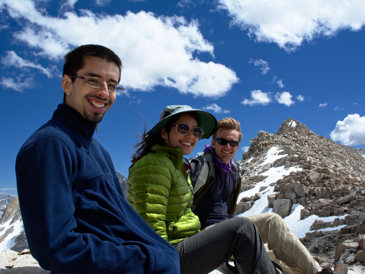
John and I have schemed to climb a mountain near the pass, Mount Julius Caesar, and leave Eddie and Roya at the pass. The climb to the summit consists of scrambling up large boulders; it’s a solid class 3 route. We reach what appears to be the peak (much to my relief; there are some steep drops nearby!) but quickly realize that the true peak is a few hundred feet away. How difficult can a short ridge walk be? John has no trouble with it and hops from boulder to boulder, over thin crevices that stretch 10 – 20 feet down into the mountain. I’m extra cautious and more than a little nervous as I straddle these gaps and make my way toward the summit. The final ascent is perhaps a mild class 4 climb: there are a couple spots where I have to use several hand- and foot-holds to scale particularly tall rock faces. Finally, I reach the peak of Mount Julius Caesar and join John in admiring the view. Snowcapped peaks stretch as far as the eye can see, and cotton ball clouds dot the sky. Although this “small” peak (13,196′) is over a thousand feet shorter than Mt. Whitney, the views are much more spectacular! From Whitney, we could see the desert, the city of Lone Pine, and the snowless White Mountains. It’s quite different here! I spot an aluminum tube under a rock; upon inspection, it opens and I pull out a small notebook and pencil: the summit log! I sign John and myself in and read a few of the names in the log. There have only been four other parties up here in 2016!
Clouds are quickly forming to the West, though they don’t seem to be accumulating; they blow away as soon as they form. Clouds are literally forming in front of our eyes (quite rapidly, really) and flowing east with the wind. John and I are uneasy about the prospect of being the highest things around if inclement weather is on the way, so we hurry down the mountain to Italy Pass. In retrospect, there is a much easier route to the peak that stays on the west side of the ridge rather than following the ridge line. Ah well, we had an exciting time!
It only takes us 30 minutes to descend to Roya and Eddie, and then the four of us return back to camp. We fill Michael in on our adventures, and he tells us about climbing up a snow chute and an icy lake he discovered over the ridge. It’s getting cold: the sun is hidden behind writhing clouds and the wind drops the temperature by 10 or 20 degrees. For whatever reason, I did not bring a thermal layer on this trip… I have a great wind breaker, but no fleece or puffy. Oh well. My little gas stove struggles to stay lit in the wind and goes out once, but soon enough I have a pot of boiling water. I add some to another couscous dinner and give the rest to John and Roya for their dinners. Eddie and Michael heat their food as well and soon we’re all enjoying a warm meal.
After dinner, we entertain ourselves by building a short rock wall around our tents to prevent the wind from blowing sand under the rain flies. I’m not sure that it helps much, but it keeps me moving and warm, so I don’t mind. I go to bed a little earlier than usual to take shelter from the cold in my sleeping bag. There’s nothing quite like crawling into a warm bag after a long day hiking in the mountains!
Mountain Morning
July 10, 2016 | 8.3 mi | +337′ / -4,467′ | View on Map
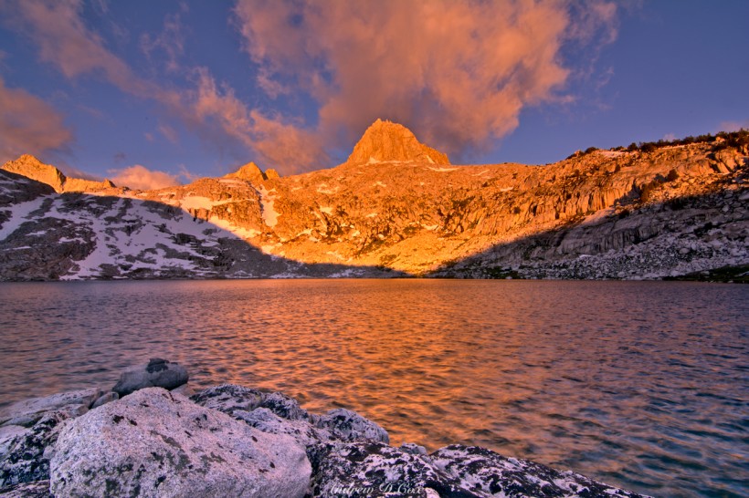
I intended to get up and take some pictures of the stars last night, but I couldn’t gather the courage to brave the cold wind. I wake up right as the sun is illuminating the peaks near Birthday Lake and scramble to put on clothes and grab my camera before the warm light turns into the harsh daytime sunlight. I’m nearly too late but still manage to squeeze off a few shots of the sun kissing the mountains and the lake.
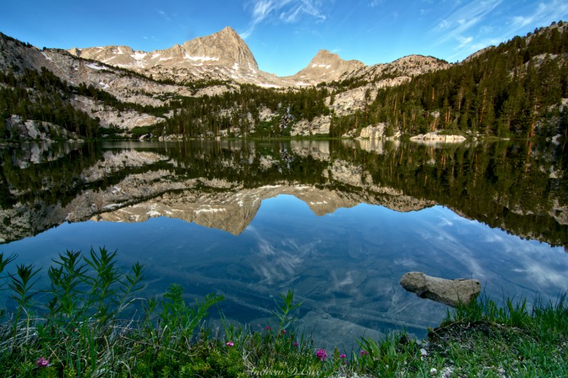
Everyone is up early this morning and we hurry to pack up our gear. Several of us have to be back to L.A. this afternoon to get some work done, so there’s not much time for dawdling. It’s impossible to ignore the scenery, however, and our descent is not entirely without sightseeing. Upper Pine Lake, pictured below, is particularly beautiful this morning! The final few miles consist of the same switchbacks from Friday. They’re brutal on the knees and hips and I’m not the happiest camper during the descent. I soak my feet in a cold creek at the trailhead and, after packing our gear into the trunk of Michael’s car, we drive off to Bishop in search of some post-hiking Mexican food and cold drinks. It’s been a great weekend; I could not have asked for a better birthday! Goodbye, for now, Sierra Nevada!






Shayla 27 February 2020
Hi! I love your pictures and your description! We are planning to do this trail in July. How long did it take you to get to Honeymoon Lake?
Andrew Cox 27 February 2020 — Post Author
Hi Shayla — thank you! Looking back at the timestamps on my photos, it looks like we hiked from the Pine Creek trailhead to Honeymoon Lake in about 5 hours. The lake is a little less than 6 miles from the trailhead, but you’ll climb 3500′ to get there. The first section is a bit of a slog and can be hot; I recommend starting in the cool morning temps so that you’re a little higher and up in the shady pines by the time it heats up.
Have fun out there!
Tyson 25 June 2020
Fantastic pics that have put Granite Park squarely on my list this summer! Thanks for the great trip report.
Andrew Cox 13 July 2020 — Post Author
Thank you! I hope you make it up there.
Bobby 27 December 2021
This was a great read and I found myself disappointed that I had reached the end because I wanted it to just keep going. A friend and I are planning a trip to Granite Park this summer to lug up my radio equipment to do some activations for Summits on the Air. We’re going to do some sightseeing but are planning on shooting up to Granite Park on day one to set up camp. Thanks for the detailed descriptions and fantastic photos!
Andrew 10 January 2022 — Post Author
Hi Bobby, I’m glad you enjoyed the read! What is “Summits on the Air?” Have a great time up there.
Brent T Boyd 16 July 2024
Hey Andrew ,
While you were up at Birthday Lake did you happen to notice if it had any trout ? I know Honeymoon and Pine Lake does , and while I’ve gone over Italy Pass years ago we zipped thru Granite Park and didnt stop to see the lakes. Any info would be helpful as we’re headed there next week. Thanks
Brent
Andrew 20 July 2024 — Post Author
Sorry Brent, it’s been far too long since I was up there and I don’t remember.
Michelle 6 May 2025
Do you remember how long it took you to get from Honeymoon Lake to Granite Park? Attempting a day hike to the latter this Fall!
Andrew 9 May 2025 — Post Author
It’s about 2 miles and 1000 feet of elevation gain from Honeymoon Lake to the general Granite Park area; the time will depend on your own pace, of course; I (a pretty fast hiker) would budget about an hour.