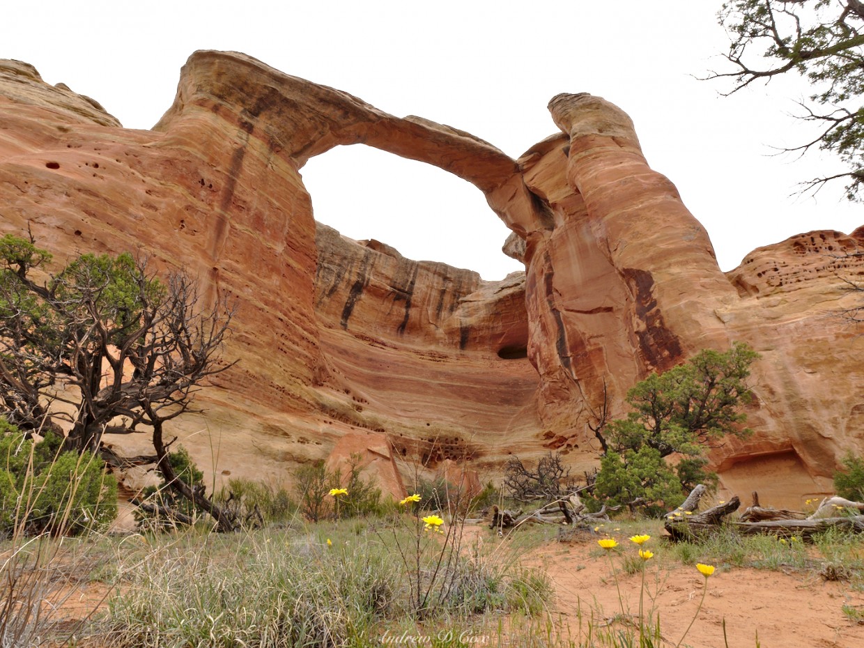
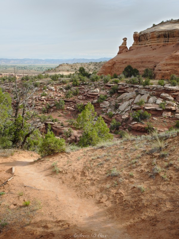
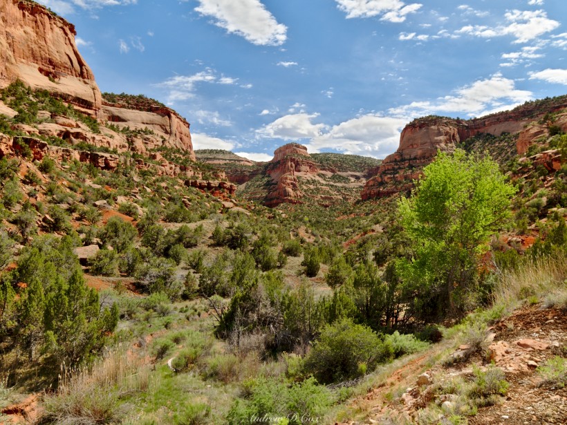
While researching hiking options near Colorado National Monument, I stumbled upon a few trail reports for the Rattlesnake Arches trail. Intrigued by the name, I investigated a little more and was soon sold on the hike. The Rattlesnake Arches trail visits arches (obviously), spires, and windows, and passes through rugged canyon backcountry. One source even claims that the arches in this area are the densest collection outside of Arches National Park! Those selling points, plus the wonderfully long 15-mile round trip distance, make this hike the perfect 1-day excursion.
Trip Planning
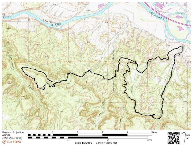
Specs: 15.6 mi | +/- 3000 ft
Difficulty: Class 1 – 3 [learn more]
Location: McInnis Canyons National Conservation Area | View on Map
Route: There are several trails that lead to the Rattlesnake Arches. The shortest hike is accessible by high-clearance vehicle from the south; it’s about an 8-mile offroad drive and then a 2-mile hike to see all of the arches. If, like me, you don’t have a high-clearance vehicle, you can hike in from the Pollock Bench trailhead (or others; there are many connecting trails). If you choose this option, you’re in for a 15-mile round trip hike but it is well worth it; the hike in is just as cool as the arches! A final option, at least on the map, is hiking in from Rattlesnake Canyon, assuming you can cross the Colorado River via canoe or kayak and then navigate/climb your way to the arches.
There are no reliable water sources along this trail, so pack what you need for the entire hike. I lugged along 3 liters on this trek (about 8 hours of walking) and drank the last drop as I was walking into the trailhead parking lot. This hike involves some class 2-3 scrambling, so be prepared to use your hands a bit. This is an incredible desert and canyon hike – enjoy, and leave no trace!
Resources: Although National Geographic prints a map of McInnis Canyons NCA, I found it to be too low-resolution to be of much use; it’s also missing the trail designations employed on the signs in the backcountry (e.g., “R1”, “P1”, etc.) and a few of the trails are not plotted. So, if you have the ability to print your own map, I would recommend this BLM map or these excellent maps from the Colorado Canyons Association (CCA). I found a stack of paper maps with the proper trail designations in the trailhead logbook box when I visited, though they lacked any topographical markings.
Rattlesnake Arches
May 9, 2018 | 15.6 mi | +/- 3000 ft | View on Map
I arrive at the trailhead a few hours after sunrise. It’s an overcast day, which I appreciate – the temperature is much cooler without the sun beating down. I log my name into the trailhead log book and read the signage on the bulletin board: a few warnings about active mountain lions and a few statistics about this 15-mile hike with an elevation gain of 3000 feet. I’m a little surprised at that last factoid – how is the elevation gain that large? None of the hills around here have that much prominence…
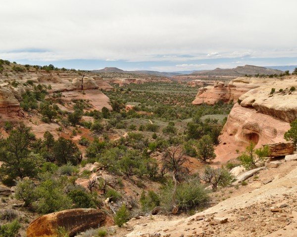
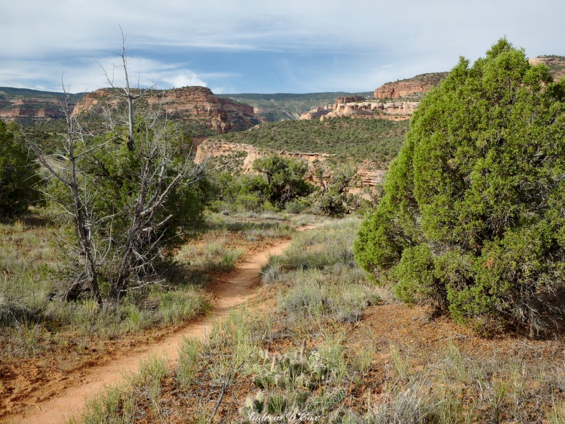
The trail climbs steadily from the parking lot, winding between scrubby juniper trees with sagebrush and stiff tufts of grass interspersed between them. I’m wearing a long-sleeved shirt and pants to keep the sun off, but, since it is cloudy and cool, they’re more effective as insulating layers at the moment. I soon find myself walking along the rim of a mesa with a precipitous 50-foot drop on one side and, beyond, some of the most incredible vistas I’ve ever seen: the green desert plains stretch out in front of me, meeting tan and red sandstone buttresses in the distance, which are in turn adorned with dark green junipers and pinyons. A trail threads through the landscape below, leading my eye toward the magnificent canyons on the horizon. I sure hope I’m headed that way!
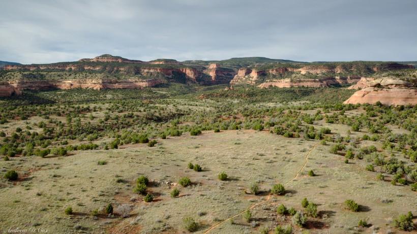
For a while, the path continues along the edge of the mesa, offering a steady stream of excellent views. However, the trail soon turns away from the welcoming canyon walls. I reach a trail intersection with simple trail designations: “P1” and “R1”. I assume that “R1” stands for the Rattlesnake Arches trail, and “P1” must represent the Pollock Bench trail – the National Geographic map I’m carrying doesn’t have these markings (though the CCA and BLM maps, linked above, do). I take the path marked “R1” and begin to descend, which surprises me; I thought I was climbing a few thousand feet? I pull out my phone to check with Gaia GPS, a fantastic backcountry navigation app. Sure enough, I’m still on the proper trail, so I continue on, hoping to turn back towards those canyons that are calling my name…
My disappointment doesn’t last long; after descending for a short while, the trail turns back to the northwest and leads me to the edge of another mesa. I have to look carefully to find the way forward; I can see the trail some 30 or 40 feet below, winding through the trees, but the descent is less clear. I thread my way along the edge of the mesa, then cut back along a smooth, inclined sandstone ledge. I’m wary of loose gravel scattered around the ledge and take care to maintain my footing. A slip here wouldn’t be deadly but it would hurt… probably a lot.
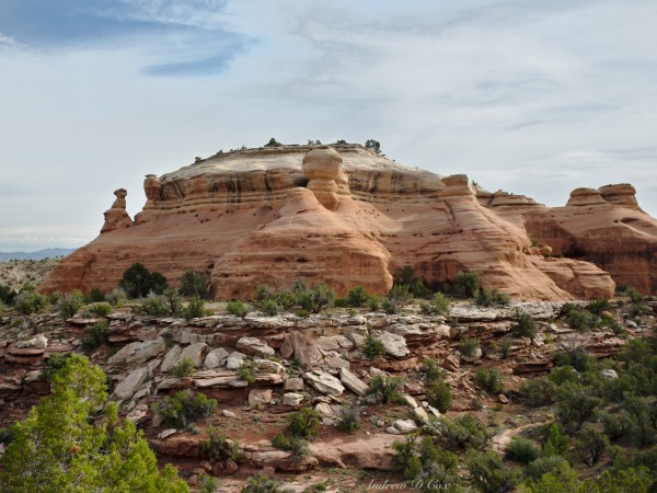
After few minutes of careful foot placement, I find myself once again on a dirt path and look proudly back up at the mesa. I wasn’t anticipating this amount of creative route finding, but it sure is fun! I stride through more juniper and pinyon pines during the next two-thirds of a mile and reach a butte that reminds me of a steamboat; the sides are smooth, grooved sandstone and several “smokestacks” jut out along the edges.
Past steamboat rock, the trail turns south and makes a beeline for the grand canyon country I glimpsed earlier. Excited, I hurry forward, pausing only to capture a few photographs of the view.
The views only get better and better as I tread along the sandy trail. In no time at all, I arrive at the edge of another canyon, again with some uncertainty as to the best route to reach the trail at the bottom. There appear to be several use trails along the rim, so I pick one and follow it downward. Mid-descent, I spot a few cairns and adjust my course toward them, using my hands nearly as much as my feet to clamber down to more level ground.
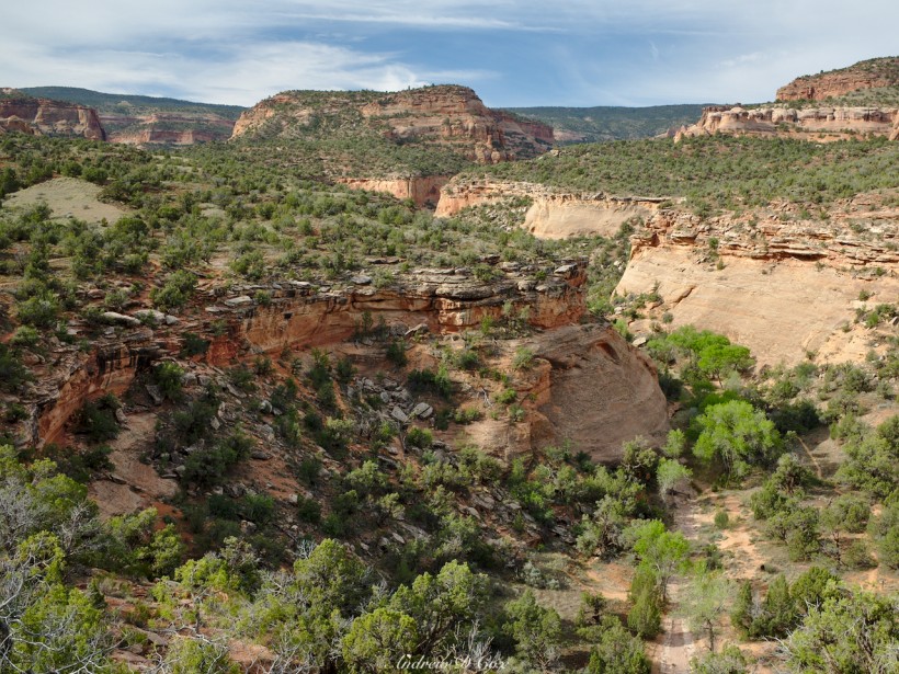
A sign on the valley floor indicates that this is Pollock Canyon and points me south, uphill, along a narrow single-track trail. Cottonwoods line a dry, rocky creekbed, providing some shade from the feeble sunlight that makes it through the clouds overhead. Everything about this hike is excellent! The scenery is incredible, the route finding and climbing are fun, and the weather could hardly be better.
I don’t make it very far before the trail reaches another wall. It appears to be heading for the top of the canyon and once more becomes faint. Now thoroughly in a good mood, I thread my way up a few sandstone ledges, clamber over some rocks, and arrive at the top of Pollock Canyon. A use trail continues up the valley, but it will have to wait for some future hike; today I continue uphill to the Rattlesnake Arches.
The next several miles are less exhilarating than the previous miles, but that’s hardly an insult considering the excitement thus far! The trail gains elevation more steadily now, climbing toward the tiered mesas in the distance. I walk past a creek bed and pause when I notice animal tracks in the soft sand. One set of prints is decidedly cloven, probably a desert bighorn sheep, and the other looks like it belongs to a mountain lion. I wonder if the cougar ate the sheep? I’m suddenly very aware that I haven’t seen a single human being in the last few hours… Like most perceived risks in the wilderness, the chances that I’ll be attacked by (or even see) a mountain lion are slim to none. Still, it’s best to be alert.
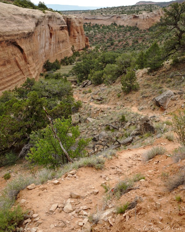
My mind is soon preoccupied with other stresses as the trail beings to climb in earnest, finally fulfilling the prediction of a multi-thousand-foot climb. I’m thankful again for the clouds obscuring the sun as I ascend the steep path. A series of switchbacks lead me to a bench between mesa tiers; to my left, a sheer stone wall that appears to be the highest point around and, to my right, expansive views of the Colorado River and the Grand Valley. I eye the cliff as I walk, wondering if I’ll be scrambling up any of the steep ramps that periodically approach the top.
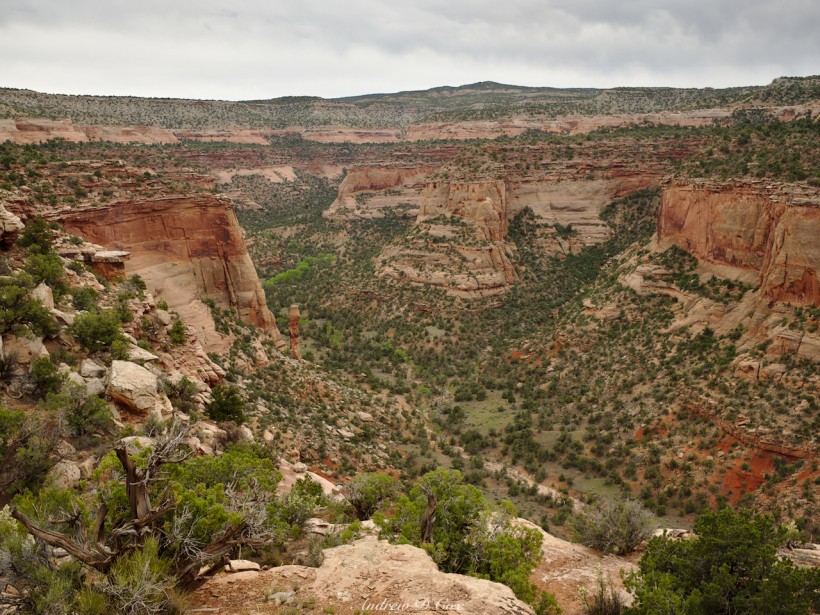
The trail doesn’t head up any of the ramps, however, and instead circumnavigates the mesa. It’s not a terribly exciting walk, but it’s also not difficult either. The brush is tall and lush, overhanging the trail in many locations with invisible spider webs stretched between branches, seemingly always at face level. I continue on through junipers and sagebrush for a mile or two before reaching the point of the mesa, marked by a stone outcropping that looks remarkably like a baby elephant. As I round the bend, my boredom evaporates and I gape at the landscape in front of me: massive cliffs, ranging in color from tan to dark red, with the familiar smattering of dark green pines and junipers. On the opposing canyon walls, I spot a few archways and spires, dwarfed by the sheer size of Rattlesnake Canyon. It’s an incredible vista, well worth the long walk (although, let’s be honest: the hike in was a lot of fun)!
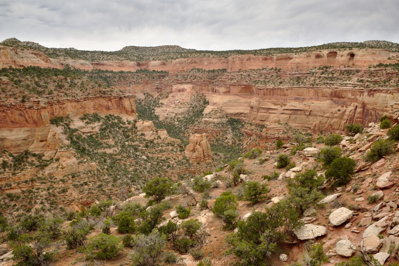
Now that I’ve reached the final mile or two of the hike, I’m content to slow down a bit so I find a nice spot with a view, take off my shoes and socks, and eat lunch while admiring the scenery. I can’t help but compare this red and green chasm to other monstrous canyons: Yosemite, Zion, the Grand Canyon. If you ask me, Rattlesnake Canyon is equally as impressive as any of those world-famous landmarks. It’s also so much less crowded due to its remote location, which is perhaps more important than the grandeur of the scenery; even the most majestic national park is uninspiring when you’re jostled about by crowds of noisy tourists brandishing selfie sticks.
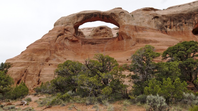
Once I’ve eaten my lunch (peanut butter, tortillas, and dried mangos), I saunter on down the trail and check out the natural arch formations. Some are barely separate from the surrounding stone; “young arches” if you will. Others are more prominent, bridging solitary stone towers. The nearby cliff faces are pockmarked with holes – birds, perhaps? Or pockets of softer stone that have eroded irregularly? I walk up to investigate and peer into a few but see no nests, droppings, or other signs of life.
The trail meaders for a mile or so, past half a dozen arches, all impressive, particularly when you consider how many of them there are in this tiny area! After admiring the final arch, I search for a way to connect the loop shown on my map. I’m not entirely sure it is a loop – the trail is marked by a dashed line, so it’s not immediately clear if the gap between my current location and a trail that appears to lead up over the mesa is a lack of trail or just another dash in the line (the trails do not connect; this is clear on the BLM and CCA maps).
I could retrace my steps, but I’d rather not. However, there don’t seem to be any routes to the top of the cliffs. Most of the stone is sheer, with some sections even arching out over the valley (a negative slope). There is one section with a positive slope – the final arch. I walk up to the base, take a look at the availability of foot- and hand-holds, and make up my mind to try climbing out. The exposure isn’t bad, nor is the wall vertical. I stow my camera and trekking poles in my backpack to free up my hands and begin the climb. It definitely looks scarier than it actually is. The sandstone is rough and easy to grip, with sufficient divots and knobs to grasp on the way up. [Other hikers have rated this route as between a 5.2 and 5.8 free climb; I would still stick this in class IV territory since the exposure isn’t high. That being said, I’m not a climbing expert.]
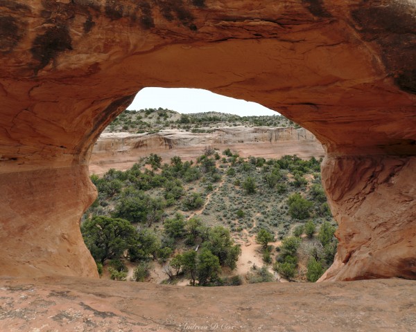
In a few short minutes, I reach a flat bench underneath the arch and pause to take a few photos looking back through. After catching my breath, I continue climbing and quickly reach the top of the mesa. Only minutes after gaining the high ground, I meet two young hikers, the first humans I’ve seen all day! They’re also here to see the arches and, after exchanging a few pleasantries, we go our separate ways.
I follow the same paths back toward the trailhead, descending the switchbacks and climbing through Pollock and other unnamed canyons. The clouds are beginning to melt away and the afternoon sun breaks through now and again. To make things hotter, I seem to be walking the same direction as the light breeze so there’s little airflow over my skin as I walk. My mind drifts from the trail to other topics: work, school, family… I proceed on autopilot until I reach the last intersection between the Rattlesnake Arches trail and the Pollock Bench trail – it’s a straight shot from here to the trailhead. I turn toward the trailhead and my car, take a few steps, and then stop. What if I kept hiking? It’s only 2PM, and I have a full liter of water and extra snacks in my bag… I look up the trail toward the hills, look back toward the trailhead, and make a decision: I’m going to keep hiking.
Flume Canyon Detour
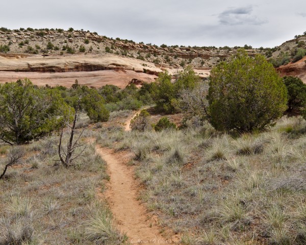
I speed through endless junipers as I walk away from my car once more, heading for the towering red sandstone canyons in the distance. As I reach the intersection of “P1” and “F2”, I realize that I should have abandoned my return journey earlier and taken the western branch of the “P1” Pollock Bench trail – it winds along a mesa rim with endless views of the incredible canyon landscape, whereas the trail I’ve chosen (the eastern branch of P1) cuts through flat, juniper-filled plains with a distinct lack of awesome views. Oh well.
My impromptu second hike of the day follows a route through Flume Canyon; from the P1/F2 intersection, I follow F2 down into Flume Canyon and then take the lower branch of F1 to stay in the bottom of the canyon (hopefully in the shade) rather than hiking along the rim. At first, I wind through narrow drainages, avoiding piles of horse poop left on the sandy trail. After descending a series of hot, dusty switchbacks, I reach a muddy streambed and the shade of cottonwood trees. The trail continues to meander through narrow ravines for a while and I enjoy the shade and interesting terrain. However, in short order I find myself emerging from the narrows into a wider valley surrounded by towering red cliffs. What a glorious vista!
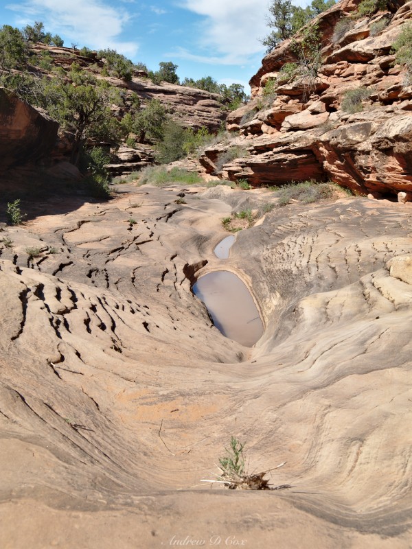
I don’t tarry too long out in the open, even if the views are incredible; the sun is out in full force and it’s downright hot! Pulling my hat down lower over my eyes, I hurry on down the valley to reach the shadier terrain of lower Flume Canyon. There, the sand occasionally gives way to smooth stone floors, some concave like amphitheaters surrounding puddles in which entire ecosystems are flourishing. Mostly, though, I walk along dry sand and enjoy the adventure of strolling through twisting stone passageways.
An hour or two later, fresh out of snacks and water, I reach the mouth of Flume Canyon and my waiting car. Air conditioning will be nice, and I’m looking forward to a shower and “real food” in town. I’m a little disappointed to be leaving Colorado tomorrow, but I’ve had a blast during the few days I’ve spent here! If you’re ever passing through Grand Junction, remember to pull off the highway for a few hours and go for a hike. You won’t regret it.
