As a graduate student, I occasionally travel to conferences to present my work. The conferences themselves are great fun, both because the presentations are interesting and because the event is a great way to reconnect with friends and colleagues. I stuck around for a few extra days and went on a backpacking trip with my friend Diane in the Mark O. Hatfield Wilderness.
Our original plan was to hike up the Eagle Creek Trail and admire the beautiful waterfalls there. However, fate intervened when the Indian Creek Fire started on July 4, closing parts of the trail. We replanned the route to avoid the fire closures and enjoyed an incredible backpacking outing. Only one week after Diane and I completed this trip, the Eagle Creek Fire started (allegedly by a teenager that threw lit fireworks into the woods). Overnight, the fire grew to 3000 acres and, a few days later, merged with the Indian Creek Fire. Much of the forest you’ll see in the photos below has been destroyed by the blaze, which is both humbling and saddening. I’m glad we had the chance to wander through this beautiful wilderness before the fires arrived.
Trip Planning
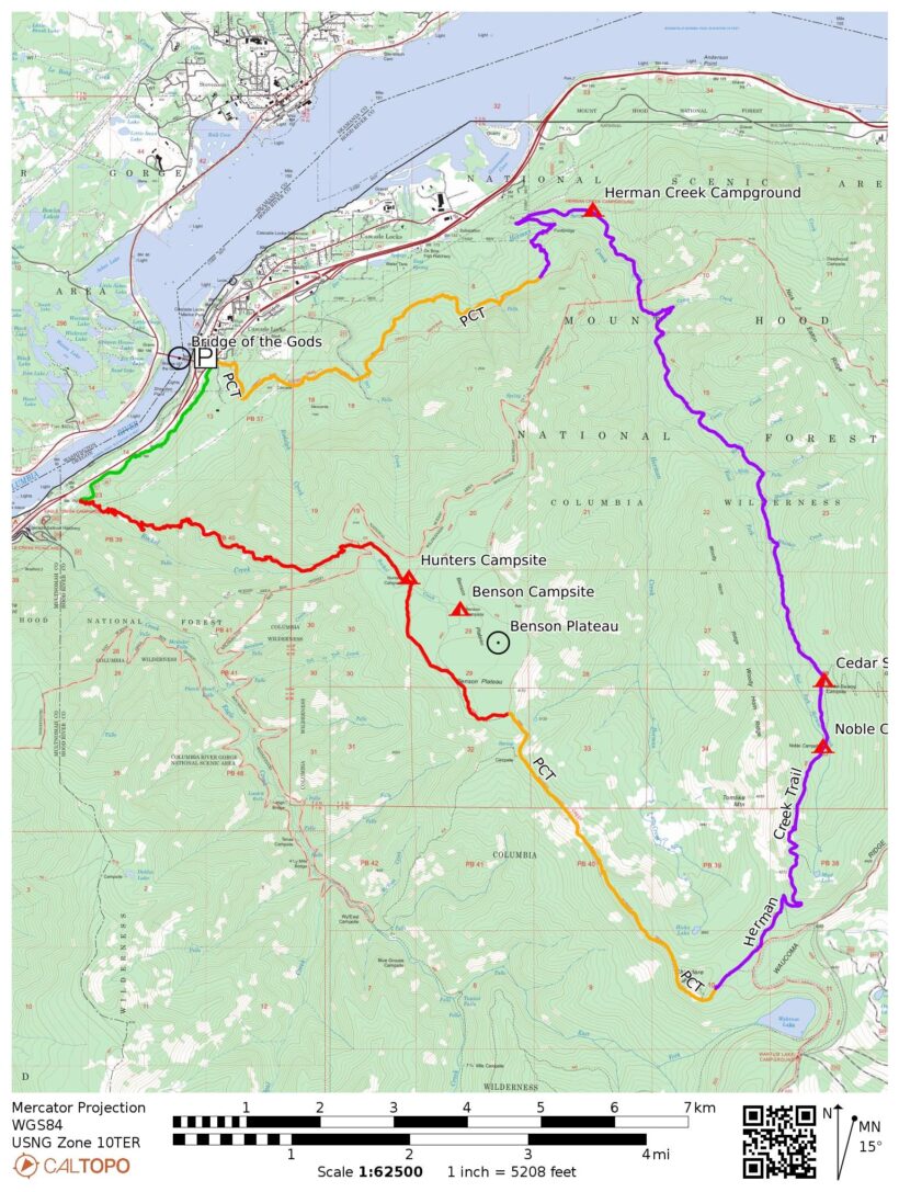
Specs: 26.4 mi | +/- 6500 ft | 2 days / 1 night
Difficulty: Class 1 [learn more]
Location: Mt. Hood National Forest | View on Map
Permits & Regulations: A wilderness permit is required in this area, but they are free and self-issued at the trailhead or wilderness boundary. Speaking of the trailhead, we parked beneath the Bridge of the Gods and walked a hundred yards to the trailhead. Parking beneath the bridge is free but limited; cheap paid parking is also available closer to the trailhead.
The standard leave-no-trace ethics apply, as well as a few other rules. Fires are prohibited in sections of the forest (more info on the USFS website), and it’s best to avoid them altogether if you can. Gas stoves are safer, require much less attention, and don’t scar the land. If you do insist on starting a fire, be very careful; you don’t want to be the person responsible for destroying 50,000 acres of pristine forest.
Resources: I primarily used CalTopo to virtually explore the area and plan the route. However, I’m a huge fan of printed maps and preferred to reference the Columbia River Gorge NatGeo map that Diane brought along. I also relied heavily on the USFS website to learn about the Mark O. Hatfield Wilderness as well as the greater Mt. Hood National Forest. If you have specific questions, the best thing you can do is call one of the rangers and ask! They are always very knowledgeable and helpful.
Up, Up, Up We Go!
August 25, 2017 | 14.9 mi | +5300 ft / -2600 ft | View on Map
It’s a warm, sunny morning in Cascade Locks on the banks of the Columbia River. Diane and I pull our packs from the trunk of the rental car in a small parking lot beneath the Bridge of the Gods. The Columbia River is not swift, but it is massive. Its serpentine form disappears into the hazy morning air far to the east and west of the bridge. On our side of the river, pine-covered slopes rise steeply toward the sky, forming one side of the Columbia River Gorge. We’re both eager to get going, so we shoulder our packs, cross a busy street and stride up a grassy slope toward the trailhead.
After a short walk along a gravel road that takes us below I-84, we reach the intersection of trail #400 and the Pacific Crest Trail. Our route this morning is down trail #400, but we’ll return to this spot tomorrow via the PCT. Two thru-hikers have made themselves comfortable in the grass on the side of the road; it’s been a few weeks since I’ve chatted with PCT hikers, and I thoroughly enjoy saying hello!
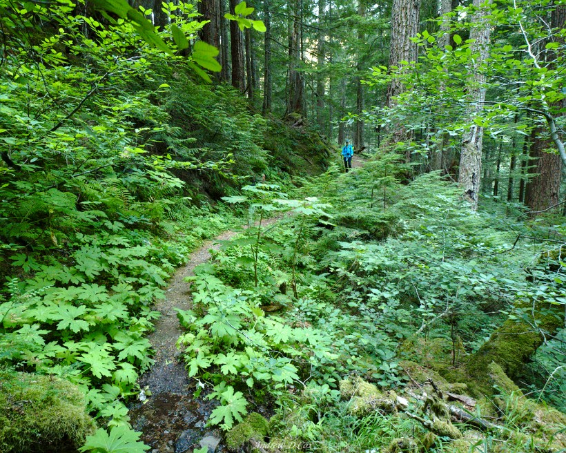
The first several of miles of trail wind through dense foliage: towering ferns, spongy moss clinging to every surface, and plants with leaves as big as my head! It’s like a scene out of Jurassic Park; I imagine dinosaurs meandering through the forest, munching on leaves. The ecology here is dramatically different than the alpine world of the Sierra Nevada mountains. Although it isn’t wet today, the lush, vibrant greenery clearly indicates that water is plentiful here.
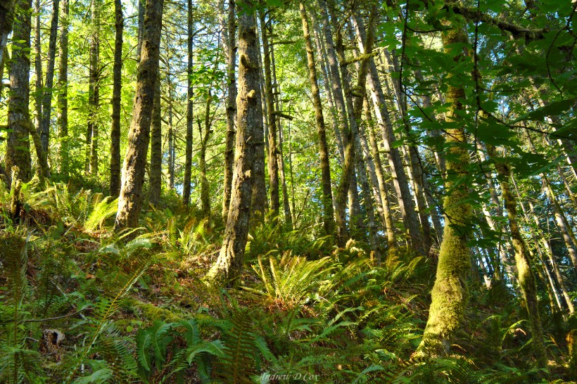
After walking parallel to the interstate for a few miles, Diane and I are happy to turn south and leave the noisy traffic and sounds of civilization behind. We’re out here to experience nature! Our path for the next six miles is the Ruckel Creek Trail, which climbs 4000 feet above the Columbia River to the Benson Plateau. I imagine the plateau as a grassy meadow with a few trees and a creek meandering through the center. Originally, we had planned on camping there, but our post-fire route will take us much further than the plateau.
The Ruckel Creek Trail begins a steep climb immediately after breaking off from trail #400, and boy do I mean steep! I’ve grown used to the gentle slopes of the John Muir Trail that switchback across hillsides; this trail just makes a beeline toward the plateau. It doesn’t take long for my heart rate to pick up and I settle into a steady groove of taking one calf-burning step after another.
Several groups of Pacific Crest Trail thru-hikers pass us on their way toward Cascade Locks. As difficult as the uphill climb is, I cannot imagine having to descend on this trail! Every single group of thru-hikers asks Diane and I if we’re SOBO (south-bound) on the PCT. I’m flattered that they think we look badass enough to be thru-hikers and chuckle as we tell them we’re just out for a weekend trip.
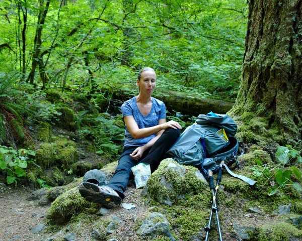
The steep uphill climb continues for several miles. We take several breaks for snacks, water, and plain old breathing along the way. It’s a beautiful day for backpacking; the sky is full of whispy clouds, and the bright sunshine filtering through the trees illuminates the forest floor with cheerful, dappled light. As we ascend, the flora begins to change from the thick ferns and monstrous plants to tufts of grass and tiny saplings, though there is still moss on every rock and fallen log.
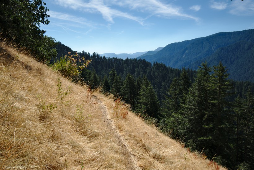
The trail levels off for a while as it winds along the side of a ridge. Diane and I trek through dry, crackling grass and over heaps of rocks that have cascaded down from the cliffs above. I welcome the easy walk and pick up speed a little to make up for the difficult climb we’ve just accomplished. During these stretches along the open hillside, I catch glimpses of distant ridges through the hazy atmosphere. Somewhere, hidden behind a ridge, is the majestic snow-capped peak of Mt. Hood. I hope we get a good glimpse of it today!
Unfortunately, the pleasant hillside stroll is too good to last and Diane and I are soon struggling up another stretch of terrifyingly steep trail. The ecology continues to shift with the altitude. Ferns reappear for a little while, and then we pass through a section with lots of mossy boulders and trees with silvery bark; I think they might be birches, but I don’t know enough about them to be sure.
At the Mark O. Hatfield Wilderness boundary, marked by a wooden sign nailed to a tree, the trail levels off for good. We made it to Benson Plateau! There is no grassy meadow in sight, only more trees. Don’t get me wrong, the plateau is beautiful (did I mention it’s flat?), it just isn’t quite what I imagined. I suppose there’s really no reason for a flat plateau to be treeless if the steep slopes are all covered with trees!
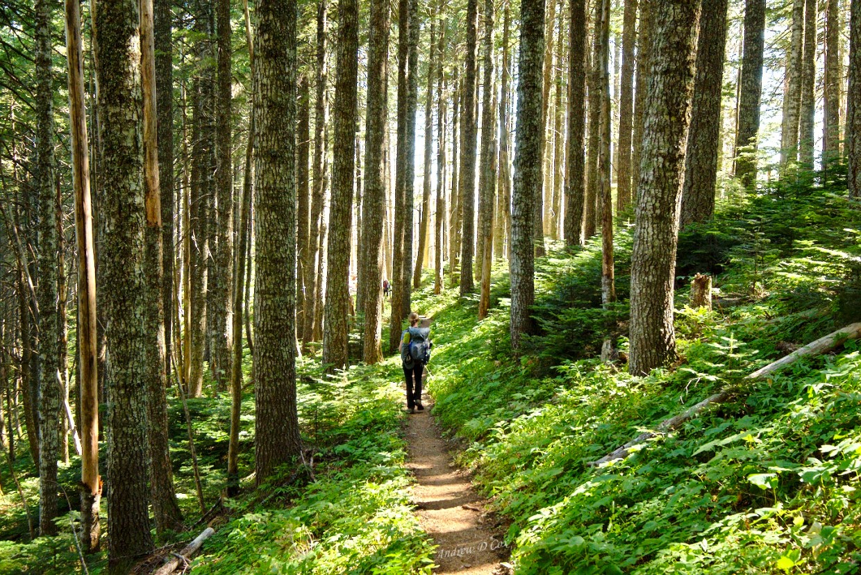
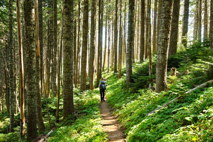
Diane and I rest for a few minutes at the wilderness boundary and then resume our trek. Camping here would have been amazing; there is indeed a small creek gurgling through the trees and rocks, and much of the ground is covered in soft grass. Gone are the ferns and moss, giving the landscape a thoroughly alpine aura. Diane leads the way through the forest and I take the opportunity to capture several images of her retreating figure in the midst of the airy forest.
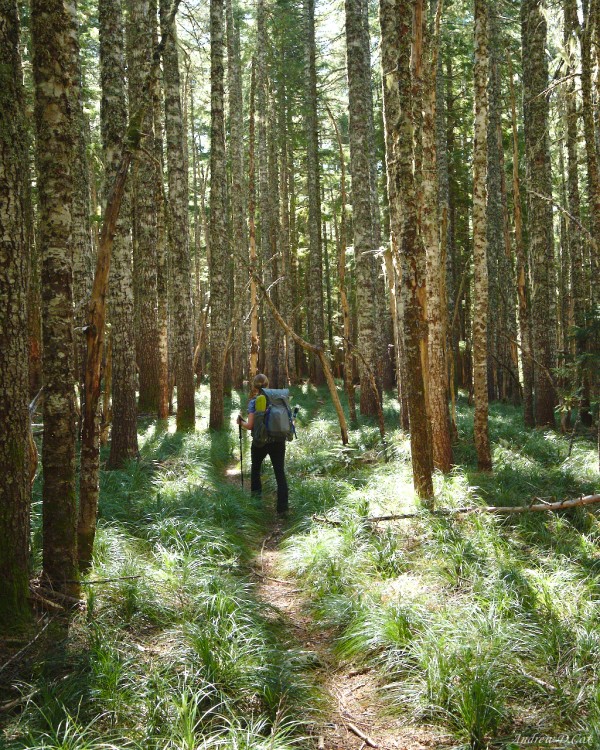
After winding through the woods for a while, we reach the Pacific Crest Trail. It’s been a few weeks since I last stepped foot on this wonderful path and it’s nice to be back! I particularly enjoy the opportunity to experience the PCT up here in the north, far from the stretches I’m familiar with in California. I’ve toyed with the idea of thru-hiking the PCT, but I’m not sure that I want to embark on a six-month journey. Perhaps I’ll section hike it. Regardless, I would love to spend more time here in the Pacific Northwest!
We meet a group of thru-hikers that are resting at the Benson cutoff trail. They ask about water sources on the plateau and all laugh when I describe the creek as “robust.” Don’t mind my engineering lingo, I just spent the past week nerding out at an astrodynamics conference! After bidding the hikers happy trails, Diane and I continue SOBO on the PCT. As we trek along the ridge, we catch glimpses of the fire to the west. Lazy plumes of smoke rise from the trees, and a helicopter shuttles water from the nearby Whatum Lake in an attempt to slow the blaze.
Further down the PCT, we encounter expansive views of the mountains to the north. The snow-capped peaks of Mt. Adams and Mt. St. Helens jut above the distant ridges, commanding our attention. Needless to say, Diane and I pause every few minutes to gape at the views each new bend in the trail delivers. As we wind our way along a rocky hillside, we happen upon a woman relaxing in the shade and working on her phone. She looks up as we approach and I realize that I’ve met this woman before: it’s Pacer! We chat for a few minutes and catch up; I leapfrogged with her and Rosy while hiking up to Evolution Lake, where I stopped for the night and didn’t see them again.
As it turns out, they kept hiking up toward Muir Pass while I explored Evolution Lake. Apparently, they got caught in the rain that evening and took shelter in Muir Hut atop the pass. Pacer laments that the Muir Hut roof leaks and she and Rosy had to set up their tent inside the hut to stay dry. It doesn’t sound like it was a very pleasant night, but I’m glad to hear that they both made it out alive. I was worried they’d had a run in with lightning up there.
After talking for a few more minutes, Diane and I say goodbye to Pacer and continue down the trail. Not even 100 feet later, we turn a corner and are greeted by the towering Mt. Hood straight ahead of us. The mountain is dozens of miles away, of course, but the sheer size of it makes it look closer than it actually is.
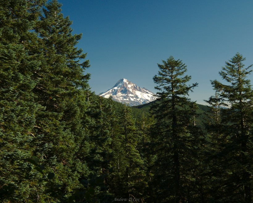
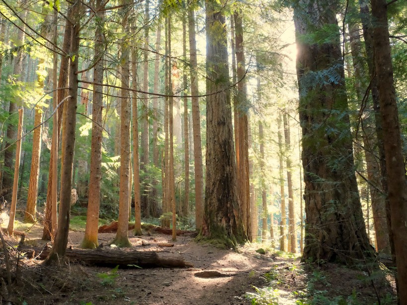
The next few hours of hiking are fast, easy, and fun. The PCT follows a very gentle grade, and the afternoon light in the trees makes for a beautiful sight. I settle into a steady rhythm and enjoy the smooth walk. We eventually reach the end of our journey on the PCT and branch off onto the Herman Creek Trail. This path winds around the southern tip of the ridge and then begins to descend on the eastern flank of the hillside. The afternoon sun is soon hidden behind a wall of trees, though its warm glow is still visible on the opposing hillside. I’m beginning to feel tired and trudge down the path in silence.
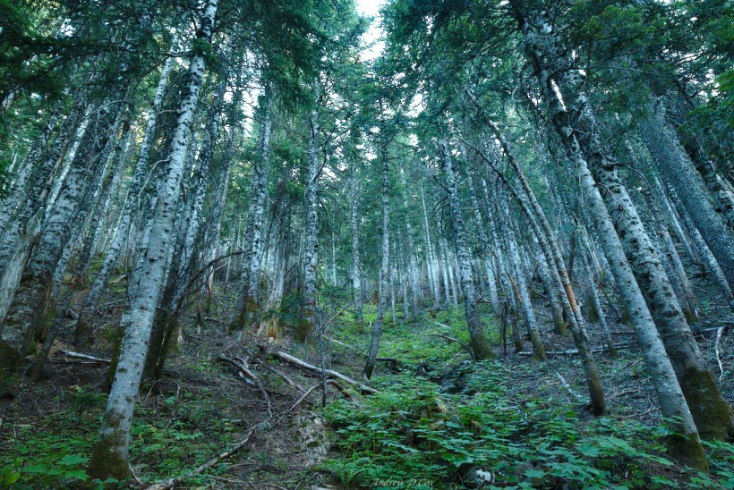
During the long descent into the Herman Creek drainage, Diane and I hike through stands of silver-barked trees that glow in the soft evening light. In between sections of forested trail, we press through thick, overgrown plants that belong in a rainforest somewhere: they have massive leaves, are bright, fluorescent green, and are taller than either of us. At times, I can’t even see my shoes or more than two feet in front of me. As the trail descends, the environment begins to shift from the airy pine forests of the ridgetops to darker, lush forests like those we encountered this morning.
We pass Noble Campsite, which is, unfortunately, already occupied. Twenty minutes later we reach Cedar Swamp Campsite and are relieved to find it completely vacant. Don’t let the name fool you; the area is not even remotely swampy. Instead, we find half a dozen cozy clearings beneath tall pine trees. The late afternoon sun streams through the woods here, unimpeded by the ridge to the west. It’s the perfect location to end the day.
We set up our tents and then relax on the soft pine needle-strewn earth while cooking and eating dinner. It’s been a long day, and dusk falls soon after we finish eating. We throw a bear hang together and suspend our food before the light fades completely, and then spend a few minutes staring up at the star-filled sky. After stargazing for a while, we head to bed.
As I drift off to sleep, a terrifying noise screeches through the woods. If I didn’t know better, I would swear it’s some kind of demonic monkey. (Writing in retrospect, I’m fairly certain it’s the caterwauling cry of a Barred Owl, perhaps mixed with a fledgling begging call. Listen to them on the Cornell Lab of Ornithology website.) The calls eventually fade away and I drift off to sleep.
Through Trees and Waterfalls
August 26, 2017 | 11.5 mi | +1200′ / -3900′ | View on Map
I wake up to crisp morning air and a renewed lively attitude. After enjoying some delicious oatmeal, Diane and I pack up our gear and hit the trail. Our route for the day is more or less completely downhill, a wonderful contrast to yesterday’s steep uphill climbs.
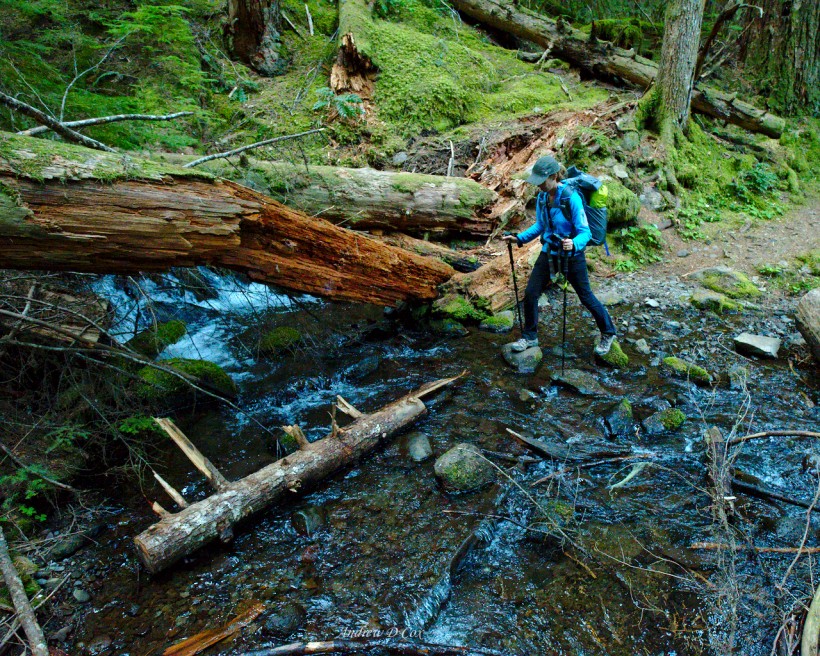
The trail sticks to the hillside above Herman Creek and winds between massive trees. Every once in a while, the trail cuts into the hillside to a ravine where a creek cascades down toward the valley floor below. Thankfully, each stream is shallow and easy to cross by hopping over rocks and logs. We’re not in any hurry today, and stop to admire the occasional view along the way. It’s amazing how green everything is!
The sun remains hidden behind the hills for several hours, but the forest is far from dark. The massive trees and lofty canopy let plenty of light through as we wind our way down the trail. When the sun does crest the hillside, we quickly shed layers as the temperature rises.
After a few hours of hiking, Diane and I pause to eat some snacks and refill our water bottles at a small, gurgling creek. I take a few photos of the water tumbling over mossy stones and experiment with some longer exposures. I did lug a tripod all the way out here, so I might as well use it!
I’m in the lead this morning and turn a corner to find a massive cascade. My jaw drops for a few seconds before I remember to close it. I glance behind me and pause, waiting for Diane to appear; I’m eager to see her reaction! I don’t have to wait long. Diane rounds the corner and sees my huge grin before noticing the waterfall. Her gaping reaction is priceless and precisely the reason I stopped to wait.
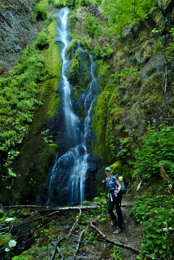
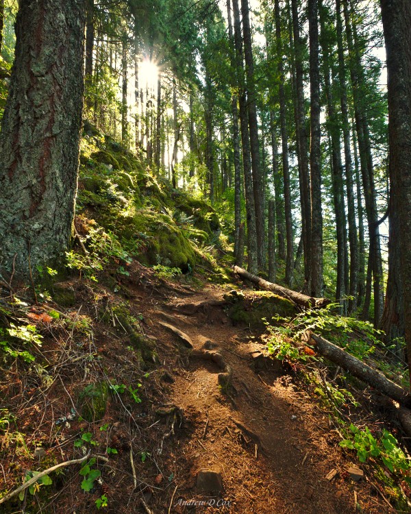
As the sun continues its ascent, the forest brightens. We pass a few spots that practically glow with the warm morning rays; Diane, a photography enthusiast like me, captures the atmosphere perfectly! These glowing forest scenes are so peaceful; I wish I could stay longer.
A few hours later, we reach the end of our trek along the Herman Creek Trail and turn south to return to the Pacific Crest Trail as it parallels the Columbia River towards Cascade Locks. We cross Herman Creek on a sturdy bridge, which we appreciate as the creek has grown wide and deep.
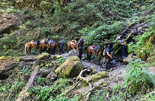
While taking a lunch break on the PCT, we’re passed by a train of horses, two of which are being led by their riders. According to the leader, the rocky trail hurts the horses’ feet. I don’t really understand why you would take a horse on the trail if you have to walk it half the time. My annoyance with the lumbering animals is exacerbated when Diane and I catch up with them when we resume hiking. I don’t have anything against horses in general, but they wreak havoc on the trail with their heavy steps, they poop all over the place, and they’re slow! Plus it’s really difficult to get around them on the narrow trail…
During the last couple miles, Diane and I change into Xero hiking sandals and enjoy some air on our feet. We manage to stay ahead of the horses all the way back to the trailhead. We encounter more and more people as we draw near to Cascade Locks; it is the weekend now. Soon, we return to the PCT junction with trail #400, the end of our Mark O. Hatfield Wilderness loop. A short jaunt down the gravel road brings us full circle to the rental car and the Bridge of the Gods. I’m sorry to leave the woods, but I’m determined to come back and hike through more of the northwest.
Until next time – happy trails!
I’m often asked what photography equipment I use to document trips like this one. On this particular adventure, I carried the Fuji X-T2 and Fujinon XF 10-24mm f/4 lens as well the Sirui T-024X carbon fiber tripod. Diane carried the Fuji X-E2 with the 18-55mm kit lens.











Aaron 8 August 2023
Great write-up and photos; thanks!
Andrew 11 August 2023 — Post Author
You’re welcome!