One day in April, out of the blue, I got an email from Diane asking if I was perhaps interested in doing a trip to the mountains this summer? As both of us are living in “the flat lands,” traveling somewhere with more exciting topography immediately sparked my interest. Without doing much research, we booked flights to Denver for a long July 4th weekend and invited a few friends to come along. Both Josh and Daniel, who joined Diane and me last year for a point-to-point hike between Pine Creek and Piute Pass in the Sierra Nevada, were free, making this our second trip as a group; the band is back together!
In the weeks preceding the trip, we brainstormed options. Both the Maroon Bells-Snowmass Wilderness and the Indian Peaks Wilderness captured our hearts, but the Rockies received so much snow this year that the routes in those areas were projected to be impassible in early July. Rather than deal with the snow and any associated hazards, we shifted our focus to drier locales, eventually settling on the Lost Creek Wilderness. We put together a rough itinerary based on “the hyperloop” route but left the details to be decided when we were all together with a map in front of us.
Trip Planning
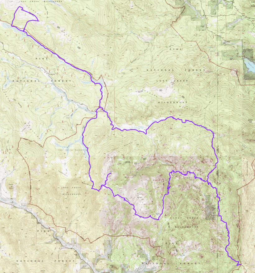
Specs: 60.1 mi | +/- 12,500 ft | 4 days, 4 nights
Difficulty: Class 1 except for “The Alphabetizer,” which has some class 2 climbing [learn more]
Location: Lost Creek Wilderness, Colorado | Home of the Ute and Cheyenne peoples | View on Map
Route: Begin at the Goose Creek Trailhead; a few tenths of a mile down the trail, turn right to continue on the Goose Creek Trail. Continue on this path to Wigwam Park, cross the meadow, and head west on Wigwam Trail. At the Lost Park campground, take the Brookside McCurdy Trail north and west to its intersection with the Colorado Trail (CT). Follow the CT west for several miles to “The Alphabetizer,” an off-trail scramble that links four peaks: Peak X, Peak Y, Peak Z, and Zephyr. From here, retrace your steps to the Lost Park campground and then continue south on the Brookside McCurdy trail to the plateau. Here, enjoy some off-trail scrambling up to Bison Peak before continuing east to McCurdy Park. At the junction, take the McCurdy Park trail through miles of incredible rock formations, eventually rejoining the Goose Creek Trail. Finally, follow the Goose Creek Trail south, back to the trailhead you began at.
Permit and Regulations: A wilderness permit is required, but is free of charge and self-issued at the trailhead. There are no restrictions or fees for parking at the Goose Creek Trailhead, but the lot fills up early on busy weekends! Bear canisters are not required, but bears do live in the area, so protect your food by hanging it or by storing it in a bear-proof container (bear canister, Ursack, etc.). As always, follow the Leave No Trace principles to preserve the wilderness for everyone.
Resources: The Forest Service website details the rules and regulations for the Lost Creek Wilderness. I also found the subreddit for the wilderness area to be a great source of information, particularly about routes and sights to see. While on trail, we navigated with the topo map from from Outdoor Trail Maps LLC; it’s small, detailed, and perfect for this route!
Day 1
July 4, 2019 | 14.2 mi | +3700 / -2200 ft | View on Map
I wake up bright and early, a little confused. It takes me a minute to remember where I am. Yesterday began like any other day, with a morning workout, breakfast, and the drive into the office. Around midday, I went to the airport, hopped on a plane, and flew to Denver, where I met Diane, Josh, and Daniel. Not much later, we were pulling into Kelsey Campground, out of cell service, surrounded by beautifully scented pine trees. The contrast was so stark — big city to mountain campground — and fast that it all seems a little surreal. But here I am, in a little tent in the woods in Colorado!
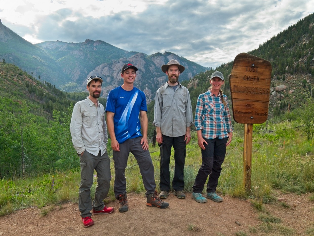
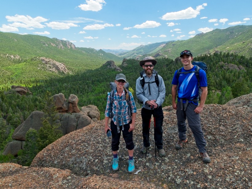
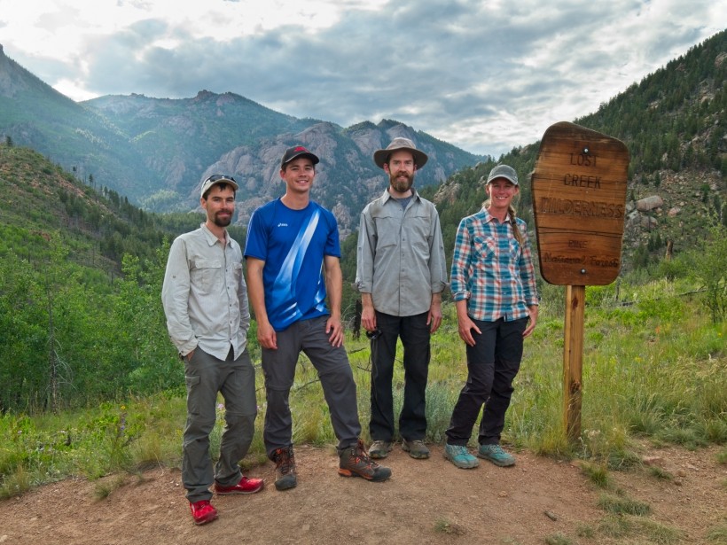
Daniel, Josh, and Diane, are all soon awake as well, and we quickly dismantle camp, eat some breakfast, and hit the road again. We have a few more miles to drive to the Goose Creek Trailhead, but it will take at least an hour as the roads are narrow, winding, and unpaved. The time passes quickly, however; we’re all excited to get into the backcountry and escape civilization for a few days. Civilization follows us as far as the parking lot, which is already packed at 8 AM (albeit on a holiday, July 4). We pull our backpacks out of the car, double check that we have the keys, and then walk to the trailhead. It’s a bright, sunny morning, and the distant mountains are calling. So, after a quick photo with the Lost Creek Wilderness boundary sign, we set off down the trail.
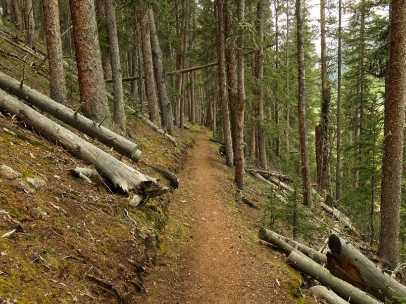
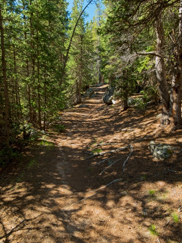
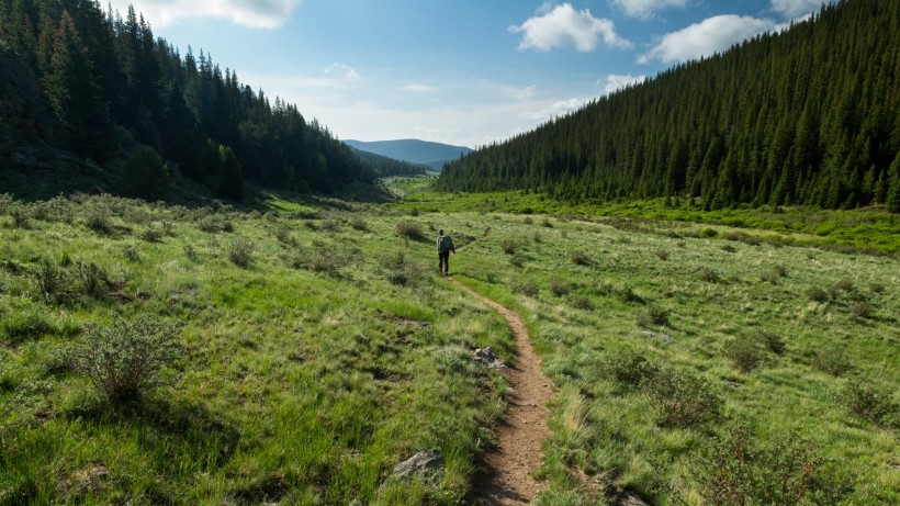
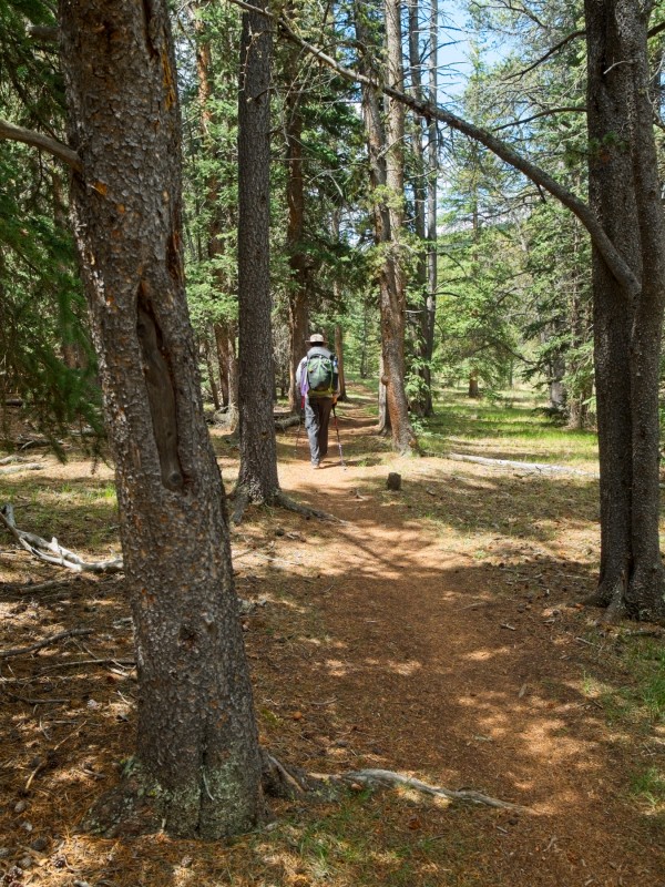
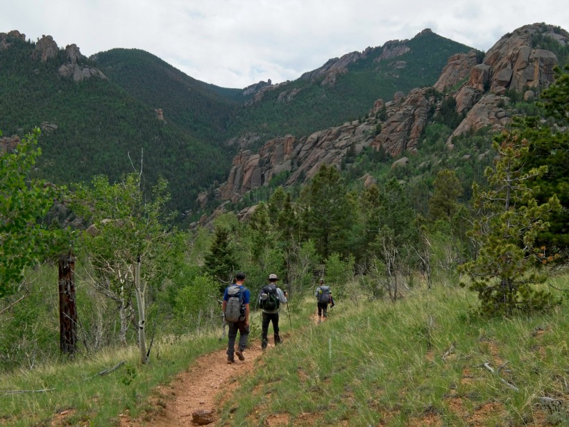
At first, the landscape is distinctly desert. It’s dusty, dry, and there are scrubby little plants scattered across the sandy soil. Soon, however, we reach a small river and the desert gives way to cool, shaded pine forest. We’re able to walk shoulder to shoulder on the wide, flat path for several miles, enjoying the sights, sounds, and smells of the woods. We pass a spur trail to the old shafthouse, stopping only long enough to peer into a few abandoned buildings. A healthy swarm of mosquitoes dissuades us from staying too long and we continue onward.
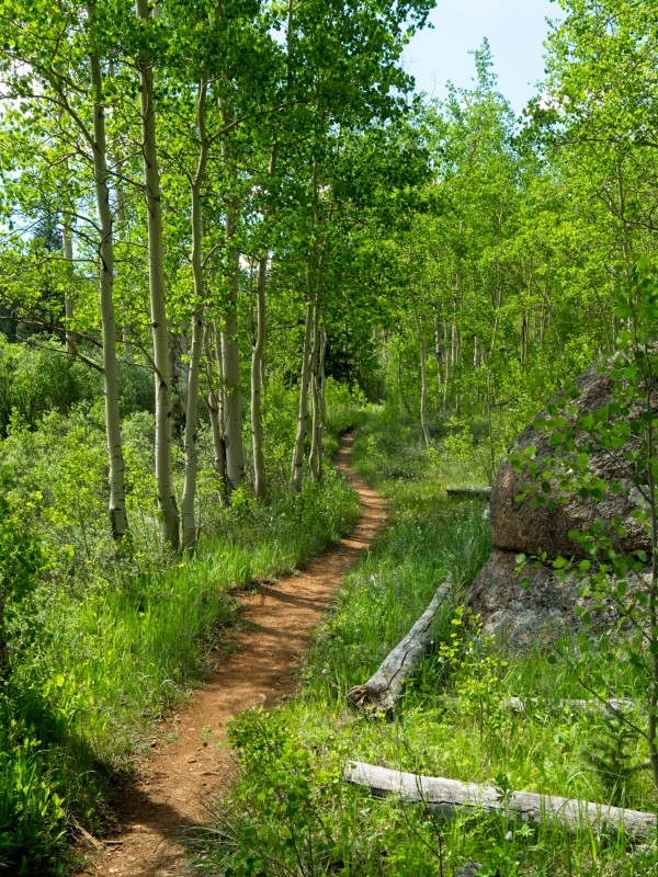
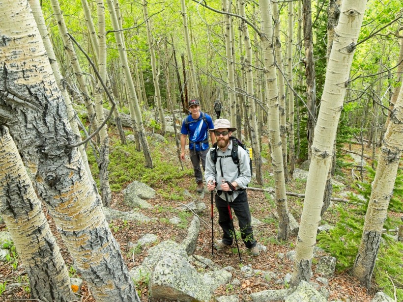
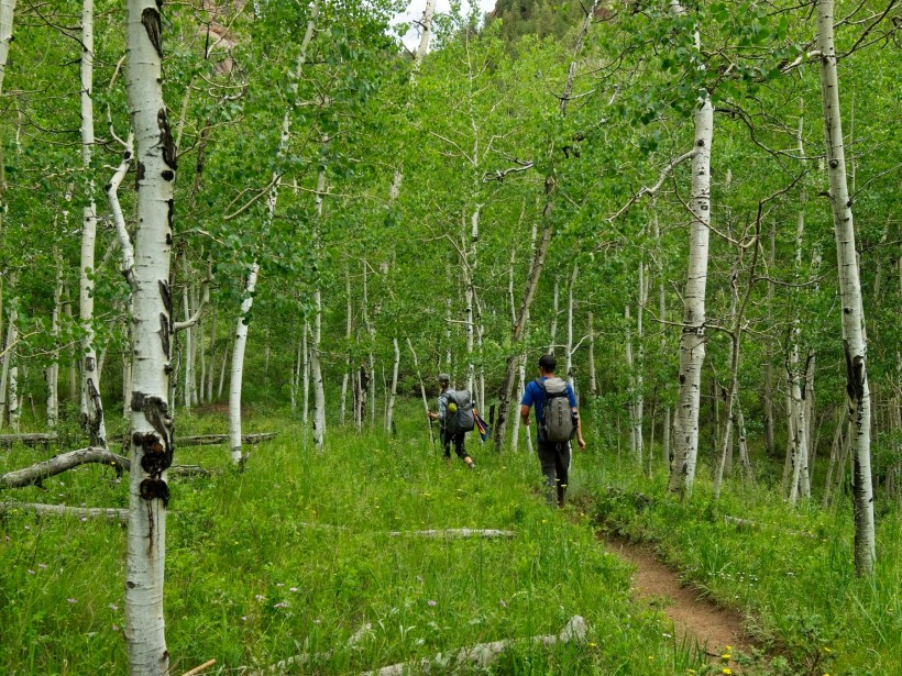
Past the spur, our trail, which has until this point been mostly flat or downhill, begins a long uphill climb. It’s harder work than I remember, but perhaps I’m just out of shape; I haven’t been backpacking since my mountaineering trip in early May after all. The hill eventually levels out, and we again find ourselves on a flat path that contours around the hillsides, weaving through pine forest and aspen groves. Every once in a while a gap in the trees reveals interesting rock formations in valley below, but we’re mostly just surrounded by trees. We all take advantage of the easy hiking to catch up; it’s been a full year since we’ve all seen each other!
Once the trail turns uphill again our conversations peter out; I can’t talk when I’m breathing heavily. We all agree that this is harder than usual, and the map offers a clue as to why that may be. We’re climbing through 9,000 feet, heading toward 10,000 feet. For a group of people that live within a hundred feet of sea level, this is some nontrivial altitude! Undoubtedly our stay at Kelsey Campground last night provided some acclimation, but one night at altitude is hardly enough to condition the body for exercise at altitude.
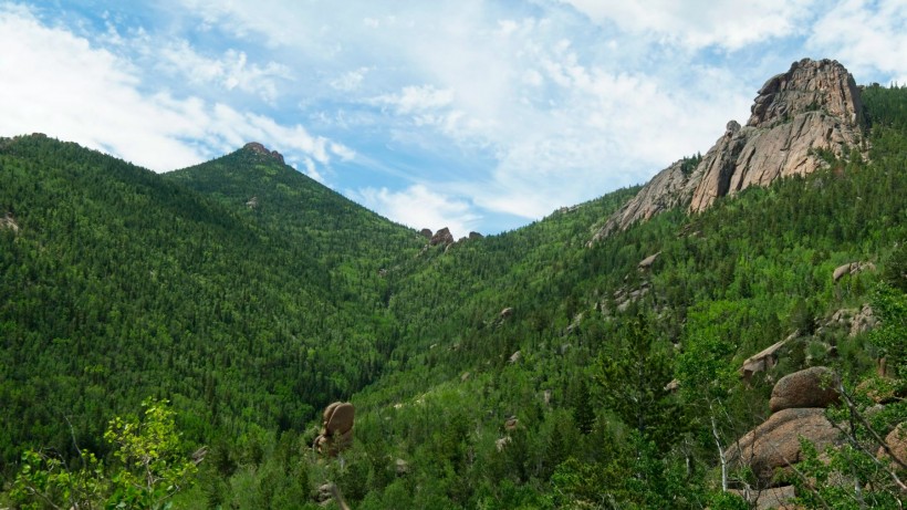
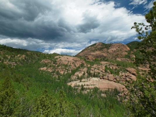
After what feels like a full hour of struggling uphill, we reach a large granite outcropping that supplies incredible views, i.e., a full panorama of the Goose Creek drainage through which we’ve been hiking. Patches of neon green aspen trees accent the darker green carpet of pines, with reddish-gray patches of granite protruding through the foliage here and there. The landscape is a little reminiscent of the Sierra Nevada, although their granite is silver.
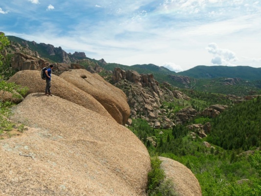
Further up the trail (and higher up the hill), we reach another viewpoint that looks over Refrigerator Gulch. The trip reports I’ve read claim that Refrigerator Gulch is one of the highlights of the Lost Creek Wilderness, and it’s now easy to see why; dozens of granite domes and interesting rock formations dot the landscape! It looks like an exciting place to explore, but our path is not descending into the valley, not today. In fact, we don’t really know where we’re going to camp tonight. We have a loose plan: hike to Wigwam Park and then either hike east on the Wigwam Trail or head north on the Rolling Creek Trail. As we haven’t reached the “decision point” (i.e., the point of no return) yet, we haven’t selected a route for the weekend. Wise? Maybe not. Fun? Definitely.
The trail continues to gain altitude, and I struggle my way up with the others. Thankfully, it soon levels out and then begins a long, downhill stretch toward Wigwam Park. Along the way, we pass a few meadows with interesting rocks; the stone looks viscous, as if it is still flowing from a volcano. I and the others scan the fields for wildlife but don’t spot much beside birds and small rodents.
After descending for a while we reach a lovely set of campsites scattered beneath tall pine trees beside a meadow. This appears to be the edge of Wigwam Park, so we drop our backpacks and rest for a few minutes. It’s time to decide which direction we’re hiking and what our route for the rest of the weekend is. There are a few locations we’re all excited to see: the plateau surrounding Bison Peak, Refrigerator Gulch, and an off-trail adventure called “the Alphabetizer.” After tallying up the miles between locations, we decide to head west. It’s a flatter route and should put us at some of the high-altitude spots early in the day, hopefully avoiding the notorious Colorado afternoon thunderstorms.
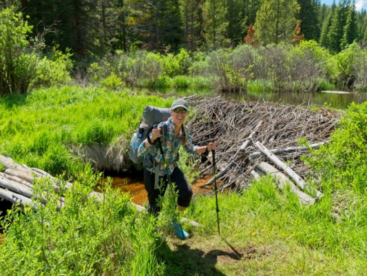
With the route decision made, we pack up our things again and backtrack a few hundred feet to the trail. Crossing Wigwam Park proves to be one of the highlights of the day: we walk right past a large beaver dam!
At the far side of Wigwam Park, we intersect the Wigwam Trail and head west. The trail climbs gradually, but at a much easier rate than the climbs we completed earlier in the day. The scenery is also top-notch. I’m partial to the aspen groves, but there are also beautiful stands of pines, a small river, and several ponds to distract from the uphill climb.
Besides being beautiful, this section of trail is also incredibly busy. We pass a few dozen backpackers and hikers, many of whom seem to be heading for Wigwam Park and its excellent campsites. A fair number are hiking in the same direction as we are though, so hopefully that means plenty more excellent hiking options exist further up the trail.
After walking for another hour or two, we reach the easternmost edge of East Lost Park, an expansive meadow that stretches on for miles. The trail mostly skirts the edge, a little up the hill from the meadow, surrounded by pine trees. It’s been a long day and we’re all tired, but we keep walking in search of a great campsite. Thankfully, the trail remains flat as it contours around the meadow.
As the evening stretches on and our energy reserves decrease, we decide to stop walking and make dinner. A few dark clouds threaten to rain on us and some distant peals of thunder motivate us to pause and refuel. It turns out to be a good decision; a light drizzle falls for a few minutes, but nothing more serious, and everyone is much cheerier and energetic after eating.
As we continue a little further down the trail, the imposing clouds drift away and blue sky reappears, brightening our moods even more. At a junction with an unnamed spur trail, we find a great little campsite with views down the meadow. After setting up the tents, we wander into the woods to find a suitable tree from which to hang our food and scented items (to protect them from any wandering bears, raccoons, squirrels, and the like). Once we’ve located a tree with a sturdy branch, the real struggle begins: throwing a rope over the branch. Diane completes this usually difficult task in a single try! With our food safe, we walk down to a brook that winds through the meadow. Besides refilling our water bottles, we enjoy soaking our sore feet in the frigid water. The sun sets a little later on, signaling bed time for us tired hikers.
Day 2
July 5, 2019 | 14.1 mi | +3300 / -2200 ft | View on Map
Upon awakening the next morning, the first thing I notice is the chilly air. Poking my head out of the tent, I see an ethereal fog lying low in the valley. This experience — waking up in the middle of the wilderness — is one of the wonderful parts of backpacking. I also appreciate the feeling of being cold; the temperature rarely dips below 70 degrees (F) in the midwest during this time of the year and the contrast is fantastic.
Everyone else wakes up too and we set about making breakfast and tearing down camp. To our surprise, we find a thin layer of ice on the tents and a wet bandana that Diane set out last night is frozen so completely that it has become rigid. Needless to say, a hot breakfast is the perfect complement to the chilly morning!
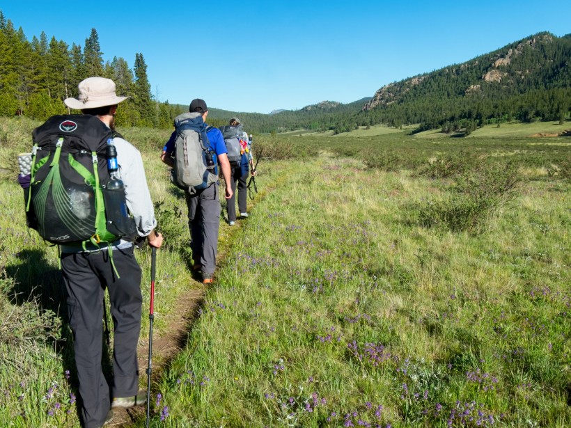
After eating, we pack up our tents and walk a short distance back to the Wigwam Trail. The single-track path winds through the meadows of East Lost Park for several miles. The flat, scenic route is the perfect way to begin the day! I keep my eyes peeled for wildlife — meadows tend to be great locations to spot grazing deer, elk, moose, and other large critters — but they are nowhere to be found.
After an hour or two wandering through the idyllic meadows, we reach a section of trail that climbs gradually through a dense pine forest. A roaring creek tumbles over rocks through a shallow canyon beside the trail, reminding me of the mountains in Idaho or California. We spot our first snow patch in the woods near the creek. It’s not large, but it is snow! Honestly, with all of the reports of snowed-in trails in the Snowmass-Maroon Bells Wilderness, I’ve been expecting to see a bit more here. After all, we’re hiking at nearly 10,000 feet above sea level, and the temperatures are clearly cold enough at night to keep the snow from completely melting. But we haven’t seen any beside this stray patch so far.
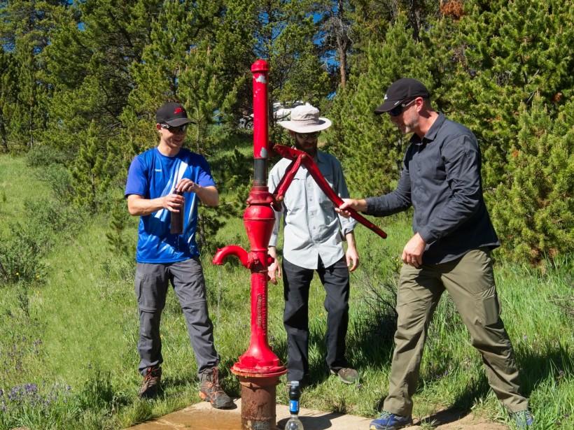
The uphill stretch through the woods doesn’t last long and we soon find ourselves meandering through another meadow. A glittering snake of parked cars in the distance marks our return to “civilization,” in this case the Lost Park campground and trailhead. After crossing a small creek, we enter the campground through a little gate and walk down a dirt road that seems extremely wide after walking on narrow trails all morning. We pause at the pit latrines and at a water spigot, grateful for the luxuries that come with road access. We don’t stay long, though; our plan for the day is to reach the Alphabetizer route and complete it, so we have a fair number of miles to walk!
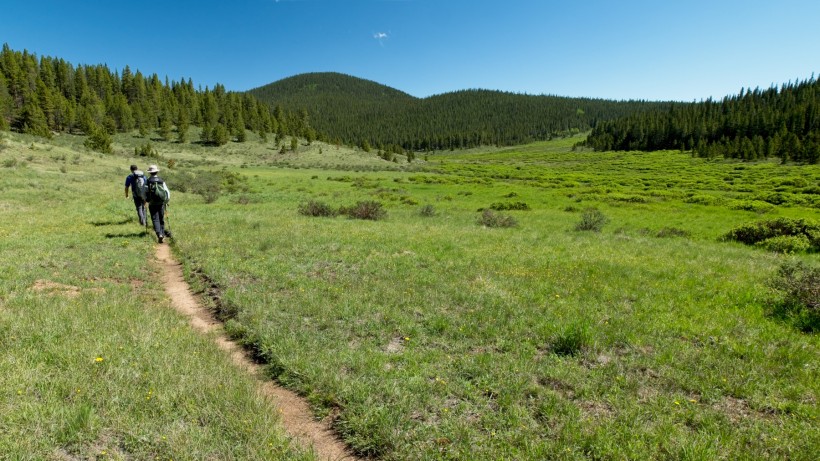
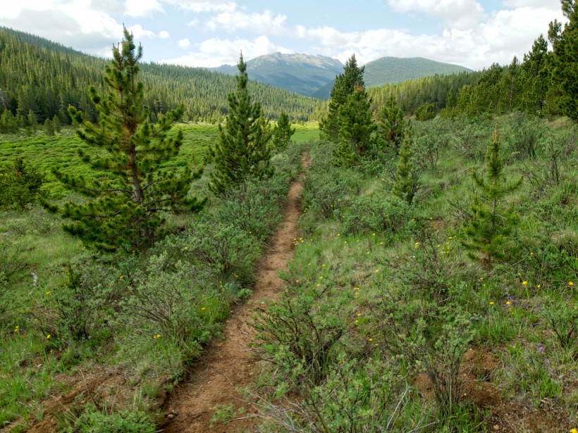
Thankfully, completing a bunch of miles proves to be a relatively straightforward task as the trail continues to wander through meadows without gaining or losing a significant amount of elevation. I’m particularly enamored with the meadows north of the Lost Park campground; they seem particularly alpine, complete with a meandering stream and little pine trees scattered across the grassy valley. It reminds me again of the Sierra Nevada, although there isn’t any granite in sight.
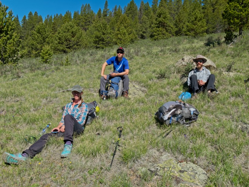
Further down the trail, we pause for a snack break and for an excuse to marvel at the meadow. There isn’t any shade to be found next to the trail, which makes the break a little warm, but it’s still nice to sit down for a few minutes.
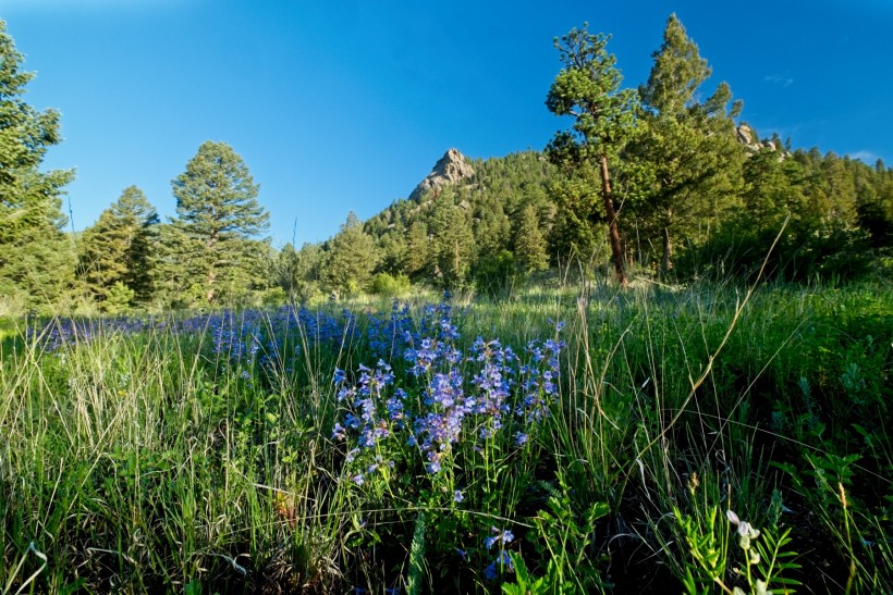
After resting, we continue through the meadows for a few more miles, eventually reaching a second trailhead, a junction with the Colorado Trail (CT). We depart the wilderness on the CT, which passes through even more meadows. Today is definitely a meadow day! I can’t complain too much, though. The flat terrain is wonderful and we’re making excellent time. As an added bonus, we get to walk through some beautiful wildflowers and pass by several beaver dams and lodges! Along the way, we keep hearing distant booms. At first, I suspect it is thunder, but it soon becomes apparent that someone is firing a gun in the surrounding mountains. Hopefully they’re far away, well outside the wilderness area because I’m not too keen on walking through their line of fire.
Several hours later, we reach a spot below a peak named “Zephyr”, the first summit we plan to reach today. Before we can begin peak bagging, however, we need to find a campsite where we can drop most of our gear. We split up and wander up the hill amidst dense aspens and pines to find a spot. Climbing up the steep slope is tough, but we soon locate a suitably flat area and set up our tents, hang our food, and prep for an afternoon of off-trail hiking.
Once all our preparatory chores are complete, we begin “The Alphabetizer,” an off-trail route that hits four 12-ers (peaks above 12,000 feet high): Zephyr, Peak Z, Peak Y, and Peak X. According to the map, we’re somewhere below Zephyr, so we head uphill. As with the lower section of the hillside, it’s a steep climb, but the ascent is much easier with our lightened packs.
The first several hundred feet of elevation gain take us through beautiful aspens. Higher up, we emerge onto talus fields that stretch up toward the now visible summit of Zephyr. Scrambling over the rocks makes me nostalgic for the Sierra High Route, which I haven’t quite finished yet… off-trail hiking is a fun and exciting way to explore the mountains!
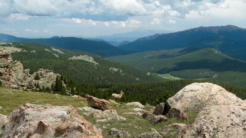
Upon reaching the wide, flat top of Zephyr, I spot a pair of bighorn sheep. They don’t appear eager to share the mountain and quickly run away, but not before I snap a photo of one!
Besides the sheep, Zephyr offers spectacular views of the meadows we’ve been trekking through all day as well as the snow-capped “ten-mile” mountain range in the distance. (So that’s where all the snow is!) Josh figures we could hike there in a day or two, which we are, in fact, supplied for… perhaps next time.
After admiring the view, we realize that our lofty perch is not quite the tallest point on Zephyr; the true summit is a few hundred yards away, across a lovely flat meadow littered with rocks. Following a quick walk across the grass, we scramble up some boulders to sit on top of the summit.
The next peak on the list is Peak Z, visible a few thousand feet away across a shallow valley/saddle. We evaluate the time and our energy before continuing: it’s 4 PM, and everyone is feeling alright, but getting pretty tired. Additionally, the clouds overhead are looking a tad dark, although not too ominous (at least not yet). We decide to continue on to Peak Z, but not to Peaks Y and X. I’m reminded of the advice I received from the guides on the mountaineering class I took this spring: Create a cut-off time to turn around and head down, and make sure you allocate enough energy and stamina for the descent! Uphill hiking is tough, but downhill hiking is equally difficult and can lead to injuries.
The path to Peak Z is certainly less strenuous than the climb up to Zephyr, but still difficult. The thin air at 12,000 feet is affecting all of us; I stop frequently to catch my breath and relieve my burning muscles. After struggling up the steep slope, we reach the summit and pause again for a while to admire the panoramic vista. However, with those dark clouds threatening to bring rain and possibly lightning, we don’t stay for too long. But before leaving, we sign the summit logbook. Gotta leave our mark.
We decide to descend along a different route than the one we followed on the climb up; might as well mix things up! For a while, we traipse through meadows of soft, irregular grass and enjoy the sweeping views. Soon enough, however, we reenter the trees. This neck of the woods is apparently mosquito heaven; swarms of them descend whenever I pause, so I simply avoid stopping and trudge back to the trail at the base of the mountains. Along the way, I pass a few more scenic aspen groves where I pause just long enough to get a photo or two!
On the established trail again, we backtrack a mile or so to our campsite. We cook dinner and then relax for the duration of the evening. After the steep ascent and descent of the two peaks this afternoon, my legs and feet are sore. I’m not much of a sit-and-do-nothing kind of person, so I wander around, snap some photos of the aspen trees in the warm evening light, and chat with the others.
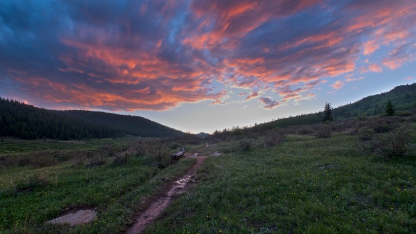
Since our campsite is surrounded by trees and dense willows, we all walk down to the meadows beside the Colorado Trail to watch the sun set. The clouds that threatened to drop rain on us all afternoon have stuck around to reflect all of the sunset colors, making for quite the light show! Once the light fades, we climb back up the hill one more time and hit the hay.
Day 3
July 6, 2019 | 15.5 mi | +2900 / -2300 ft | View on Map
The rain that we were lucky to avoid during our high-altitude escapades yesterday afternoon arrived last night at 10:30 or so, along with gusty winds and loud claps of thunder. The commotion made it rather difficult to sleep and, thus, I’m a bit tired this morning. Everyone else seems to be in the same boat, so we take it easy for a little bit, slowing making and eating breakfast. The overcast skies hint at more rain to come, which has me in a dreary mood. Regardless of what the weather will be, we have a fair number of miles to complete today so we don’t tarry too long at camp. Thankfully, the foreboding clouds begin dissipating as we retrace our steps along the Colorado Trail and by mid-morning the sun emerges to cheer us up!
Walking along the Colorado Trail through the meadows for several hours is just as lovely today as it was yesterday. We pause again at the Lost Park Campground to use the pit latrines and take advantage of the intermittent sunshine to dry out our drenched tents.
Past the campground, we begin hiking on new trail; our backtracking is complete! The path initially winds through airy pine forests, gradually gaining elevation. It’s nice and cool in the woods, although the relative shelter the trees provide also protects the mosquito population. They don’t bother us too much so long as we continue hiking, but are a nuisance when we pause to eat lunch on the outskirts of a large meadow. Bug spray proves ineffective, but wandering around slowly while munching on peanut butter and dried fruit is enough to avoid the little vampires.
After eating lunch and relaxing a bit, we continue up the trail. The sunshine we’ve enjoyed all morning fades as dark clouds begin to drift by. We press on, determined to walk as far as we can before taking shelter from what appears to be an approaching afternoon thunderstorm.
Once the clouds overhead have completely obscured the sun and the distant peals of thunder have drawn close, we abandon the trail and pitch our tents in a small clearing a few hundred feet away. Only moments later, the storm begins, pelting the ground with hail. Safe in the warm, dry, confines of our tents, we wait it out; the storm, while ferocious, is short lived and we emerge 30 or 40 minutes later to a strange new winter scene. The ground is covered in hail, giving the appearance of a snowstorm; Vince Guaraldi’s “Christmastime is Here” immediately begins playing through my head and I can’t help but whistle a bit of it as I happily crunch through the ice around our tents. It’s fun to experience such strange weather, particularly in July!
The dark clouds soon clear away and the sunshine returns, quickly melting the hail. We pack up our tents (wet again; drying them out this afternoon was rather futile) and return to the trail to continue hiking. Our next challenge is a steep climb up to a plateau at nearly 12,000 feet. While strenuous, the ascent does deliver some excellent views of the meadows and forests we’ve walked through today, an empowering reminder of the large distances we can travel if we just put one foot in front of the other for a day.
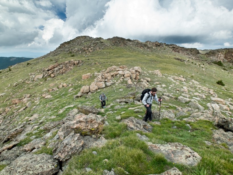
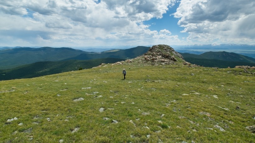
While the views during the ascent are nice, the plateau itself is much more impressive! A vast expanse of alpine meadows stretches out before us, dotted here and there with precarious-looking granite monoliths. It’s an excellent spot for a break, particularly after climbing a thousand feet. With sunny skies overhead and plenty of daylight left, I propose making a quick detour over to Bison Peak, a 12,431′ peak just across the plateau. Diane and Daniel opt to relax on the grass, but Josh is game so he and I leave our heavy backpacks with Diane and Daniel and hurry off toward Bison Peak with a promise to be back in 30 or 40 minutes.
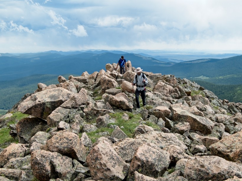
At first, the journey to Bison Peak is an easy walk across the expansive plateau. The slope soon steepens, though, and I find myself struggling to climb through the thin, oxygen-deprived air. As we approach the peak, the grass gives way to an increasing number of rock formations and the route finding becomes a little more interesting (and fun!).
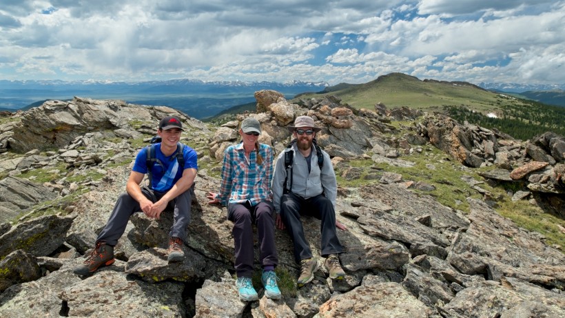
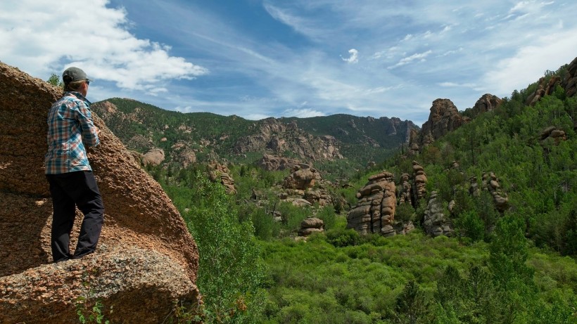
Thankfully, plenty of grassy ramps supply easy paths between the rocks and Josh and I soon arrive at the summit. I would bet that the entirety of the Lost Creek Wilderness is visible from Bison Peak; to the northeast, a particularly impressive maze of rock formations catches my eye. We’ll trek through there tomorrow!
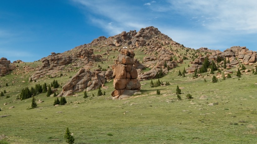
Just south of the plateau, we can see a rain or thunder storm drifting by, dumping precipitation on the valleys below. It’s nice to watch the storm from a distance, although I’m sure some poor people are less than happy about the storm. With Diane and Daniel waiting for us, Josh and I hurry back down the mountain to the plateau. Along the way, we pass some incredible rock formations, including a tower of stone that must be at least 100 feet tall! It looks like a great spot for climbing.
Reunited once more, we return to the trail and continue along the plateau. The epic scenery continues for a while; I could easily spend an entire day or two just exploring this area! The expansive views of the grassy plateau are interspersed with green tunnels as the trail passes through thickets of small pine trees, providing some variety. As with our first day on the trail, we stop for dinner before reaching a campsite because we’re all tired and hungry. It’s much easier to think clearly on a full stomach!
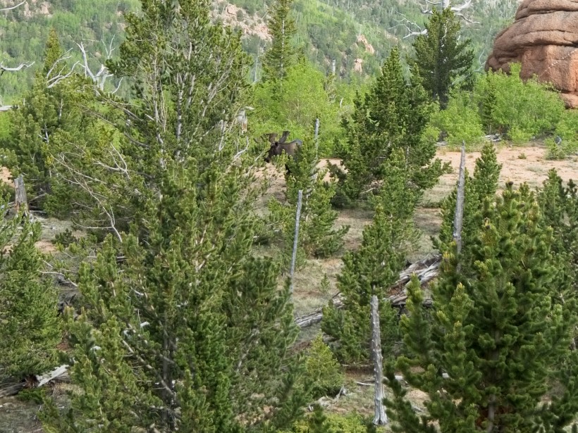
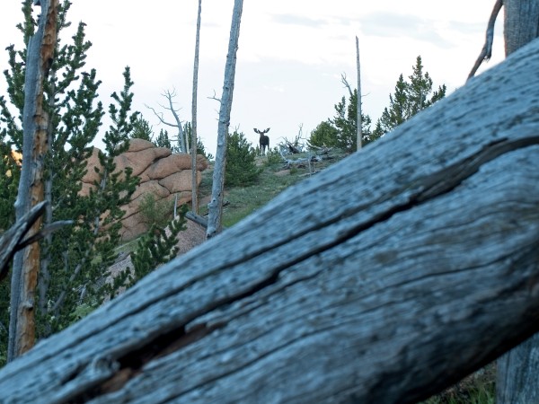
After eating, we split up and check out a few nearby areas that could have some nice campsites. I have my eye on a small hill that appears to have an excellent vantage point for sunset, so I walk over and climb up the hill to see if there is ample space to pitch our tents among the trees that dot the top. It looks like a wonderful area, at least until I spot something moving in the trees. I freeze and stare at the dark mass for a minute, unable to tell what it is until it lifts its head, revealing a massive set of antlers. There’s a bull moose munching on the grass up here! The moose’s presence pretty much rules out camping here; moose are not keen on sharing their space and they are much larger than we are…
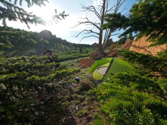
I quietly descend back toward the valley below where the others are looking for a campsite, careful to keep my eye on the moose; I’m not eager for another encounter with a charging moose (like during my trip to the Teton Mountains last summer). Thankfully, another campsite with a wonderful view (and without a bull moose) has been located. We pitch our tents and relax for a while, enjoying the warm evening sunshine.
As sunset draws near, Diane, Josh, and I wander over to the hill where I spotted the moose, both to watch the sun set and to see if the moose is still around. Sure enough, he’s still munching on the grass up here!
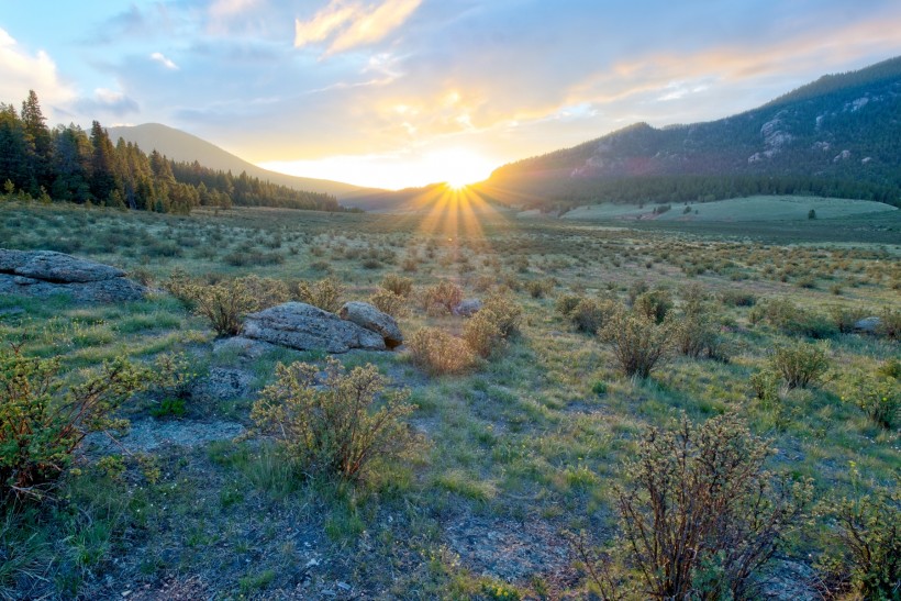
Keeping our distance, we retreat to the other side of the hill and perch on some rocks. A few deer wander through the trees below as the sun sinks lower and lower. Distant clouds on the horizon block most of the colorful light, but do provide some impressive rays that span half of the sky!
After a while, Diane, Josh, and I descend back to our campsite. The moose has also descended from the hilltop and is now grazing in the willows a few hundred feet from our tents. His presence makes us a little nervous, but he seems to keep his distance. After warily watching the moose wander through the willows for a while, we all go to bed.
Day 4
July 7, 2019 | 16.4 mi | +2600 / -5800 ft | View on Map
The next morning brings sunshine, scattered clouds, and cool temperatures. We take our this morning, enjoying the plateau that we’ll soon have to leave. After everyone has eaten, packed, and refilled their water containers, we return to the trail and continue hiking across the plateau. Like yesterday, the trail winds through open meadows and dense thickets of pines and aspens, alternating sweeping vistas with tunnels of green needles/leaves.
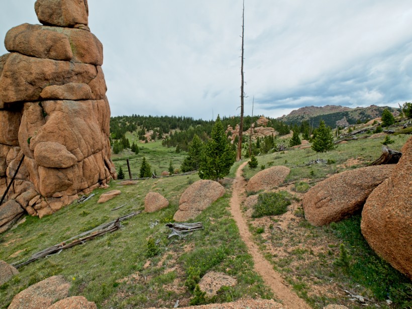
After hiking along the plateau for an hour or so, the trail begins a steep descent, switching back every few hundred feet until it reaches the wide, flat expanses of McCurdy Park. We continue down the trail, skirting the open meadows for a while before beginning yet another lengthy descent. A series of very long switchbacks delivers us to a stream and a nice place to rest. After crossing the stream, we follow the trail toward Refrigerator Gulch, passing an increasing number of awesome rock formations surrounded by aspen trees and wildflowers that more than make up for the long, painful descent.
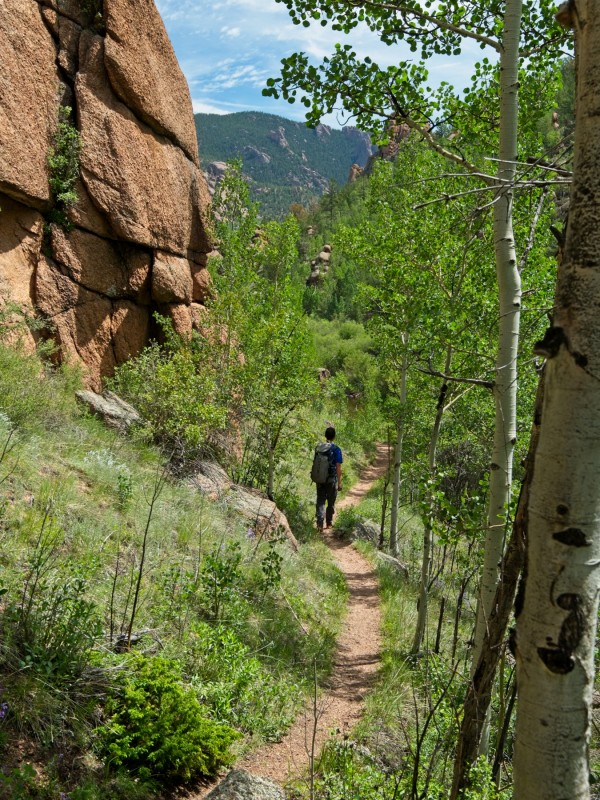
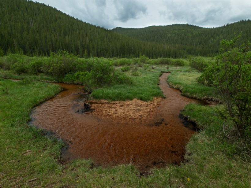
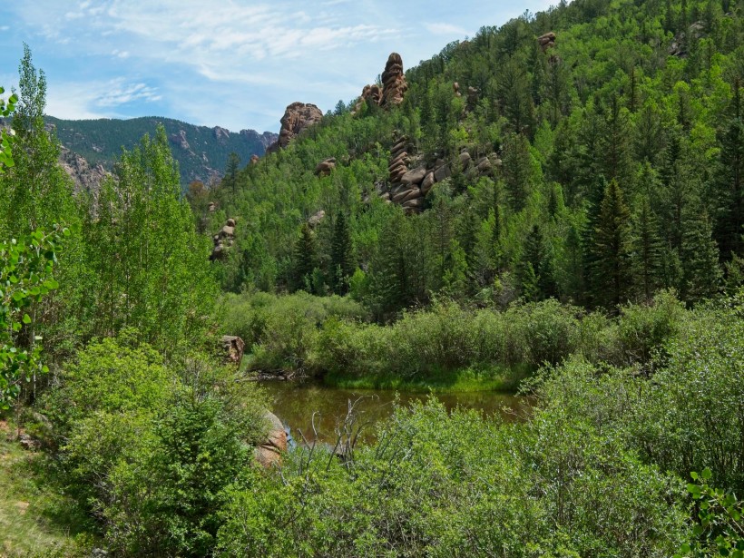
Shortly after leaving the quiet stream, we stroll past a small lake, the first (and only) significant body of water we’ve seen this entire weekend! Unfortunately, it isn’t very picturesque; the murky brown water doesn’t evoke much awe.
A little ways past the lake, we find a nice spot with a great view of the valley. We’ve caught fleeting glimpses of the rocky landscape through the trees, but this is our first clear view of “the gulch”.
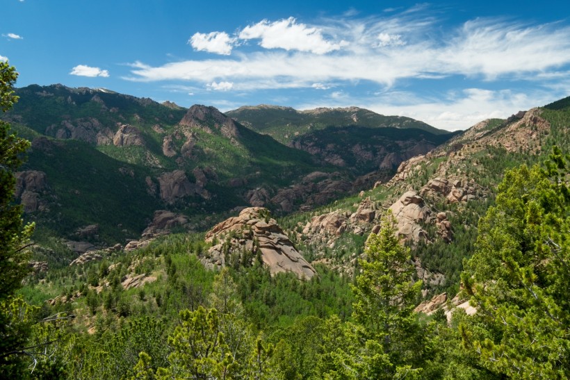
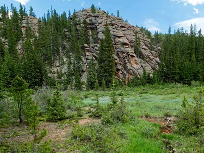
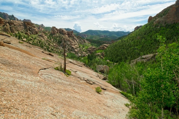
Refrigerator Gulch is surely one of the most interesting parts of the Lost Creek Wilderness. Enormous granite domes protrude from the trees, a sort of red-toned Yosemite. Unlike Yosemite, however, there are the dozens of oddly shaped rock formations. The trail winds among the formations, occasionally climbing to the top of a hill or ridge where we can admire the landscape as a whole.
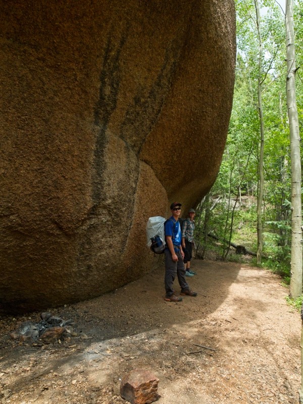
As the morning transitions into midday, dark clouds begin gathering overhead. We press on, but keep an eye on the sky to avoid being surprised by a rain shower or hail storm. When lunchtime arrives, we stop under a giant boulder with a bit of an overhang to shelter us from any impending storms. Thankfully, the storms don’t materialize and we remain dry while eating our last lunch on the trail.
One of the highlights of the day is finally reaching the Lost Creek, the namesake of the wilderness area. At one particularly memorable spot, the creek winds through a collection of fallen boulders and disappears into a twisted canyon that could be part of a Dr. Seuss illustration. I’ve read trip reports from adventurous people that have attempted to follow the creek as it winds through the strange landscape; it sounds like an exciting route, but definitely not one we have time for today. Turning away from the mysterious creek, we continue down the trail.
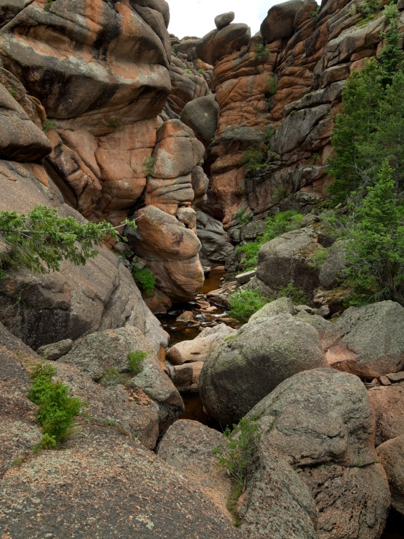
Looking at the map last night, I anticipated that our walk today would be mostly flat. The trail didn’t seem to cross too many of the contour lines, and the gulch itself looked pretty level. I was very wrong. Throughout the afternoon, we climb up (and then down) half a dozen hills, each several hundred feet tall. The hilltops do deliver some spectacular views, but tiredness begins to creep in. It’s been a long weekend; I’m not sure any of us expected 15-mile days to feel this difficult. There’s not much to do about it now, of course. The shortest way out of the wilderness is forward!
When I’m feeling particularly tired on a hike it can be difficult to appreciate the experience. Epic views aren’t as exciting and beautiful flowers earn only a cursory glance. But sometimes the wilderness really outdoes itself, and I find myself reawakened from the tiredness. A beautiful aspen grove is that medicine this afternoon; it’s a nice contrast from the mostly dusty, dry, hot landscape we’ve walked through for the past few hours.
Of course, almost immediately after appreciating the aspens, we begin the longest climb of the day, a 300-foot ascent along a series of switchbacks. It’s not even that much of a climb, we’re all just tired and it’s hot outside. My strategy is to power through the climb, so I settle into a pace I can maintain and keep going until I reach the top of the hill, dripping sweat and very much in need of some snacks. We all rest for a while and refuel before beginning the last leg of our hike: a 6.5-mile trek along the Goose Creek Trail.
Because we hiked this section of the trail on our first day, the time seems to pass a little more quickly. It’s also a wider path than some of the other trails we’ve walked this weekend, so we walk side-by-side and chat for a few hours.
We take one last break for dinner beside Goose Creek. I don’t know about the others, but my energy reserves are dangerously low and I have to eat before walking any further. Sure enough, after downing some tuna and couscous, I feel much better.
The final few miles pass by quickly enough and we arrive back at the wilderness boundary with plenty of daylight to spare. I’ve enjoyed the weekend — great friends, epic scenery, and even some cool wildlife made for a great experience — but I’m also happy to return to a few creature comforts like air conditioning and fresh food.























jim cox 19 September 2019
Awesome! We are going to Redfish today with Tom and Charlotte; coming back tomorrow, love ya, grandpa
Alsea 12 June 2020
I love this trip report!
David N 12 June 2020
Great trip report! Thank you for taking the time to write it up!