To read about earlier or later segments of my John Muir Trail thru-hike, use the navigation links below.
For trip planning information, please refer to the JMT Alternate Beginning post.
Glenn Pass
August 7, 2017 | 17.0 mi | +3700 ft / -5000 ft | View On Map
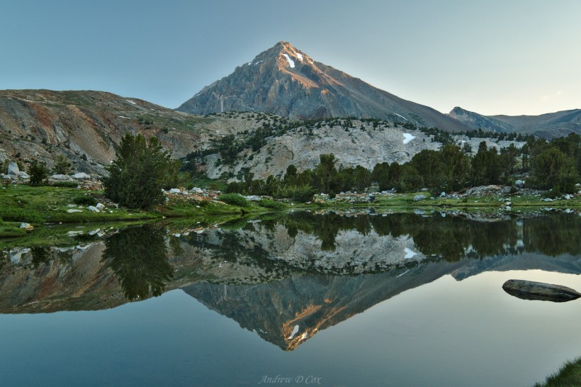
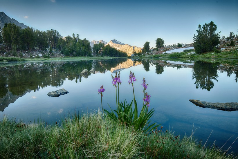
It’s chilly this morning! I’m bundled up in my down puffy and jacket as I wander away from my tent to do a little early-morning photography. Unlike the past few days, the skies are clear and no rain has fallen overnight! I spot a massive rabbit – the size of a large, fluffy cat – grazing next to the lake. It spooks as I draw closer and disappears up the meadow. There are signs of marmot activity all over the place, though I don’t spot any out this early in the morning. I think I’ve seen more wildlife at this lake than anywhere else on the trail!
I return to a few of the compositions I found last night and capture them with the morning alpenglow. The tripod I’ve lugged all the way down the trail comes in handy for these low-light shots and I’m glad I brought it, even if it does add two pounds to my pack.
After photographing the scenery for a while, I return to my tent and eat some oatmeal that I rehydrated last night. I only eat half the bag and save the rest for later. I’m experimenting with meals a bit to see if I can stave off hunger more consistently. During the past few days, I’ve noticed that I feel hungry two hours after breakfast and my morning snack (a Cliff builder bar) doesn’t last me until lunch if I eat it too early. I figure if I eat my breakfast in shifts and then eat the bar closer to midday, I can hike while mildly hungry instead of being completely starving when lunch time finally arrives.
The trek from Wildlife Lake to the next trail junction at the Woods Creek Suspension Bridge is all downhill. The first stretch winds through beautiful sub-alpine country like the area I hiked through after descending from Pinchot pass yesterday afternoon. I love these high altitude ecosystems. Soon the mellow, meandering trail steepens and I find myself relying on my trekking poles to absorb the shock of descending the massive granite steps.
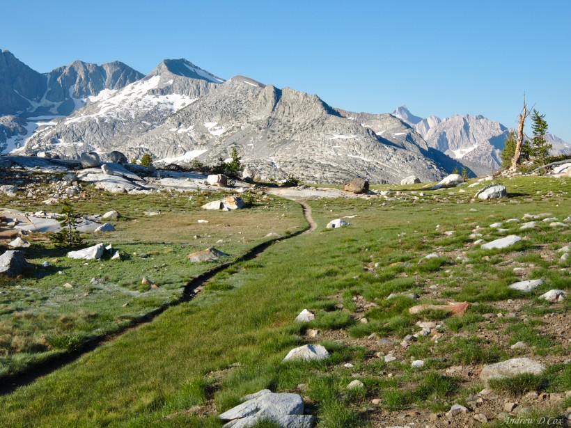
The trail parallels Woods Creek for about four miles; some sections are shaded and cool, others pass through hot, desert-like landscapes. In one particularly shady area, I’m amazed to find a massive snow bridge arching over the wide river. The trail disappears under the snow, leaving me to jaunt across the top of the drift. I enjoy the juxtaposition between summer and winter, snow and sand.
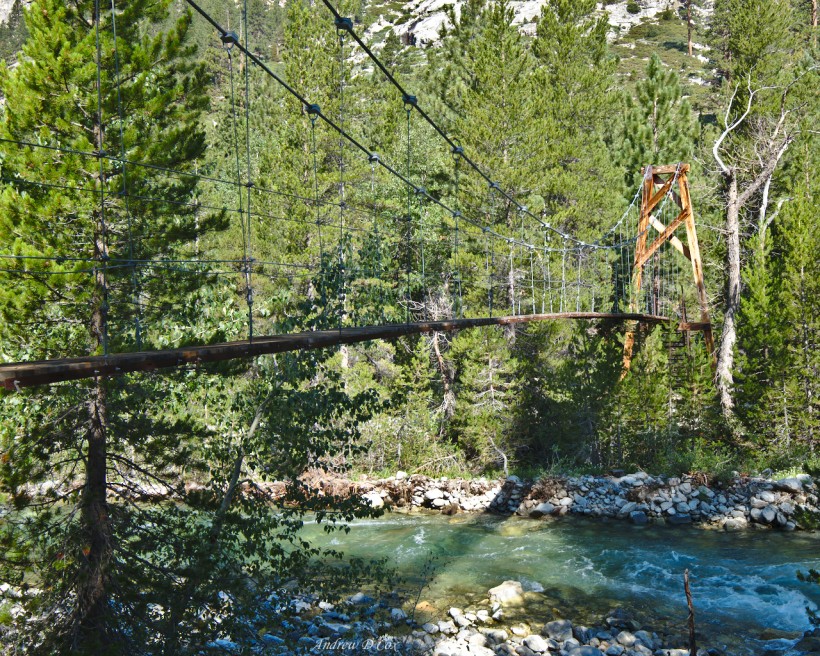
At the bottom of the long descent, I reach the famous suspension bridge. As I walk out across the wooden slats, the bridge bounces and twists beneath my feet. The movement is slightly disconcerting, but the chances of falling off the bridge are slim; the sides are secured with cables at hip and chest height. I bounce intentionally a few times and goofily strut over the river while the bridge recoils from my weight.
On the other side of the river, I pause for a few minutes and eat half of my mid-morning snack (I finished off my oatmeal hours ago…). I watch as other hikers cross the bridge one by one, some pausing for photos with their partners and some gripping the cable handrails tightly to feel more secure. After a little rest, I continue up the trail. I pass dozens of hikers during the next several miles, including two women in their 70’s out to complete the John Muir Trail. Kudos to them! This section of trail is also part of the popular Rae Lakes Loop, and I meet many folks completing that trek as well.
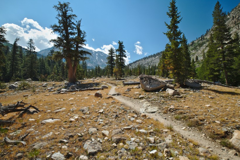
During the next mile, I walk through a thick pine forest with dense vegetation and plentiful water. However, the trail soon climbs higher into more desolate country. Despite nearby rivers, the grass is dry and brown. The rasp of grasshopper wings is awfully similar to a rattlesnake warning, and I’m startled more than once when a grasshopper suddenly takes off to avoid being stepped on.
Further along the trail, I wade through a wide stream cascading over rocks and fallen pines. The cold water is refreshing after trekking up the dry, dusty path and I’m reminded to rehydrate. My soggy shoes actually feel nice today in the heat, and I’m sure they’ll dry quickly as I continue upward. As I squish up switchbacks, I catch up with a hiker I met on the golden staircase a few days ago. We chat for a moment and then I hike on, eager to reach Dollar Lake. Today, I’ve decided, is bath day.
The John Muir Trail continues through varied biomes. There are muddy swamps with clouds of mosquitos, dusty meadows full of grasshoppers, smooth granite slabs lined with talus, and cool woodlands with towering pines. It’s impossible to be bored in such a dynamic place, and the constant distractions of new flora and fauna keep my mind occupied while I walk.
I reach Dollar Lake right at lunch time; the sun is high in the sky, there’s a gentle breeze, and the water crystal clear. First things first: a bath! I remove my shoes, socks, pants, and shirt and then wade into the chilly water. The cool water feels fantastic as I scrub some of the dust and sweat off my body. Once I am clean(er), I give my dirty clothes a few squeezes, wring them out, and hang them from the branches of a nearby pine tree. While my clothes dry in the hot afternoon sun, I munch on a tortilla, Nutella, and dehydrated mangos; only on a backpacking trip can I get away with eating like this!
It doesn’t take long for the sun and wind to dry my clothes and me. Feeling refreshed and refueled, I shoulder my pack and continue up the trail. The wilderness above Dollar Lake is gorgeous: the meandering Arrowhead Lake outlet creek winds through soft, grassy meadow before cascading over a cliff to Dollar Lake below. The river crossings here are deep but the water is slow; I locate a log and avoid the deep wade. If I hadn’t just jumped in the lake, I might wade through just to cool off.
About an hour later, I reach the first lake in the Rae Lakes chain. Most hikers I’ve spoken with agree that the Rae Lakes are some of the most beautiful on the JMT. They’re not wrong; the towering mountains and dense pine forests ringing the turquoise lakes give the area a very romantic appeal.
My original itinerary had me camping at these pristine lakes, but it’s too early in the day for that. I still have six more hours of daylight and, if my luck holds out, I’ll be able to make it over Glenn Pass before any afternoon weather coalesces. So, I stroll past the lakes, albeit slowly to admire the views and take a few photographs. I would like to return here someday and spend some time fishing, swimming, and exploring the surrounding wilderness; there are dozens of lakes in nearby valleys!
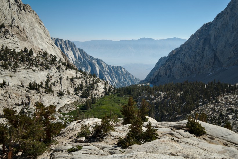
After wading through a deep, but slow straight between two lakes, I begin the ascent to Glenn Pass. Whereas the trail around Rae Lakes has been relatively flat and easy, the path in front of me climbs steeply uphill. As I navigate the switchbacks, I leave the lakes, trees, and vegetation behind. The climb is hard work, but I’m rewarded with incredible views and a sense of adventure; there’s something gratifying about trekking through this barren alpine landscape. Even though the trail is clearly defined, it feels as though nobody else has ever been here.
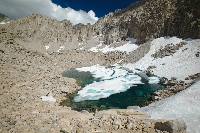
With the increasing altitude comes increasing snow. I cross several wide snowfields to reach the final set of switchbacks that cut through a talus slope. As I huff and puff up the steep path, I reach snowfields that lie across the switchbacks and force me off trail and into the lose rock. There are use trails through the talus, but the footing is treacherous: due to heavy foot traffic, the rocky soil is loose and slippery. I avoid the worn trails when possible and instead scramble through larger talus. The slope is extremely steep and I’m frequently out of breath; the altitude (nearly 12,000 feet) certainly doesn’t make this any easier!
The final hundred yards of trail traverses a long, lateral snowfield on a steep slope. I repeat my strategy from Mather Pass, carefully stepping in exiting boot prints and stabbing my trekking poles into the snow for extra support. I pause a few times to admire the sheer drop off below; I might as well appreciate this incredible landscape!
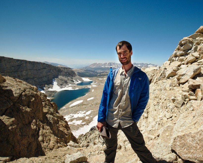
A few minutes later, I clamber up over a few large boulders and reach the Glenn Pass saddle. I slip my pack off and catch my breath after the climb; this is definitely the most difficult pass I’ve climbed so far! I’m joined shortly by hikers ascending from the other side. I can feel the backs of my calves burning in the sun while I chat with the them; there is no shade up here and the air offers even less UV protection at altitude than it would at sea level. I zip my pants back on to protect my skin and, once I’ve recovered from the ascent, gather my pack and begin the descent.
Thankfully, the southern side of the pass is snow-free and I’m able to quickly and easily navigate the switchbacks. I pass several groups of hikers struggling up the steep trail; I offer a few words of encouragement as I speed by. Behind me, dark clouds gather over the Rae Lakes basin. They won’t affect me, but I hope these other adventurers make it to the tree line before any inclement weather begins!
While I’m striding down the trail I have a terrible realization. I have no recollection of packing my stove, pot, and gas canister this morning. Of course, the fact that I don’t remember packing them is not necessarily meaningful; I forget habitual things like that all the time. However, my fears are confirmed when I stop beneath the shade of some trees and dig through my pack: the cook set is not there. I know exactly where it is, too. It’s sitting in an olive-green stuff sack beneath a tree near Wildlife Lake, exactly where I stashed it last night. Since I don’t cook breakfast in the morning, I accidentally left it there where it blended in with the dirt and pine needles. I briefly consider returning to get it, but immediately discard the idea. It’s too far of a walk and I can’t afford to lose an entire day of hiking. Continuing without the stove is not the end of the world – all of my food can be rehydrated without heat – but I feel terrible about leaving such a large amount of “waste” in the wilderness. I hope someone finds it and either makes use of it or returns it to a ranger station.
It takes me a little while to stop mentally berating myself, but my mind eventually turns to other things. Now that I’ve descended from Glenn Pass, I need to find a campsite for the night. There are a few options on a south-facing ridge above Vidette Meadow, but when I arrive at the sites I find them bug-ridden and completely lacking in views. So I continue downhill to Vidette Meadow. I’ve encountered several signs since Rae Lakes warning of active bears between Glenn and Forester Passes. While I know that it’s unlikely I’ll encounter them, I’m hoping to find a campsite with other hikers; there’s safety in numbers! Although, logically, camping with other humans likely increases the chance that bears find your collection of snacks and scented items. Oh well – I know the safety risks are low, it’s my mental apprehension I seek to calm.
When I reach the bottom of a long set of switchbacks at Vidette Meadow, I find a group of Boy Scouts from Pasadena that are out backpacking through the wilderness for a few days. They’re a friendly gang and I’m exhausted, so I find a nice campsite nearby and set up camp.
As the light turns gold, I retrieve my camera gear and engage in my nightly photography ritual. I’m forced to wear full mosquito gear (hat, head net, hard shell jacket) and keep my hands in my pockets when I’m not adjusting camera controls. It’s a small price to pay for the privilege of enjoying the beautiful meadow.
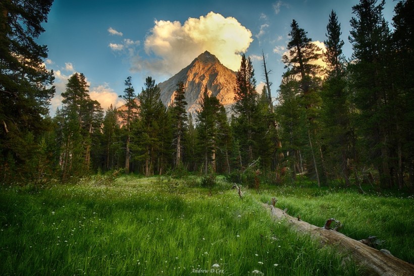
Over the Kern Divide
August 8, 2017 | 14.1 mi | +4100 ft / -2300 ft | View On Map
I’m up early this morning, before most of the boy scouts. I eat about half of my breakfast while packing up and save the rest for later. Today I’m climbing the tallest pass on the John Muir Trail: Forester Pass. Technically, Trail Crest, on the ridge of Mt. Whitney, is the highest pass at 13,403 feet, but since the JMT doesn’t actually go over the pass, I’m counting Forester (13,160′) as the tallest. But I’m getting ahead of myself: I have a six- or seven-mile walk to reach the pass.
In the meantime, I trek through a cool, shady forest of towering pines and gradually gain altitude. It will be a while before the sun makes it over the ridge, but I’m plenty warm thanks to the physical exertion. I pass through a makeshift gate in a barbed wire fence, an oddity this far out in the wilderness. I’m not sure what the fences are for; I’ve never seen any livestock out here other than the mule trains.
As the miles slip by, I begin to lose energy. I eat the other half of my breakfast, which helps a little, but soon find myself feeling tired and grumpy again. I didn’t get the world’s best night of sleep last night, but I did sleep for at least 9 hours… that ought to be plenty! I don’t have enough snacks to keep refueling, so I turn to my emergency calorie source: Gatorade. Once I locate the bag of blue crystals, I dump some into one of my water bottles and mix up the sugary drink. I rest for a few minutes while sipping on the delicious beverage and then gather my things and continue toward the pass.
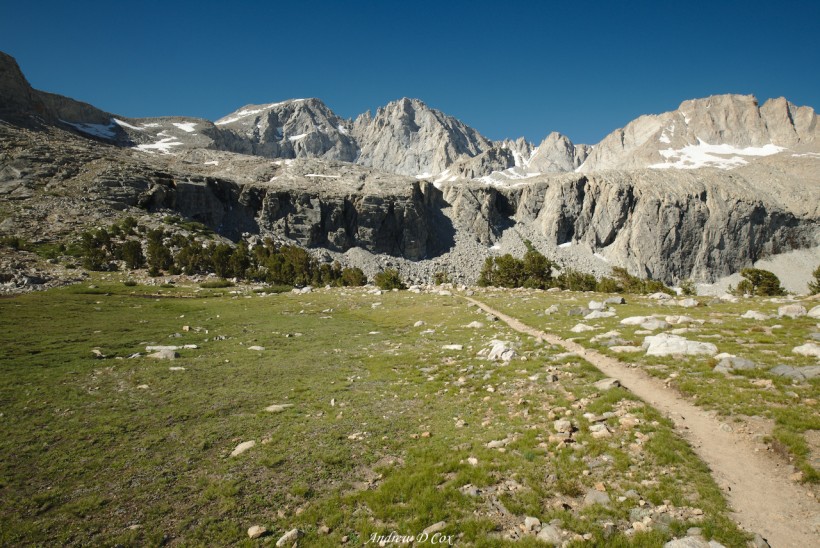
The trail continues to climb up into the mountains; the trees are smaller and Bubbs Creek, which I’ve been following for miles, is only a small brook in the ravine below. I feel much stronger now thanks to the Gatorade and I make good time striding up the path. I soon emerge from the shade of the tree-lined trail into a vast, open meadow: the high country!
During the next mile or two, I saunter through the alpine meadows and leapfrog with the first south-bound backpacker I’ve met today. I’m hiking more quickly than he is, but he passes me when I stop to take photos of the gorgeous wilderness. He doesn’t seem interested in talking, so I don’t pester him other than to say good morning.
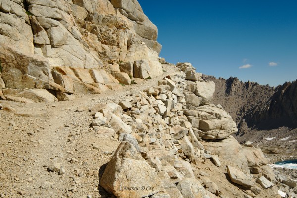
The trail soon leaves the meadows and climbs into a barren landscape of rock and ice. The path is well engineered, with flat stones spaced evenly across the streams and neatly defined passageways through the fields of boulders. I can’t begin to imagine how much effort is required to build this kind of trail and I’m grateful that I don’t have to pick my way across the talus landscape.
I pass the 12,000′ contour on my map and realize that this is the highest I’ve been on the JMT so far! That being said, Forester Pass is still another thousand feet up! A stiff breeze is blowing down the valley, and I appreciate the cool air as I push myself to climb the switchbacks. After a particularly long set of twists and turns, I plop down between two large boulders, sheltered from the wind, and rest for a few minutes. The path ahead of me crosses several large snowfields and then winds up the side of a nearly vertical cliff. I admire the well-engineered trail while munching on part of a protein bar, once again thankful for the hard work of the trail designers.
Gathering my energy for the next section, I cross the snowfields and walk up the gravel path. With every step, the views of the valley to the North – the valley I’ve been walking through all day – become more and more expansive. I reach the northern tip of this jutting stone ridge and admire the view for a few minutes before turning south again and climbing toward Forester Pass. The snowfields here are large and cover most of the ridge; I watch as a few hikers a few hundred yards ahead of me move vertically up one of the steep snow fields. It’s not such a difficult climb, I realize when I arrive. It’s steep, but the heavy traffic has kicked in a nice set of steps and my only task is to put one foot in front of the other and push myself up the slope.
The final few hundred yards to Forester Pass are a combination of horizontal snowfield traverse and class 2 scrambling. To be honest, I prefer the snow. I make quick progress walking in others’ footprints on the soft snow but am forced to slow down and consider various routes in the talus. Also, the talus tends to move when you least expect it too… I’m less cautious than some of the hikers in front of me and hop around them as we all make our way across the steep boulder field.
At long last, I arrive at Forester Pass, a small notch in a wall of imposing stone. There are several other hikers here: a mother and daughter that are thru-hiking the PCT, and a handful of JMT hikers. It’s high time for a rest, so I take off my pack and spend some time talking with the others. The views are incredible and cameras are passed around to capture the scene and each other.
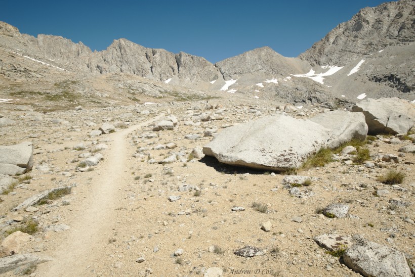
As good as the views are, I’m only halfway done with my day and soon continue down the other side. The southern face of Forester Pass is mostly snow free, although I’ve heard that a dangerous snow chute existed here until just a few weeks ago. I fly down the switchbacks, aided by my trusty trekking poles, and reach the top of a long, gently-sloping valley. Like the wilderness on the north side of the pass, I’m surrounded by stone and ice for miles which makes for easy walking.
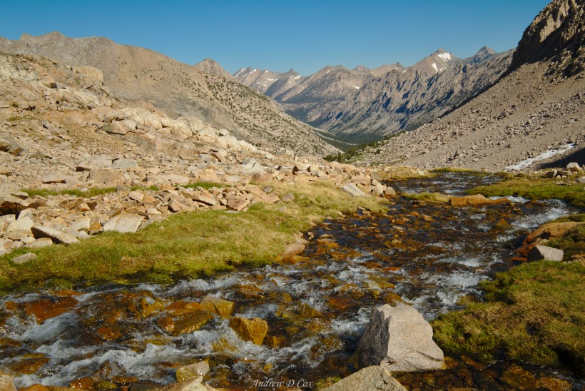
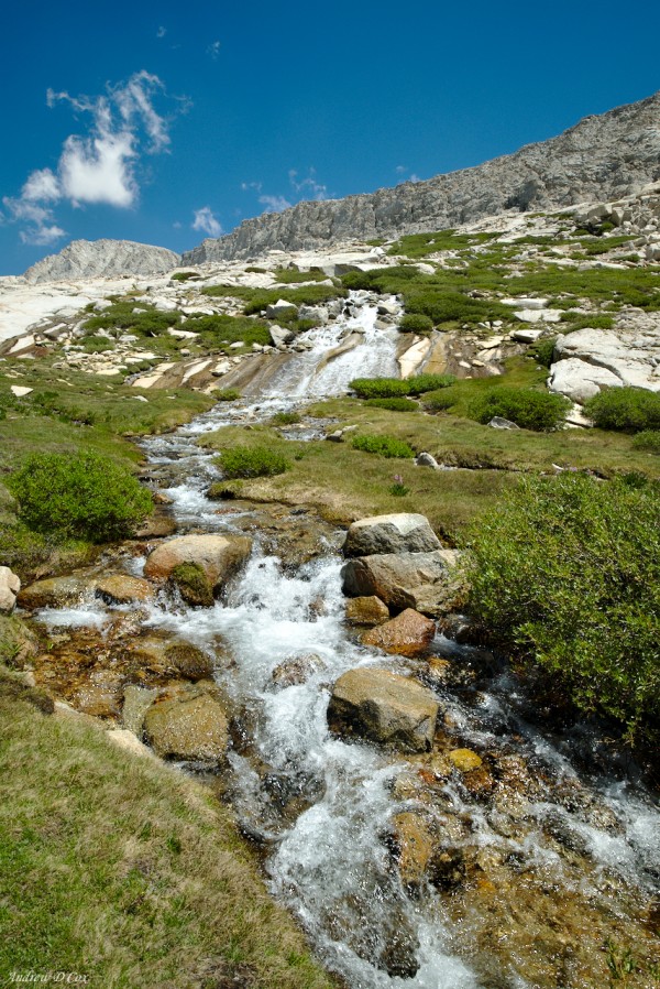
I break for lunch on a granite outcropping with a view of the valley. Water flowing from the snowfields and lakes above collects into small creeks and pours over the rocky landscape. Near the waterways, grass and bushes thrive with tiny wildflowers adding dashes of red, blue, and orange to the greenery. The swaths of life are not wide, however, and the rest of the countryside is dominated by talus and gravel.
After lunch, I walk for what feels like hours across the open wilderness under the hot afternoon sun. The weariness I experienced this morning returns and my mood sours. When I finally reach treeline again, I hurry into the woods and find a nice shady spot for a rest and munch on some trail mix. I’m not sure what my deal is today: a lack of sleep, a lack of calories, maybe I’m also dehydrated, or the altitude is playing a role? There’s not much I can do about the altitude; I won’t descend below 10,000 feet until after I summit Mt. Whitney in a few days. I’m eating as frequently as I can without depleting my rations for the rest of my hike, and I’m drinking plenty of water. I could sleep… I’ll wait to do that until I reach my campsite for the day; only a few more miles!
Within the next hour, I reach Tyndall Creek and wade across. I’ve heard this creek is one of the “difficult” crossings. Honestly, at this point it’s just another wade: Knee-deep, swift, but completely manageable. I don’t bother to remove my shoes before walking through, and my shoes squish and squelch as I begin climbing a set of switchbacks on the opposite side of the creek. I finally reach my campsite for the day – Tyndall Frog Ponds – at about 15:00 and waste no time taking off my wet shoes and setting up camp. I settle down for a nap but am interrupted before I can fall asleep: a ranger is passing through and asks to see my permit. After checking my paperwork, she wanders off in search of some frog researchers that are camped nearby and I doze off for an hour.
When I wake up, I feel much better. The ranger passes by again and I ask her about things I should see in the area since I have the rest of the afternoon and evening to explore. She suggests checking out the nearby frog ponds and mentions that the views from Bighorn Plateau and Tawny Point are great. I spend half an hour walking around the ponds but am not particularly enamored; I do spot one of the frog researchers taking samples on the distant shore!
Back in the shade of my tent, I check out the ranger’s other suggestions on the map. Tawny Point is a peak about 1,000′ above the frog ponds and, while I’m sure the views are great, I really don’t feel like climbing up there just to get a look. The Bighorn Plateau, on the other hand, is practically on the JMT and features a small lake. After deliberating for a minute, I decide to move camp up to the plateau. I’m sure the sunset views will be much better than they are here!
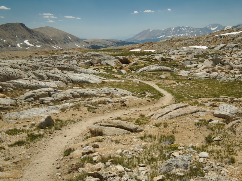
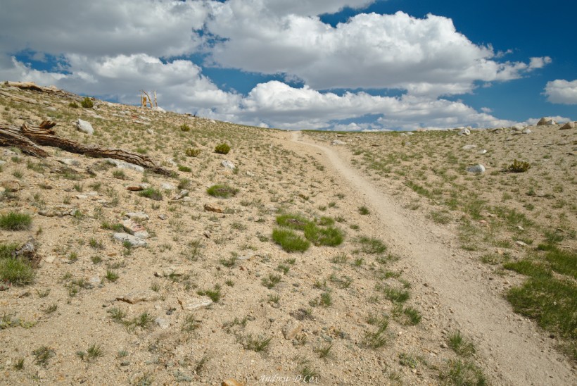
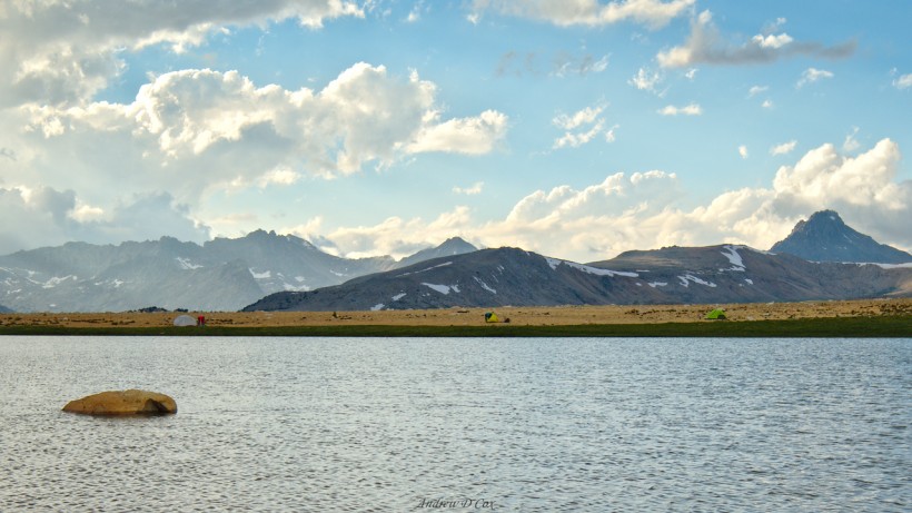
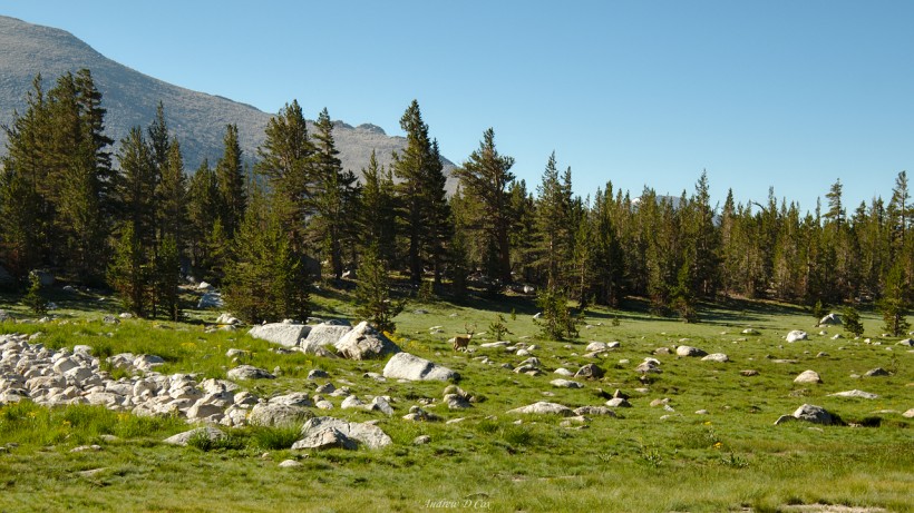
Bighorn Plateau isn’t far, but it is a few hundred feet higher than the Tyndall Frog Ponds. The climb, combined with the relentless afternoon sun, makes me sweaty but doesn’t bother post-nap me very much. There’s a pleasant breeze and the consistent sunshine means rain is unlikely! As I reach the flat top of the plateau, I’m taken back by the expansive vista in front of me. The plateau is huge and covered in smooth gravel for miles. In the center of the plain is a blue lake ringed with green grass. There’s no inlet stream carrying water into the lake, nor is there an outlet stream; the water is just… there. I spot a few tents near the lake and am instantly convinced that this will be a fantastic campsite.
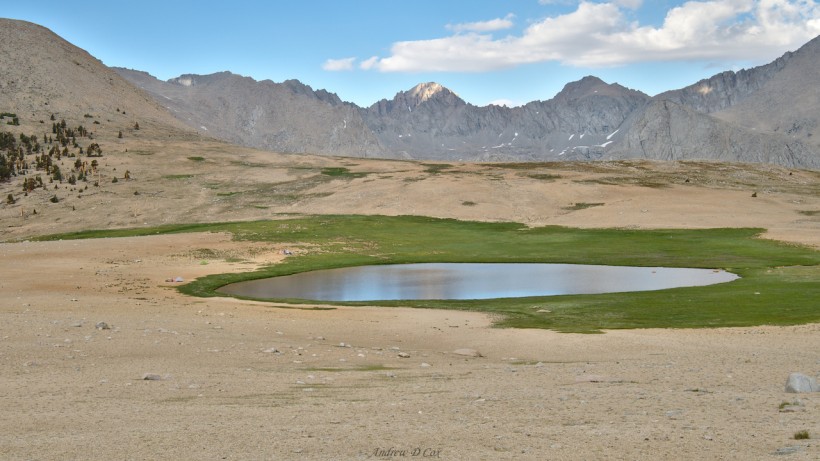
The walk from the trail to the lake is much longer than it appears from the trail and it takes me several minutes to reach the tents. It’s not difficult to find a flat spot that meets the leave-no-trace ethics; the entire plateau is flat and free of vegetation. I plop my stuff down a reasonable distance from my neighbors and set up my tent. Strapping the rainfly down is a struggle in the breeze, but I’ve developed a system and soon have everything tied down and taut.
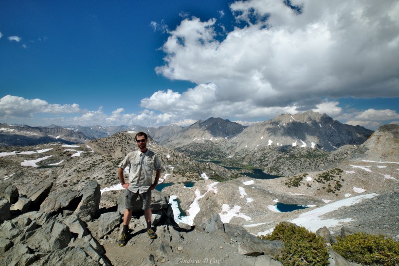
With camp all set up, I wander over to meet my neighbors: Grace, Sarah, Gordon, and Claudia. Grace tells me that she’s heard the views from the nearby hill are incredible, so, after chatting with them for a little while, I saunter over to check it out. The trek to the hill is also deceptively far – it must be the flatness that makes everything look close – but I’m on top of the hill within 30 minutes. Grace’s information is spot-on: the views are spectacular! I can see for miles and miles and miles… To the north is the barren countryside I trekked through this afternoon. Beyond the alpine wilderness lies Forester Pass, and, far in the distance, the Palisades; their sharp sawtooth-like pattern is unmistakable, even from 30+ miles away. To the west lies the “Great Western Divide,” including the glaciated Kaweah Peaks Ridge. To the south, the Kern River carves out a canyon that stretches as far as I can see. Finally, the eastern horizon is dominated by Mt. Whitney and its surrounding peaks.
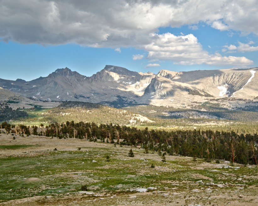
After gazing at the views, mouth agape, for several minutes, I wander back down to camp and gobble up some dinner. I return to the hilltop at sunset and relax on a large stone, comfortably wrapped up in my down puffy and rain jacket, while the clouds speed across the sky. A storm is dumping rain on the distant western peaks, and I spot the occasional flash of lightning but never hear the thunder. Above my head, the dark clouds churn but don’t deliver any rain. As the evening progresses, the light fades and the clouds to the north shift from white, to orange, to pink, then to purple, and finally to black. I click away with my camera, again glad to have a sturdy tripod, while I watch the show.
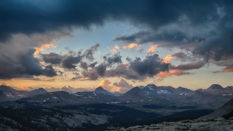
When I’m convinced the sunset is over, I collect my photography gear and hurry back down to my tent. With the sunlight gone, the temperature is dropping quickly and I’m eager to cocoon myself in my sleeping bag. I stash my camera in the tent and connect it to the battery pack; I’m pleasantly surprised to find that the power bank still holds half the total charge capacity. Once I have my gear situated, I cinch down the mummy bag over my face and drift off to sleep.
Guitar Lake
August 9, 2017 | 9.7 mi | + 2200 ft / -1900 ft | View On Map
I wake for my usual middle-of-the-night bathroom break and discover that the rainfly is drenched, as are the tent walls near the ground. Thankfully, the footprint beneath my tent has kept the nylon beneath my sleeping bag dry. I unzip the door, careful to avoid dripping water into the tent, and wander across the gravel under the light of the full moon, use the bathroom, and then return to the tent. The ground appears to be drenched as well; I wonder if it rained?
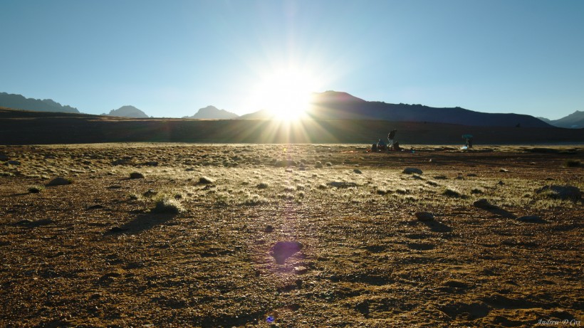
I go back to bed and get up a few hours later when the sky begins to lighten. The tent and ground outside are still soaked. I’m in absolutely no hurry today – I only have a handful of miles to walk – so I take my time with breakfast and leave my tent up to wait for the morning sun to dry it off. In the meantime, I return to the top of the nearby hill and take some panoramic shots of the Great Western Divide as the morning alpenglow creeps down the peaks. Behind me, the sun illuminates the eastern face of Mt. Whitney; there are beautiful views all around!
Once the alpenglow has brightened to daylight and lost its color, I skip down the hill to my tent by the lake. A thin layer of mist hovers over the water and I notice that the grass is icy. When I reach my tent I find the rainfly has completely frozen. The temperature must have dipped below freezing after dawn, because the rainfly was decidedly wet, not frozen, when I left to check out the views from the hill. Claudia discovers the ice when she is unable to open her bear canister to retrieve her breakfast. The lid is frozen closed and she’s forced to wait for the sun to creep over the ridge before she can open it up.
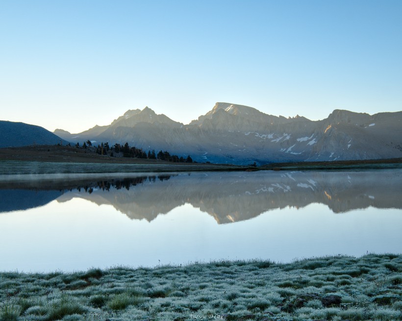
I and my neighbors are all glad when the sun finally crests the eastern ridge and begins to warm us and our gear. I pack up what I can and drape the wet tent pieces out over rocks to dry. To kill some time, I chat with my neighbors and sew up a corner of my tent that has developed a tear.
Once my tent is reasonably dry, I pack up my things and head out. Claudia is already on the trail, and Grace, Sarah, and Gordon aren’t far behind me. I take my sweet time this morning and admire the sights. The trail winds downhill from the Bighorn Plateau for a mile or two through dry pine forests and a few spongy meadows. I spot an 8-point buck grazing in one of these grassy oases and stop to take a photo, though the short focal length doesn’t do his magnificent form justice.
The downhill section ends when I reach the Wallace Creek Ford, a relatively easy river crossing with several nearby campsites. Soon after crossing, I catch up to Claudia and leapfrog with her for a few miles as the trail climbs toward Crabtree Meadow. Up at these high altitudes, the afternoon sun is relentless even if the temperature isn’t super hot, and I’m grateful for the occasional stretches of forest where there is some shade. Claudia and I eventually realize that we’re traveling at the same pace and decide to stick together.
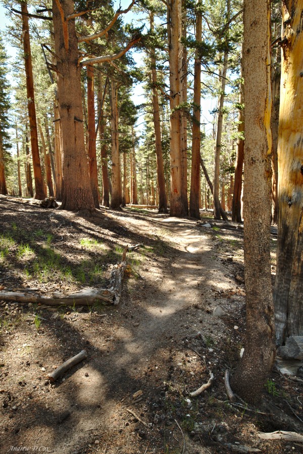
This final section of the John Muir Trail is no longer part of the Pacific Crest Trail, though many PCT hikers make the detour to summit Whitney. As we draw near to Mt. Whitney, we pass a plastic box that holds dozens of “wag bags,” glorified trash bags with something like cat litter in the bottom. Pooping in the wilderness near Mt. Whitney is prohibited due to the high altitude and the area’s popularity. Poop just won’t decompose very quickly up here and the last thing anyone wants is a minefield of cat holes. The solution is to pack out your solid waste in the wag bags. It’s not a particularly glamorous part of the trip, but if that’s what is required to maintain the beautiful wilderness, then so be it. I received a wag bag in Yosemite when I picked up my permit, so I don’t need one from the box and continue up the trail, through a sandy meadow and towering pine trees.
The path climbs up steep switchbacks and I’m soon breathing heavily as I climb toward Mt. Whitney. I won’t make it to the summit today; that isn’t the plan. No, I’ll be camping at or near Guitar Lake just below the famous summit to enjoy one last evening on the trail.
I meet Claudia for lunch on the banks of Timberline Lake. We relax in the shade and munch on various delicacies like almond paste, dried mangos, and peanut butter. My bear canister is practically empty at this point and I’m loving how light my pack is!
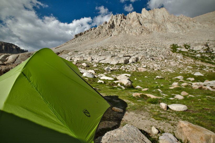
About an hour later, we arrive at Guitar Lake. There are dozens of campsites scattered around the lake, nestled between boulders on the sandy soil, but Claudia and I decide to walk a little further to a small lake above Guitar Lake and pitch our tents there. I’m unable to use stakes because of the thin, rocky soil and once again tie off the tent and fly guylines to nearby rocks. As is usual at these high altitudes, the fabric flaps around in the wind, adding a little extra challenge to the endeavor. A marmot watches as I unpack my bear canister and I imagine the little furry critter is eyeing the food inside. I toss a few small rocks at him to scare him away and then continue setting up camp.
Once I’m settled I glance down at my watch and groan a little; it’s only 13:30! There are seven more hours of daylight left, and I’ve already reached my destination for the day… Luckily, I have a new friend to get to know! Claudia and I spend the rest of the afternoon talking and admiring the scenery. The sun and clouds wreak havoc on my thermal homeostasis while I sit on a sunny boulder: when clouds drift in front of the sun, I’m cold and pull on extra layers, but then the sun emerges and I’m forced to remove a few to avoid overheating.
Originally, my plan for tomorrow was to wake up at my usual time, summit Whitney, and then hike out to Whitney portal and hitch into Lone Pine. However, after chatting with Grace, Claudia, and others, I’ve decided to summit with the rest of them early enough to watch the sunrise from the summit. It’s between three and four miles from here to the summit with a vertical gain of 3,000 feet, which should take me about 2.5 hours to walk. Sunrise occurs just before 6:00, so I’m planning on beginning the trek at 3:00. It’s an awfully early time to wake up, so I hope the sunrise experience at the top of the mountain is worth it!
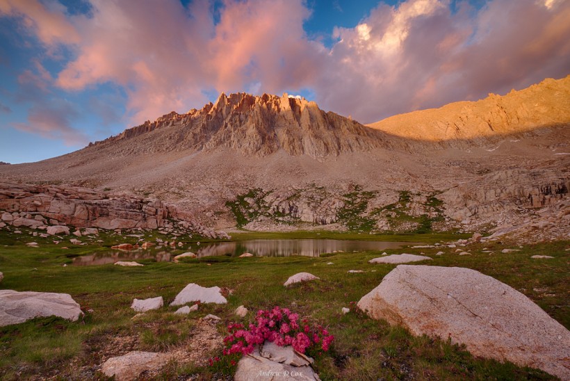
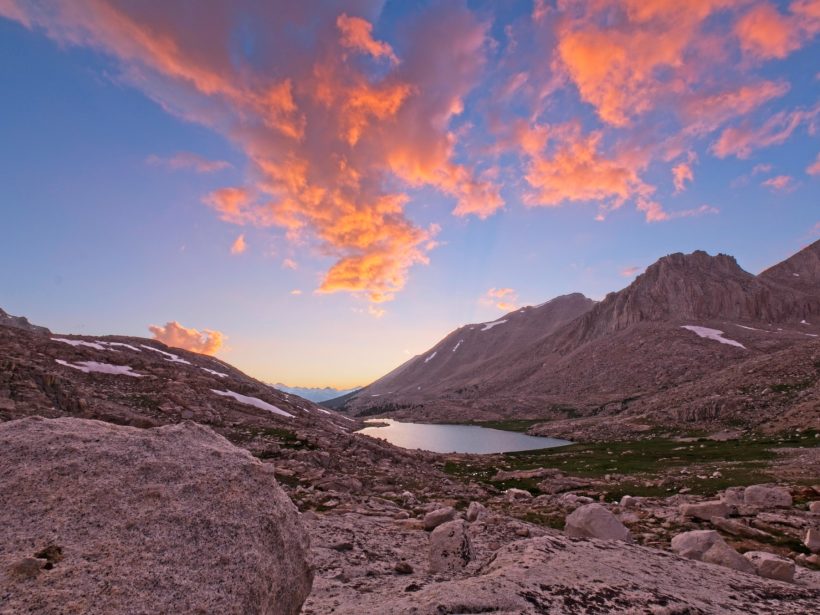
As 8:00 rolls around, the clouds begin to turn bright shades of pink and orange. The entire landscape, including the spires of Mt. Whitney, reflect the warm light. I grab my camera and tripod and rush out among the granite boulders to take some photos. I chat with a woman named Jenn, who has just arrived and is camping nearby, while I admire the sunset.
It’s a spectacular final night on the trail; I can not imagine a more beautiful sunset! Once the color has faded from the sky, I return to my tent and go to bed in an attempt to get as many hours of sleep as possible.
Moonlit Walk to Whitney Summit
August 10, 2017 | 13.8 mi | +3200 ft / -6400 ft | View On Map
My beeping watch rouses me from sleep at 2:30; I’m wide awake with anticipation despite the early hour. I take care to be quiet as I pack up my gear so as not to wake Jenn or any other nearby campers. I’m not particularly hungry, but I eat half of my overnight oats anyway so I’ll have some calories to burn while I walk. Once I finish eating, I take down the tent and stuff the thin fabric into my pack, grateful that it is dry this morning.
After a final glance around my campsite to make sure I’m not leaving anything, I turn the beam of my headlamp toward the trail and stride into the night. Claudia started a little earlier than me and is somewhere ahead on the trail. The air is frigid at this early hour, and I’m bundled up in all my layers despite the fact that I will be working hard to climb 3,000 feet to the summit. In true hiker fashion, I’m wearing a pair of socks on my hands as makeshift gloves.
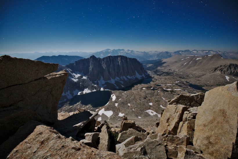
I soon realize that the headlamp is unnecessary and turn it off; the trail is easily visible under the light of the full moon! Walking through the moonlit landscape is enchanting. Everything is still and the only sounds that reach my ears are the crunch crunch crunch of my feet on the rocky trail. To add to the euphoria, I feel strong and fast, unlike my trip up this mountain last year. I wasn’t properly acclimated then and I remember feeling breathless and dizzy at this altitude. I’m much more prepared now after spending the past two weeks climbing progressively higher into the mountains. I haven’t even stepped foot below 10,000 feet in days!
I catch up with Claudia shortly before the junction with the Whitney Portal trail. There at the crossroads, I take a break. I’m beginning to feel a little faint from a lack of calories and enthusiastically devour a Cliff builder bar to regain my strength. I also take advantage of the break to pull out my camera and take a photo. The moonlit landscape that appears in the digital viewfinder 30 seconds later takes my breath away. Every mountain, ridge, and lake is visible under the bright moonlight, and the long exposure also captures the stars! I fiddle with the settings and expose a few more frames before my fingers grow too cold to articulate. I stash my camera back inside my bag, pull my sock-gloves on, and set off up the final two miles of the John Muir Trail.
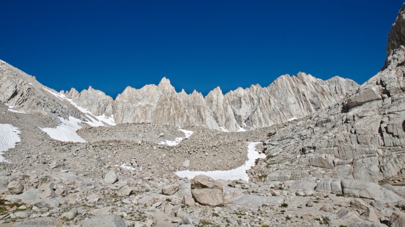
As I saunter along the trail, I reach the first of several “windows” in the scalloped ridge. The boulder-strewn slope comes to a point a few feet in front of me, granting a view of Owens Valley, the sleepy town of Lone Pine glowing with orange streetlamps, and a thousand-foot drop to icy tarns and steep snowfields directly below. The exposure is enough to twist my stomach, but I’m transfixed by the view. The horizon is already beginning to lighten and the distant mountains stand silhouetted against the pre-dawn light.
I pass several more windows as I hurry toward the summit; I would love to stop and pull out my tripod to capture a photo, but I’m racing the sunrise to the summit. I relish my body’s capability to perform at altitude and move as quickly as I can while maintaining some modicum of caution on steep slopes. Soon, I reach an icy snowfield. I don’t see a way around it, so I begin to climb. The snow is treacherously slick, and the exposure is nontrivial; a fall here would probably result in broken bones. My heart beats fast as I carefully wedge my feet into small divots in the ice. I use my trekking poles as much as I can to stabilize myself and soon reach the top of the snow.
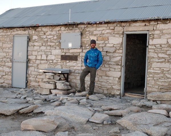
Relieved to be on stone once more, I speed walk past the summit hut and breath a sigh of relief when I catch a glimpse of the horizon: the sun has not yet risen. Several small groups of people are already up here. I wave to Grace, Sarah, Gordon, and a few other JMT adventurers I’ve met during the past few days and then walk to the edge of the cliff to find a nice spot to watch the sunrise. The drop here is at least 2,000 feet… Not a good spot to lose your balance!
As I’m setting up my tripod, I notice a couple huddled together in a sleeping bag a few feet away. I look more closely and realize it’s Matt and Darby! I hadn’t expected to see them again and am overjoyed to discover that they made it here to the end of the trail. We chat while waiting for dawn, and I continuously glance over my shoulder to see if Claudia has made it up. She wasn’t far behind me and I’m anxious to make sure she doesn’t miss the sunrise.
Soon after Claudia arrives, the dark red disk of the sun begins creeping above the distant horizon. From this high vantage point, the sun appears to be below us as if we are observing the world from some lofty heavenly perch. A dark stripe of cloud and smoke that stretches across the sky at eye level strengthens this illusion that the sun and distant mountains are actually below the horizon. As the sun rises, the dawn light casts a reddish glow over the world. Behind me, I notice the first hints of alpenglow beginning to creep down the Great Western Divide. This is so cool! I’m so glad I decided to make the early morning trek.
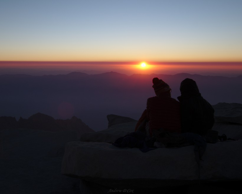
While the sunrise is incredibly beautiful, dawn coincides with the coldest part of the day and my fingers are soon numb. It’s all I can do to adjust knobs on my camera and snap photos of the incredible vista. Once the sun has crested the horizon, I take a break from photography and eat the rest of my morning oatmeal. Manipulating the spork with my frozen fingers is particularly challenging. I also take some time to chat with Darby, Matt, Claudia, and others. In retrospect, I really wish I had taken some pictures with them!
With sunrise over, I’m eager to get moving again. I sign the summit register and then begin the trek back down the JMT toward Trail Crest. I’m able to avoid the icy snow just below the summit by taking a well-defined use trail that I didn’t see in the pre-dawn darkness. I hustle down the trail in an attempt to generate some body heat but am only mildly successful as the entire ridge lies in the shade. It isn’t until I reach the pass at Trail Crest that I’m able to bask in the morning sun and truly warm up.
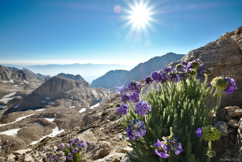
On the walk down the 99 switchbacks, I befriend a geology Ph.D. student and strike up a conversation; it’s fun to talk shop with someone way out here in the wilderness! We pass several clumps of Sky Pilots, a small purple flower that is endemic to the Sierra Nevada mountains and only grows way up here above 10,000 feet.
When we reach Trail Camp, I bid farewell to my fellow Ph.D. student; he returns to his tent to pack up camp and I continue down the trail. I pass a ranger that is out collecting wag bags that hikers have left up here; what a truly horrible job! It would be nice if the bags were numbered and could be linked to the permit holder they were given to; at least then the Forest Service could punish those irresponsible jerks.
I grow grumpier as I descend. There is little shade, the sun is hot, the constant downhill takes a toll on my body, and I’m leaving the mountains. For whatever reason, this end-of-hike angst is something I’ve come to expect. I think the anticipation of returning to “real life” is a big factor; I’ve lived simply for the past few weeks and am not looking forward to handling all the societal logistics again. I’ll be expected to shower, be at certain places at specific times, urinate only in designated pools of water… trail life is so much easier.
The hiking life is also so rewarding. It’s hard to beat the satisfaction of reaching the top of a pass or the euphoria that accompanies the sight of a pristine alpine lake… the smell of aspens, or the scent of the pines… picas squeaking as you walk softly through an alpine meadow… snowfields, talus, sand, granite… entire ranges of snow-capped peaks reflected in pools of crystal clear water… yeah.
When I reach Whitney Portal, I toss my used wag bag into a designated “human waste” receptacle and sit defiantly in the pine needles beneath a tree, refusing to use nearby benches. Claudia is the first of my friends to arrive, and her whole family is here to greet her. Matt and Darby arrive soon, and then Grace, Gordon, and Sarah. We all feast on burgers, fries, ice cream, beer, and soda from the Whitney Portal store until we can eat no more. After saying goodbye to other hiker friends, I squeeze into a car with Grace, Gordon, Sarah, Darby, and Matt. To avoid breathing our own stink, we open all the windows as Gordon navigates the tight switchbacks of Whitney Portal road. With the cool breeze blowing through the car, Grace turns on “American Pie,” and we all sing along as we drive down into the desert.
I’m often asked what photography equipment I use to document trips like this one. On this particular adventure, I carried the Fuji X-T2 and Fujinon XF 10-24mm f/4 lens as well the Sirui T-024X carbon fiber tripod. See my dedicated gear post for a complete gear list.



Sule 5 August 2020
Impressive.Im jealous .