To read about earlier or later segments of my John Muir Trail thru-hike, use the navigation links below.
Trip Planning
Acquiring a permit to hike the John Muir Trail is arguably more difficult than actually completing the hike. Yosemite National Park reports that thousands of people apply each year, all hoping to be granted permission to hike from Happy Isles to Donohue Pass before continuing on to Mt. Whitney. Because of this difficulty, many people (myself included) have found alternate routes to begin the John Muir Trail (JMT). After failing to get a permit from Happy Isles over Donohue Pass, I applied for a permit to instead begin at Glacier Point and exit Yosemite via Isberg Pass. I’ve hiked through Yosemite in the past and visited Thousand Island and Garnet Lakes, so I didn’t miss many areas that I haven’t visited before. Besides, this alternate route over Isberg Pass covers just as many miles (if not a few more) and traverses the same kind of incredible wilderness!
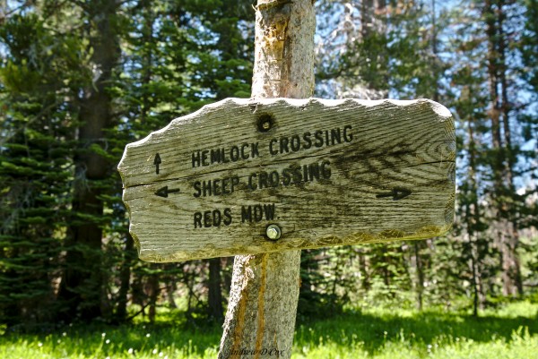
Route – Begin at Glacier Point and follow the Panorama Trail down to Illilouette Creek. Continue up the creek to the Merced Pass Lakes, then turn northeast and cross over Red Peak Pass. The trail descends to the Triple Peak Fork of the Merced River; here, cross the icy river and continue east to Isberg Pass. Beyond this boundary of Yosemite National Park, follow the trail past the Isberg Lakes, down the East Fork of Granite Creek to ruins of Chetwood Cabin. Just south of the old cabin, turn north and follow a trail to Hemlock Crossing, where the trail abruptly turns south again and ascends the western side of the Ritter Range. The path can be difficult to follow in this area, so be sure to have a map handy! Continue along this low-traffic route, through Naked Lady Meadow, Earthquake Meadow, Headquarters Meadow, until you reach Corral Meadow, where a north-south trail cuts across the route. Rather than following this path, continue east, heading for the Granite Staircase on the ridge overlooking Devils Postpile. From Devils Postpile, follow the John Muir Trail to its southern terminus at Mount Whitney.
Permits and Regulations – Acquiring a JMT permit is perhaps the most difficult part of the entire trip. The most popular option is a permit that departs from the Happy Isles trailhead in Yosemite National Park and exists Yosemite via Donohue Pass; this and all other permits for trips originating within Yosemite must be obtained from the national park. If, like me, you are unsuccessful in reserving the traditional JMT permit, there are plenty of other trailheads to start from. If you plan to hike south-bound (SOBO), check for permits in Inyo National Forest, or Sierra National Forest. You can also flip the route, beginning at the southern end and traveling north-bound (NOBO). The possibilities are endless!
Unlike many national parks, backcountry camping in Yosemite and Sequoia-Kings Canyon is not confined to designated campsites or camping “zones.” You are, of course, expected to follow the Leave No Trace principles, particularly on the tremendously popular JMT/PCT. Bear canisters are required along almost all of the route. Additionally, the final few miles in the Mt. Whitney area are “wag bag” territory: you must pack out your poop in a wag bag! You can pick up a bag near the Crabtree Meadows Ranger Station (SOBO) or when you pick up your permit (NOBO).
Logistics – Besides securing a permit, there are two logistical hurdles associated with the JMT: transportation and resupply. Luckily, both are very straightforward. Transportation to and from the trailheads is easiest on the eastern side of the Sierras; SummitPost has an excellent page with lots of information on the topic. I chose to fly into Reno, NV, then drove a one-way rental car to Mammoth Lakes. From Mammoth, YARTS provides access to Yosemite. For the return trip, I boarded an Eastern Sierra Transit bus in Lone Pine and rode all the way to Reno to catch my flight home.
I included two resupplies in my trip, one in Mammoth Lakes, and another at the Muir Trail Ranch (MTR). In the Mammoth Lakes area, resupply packages can be mailed or delivered in person to the Reds Meadow resort near Devils Postpile or to the Mammoth Lakes post office. Similarly, resupply packages can be shipped to Muir Trail Ranch. Both locations charge fees to pick up and store your items, but the convenience of these services is well worth the marginal costs. Some hikers choose to include an additional resupply between MTR and Mt. Whitney, hiking out to Independence via Kearsarge Pass.
Resources – As usual, I relied heavily on CalTopo and National Geographic maps. In particular, I recommend the Yosemite map, and the John Muir Trail map set. The former includes almost all of the trails between Glacier Point and Devils Postpile, while the latter includes the entire JMT corridor. I’ve also heard good things about the Tom Harrison JMT map set, although I cannot personally vouch for it.
Travel to the Trailhead
After years of dreaming and months of planning, this trip is finally happening! Dad and I arrived in Reno a few days ago and, after a long drive and an even longer ride on a YARTS bus, made it to Yosemite National Park around noon. We spent the rest of the day exploring the valley, taking in views of Half Dome, El Capitan, and Yosemite Falls.
Dad and I took a tour from the Yosemite Valley Lodge up to Glacier Point. We probably could have hitched, but the tour ended up being really fun! The bus driver knew everything about the history, geology, and ecology of the park. During the drive, he taught us about the different species of trees that live in the forests and how they interact with other species. He also threw in several terrible puns, which Dad and I laughed at for hours afterward; nobody else seemed to find them very funny…
The Illilouette Drainage
July 26, 2017 | 13.8 mi | +3100 ft / -1400 ft | View on Map
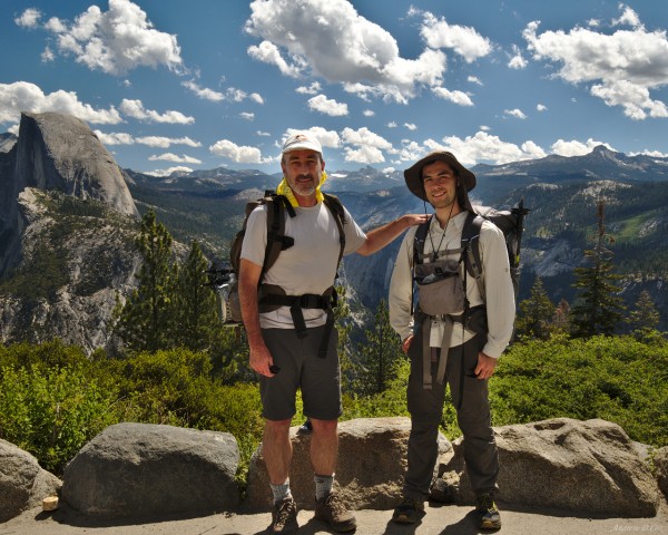
We’ve finally arrived at Glacier Point! The views from the various outlooks are incredible and we spend some time admiring each vista. However, we have plenty of miles to cover today and, after taking a few commemorative photos at the trailhead, we begin our hike. John Muir Trail, here we come!
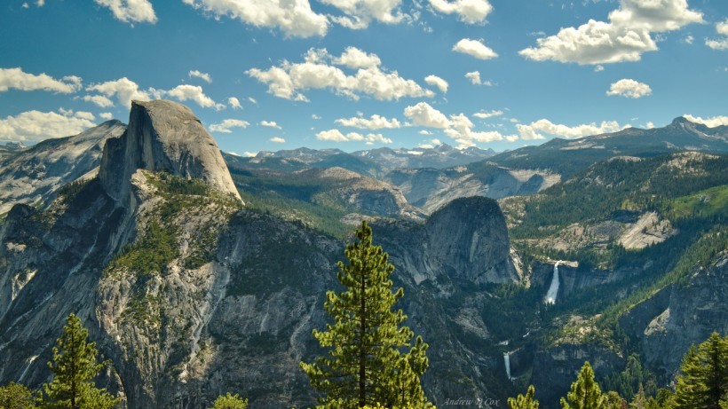
During the first several miles the trail descends from Glacier Point toward Illilouette Creek. The sun, already high in the sky, beats down on the arid landscape and every footfall kicks up dust. It’s not so bad, though – we’re fresh off the bus, are relatively clean, and have plenty of water. Plus, the views of Half Dome, the waterfalls, and distant granite peaks are more than enough to keep my mind distracted from the heat.
We soon reach the Panorama Trail junction and I’m tempted to take the 2.3-mile detour to see all the acclaimed views, but we have too many miles to cover today to afford the delay. Besides, we’ve already seen some incredible views! So we turn away from Yosemite Valley and begin trekking further south, up the Illilouette drainage.
A few miles later, we reach Illilouette Creek. Yosemite wilderness rangers have been warning for weeks that this crossing is dangerous. In fact, last I checked, their advice was to cross the creek via the bridge on the Panorama Trail. The fact that backcountry conditions change quickly is to our advantage today: the creek is only knee deep and the flow isn’t too swift. After removing our shoes and socks, we wade into the water. The ice-cold water is refreshing on our dusty legs but is too cold to spend much time in.
With shoes and socks again protecting our feet, Dad and I continue up the trail. For the first time today, we begin to climb uphill. We find evidence of a recent forest fire everywhere: charred trees strewn across the ground, a distinct lack of shade, and a ton of grass, small shrubs, and young saplings. For a few hundred yards we struggle up a sandy slope, which is a strange change from the pine forests we’ve walked through today.
After crossing the sand, we trudge another mile or two and stop for lunch in the shade next to a small, gurgling brook. Today’s menu includes hummus, extra sharp cheddar cheese, dried fruit, and one tortilla each. Dad and I filter some water from the brook, relax for a while on a fallen pine tree and then continue, re-energized, up the trail.
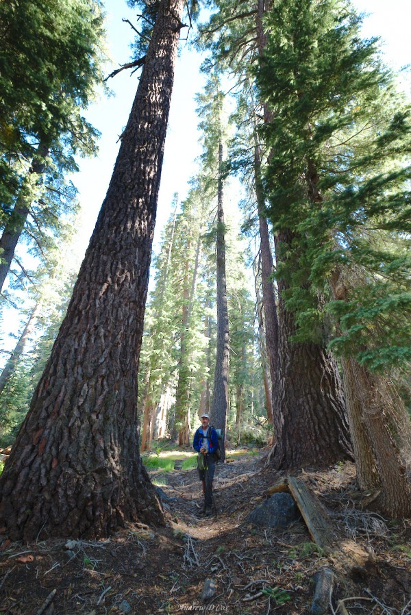
The sandy desert landscape soon gives way to groves of massive Jeffrey Pines, each at least 10 feet in diameter and several hundred feet tall. Dwarfed by these red giants, we make good time up the gently sloping trail. I stop a few passing hikers to inquire about the country ahead – I’m particularly interested to hear what Red Peak Pass is like. The latest I’ve heard from the online hiking community is that the pass is snow-free on this side (the south side) but is covered in deep snow for miles on the north side. Crampons are almost definitely required, and finding the trail could be a challenge in the snow. Unfortunately, the hikers we meet on the trail have only been as far as Lower Ottoway Lake to do some fishing and aren’t able to offer much information about the pass.
The trail continues to climb and we soon reach areas I remember from my last hike in Yosemite: a seemingly infinite string of hills. Every time we reach the top of one hill, expecting to see the glittering waters of Lower Merced Pass Lake (our destination) below, we’re instead greeted with views of yet another hill to climb.
It’s high time for a rest and some trail mix; Dad spots a spot with easy access to the creek and we spend a few minutes soaking our feet and relaxing. The water is ice-cold, of course, and rushes over large, flat slabs of granite. In fact, the entire landscape is composed of enormous slabs of granite, which impresses Dad much more than me since I’ve hiked this particular section before. It’s a dramatically different landscape than anything we have in the midwest or on the east coast!
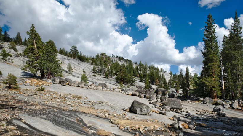
The next several miles of our journey traverse these granite slopes, climbing ever higher. While there is no trace of a trail on the smooth granite flows, the path is clearly marked with rows of stones on each side. Pine trees are scattered across the landscape, somehow managing to cling to whatever cracks they can find. My feet soon notice the difference between the soft forest floor and the granite. The unyielding stone makes my feet ache and I have to take care to avoid jarring steps when the trail descends between ridges. Still, it’s difficult to be too annoyed when you’re walking through such a beautiful landscape.
After what feels like several hours, Dad and I reach a creek crossing that I distinctly remember from several years ago. It was here, on the banks of this small creek lined with lush, green grass, that I first realized just how terrible mosquitoes can be in the Sierra Nevada. This year, I’m prepared for them: I treated my clothes with Permethrin to repel the little blood-sucking demons, and I’m fully covered with long sleeves and pants. For good measure, I also brought bug spray and a head net. Dad is similarly prepared, although he accidentally left one half of his zip-off pants at home.
Thankfully, the mosquitoes don’t seem as aggressive as I remember them being. However, there are still enough to be a nuisance, so Dad and I don’t tarry long in this wet, marshy area and instead continue uphill. We’re within a few tenths of a mile of the Merced Pass lakes now, so we abandon the trail and follow the sounds of the outlet creek. I enjoy our little bushwhacking jaunt and, after some very steep granite scrambling, we arrive on the banks of Lower Merced Pass Lake!
With a sigh of relief, we extract ourselves from our packs’ straps and buckles and wander around a bit to locate a nice spot to spend the night. A wilderness guide and her clients are camped nearby, so I stop by to say hello. The guide has news I’m interested in: she climbed part way up Red Peak Pass from this (southern) side recently and warns me that there are still significant snow drifts on this side of the pass. That’s not really the news I’m hoping for, and it contradicts what I’ve heard from others. Dad and I will have to hike up and see it for ourselves. When I ask if she knows of any other campsites around the lake, she points me toward the southern shore and tells me the views of Red Peak at sunset are incredible from there.
Dad and I struggle to find a spot large enough for our tent but eventually locate a patch of pine needles large enough to sleep on and set up camp. The nearby lake looks inviting, so we decide to jump in. The cold water feels great on my skin and I swim around a little before scrubbing some of the sweat off my body. Dad finds the water much colder than I do and we don’t swim for long; the sun is quickly setting, and neither of us wants to be wet when the temperature begins to drop.
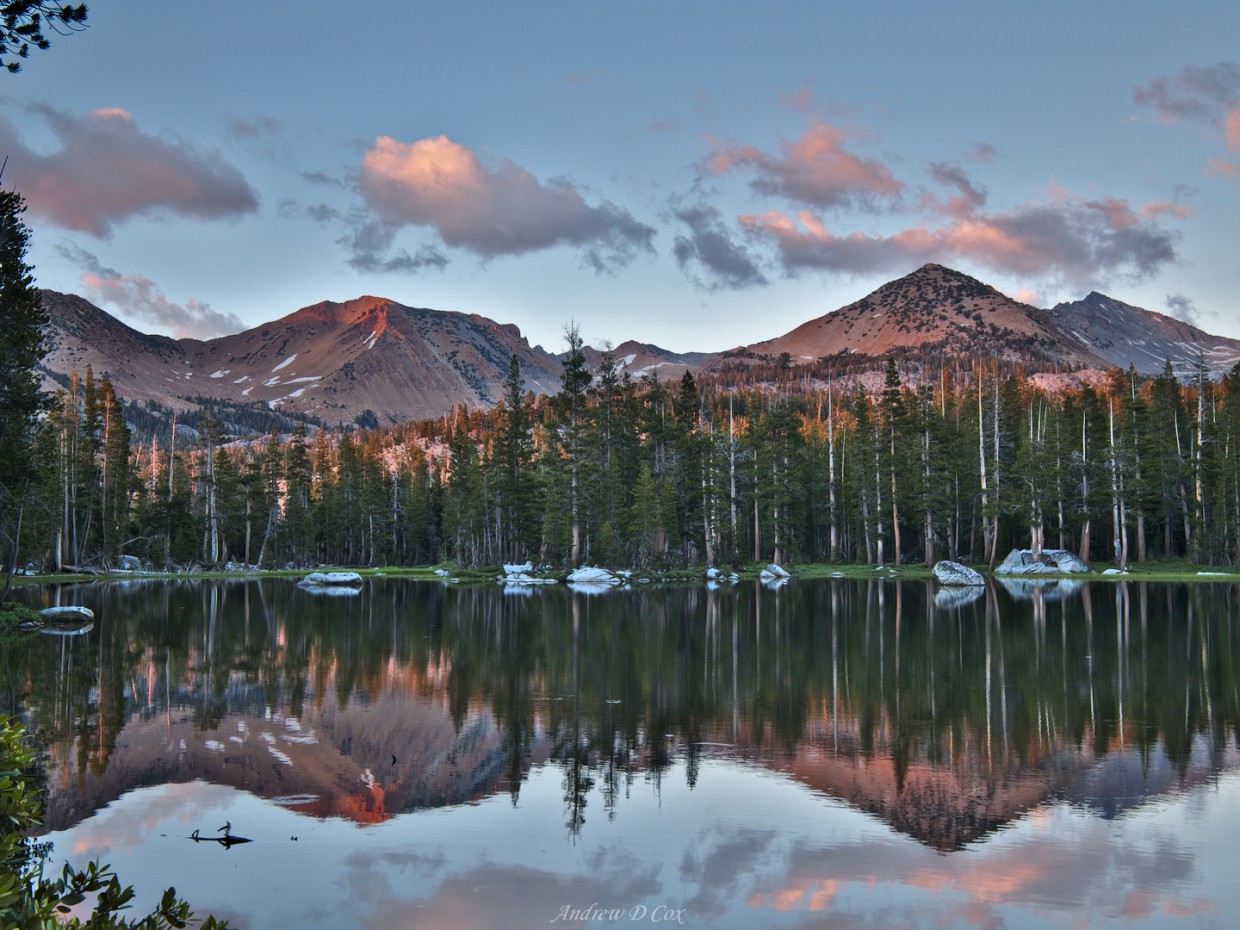
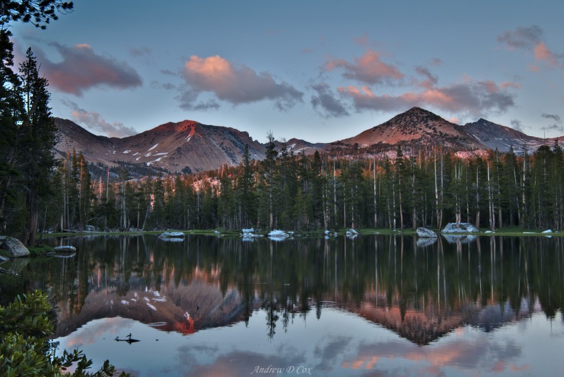
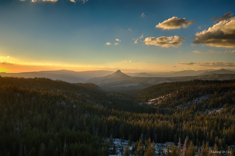
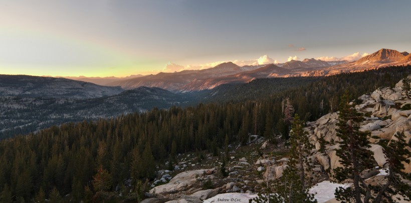
We boil water and rehydrate our rice and bean dinners in their ziplock bags while watching the evening light softly illuminate Red Peak and the neighboring mountains. Our neighbor is right: the views are incredible! Eager to see the sunset, I scramble up the granite slopes behind our campsite toward a ridge with a view of the Illilouette Drainage to the northwest. I can see golden light streaming through the twisted branches of whitebark pines above me, but even that hint doesn’t prepare me for the view I find upon cresting the ridge. The golden rays of sunset illuminate a patchwork landscape of pale granite and dark green pine forests. A few puffy clouds float lazily across the sky and, commanding my attention, Star King’s bald, granite crown juts above the trees.
After capturing several images, I race back down to camp and insist that Dad go see the view for himself. In the meantime, I capture a few more photographs of the lake. It’s moments like these that I’m incredibly grateful to be carrying several pounds of photography equipment, including a tripod, with me in the backcountry.
As the evening light disappears, Dad and I brush our teeth, clean up camp, and hang some wet clothes on a line between two nearby trees. A light breeze blowing across the lake toward us is enough to keep most of the mosquitoes away, thankfully! Lying down in our little 2-man tent is a welcome relief after spending the day on our feet and Dad and I quickly drift off to sleep as night falls.
Over The Clark Range
July 27, 2017 | 12.8 mi | +3900 ft / -2700 ft | View on Map
After a restless night in the tent, Dad and I stumble out into the chilly morning air at about 6 am. I amble away from camp and find a secluded place to dig a cat hole. The mosquitoes aren’t out yet, which is a boon as we take down camp and rehydrate our oatmeal. This isn’t your everyday oatmeal: I mixed the ingredients myself and included protein powder, chia seeds, and one of several dehydrated fruits including peaches, cherries, blueberries, and cranberries. The extra protein means we won’t feel hungry for a few hours, which is an improvement over the instant oatmeal packets from the store; I always need to eat again soon after eating those.
About an hour after rising, we’re on our way up the trail toward Lower Ottoway Lake. The path winds through the pines, trending consistently uphill. We rock-hop across several streams flowing down toward the Illilouette drainage below and avoid stopping too often for fear of being eaten alive by mosquitoes. As we hike, the sun climbs over the Clark Range to the east and streams through the trees; it’s a beautiful morning!
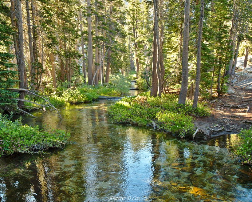
The trek from Lower Merced Pass Lake to Lower Ottoway lake feels like it is much longer than the map predicts. However, hikers are famously terrible at judging distances, and even a few miles can feel like an eternity some days. Both Dad and I are relieved to reach the lake after a few hours of uphill walking. We set our packs down on a slab of granite and then plop down next to them and dig out protein bars. I take a big bite of the chocolatey snack and soak in the views: harsh, bright morning sunlight, crystal clear water, and distant snow-covered peaks.
After spending several refreshing minutes relaxing on the shores of Ottoway Lake, we haul our packs back on and begin the long uphill climb toward Red Peak Pass. The trail gains elevation quickly; within 30-minutes, the large lake appears as a glistening jewel embedded in the granite far below us. Of course, such a steep path necessitates plenty of breathing breaks, which also provide opportunities to admire the views and snap a few photos.
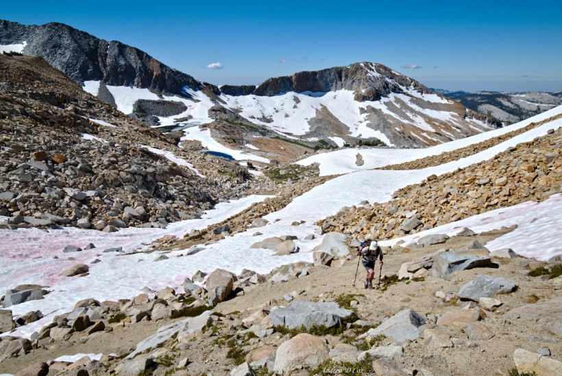
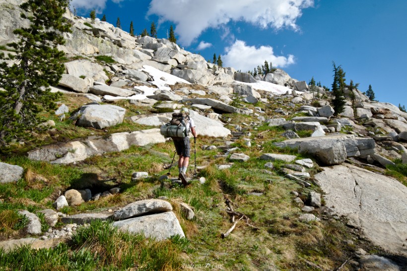
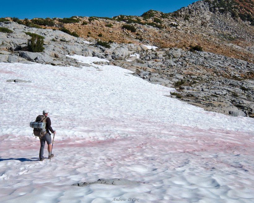
We soon leave the treeline behind as we trek higher and higher into the alpine zone. Several large snow fields extend over the trail; finding secure footing is tricky on the hard, icy surface. I’m sure the snow will be soft and easy to walk on in a few hours once it has absorbed more of the sun’s energy. In the meantime, we navigate around most of the massive drifts and scramble up the adjacent talus when the route trends uphill. Soon, however, traveling on the snow becomes inevitable. I test out the friction between my trail runners and the snow and begin a careful uphill trudge. There is little risk of injury if I fall, just a short slide down the gradual slope.
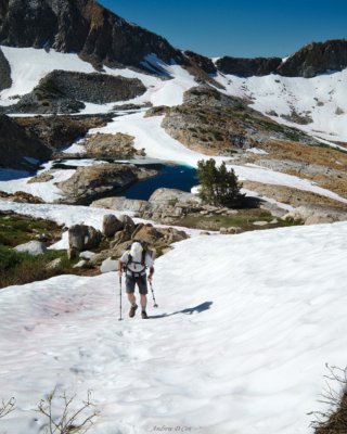
After ascending several snow fields, we hike up steep, gravel switchbacks, occasionally scrambling between them to avoid the steep snow. I feel guilty about cutting the switchbacks – it is very frowned upon – but it’s the only way to reach the pass without braving the steeper (and icy!) snow. (In retrospect, this would have been the ideal time to pull out crampons.) The final few hundred feet are completely snow-free and soon Dad and I are standing on Red Peak Pass, very much out of breath.
Behind and far below us, Upper Ottoway Lake glistens in the sun beneath the imposing Merced Peak. From this high vantage point, rows and rows of peaks are visible in both directions; I align the map with the compass to see if I can see Isberg Pass, but it is hidden behind a ridge. The north side of the pass is blanketed in snow for miles; a few red rocks protrude here and there, but the vast majority of the landscape is white. The trail, as expected, is nowhere to be seen.
To tackle this new challenge, we strap on our Hillsound Trail Pro Crampons and, after snacking and resting for a few minutes, begin a steep descent down the snow. Thankfully, the sun has warmed the snow sufficiently and the crampon teeth easily grip the soft layer of snow. As we descend, the slope levels out a bit and we pick up speed, stepping between the ridges of the sun cups, some of which are several feet deep! Even with the uneven footing, the Hillsound crampons don’t slip on my trail runners.
With snow in every direction, we are free to choose our route down the mountain. From my experience in this area several years ago, I know generally where the trail is below us. Rather than follow the trail, however, we decide to take a bit of a “short cut” and head over a ridge to the lakes below. In the end, this detour doesn’t save us much, if any, time but we do eventually reach the smattering of small lakes below the pass. Even here, a thousand feet lower, snow dominates the landscape and the trail is nowhere to be found. After a fruitless 15-minute search, Dad spies a stretch of trampled dirt between patches of snow that appears to show signs of human activity. Sure enough, it’s the trail!
During the next hour or two, we trek over alternating stretches of snow, sand, and granite. Tiny pools of snowmelt and large, partially frozen lakes dot the alpine landscape. The trail winds between large stone outcroppings and we frequently find ourselves walking on snow bridges over the trail-turned-creek.
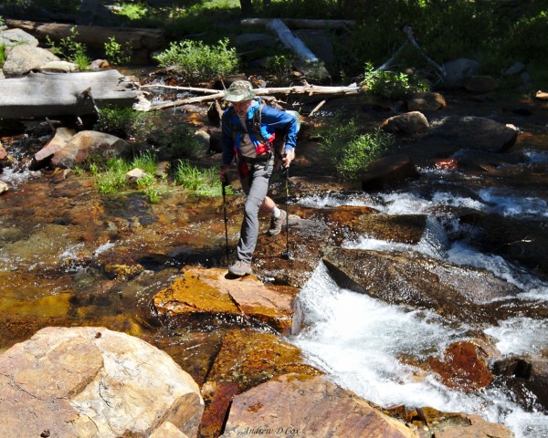
Soon after descending below the tree line, we reach the Merced Peak Fork. The water is surprisingly deep and swift as it crashes between boulders and grassy banks. The small river is too wide to jump across and the rocks too wet and slippery to leap between, so we take off our shoes and socks and wade across. The water is freezing, which is no surprise given the vast snow fields above us that are undoubtedly the source of this raging creek. Once across, we slip back into our dry shoes and socks and continue down the trail.
Although the distance doesn’t appear large on the topo map, Dad and I don’t arrive at Triple Peak Fork for several more hours. I’m tired and am beginning to drag, so we stop for a break. Unlike the Merced Peak Fork, this creek is much wider, deeper, and slower. A massive, sun-bleached log spans the banks, so I cross to the east side without getting wet at all. A few hundred feet down the trail we encounter a very different kind of river – massive flows of granite, warm in the afternoon sun, completely dry, and almost entirely bug-free!
The combination of elements is too perfect to pass up: Dad and I drop our packs on the granite, take off our shoes and socks, and pad through the spongy grass to the river. I step in and let the cool water wash over my dusty body; it’s cold, but not nearly as freezing as the Merced Peak Fork. Dad is skeptical of my temperature report and stalls for a few minutes before ultimately shallow-diving into the deep pool of crystal clear water.
After swimming for a few minutes, we’re both cold enough to evacuate back to the sun-warmed granite. We relax on the heated stone and soak up the sun while our clothes dry. I’m already feeling much better; there’s something very freeing about swimming in a cold mountain stream and then wandering around in compression shorts while munching on almonds and dried cranberries!
My original plan for the day involved camping here at Triple Peak Fork, but there are still many hours of daylight left and I’m feeling refreshed after our swim. So, we hoist our packs back on, tighten up the straps, and continue down the trail toward Isberg Pass. The map shows two large lakes on a plateau below the pass; with any luck, the plateau will be dry and snow-free and we’ll find a great campsite!
The trail soon turns uphill and climbs out of the Merced River drainage. After the many hours of downhill hiking we’ve completed today, moving uphill is a nice change. We soon reach my favorite biome, the sub-alpine zone with its stunted trees and acres of fragile grass. The final uphill push travels up a carefully constructed staircase built by some wonderful trail workers years and years ago.
As luck would have it, the plateau is indeed snow-free. Grassy meadows and groves of short pines stretch out for miles; a glimmer in the distance hints at the presence of the lakes. We drop our packs behind a rock and wander out to explore the area. People tend to favor campsites near lakes for obvious reasons: easy access to water, beautiful views, etc. However, the mosquitoes up here also love to live near lakes and that is enough to persuade me to camp elsewhere. These lakes are no different. As our feet squish through the moist turf surrounding the lakes, we are swarmed by mosquitoes. We quickly put on head nets and long sleeves to minimize the amount of skin the mosquitoes can reach. Sure, it is beautiful here, but I have a difficult time relaxing when I’m being eaten alive.
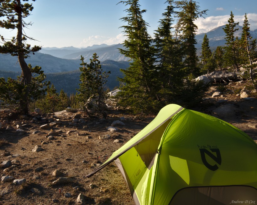
We instead locate a campsite on a ridge above the lakes with incredible views of the Merced River valley: granite ridges stretch out for miles, many covered with green pine forests. Several mountain ranges stretch across the horizon, their jagged peaks cutting into fluffy cumulonimbus clouds. Perhaps most importantly, the swarms of mosquitoes from the lake are gloriously absent.
After setting up the tent, we cook dinner and munch on homemade peanut-Thai pasta and spicy rice and beans. Then, fed and rested, we return to the glassy lakes for some photography fun. Bug nets and long sleeves are once again a must, but the insects seem to lose interest after a few minutes when they are unable to penetrate our clothing. We are left in peace.
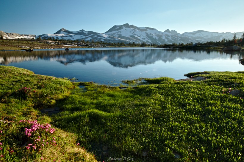
I search for compositions as the beautiful sunset light plays across the meadow and casts warm rays on the distant snow-covered slopes of Triple Divide Peak. I find a few and capture several images while Dad relaxes on the grass. Soon, the sun is too low to illuminate our grassy plateau so we make our way back to camp. The last rays of light are still illuminating the distant northern peaks, however, so I take a few photos to create a sunset panorama before calling it a night.
Adieu, Yosemite
July 28, 2017 | 17.3 mi | +2100 ft / -4400 ft | View on Map
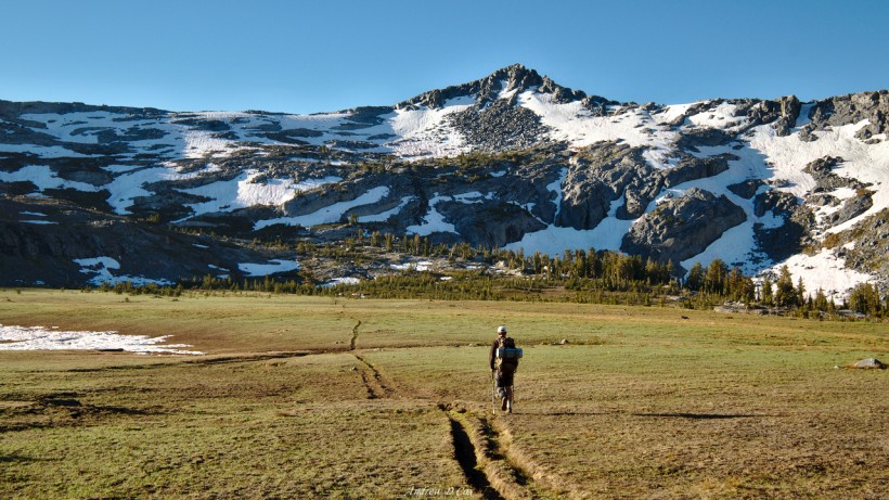
The morning air is cold and crisp, which motivates Dad and me to keep moving once we’ve left the comfort of the warm tent. We enjoy ziplock bags of oatmeal for breakfast, pack up camp, and begin our walk. We’re both stiff from yesterday’s exertions, so, after walking about a quarter mile, we stop to stretch. The trail soon leads us out from dense groves of pine trees onto the open plains of the Isberg Plateau. The trail forms a deep furrow in the otherwise smooth, grassy landscape; at times the furrow is too deep to walk in without tripping, but we strive to minimize our impact and walk in the rut where others have tread before.
Upon reaching the opposite side of the plain, the trail winds up and over slabs of granite and banks of snow. Due to the cold morning temperatures and shade on this (west) side of the pass, the snow is still solid ice but we’re able to maneuver around it without any trouble. The snow is melting under the bright morning sun and the runoff follows the path of least resistance: the trail. Usually, the trail-river is so shallow that I can hop from one rock to another or even splash through the wet gravel without risking soaking my feet. However, I’m occasionally forced off the trail to avoid walking through the water; neither Dad nor I want to deal with wet shoes and socks this early in the morning.
Patches of snow block the trail as we climb higher toward Isberg Pass, but since the terrain here is rocky without any clear path in the first place we find our own way to the saddle. The views from the pass are incredible! To the west: Yosemite National Park, the Clark range, and the beautiful Isberg Plateau. To the east: Inyo National Forest, several alpine lakes glittering in the sun, and, in the distance, the Ritter range.
We take a few minutes to soak in the sun and eat some snacks before continuing down the eastern side of the divide. The path is once again obscured by a large snow field, but the trail appears to cut horizontally across the ridge and then descends a snow-free slope. The gradient of the snow field is so slight that we don’t bother with crampons and instead walk straight across. Our feet definitely slip around much more than when we wore the traction devices, but neither of us fall.
After crossing the snow, we soon lose the trail in a maze of granite slabs. A few hundred feet below, the trail appears again as it cuts through the spongy turf surrounding a small lake. Rather than fuss over finding the trail in the rocks, we find our own way down the terraced slope until we reach the path.
We travel along the single track path, through meadows, over rocks, past a handful of beautiful little lakes with flowers lining the shores… what a beautiful place! Soon, the trail begins to descend we transition from the sub-alpine zone to the upper montane forest zone. The terrain here is very reminiscent of the forests in the Sawtooth mountains in Idaho: tall pines, dry, dusty soil, a smattering of grass, and sun-bleached deadfall. Down we go, leaning on our trekking poles to take some of the impacts off our knees.
It’s a grueling descent until we reach the East Fork of Granite Creek. There, on the banks of the creek, we are presented with a puzzle. How to cross without getting our feet wet? After a few false starts and a little backtracking, we find a way to string together rocks and logs to cross the creek. It’s a convoluted route, sometimes traveling straight down the center of the river, but it gets the job done!
The descent levels off after crossing Granite Creek and Dad and I increase our speed. The miles fly by as we walk beside the river, which swells larger with every tributary we jump across. The trees thin out a bit and we pass over hot, dusty stretches of trail. Soon, the river once again blocks our path forward. This time, there does not appear to be a dry crossing option; the wide, shallow creek flows gently over a bed of smooth river rock, none of which protrude above the surface of the water. As we’re really on a speed kick and the sun is so warm, we walk straight through the water without removing our shoes or socks. They’ll dry as we continue to walk.
During the next few miles, our trek leads us through unavoidable puddles and a handful of additional creek crossings; needless to say, our shoes do not dry out. Soon we reach a junction on the Isberg Trail and turn west toward Chetwood Cabin. As I walk along this poorly maintained side trail, I imagine a little log cabin with a porch, surrounded by trees, and a gurgling stream nearby. It would be nice to sit on the porch, eat lunch, and put our feet up… Unfortunately, we find no such luxury at Chetwood Cabin. All that remains of the structure is a pile of splintered logs and rusted pieces of corrugated tin. Oh well.
We spread our lunch out on a large rock, free our feet from their wet shoe prisons, and relax while munching on tortillas, hummus, and dried fruit. Like most places in the Sierra Nevada, giant black ants scurry around our feet, occasionally crawling up our legs to investigate. They don’t bite, but it’s always disconcerting to find one crawling around in your shirt several miles later…
We turn south past Chetwood Cabin and continue down Long Creek Trail. This stretch is even more poorly maintained than the previous section; we reach one swampy section where the trail is nowhere to be found. Operating under the assumption that the trail passes straight through the swamp, we skirt the deepest water and manage to pick it up again on the opposite side.
A mile or two later we reach another junction, this time with Stevenson Trail. Thankfully, the Stevenson route is more popular than the trails to and from Chetwood Cabin that we’ve been traveling on and is, therefore, much easier to follow. Dad and I pick up speed again as we trek north toward the distant Mount Ritter. Along the way, we run into a family of backpackers that is also trekking toward Red’s Meadow, but they’re walking in the opposite direction as we are. They report that Dike Creek, which we’ll reach tomorrow, is completely impassible. Their tales of waist-high, raging water, sheer cliff walls upstream, and the complete lack of feasible rocks or logs to ease the crossing scare both Dad and I. But what are we supposed to do? Turn around and give up? No, we’ll continue hiking and hit that crossing tomorrow morning. With any luck, the water will be lower and more manageable before the sun has had the chance to increase the melt rate higher in the mountains that feed the creek.
With that foreboding news stewing in the backs of our minds, we wish the family good luck on their journey and we continue up the trail. Soon, we’re marching up a steep incline and sweat begins to drip from my chin. A cool breeze makes the ordeal more bearable, particularly when the trees open up and the hot afternoon sun beats down on my back. Part way up the hill we walk through a grove of aspen trees. The intoxicating aroma is more than enough to push away tomorrow’s worries and reminds me why I love backpacking so much.
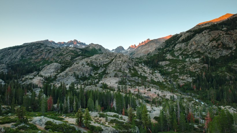
The trail levels out on a ridge and we take a breather on a small outcropping of stone with awesome views of the surrounding country. The North Fork of the San Joaquin churns thousands of feet below and, directly to the north, the imposing spires of Mount Ritter tower over the landscape.
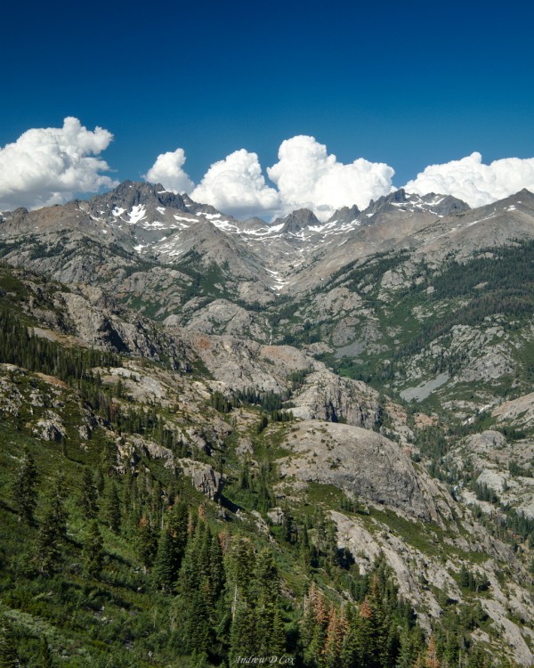
It’s already been a long day and both Dad and I are tired, though Dad more so than myself. We still have several miles left to walk, however, particularly if we want to arrive at the troublesome Dike Creek early tomorrow morning. So we press on, trekking along the ridge and catching an occasional view of the mountains across the canyon. I’m particularly enthusiastic about seeing the back side of the Minarets. I was awed by their pinnacles last summer but only saw them from the east; they are equally impressive from the west!
For an hour or two Dad and I traverse the gentle slopes of the ridge, sometimes in the midst of giant Jeffrey Pines; at 10+ feet in diameter and 150+ feet tall, the trees completely dwarf us! On the north-facing slopes, we encounter drifts of snow covered in pine needles and fallen leaves. The dense forest provides shade and cool air, which is much appreciated this late in the day.
Soon, the trail begins a steep 800′ descent. As we’ve already descended several thousand feet today, our feet and knees quickly become sore. I’m thankful for my trekking poles and rely heavily on them to absorb a great deal of the shock of the descent. Dad, who has a few extra decades of wear and tear on his knees, lags behind a bit, so I take advantage of the extra time to scout out a campsite.
At the bottom of the long descent, the forest becomes unbearably swampy. Swarms of mosquitoes hover over stagnant pools of murky water and the trail transforms into sticky mud. This is clearly not a place I would like to camp! However, just to the east of the trail are several rocky hills. I find a few sandy areas between granite outcroppings and then return to the trail where Dad is waiting. With a bit of effort, we coerce our creaking joints to climb just a little bit further to one of the sandy clearings and set up camp.
The views from our site are fantastic and we enjoy the mountainous vistas while we cook and eat dinner. Up here, away from the swampy forest below, there aren’t any mosquitoes and a cool breeze blows through the scrubby whitebark pines and small shrubs. It’s a beautiful evening! Dad soon retires to bed while I struggle to stay awake for a little longer to watch the alpenglow creep up the mountains. Once the color has faded from the sky, I climb into the tent and collapse onto my sleeping pad. It’s been a long day and we’re both asleep within minutes.
Lost in the Woods
July 29, 2017 | 12.6 mi | +3400 ft / -1900 ft | View on Map
Dad and I rise early and hit the trail to reach Dike Creek at its lowest possible flow. First, however, we have to cross the North Fork of the San Joaquin. Luckily, a bridge at Hemlock Crossing eliminates the need to ford the raging river.
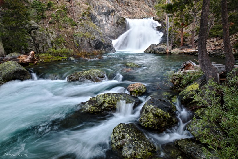
The trail winds through rocks and brush along the river until it reaches Dike Creek. The creek is indeed foreboding: it crashes violently through a narrow canyon directly into the San Joaquin. One or two logs span the canyon, but they’re 20-30 feet above the foaming cascades and arguably a terrible crossing choice. However, right next to the San Joaquin, the creek widens slightly and the canyon walls disappear as it flows into the river. This is where the trail crosses Dike Creek and, to our great relief, it appears completely manageable. While the water is swift, it’s only knee-deep. With Dad watching warily behind me, I walk into the water, planting my trekking poles carefully as I move to the other side. The icy water motivates me to expedite the crossing and soon I’m on the other side, hopping from one foot to the other in an attempt to warm them up. Dad follows me and then it’s over – we’ve crossed Dike Creek!
Of course, we still have many miles left to cover, so we don’t spend too much time celebrating. With wet shoes, we continue our trek and climb high above the river. A few stretches of trail resemble a tropical jungle, with water dripping down the rocks and plants completely grown over the path. At one point, I spot a black bear running up river far below us. I shout out to Dad but the bear disappears into the brush before Dad is able to locate it.
Further up the trail, we reach Iron Creek, another raging stream confined to a narrow canyon. The roar of the water is audible from several hundred feet away! The trail begins to switch back and forth, trending uphill toward a more feasible crossing location. When we reach the designated ford, I breathe another sigh of relief. This crossing is no worse than Dike Creek! I walk straight through the water, but Dad, who has been suffering from blisters, finds a log jam to cross farther upriver. We pause for a few minutes on the other side of the creek for a snack break and to apply sunscreen.
During the next several miles we traverse hot and dusty landscapes, as well as lush, green meadows and dark, creepy forests. The trail is sometimes faint and difficult to follow, but we’re usually able to pick it up again by continuing in a straight line. Then, while walking through ferns beneath the dark canopy of dense pines, we lose the trail altogether. It’s impossible to tell the difference between a game trail and a human trail in the thick foliage. We wander for a few minutes and eventually locate the path again when we encounter a tree that has been cut with a saw, a clear mark of human activity.
For a while, we follow the trail through alternating patches of pine forest and open sagebrush-filled meadows. Every now and then I have to rely on faint footprints in the dirt, trekking pole holes, and lightly trampled grass to identify the route. Occasionally, a blaze cut into a tree guides us in the right direction. What a route-finding adventure!
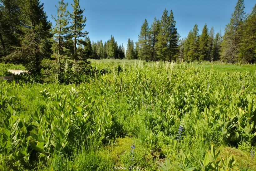
Soon, we reach Naked Lady Meadow and are confronted with a wall of vegetation. There is no clear path through the wall of plants, so we simply start walking through them. Every once in a while I spot a human boot track, but then I lose the trail again in the mess of greenery. Once on the other side of the meadow, Dad and I spread out and look for any signs of human traffic. We find a cairn and a faint path through the grass and follow it into another stretch of forest.
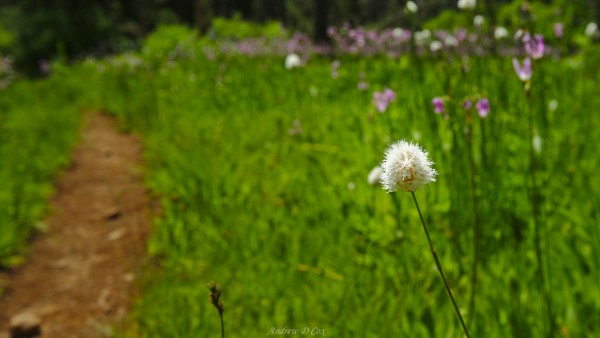
For a while, we’re once again on a discernible trail, but we quickly lose the path when we reach the wildflowers and tall grass of Earthquake Meadow. Another search reveals a trail sign that points us in a general eastward direction. Shortly after traipsing through the meadow, the trail disappears completely. There are no sawed logs, no boot tracks, no trail blazes, nothing. So… I pull out my compass, adjust for the local declination, pick a landmark due east of our current location, and begin orienteering.
We continue this way for what feels like hours. Once, while walking through an open stretch of sagebrush between pine forests, Dad spots a cairn. However, when we reach the cairn and look around, there is no trail in sight. The ground is too dusty and hard to make out footprints and the brush is too sparse to reveal any patterns across the field. Thus, the compass navigation continues. Soon, Dad and I are clambering over fallen trees, struggling to avoid falling on our faces.
Frustrated, hot, tired, and hungry, I plop down on a rock and pull out my phone. The GPS works just fine without cell service and I downloaded the relevant topographical maps on the Guthook app before we left. In a few seconds, the phone locks onto several satellites overhead and pinpoints our location. To my surprise, we’re practically on the trail. Of course, that doesn’t mean the trail is visible or even exists in real life, but it’s comforting to know we’re on the right track.
With our spirits lifted, Dad and I continue to struggle through the forest. We soon reach Cargyle Creek and stop for lunch on the eastern bank. We’ve only walked a mile in the past hour; it’s amazing how much slower you travel when you have to climb over trees and fight through thick brush every step of the way! Once we’ve had some time to cool down and rest, we resume our battle through the forest. I occasionally check the GPS to ensure that we continue toward the next trail on our itinerary.
After cresting a small hill, the landscape changes and we catch the first sign of human activity in several miles: a sawed log! We leave the dense forest behind and are confronted with a new set of challenges. A fire swept through this area sometime in the recent past, toppling most of the trees and stripping the foliage from any that are still standing. While the absence of dense vegetation makes it easier to look ahead for signs of the trail, I miss the shade; it’s hot out here in the open! To add to the fun, prickly bushes have sprung up to take advantage of the sunlight; their thorny branches scratch at our bodies as we pass through.
We lose the trail several times in the burn area, but always manage to pick it up again. Dad and I follow the meandering path and soon spot the most wonderful sight: a wooden trail sign! We rush to the sign, drop our packs, and lie down on a patch of soft grass. After such a long, difficult afternoon, it’s wonderful to have a rest.
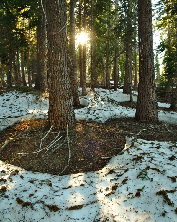
The final push of the day brings us to the “granite staircase,” which is a poor name if you ask me. There isn’t much of a staircase, just a series of switchbacks along granite benches. The steep uphill climb is tough after a long day of bushwhacking, but Dad and I eventually make it to Summit Meadow. From there, the trail meanders downhill through pine forests interlaced with snow drifts. The air is noticeably cooler, which is a welcome change after the hot afternoon. We can’t be higher than eight or nine thousand feet, so the presence of so much snow is somewhat surprising. I enjoy skating around on the slippery surface more than walking and narrowly avoid falling flat on my back a few times…
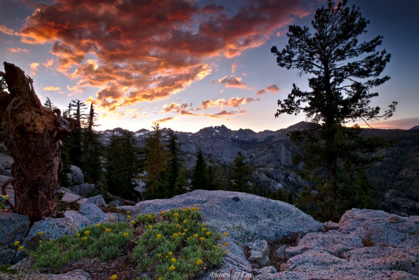
A few stream crossings later, the forest opens up and Dad and I find a campsite with a view of the Ritter Range on a granite bench. With a clear line of sight to the valley below, we suddenly have cell service! Dad calls home and chats with a few family members while I cook dinner. It’s been another long day, so we both remove our shoes and socks and let our feet relax in the cool evening air. I once again find a nice spot to watch the evening light. The sunset tonight is absolutely incredible, with bright hues of red and orange lighting up the sky. I’m content to sit on the cool granite, warm in my down puffy, and watch the clouds and sky fade to gray.
Descent to Pancakes
July 30, 2017 | 5.0 mi | +700 ft / -2100 ft | View on Map
The last day of any hike is always complicated by the urge to reach the final destination. I don’t know why, exactly; I’m not always in a rush and I’m frequently less than happy to be leaving the wilderness. Today is no exception, and Dad and I descend quickly from our campsite into the valley below. There aren’t many challenges to slow us down: the trail is smooth and well marked, there are very few creek crossings, and no more snow to navigate. The only major obstacle is the King Creek crossing; the water is wide and requires a wade, so we take off our shoes and walk across barefoot.
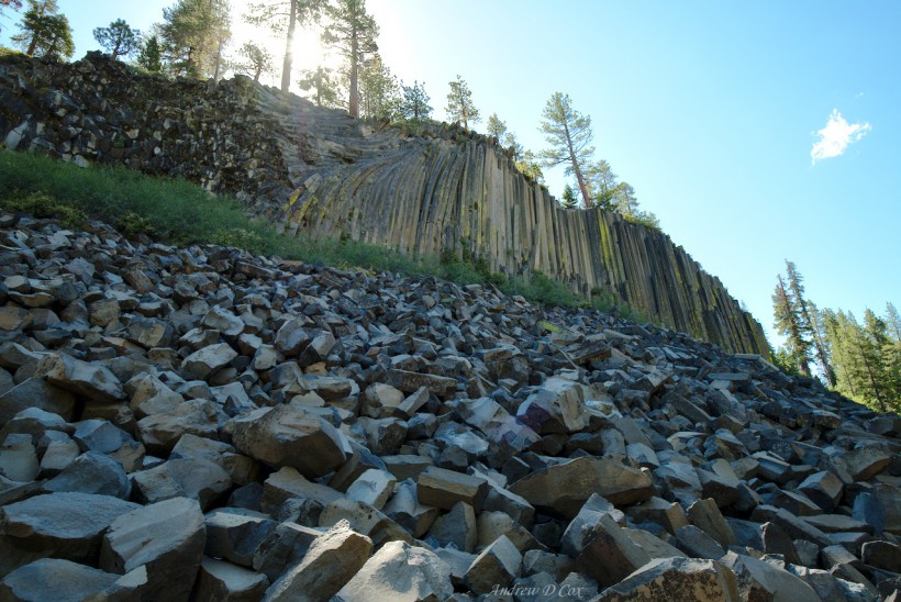
Beyond the river crossing, we’re treated to a mile of sandy trail as we ascend yet another ridge and descend into Devil’s Postpile National Monument. We briefly join the John Muir Trail before reaching the Middle Fork of the San Joaquin. There, on the banks of the biggest river I’ve seen so far, we filter some water from and then continue down the trail toward the basalt columns. Several strongly scented tourists pass by and I do a double take as I catch a whiff of their laundry detergent and perfume; do we smell that strongly? We stop at Devil’s Postpile to admire the incredible rock formation and then continue on toward Red’s Meadow. I feel a little out of place among all these perfumed people with their tiny backpacks and clean clothes.
Red’s Meadow feels much more like home. Dirty thru hikers lounge around the yard, some opening packages and others relaxing on the grass. We don’t have a resupply waiting here – we’ll pick up some things in Mammoth Lakes – but we do enjoy some hot pancakes fresh from the restaurant! The food is delicious and I quickly devour my share. Dad isn’t feeling particularly hungry, so I finish off his portion too.
With full stomachs, Dad and I board the shuttle bus to Mammoth Lakes. From the lodge, we take another bus into town and check into a hotel for the evening. We do laundry, take showers, and brush our teeth with real toothpaste – ah, the luxuries of civilization! After cleaning up, we stroll across the street and enjoy a big Italian dinner. The food is delicious but, true to American form, the meal is far too big to eat in one sitting. I take some leftovers back to the hotel and pack them for tomorrow’s lunch. I’m shipping my crampons home with Dad to eliminate a few pounds from my pack, but all my other gear is continuing on with me.
Tired even after a relatively short day, Dad and I go to bed with the sun. After all, Dad has to catch an early bus to Reno in the morning. I, on the other hand, am heading back to Red’s Meadow where I will begin the next section of my hike: the official John Muir Trail!
I’m often asked what photography equipment I use to document trips like this one. On this particular adventure, I carried the Fuji X-T2 and Fujinon XF 10-24mm f/4 lens as well the Sirui T-024X carbon fiber tripod. See my dedicated gear post for a complete gear list.
















Dad 7 September 2017
🙂 🙂 🙂 Thanks for the terrific writeup and beautiful pictures, Andrew. You picked the most amazing campsites! Can’t wait to hear about the rest of the trip…
Grandpa c 8 September 2017
Wonderfull!!!!!!!!
Mireia 10 September 2017
Your pictures are gorgeous! Which camera / lens did you use?
Andrew Cox 10 September 2017
Thank you! I packed a Fuji X-T2 and the Fuji 10-24mm lens. I don’t have any complaints; it’s a fantastic system! I took a few other pieces of gear (tripod, battery pack), which I’ve explained a little bit in my gear post.
Timo 10 September 2017
Please check your spelling – I believe it’s Donohue Pass.
Andrew Cox 10 September 2017
So it is; thanks for the tip!
Marilyn 10 September 2017
Thanks for sharing your amazing trip and fantastic photos. I love that you wrote of your observations, flora, fauna smells, sights and sounds. It transported me to a place that I can only dream of reaching someday. Happy Trails !
Andrew Cox 10 September 2017
Thank you, Marilyn! That is high praise. I hope you make it out to the Sierras soon. Happy Trails!
Steven Thaw 28 July 2019
The Sierra (not sierras) is a single mountain range. Sierra Nevada is Spanish for “snowy range”. The California Miwok named it “Kayopha” – The sky and the peaks that touch it.
John Muir called it “The Range of Light”. Best, Steve Thaw, Moraga, California
Thomas Scholz 3 August 2021
Thank you for the in depth trip report. I could not find Hemlock and Sheep Crossing on my Yosemite map. What is the mileage and elevation gain / loss for this trip?
Andrew 3 August 2021 — Post Author
You’re welcome! Hemlock and Sheep Crossing are outside Yosemite, but appear on the National Geographic Yosemite map; I’d encourage you to use an app or website like CalTopo or Gaia GPS to see the areas outside the maps. The specs for this trip from Yosemite Valley to Devil’s Postpile are: 61.5 mi, +13200/-12500 ft.
Thomas Scholz 3 August 2021
Thank you for the quick response. I have a Tom Harrison map from 2018 that does not show Hemlock and Sheep Crossing but the map does extend to Reds Meadow. I added the mileage from that map and got 60.3 miles. I also have a Topographic Map of Yosemite National Park and Vicinity from 2002 and it does show Sheep Crossing but not Hemlock Crossing. I think this map came in a Yosemite National Park, a complete hikers guide book by Jeffrey P. Schaffer that I purchased in 2002. I see the West to East route from Glacier Point with a lot of North and South included.
Andrew 4 August 2021 — Post Author
Hi Thomas – you’re right, I must have left one of the days out when I calculated the distance. I’ve updated my comment above with the correct values; they’re a little different from yours, probably due to sampling differences in the calculations.
Thomas Scholz 5 August 2021
I found Hemlock Crossing on my older 2002 map. Thank again for your pictures and report.