My dad, Steve, and I set two weeks aside for an 8-day backpacking trip through Glacier National Park this summer. We got lucky and won the lottery: we were granted a permit for the very end of that 2-week window! Rather than arrive just in time for the backpacking, we decided to take the full two-week vacation and spend the first few days doing some day hikes to see the areas that we will not visit while backpacking. We picked out several routes and they turned out to be pretty spectacular! Your opinion may vary, of course, but I’ll let the pictures and trip reports below speak for themselves.
Trip Planning
Getting There: For day hikes in the Many Glacier area (i.e., the Grinnell and Iceberg hikes described below), your only option is to drive into the park; no public transportation options exist. Arrive early to find parking and beat the crowds!
For hikes with trailheads on the Going to the Sun Road (e.g., the Siyeh Pass Loop described below), you have a few options. You can drive your own vehicle, but parking at the trailheads is extremely limited. Luckily, the Glacier National Park shuttles are a great, free way to get to various locations along the road. I’ll add a similar warning about the crowds: arrive early to avoid waiting in line for an hour (or more) to board the shuttles. The shuttles travel between the Apgar Visitor Center and Logan Pass, and between the St. Mary Visitor Center and Logan Pass. The easiest place to board the shuttles is at the visitor centers; they don’t have much space to pick up passengers between those locations and Logan Pass. If you’re starting at the Apgar Visitor Center, you can also take advantage of the free Eagle Transit shuttle that runs between Kalispell and the Apgar Visitor Center multiple times each day! For some reason, the national park doesn’t advertise this shuttle, but we used it several times and were happy to avoid the fiasco that is parking in Glacier.
Permits and Regulations: Glacier National Park has an entrance fee (paid per vehicle, or per person if you take the shuttle into the park), but no other restrictions on day hiking (i.e., no permits are required). While not technically required, make sure you bring bear spray and know how to use it!
Resources: As usual, the national park website contains a treasure trove of information. For navigation, I carried the National Geographic topographic map for the park; the scale is a bit small for the day hikes, but it’s a useful resource when identifying distant peaks or neighboring valleys. The park newspaper and guides proved invaluable to us as well, so make sure to pick one up when you arrive!
Contents
- Going to the Sun Road | 50 mi (drive)
- Grinnell Glacier Trail | 10.6 mi | +/- 3100 ft | Class 1
- Iceberg Lake Trail | 10 mi | +/- 2200 ft | Class 1
- Siyeh Pass Loop | 10 mi | +2900 / -3500 ft | Class 1
Going to the Sun Road
29 and 31 July 2019 | 50 mi | View on Map
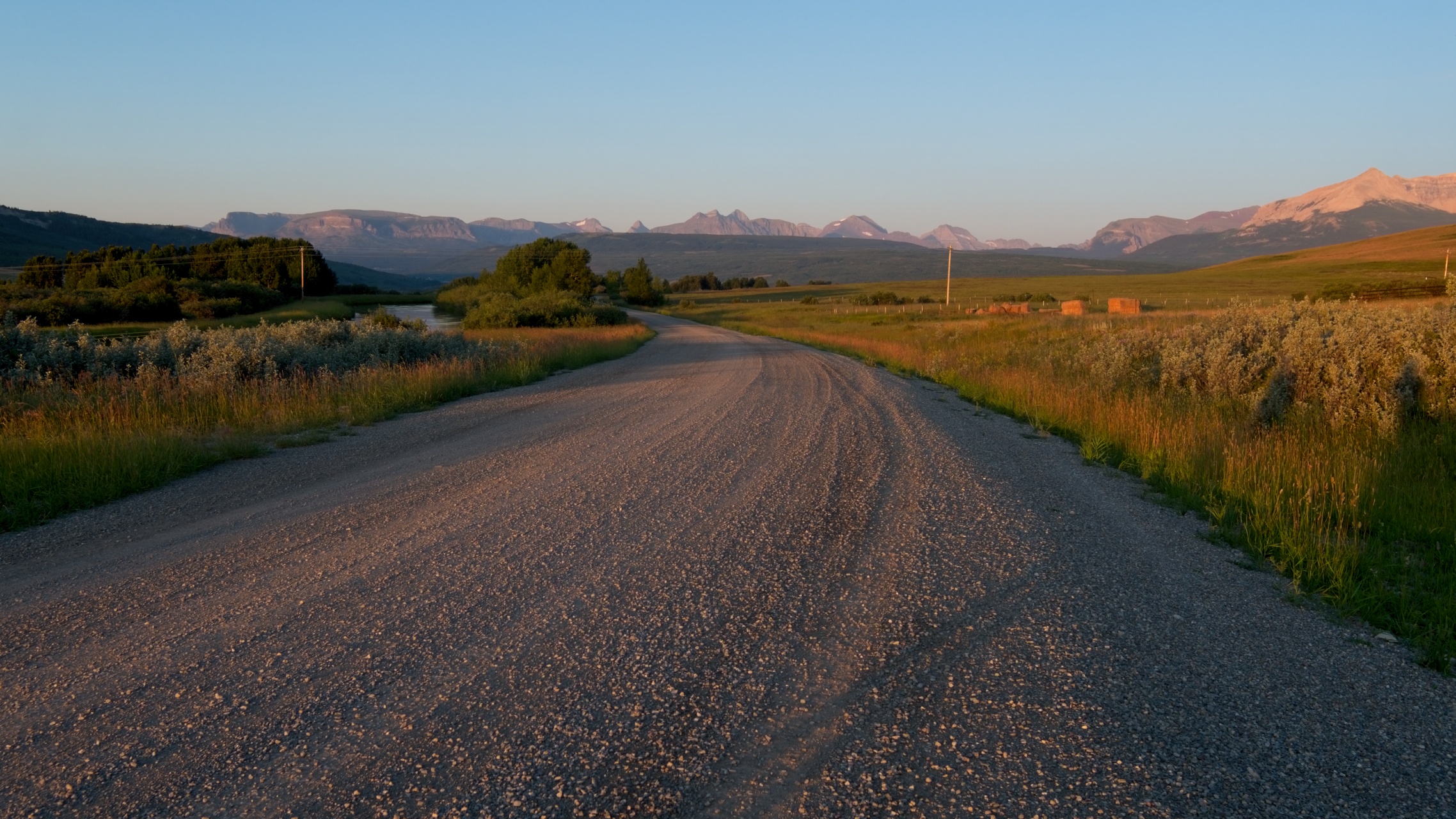
Steve and I touch down in Kalispell on a sunny Monday morning. After renting bear spray, picking up the rental car, buying isobutane, and eating lunch, we drive into Glacier National Park. Our hotel for the night is located on the eastern side of the park, a good staging spot for our planned day hikes in the Many Glacier area. We could drive around the park to reach the hotel, but driving through it via the Going to the Sun Road is a shorter and certainly more scenic route.
Our first stop inside the park is the Lake McDonald Lodge, a beautiful hotel located near the north end of the 10-mile-long Lake McDonald. We dip our feet in the water, admire the scenery for a little while, and then continue up the road. We stop at numerous overlooks along the way to gape at the mountains, lakes, glaciers, and waterfalls. The views near Logan Pass are particularly spectacular, but the parking lot is full to capacity (its normal state) so we don’t stop there today. On the eastern side of the mountains, we pause at the Jackson Overlook and gaze across the valley at the monstrous Jackson Glacier; it’s one of my favorite sights on the road.


While driving along the Going to the Sun Road is a fun experience, if you really want to see the sights the road has to offer, I would suggest taking one of the bus tours; they’re expensive, but supply commentary about the park along the way and a avoid the hassles of parking!
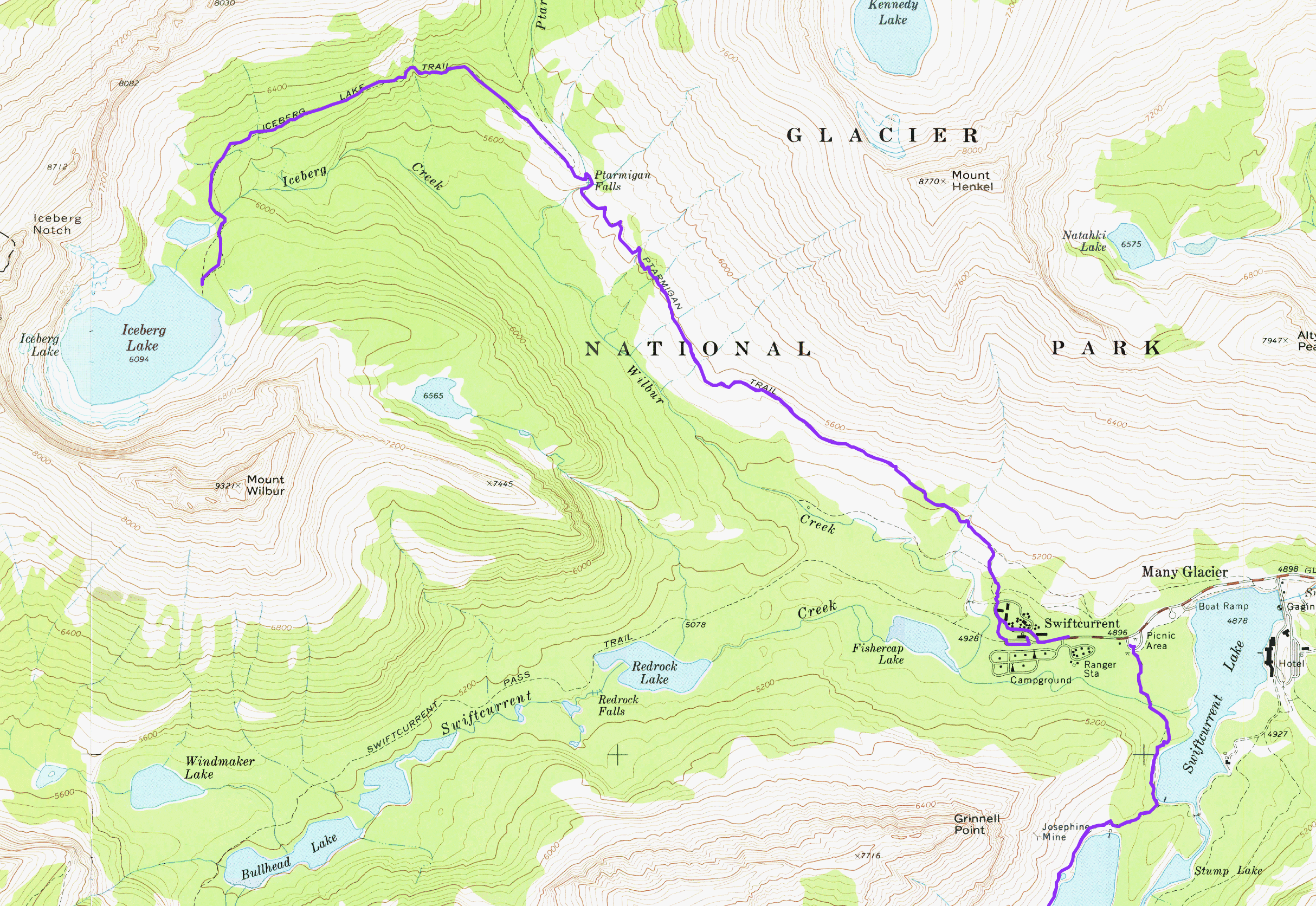
Grinnell Glacier Trail
30 July 2019 | 10.6 mi | +/- 3100 ft | View on Map

With our internal clocks still on Eastern time, Steve and I wake up bright and early at 5 AM! After eating some breakfast, we drive to Many Glacier and park at the hotel. We buy some sandwiches and snacks from a small shop in the basement and then hit the trail! Our plan is to hike up to the Grinnell Glacier. It’s a 10+ mile round trip, but we have all day… that’s the beauty of a day hike!
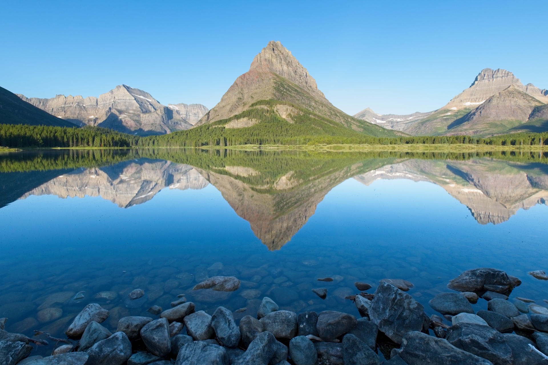
The trail (well, one of several trailheads) to the Grinnell Glacier begins at the hotel, which is located on the banks of Swiftcurrent Lake. The water is smooth as glass this morning, reflecting Grinnell Point and surrounding peaks with perfect clarity. It’s also quite chilly, particularly in the shade of the woods along the lake.
The trail around Swiftcurrent Lake might as well be paved; the dirt is packed to rock-like density from all the foot traffic this popular route enjoys. Curiously, we don’t encounter any other people for while. Remembering our research about grizzly bears, we try to make noise as we walk around the lake. The solitude doesn’t last for very long; upon reaching the opposite side of the lake from the lodge, we begin seeing other hikers. Perhaps a different trailhead is more popular than the one we chose? It’s difficult to imagine there being a more beautiful route than ours.

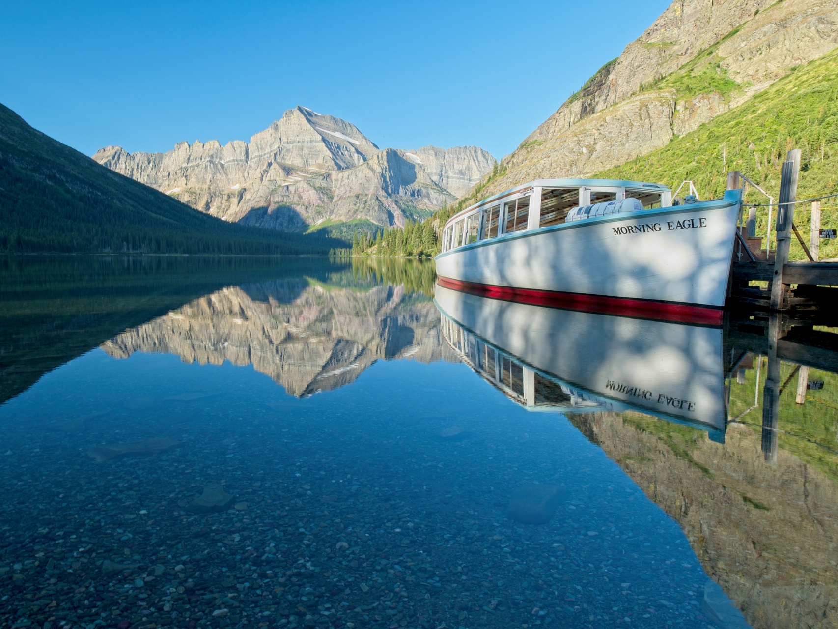
The trail climbs away from Swiftcurrent Lake for a short distance up to the next lake in the chain, Lake Josephine. Like Swiftcurrent Lake, the water here is crystal clear and perfectly still; a picturesque boat tied to the dock waits patiently to shuttle paying customers to the opposite shore.
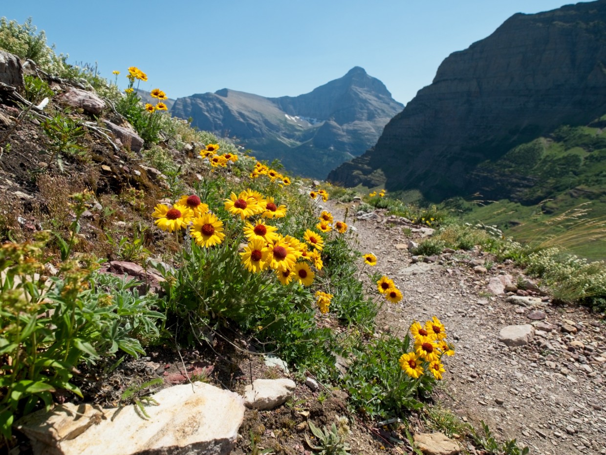
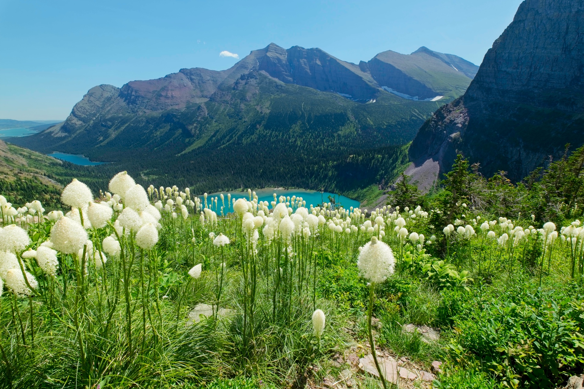
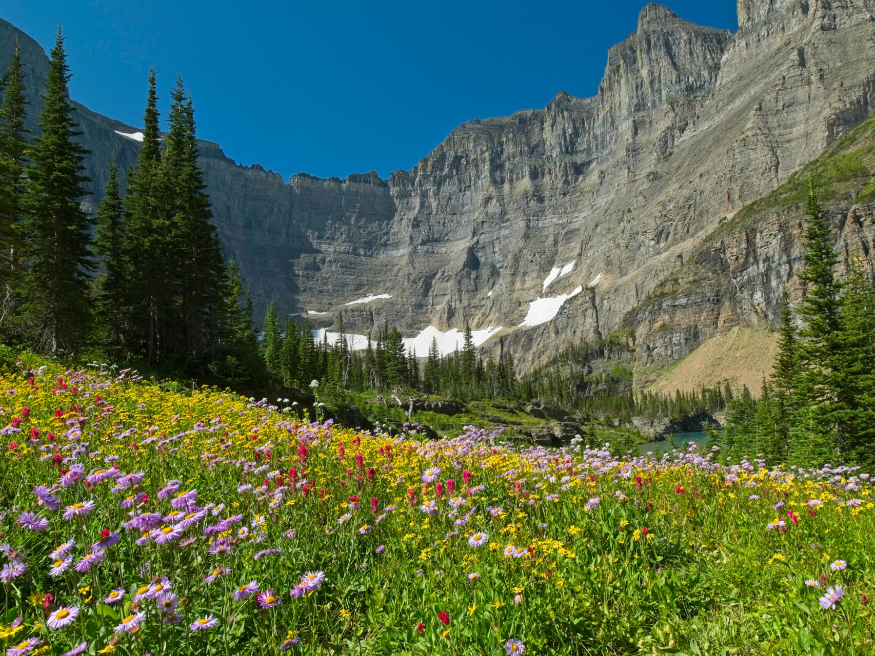
We continue up the trail, which soon departs the shores of Lake Josephine and begins a gentle climb on the western side of the lake, leaving the trees and shade behind. Thankfully, it’s quite cool at this early hour, and the colorful morning light makes for some beautiful photographs! After ascending a bit, Grinnell Lake comes into view, a dark teal jewel nestled beneath towering cliffs and fed by a spectacular cascade delivering water from the glaciers above. We also get our first glimpse of the Grinnell Glacier; from far away it looks just like a snowfield, albeit a very large one. The real highlight of the hike are the numerous and diverse wildflowers. I recognize many of them — Indian paintbrush, fireweed, penstemons, and arnicas — but some are new to me. The colorful display reminds me of the incredible flowers in Teton Mountains last August, although I dare say Glacier has outdone the Tetons!


The remaining few miles to glacier and glacial lake are pleasant and easy. The cool morning air persists as we gain elevation, and the climb isn’t too difficult, particularly since we’re carrying small little day packs. Furthermore, despite the barren, alpine appearance of the terrain, the highest point on the trail is only 6500′ above sea level, well below the altitudes at which breathing becomes more difficult.
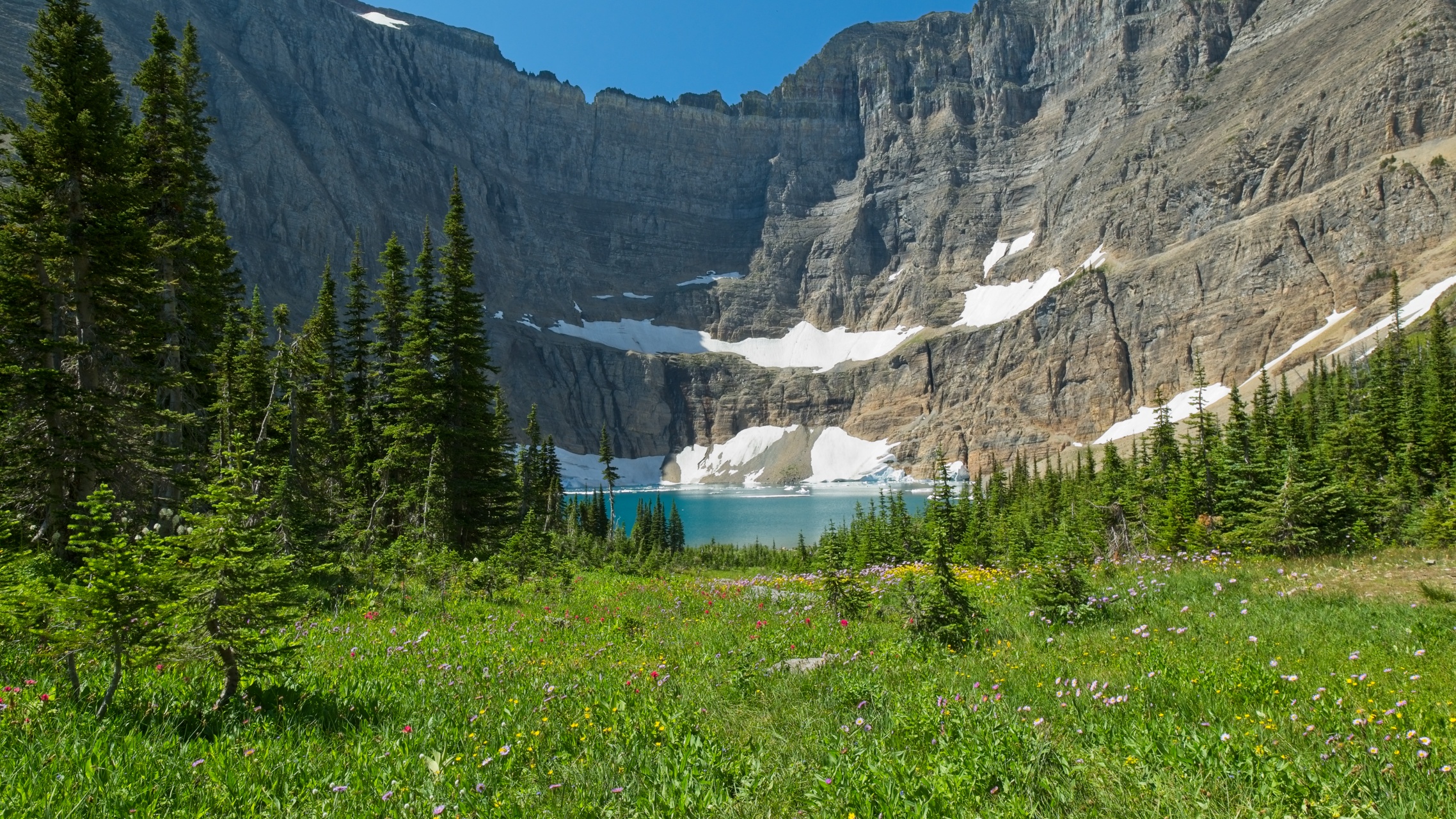
Cresting the final hill, Steve and I find dozens of hikers lounging around a bright teal glacial lake. We make our way down to the shore and feel the water; it’s absolutely freezing, as you might expect given the number of small icebergs floating in the water. The terrain around the lake is distinctly glacial. A loose jumble of stones and sand, glacial till left by the receding Grinnell Glacier, covers most of the landscape. Beneath the gravel are inclined shelves of silky-smooth stone; if you look closely, you can see the scratches where the glacier scraped over the rock! And, of course, there is the Grinnell Glacier covering the southern edge of the cirque. In the past 50 years, this glacier’s acreage has shrunk by 50%! Given the current warming climate, the glaciers will continue to shrink. This trend is the biggest reason I planned a trip to Glacier for this summer; I want to see them before they disappear and/or become inactive!


After exploring the area a bit, we find a spot to sit and eat lunch. The tuna sandwiches we bought this morning are surprisingly delicious and, with the lake and mountains before us, we really couldn’t ask for a better view! While we’re eating, a bighorn sheep wanders down the hill just 20 or 30 feet away from us! I excitedly grab my camera, swap out the wide angle lens for a telephoto, and snap photo after photo of the sheep. He seems utterly unconcerned with all of the hikers watching him and casually munches on the bushes.


After watching the sheep for a while, Steve and I finish eating our lunches and then begin the hike back to the trailhead. It’s much hotter on the way down, which makes the entire experience less fun than the ascent. The flowers continue to amaze us, though!
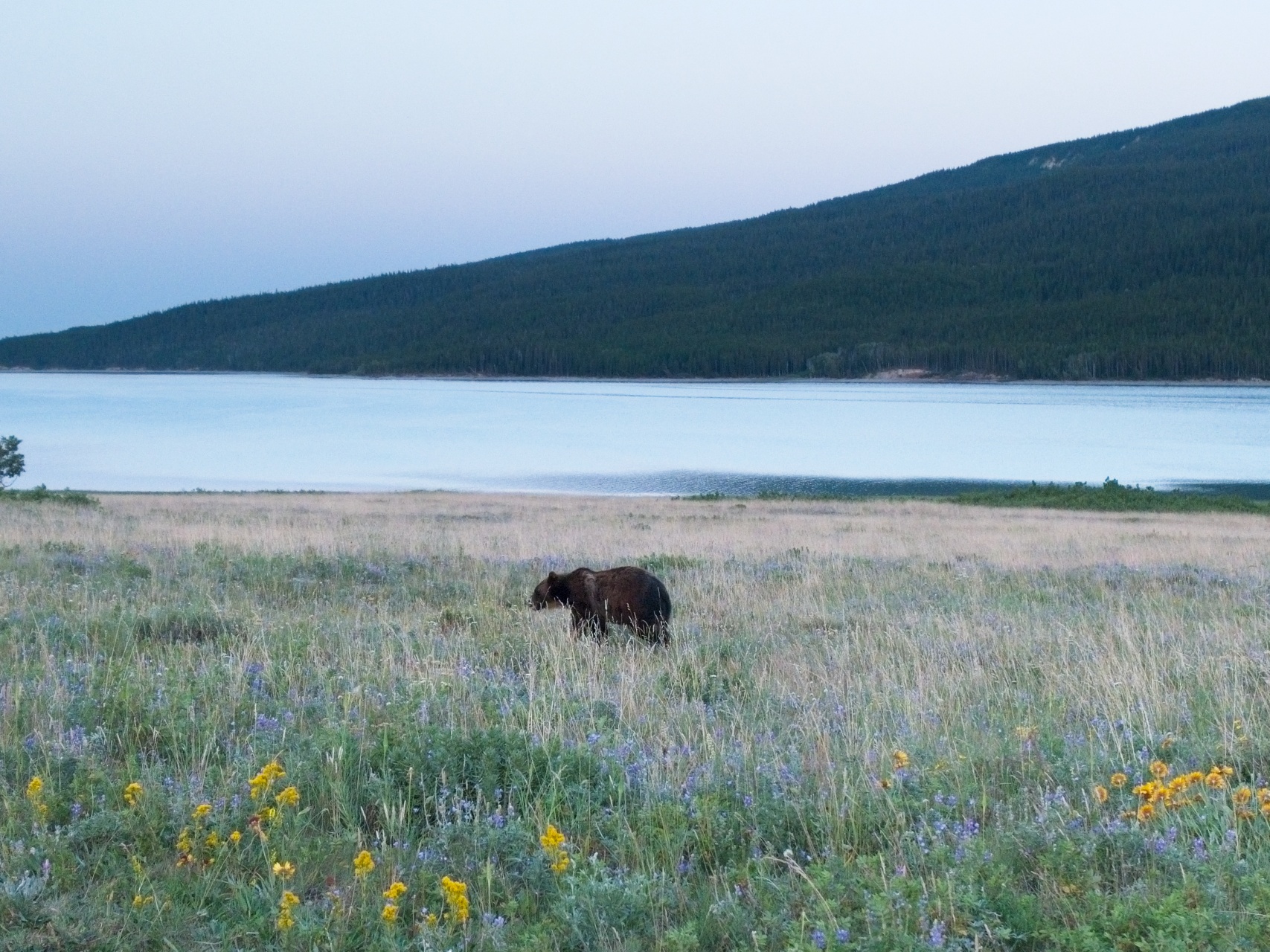
Several hours later, we arrive back at the Many Glacier Hotel, hot and thirsty. We spend the rest of the afternoon sipping cold drinks and putting together a puzzle indoors. We stick around for dinner at the hotel, which is delicious, and then attend an excellent ranger program about the geology of the park. It’s an entertaining and educational (and free!) event. On the drive back to our motel, we get a good look at a grizzly bear near the road, a wonderful conclusion to our first full day in the park!
Iceberg Lake Trail
31 July 2019 | 10 mi | +/- 2200 ft | View on Map
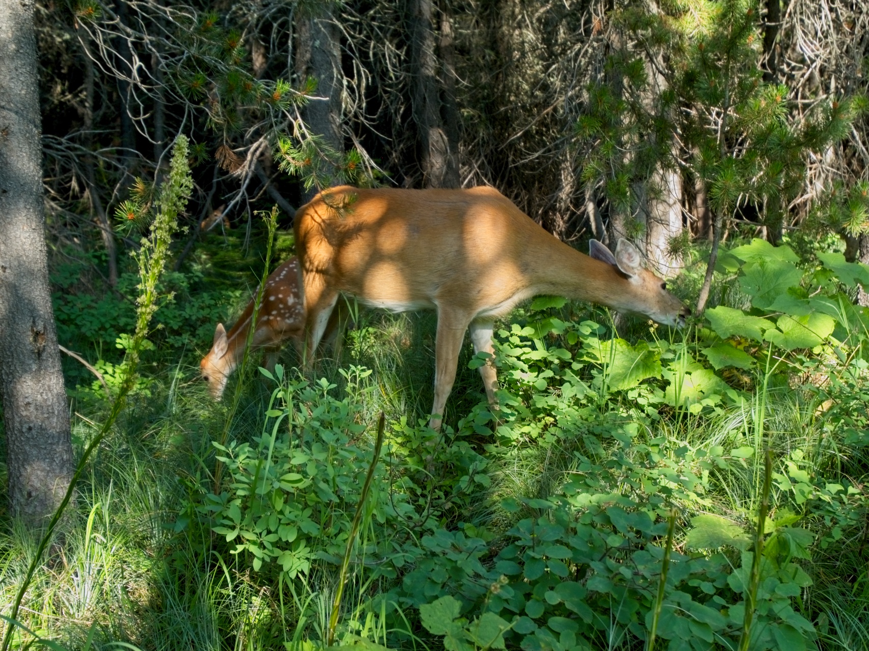
This morning begins the same as yesterday: eat breakfast at the hotel, then drive into Many Glacier, grab some sandwiches, and hit the trail. Today we’re hiking from the Swifcurrent Motor Inn to Iceberg Lake. Several hikers have recommended the route to us, and we’re excited to visit another iceberg-filled lake! We’re not quite as early as yesterday and subsequently share the trail with dozens of other hikers from the start. The path winds in and out of shaded woods where we pass a doe and her fawn grazing beside the trail, completely unconcerned with the people walking by just feet away.
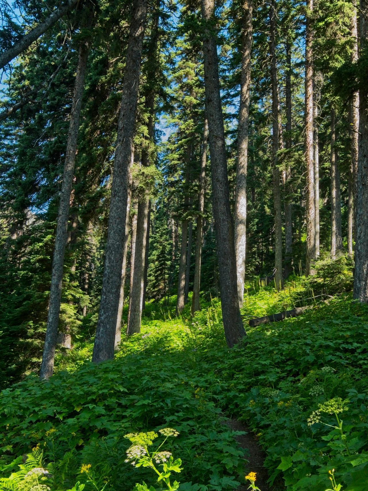
Similar to the Grinnell Glacier hike, the trail to Iceberg Lake gains altitude slowly, making for an easy ascent. The views are a little less spectacular than the Grinnell hike; there are no crystal clear lakes along the way and many fewer wildflowers. That being said, it’s certainly not an unpleasant hike and the views beat anything we have in the Midwest! The cool woods are lovely, and we’re treated to several awesome panoramic views of the surrounding peaks.


As we near the lake, the scenery takes a dramatic turn for the better: we cross a little creek and then walk straight through several meadows chock-full of wildflowers!
Unfortunately, the wildflower-filled meadows are the highlight of the hike; Iceberg Lake itself leaves a little to be desired. For starters, there is only one tiny iceberg near the shore, a swan-shaped chunk of ice that melts in two as I watch it. The lake below Grinnell Glacier had many, many more icebergs. On the other hand, Iceberg Lake is encircled by a spectacularly tall ampitheater of stone cliffs!


Steve and I snag a spot on the shore to sit and eat lunch while admiring the landscape. After a while we head back down the trail, pausing to admire the beautiful meadows one last time.
Similar to yesterday’s return hike from Grinnell Glacier, this afternoon’s return trek is hot and less enjoyable than the ascent was this morning. Rumors of two grizzly bears on the trail trickle in from hikers heading in the opposite direction, which makes for an exciting couple of miles, but we never see them.
Back at the Swiftcurrent Motor Inn, we treat ourselves to some huckleberry ice cream, relax on the porch for a little while, and then begin the multi-hour drive back to the western side of the park via the Going to the Sun Road. We attend another ranger talk in the evening at the Apgar Campground, this one about the ways different animals survive through the winter. I learn all sorts of new things, like that bears can recycle their own waste to prevent muscle degradation, and that pikas carefully dehydrate and store 30 pounds of food to eat during the winter! Afterwards, we lounge on the shore of Lake McDonald, skip rocks, and watch the sun set.

Siyeh Pass Loop
1 Aug 2019 | 10 mi | +2900 / -3500 ft | View on Map
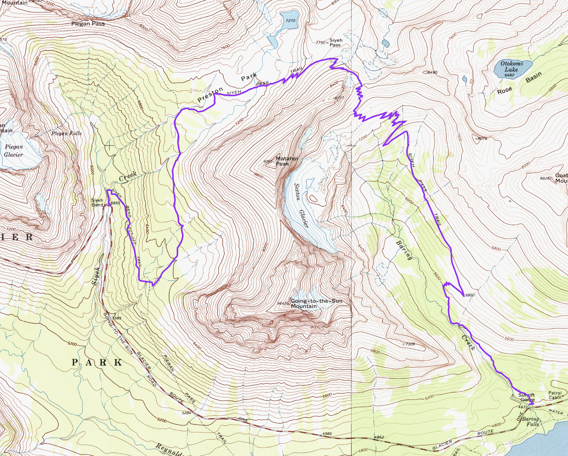
Our final day hike in Glacier National Park is the Siyeh Pass Loop, a route that comes highly recommended by several other hikers. Technically, it’s more of a “horseshoe” than a “loop”; a short ride on the park shuttle is required to connect the ending point to the starting trailhead. The logistics of reaching the trailhead are a bit more complicated than previous days’; Steve and I park the car at the Apgar Visitor Center, then ride one of the free shuttle buses to the Avalanche Creek campsite where we wait for a while (maybe an hour?) to board another free shuttle bus to Logan Pass. (Pro tip: arrive at Apgar early enough to catch one of the shuttles that goes directly to Logan Pass.) From there, we hop on yet another shuttle bus heading toward St. Mary and get off at the Jackson Glacier Overlook stop, the location of the Piegan Pass trailhead.
By the time we get off the final bus, it’s already 10 AM and the sun is high in the sky. To begin the hike, we cross the road and head uphill on the Piegan Pass Trail. Much of the path is overgrown with thimbleberry bushes and other tall, leafy plants that make it difficult to see. I can barely see my feet, let alone the trail ahead. Nervous about the prospect of grizzly bears in the brush, we make lots of noise as we walk.
After a while, the vegetation thins out and we can once again see our surroundings. The forest continues, but with more open space and a lovely scattering of bear grass, those iconic white flowers you see in so many photos of the park.
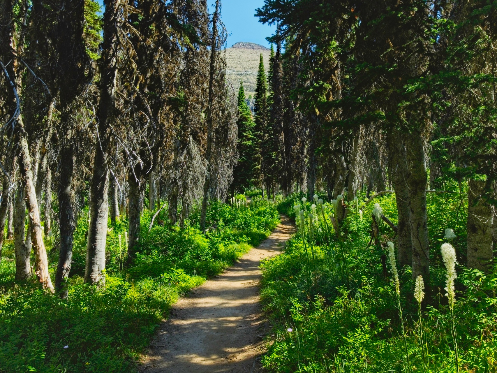
After ascending about 1500′ from the road, we exit the forest and enter vast meadows full of wildflowers. Steve jokes about being “stuck” with yet another meadow of flowers, as if the amazing display of color could ever get old. The joke only gets better as we pass through meadow after meadow full of blossoms. How many individual flowers do you suppose there are in one of these clearings? Thousands? Millions?

The trail climbs steadily toward a saddle in the ridge, eventually leaving most of the trees behind. This alpine area, named Preston Park, is easily my favorite location so far. I love the open meadows, the scrubby trees, and the little creek that twists through the middle of it all. The imposing facade of Reynolds Mountain and the glistening Piegan Glacier only improve the vista!


We eventually leave the lush alpine meadows behind as we climb higher. Up on the saddle, the landscape is composed entirely of scree and gravel. Although there’s no shade, a stiff breeze keeps us cool during the ascent.


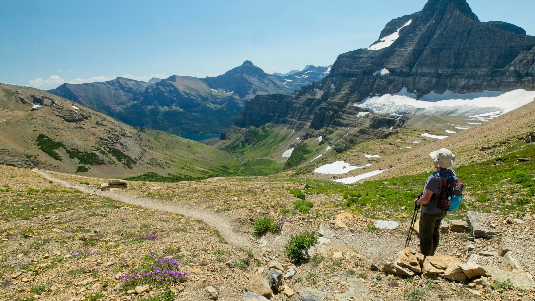
As we wind around Metahpi Peak, the alpine meadows of Preston Park recede behind the rocky slopes. We get a few glimpses of the Boulder Creek drainage lined with rust-red slopes, but soon lose that view as well as we reach Siyeh Pass. From that high vantage point, we’re treated to a spectacular view of the valley we’ll be hiking through for the remainder of the afternoon, the Baring Creek drainage. The massive Sexton Glacier feeds half a dozen cascades which in turn feed the roaring Baring Creek several thousand feet below the pass.

The descent from Siyeh Pass is very long with a mind-numbing set of switchbacks, but not at all unpleasant. Despite the heat and knee-knocking descent, there are lots of beautiful distractions. We pass countless stunning displays of wildflowers, some pristine little alpine meadows, and several intriguing rock formations.


Several hours later, we finally reach the bottom of the valley and Baring Creek. The water has cut little canyons into the red sedimentary rock and the powerful cascades shower us with mist as we stroll along. Down here near the creek, the dense vegetation returns as do our periodic refrains of “Hey, there — coming through!” to scare off any hidden wildlife.

")

During the final few tenths of a mile we pass through the scar of a past wildfire, a forest of bleached-white skeleton trees. This last bit is by far the hottest section of trail, but it is soon over and we find some shade near the Sunrift Gorge shuttle stop.
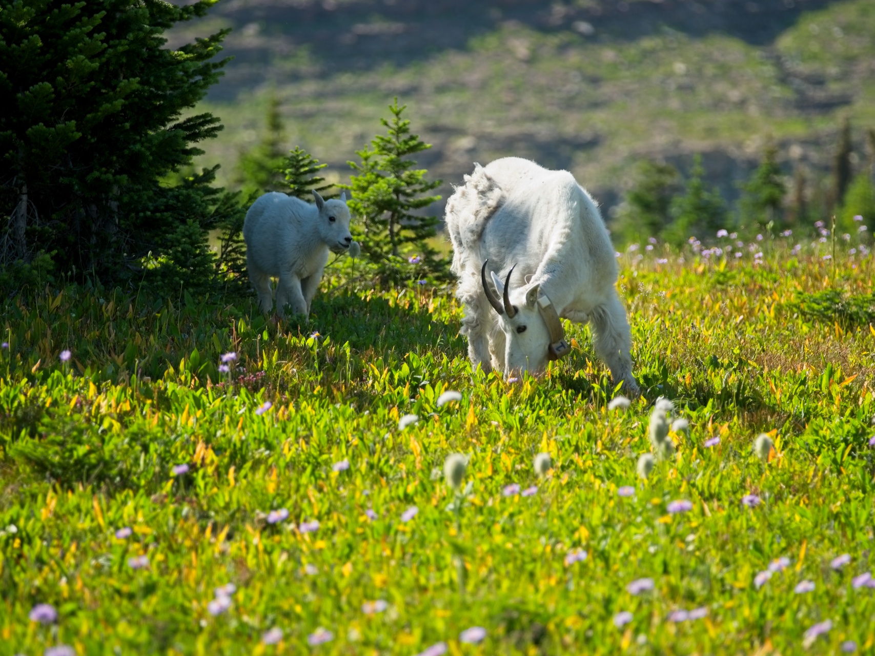
A short shuttle ride brings us back to Logan Pass. Up to this point, we haven’t had the chance to explore the area because the parking lot is always full. Arriving via bus eliminates that particular struggle, so we take advantage of the easy access and spend some time strolling up the board walk toward Hidden Lake. We don’t go very far, just far enough to watch a nanny and her kid grazing in the — wait for it — wildflower-filled meadows. The telephoto lens I’ve been lugging up and down the mountains comes in handy once more to capture several nice images of the mountain goats!
With sunset (and the end of service for the shuttles) approaching, we board a bus to Apgar Visitor Center and enjoy the ride back to our car. The rest of the evening is spent preparing for our 8-day backpacking trip; we start tomorrow!
Steve Cox 7 October 2019
Beautiful. Thanks for the amazing writeup and beautiful photos, Andrew. You do such a great job on these!