I’ve been meaning to return to the “bear lakes” basin south and west of Italy Pass since I first visited on the Sierra High Route in 2018. This year I managed to snag a permit over Italy Pass and decided I’d try to climb Gemini and Seven Gables while I was up there. Craig was going to join me on this trip, but he had a minor injury and stayed home to recover so I went solo.
Trip Planning
Specs: 33.6 mi | +/- 11,000 ft | 3 days, 2 nights
Difficulty: Class 4 [ratings]
Location: Inyo & Sierra National Forests, California | Home of Western Mono and Northern Paiute peoples | View on Map
Route: I hiked up the trail toward Italy Pass to about 11,400 and camped near one of many small lakes in Granite Park. From Italy Pass, I hiked a traversing line over to White Bear Lake and then followed a series of grassy ramps down to Vee Lake and then the Seven Gables Lakes. The terrain through these lakes is complex and a map or GPS is very helpful.
From the Seven Gables Lakes basin, scramble up the granite slabs to Seven Gables Pass. From here, it’s a straightforward class 2 scramble up to Gemini. To reach Seven Gables, contour across the west slopes and then scramble up a loose, dirty chute. Secor provides many more details, but I’d like to add that the “3rd class chute” he mentions climbs like 4th or easy 5th class. To descend Seven Gables, I walked down the class 2 talus on the north slope and then slid my way down the steep chute that drops toward Stub Lake.

Permits & Regulations: A permit is required for all overnight travel in this area. Reserve a wilderness permit online from Recreation.gov. Bear canisters are not required, but are recommended; hanging a bear bag from the scraggly pines that dominate this region is difficult, and much of the route is above treeline. As always, practice leave no trace ethics to preserve this beautiful wilderness for others!
Resources: The USFS page for the Italy Pass Trail has lots of great information about weather, current conditions, and restrictions. For cross country navigation information, see Secor’s High Sierra book and Roper’s Sierra High Route guide.
Up to the Alpine
Friday, 23 Aug 2024 | 7.3 mi | +4100 / -100 ft | View on Map
I drove up to the Italy Pass Trailhead this morning, arriving around noon. I munch on a sandwich at the trailhead, change into my hiking clothes, and hit the trail at 12:30. Normally hiking up this trail in the afternoon is a blisteringly hot ordeal, but a cold front has moved in this weekend and it’s only 73 degrees! I thoroughly enjoy the abnormally pleasant hike up the rocky switchbacks to Pine Lake.


My goal for the day is to find a campsite up in the “Granite Park” area, somewhere around 11.5k feet elevation. I stroll around Pine Lake, wander up to Upper Pine Lake, and hop across a few dozen rocks that span its inlet creek. I reach Honeymoon Lake, which is just a little further up the trail, at 4 PM. Here, the path bifurcates with one branch heading toward Pine Creek Pass and the other toward Italy Pass.
The Italy Pass Trail is exactly how I remember it from the last time I visited in 2018. It’s faint for a little while as it winds through the rocks above Honeymoon Lake, but then a well-trodden path emerges. I follow the single track for about an hour, through the thinning trees and into the alpine tundra. I’ve made it up to 11.3k feet and am really feeling the altitude so I decide this is far enough!


I choose a campsite with rocks and a cliff on three sides to shield me from the wind. It isn’t blowing too hard right now, but the forecast predicts some gusts tonight and there are lenticular clouds (a sure sign of ferocious wind) above Owens Valley so I want to be ready for high winds. I relax for the rest of the evening, mostly sitting outside and watching the lenticular clouds appear, morph, and disappear above the valley. Once the sun sets I retreat into the tent and read for an hour or two before falling asleep.
August Snow Storm
Saturday, 24 Aug 2024 | 19.0 mi | +/- 6800 ft | View on Map
Unfortunately for me, I didn’t sleep well at all last night. I drag myself out of bed at 5:30 and peek out the tent door to find snow on the ground! The forecast this weekend did hint at snow; it was very non-committal, but the tiny probability has materialized. It’s also quite cold outside — probably just below freezing — so I bundle up before leaving the tent.


I’m on the trail by 7, wearing almost all of my layers, including gloves, a thick puffy, a beanie, and a buff. The layers are mostly to protect me from the gusty, cold wind, which periodically howls across the treeless terrain. It must be blowing more steadily above, because the clouds are racing over and around the nearby peaks. Snow comes in waves, never snowing very hard or lasting more than 20 – 30 minutes.
It takes me about an hour and fifteen minutes to reach Italy Pass, where I get my first view of Seven Gables. It’s not a very inspiring view this morning, what with the low-hanging clouds and howling wind. I think about turning back… I could be down to the trailhead in the early afternoon and home to my comfy bed a few hours after that… But no, it’s difficult to get these permits and I want to go see some new mountains. Plus, if you go out when nobody else will you get to see things nobody else does. Right?


From Italy Pass, I contour across the slope, moving southwest on talus and granite slabs toward a saddle. I crunch over two permanent snow fields on the way. I’m a little nervous they’ll be slippery but my trail runners hold just fine on the crusty surface. It’s a good thing too because I completely forgot to bring extra traction.
Once I reach the saddle, the ground flattens out and the talus gives way to sand. I’m able to speed up considerably, which helps me stay warm. Partway across the saddle I run into three backpackers! I think I’m just as surprised to see them as they are to see me. They’re section-hiking the Sierra High Route and are hiking out today. We chat for a few minutes and then go our separate ways. My mood is much improved after seeing them – other people are out here, it’s not just me!


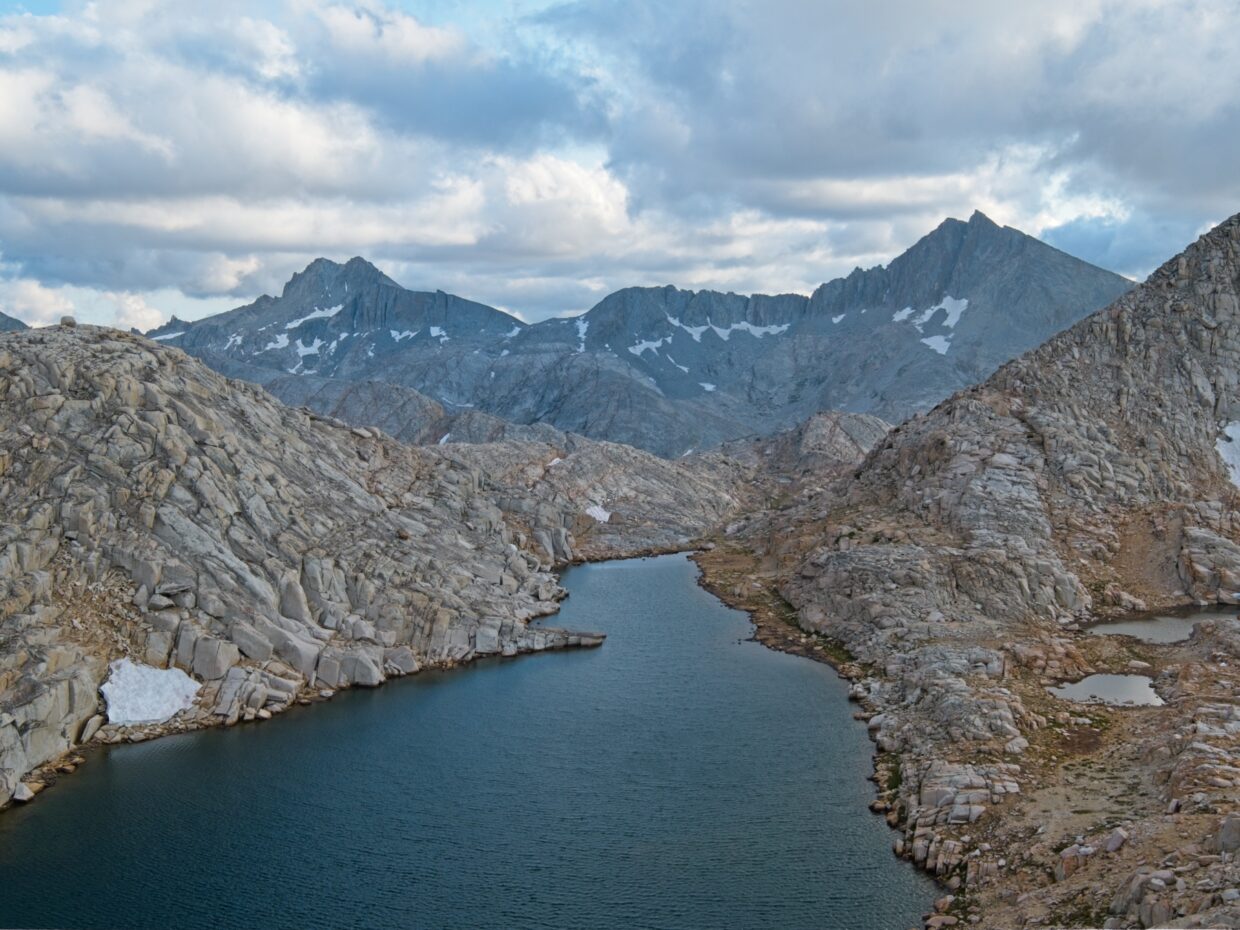
The saddle ends at a sandy slope overlooking White Bear Lake. Gemini and Seven Gables are now both visible, but just barely through distant blowing snow. I plunge-step down the sand to the lake, walk around the north side and then follow a series of grassy ramps down to Black Bear Lake. This is the High Route as described by Roper with a faint but obvious-enough use trail most of the way down. Another series of ramps leads down to Big Bear Lake, which I pass on the north side.
The last time I was in this bear-themed basin, the visibility was horrible due to wildfire smoke. I’ve been excited to come back and see it more fully without the smoke, but the visibility really isn’t too much better today. I’ll take snow over smoke, but it’s not the sunny, cheerful visit I was hoping for.
After walking around Big Bear Lake, I hike past Little Bear Lake, a delightfully elongated body of water nestled between parallel cliff bands. From the end of Little Bear Lake, Roper suggests following the outlet creek down to the East Fork of Bear Creek. That’s a bit out of my way, however, so I decide to improvise and follow a grassy bench southwest toward Vee Lake. Will it continue all the way to the lake? Will there be insurmountable cliffs?


No, as it turns out. The bench leads directly to Vee Lake over the most pleasant terrain imaginable. I have no trouble walking down to Vee Lake and enjoy a stroll along its north shore to the outlet. Here I once again have two route options. A clear use trail follows the outlet creek down a chute to Stub Lake, which sits directly below Seven Gables. On the other hand, gently-sloped granite slabs provide a more direct line toward Seven Gables Pass, which is the next landmark on my itinerary. After a quick look at both options I choose the direct route and quickly descend the slabs to the Seven Gables Lakes.


I reach the valley floor at 10:45 and pause for a snack and to refill my water bottles from a small creek. A few tiny patches of blue sky are beginning to appear between the swiftly moving clouds and I’m optimistic that I might actually see the sun today! After a short break I begin hiking up granite slabs toward Seven Gables Pass, the low point between Seven Gables and Gemini. It’s a steep slope but very straightforward and I’m on the pass within an hour.

Twin-peaked Gemini looms above the pass to the south. It’s not a particularly long or steep slope, but it’s entirely talus hopping, which feels tedious. I struggle up the rocks, pausing frequently to catch my breath, and reach the summit at 12:30. I’m tired and hungry, but it’s too cold and windy for a comfortable break up here. I snap a few photos, sign the summit register, and then reverse the tedious walk to the saddle.


By the time I reach the saddle, the clouds have broken up enough to let the sun through! I find a flat rock beside a small tarn and thoroughly enjoy soaking up the warm light while eating lunch. Many of the clouds zooming by are at or below my altitude (11.9k ft) and I’m a bit nervous about storms; in my experience out here, low clouds usually mean rain and/or thunder are near. That being said, it’s been “storming” all day and I haven’t heard a single peal of thunder.
After enjoying a sunny lunch break, I start the hike over to Seven Gables. Following Secor’s instructions, I contour across the west face of the mountain until I reach a series of chutes that lead directly to the summit. The chutes are full of loose, sandy soil and I really struggle to make it up the slope; it’s a two steps forward, one step back kind of climb.
I eventually reach solid rock and scramble up through third class boulders to a knife-edge ridge just below the summit. I snap a picture of the sheer north face of the peak before descending a chute to the west for about a hundred feet where a chimney / crack system leads back up to the summit. Secor describes this as class 3 climbing, but I’d give it a solid class 4 rating. Hand and foot holds are not that obvious in several sections, and the exposure is high enough that I’d only feel comfortable down-climbing it facing into the wall. Secor’s beta above the chimney proves very helpful and leads me straight to the summit.


I sit atop Seven Gables for a while and enjoy the dramatic clouds. They swirl past the peak at my eye level, obscuring and revealing different parts of the mountain range in real time. It’s mid-afternoon (3:20), so I take some time to eat snacks and apply sunscreen, optimistic that the sun will persist. I have a lot of ground to cover to return to camp, so I leave the summit as soon as I’m rested and recharged.


Rather than retrace my climb through the class 4 chimney and the loose chute, I descend an easy talus slope on the north face of the mountain. A steep gully between Seven Gables and its dramatic northern satellite leads down to the Seven Gables Lakes basin. It’s also very loose, but isn’t too long and I’m able to glissade down the bottom third on permanent snow fields. After a little bit of tricky route finding through steep grass, I reach the lakes and wonderfully lush meadows on the valley floor. I want nothing more than to lie down on the grass and take a nap but I have to keep going; it’s getting late.


The sun comes out in force as I hike up the outlet creek of Vee Lake and retrace my steps to Little Bear and Big Bear Lakes. I take lots of pictures, reveling in the warm evening light. I get my wish for better views after all!


From Big Bear Lake I take a direct route up to White Bear Lake, following a well-traveled and cairned use trail that I missed on the way down. I’m treated to a fantastic view of Gemini and Seven Gables from the lake, much crisper this afternoon without miles of blowing snow between me and the peaks.


I struggle up the sandy slope from White Bear Lake to the saddle and then stroll across the flat ground toward Italy Pass. When I reach the other side of the saddle, I’m treated to a spectacular sky above Jumble Lake and Lake Italy. Parts of the low-hanging clouds glow in direct sunlight while other parts are shadowed. Every few minutes, golden sunlight bursts through a gap in the clouds, completely changing the composition. I snap a few photos but am wary of the time; the sun will be setting soon and I’d like to be over Italy Pass and back on a trail before darkness falls.


I manage to make it down the pass in the twilight. I stubbornly refuse to turn my headlamp on even once it’s completely dark and honestly don’t really need it. It’s amazing how well you can see if you let your eyes adjust! I reach camp at 8:20 PM and happily plop down on the ground for a meal and then bed.
Hard Freeze
Sunday, 25 Aug 2024 | 7.3 mi | +100 / -4100 ft | View on Map
You would think one poor night’s sleep plus a very long hike would be enough to keep me asleep all night. Unfortunately, that’s not the case and I toss and turn from 3 AM onward. I get out of the tent at 6 AM to sunshine and cloudless skies, a wonderful contrast from the past few days. It’s very chilly, but I’ll take it! After a quick breakfast, I pack up my gear and hike down the trail, admiring the golden hour views. Delicate ice feathers on Upper Pine Lake catch my eye and I stop for a while to admire them and capture a few in photos.


Lower down the mountain I chat with a few groups of hikers that are also on their way out of the mountains. When I reach the trailhead I discover that my car battery is completely dead. One of the people I chatted with helps me jump the car, but with no luck; the engine turns over once and then stops responding entirely. They’re kind enough to give me a ride into town where I can call a tow truck – luckily a bigger boost from the tow truck driver’s portable jump starter is enough to revive the dead battery and get me on my way back home.


Diane 13 May 2025
Hi Andrew
Bear Lakes Basin is one of my favourite destinations in the Sierras, and your pictures and write-up were phenomenal. I admire your willingness to share the inner ” should I or shouldn’t I ” that we all go through when trying to pull off a trip that is just a little bit out of our comfort zone. Happy Sierra travels this summer ! Thanks for posting these fantastic writeups !
Diane in Kamloops BC
Andrew 23 May 2025 — Post Author
Thanks, Diane! Bear Lakes Basin is gorgeous, and so rugged – a real gem! 🙂