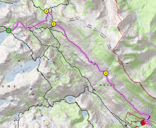
My time in California is coming to an end… Don’t get me wrong: I enjoy my work and friends at Purdue, but I’m really going to miss mountains and climate of California. For my last weekend in the Golden State, I planned a two-day trip to the Ansel Adams Wilderness. My route begins at Agnew Meadows, up the River Trail toward Thousand Island Lake. I make a brief detour to Ediza Lake to check out those views (it’s gorgeous) and then continue up the JMT to Thousand Island Lake. I camp there, then return to Agnew Meadows via the PCT. This is a solo trip: I’ve really had a great time backpacking with other people this summer, but the freedom of a solo hike is nice for a change.
Trip Planning
There are several maps that cover the wilderness this trek traverses. Both the Yosemite NatGeo and Yosemite SE NatGeo maps include the northern half of this trip: the areas near Garnett and Thousand Island Lakes. The Mammoth Lakes NatGeo map includes the rest of the trails south of those large lakes. Because this route parallels the JMT and PCT, the John Muir Trail NatGeo map set includes the entire route. Similarly, the Tom Harrison Mammoth High Country, Devil’s Postpile, and John Muir Trail maps all detail the entire route.
Permits are required for all overnight trips in this area and, due to the popularity of the region, are difficult to come by. You can reserve one online months ahead of time or try your luck at the daily permit lotteries for a walk-up permit. The usual Sierra Nevada rules and regulations apply (bear canisters are required) and take care to leave no trace! For more information, visit the Inyo National Forest website.
Journey to Agnew Meadows
August 5, 2016 | 1.0 mi | +/- 0′
I woke up this morning at 4 AM, went in to the office at 05:00, and worked all morning. I leave town after a meeting at 12:30 and head north to Mammoth Lakes. The drive is actually pretty long; it takes nearly five hours to drive from LA to Mammoth Lakes. My plan is to find a campsite at one of the many campgrounds in the area. Although it was over 90 degrees in LA, the temperature in Mammoth Lakes is a balmy 75 degrees! It’s fairly high in elevation (over 7,800′) so a temperature decrease is definitely expected. The town is simply beautiful. It’s very much a tourist mountain town, but the commercial feel doesn’t make it any less beautiful. I stop at the ranger station, pick up my permit, and then drive to the Twin Lakes campground. I’m taken back by how simultaneously wild and settled the campground is: the lakes are gorgeous, with tall pines as as far as the eye can see, huge granite peaks towering above, and hundreds of campsites nestled along the shore. Unfortunately, every single site is taken. There’s a big festival in town, plus it’s a Friday night. I certainly can’t blame people for wanting to be here!
I check several other campgrounds in the area with the same results: they’re all full! Although I had originally planned to enter the wilderness early tomorrow morning, I have my permit and decide to hike in a little tonight and camp along the trail somewhere. Cars are not permitted on the road to Agnew Meadows and Devil’s Postpile, but there is a shuttle that runs regularly throughout the day. The last shuttle leaves the lodge at 7 pm, and it’s now 6:30, so I hurriedly drive to the lodge, change into my hiking clothes, double check my gear, and get to the bus stop. The ski lodge is pretty empty; there are a few cars parked along the road and in the parking lot, and a small restaurant and hotel seem to have plenty of business. When the bus arrives, a few JMT thru hikers hop off. I chat with them while they wait for a shuttle into town.
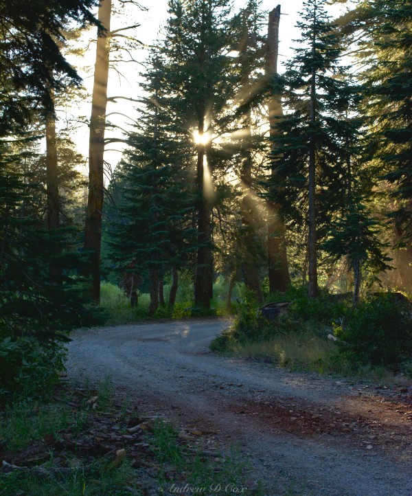
The round trip bus ticket is $7 and the ride to Agnew Meadows is short; only 15 minutes. The road from the lodge to the trailhead is narrow and barely facilitates two-way traffic. The bus driver drops me off at a gravel road; it’s about 0.4 mi to the trailhead. There isn’t much daylight left, so I hurry down the road so I can make it far enough away from the trailhead to set up camp for the night. The setting sun streams through the trees and makes for some really incredible imagery. The air is cool, and the crunch crunch crunch of gravel under my shoes is soothing. I soon reach Agnew Meadows and spend a few confusing moments trying to decide which branch of the trail is the River Trail. The PCT passes through this trailhead as well, so there are several options.
The River Trail begins as a narrow trail through tall meadow grass. After a short walk, I reach a more established trail and take the north-bound road. There’s not a soul out; the only sounds are birds chirping in the trees and my boots on the soft dirt trail. Once I hike a respectable distance away from the trailhead, I locate a sandy spot on a rocky ridge and set up camp. I’m starving and waste no time rehydrating a Couscous, tuna, and balsamic vinaigrette salad. As I eat, I take in my surroundings. It’s quiet and peaceful. The gondola cars at the Mammoth Lakes ski resort glint in the evening sun far in the distance. It’s been a long day, so I go to bed at about 9:00.
Despite the tranquility of my surroundings, there’s something about the first night of a solo hike that freaks me out. Perhaps because I began this hike just before nightfall and haven’t seen other humans, I feel more alone. I toss and turn in the tent, worries of bears and other backcountry misfortunes racing through my head. Eventually, I fall into a light sleep.
Up the River Trail
August 6, 2016 | 19.8 mi | +5133′ / -3582′
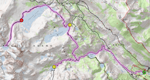
My route for day 1: Agnew Meadows > Shadow Lake > Ediza Lake > Garnet Lake > Thousand Island Lake > Lake Catherine > Thousand Island Lake; Generated with Sierra Mapper
Dawn brings relief from any worries I had last night, but it also steals all the warmth; it is freezing! I am somewhat prepared, at least: I brought a fleece jacket and a windbreaker. I pull both of them on while I rehydrate some homemade cherry almond oatmeal and take down my tent. The food is delicious, but my hands are painfully cold, so I pull out a pair of extra socks and use them as mittens. I’m not sure if using socks as mittens is a common hiking trick, but it is definitely a common running trick.
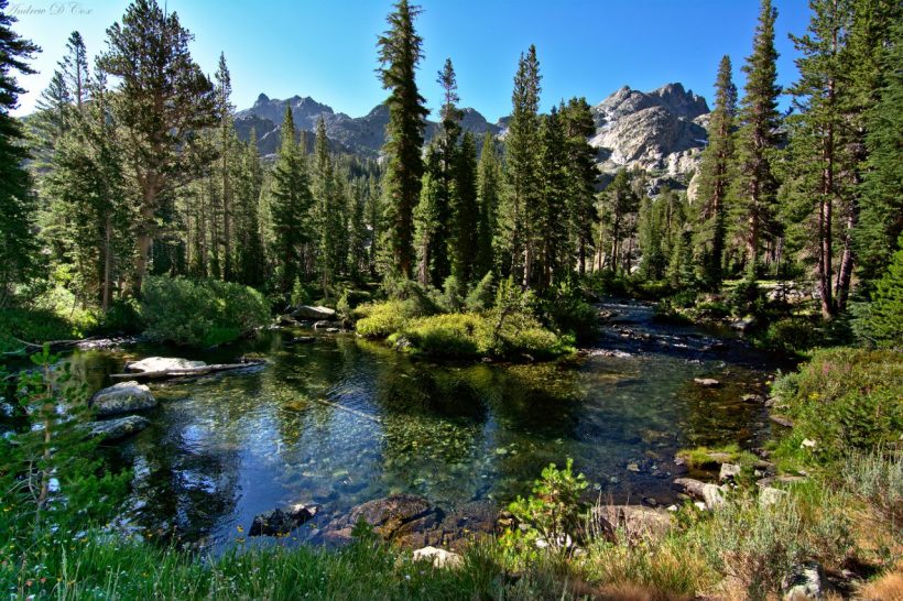
Once I begin hiking, my body quickly warms up even though the temperature still hovers in the upper 30’s. I pass a woman named Lindsey soon after leaving camp; she’s heading in the same direction as I am, toward Ediza Lake. Hiking in the early dawn light is pleasant. The Sierras are very blue and green – the granite has a grey-blue tone, and the pine trees are all shades of muted green. The early morning light, in particular, is cool and blue as the sun has not yet crested the eastern mountains and the only light that reaches the landscape around me is refracted through the blue sky. A gang of young trail runners pass me as I make my way toward Ediza Lake. This would be a great trail to run because it isn’t very steep! Perhaps I’ll give that shot next time I’m out here.
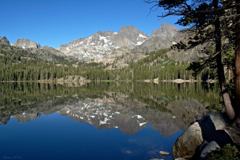
On the way to Ediza Lake, I reach Shadow Lake. The sun is still very low in the sky and it casts huge shadows across the landscape. The lake itself is beautiful, and I stop several times while hiking along the shore to take photos. Lindsey catches up to me several times while I’m taking photos, and we trade small talk as we pass each other on the trail. One of the fun things about solo hiking is you have no excuse not to talk to other hikers. You meet a lot of neat people when you don’t have existing friends to chat with!
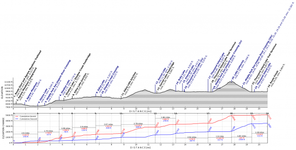
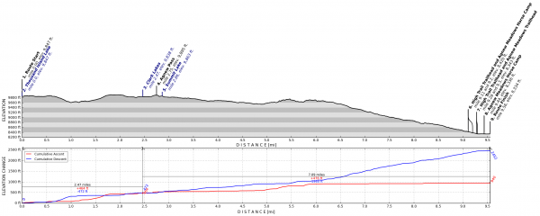
The trail to Ediza Lake (and the trail to Shadow Lake) is surprisingly flat; if you look at the elevation profile, it’s only 400′ elevation gain from the trailhead to Shadow Lake and only another 500′ gain to Ediza Lake, all over the course of 7.15 miles. Flat hiking is by far my favorite: uphill is a cardiovascular workout, downhill is tough on joints, and flat ground is just easy!
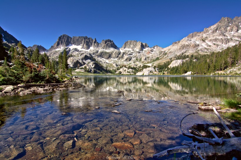
Many of the trail reports I read while planning this trip specifically mentioned that Ediza Lake is a “must see.” It isn’t far out of my way, so I make the detour. There are three prominent peaks or sets of peaks on this trip. Banner Peak lords over Thousand Island Lake, Mt. Ritter stands nearby, and the Minarets lie just south west of Ediza Lake. It’s the Minarets that I am really hoping to see at Ediza. Of course, they’re visible from any of the nearby trails, but snow-covered peaks are always particularly beautiful when reflected in a clear alpine lake.
True to the reports, Ediza lake is a stunning sight. During my trip planning, I was a little worried that all the snow would have melted. You might wonder why I would want there to be snow, right? There are a few reasons. First, it makes the photos much more interesting! Second, hiking in mountains and between snow fields makes you feel like a badass explorer in some never before seen wilderness, even if it’s one of the most popular hiking spots in the Sierras. Plus, the presence of snow clearly indicates that this is a different biome, very different from the desert mountains that surround Los Angeles.
Lindsey reaches Ediza Lake shortly after me, and we chat for a few minutes while enjoying snacks and taking in the view. She’s continuing on to Iceberg Lake for even better views of the Minarets; I briefly contemplate going the same direction to see the sights, but I still have miles and miles left to get to Thousand Island Lake so I bid her farewell and return down the trail toward Shadow Lake. Before reaching Shadow Lake, I come to a trail junction and take the northbound John Muir Trail. This stretch of the path climbs over 1,100 feet and requires much more exertion than the previous sections. Still, it’s only 10:00 and the air is just beginning to warm up. I reach a rocky pass and am instantly granted a wonderful view of Garnet Lake. After the climb, I’m tired and take a break while munching on trail mix. It’s amazing how delicious the simple mixture of nuts, raisins, and chocolate is on the trail!
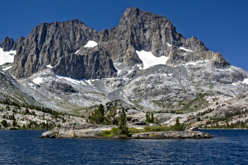
The descent to Garnet Lake doesn’t take very long and soon I’m standing on the shore, looking out at little rocky islands and, in the distance, Banner Peak. A wooden bridge spans the outlet creek. I pause to refill water bottles and take some photos while the chemicals go about their bacteria destroying business.
It’s about noon, but since I just ate a bunch of trail mix, I decide to wait to eat lunch until I reach Thousand Island Lake. The trail from Garnet Lake to Thousand Island Lake passes several small lakes: Ruby Lake, and Emerald Lake. Ruby Lake has some distinct red rock nearby, which may have given it its name. I didn’t see any particularly green features near Emerald Lake, so perhaps its proximity to another lake named after a gemstone is the only influence on its name.
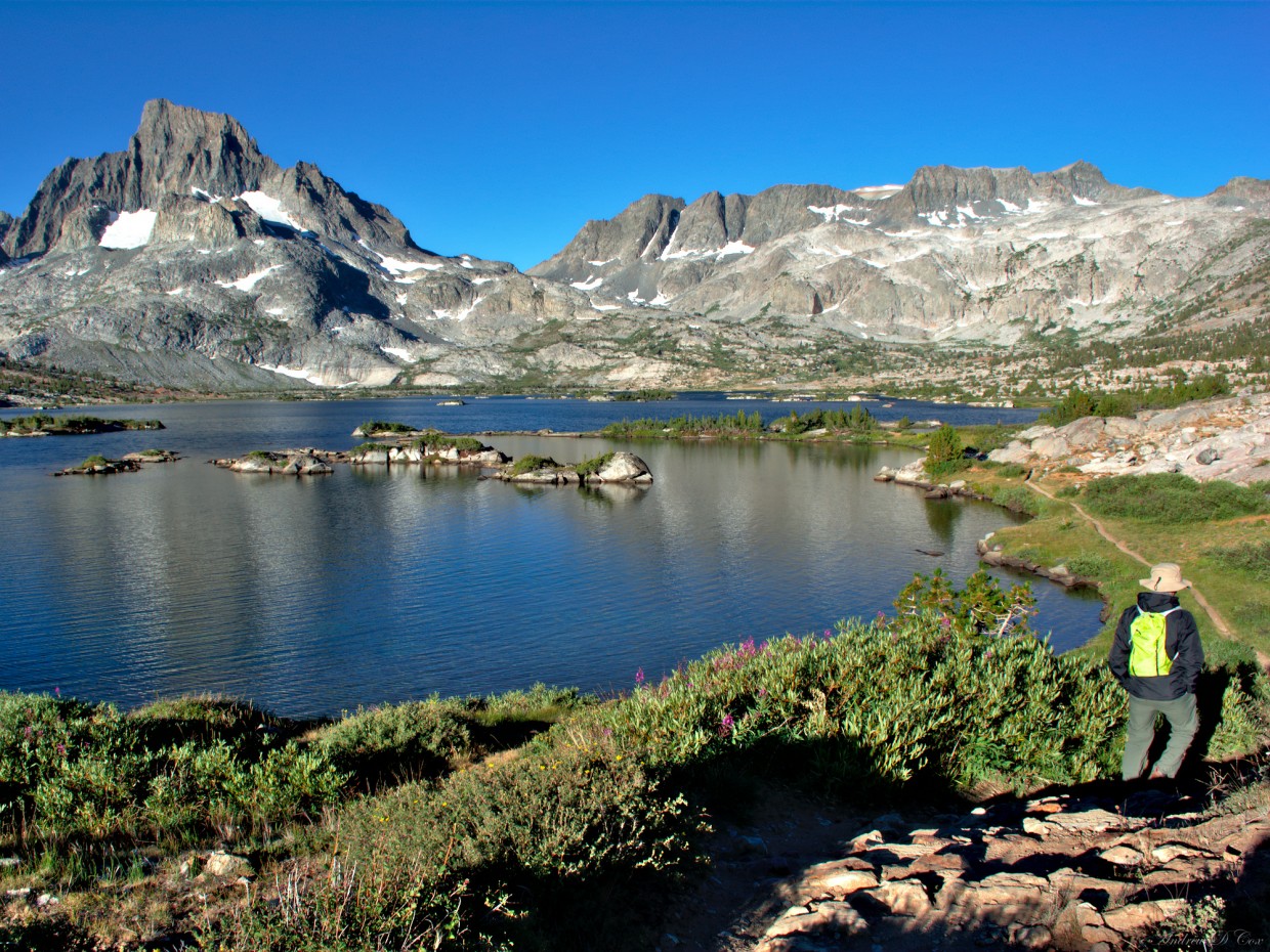
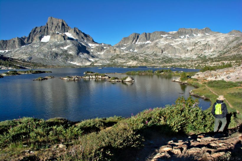
I reach Thousand Island Lake right at 1:00. I have to say, I’m a little disappointed with the number of islands. There might be 300 small rocks and islands, but there are certainly not 1000. Another hiker I met on the trail called it “Ten Thousand Island Lake,” and that’s just ridiculous. The islands are neat, but not quite what I had imagined for a lake with 1000 islands. Oh well. I find a nice spot on the shore and eat a tortilla, “dried” apples (the store-bought ones are not very dry), and peanut butter. As it is still the early afternoon, I have a decision to make. Do I continue hiking and camp at a different lake, or do I set up camp here like I originally intended? I’m not content to sit around for the next 7 hours of daylight. Others may be happy to bum around camp, but I get far too restless. I’m unsure how the camping is at any of the nearby lakes, so I decide on a compromise: I’ll camp here and then do a spur hike up to Catherine Lake. To reach it, I’ll have to climb up to North Glacier Pass. There isn’t a trail to the pass marked on the map, but I can see the pass clearly from my lunchtime vantage point and I’m not worried about getting lost. Besides, I have a map and compass and plenty of orienteering practice.
There are dozens of campsites along the north shore of Thousand Island Lake. I spot several groups that have set up their tents on the grass, in violation of Leave No Trace. You’re only allowed to camp in “impacted spaces,” which means it needs to be a pre-existing campsite. The grass is attractive – it looks so soft and comfy – but the plant life up here at high altitudes is very fragile and camping on it will very likely kill it. I find a sheltered sandy spot nestled between some short pine trees and a large rock. The wind is beginning to pick up, so I want a place to sleep that will be sheltered from the cold breeze.
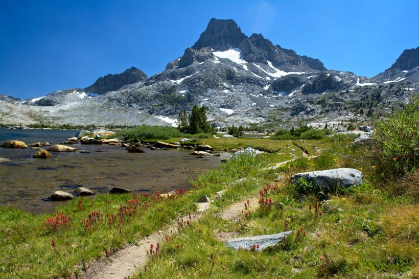
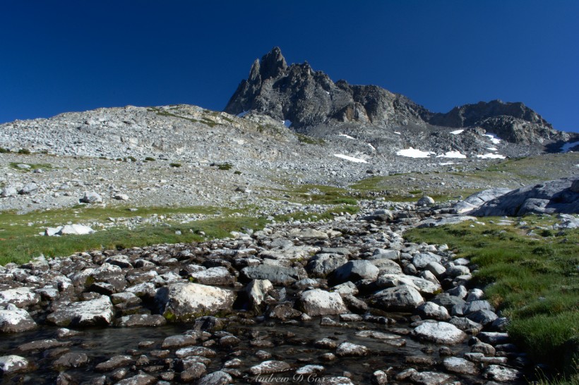
Once I erect the tent, I toss in my sleeping bag and sleeping pad, and then hide my bear can in a nearby stand of pine trees. With my first aid supplies, photography gear, and a few snacks, I set off around the lake in the direction of Banner Peak and North Glacier Pass. The landscape up here is incredible! The narrow trail winds between rocks and grassy, wildflower-filled meadows. I soon reach a point where I have to leave the trail; it continuous on around the lake, but my goal is the pass high above. The map depicts several small creeks that feed into the lake, so I follow one of those up a gradual slope. Tiny ground squirrels squeak and run into hiding as I trek across the meadows. Partway up the slope, I find a barely distinguishable use trail and begin following it up the mountain. The grass fades away and is replaced by small scree and, eventually, large refrigerator-sized boulders. I’m not sure why, but I have a definite thing for high altitude hiking. Yes, the thin air makes it more difficult to breathe, it’s cold, and the trails tend to be difficult to find because few venture so high. However, I like going places where others won’t, and the juxtaposition of the fragile environment with the imposing peaks is incredible.
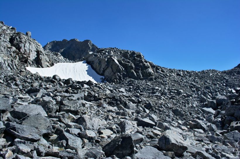
The final climb to the pass is difficult and slow going. I have to clamber up the large boulders. The slope isn’t terribly steep, but the rocks themselves are definitely not flat, and some of them are more mobile than others. As I’m ascending to the pass, I see two small figures appear at the top of the slope and begin their way down toward me. When we come near each other, they tell me they’ve been climbing over this kind of rock all day and are beyond tired. I can imagine; this climbing is already tiring me out!
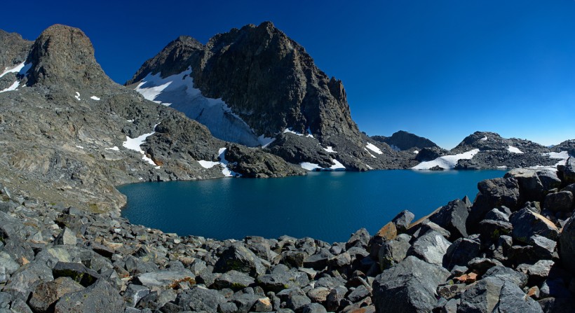
When I reach the top of the pass, my heart falls a little. There’s a rocky bowl and another, higher pass beyond. I still have plenty of time before I need to turn back, however, so I rest for a few minutes and then continue on. The rock in the bowl is much smaller and easier to travel through, and the trail seems to have reappeared as a faint trace of gravel winding up the bowl. When I crest the next ridge, I glimpse a bright turquoise lake and am simultaneously nearly blown over by the ferocious wind. Before making my way down to the lake, I hide on the leeward side of the pass and put on my windbreaker. For a few seconds, the wind is terribly strong, but as I descend from the pass, its intensity lessens and I’m no longer using all four limbs to steady myself.
For some reason, there are an enormous number of midges hovering between the rocks by the lake, and lots of small sparrow-like birds hopping around. My legs are more or less spent, so I rest on a rock next to the lake and admire the view for a while. There is a permanent snow field on this side of Banner Peak, i.e. North Glacier. I see a few other hikers on the far side of the lake. I wonder what they’re doing up here?
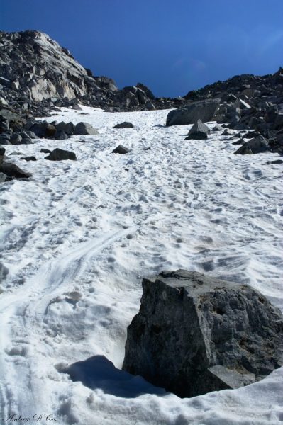
After resting for a while, I climb back up to the pass. Once again, I’m forced to steady myself with my hands to avoid being blown over as I crest the pass. Descending the scree bowl is much faster now that I’ve had time to catch my breath. Descending these types of fields also gives you the advantage of being able to see where you’re going and pick the best path. There is a long snow field descending several hundred feet from the first pass crest. I don’t have any trekking poles to self-arrest, but I decide to risk a glissade. I to have a tripod, so I pull it out to dig into the snow just in case I need to slow down. However, it is the late afternoon and the snow is soft and not nearly as slick as it could be. Glissading down the field proves to be a lot more fun than boulder hopping! My pants are quite wet, but other than being a little cold, I’m fine.
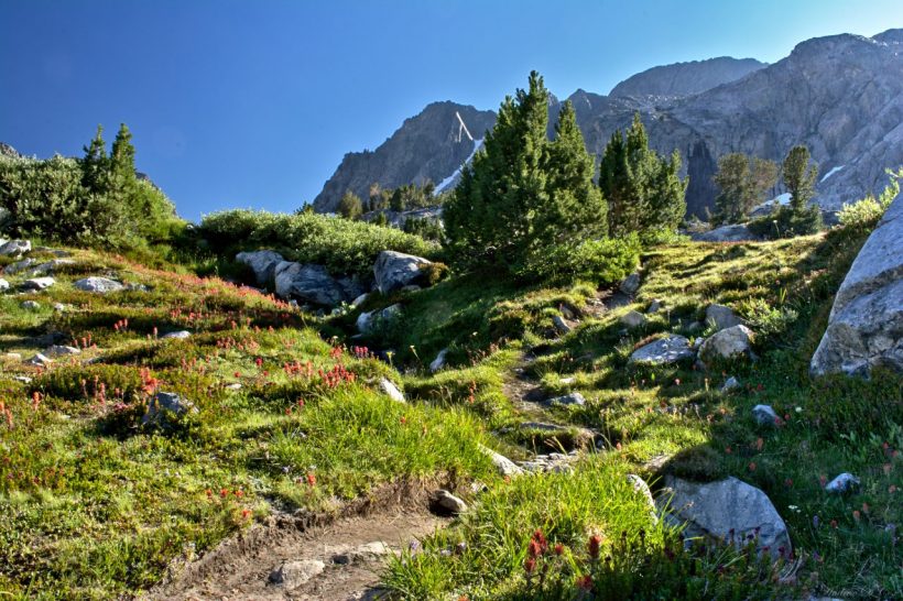
The rest of the descent is my favorite hiking of the day. The sun is beginning to set and the light is warm and golden. From this high vantage point, I spy a small trail and make my way to it. The trail winds its way back down into the grassy, flower-filled fields and I stop several times to take photos.
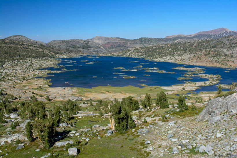
The view of Thousand Island Lake is spectacular from above as well. You can actually see the many islands (still not more than a few hundred)! It takes me nearly as long to descend as it did to ascend because I keep stopping for photos. The tripod earns its keep by providing stability when I decide to use small apertures.
By the time I get back to camp, my legs are exhausted. I drop my makeshift day pack next to the tent and retrieve my bear can from its hiding spot. I add water to another Couscous and tuna dinner and try to wait patiently for it to rehydrate as my stomach grumbles. After eating, I stretch out in the sun and catch up on journaling. The wind is howling down the lake, but I stay comfortable in a windbreaker on the warm rocks. I snap a few photos in the evening light but am much too sore to walk around much and finally give in and retire to the tent. The rocks and nearby trees shelter the tent from the wind, so it’s nice and cozy inside. I drift off to sleep as the sun sets; hiking to exhaustion will do that to you!
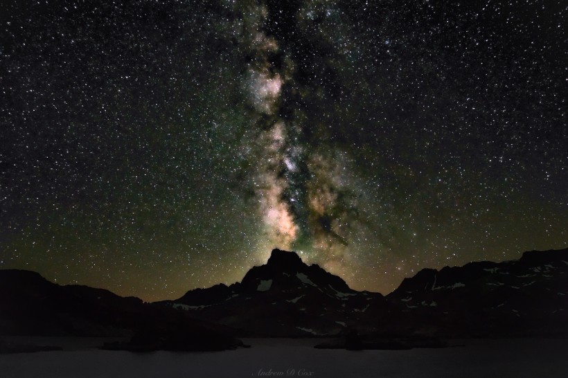
Since I went to bed so early (between 8 and 9, I believe), I wake up for a bathroom break before midnight. The stars are out and shining brightly, and the Milky Way is clearly visible. After relieving myself, I pull on a few extra layers, grab my camera and tripod, and walk down to the lake to see what astrophotography will look like here. As luck would have it, the Milky Way is aligned with Banner Peak, so I hurry to get the composition right and begin taking some photos. You can see the results below; I think the shot turned out quite well!
Pacific Crest High Trail
August 7, 2016 | 9.6 mi | +939′ / -2452′
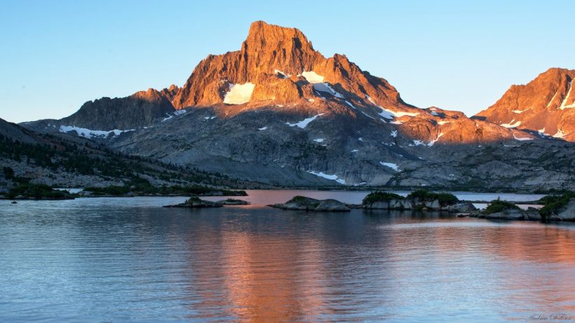
I wake just before first light the next morning and waste no time getting up. I’ve found that lounging around in bed only makes me more tired; it’s best for me to get up when I wake up the first time. It’s very chilly, though warmer than yesterday morning, so I pull on all the layers I packed in. Thousand Island Lake is east of Banner Peak, so I grab my camera gear and my breakfast and head to the eastern shore of the lake to try to capture some morning alpenglow. I munch on granola and rehydrated milk while I watch the sun slowly illuminate the distant peak. What a great way to spend the first hours of the day!
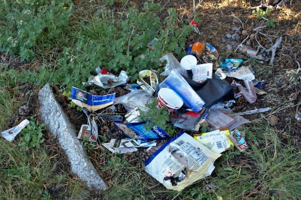
Soon, the sunrise colors have faded and harsh light sweeps over the landscape. I pack up my things and prepare to leave. Before departing the lake area, however, I walk over to a disturbing sight I noticed on my walk to the high pass yesterday: some idiot left a huge pile of food wrappers and containers next to the trail. From the looks of things, this person thought it would be wise to store their food in a nylon stuff sack and an animal got into the sack. Rather than pick up the resulting mess, said schmuck left it there… I can’t in good conscience leave the trash here now that I’ve seen it, so I stuff it into my now empty bear can, grumble about the idiocy of some human beings, and begin my trek back to Agnew Meadows.
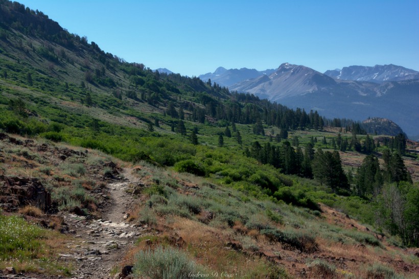
Rather than retrace my steps down the JMT, I take the Pacific Crest Trail. This section of the PCT follows the ridge above the River Trail and is supposed to have fantastic views of the nearby mountains. The first few miles climb gently from the lake; I take a brief detour to Clark Lakes and Agnew Pass. This little stint adds a few miles to my route for the day, but I don’t really have that many miles to hike! Besides, the little lakes are beautiful and everything is quiet and peaceful.
As I crest Agnew Pass, I get a good view of the canyon that leads down to Agnew Meadows. Banner Peak and the Minarets tower above the landscape… I stand still and take in the views for a few minutes; the reviews were 100% right when they said the vistas on the PCT are incredible here!
The rest of my hike is fast and easy. The PCT gently descends for five and a half miles as it follows the ridge back to Agnew Meadows. Even the final few miles, which include a series of switchbacks, aren’t very steep and are easy on my tired knees. A short 0.4-mile stroll from the trailhead brings me back to the main road and the bus stop. There are a bunch of other hikers waiting at the bus stop. I recognize two of the men from last night; they were descending from North Glacier Pass as I was ascending. I chat with them for a few minutes and learn that they’re hiking the Sierra High Route, which has no established trail. I may have to do some research and try to hike that… it sounds awesome! Soon, a bus arrives and all of us smelly, dirty hikers climb aboard. It’s a 15-minute ride to the Mammoth Lakes Ski Lodge. Once we arrive, I say goodbye to the few people I’ve met along the way and then stroll over to my car. Every time I return from an overnight trip, I’m nervous about my car being gone. What if I parked in the wrong place and someone towed it? Thankfully, that is not the case today and my vehicle is still parked where I left it. Two nights ago, when I arrived here at the lodge at 18:30 or so, the place was nearly empty and I assumed it didn’t get much business during the summer. I was very wrong: the place is packed today! There are families and kids all over the place enjoying a climbing wall and other outdoorsy activities. The line to get on the shuttle bus toward Agnew Meadows and Devil’s Postpile is 30 – 40 people long! I was the only person on the shuttle two nights ago at 7 pm. I suppose arriving late in the evening may very well be the best way to avoid the crowds. I toss my gear in the back seat and back out; a lucky tourist gets my spot right next to the lodge.
Thus ends my summer adventures in the California Mountains! I’ve had a great time and cannot wait to come back out. The JMT is definitely in my future, and perhaps the Sierra High Route as well.


gabigabs111 9 September 2016
Beautiful area to enjoy.
Roger Nelson 17 April 2018
Looks amazing, I’ve been wanting to go see 1,000 islands lake (or less than 1,000 islands lake). I was wondering what trail permit you got? River Trail?
Andrew Cox 17 April 2018 — Post Author
It’s a great spot! Yes, I got the River Trail permit.