It all began when my friend Theresa asked if anyone wanted to plan a trip up into the Sierra Nevada mountains for next weekend. Sure, I thought, that sounds like fun! After spending an hour on the internet, I had a rough itinerary and pitched it to Theresa and John. There’s a not too difficult 14-er named Mt. Langley within a few hours’ drive from LA that we could climb. Of course, the permits for the next weekend(the 4th of July) are long gone, but there should be 24 walk-up permits available. If we show up early on Saturday morning, we should be able to snag a few. It is a holiday, so there will likely be a lot of people out hiking, but surely three of the 24 permits will still be available. The only way to find out is to go and see!
Trip Planning
There are many high-quality maps of the Mt Whitney area, including the National Geographic Mt Whitney map and Tom Harrison’s Mt Whitney High Country and Whitney Zone maps. The Whitney Portal trail is also represented on the National Geographic Sequoia Kings Canyon map.
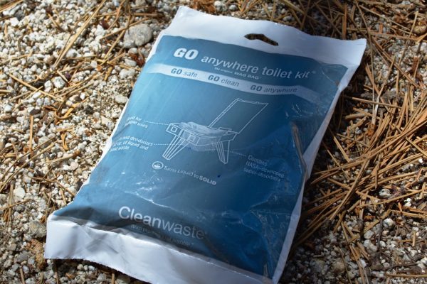
Permits are required for all overnight and day hiking trips in this area and, due to the popularity of the region, are very difficult to come by. You can reserve one online months ahead of time or try your luck at the daily permit lotteries for a walk-up permit. The usual Sierra Nevada rules and regulations apply (bear canisters are required) and take care to leave no trace! Additionally, due to the high altitude and high traffic volume you are required to pack out all solid waste in a “wag bag.”
A Glorious Commute
July 1, 2016
John, Theresa, and I meet up on Friday afternoon after finishing our work for the day. We stuff our backpacks into the trunk of Theresa’s car, hop in, and get the heck out of town. As it’s a holiday weekend, the highways around LA are clogged with travelers. To avoid that mess, we take the Angeles Crest Highway through the San Gabriel mountains and then diverge off toward Lancaster, avoiding any traffic on the 210 or the 5.
The first few hours take us through the Mojave desert: we pass through Lancaster, Palmdale, and then make a stop in the city of Mojave for fuel and cheap gas station food. As we continue north, the mountains begin to grow larger, teasing us with promises of adventure as we drive through the flat, dry desert.
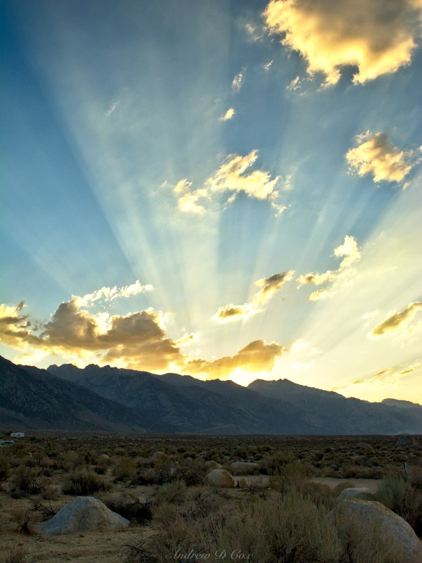
We arrive in Lone Pine, CA, a small mountain town at 3,700′ in the desert valley between the Sierra Nevada and White mountains, in the early evening. The sun is beginning to set and is sinking behind the Sierras. We drive a little west of town to a BLM campsite named Tuttle Creek. As we pile out of the car, the sun casts rays across the hazy sky; what a sight!
A few of our neighbors inform us that there is a fire burning on Whitney Portal Road a few miles away, which explains the haze in the sky. As the sun sets, we can make out a red glow in the distance from the blaze. It grows brighter when the wind picks up; we worry that it may spread toward us but decide that, if that becomes the case, the fire crews will certainly tell us to leave. With that comfort in mind, we squeeze into our 3-person tent and try to sleep. I often struggle to sleep the first night outdoors, and tonight is no exception. It’s a little too warm and too crowded to sleep soundly. It’s hard to be too unhappy camping so close to the Sierras though; we all eventually doze off.
Winning the Lottery
July 2, 2016 | 6.7 mi | +3,766′ / -81′ | View on Map
When I wake the next morning, the sky is full of haze from the fire. We all eat breakfast and then drive over to the ranger station to attempt to secure permits for the Cottonwood Lakes trail to Mt. Langley. We’re early, so we wait outside with other hopeful hikers until the office opens. At 8:00 sharp, a ranger comes outside with a box full of tickets. Each group leader draws a number; we’ll be called up to get permits in the order of the numbers we draw. I draw 12, which isn’t too shabby considering there are 30+ groups here. A few minutes later, my number is called and I walk up to the counter and ask for permits for the Cottonwood Lakes trailhead. The ranger informs me that there aren’t any free; they were likely claimed at the 11:00 lottery yesterday. There will be another lottery today at 11:00 for permits that leave tomorrow. I’m a little disappointed, but we can easily complete our summit bid in two days, so we leave the station and plan to come back in a few hours for the next lottery. In the meantime, we drive over to the Alabama Hills and scramble around on the rocks.
We return to the ranger station at 11:00 and once again wait for the lottery. John draws a 7 this time and we wait patiently for our turn to request permits. I’ve never done anything like this; I always reserve permits ahead of time to avoid the stress of wondering whether or not I’ll be able to go on my hike. Soon enough, our number is called and we go up to the counter. We figure that, while we’re here, we might as well ask and see if there are any permits available to hike up to Mt. Whitney. For those of you that aren’t familiar, Mt. Whitney is the tallest mountain in the lower-48 states at 14,496 feet above sea level. It’s a hugely popular hike! We met a man in the crowd who’s been trying to get permits to hike Whitney for five years! We tell him that if we get permits, we’ll add him to our group so he can finally make his summit bid.
None of us expected there to be any Whitney permits available, but when John tells the ranger we’d like permits for Whitney Portal, the ranger asks, How many do you want? Four, we respond.
Overnight or day hike?
Overnight.
When do you want to start?
Uh… today?
Ok, here you go!
WOOOOO! We have Whitney permits! And for today, of all things! How in the world were they not all claimed yesterday? The only explanation is that the fire on Whitney Portal Road scared a few groups into abandoning their plans, freeing up their permits.
Overjoyed, we all call our emergency contacts to update them on our new plans. We carpool with our random friend from the crowd up to the Whitney trailhead, gushing with excitement the entire way. Recall that Lone Pine is located somewhere around 3,700′ MSL; the drive up to the trailhead takes us up to 8,400′, into a beautiful alpine forest. In contrast to the desert below where the temperatures are already reaching the mid 80’s, it’s a cool 65 at the trailhead. Still bouncing off the walls with excitement, we change into our hiking clothes and finish packing our backpacks. One of the unique aspects of hiking up to Mt. Whitney is that you’re required to pack out your poop. The forest service makes this a little easier by providing “wag bags,” which are essentially glorified ziplock bags; we each have one, and we stow them away in our packs.
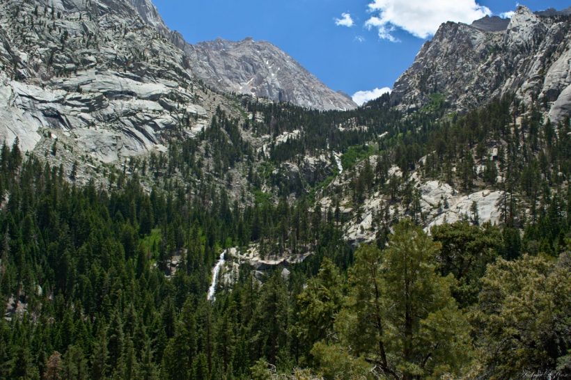
As soon as we finish organizing our gear, we hit the trail. The sun is warm and there are no clouds to provide shade, but we don’t mind: we’re on our way to Mt. Whitney! The first section of the trail consists of long switchbacks that climb up into the mountains, away from the road and parking lot. After only a mile or two, we get our first glimpse of the wilderness ahead: huge granite cliffs, cascades coursing down the rock, and pine trees as far as the eye can see… paradise.
The next few miles yield more of the same, though there are fewer switchbacks. It’s incredible how alive the mountains are when there is a desert a few miles away. The creeks are raging with snowmelt, flowers are blooming everywhere, and we even see a young Ptarmigan family!
As we hike higher and higher into the mountains, it becomes more difficult to climb. Well, it becomes more difficult for Theresa and I. John leaves us in his dust as he excitedly hikes up the trail. Once we reach 11,000′, I really begin to tire out. We’ve already hiked around 5 miles and have ascended 2,500′, which is reason enough to be a little weary, but it’s the lower concentration of Oxygen that makes the climb so difficult. We each settle into our own paces and spread out, concentrating on the trail. I stop to take photos every so often; there is so much beauty to capture up here!
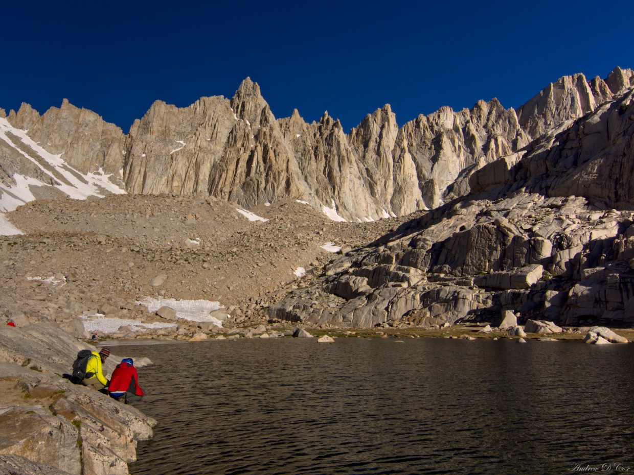
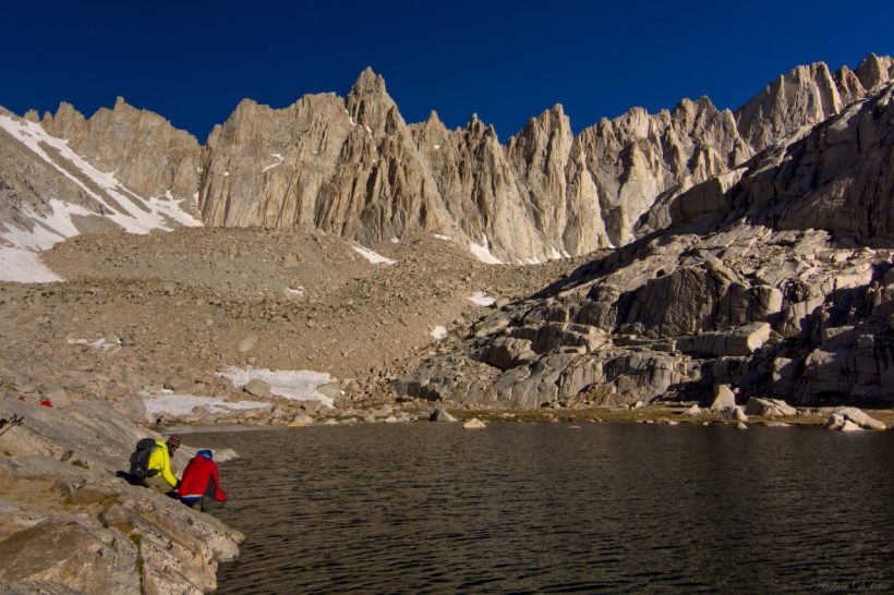
John arrives at Trail Camp (elevation 12,000′) well before Theresa and I. By the time I reach camp, my head is pounding and I feel a little dizzy. That’s what the elevation does to you. However, I feel much better after resting for a few minutes. Trail Camp is located well above tree line and the landscape is dominated by huge granite outcroppings; there isn’t much green around. Not far from camp is a small lake of frigid water; the western bank is a snowfield, and there is no inlet other than the melting snow. Drinking water from the lake is particularly enjoyable: the water tastes sweet and is icy cold.
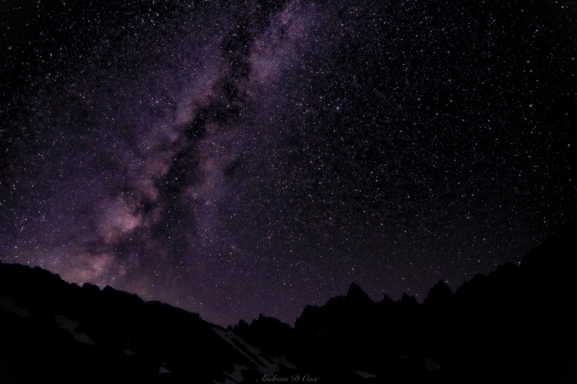
We set up camp in one of many flat clearings amidst the rocks and boil some water for dinner. We’re all tired and don’t spend much time talking once the sun goes down. At this altitude, the temperature drops quickly after the sun sets and there are no trees to shelter us from the wind, so we crowd into the tent to escape the elements. In contrast to last night, the close quarters and accompanying warmth are quite welcome! I wake up in the middle of the night and brave the cold for an hour to capture a few shots of the stars. Yet another amazing aspect of the mountains: there is very little light pollution and the scenery is amazing even when the sun has set.
Mt. Whitney Summit
July 3, 2016 | 11.4 mi | +3,031′ / -4,680′ | View on Map
When I wake the next morning, it is very cold. What a strange sensation, to experience cold in the middle of the summer! I eat a delicious ziplock bag of raisin bran and rehydrated milk and then prepare to climb Mt. Whitney with John and Theresa. We leave most of our gear at camp: the tent, sleeping bags, sleeping pads, and bear cans all stay behind. The route from camp doesn’t waste any time beginning the climb. Rumor has it that the trail includes 99 switchbacks on the way up to the ridgeline. I wouldn’t be surprised if that were true. Like yesterday, John, Theresa, and I spread out and hike at our own paces as we ascend. There are several small streams gurgling down the rocky slopes and over the trail, and the nearby slopes are full of spring blossoms. Thankfully, there is no snow on the switchbacks, though there are a few small patches hiding in the shade of the rocks nearby.
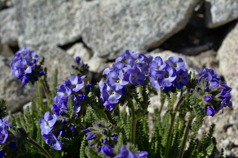
These little flowers flourish at high altitudes where barely any other life of any kind can be found!
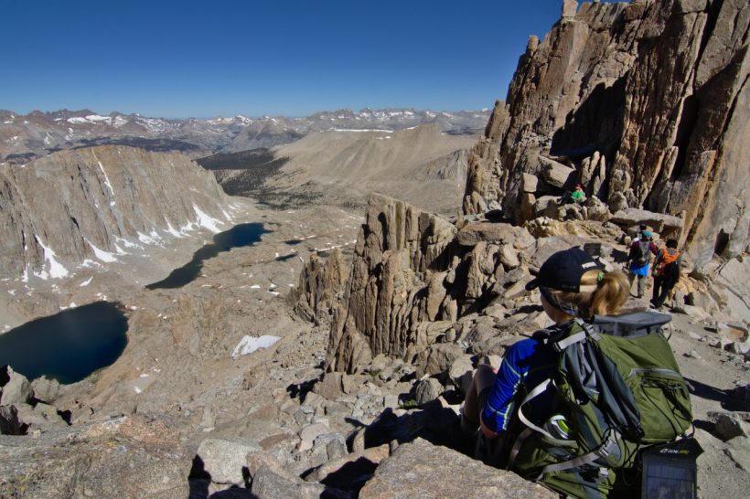
The switchbacks end at the ridgeline, i.e., at “trail junction.” We’ve completed most of the climb at this point and sit at 13,400 above sea level. I’ve got a headache again from the combination of thin air and rapid heartbeats. I pop a few vitamin-I and feel better soon after. John, Theresa, and I regroup and spend a few minutes resting and admiring the views. On the east side of the ridge is the trail we just climbed; Trail Camp lies far below, and the desert even farther. The landscape to the west is dotted with high-altitude lakes; this is Sequoia National Park! We chat with several other heavily breathing hikers as we snack, rest, and admire the view.
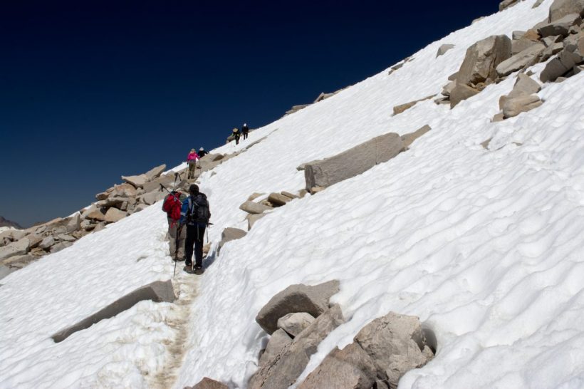
The final few miles to the summit are much less steep than the switchback section we just completed, but somehow feel more difficult (to me, at least). I have to stop several times along the way to breathe. One of the hikers on the trail suggests taking really deep breaths and then expelling all air from my lungs. It seems to help! We cross a few snow fields just before reaching the summit. The snow is a little slick, but many boots have flattened the path and it’s fairly easy to walk across without microspikes, crampons, or trekking poles.
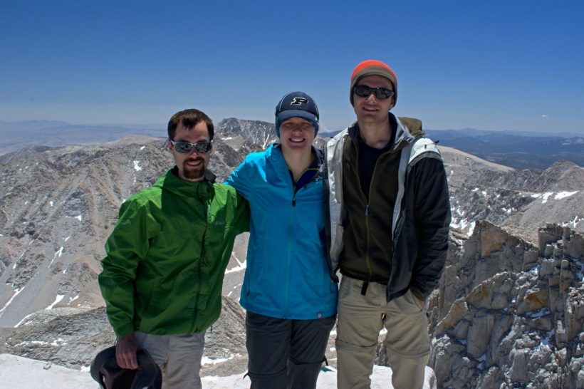
The summit of Whitney is wide and very flat. Massive slabs of granite lie every which way, providing ample seating for everyone who completes the climb. The wind isn’t too bad up here, which is surprising, but welcome. We spend an hour or so admiring the view, taking photos, and eating more snacks. There are all sorts of people on the summit: PCT thru hikers, day hikers, overnight campers like us, and a group of people that climbed to the summit via the mountaineer’s route. Because the hike isn’t technically difficult, this summit is one of the most popular in the area.
We begin our descent at about 13:00. Hiking downwards at altitude is much easier than hiking up! We stop along the way and try to climb Mt. Muir, another 14-er near the trail, but cannot quite make it to the top as the approach becomes incredibly steep (vertical, really). I’m all for scrambling up scree slopes, but I’m not about to attempt a vertical ascent without some climbing gear. The switchbacks take quite a while to descend, and I think I can speak for all of us when I say that it was much less exciting than the ascent was.
Back at Trail Camp, we pack up the rest of our gear and continue down the mountain in search of a warmer and more sheltered camp site. We pass plenty of beautiful views on the way down: snowmelt rushing over fields of boulders, and puffy clouds lazily floating over the majestic granite landscape.
We descend a few thousand feet to Outpost Camp and find in the trees. Theresa sets up a hammock to sleep in, leaving John and I all sorts of room in the tent. We feast on our food and relax while reflecting on the day. Every once in a while one of us remarks, still in disbelief, Guys, we got Whitney permits!
Reluctant Descent
July 4, 2016 | 3.6 mi | +77′ / -2,113 | View on Map
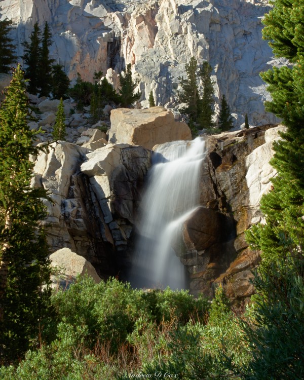
The next morning – our last in the Sierras – I wake up with plenty of time to watch the sun rise and illuminate the nearby peaks. I identified a neat composition of a nearby waterfall last night and spend some time this morning capturing a photo of the water in the early morning light. However, conscious of the fact that we still have a 3.5-hour drive home and work tomorrow, we don’t tarry too long at camp. After eating breakfast, we pack up our gear and continue down the trail toward the car.
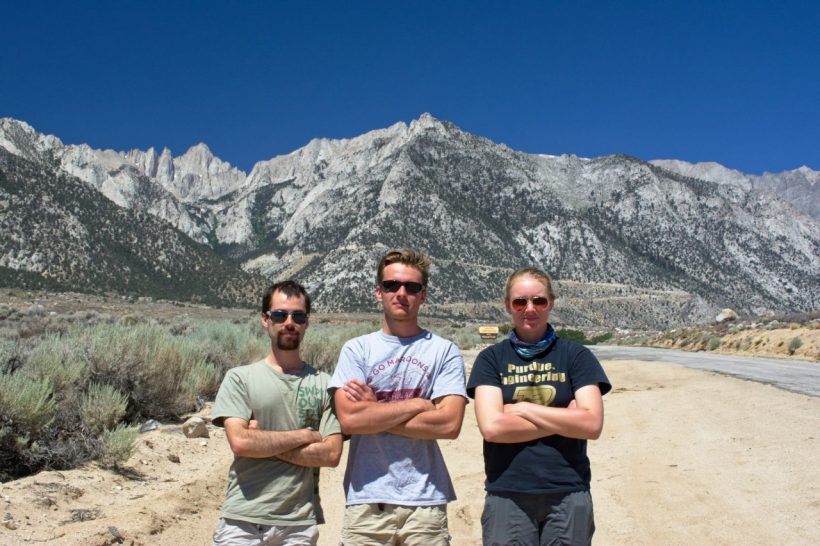
The hike out is a little subdued. Leaving the cool, beautiful mountains and returning to the hot, dull desert is not very appealing. The going is quick, however, and we’re back at the trailhead before we know it. After soaking our sore feet (descending is rough on the feet) in a cold creek for a few minutes, we drive back down Whitney Portal Road towards Lone Pine. A quick stop on the side of the road scores us a victory photo with Mt. Whitney in the background before we take our leave of the mountains… for now.






janerunswild 14 July 2016
Wow, that’s an absolutely breathtaking hike! Thanks for the interesting and exciting details of the climb. I’d love to get out there one day!
BoobOnARock 14 July 2016
Incredible hike! And I love that you were able to give the other hiker the opportunity to climb with you!
Laurie Schwaller 28 August 2023
082823 Dear Andrew — We are writing to request permission to use your photo of the Milky Way from Trail Camp to help to illustrate our article on the Smithsonian Shelter on Mt. Whitney on our totally non-commercial, non-profit, all-volunteer, public-interest website, http://www.tularecountytreasures.org.
Our mission is to celebrate, educate, and inspire by sharing the stories of the amazing variety of places that have been conserved in our county and are open to the public, and the dedicated people who have worked to protect and steward them.
If we may use this photo, please let us know how the credit should read.
Please respond to my email. Thank you for your prompt response, and for your beautiful and informative website.
— Laurie S./for TCT Project Team
559-561-0111