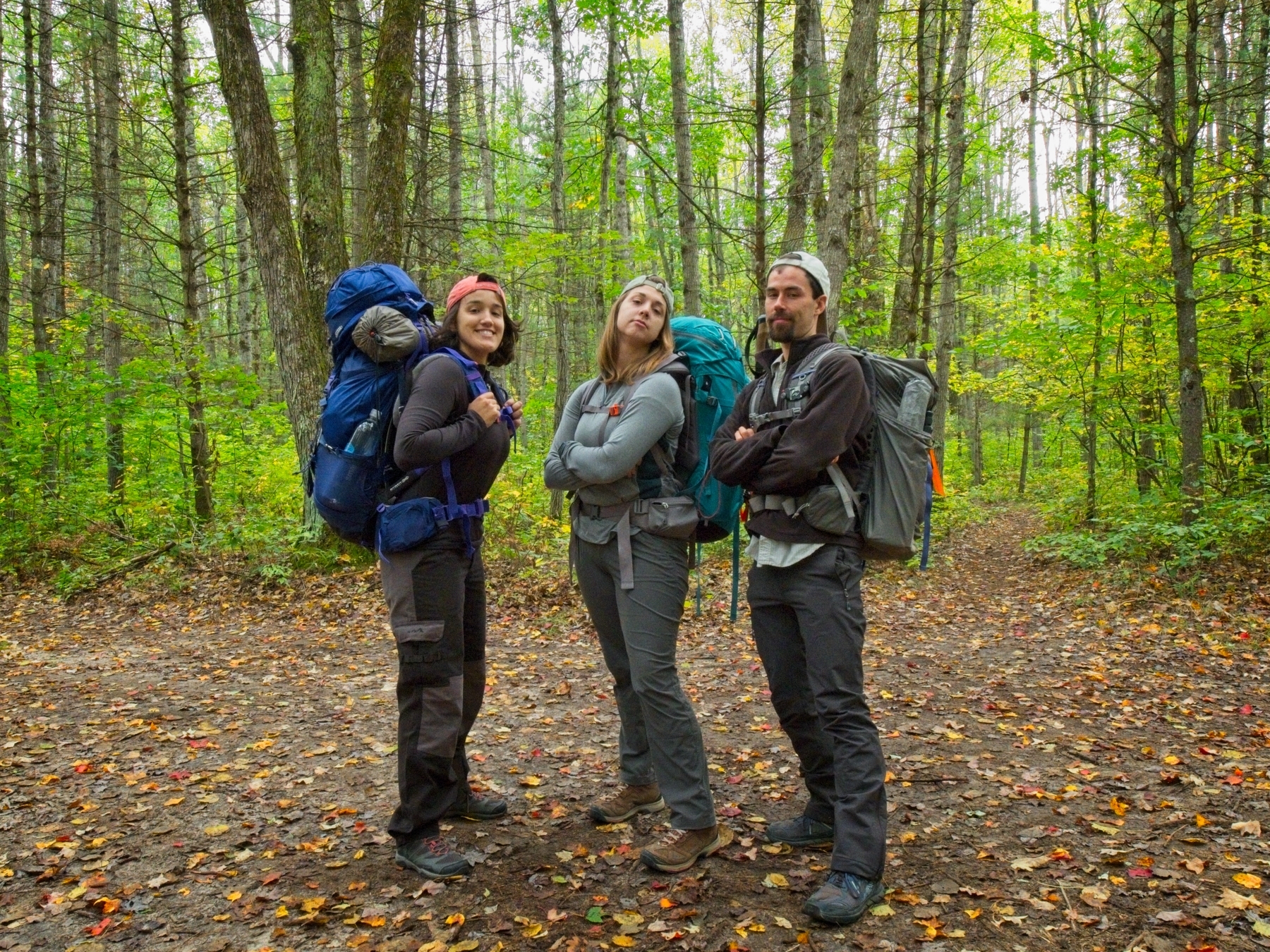
One day at work, Emily suggested that we snag some cheap airline tickets to Denver, CO and spend a long weekend in October backpacking in the Rocky Mountains. After a frenzied hour of planning we realized that the cheap tickets were not so cheap once you account for baggage… we were still determined to get outside though, so we reduced our travel radius to the Midwest and kept searching. We eventually settled on the Manistee River Trail in northern Michigan and recruited our friends Kenza and Juan to join us. Unfortunately, Juan was unable to come along, but Emily, Kenza, and I very much enjoyed a leisurely weekend on the trail!
Trip Planning
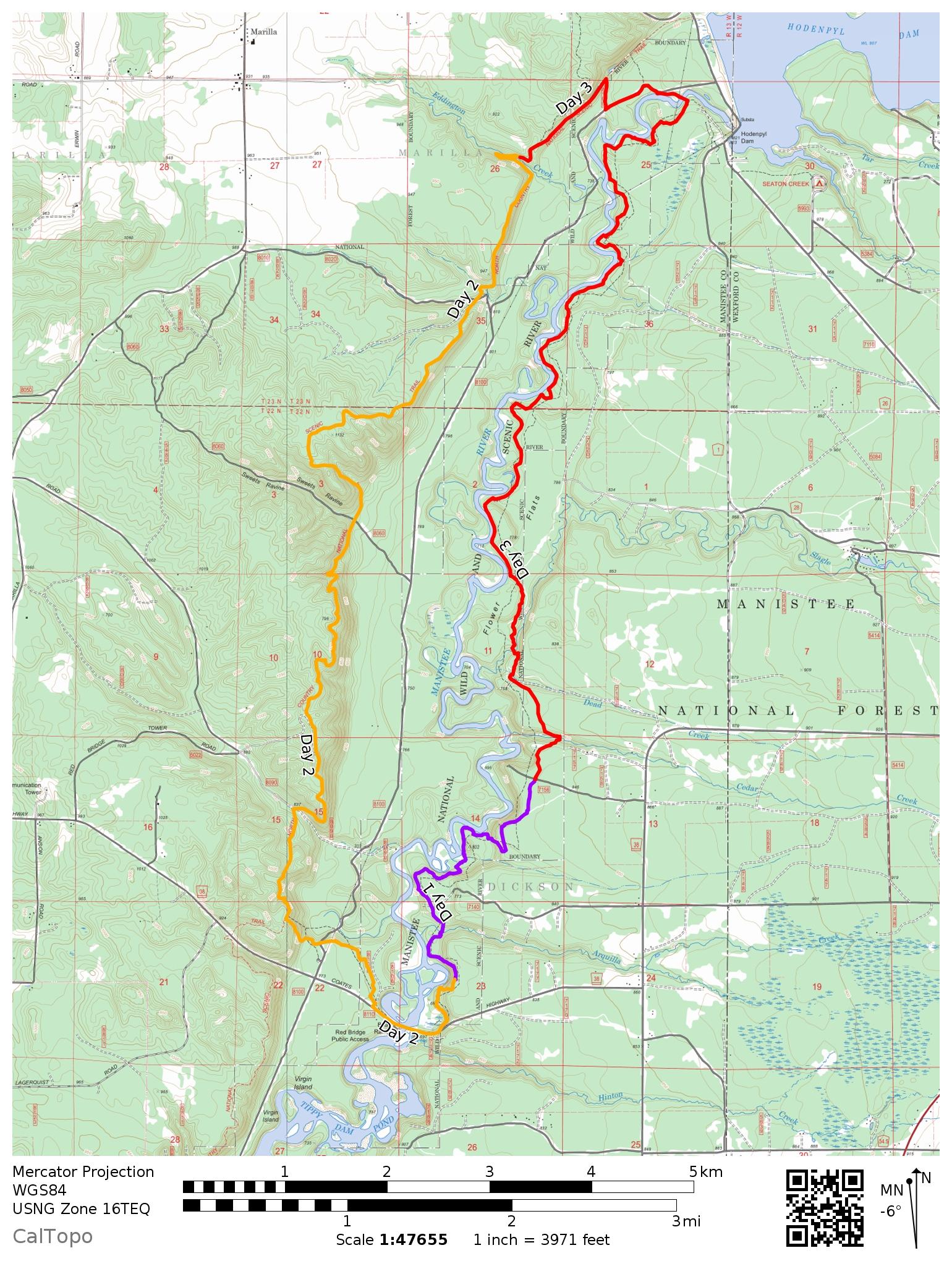
Specs: 19.1 mi | +/- 2540 ft | 2+ days / 1 night
Difficulty: Class 1 [learn more]
Location: Manistee National Forest, Michigan | 44.36207, -85.8221 | Home of the Odawa people | View on Map
Route: The route is pretty straightforward. The Manistee River Trail and North Country Trail form a 20-mile loop with a number of access points. Begin at one access point and hike the loop in whichever direction you choose!
Permits and Regulations: As this loop is located within the Manistee National Forest, regulations are sparse. A permit is not required to hike or overnight on this loop and dispersed camping is allowed along both trails; there are also established campsites (free; first come, first served) along the Manistee River Trail. Parking is free at Red Bridge, Cottage Road, and South Slagle Creek Road. Parking and camping at the Seaton Creek Campground costs a small amount, paid at a self-registration station. As always, you are expected to follow the Leave no Trace principles to preserve this beautiful landscape for all outdoor enthusiasts!
Resources: I found a map from Michigan Trail Maps to be a great resource; it marks all of the established campsites, mileages, attractions along the trails, and parking locations. The National Forest website also supplies an abundance of useful information.
Walking the Manistee River Trail
5 October, 2019 | 2.5 mi. | +330 / -350 ft | View on Map
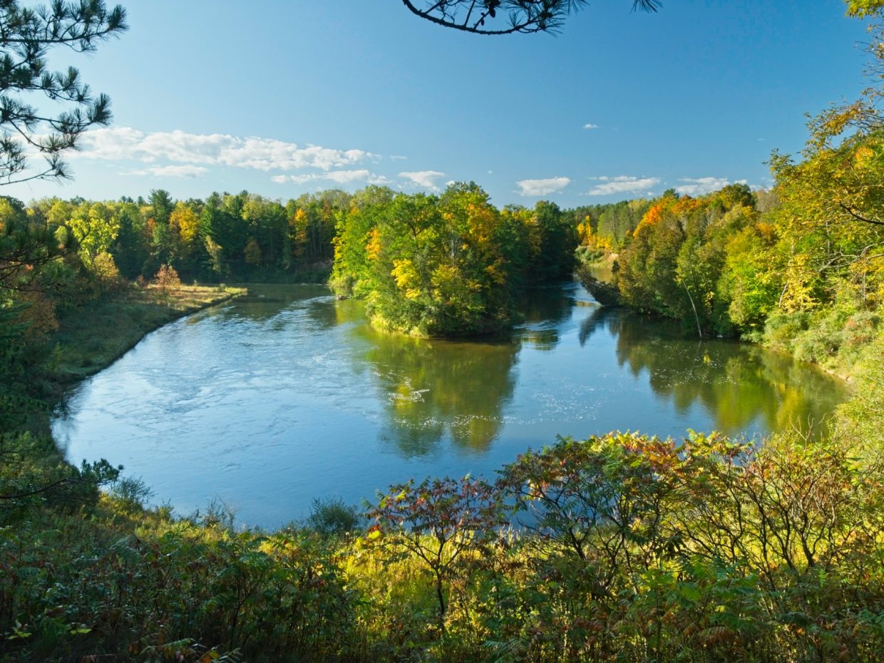
After a long drive to Northern Michigan, Emily, Kenza, and I are excited to spend some time out in nature. The leaves are beginning to turn and the air is cool; basically the perfect conditions for backpacking! We park the car at the Cottage Road parking area, near mile 7.8 of the Manistee River Trail and, after changing into our hiking clothes, hit the trail.
From the road, the path takes off through a tunnel of young trees before breaking through into a more open pine forest. The ground is littered with brightly colored leaves from the occasional oak or maple tree and the late afternoon sun streams through the canopy. We pass several occupied campsites with excellent views of the river as well as a few spots nestled beside the shore. There are a fair number of people out this weekend, which isn’t surprising; the forecast calls for sunshine and cool temperatures!


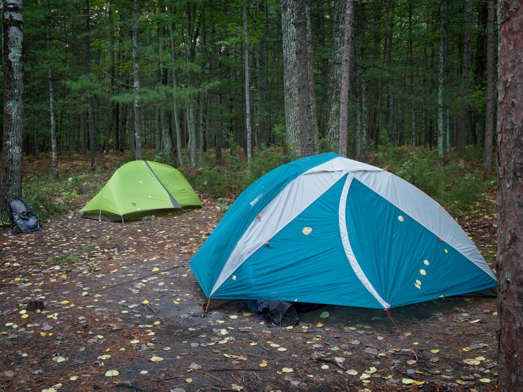
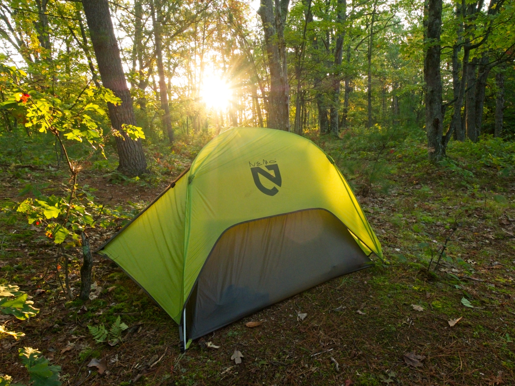
We stroll down the trail, into riverside marshes, through dark forests, and over open ridges. We’re actively looking for a campsite since there are only a few hours of daylight left, and we have plenty of options within a few miles. The first five or six sites we pass are occupied, but we manage to snag the last spot on the trail, site 10b. Marked with a waist-high blue Carsonite post, 10b is spacious and sports an excellent view of the river and the colorful trees. A light rain begins to fall as we set up camp, so we pull on our rain gear before relaxing and eating dinner.


The drizzle continues into the evening, and we eventually retire to our tents to stay dry and comfortable.
The North Country Trail
6 October, 2019 | 8.9 mi. | +1380 / -1360 ft | View on Map
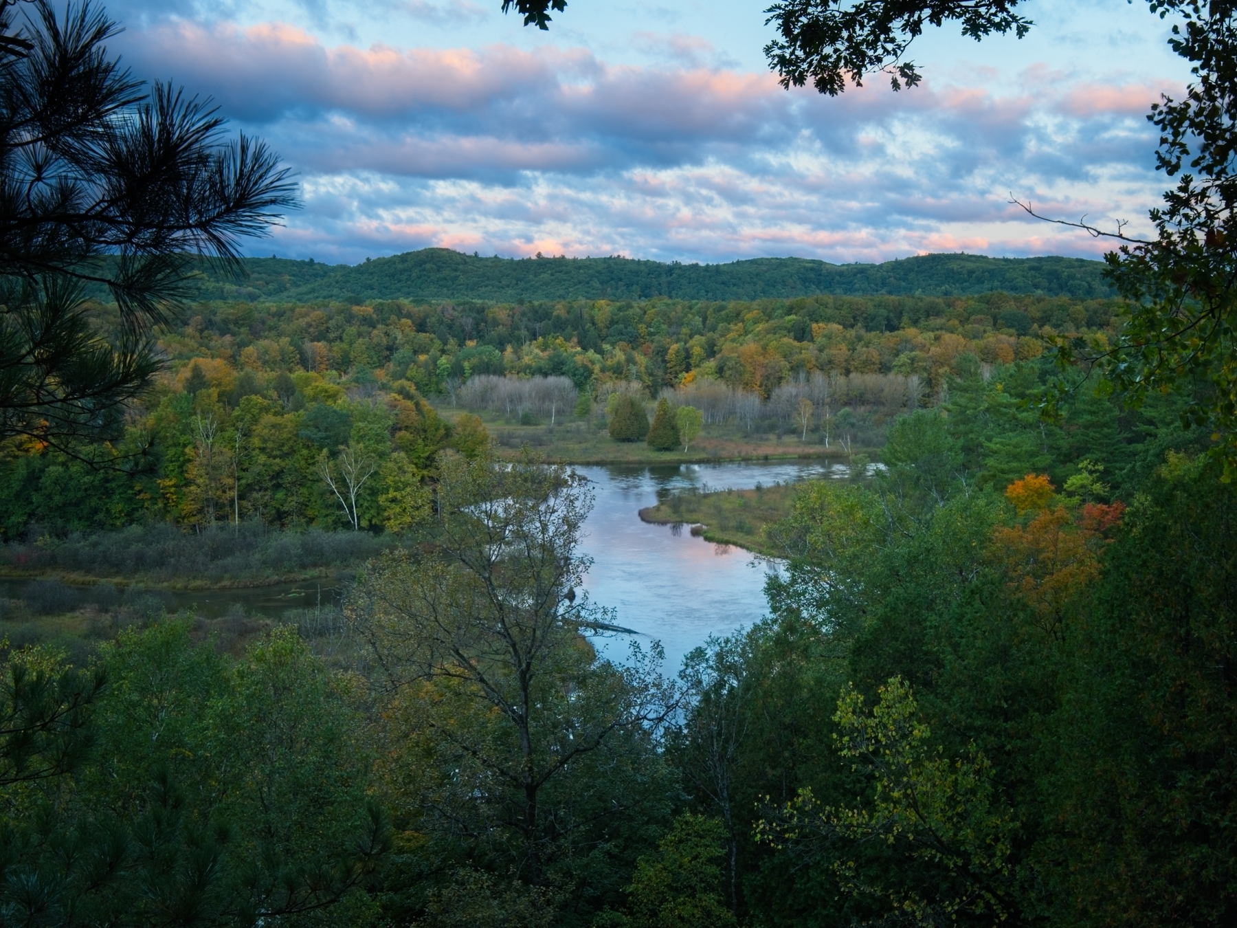
When I wake up in the morning, I’m happy to find that the rain is gone and the sun is peeking over the horizon. The clouds above the river valley turn purple and then pink as the sun climbs higher, a beautiful show to begin the day!


After eating breakfast, we pack up camp and hike a few tenths of a mile to the Red Bridge, which, incidentally, is not red. Kenza, Emily, and I filter water from the river to prepare for the day’s hike. We won’t encounter reliable running water again for about 10 miles, so we fill all of our bottles. In the summertime, the spigot located in the nearby campground supplies potable water, but it has been shut off for the season already.


Once we’ve tanked up, we shoulder our packs and hike a short distance (and up a few steep hills!) to the North Country Trail (NCT). The NCT stretches over 4,600 miles from Vermont to North Dakota, although it isn’t complete yet. Needless to say, we’re not going to walk the entire NCT; we’ll follow it northbound for eight miles or so. In contrast to the Manistee River Trail, the NCT winds along a forested ridge out of sight of the river. The NCT also includes much more elevation change than the Manistee River Trail, but that isn’t a very high bar to surpass.


We take our time strolling through the woods. Around noon we stop at Red Hill, one of the high points on this section of the NCT, to eat lunch and hopefully admire some nice views. The outlook is a tad underwhelming, but Red Hill is as good a lunch spot as any. After lunch, we continue along the NCT. It’s a pleasant walk with plenty of shade, dappled light, and colorful leaves. Despite the practically perfect weather, we don’t see hardly any other people besides a couple of mountain bikers.


In the early evening, we locate a nice campsite on a small ridge above Eddington Creek and decide to stop for the day. We set up our tents, still a bit wet from the rain last night, and then relax around a campfire. I appreciate the heat from the small blaze; while the temperatures during the day have been very comfortable, it’s getting chilly as the sun goes down! After eating dinner, we all relax with cups of tea and enjoy the rest of the evening.


Return to the Manistee River Trail
7 October, 2019 | 7.67 mi. | +830 / -830 ft | View on Map
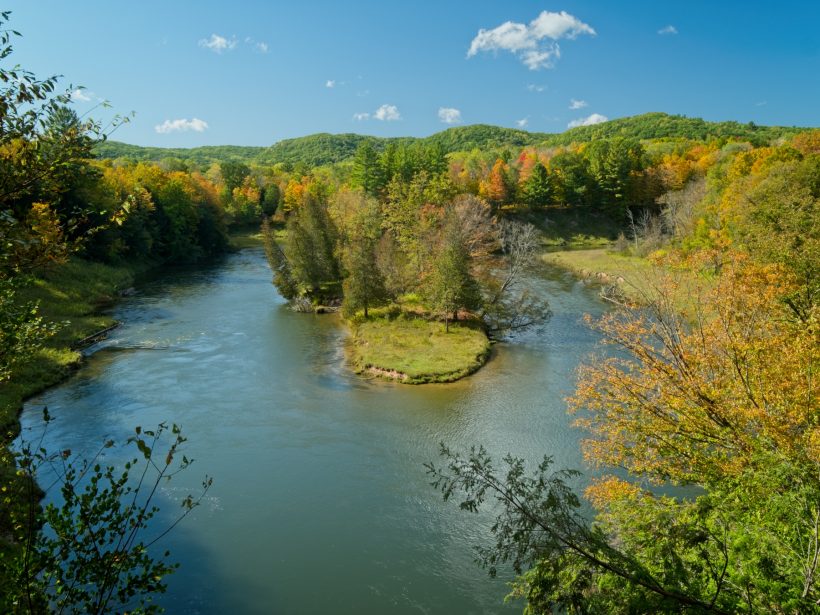
The next morning is once again sunny and cool, another perfect day for backpacking. The beginning of our hike this morning follows an old railroad grade, which makes for an easy walk. About a mile from our campsite at Eddington Creek we turn onto a spur trail that leads back to the river and a suspension footbridge! After crossing the bridge we rejoin the Manistee River Trail.


Walking alongside the river turns out to be much more beautiful and scenic than the ridge-bound North Country Trail. Honestly, hiking the Manistee River Trail as an out-and-back might be preferable to the loop.


A short distance down the trail we pass a “waterfall.” According to the information on the map I’m carrying, this is only the second waterfall ever discovered in the lower peninsula (in 1990)! With a total drop of perhaps five feet, it’s not surprising that it was discovered so recently; perhaps it’s more impressive in the springtime when the creeks are flowing more vigorously.


We take our time this morning, stopping to look at colorful trees, to eat snacks, and to generally enjoy the beautiful weather. Around mid-morning, we stop on the bank of the river for a snack break. Kenza soaks her feet in the river, and Emily and I take a nap in the sunshine. I don’t think I’ve ever stopped for a morning nap before on a backpacking trip, but it’s awfully nice.


After our mid-morning break, we continue strolling along the trail. Much of the path follows the ridge just above the Manistee River; a few 180-degree turns of the river supply wonderful views. When we’re not walking high on a ridge, we follow the trail through shady groves of trees on the shoreline. However, as we get closer to the car, we leave the river behind for a while, crossing Slagle Creek and then Dead Creek and Cedar Creek. A short climb through a forest of tall pines later, we arrive back at Cottage Road, right where we left the car. It’s still there, covered in a layer of fallen leaves, waiting to carry us home.
Steve Cox 2 March 2020
Beautiful. Lots of smiles… looks like you had a great time.
Brian Burtrum 25 March 2020
Awesome trail.
Tom 13 August 2022
I am thinking of taking my young twins hiking there but to test them I just want to hike about a couple miles and turn around and go back to my car. Where is the best place to get the most out of two miles? Thanks!
Andrew 14 August 2022 — Post Author
Hi Tom. I would go down by the Hodenpyl Dam – there’s a cool bridge there and some nice trees. But really the whole east side of the river is gorgeous!
Tom Elliott 15 August 2022
Thanks Andrew. Is there parking at Hodenpyl Dam? I take it I would walk south from there? Does anybody offer a service of giving you a ride back to your vehicle? Just curious if Uber works there? Sorry if these are dumb questions but I am just trying to figure out how to have the best time with kids. Thanks again!
Andrew 28 August 2022 — Post Author
Hey Tom, Google Maps shows a parking lot near the dam. I’ve only been once (for this trip) so my memory is a little fuzzy. Yes, definitely walk south (on the east side of the river). I’m not sure about shuttle services, but it’s pretty remote so I wouldn’t rely on ride share. I bet the Forest Service can answer your questions: Cadillac/Manistee Ranger District – 231-577-8902
Rachel 15 February 2023
Hi Andrew – did you have to forage for your own firewood?
Andrew 5 March 2023 — Post Author
Hi Rachel – yes, we did forage for our own firewood.