Last summer I joined the DC ultralight backpacking club (DCUL) while I lived and worked in the DC area. I really enjoyed the trip I took with them to the Dolly Sods so when the opportunity presented itself to join a group of DCUL folks on a trip to Death Valley National Park, I signed up immediately. On this excursion, we visited Death Valley and hiked the popular Cottonwood/Marble Canyon Loop, a 26-mile route that traverses remote wilderness and awe-inspiring canyons.
Trip Planning
Specs: 30.0 mi | +/- 4900 ft | 2+ days / 2 nights
Difficulty: Almost entirely class 1 with a brief class 4 section [learn more]
Location: Death Valley National Park | View on Map
Permits & Regulations: Backpackers are required to obtain a free backcountry permit from either the Furnace Creek Visitor’s Center or the Stovepipe Wells Ranger Station. Backcountry camping is permitted with some restrictions. The biggest backcountry challenge in Death Valley is ensuring you have enough water; check with rangers before beginning your trip and be prepared to cache or carry enough water for your entire hike. And, as always, practice good outdoor ethics and leave no trace! The desert is as fragile as any other natural area, so be sure to read the Death Valley backcountry ethics tips before hiking.
Resources: Both National Geographic and Tom Harrison offer maps of the entire Death Valley area. If you have the ability to print your own maps, check out this topo from the NPS of the Cottonwood/Marble Canyon Loop or visit CalTopo and create your own customized map. I packed both the National Geographic map and the NPS map and found them sufficient, but a functioning GPS was also useful during some of the more difficult route-finding sections.

Death Valley: The Quick Tourist Visits
As the name suggests, the DCUL club is based in Washington DC, thus, we all flew to the west coast for this trip. To avoid stressful time crunches, we arrived early and spent half a day checking out some of the most popular spots in Death Valley via car. If you’re visiting and need tips on what sights you should prioritize, I recommend reading through the “Plan Your Visit” pages on the NPS website.
Badwater Basin
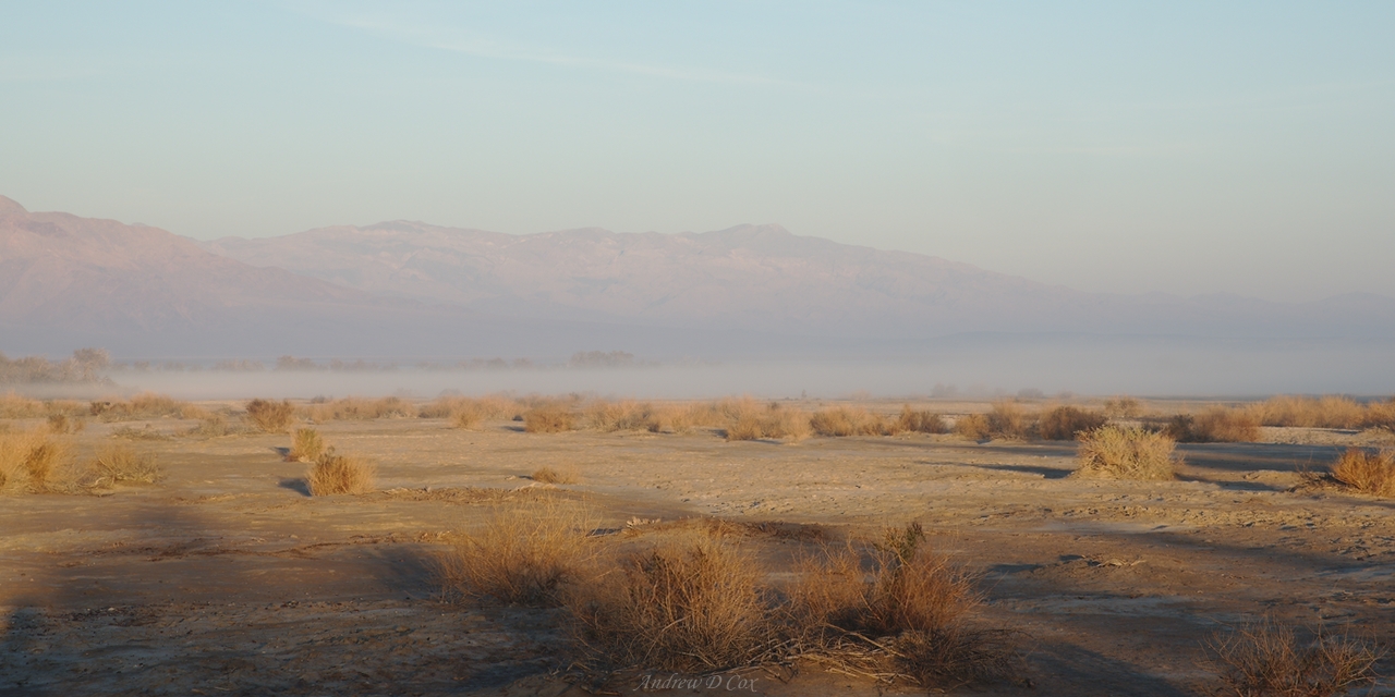
One of our first stops, after picking up permits and visiting our campsite for the night, is Badwater Basin, the lowest point in North America at 282 feet below sea level. The landscape consists of miles and miles of salt flats and is bounded on the east and west by mountains. It rained a few days before we arrived, so there is a shallow pool of water about a mile from the parking lot.


Artist’s Drive
The next attraction on our mini-tour is Artist’s Drive, a short, scenic loop through colorful volcanic and sedimentary hills. We pull off the loop at an overlook for “Artist’s Pallete,” and spend a few minutes admiring and photographing the hued landscape. Between the ten of us, there are at least five or six DSLR, mirrorless, and micro four-thirds cameras, so we have no shortage of images.


Mesquite Sand Dunes
Someday I would love to come back to the sand dunes and try my hand at photographing them in the early morning or late evening light. We visit in the late morning – the sun is already high in the sky and the dunes are covered in thousands of footprints. I enjoy exploring barefoot in the soft, cool sand; Dave and Aileen both try sand-sledding but discover that the slightly damp sand (from those recent rains) is too viscous to facilitate sledding.


Zabriskie Point
We visit Zabriskie Point during the golden hour and enjoy the warm evening light as the sun sets over the Panamint Range. After a long day of driving and walking, it’s nice to relax and passively take in the views.


After admiring the desert views from Zabriskie Point, we enjoy dinner in Stovepipe Wells and then return to our campsite at Furnace Creek. If you’re planning to camp in Death Valley, I would recommend Furnace Creek over the sites at Stovepipe Wells; Furnace Creek has trees and bushes, and its proximity to many of the popular sights is unbeatable.
Cottonwood Canyon
January 13, 2018 | 12.7 mi | +2800 ft / -100 ft | View on Map
Daylight begins creeping into the sky shortly after 6 AM, which is enough of an excuse as any for me to get up. Even though the desert climate shelters us from frigid temperatures, it doesn’t do much for the duration of daylight: the sun set last night at about 5 PM, and I’m glad to see sunlight again. I’m also hoping the sun will dry our tents… When we returned from dinner last night we were all surprised to find our tents completely soaked. It didn’t rain, so the only explanation is that the moisture in the air condensed on every possible surface as soon as the temperature dipped below the dewpoint. You would think that Death Valley, a location infamous for heat and lack of water, would be dry, but I suspect the rainstorm earlier this week is the reason for the wetness.
This morning, our tents are still soaked. I hang my rain fly from a nearby tree and leave it to drip while I prepare and eat breakfast. The sun eventually creeps over the eastern mountains, but by the time its rays reach our campsite, we’re bagging everything up and hitting the road. We’ll just have to hope that our backcountry campsites are less humid.
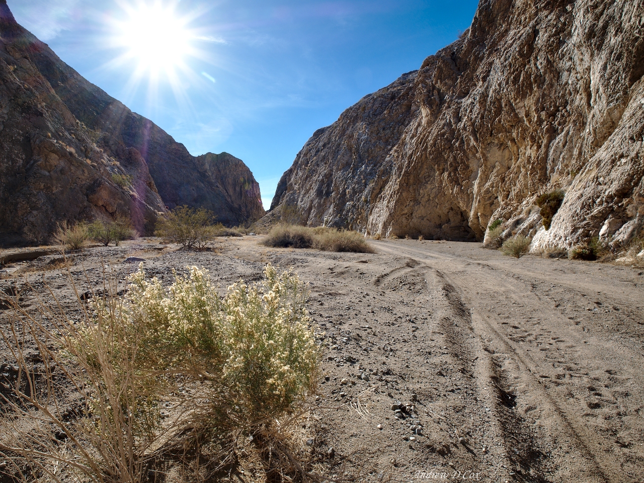
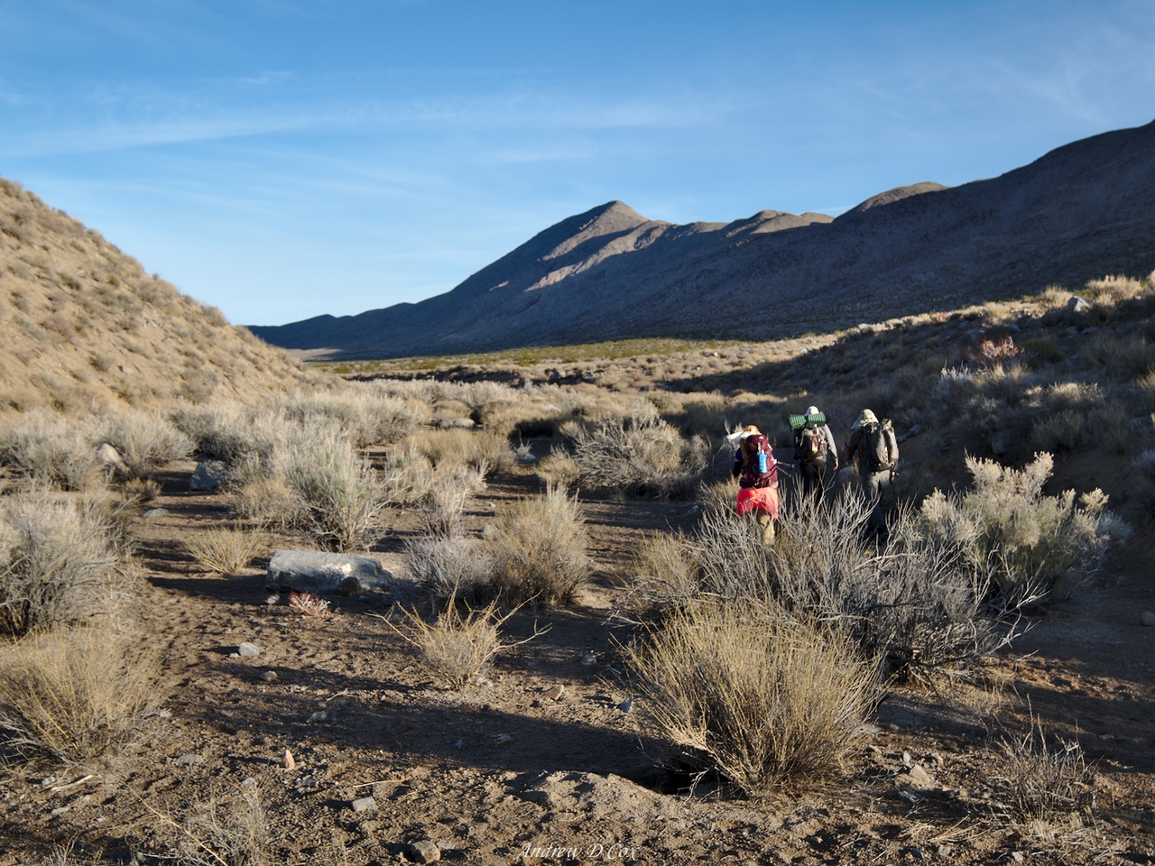
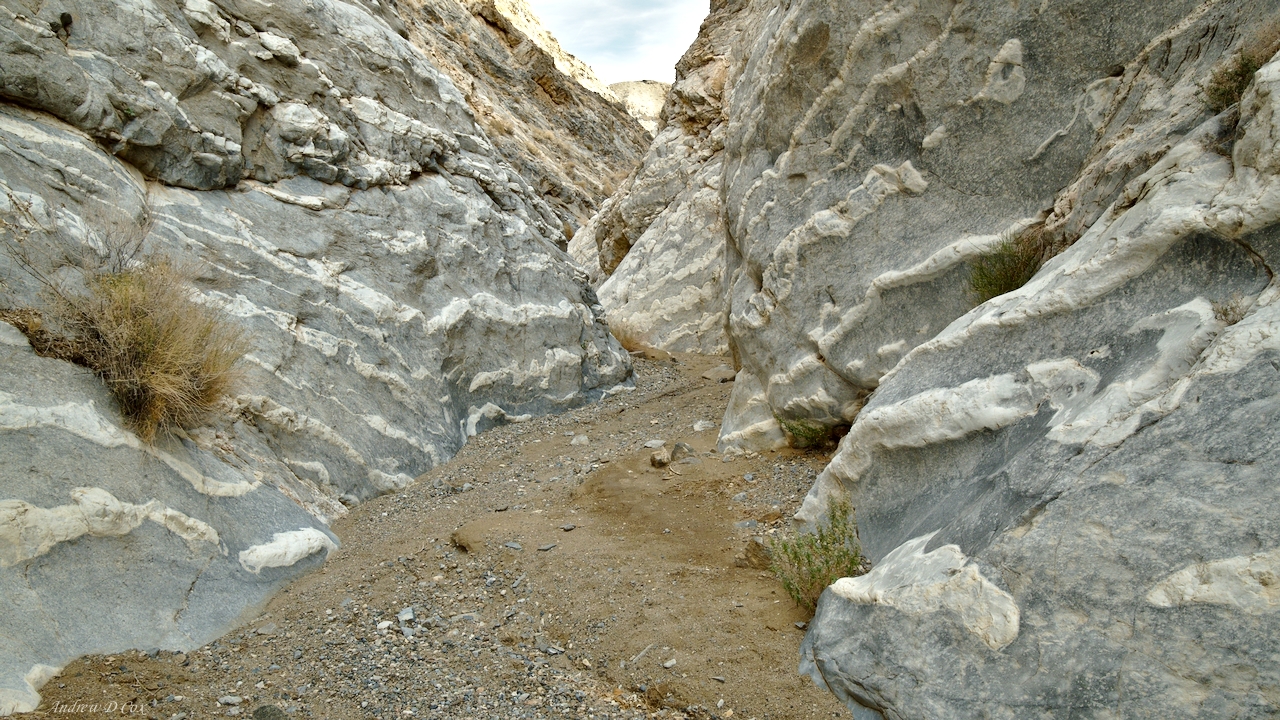
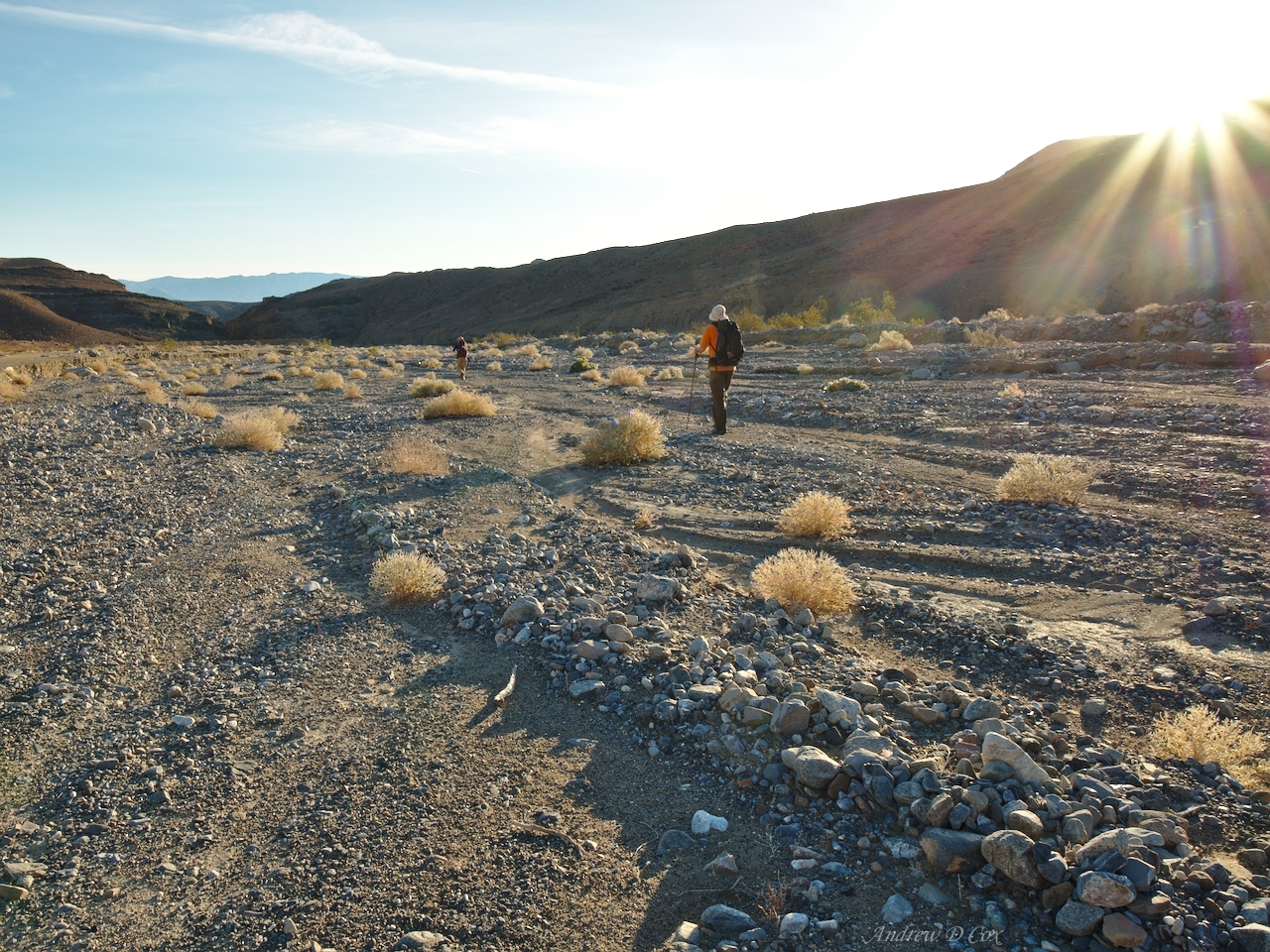
The drive from Furnace Creek to Stovepipe Wells lasts about 30 minutes. We leave the paved road just past town and drive down a 15-20 mile dirt lane. It’s slow going as we navigate around rocks and through dry washes, but we eventually reach the entrance to Cottonwood/Marble Canyon. The flat, sandy landscape gives way to towering stone walls, which leaves us oohing and aahing.
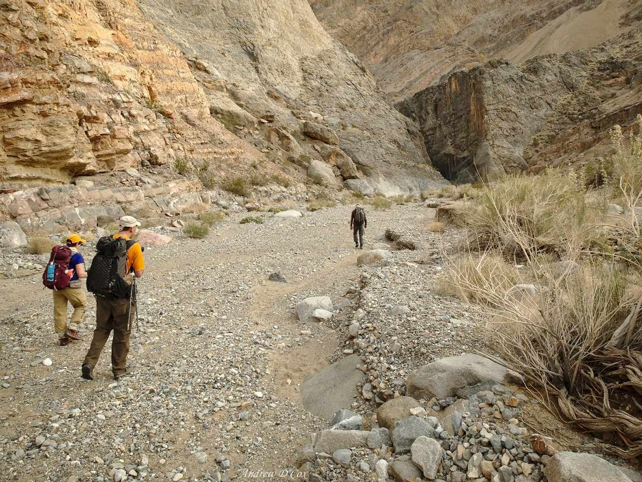
Soon, we reach a point past which we don’t trust the cars and tires to safely traverse, so we pull off the path and park. Everyone grabs their packs from the cars and we begin the trek! The first mile or so continues to follow the road to a junction where Cottonwood and Marble Canyons meet. We find several other cars parked there and say hello to a few other adventurous souls that will be traveling the same route as us.


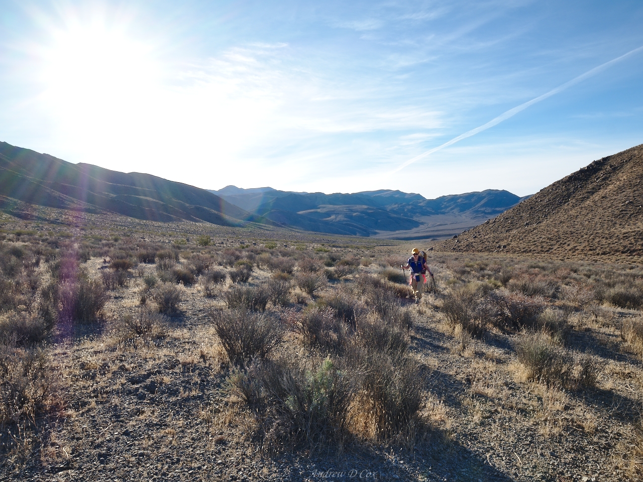
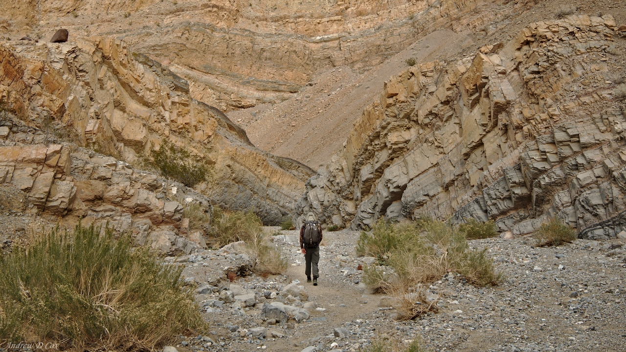
At the junction, we turn south and hike into Cottonwood Canyon. The road continues for many miles, so the terrain is easy to traverse and we walk side by side on the wide, dusty path. For a short while, the road is shaded from the morning sun and I’m content to plod along in my down puffy jacket. However, I begin to overheat when the sun rises above the canyon walls, so I pack away my extra layers. The high temperature for today is only predicted to be 65 degrees – hardly “hot” – but I feel awfully warm, even without a jacket on.
As everyone settles into their own hiking pace, we spread out and enjoy the stillness. Other than the crunch crunch crunch of my shoes on the gravel, there’s not much else to hear. I scan the canyon walls every once in a while, hoping to see a bighorn sheep, but never do. However, I do notice the curious composition of the cliffs. Many appear to be little more than dirt; a solid kick easily dislodges a few clods and creates a cloud of dust. It’s amazing that they’re so tall; I would think that even a little rain would wash them away.
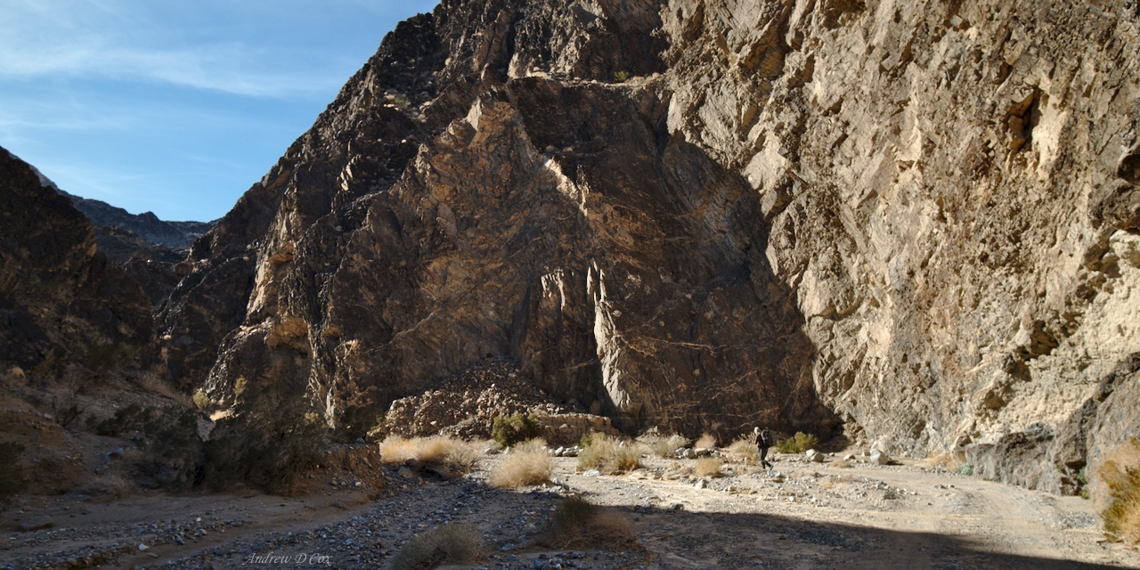
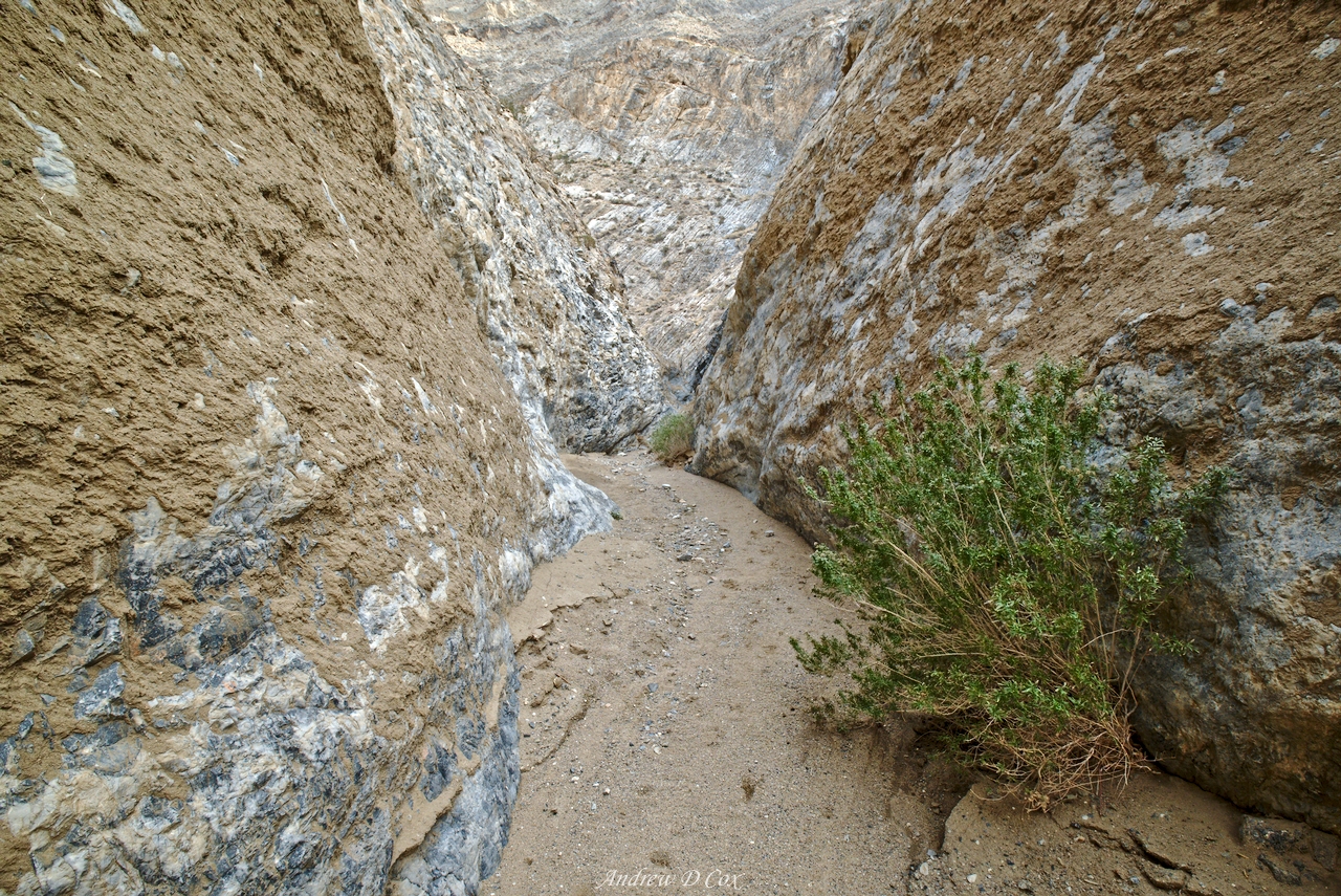
As the miles pass by, the sandy, sedimentary cliffs are replaced by sturdy stone. No amount of kicking will bring these suckers down. The road continues to thread through the canyon, which oscillates between twisting, narrow stretches with steep walls, and wide desert meadows, full of sagebrush and surrounded by scree-covered slopes. In the narrows, I swivel my head all around to admire the canyon; in the meadows, I pull my hat low to shade my face from the sun trudge on.
During a particularly dusty trudge through one such meadow, I look up and see trees ahead. What a strange sight, after miles and miles of scrubby brush and sandy expanses: full-sized trees! Golden leaves adorn every branch, another curious sight for this time of year. Back east, the trees are bare skeletons, but here they appear to be stuck in some sort of eternal autumn. I wonder what time of year the leaves are green?
I find a shady spot beneath the trees and wait a few minutes for those behind me to arrive. We munch on snacks, sip some water, and enjoy a break. The breeze rustles the leaves above us, and a small creek gurgles through dense reeds a few feet away. If I’m not mistaken, this is the first flowing water I’ve seen since landing in Las Vegas! The map does identify a “seasonal spring” here, i.e., the spring is often dry. I’m grateful for the recent rain that is surely responsible for the increased flow.
After eating some snacks, I feel a second wind arriving so I shoulder my pack and resume hiking. To my great pleasure, the road ends at the spring and the trail from here on out is a true footpath. I find Peter sitting on a rock a hundred yards down the trail and we continue together into the mini-forest that thrives near the spring. The path winds between trees and over fallen branches, and a thick layer of golden, decomposing leaves blankets the ground, filling the air with the intoxicating aroma of fertile soil.

As we stroll through the cottonwood oasis, Peter and I stumble upon another curiosity: fresh horse tracks and poop. This is the first either of us has noticed them, and we surely would have seen prints or scat on the previous 8 miles of trail; horses are not shy about relieving themselves whenever and wherever they feel the urge. We assume that their riders arrived via a different trail and ventured to the spring to water and graze the animals.
However, as we continue down the trail we soon come to a different conclusion. We emerge from the overgrown forest onto a wide, open meadow and observe more prints and piles of scat. In the distance, we see a few horses grazing on the brush but can’t see any riders. With a creek nearby, this is as good a place as any to pause during a horseback-riding adventure. Peter and I are soon within a dozen yards of the horses and pause to look at them. A single stallion stares us down while three other horses graze near the stream a little further away. To our surprise, none of the horses are wearing any kind of tack: no harnesses, saddles, nor bridles… The horses are also not marked in any way (no brands, piercings, nor tags) and there aren’t any other people as far as we can see.
It suddenly dawns on us that these are wild horses! I’ve never encountered free-roaming horses before, and I’m incredibly excited to be so close to a small herd of them. The stallion continues to look our way as we take a few photos, but doesn’t make any move to run away. The puzzle pieces all begin to fit together: the horses are awfully thin, so they must rely entirely on the scant vegetation here in the upper canyon near the springs. The abundance of hoofmarks and large piles of poop also point to a continued existence here, and their fearlessness is easily explained by the fact that they’re accustomed to hikers passing through their home.

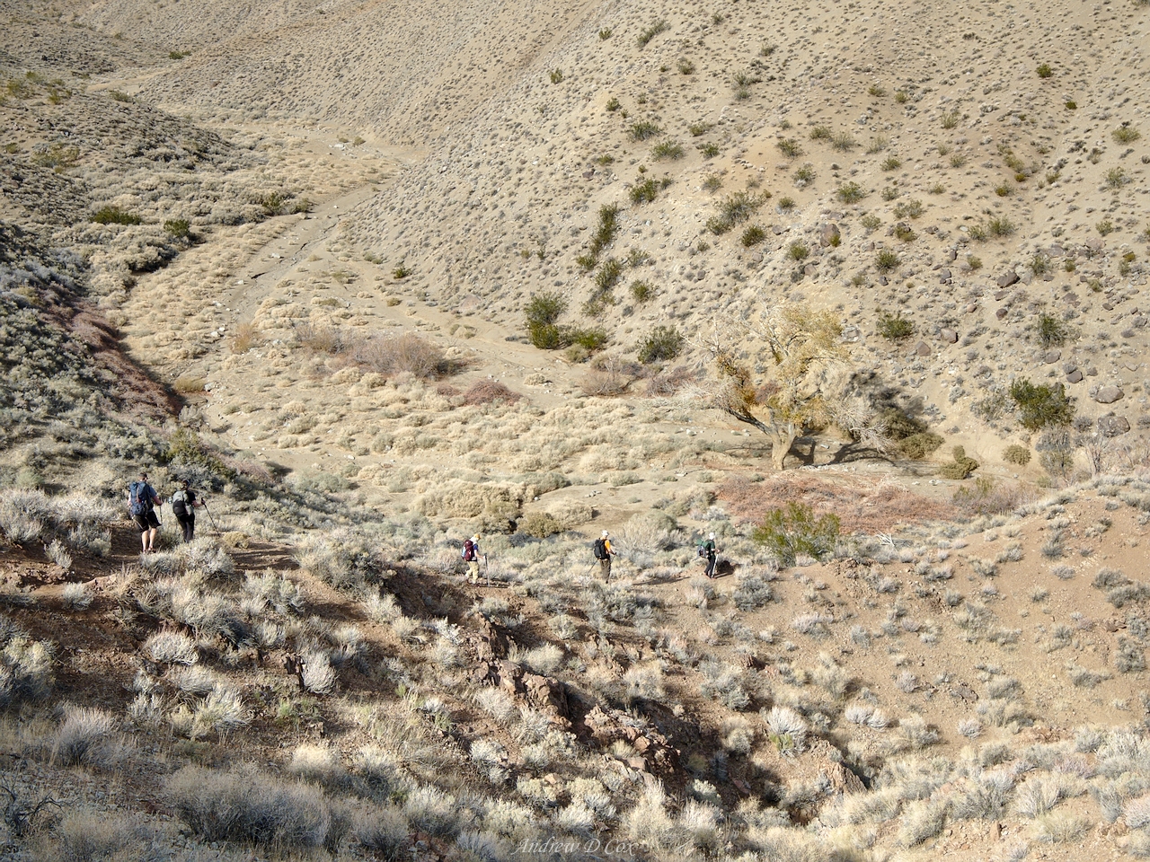
Peter and I continue down the trail and soon reach another grove of cottonwood trees. We cross a small bog and climb up to a notch in the hills. According to the map and GPS, we ought to be approaching our destination: Cottonwood Springs. We descend from the notch, winding through the trees until we reach another hill. Half a dozen trails wander up the slope so we pick one and make our way to the top. It’s not immediately clear where the springs are, but we spot Dave and Max, who have been ahead of us, in the trees below and hike down to join them.


In the area around the trees, large shrubs dot the landscape with patches of flat, sandy ground between them – perfect little spots to pitch tents! Dave, Max, and I search the area for the spring but can’t find it. There are muddy washes, but no flowing water. Michael arrives soon after Peter and me and is able to locate the water with his GPS. Huzzah!
During the next hour, group members trickle into camp and everyone finds a spot for their shelter. The sun sets early this time of year and our little hollow is soon in shadow. By the time 6 PM rolls around, the sky is dark, stars begin to appear, and the air becomes chilly. We gather under a large cottonwood tree to cook, eat, and chat. Max becomes everyone’s favorite person when he procures cans of beer from his pack. The club record is 16 beers packed into camp, and Max has just crowned himself the new leader by carrying 20!
As the night continues, we exchange stories and enjoy the beers. A few hours slip by and, in the darkness, it feels late. To our chagrin, it’s only 7 PM… to burn some more time before giving in and going to sleep, Michael and I find a sandy spot to set up our cameras and shoot some astrophotos. Although the galactic core is beneath the horizon this time of year in the Northern Hemisphere, the Milky Way still makes for an incredible subject!


After shooting photos for a while, I say goodnight to Michael and the others and return to my tent. It’s a chilly night, but I’m soon warm and cozy in my sleeping bag.
Marble Canyon
January 14, 2018 | 14.4 mi | +2100 ft / -4100 ft | View on Map
When I wake up in the morning, my first move is to check my tent for condensation. It’s a little damp, but thankfully nowhere near as wet as yesterday morning! I pull on all of my layers before exiting the tent (it’s cold!) and make my way over to the communal food spot beneath the large tree. Several others are already up and I join them on the ground, using the foam pad from my backpack as a seat. To conserve weight and minimize the number of partially used gas canisters at the end of our trip, we share a handful of stoves between the ten of us. I wait my turn and then boil some water for my backpacking breakfast of choice: blueberry oatmeal! I cradle the hot ziplock bag as the oats rehydrate and relish the warmth.
Once the oatmeal is “cooked,” I dig in and chat with the others. Our route today will take us through several miles of brush, over an unnamed saddle, and finally down into Marble Canyon. Routefinding is the name of the game, but several group members have GPSes and I’m sure we’ll find our way.
Soon, everyone has eaten their breakfast, packed up, and is ready to go! We follow Michael and his GPS until we reach a wide valley through which the way is clear. We aim for a saddle in the ridge of mountains to the east and start walking. There are plenty of footprints to follow, and we soon spread out and settle into our own comfortable paces.
I crunch through the gravely soil and am startled when a gray blur speeds out from behind some sagebrush. The small mammal continues to bound away as I shout, “jackrabbit!” Its quite large for a rabbit – much larger than the ones that live in the flat grasslands of northern Indiana (Fun fact: jackrabbits use their extra large ears to release heat and stay cool in the hot desert climate). We’re also on the lookout for kangaroo rats but don’t see any, though I do spot another small herd of wild horses on the ridge!
I very much enjoy bushwhacking through the desert landscape. The way forward is clear – aim for the saddle – so we’re free to walk wherever we please. The complete lack of a trail and occasional jackrabbit fleeing my footsteps creates a wonderful sense of adventure that I relish. It’s also incredibly quiet – there is a light breeze and a few birds chattering at one another, but no other noises disturb the peaceful desert. Well, no noises other than my loud footsteps in the soil.
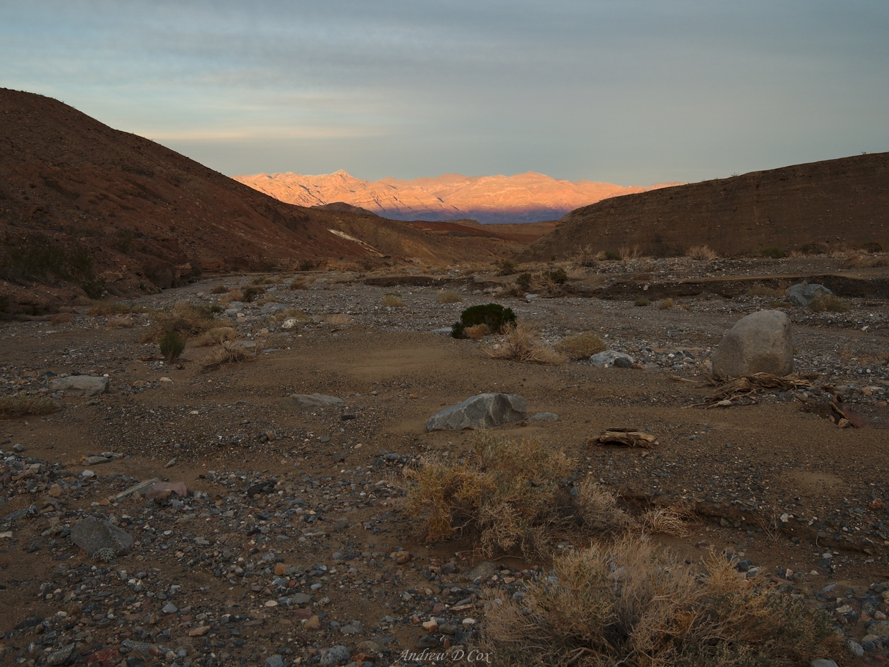
As I climb toward the saddle, I glance back to the south and am surprised at the distance we’ve covered in the past few hours. I remember the same feeling while hiking on the John Muir Trail – distances are deceiving and it’s not terribly difficult to travel “as far as the eye can see” in an afternoon. Once atop the saddle, I catch a glimpse of Deadhorse and Marble canyons stretched out in front of me and, far in the distance, the Grapevine Mountains.


From the saddle, we march down a ravine between hills, taking care to stick together so that no one ends up hiking into the wrong canyon. After a short walk, we reach another saddle above a steep drop to Deadhorse Canyon. We stare at the precipitous gully for a few minutes and debate whether or not to follow the instructions the NPS publishes or to follow a well-trodden side route. We end up taking the side route and, after winding around a few hills, we reach a small stand of cottonwood trees that mark the beginning of our journey through Deadhorse Canyon.
Only a few hundred yards down the trail from the cottonwood trees we reach another spring. The NPS suggests that this spring is only seasonal, so we’re lucky to find it flowing. It seems like a natural spot for a lunch break and everyone camels up as this is the last water source on the route. I munch on dried fruit, peanut butter, and pita bread while I wait my turn to refill my bottles from the spring.


We reach a short drop-off soon after departing the spring which is labeled a “dryfall” on the map and park publications. We take turns lowering our backpacks to the bottom and then climb or jump to the bottom. Once everyone has descended the dryfall, we continue down Deadhorse Canyon. While we don’t encounter any dead horses, we do pass a dead bighorn sheep. The poor guy has been completely devoured and only his skeleton remains.


Our trek through Deadhorse Canyon doesn’t last much longer past the sheep and we soon reach the intersection with Marble Canyon. To the right, Upper Marble Canyon winds into the hills. Rumor has it that ancient people left petroglyphs on the canyon walls and, eager to see them ourselves, we drop our packs and explore up the canyon a little bit.
At first, Upper Marble Canyon is very similar to Deadhorse Canyon with a wide, brush-filled floor. However, after walking for a few minutes, we reach a much narrower section. The walls certainly look like marble, but I’m not geologically informed enough to tell you whether or not they’re truly marble. Despite careful searching, we only find a few patterns etched into the stone that could be petroglyphs. So much of the canyon is scratched from flash floods that it’s difficult to say if the patterns are real or just my mind creating images from an otherwise meaningless set of markings, like cloud animals or star constellations.
After a thorough search and a pleasant walk through the shaded narrows, we return to the main canyon and continue the trek. Stone cliffs tower above me but offer no protection from the sun, which lies directly at my back. For the moment, the canyon is wide and the path is similar to the easy roadwalk we enjoyed yesterday, sans tire tracks.
We soon reach the first of three sets of narrows. Sun-dried mud cakes the walls in a few spots, making me wonder when the last flash flood was. I’m sure it would be exciting to witness water rushing through these canyons, preferably from the safety of some lofty vantage point. The “upper narrows,” as they are called, do provide a little shade, but are otherwise a continuation of the same geology from the upper canyon.
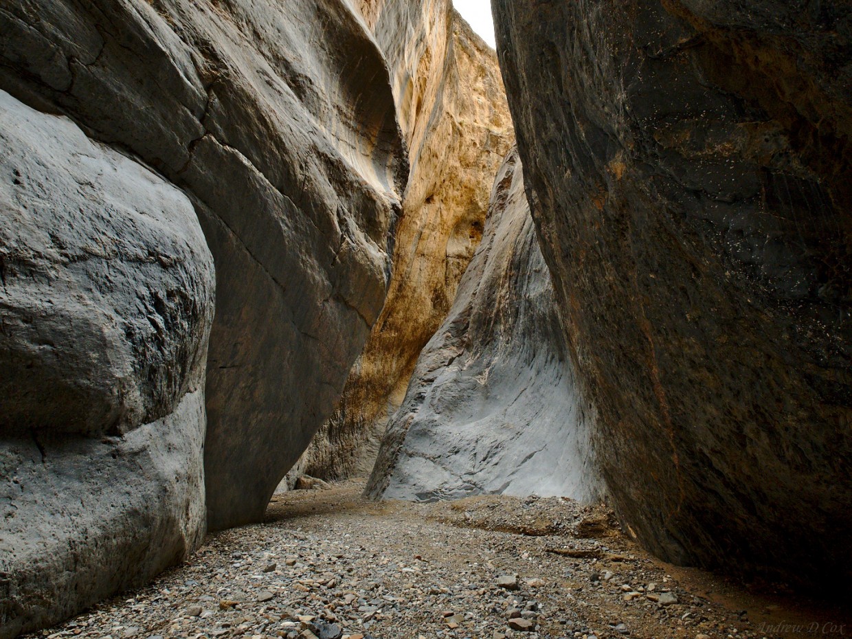
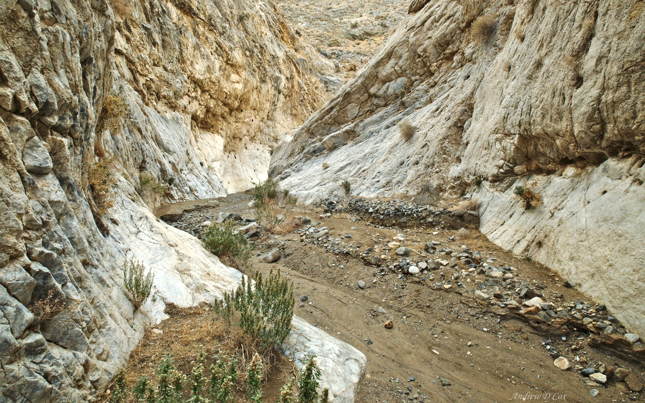
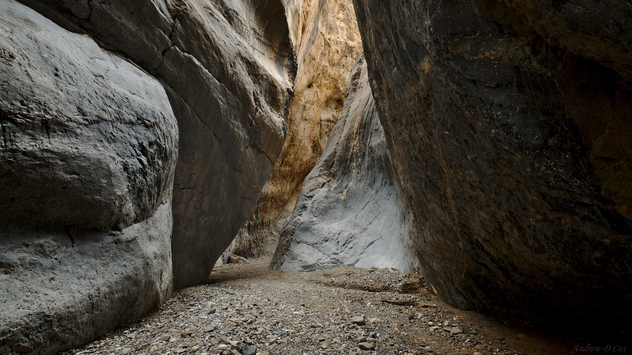
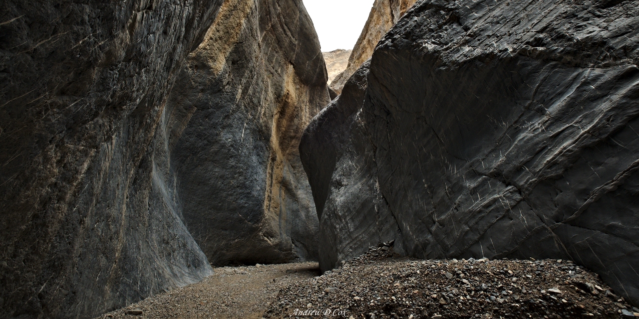
Beyond the upper narrows, the canyon widens once more and I talk with my nearby hiking companions. Time passes slowly when you’re walking, particularly when the landscape remains unchanged. However, just as I’m beginning to get a little bored, we reach the middle narrows. This slot canyon promises to be interesting, even when viewed from a distance. Dark-stoned cliffs block the canyon ahead with only a thin passage between them. I hurry along with Dave, Brian, and Aileen to check them out.
As soon as we round the first bend in the cliffs, everyone gasps and stops in their tracks. This is what I imagine when I think of a slot canyon. Smooth rock walls rise 40, 50, 100 feet above our heads, twisting and turning into the sky. Colorful striations stretch across several of the cliff faces, adding color and texture to the dark stone.


Naturally, we pause every ten steps or so to take pictures. Each bend in the slot canyon reveals a new composition and we’re eager to see and capture them all. I run my hand along the cool walls as I wander through the canyon, surprised at how smooth the rock is even though I know these forms have been molded by thousands of years of erosion.
After passing through the narrows, we find ourselves once more in a wide canyon. I pause a few times to capture images of several plants that catch my eye – a yellow wildflower and a white-leaved bush are particularly photogenic.


The walls of this lower canyon section are composed of oddly tilted layers of sediment, giving the distinct impression that the canyon walls have somehow crashed into the ground. It’s a little disorienting and, if I tilt my head to the side, it’s easy to imagine that the striations are level and the canyon floor is tilted instead.
We hike through the lower narrows and continue on until we reach the beginning/end of Marble Canyon Road. When Max arrives he procures a box of 10 cold beers from this pack and hands them out to anyone that wants one. I’ve never tasted a better IPA in my life! What more could a backpacker want than a cold beer after a long day of hiking?
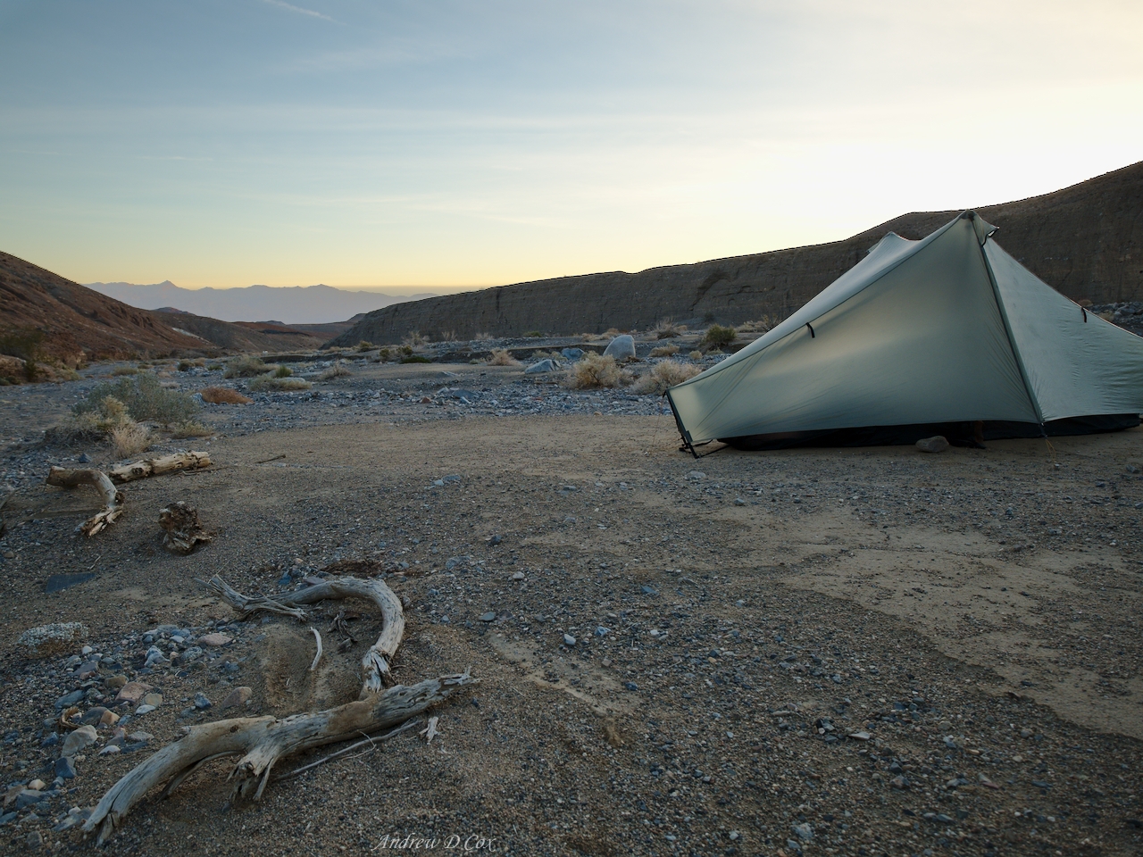
We camp near the road’s end on flat sandbars that punctuate the gravel canyon floor. With the towering canyon walls behind us, we’re granted a view of alpenglow on the distant mountains as the sun sets. Thankfully, it’s much warmer tonight than last night, which makes our evening socializing much more comfortable.
Hike Out
January 15, 2018 | 2.9 mi | +0 ft / -700 ft | View on Map
I wake early the next morning – several hours before sunrise – and am unable to fall back asleep. I suppose that’s the consequence for going to bed at 8 PM… To kill some time, I read in my tent for a while and, once I tire of that, stare up at the stars. I spot a few dim satellites crossing the sky and am lucky enough to watch the International Space Station (ISS) speed overhead. The ISS is easy to spot; it’s the brightest object in the sky and it moves very quickly.
The sun rises a little while later and I mosey out of bed to make some breakfast. Last night’s warm temperatures have stuck around and I appreciate the fact that I’m not shivering while I wait for my oatmeal to rehydrate. I chat with my friends and we reflect on our favorite parts of the hike: the middle narrows are a crowd favorite, as is the cross-country bushwhacking part of yesterday’s hike. We all agree that this trip has been amazing!
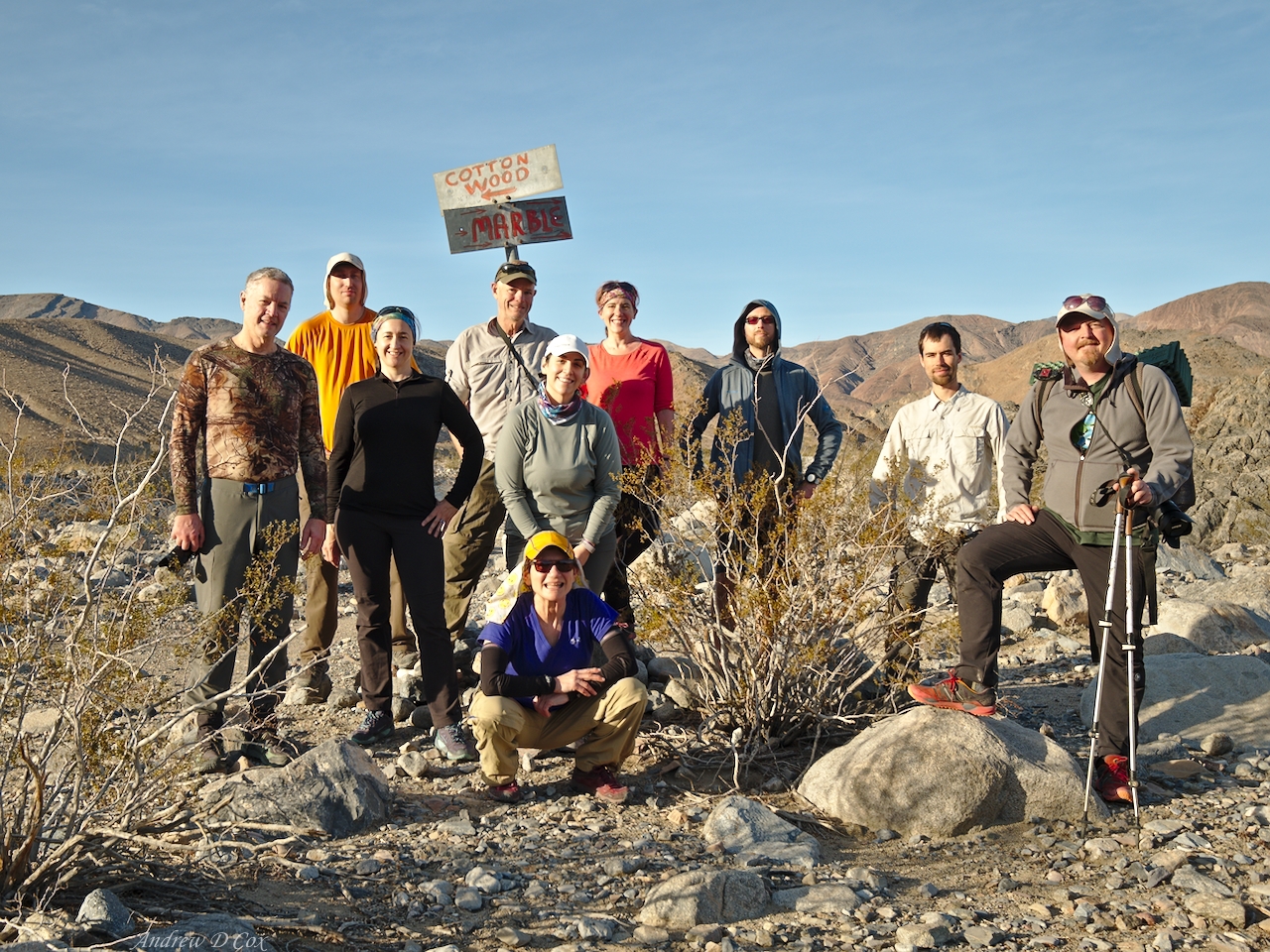
We don’t have far to walk this morning, but we don’t dilly dally around camp. We’re soon on our way and make good time through the final miles of Marble Canyon to the intersection where we began a few days ago. There, at a sign marking the two canyons, we pause for a group photo before finishing the trek to the cars.
It’s been a great hike, one that I won’t soon forget. Until next time, happy trails!
Dad 25 January 2018
Fantastic write-up, Andrew. Looks like a fascinating place – very different plants, formations, and climate! It would be really fun to see during flash flood season.
Andrew Cox 27 January 2018 — Post Author
Thanks! It is fascinating. I wouldn’t mind spending more time in Death Valley. I’m not sure that there are many other backpacking options, though – this loop is the longest listed on the NPS website. There’s plenty more to explore via car, though!
grandpa 27 January 2018
Grandpa..looks like a fun trip…just like the desert of Idaho. Some of the cliffs remind me of southern utah. Some times the stallion will leave a distinct pile on a ridge to mark his territory.
Diane Giampapa 19 February 2018
We do not want to hike the entire Cottonwood/Marble canyon loop. Our plan is for a day hike part way through Marble Canyon. What is your best guesstimate on how many miles we’d have to hike to see the narrows of Marble Canyon? (By looking at the map it looks like we’d drive to the end of the road and then Marble Canyon is the trail to the right). Thanks for any input.
Diane
Andrew Cox 19 February 2018 — Post Author
Diane, there are three sets of narrows in Marble Canyon (lower, middle, and upper). I would recommend hiking at least as far as the middle narrows, which are about 4 miles up the trail/road from the intersection of Cottonwood and Marble canyons.
Charlotte Ryan 5 March 2018
We just day hiked the length of Marble Canyon coming up from Stovepipe Wells. We rented a jeep and were able to go beyond the junction of Cottonwood /Marble canyons. You take the wash to the right for Marble; it is slow going but easy for a jeep that can be rented at Furnace Creek. We loved the hike so much we did it twice in a week. It is an easy day trip and we had the entire canyon to ourselves this first week of March.
Dave Collins 8 November 2018
Great write up! Very helpful for planning our trip and beautiful photography. Thanks so much and happy trails!
Andrew Cox 8 November 2018 — Post Author
Dave – thank you, and I’m glad my trip report was useful for your own adventures!
Andy D 24 February 2019
Fantastic trip summary and beautiful photos to mark the significant sights and route milestones.
I live in DC also and I’m planning a solo trip to Death Valley later this year… although I was hoping for a ~40-mile / 4-day loop, it appears this route is the longest reasonably available.
Thanks again for the excellent trip report.
– Andy D
Andrew Cox 24 February 2019 — Post Author
Hey Andy, thanks for your kind words! If you wanted to tack some extra miles on, you could set up camp at Cottonwood Springs and do a day trip along the trail toward Lemoigne Canyon, or up higher into the hills and make a loop to Goldbelt Spring. Best of luck!