I recently had the opportunity to travel to Germany for a conference with my friend and coworker, Robert. We took advantage of the university-funded airfare and scheduled a few “personal days” after the conference to explore. Since Robert and I both enjoy hiking, we visited Garmisch-Partenkirchen, a location described as “a hiker’s paradise in any season,” and spent two solid days in the nearby German Alps. We completed a rigorous loop route that includes Höllental Canyon, spent a few hours atop Germany’s highest peak, Zugspitze, and took a leisurely stroll around Eibsee Lake.
Trip Planning
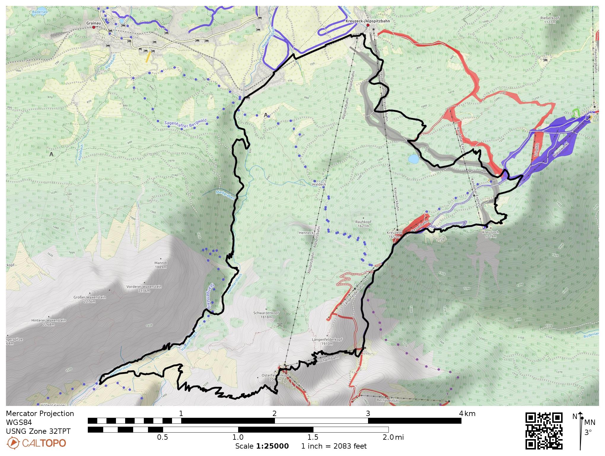
I discovered several interesting routes by searching AllTrails.com for hikes near Garmisch-Partenkirchen. While visiting, I discovered that the Ehrwalder Almbahn website has some great brochures; my favorite is the Summer 2018 brochure since it lists several great “tours”, i.e., hiking routes. There is also a hiking page with some popular destinations, route descriptions, and elevation profiles. Finally, you can explore the area yourself by viewing the TF Outdoors, OpenCycleMap, and OpenStreetMap layers on CalTopo.
Regardless of your planning tools, be warned: many of the hiking routes and trails in this area are exposed and should only be attempted if you are experienced and equipped with the right gear. Do your homework! I was surprised to find that several routes I was considering require glacier-crossing gear (crampons, ice-axe) and/or rock-climbing gear (helmet, harness, carabiners).
Höllental Loop
7 Oct. 2018 | 20.0 km | +/- 1730 m | View on Map
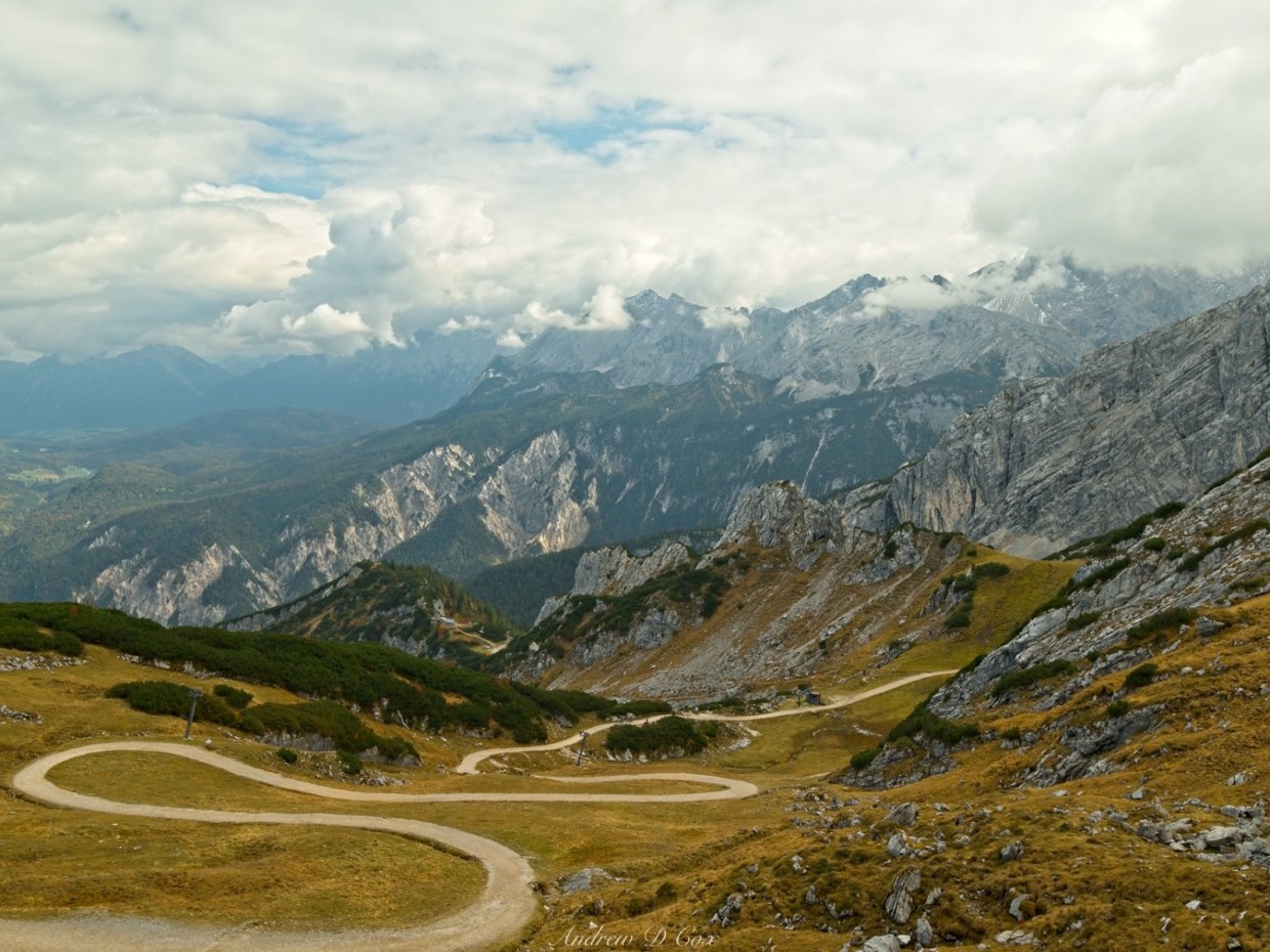
It’s a gray, subdued day in the German Alps; the overcast skies block out the sun that might otherwise warm the cool morning air. It’s not exactly the kind of day I was hoping for on my first day in the Alps, but there’s nothing I can do about it except enjoy the scenery as it is. With sandwiches and snacks from a nearby gas station stuffed into our backpacks, Robert and I stare up at the mountains above the Kruezeckbahnhof, wondering where the hike will take us. It isn’t immediately clear where the trail is; there are no signs for the Höllental loop. However, with a little help from the Gaia GPS app, we soon locate a small, paved road that appears to be the beginning of the route.
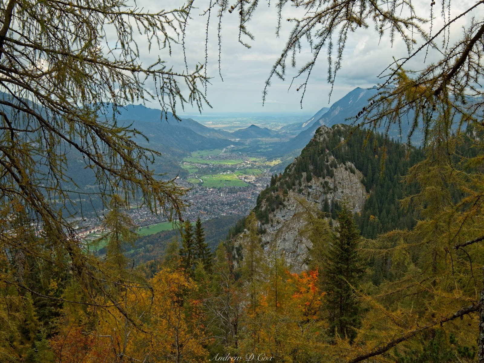
The pavement doesn’t last long and the road transitions to gravel. Normally I would prefer the gravel but the path climbs so steeply that the loose rock threatens to slip beneath my feet. Robert and I are soon out of breath. We take frequent breaks as we wind up the switchbacks beneath the ski lift and are particularly grateful for the few benches along the path! Occasionally, we cross a ski run and catch a glimpse of the grassy meadows surrounding Garmisch-Partenkirchen below. It’s really not a very impressive sight, although I do find the little barns scattered throughout the fields rather quaint.
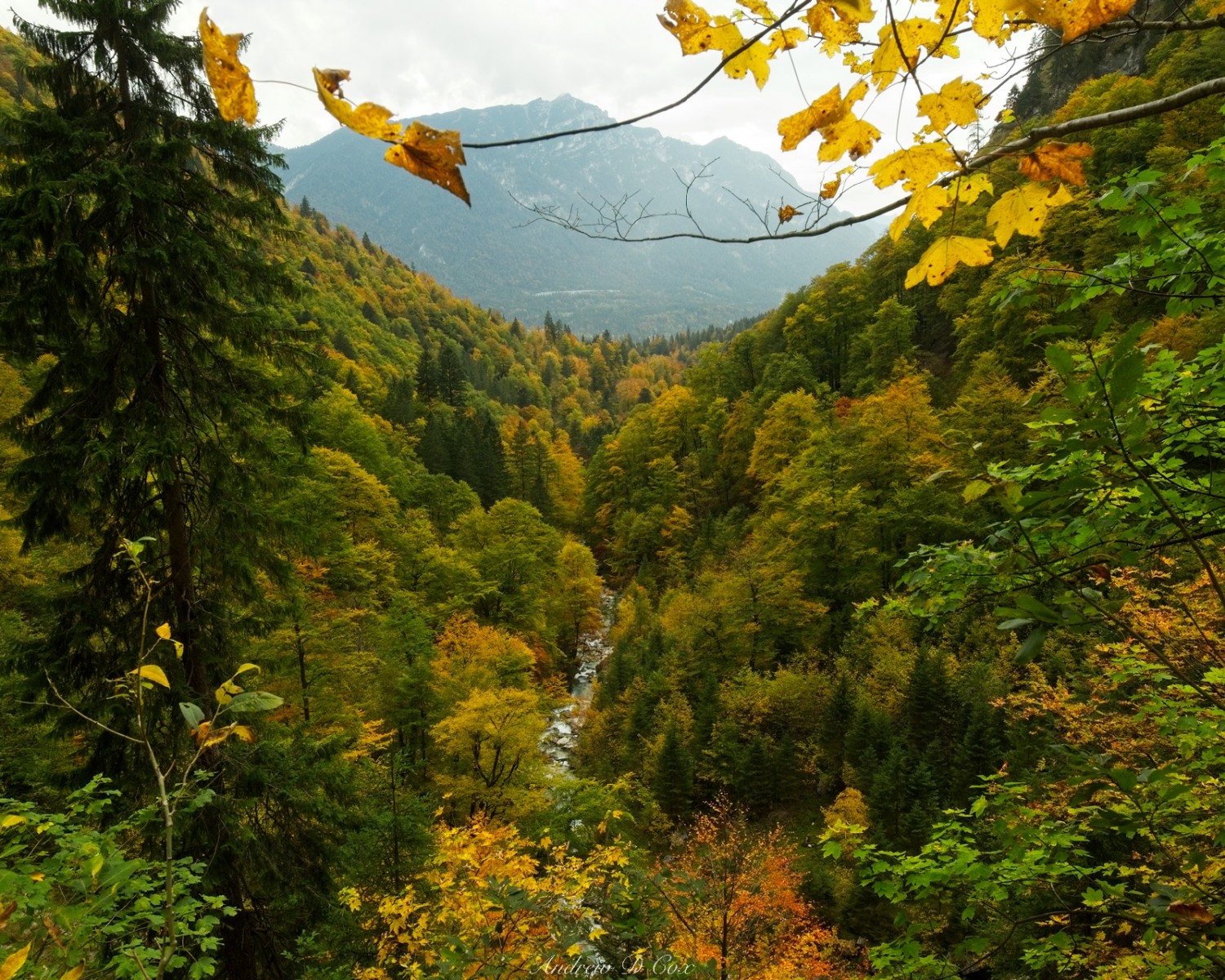
A few bits of scenery catch my eye along the way and offer a much-needed distraction from the steep climb. A small creek gurgling down the hillside reminds me that we’re out in nature, despite the well-traveled gravel road we’re trudging up and the well-manicured ski runs all around. I particularly love the canopy of golden leaves above the creek; the trees back home in Indiana haven’t even begun to change color yet. Further up the mountain, Robert and I pass a large pond. While certainly man-made (perhaps to feed the snow machines?), the reflections of the mountains and trees in the turquoise water are nice.


I check the Gaia GPS app frequently on the way up the mountain; multiple roads, ski runs, and trails crisscross the mountainside, and I have no other map to consult. Upon reaching a small ski hut, we discover that our planned route is blocked by caution tape with warnings about fallen rock. I suppose the plethora of paths is a good thing after all. Robert and I make a short detour and then cut back across the mountain to our original route. Although the detour is short, leaving the planned route awakens the little voice in my head prompting me to take more detours, to leave the wide gravel road. We soon reach a trail – an actual trail with dirt and roots and rocks – that climbs up to the top of the ridge. The temptation to see what’s on the other side of this hill we’ve been climbing is too much to resist. Besides, the detour appears short on the map!
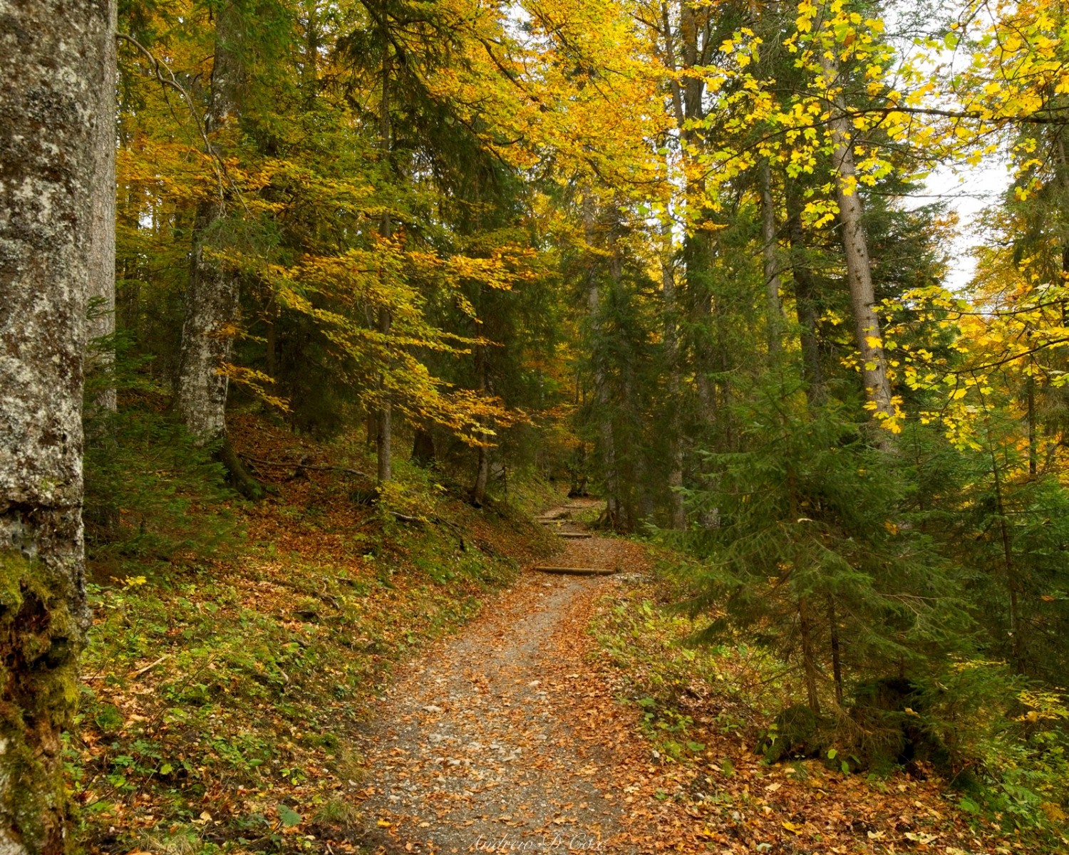
Leaving the wide service road for the narrow trail improves my mood considerably. The trail is also noticeably less steep, which Robert and I are both thankful for. We stroll through pines and more brightly-colored deciduous trees, pass another gurgling creek, and wind our way up some properly graded switchbacks. After a few minutes on this pleasant trail, we catch sight of a wall of cliffs ahead; I expect that we’ll wrap around them and ascend the mountain on a shallower, unseen slope. However, the trail shows no sign of contouring around the cliffs and continues to lead straight toward them.


The path to the top soon appears as we reach the base of the cliffs. A set of stairs constructed from logs and back-filled gravel between two of the stone escarpments provide an easy route to the top. As soon as I reach the top I’m instantly distracted by the incredible vista that has appeared on the other side of the ridge. Multiple lines of craggy, snow-dusted mountains stretch across the horizon, their peaks hidden in the clouds. The long, tedious climb up the ski runs and gravel roads is well-worth this reward!

While I’m ogling the epic view and snapping pictures, Robert explores the summit we’ve reached. He finds the summit cross a few meters from the trail, perched on a small stone outcropping next to a gut-twisting drop of several hundred meters. Despite the drop-off, or maybe because of the drop-off and the spectacular views it provides, we both take a photo with the summit marker.


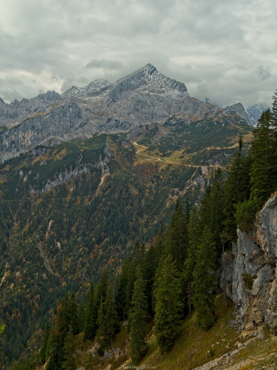
While we’re relaxing at the summit, another peak catches my eye. It is also dusted with snow, and a few isolated wisps of cloud drift in front of the imposing facade. I later learn that the peak is named “Alpspitze.”
After resting for a few minutes and soaking in the views, we continue along the trail, which now descends along the ridgeline toward the Kreuzeckhaus. It’s an easy walk, particularly since we’re descending for the first time today. We make a brief pit stop at the Kruezeckhaus to use the bathroom (it’s a fully-equipped restaurant!) and glance jealously at the stream of people that have skipped the steep climb up the mountain and are emerging from the nearby tram station.
From the Kruezeckhouse, we follow a wide path along the ridge for a while until we reach a small trail that contours around the northern face of the mountain. I’m happy to leave the gravel road behind and enjoy feeling more immersed in nature. As we wander along the path, we get a few glimpses of Garmisch-Partenkirchen, now far below us. The view is certainly more impressive from here than it was from the ski slopes.
A short while later, Robert and I reach a junction. Our planned route continues to contour around the mountain and will soon descend into Höllental canyon. Reluctant to leave these lofty heights, I suggest taking another detour, this time up to the nearby Osterfelderkopf peak. It should only add one or two kilometers to the total route distance and will give us some more time up on the ridgeline with those epic views. Of course, we’ll have to gain a good bit of altitude… Further complicating things is our obligation to pick up my parents from the Munich airport this evening. I don’t want to leave them stranded in Munich after their long day of travel from the US, but how often do I have the opportunity to hike in the Alps? In the end, we decide to take the detour and bet that we’ll be able to reach Munich on time.

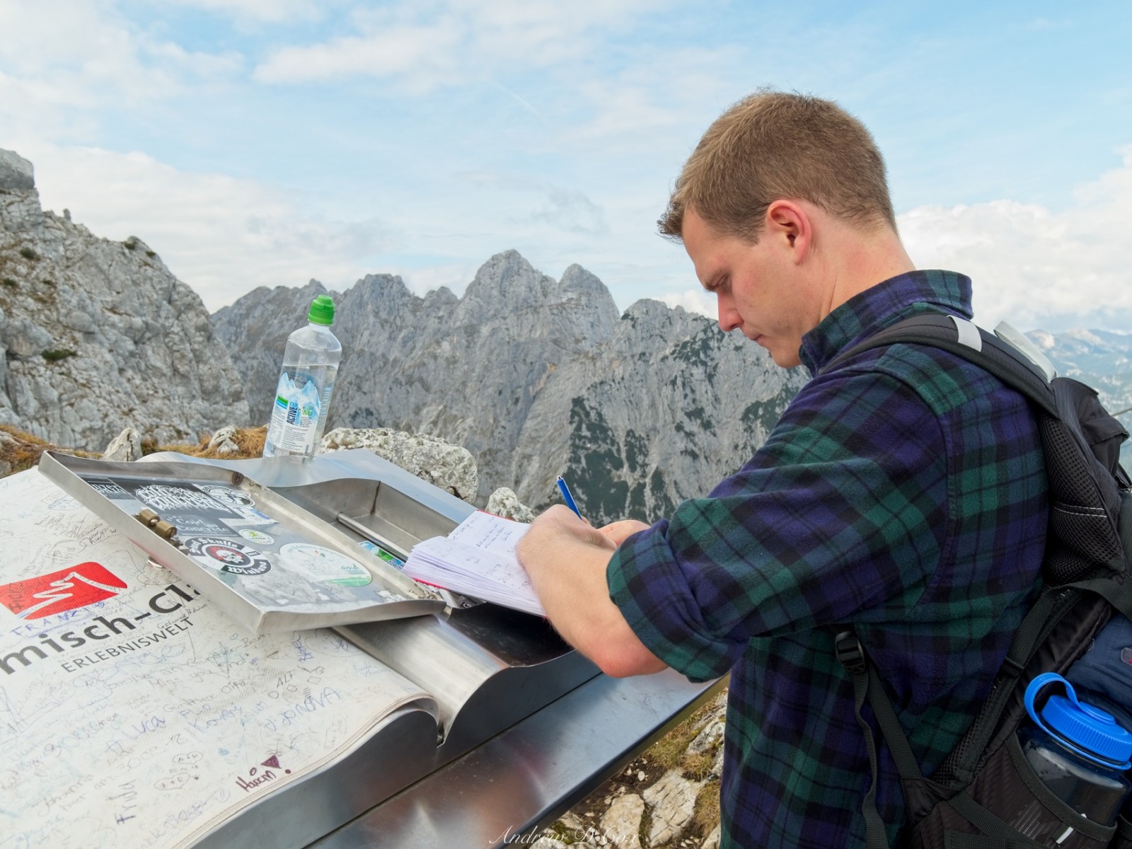
Almost immediately after leaving the trail junction, we begin another steep ascent, although it isn’t nearly as steep as the ski slopes we climbed this morning! Still, Robert and I are soon sweating and breathing heavily as we climb toward Osterfelderkopf. It’s a hard climb but not terribly long, and the sun emerges to cheer us up while we’re struggling toward the peak. After completing the climb, we join lots of other day hikers lounging around the summit and take a much-needed lunch break. A few hungry birds flit around us, hoping for handouts; they’re mistaken if they think they’re getting any of my food!

After eating, we sign the summit logbook and admire some more of those incredible views. Alpspitze towers directly above us, so close that I can make out the summit cross. I watch a few adventurers wearing climbing helmets and harnesses hike along a trail that signs call the “Summit Adventure Trail.” The name of the trail alone is enough to stir my imagination, but we certainly don’t have time to check it out today. Next time, I suppose…
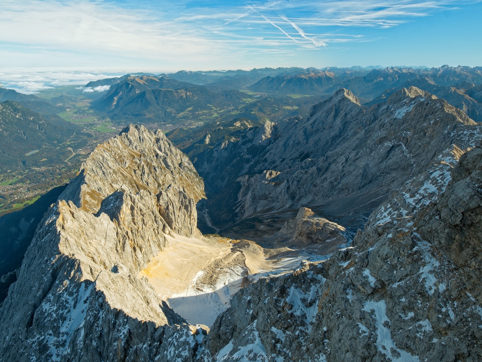
From Osterfelderkopf, we climb a little higher, following the Summit Adventure Trail for a short distance, and then fork off onto the Rindersteig, the trail that will lead us into Höllental Canyon. We soon arrive at the top of the ridge and are treated to yet another awesome view, this time of Zugspitze, Germany’s highest peak, and the Höllentelferner glacier. Our path descends rapidly down a scree-filled chute, although the trail itself is well-packed and features more of the stairs we encountered earlier near Kruezeck peak.

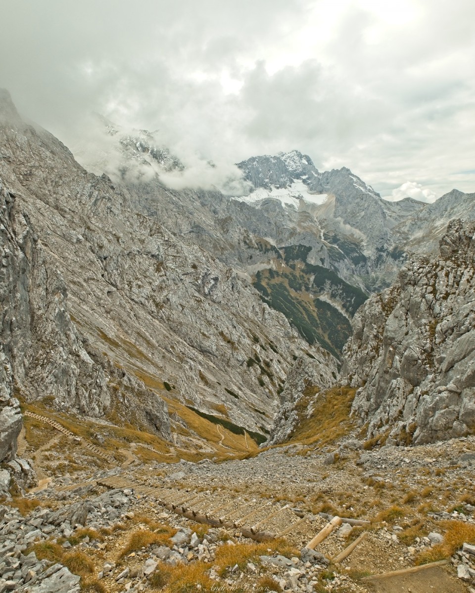

As we exit the chute, we’re afforded much wider views of the valley and the endless switchbacks before us. Perhaps this detour is going to cost us a little more time than I anticipated… There’s not much we can do about it now except to descend as quickly as we safely can. We make short work of the steps and are soon zipping across the switchbacks. Along the way, we pass several gorgeous displays of autumnal color; I stop long enough to take a few photos, then continue down the zig-zagging trail.


After what feels like a very long time, Robert and I reach the canyon floor. A small restaurant (the Höllentalangerhütte) serving delicious-looking snacks and even better-looking beer catches my eye and I regret our rush; I would enjoy stopping for an hour to have a snack and a drink while soaking in the mountain views. Who knew there were so many full-service amenities in the Alps? Next time, I promise myself, I’ll plan for a few indulgent stops.
Past the restaurant, we begin the final leg of the hike: the descent through Höllental Canyon. The path winds deeper and deeper into the gorge, following Hammersbach Creek. Near the restaurant, the creek is tiny, but it grows larger and louder with every new tributary. We’re soon crunching along a rocky trail beside a small chasm through which the creek roars. A crumbling aqueduct, presumably once used to deliver water from the mountains to the valley below, parallels the creek.
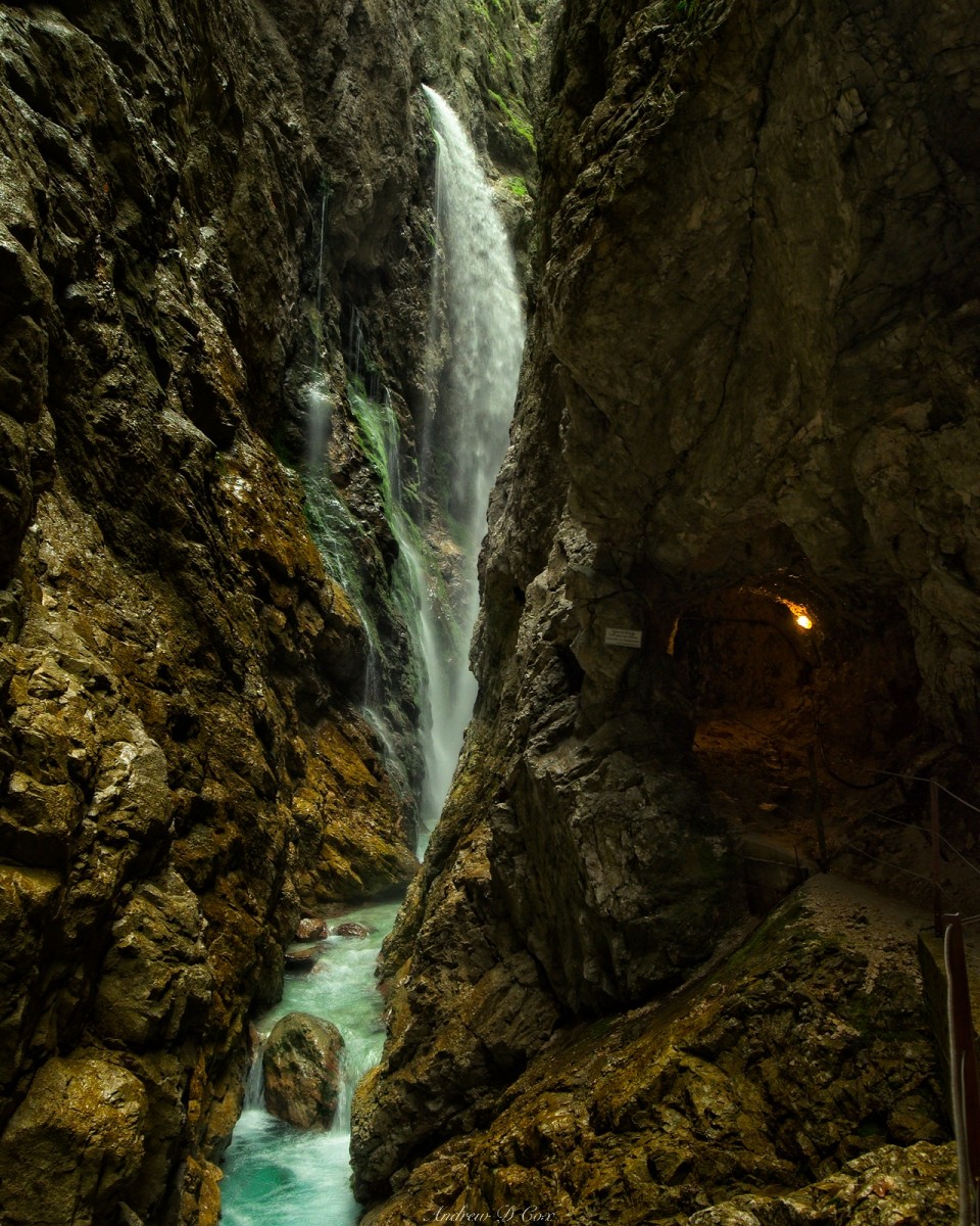
A few more minutes of hiking bring Robert and me to one of the most unique features I’ve ever encountered while hiking: a tunnel blasted straight into the canyon wall. A few lights illuminate the interior and a sign posted next to the tunnel gives some information about the passage, but neither Robert nor I know nearly enough German to understand what it says. From the looks of things, the trail used to wind through the canyon on a narrow ledge, but that way is fenced off.
With no other option, we descend into the dimly-lit tunnel. Windows cut into the walls provide periodic views of the canyon itself, but it’s hard to see much due to the many twists and turns. Throughout the entire tunnel, water drips from the ceiling onto my hair and shoulders, but this is only a mild discomfort and is well worth the experience of hiking through this man-made cave! A few ledges between cliff faces supply some “outside” moments along the way with awesome views of the creek and even a spectacular waterfall dropping down into the canyon!
After half an hour traversing the canyon, we emerge into a wider valley full of light and trees. A short distance past the tunnel is a sturdy gate and yet another small restaurant. A young man at the gate informs us that we owe 5 euros to pass through, which might seem ridiculous until you consider the amount of work that must be required to maintain these tunnels and bridges. The roaring creek seems angry enough today, but it’s October, a low-water time of year; I can’t imagine the volume and ferocity of the creek at peak snowmelt in June or July!


After handing over 5 euros each, Robert and I pass through the gate and speed down another series of switchbacks. We’re definitely behind schedule to pick up my parents at this point, so we don’t spend much time admiring the scenery and instead focus on walking quickly. A light drizzle falls as we trek through the trees, enough water to notice but not enough to be uncomfortable.
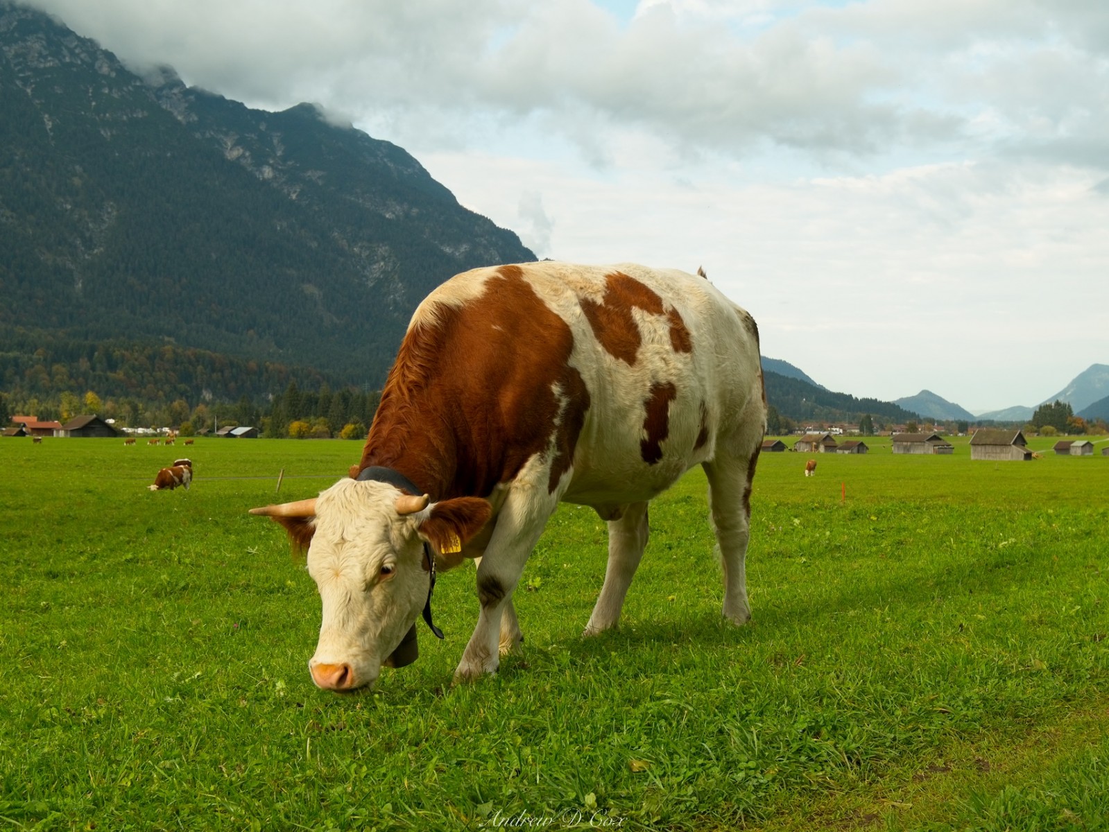
By the time we reach Hammersbach, a small village at the mouth of the canyon, the drizzle has faded away and the clouds are beginning to clear. We stop at a hotel on the main road and make use of their Wifi to update my parents on our delayed schedule before continuing on. Past the village, we walk down a wide, paved path that cuts through cattle pastures. The cows themselves seem utterly unconcerned with our presence, their cowbells tolling loudly as we stride past.
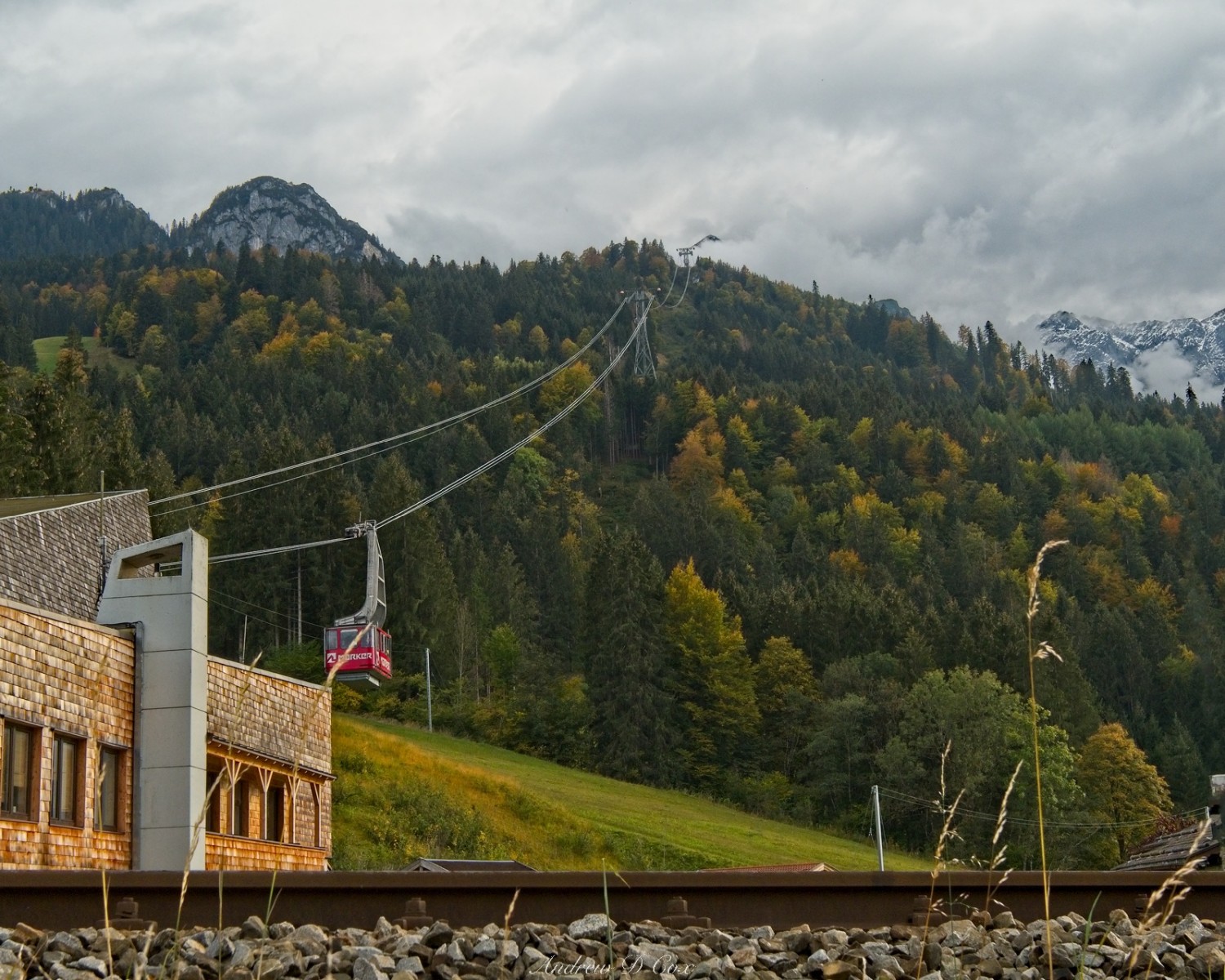
Only a few minutes later, Robert and I arrive back at the parking lot just below the Alpspitzbahn station where we parked this morning. Low-hanging clouds obscure the top of the lift, which we also hiked past a few hours ago. In retrospect, it may have been worthwhile to pay the lift fee to ride up into the mountains; I would have appreciated more time up there next to the peaks. On the other hand, completing the difficult climb ourselves gives us a sense of accomplishment. We earned those views!
Zugspitze Views
9 Oct. 2018
A few days later, Robert and I return to the mountains with my dad, Steve, and step-mom, Paula, for some more hiking. Well, hiking is perhaps too athletic a word for our trip to Zugspitze. Rather than hike 2000m from the valley to the summit, we take the tram up. It’s an exciting ride with some incredible views of the mountain along the way.
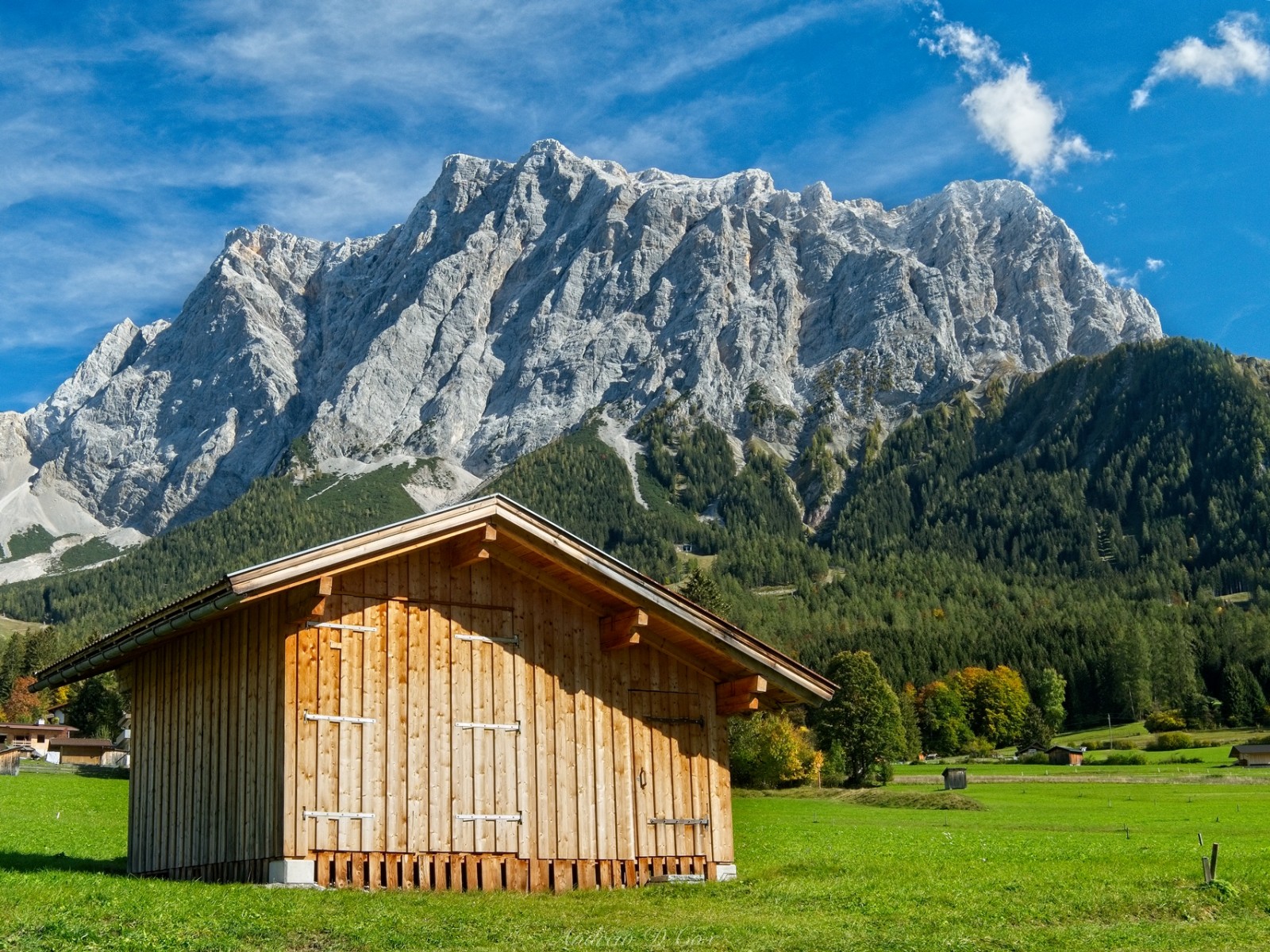
As incredible as the scenery is on the way up, the views from the observation decks at the summit are nothing short of spectacular! To the north, Bavaria is covered in clouds, although Garmisch-Partenkirchen and the nearby villages are enjoying the sunshine. The Alps stretch as far as the eye can see in every other direction.


I particularly enjoy staring down the canyon Robert and I hiked through yesterday. We’re much closer to the Höllentalferner glacier here, but most of it is hidden behind the ridges that lead up to the summit.
While wandering around the various observations decks, we discover a short route that leads out to the true summit, marked by a shiny golden cross. Some of the route is covered in snow, but cables provide sturdy hand-holds along the entire path and iron rungs in the stone make it easy for just about anyone to clamber up to the summit.
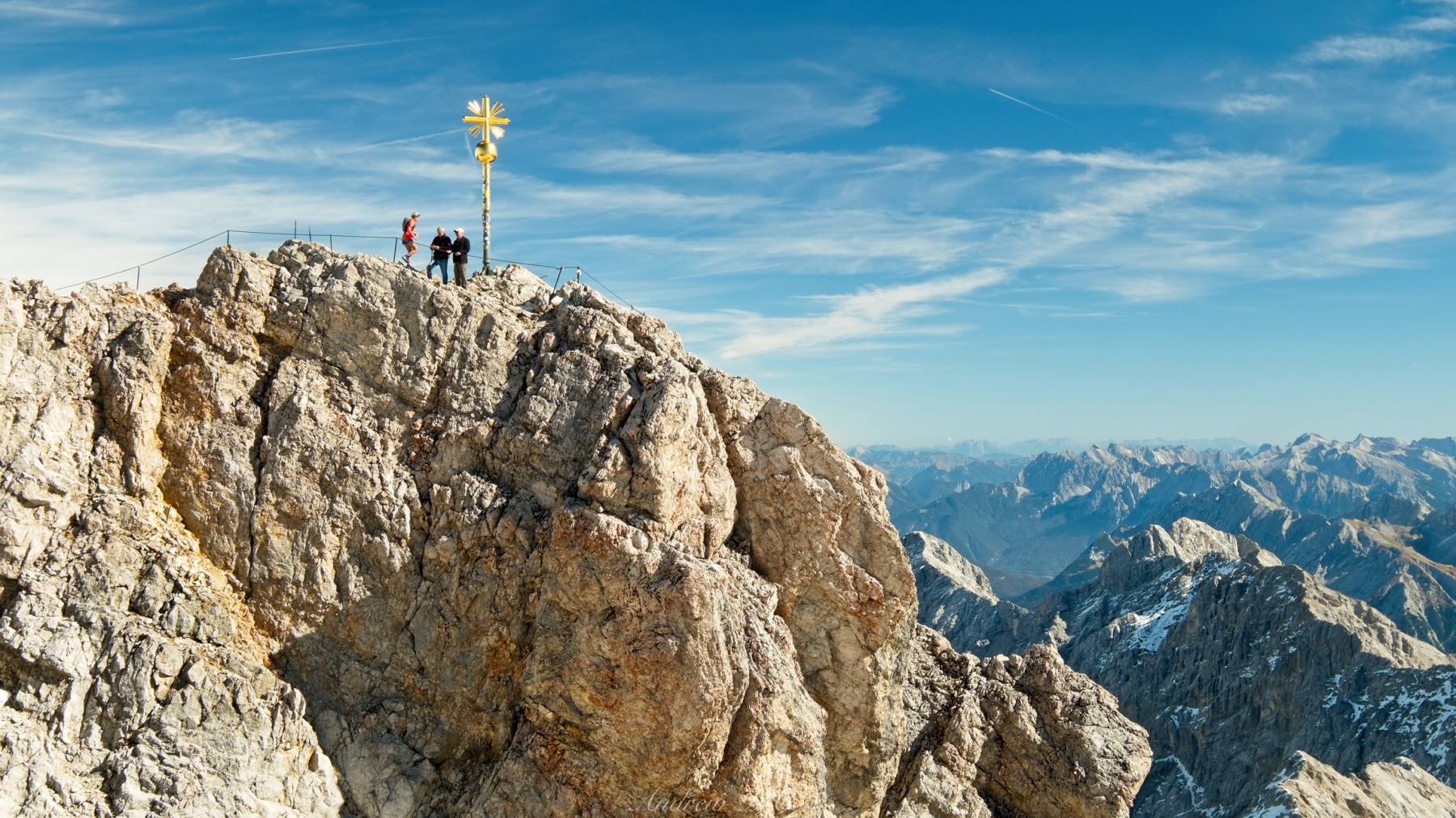
This kind of cable-assisted climbing route is called a via ferrata, Italian for “iron path.” A via feratta generally offers hikers and climbers some safety on exposed routes and allows less-experienced adventurers to visit locations that would otherwise be accessible only to rock climbers. To fully take advantage of the via ferrata, you wear some kind of harness and secure yourself to the cables via a pair of carabiners. Of course, we don’t have harnesses or carabiners, but the exposure isn’t great and the route doesn’t look very difficult, so Steve, Robert, and I give it a try.


A much more cautious grandfather and his grandson, both decked out with harnesses, navigate the route in front of us. It’s a bit slow going as they move their clips from one cable to the next, but I appreciate their precautions, particularly during the sections that are slippery from the snow and ice. Following several minutes of careful climbing, we reach the summit cross and pose while Paula snaps a photo. We take a few moments to look around from the highest spot in Germany and then return to the via ferrata and make our way back to the Zugspitze observation decks.
Back on solid ground, we sit for a while and enjoy some hot drinks and tasty cakes from one of the restaurants. It’s hard to beat a relaxing morning like this up on top of the world!
Eibsee Lake Loop
9 Oct. 2018 | 7.0 km | +/- 450 m | View on Map
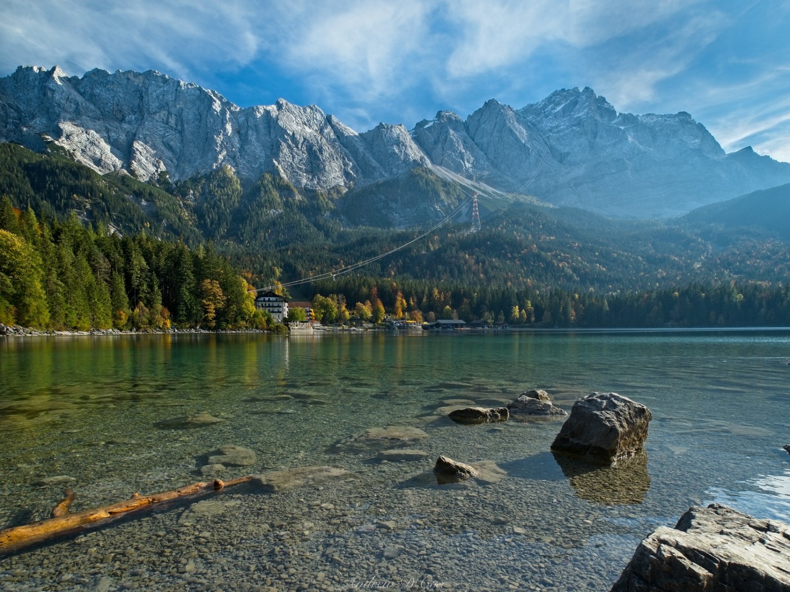
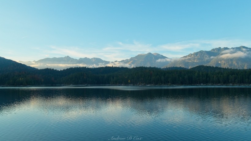
Later in the day, Steve, Paula, Robert, and I visit Eibsee Lake. We got a good look at it from 3000m this morning, but it’s nice to actually visit and see it up close. The sheer beauty of the lake catches me off guard; usually, the most beautiful spots are far from the parking lot! The crystal-clear water reminds of the Sierra Nevada mountain lakes I love so much, and the mountains towering above the opposite shore are absolutely incredible.
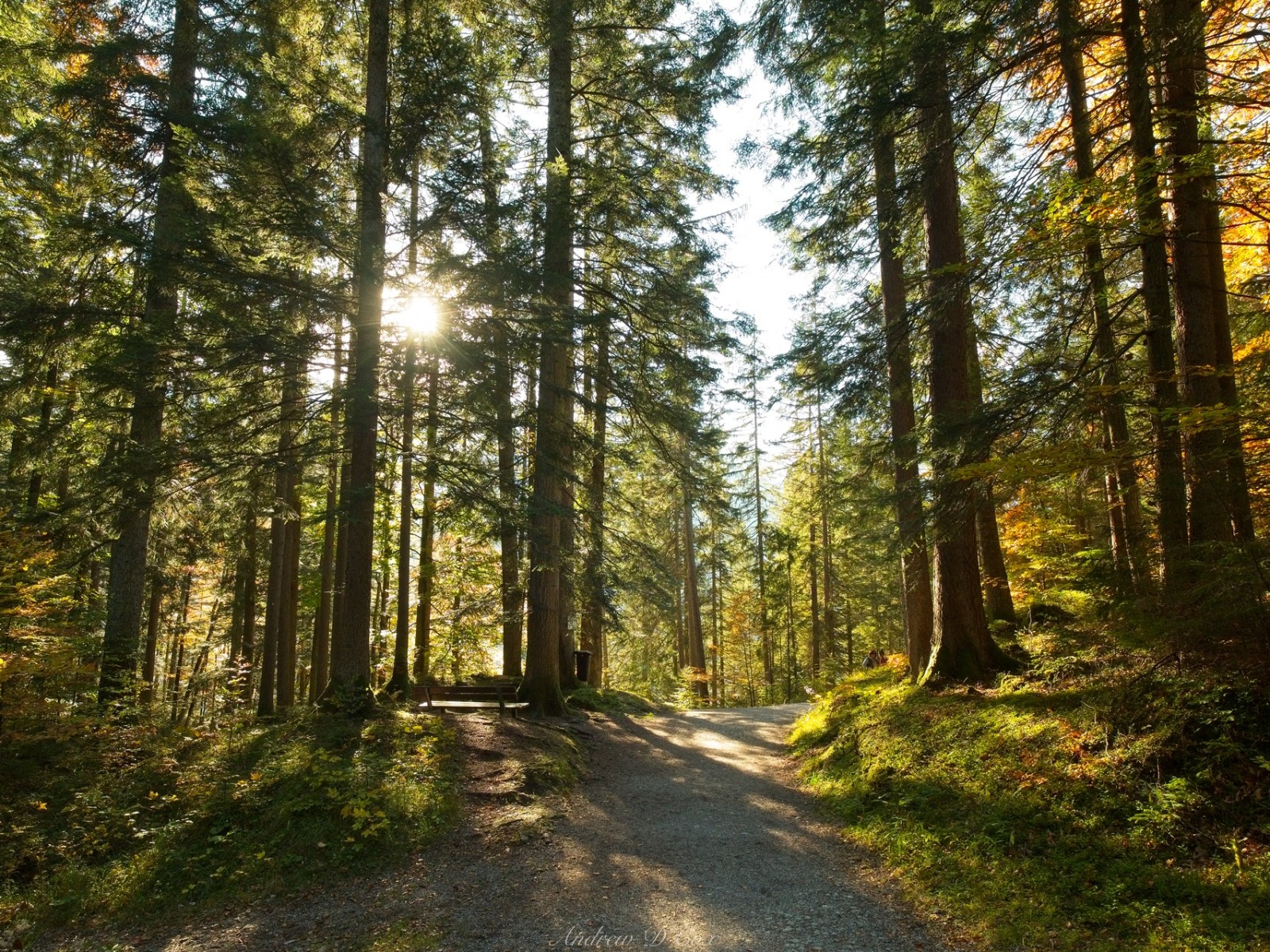
After enjoying some lunch at a restaurant on the water, we find the trail that loops around Eibsee Lake and begin to walk. Much of the forest is shaded by the dense trees, but the few deciduous trees scattered among the pines glow fiery shades of red and orange! The path is smooth and easy to walk along, so one’s mind and eyes are free to wander; in short, it’s the perfect spot for an afternoon hike.
We’re in no particular hurry, and we take our time circumnavigating the lake, stopping at several look-out spots along the way. The sun dips lower and lower until the lake lies in shadow and only the surrounding mountains remain lit, their warm reflections blurry in the rippled water. As we walk, we snack on some crunchy discs of granola, seeds, and honey we bought at a local bakery this morning. They’re sort of like granola bars, but much, much tastier.
By the time we’ve completed the loop, we’re all tired and ready for some relaxation, which works out well since we have a 90-minute drive ahead of us to reach Munich. Robert and I fly out tomorrow to return to the US and “real life.” I’m glad we got to experience a small slice of the German Alps up close, and I hope to come back soon!