Over two million visitors travel to Acadia National Park each year to visit the patchwork of islands, mountains, and seaside villages. The 47,000+ acres of conserved land are mostly forested, offering plenty of shade in the summer and beautiful color in the autumn. I visited in late May with a group of friends, just before the summer season kicked off on Memorial Day. Here are the highlights from our hikes along some of the park’s most iconic trails.
Trip Planning
May 24 – 28, 2018
Location: Acadia National Park | View on Map
Logistics: Perhaps the most difficult logistics problem in visiting a popular national park is coordinating accommodations. We booked our hotel rooms months in advance and there were few vacancies when we arrived. However, I did notice that many of the campgrounds had open spots, at least at this early time of the year. As backcountry/distributed camping is not permitted in the park, you must either camp in a frontcountry site or otherwise reserve housing in one of the nearby towns.
Permits & Regulations: Once you’ve nailed down your accommodations, you’ll need to purchase a park permit, which is valid for one vehicle for seven days; separate permits for hiking are not required. The main artery through Acadia, Park Loop Road, becomes congested quite quickly during the busy summer season. To avoid parking headaches, ride the Island Explorer bus that operates between late June and early October.
Resources: There are several map options for Acadia National Park. First, the map printed by the National Park Service themselves is quite good, though not tear-resistant or water-proof. I personally recommend the Map Adventures trail map; there is also a National Geographic map available.
Jordan Pond Loop
5.7 mi | +/- 1800 ft | Class 1-2 | View on Map
On our first day at Acadia, Robert, Kenza, Juan and I visit a ranger to acquire a park permit and to get some hiking advice. The ranger enthusiastically recommends a route near Jordan Pond and Sargent Mountain. Her description of breathtaking vistas captures our imagination, so we accept her guidance and, after buying the entrance permit, drive straight to the Jordan Pond Nature Trail parking area.
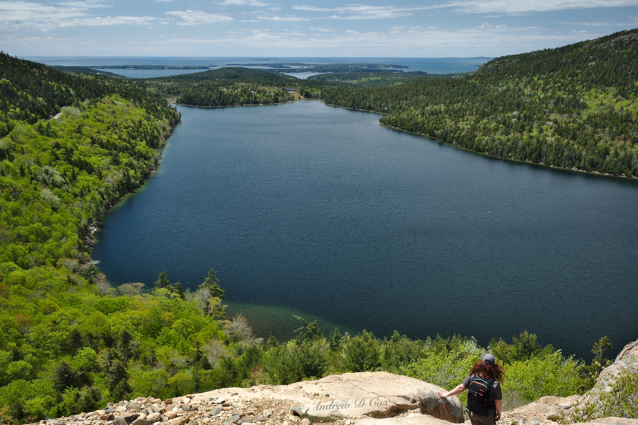
Almost immediately after leaving the parking lot, we encounter fantastic views from the southern shore of Jordan Pond. The crystal clear (and very cold) water, tree-clad mountains, warm sunshine, and puffy clouds drifting overhead are enough to convince all of us that the ranger was right: this is a great area to hike!

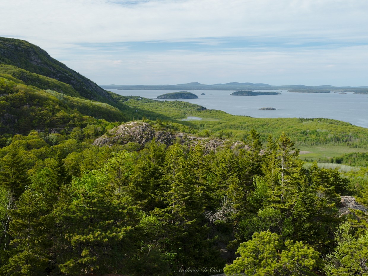
Across the “pond” (it’s definitely a lake… I’m not sure why “pond” is the classification here) we spy two rounded peaks called The Bubbles. These landforms, like much of the Acadia landscape, are the result of the Laurentide Ice Sheet, a large glacier that existed from about 85,000 to 11,000 years ago [source]. The Bubbles themselves are an example of a glacial formation called a roche moutonée, with smooth, gradual slopes on the upstream (north) side and sheer cliffs on the downstream (south) side.
Though it’s not in the itinerary suggested by the ranger, we decide to climb South Bubble. The initial approach from the lakeshore is a rugged class II scramble up a field of microwave-sized boulders left over from the glacier. After huffing and puffing up the steep slopes for a few hundred feet, we arrive at more solid cliff-faces with some class III (use your hands and feet) clambering required to reach the top. It’s an exhilarating route but we’re all relieved to reach the summit and rest for a few minutes while admiring the views of Jordan Pond.
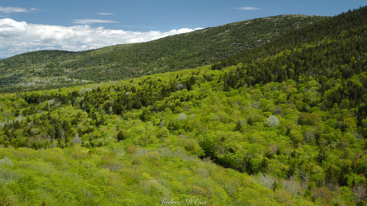
After our heart rates return to normal, we explore the top of South Bubble. A large glacial erratic, appropriately named “Bubble Rock” lies perched on the edge of a cliff and is a popular tourist attraction. In my opinion, the foliage is the most interesting sight from the top: the mountains are completely covered in a blanket of greenery, with colors ranging from neon-green aspen and birch leaves to a more subdued palette of fir and spruce needles. This biodiversity is largely a result of the 1947 forest fire that burned much of the national park. “Spruce and fir that reigned before the fire have given way to sun-loving trees, such as birch and aspen. But these deciduous trees are short-lived. As they grow and begin to shade out the forest floor, they provide a nursery for the shade-loving spruce and fir that may eventually reclaim the territory [source].”
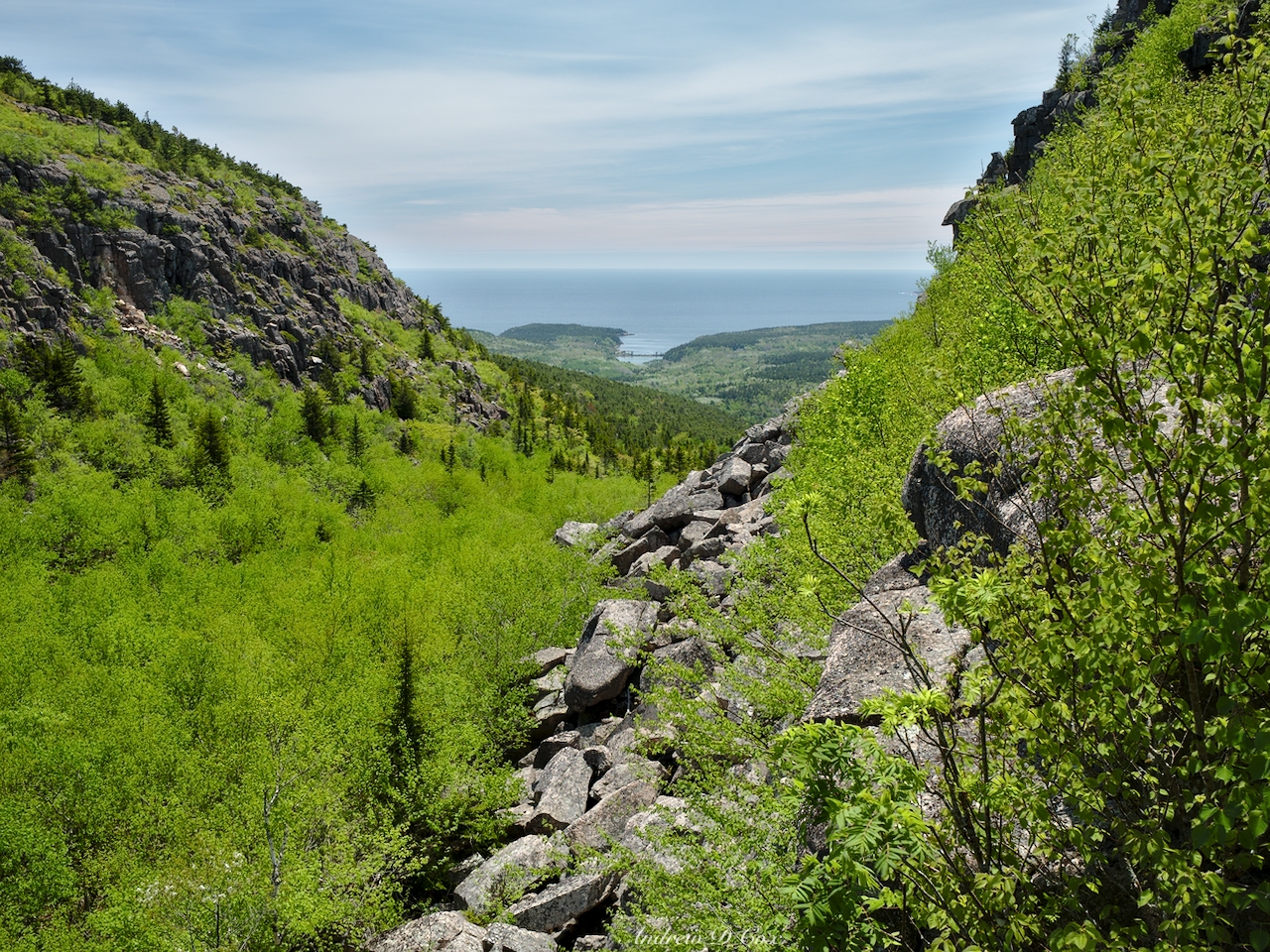
After admiring the views a little longer, we continue on our way and descend South Bubble via a different, slightly safer class-II route. Careful footing is still required; a layer of fallen leaves atop another boulder field make for a slippery slope. On the shore of Jordan Pond once more, we cross the inlet stream via a sun-bleached wooden bridge and enjoy a few hundred yards of flat trail. The easy walking doesn’t last long, however, and we soon find ourselves climbing more boulders toward Sargent Mountain. Although this ascent is less technical than the approach to South Bubble, it’s still a fun puzzle to navigate the granite walls.
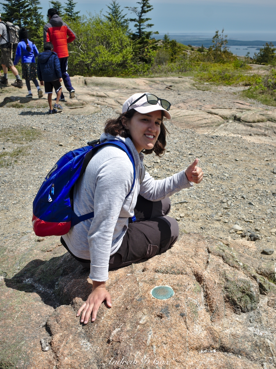
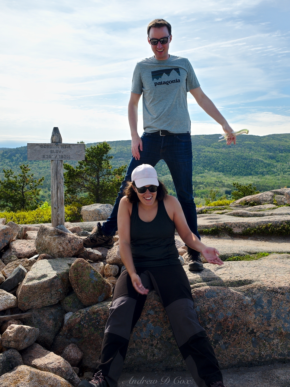
The final third of a mile to the Sargent Mountain summit reminds me of the Sierra Nevada mountains. Like those western peaks, the mountains here in Acadia are solid granite. The gently-rounded summit block looks very much like Yosemite, with slabs of granite dominating the landscape and scrubby bushes and trees growing where they can amidst the rock. Since most of the vegetation and nearly all of the impressionable soil is absent here, cairns mark the way. Thankful for a smoother road, we wander up granite slabs until we reach the summit, marked by a wooden post anchored in a pile of loose rock. It’s high time for lunch, so we pass around a loaf of bread, a jar of peanut butter, and a bag of apples and munch away. Although the sun is shining, a steady wind soon chills the entire group and we re-don our jackets to stay warm.
Sufficiently fed and rapidly getting colder, we snap a few photos with the summit sign and begin hiking again to regain some internal heat. The descent from Sargent Mountain along the south ridge trail yields some of the best views of the entire hike. The smooth granite foreground and island-dotted seascape background combine for a truly impressive vista.

To add a little more interest and bag another peak along our return journey, we hike over to Penobscot Mountain. The wind has only increased in ferocity, so we don’t stay long, preferring instead to keep moving and head for lower ground. The 360-degree views continue as we walk a mile down the southern ridge on Penobscot Mountain Trail, but come to an abrupt end when we turn east and descend several hundred feet along a cliff. The Spring Trail guides us back to the Jordan Pond House, from which the nature trail parking lot is only a short walk.


All in all, this loop is a fantastic hike for those not afraid to use their hands and clamber a bit. Both Sargent and Penobscot Mountain offer phenomenal views of the surrounding mountains and of the many islands that dot the sea south of the park.
Cadillac Mountain Loop
4.9 mi | +/- 1500 ft | Class 1 | View on Map
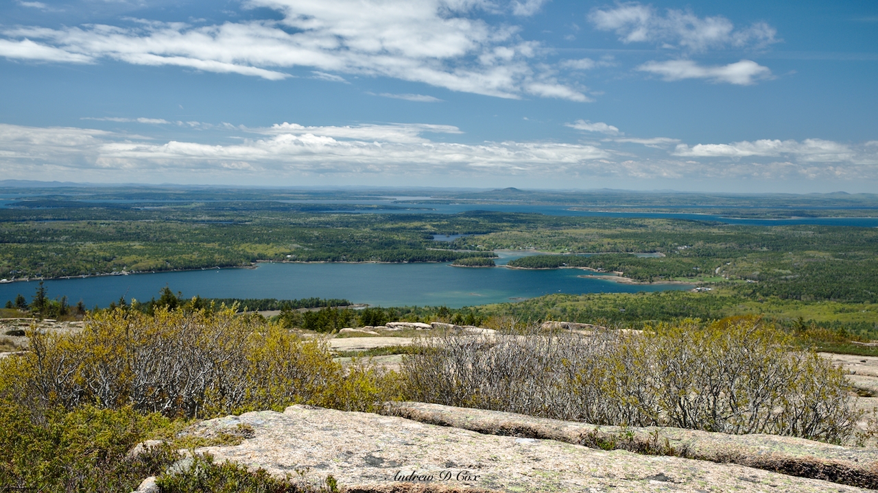
Cadillac Mountain, previously known as Mount Desert, is the tallest mountain in Acadia National Park and also happens to be the tallest mountain “along the eastern coast of the United States” (which must imply some maximum distance from the sea because many Appalachian peaks are several times higher). Thus, it is no surprise that this peak is one of the most popular spots in the park. The summit is accessible via a 3.5-mile road, but it’s much more enjoyable to hike up! Kenza and I make the trek one sunny morning beginning from the Kebow Brook Trailhead and hiking up the Cadillac North Ridge Trail. It’s not a particularly difficult walk, especially compared to the steep, rocky slopes we navigated to summit South Bubble and Sargent Mountain, but the 1500-foot elevation gain will still get your heart rate up. At the summit, Kenza and I join hundreds of other tourists wandering around the cadillac granite slabs for which the mountain is named (or renamed).
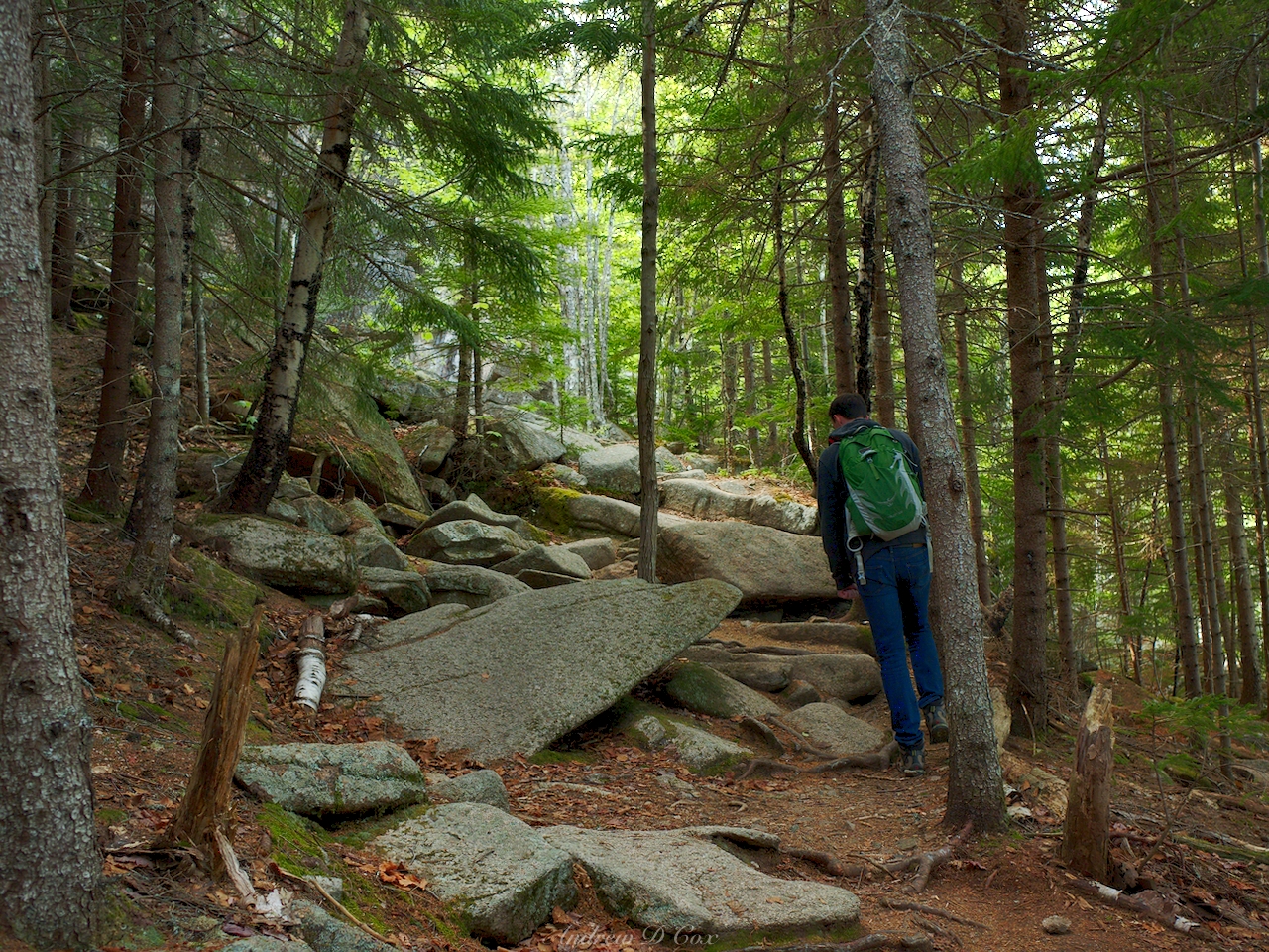
To construct a loop route, we descend from Cadillac Mountain along the Gorge Path. Whereas the Cadillac North Ridge Trail is an easy class I/II hike, the Gorge Path introduces some class II/III terrain as it descends a steep four-tenths of a mile to a ravine between the Cadillac and Dorr mountains.
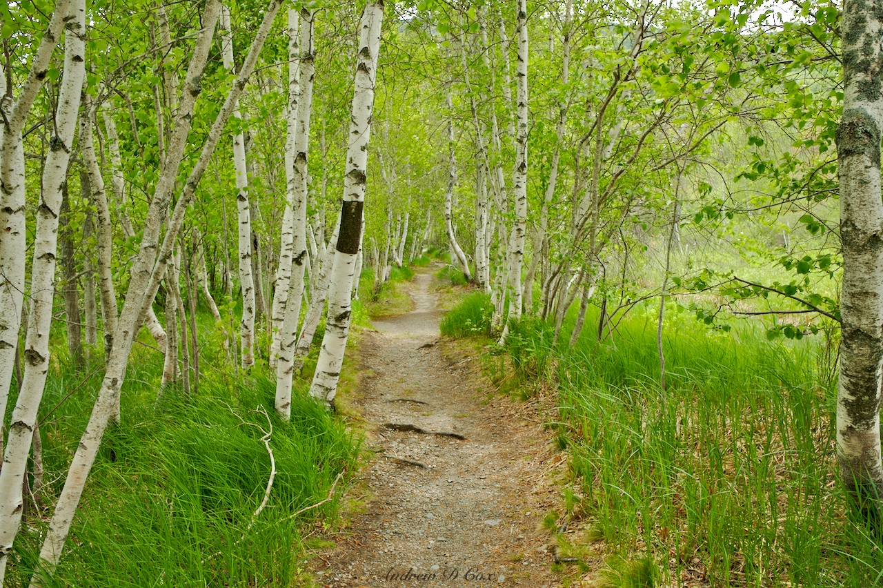
Within the ravine, we descend stone staircases along a tiny stream until we reach flatter ground and groves of birch and aspen trees. From there, it’s an easy walk back to the trailhead.
There are many other trails with access to Cadillac Mountain, some longer and some shorter than the route Kenza and I explored. Check out one of the maps linked above and plan your own loop!
Ocean View Loop
3.8 mi | +/- 1000 ft | Class 1-3 | View on Map
Perhaps the most iconic Acadia National Park landscape is the combination of mountains and seashore. As we’re not about to miss the iconic landscapes, Nick, Kenza and I spend an afternoon hiking along the coastline near the south-east corner of Mount Desert Island. Our route begins at the Gorham Mountain Trailhead, where there are about a dozen parking spots; we’re lucky to snag one on the holiday weekend.
For a half-mile or so, we wander along the Cadillac Cliffs and enjoy the sound of far-off bell bouys tolling in the waves. Much of the route is forested, providing welcome shade from the afternoon sun. At a few rocky sections of the trail, we take advantage of rebar handholds to climb particularly large rocks, adding a fun “hardcore” feeling to an otherwise nontechnical hike. Once past the cliffs, the walk is more straightforward and we soon reach Gorham Mountain. I enjoy photographing the pink granite and ever-interesting forest foliage.


Nick and Kenza, on the other hand, are full of energy and pose for a series of increasingly goofy photos with the summit post.
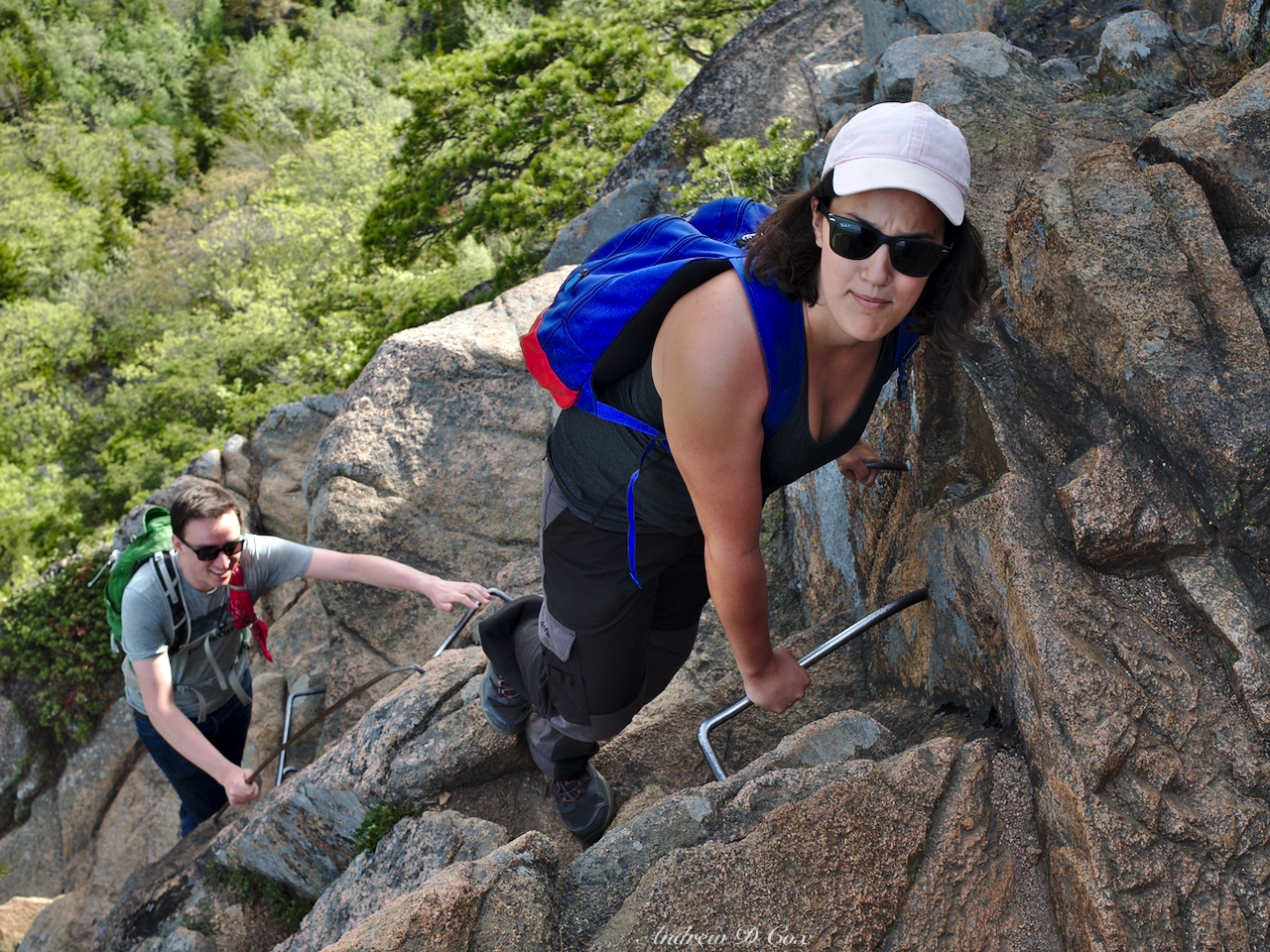
The next attraction on the Ocean Path loop is The Beehive: a small mountain with an infamously precarious climb to the top. To avoid deaths, the NPS (or some previous party) installed iron rungs in the stone for easy hand and footholds. Even with the man-made assistance, the trail is not for those with a fear of heights. We thoroughly enjoy the climb and stop to take several photos during the ascent.
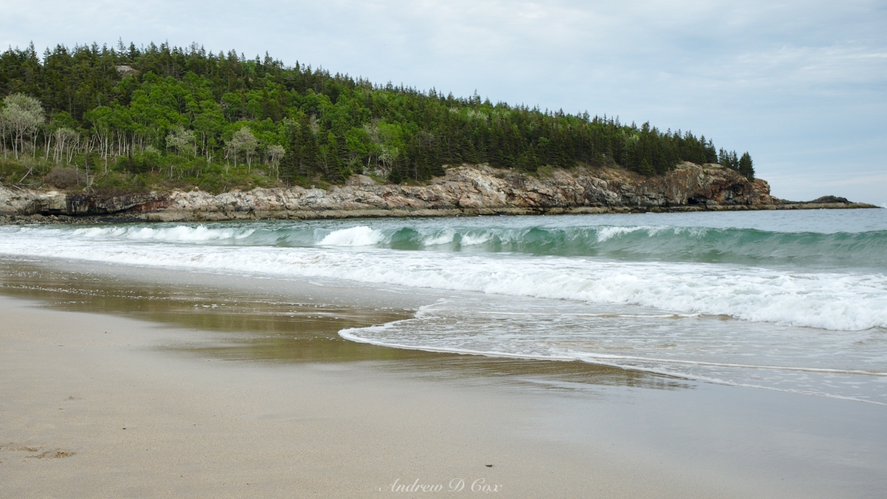
From the summit, we’re afforded great views up and down the coastline, which is mostly just a continuous sea of trees. Sand Beach, a rare exception to the rocky coastline, lies directly west of us at the head of Newport Cove.


After snapping a few photos at the summit sign, we descend from the Beehive via a gentler trail and walk over to Sand Beach. Just for kicks, we take off our shoes and walk out to the water. I gasp as a wave rolls in and submerges my feet; the water is frigid! We stay in the water just long enough for a selfie and then hurry back up the shore to our waiting socks and shoes.
Following that refreshing foot icing, we walk back to the Gorham Mountain trailhead via the Ocean Path, a mostly paved trail running parallel to Park Loop Road. Along the way, we step off the path a few times to check out the waves and cliffs.
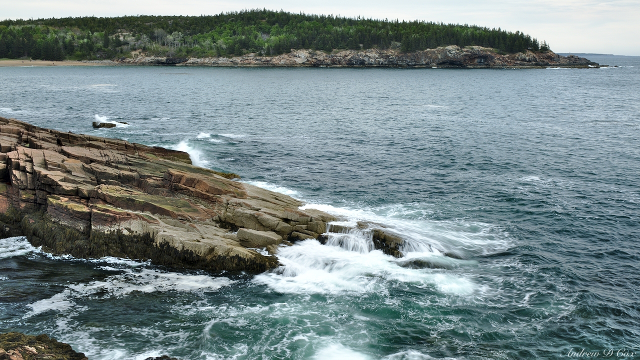
While hiking to Gorham Mountain and the Beehive requires some scrambling, the Ocean Path is easily accessible to all ages; much of it is even wheelchair accessible. This loop is well worth a few hours of your day!
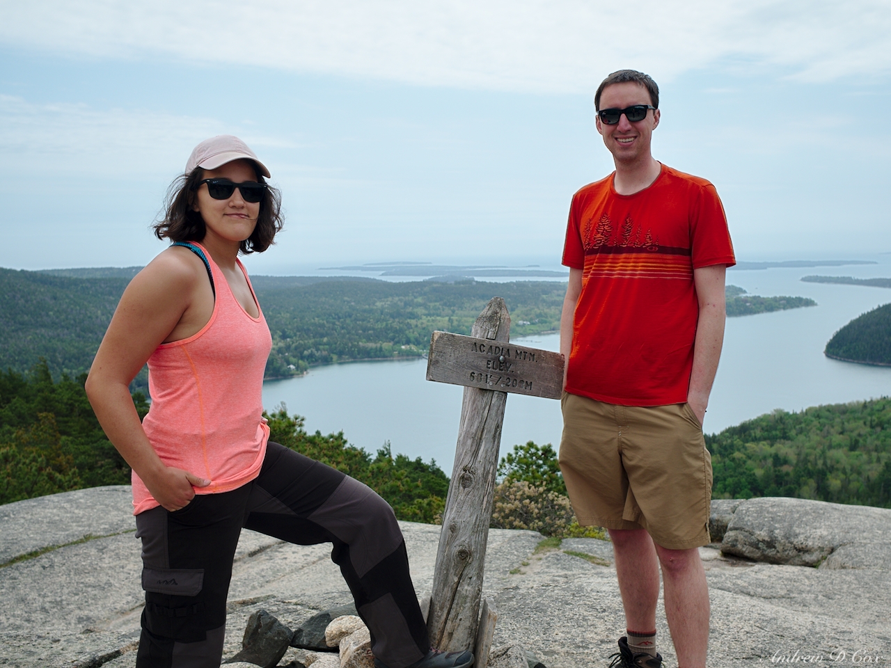
Acadia Mountain Loop
2.9 mi | +/- 800 ft | Class 1 | View on Map
On our final day, Nick, Kenza, and I squeeze in a short morning hike to Acadia Mountain. The trailhead, located just off of route 102, only has a few parking spots so we end up parking a little further down the road. It’s a short, but enjoyable walk to the summit where we admire a sweeping view of Somes Sound and Greening Island.
Our descent from Acadia Mountain (on the east side) is much more intense the ascent (on the west side). The east side has stairs; the west side is very large boulders to clamber over. After days’ of hiking and walking, we’re all a bit sore and the steep descent is hard on the knees. From the bottom of the Acadia Mountain trail, we follow the Man O’ War Brook Fire Road back to the trailhead.
There are several other trails and peaks in the area worth visiting if you have more time, including some trails which skirt cliffs near the sound. Unfortunately, the cliff-side trails are closed in the spring to avoid disturbing Perigrin Falcons nesting there. If you visit later in the year, I expect you’ll find these trails to be incredible.
Although we didn’t see all of Acadia, we were able to visit many different landscapes and see a great deal of the scenery there. I hope to return again, perhaps when the trees are turning magnificent shades of red and orange. Have you been hiking in Acadia? Share your stories in the comments!
Dad 11 June 2018
Beautiful. Thank you for sharing, Andrew. I need to put this place on my bucket list!
Kenza 11 June 2018
Awesome post Andrew! It was a very cool trip.
Marie-Pierre, from Paris 16 June 2018
Thanks a lot Andrew for those beautiful pictures.
Marie-Pierre, from Paris 16 June 2018
Thanks for those beautiful pictures.