This is the first of what I hope will be many trip reports this summer. I’m in southern California and am trying my best to spend as much time hiking and backpacking as possible before I return to flatter-than-a-pancake Indiana. First up: an overnight trip into the San Gorgonio Wilderness to summit Mount San Bernardino (10,649 ft).
Trip Planning
I recommend the Tom Harrison map of the San Gorgonio Wilderness for this trip. A permit is required for day hikes and overnight trips in the area, but is free of charge! You can walk up to the Mill Creek Ranger Station to get a permit or apply for one up to 90 days in advance; the San Gorgonio Wilderness Association has detailed instructions on their website.
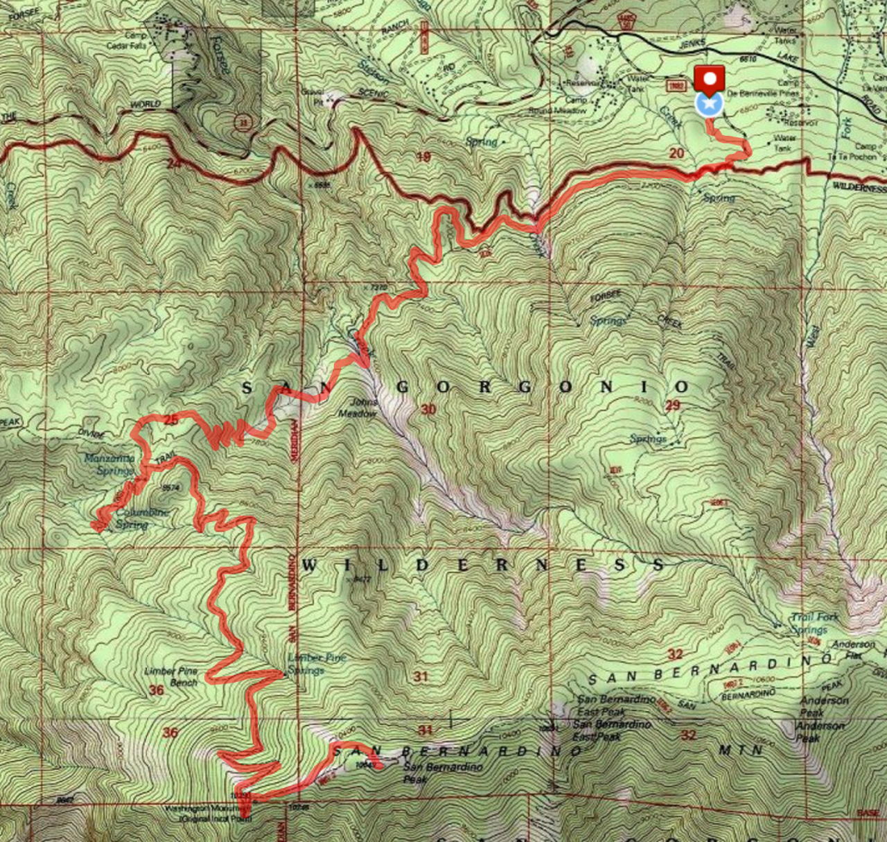
Route from Forsee Creek Trailhead to Mount San Bernardino
Forsee Creek Trailhead to Columbine Spring Campground
June 18, 2016 | 6.5 mi | +3,270′ / – 300′ | View on Map
It’s Saturday morning, somewhere around 10:00. I’ve got three new friends with me – Jyoti, Carol, and Aaron, all coworkers at JPL – and we’re on the 210, eastbound, on our way to the San Gorgonio Wilderness. The forecast for LA and the surrounding area calls for highs in the upper 90’s and low 100’s this weekend and the temperature is already approaching 90 degrees F. As luck would have it, the air conditioner in my car broke a few weeks ago and everyone is sweating as we fly down the highway.
From the 210, we hop on to the 10, and then exit the freeway near San Bernardino and head north, into the mountains. As we gain altitude, the temperature drops sharply from 90 down into the 70’s. We roll down the windows, breath in the fresh air, and take in the sights. The mountains are distinctly part of the desert but also sport many pine trees; it’s amazing that such an alpine environment exists so close to Los Angeles. To supplement the alpine climate-induced bliss, I love driving on windy mountain roads; the views are infinitely more interesting than driving through the desert or suburbia, and it makes me feel like a race car driver. Someday, perhaps, I’ll have the opportunity to drive a really fancy car on a winding mountain road and will be able to appreciate how well they handle. My car gets the job done, but it’s not sporty.
Speaking of cars, once we near the trailhead, the road transitions from asphalt to dirt and rocks and I begin to fear for the underside of my car. Four-tenths of a mile later, we arrive at the parking lot and pile out into the woods. It’s only 11:00, but we have some lunch and then unload our gear from the trunk. Someone suggests that we ditch our tents completely – it’s supposed to be warm, there are very few bugs, and it’s definitely not going to rain, so why not save the weight and go cowboy camping? I’ve never camped without a tent, but there’s a first time for everything and I can’t argue with the logic. Less weight sounds good to me!
We begin our trek at the Forsee Creek trailhead. A short jaunt up the trail brings us to a junction, but one fork is blocked by a mess of red tape and signage prohibiting anyone from proceeding in that direction. This trail leads into an area that burned last summer and is still considered unsafe for hiking or backpacking. I learned from a forest ranger that fires can smolder for months underground, slowly devouring root systems, and walking over one of these buried fires can result in a cave-in and serious burns. The trees in the area are also prone to falling over at the least disturbance, and the trails are likely strewn with fallen trees and other forest fire casualties. Of course, we knew all this beforehand and are bound down the open fork of the trail, toward Forsee Creek and John’s Meadow.


The first several miles of the trail gradually climb away from the trailhead, dipping into ravine after ravine along the northern face of the mountains. We settle into a moderate pace and stop every 10-20 minutes to sip water and rest a little. The last thing I want is for one of us to get heat stroke or become dehydrated.
We hear Forsee Creek before we see it – the gurgling of water is unmistakable and quite a welcome sound. We stop, remove our shoes and socks, and soak our feet in the ice-cold water. There must be snow melt somewhere up the mountains feeding the stream, because it’s cold enough that I can only keep my feet in for a few seconds at a time. In addition to cooling off, we refill all our water bottles and purify the creek water. This will be the last reliable water source until tomorrow afternoon; there are no active springs near our campsite tonight.
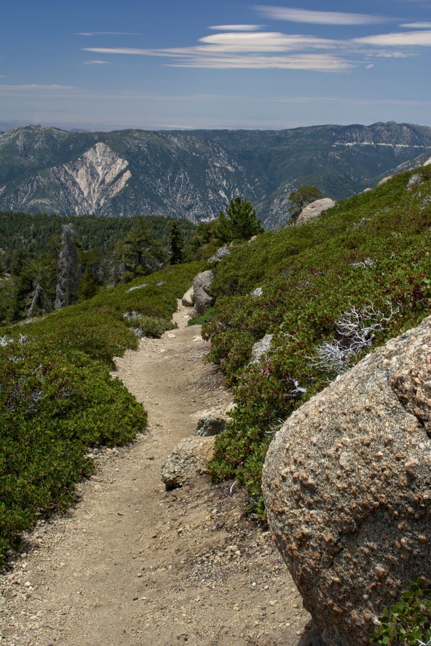
The next 2 miles are long, hot, and difficult. The trail climbs from 7260′ at John’s Meadow to 8300′ at the junction with the San Berardino Peak Trail. This section of the trail isn’t maintained; many stretches are barely visible and only a few inches wide. The switchbacks, in particular, are made more intimidating by the fact that the trail carves out only a thin shelf on the steep slopes. That being said, the wild nature of the trail gives the experience a raw feeling that I can’t help but enjoy.
After many breaks for water, snacks, and breathing, we reach the trail junction and find ourselves at a small, sandy clearing among the manzanita. This spot offers stunning views of the San Bernardino Valley, and we opt to sit and admire it for a while.


Our campsite at Columbine Spring is only a half mile from the vista, so it doesn’t take us long to reach it. With a name like Columbine Spring, one would expect there to be water. While there were lots of green plants in what appeared to be a small wash, we couldn’t find any running water. If there is a spring there, it isn’t flowing this time of year. After a little scouting, we locate a nice flat area, set up a tarp, and lay our sleeping bags and mats down. The site is in a ravine, which shelters it nicely from the wind and afternoon sun, but it also offers no view. We take our dinners back up to the vista and eat while watching the sun set. Well-earned food, good conversation, cool alpine air, and a beautiful view: what more can a person possibly ask for?
 in the distance, through the mist/smog")


By the time the sun fully sets below the horizon, we’re all ready for sleep. In the last lingering light, we wind our way back down to our campsite and climb into our sleeping bags. A few stars appear, but most are drowned out by the light pollution from the surrounding cities.
Up to San Bernardino Peak and Down Again
June 19, 2016 | 10.2 mi | +2,649′ / – 3,981′ | View on Map
Although we aren’t visited by any animals in the night, my sleep is fitful. That being said, we went to bed around 21:00 and I didn’t get up until 05:30; I felt rested enough. We spend too much time and effort trying to be as comfortable as possible. Fitful sleep? Oh well, it won’t hurt me, and it’s not every day that I get to wake up in the middle of a national forest. 🙂
After enjoying some breakfast, we pack up our things and hike out of camp. Today’s agenda includes summiting San Bernardino Peak and then descending back to the Forsee Creek trailhead. To lighten our load, we leave sleeping bags, pads, and other gear at our vista spot from last night and then proceed up the trail with only the essentials.


We haven’t had the opportunity to refill our water bottles since yesterday afternoon at Forsee Creek. I gulp down the last of my water just before we reach the Lone Pine Spring, which, thankfully, is flowing very well with more of that ice-cold mountain water.

Lone Pine spring
I fill three bottles from the spring and take advantage of the downtime while I wait for Aquamira to do its magic and take a long exposure photograph of the spring. It’s moments like these that make carrying a 2-pound tripod worth it.
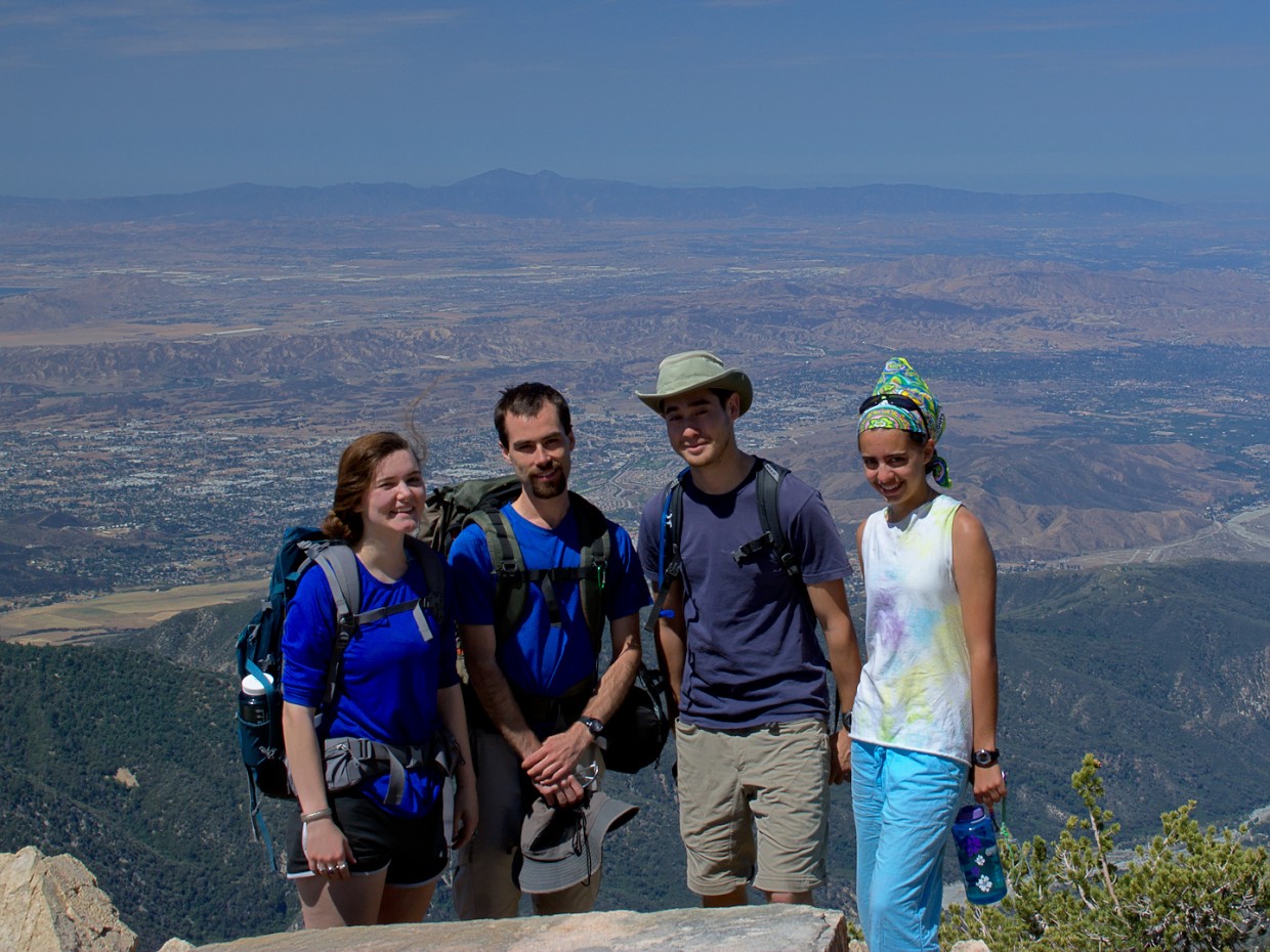
The rest of the trek to the peak is hot and shadeless. Long switchbacks lead up the mountain, and we take several breaks to sip on water, eat snacks, and admire the view. After reaching Washington Monument, the trail levels out (somewhat) for a while. A steep side trail to the peak is marked by a cairn; at this point, it was time to go for it. No more stops. Upon reaching the top, we find several other people resting. We take a few celebratory pictures and chat with the other hikers. One of the great things about hiking is the cool people you meet. I suppose it makes sense that hikers enjoy each other’s company – not everyone is out on a Sunday hiking up a 10,000+ foot mountain!


As one might expect, the hike down the mountain takes significantly less time than the ascent. We stop again at the Lone Pine Spring and Forsee Creek to refill water bottles and soak our tired feet in the cool water. We reach the car by 17:00 and, after a short drive to a small diner in Angelus Oaks, enjoy burgers, mac & cheese, and a pitcher of ice water. The drive back to Los Angeles is pretty quiet; everyone is tired. I’m a little surprised to watch the thermometer on my dashboard climb from 83 degrees in Angeles Oaks to 106 degrees in San Bernardino… we really dodged a bullet by climbing up into the mountains!
All in all, this was a great trip. I can’t wait to get back out there for another backpacking adventure.
There is no better way to travel